The Mountains of Arizona
www.surgent.net |
|
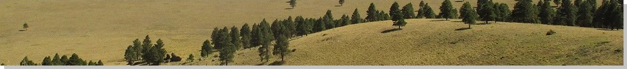
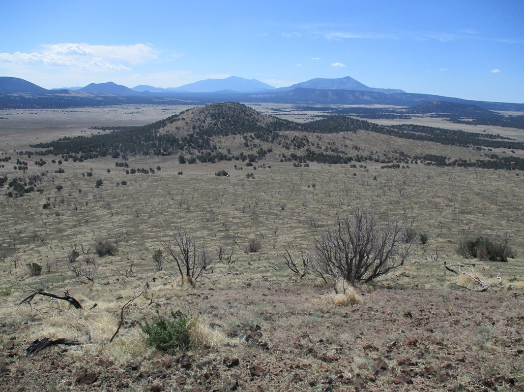
Double Top • Butcherknife Hill • Peak 7676 I was in Flagstaff to handle some personal matters, but it did not appear it would take more than an hour. Rather than drive all this way for something that short, and that it's very hot in the deserts now, I allotted myself a full day in the high country, with three peaks on the agenda. The three peaks I was looking at are grouped along US-180 about 35 miles northwest of Flagstaff. I had my sights set on Double Top, then Butcherknife Hill, then Peak 7676. All three are gentle cinder mounds with some forest cover and mostly-open views. No challenging hikes today, just three easy peaks. I was on the road before 5 a.m. and in Flagstaff about 7 a.m.. I got gas then drove through town, following US-180. The highway wanders through ponderosa forest for about 25 miles, then drops in elevation, leaving the big trees. Down "lower", it was mainly piñon and juniper woodlands. Up first was Double Top.
Date: June 11, 2022
• Elevation: 6,825 feet
• Prominence: 342 feet
• Distance: 1 mile
• Time: 40 minutes
• Gain: 290 feet
• Conditions: Clear and warm
Arizona
•
Main
•
PB
•
LoJ
•
USGS BM Datasheet
•
Interactive map
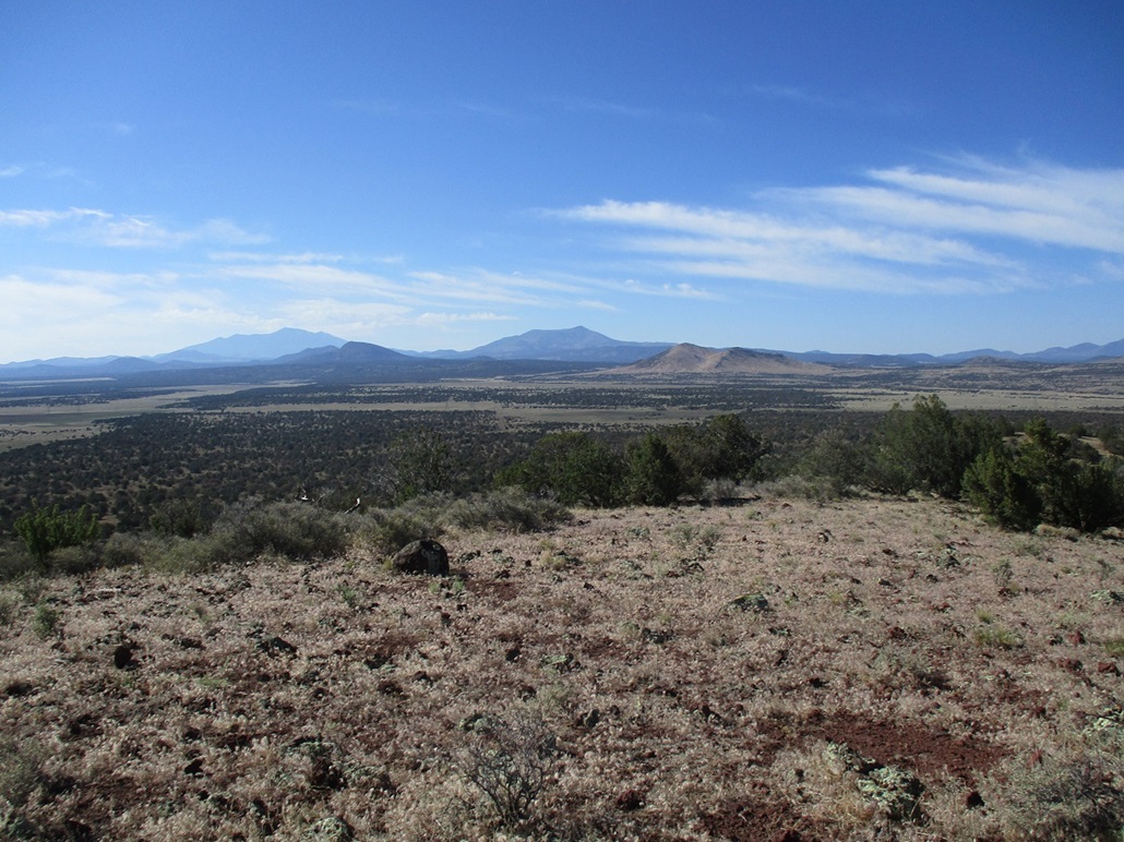
Double Top lies north of US-180 about three miles, opposite Ebert Mountain. The land starts to flatten more this far out. North of US-180 there aren't as many big volcanic mounds, just a smattering of a few gentle hills, all spaced apart. Double Top was just an excuse to explore this side of the highway. Other peaks are out this way, and I was curious about access and road conditions.
The track I wanted starts opposite where FR-141 starts, the main forest thoroughfare that heads south toward the interstate. On the north side, it was just a simple dirt track and I had to slow fast to get onto it. I hope the guy with Cali plates riding on my rear bumper wasn't too upset.
The road was good, this being a Forest Road for the mile or so until it came to a fence line and gate. This is where the National Forest property ends and the private ranches begin. Most of the land in this vast region — essentially all lands up to the Grand Canyon — is State Trust land mixed with private ranches in the checkerboard pattern.
At the gate, I opened it and crossed in, then saw the sign about getting a ranch pass. This is the CO Bar Ranch, a subsidiary of the Babbitt Ranches. They have a website, so I went onto it, and in the middle of nowhere, got myself a ranch pass arranged. What an age we live in.
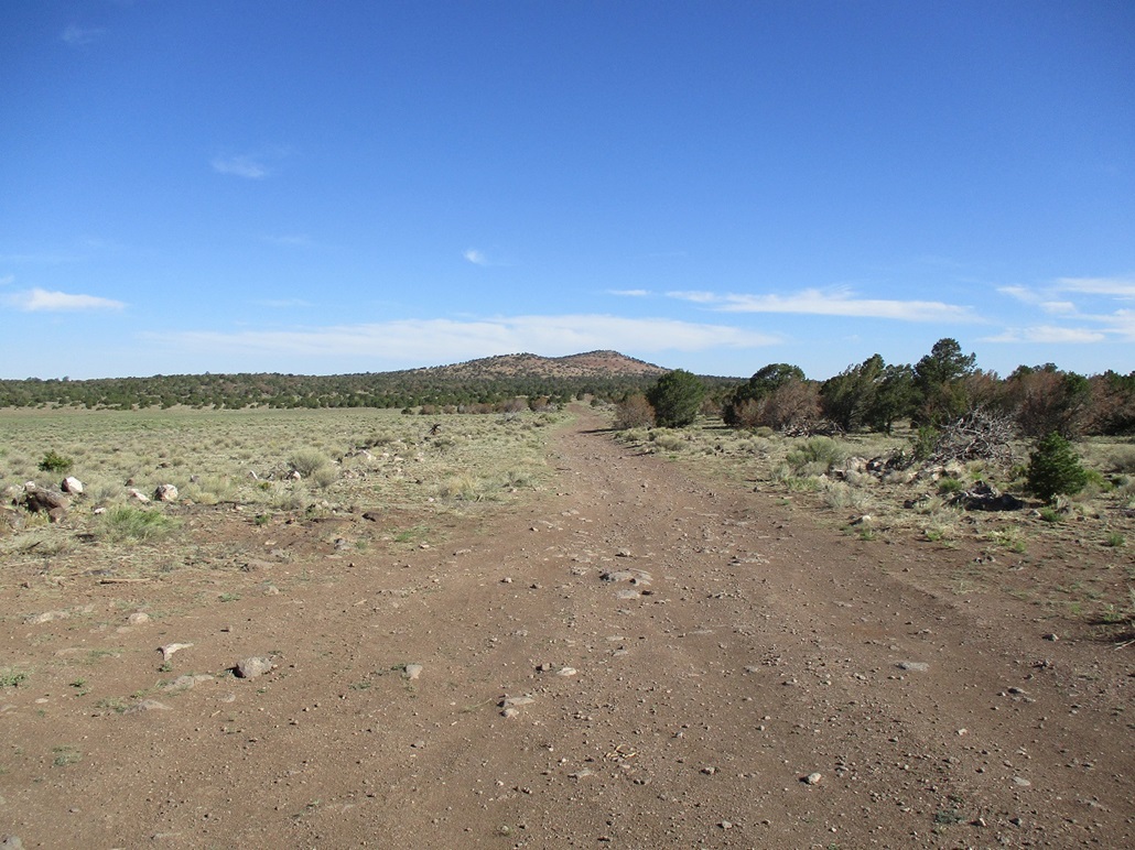
I followed the main road northwestish, Double Top up ahead. The road was decent, but not great. Some parts were rocky and uneven, other parts smooth. My Subaru Forester handled it well. A passenger vehicle with low clearance would have trouble. I drove until I was east of the peak, and parked.
It was warming now, low 80s, even at 8 a.m.. I knew it would be a warm day all over, but still, 80s at 8 a.m. bummed me. I hoped it wouldn't get too much hotter. I got my stuff arranged and started hiking, the time a little after 8.
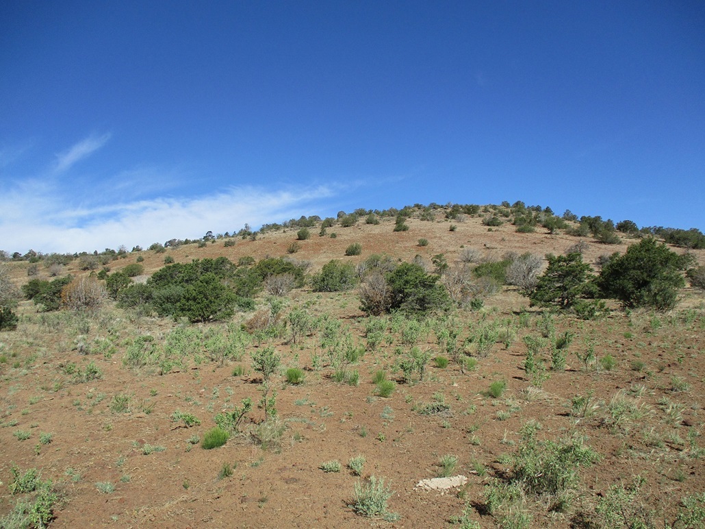
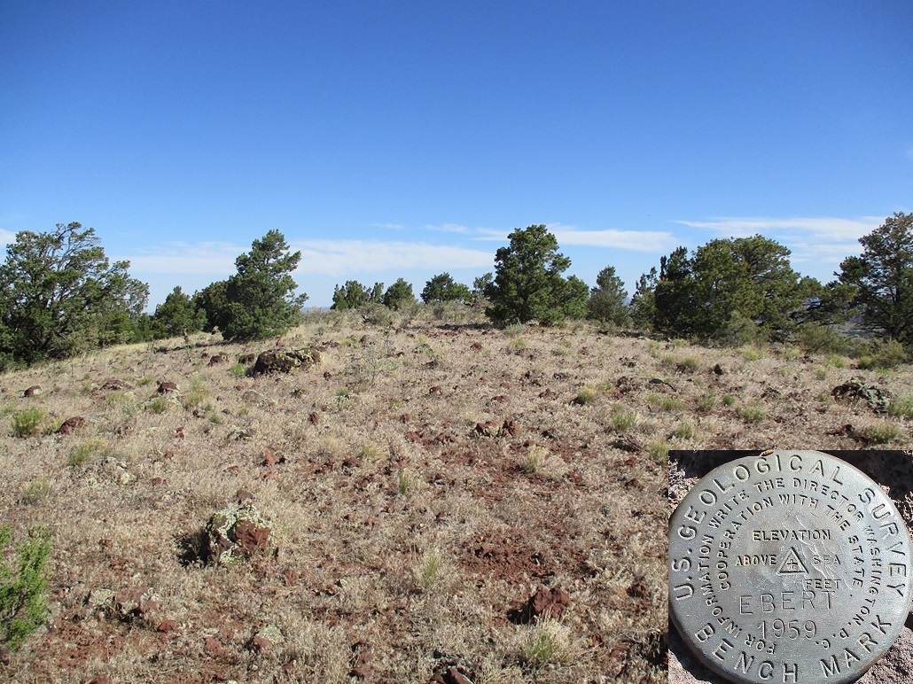
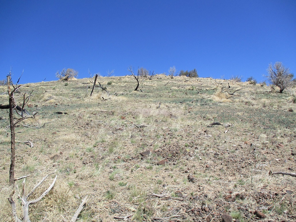
The route is a no-brainer. I went west through the spread-out trees, then onto the gentle slopes, and twenty sweaty minutes later, was on top the humble hill. The top was mostly open with a few trees on the fringe. I had fine views in all directions. I snapped an image of the "Ebert" benchmark, but didn't stick around much. I looked for a register but saw nothing.
I retraced my route and was back to the car quickly, a 40-minute round trip hike, covering about a mile total. Ity was toasty but not too bad. The sun was intense. Curiously, the whole areas was buzzing loudly with cicadas. I was not expecting them. When a few hundred thousand cicadas get going, it can be very loud!
My next objective, Butcherknife Hill, was nearby.
Elevation: 7,188 feet
• Prominence: 468 feet
• Distance: 1 mile
• Time: 50 minutes
• Gain: 398 feet
• Conditions: Warmer
PB
•
LoJ
Driving out from Double Top, all I needed to do was cross the highway, which put me on Forest Road 141. I drove south on it for a couple miles, until southeast of Ebert Mountain, then eased onto FR-710 (402 on the map). This road was fair, with some high centers but no rocks or mudpits. It aims southwest between a couple lower hills, after which Butcherknife Hill is now visible.
The road drops slightly, then bends left and comes to a gate. I passed through it and went soft right toward a lowpoint south of Butcherknife Hill. I parked behind a juniper about a hundred feet off the road. A single cow was grazing nearby.
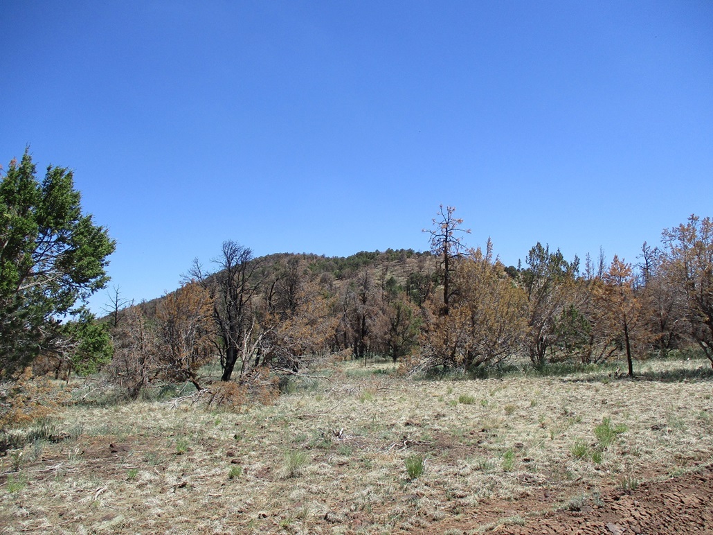
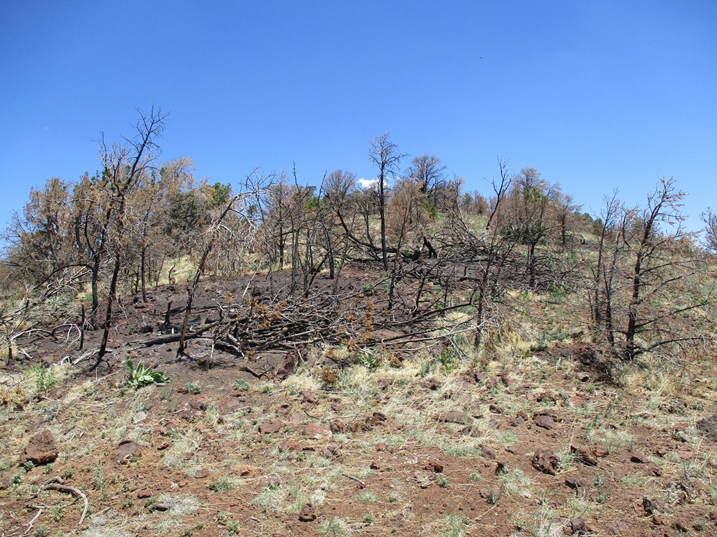
This hike would not take long nor too much thinking. I was south of the hill, and as soon as I started walking, the uphill gradient began, first gently, then slightly steeper. The forest here burned some time in the past, leaving behind a scape of charred and bleached juniper and piñon skeletons, no big trees here to begin with. The ground was covered in spotty low grass and lots of cinder pebbles.
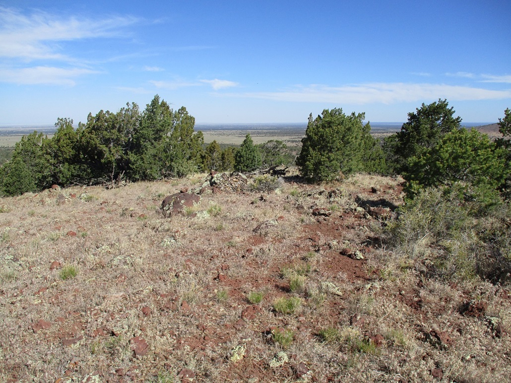
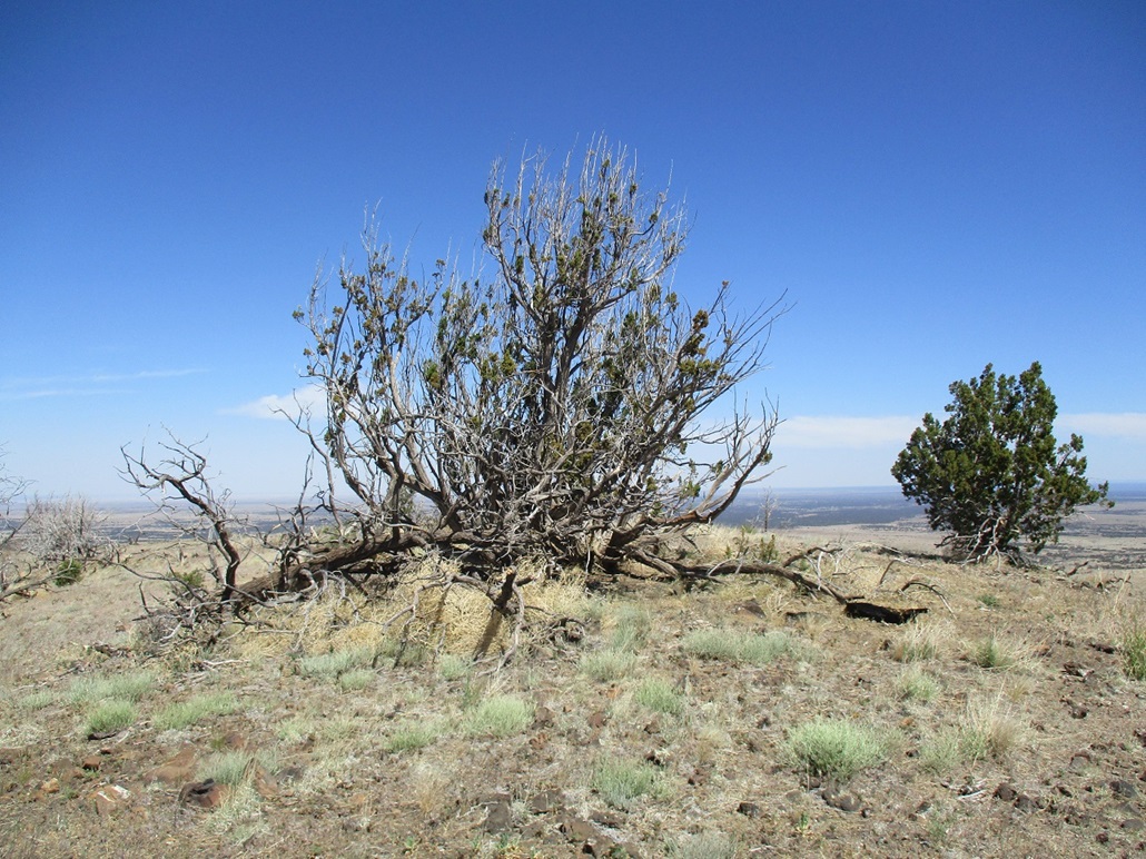
The uphill walk went well, there being no challenges to it. It was warmer now, and I stopped every few minutes to catch my breath. No reason to rush. I was quickly on top the summit ridge, and soon to the highest point. It appeared to me the very highpoint itself was beneath or beside a big gnarled juniper that appeared to be half dead and half alive. I walked along the ridge to take photos. The day was clear and I could see for miles in all directions. In the moderate heat, the insects were out too. What is it in my ear they want so badly? I'll never know.
The hike down went well too. I was gone for about 50 minutes, covering a mile. My knee was holding up well. I tweaked it back in January and it hasn't really healed entirely since then. However, I hadn't done any hiking for awhile and hoped the down time would help it. I was encouraged. So far, I was 2 for 2. Up next, Peak 7676.
Elevation: 7,676 feet
• Prominence: 416 feet
• Distance: 1 mile
• Time: 50 minutes
• Gain: 415 feet
• Conditions: Hot
PB
•
LoJ
I retraced my driving route back to FR-141 and highway US-180. On FR-141, I had to wait out about a half-dozen off-roader-type vehicles whizzing past and kicking up lots of dust. When I got to US-180, they had all stopped to give each other high-fives and chest-bumps.
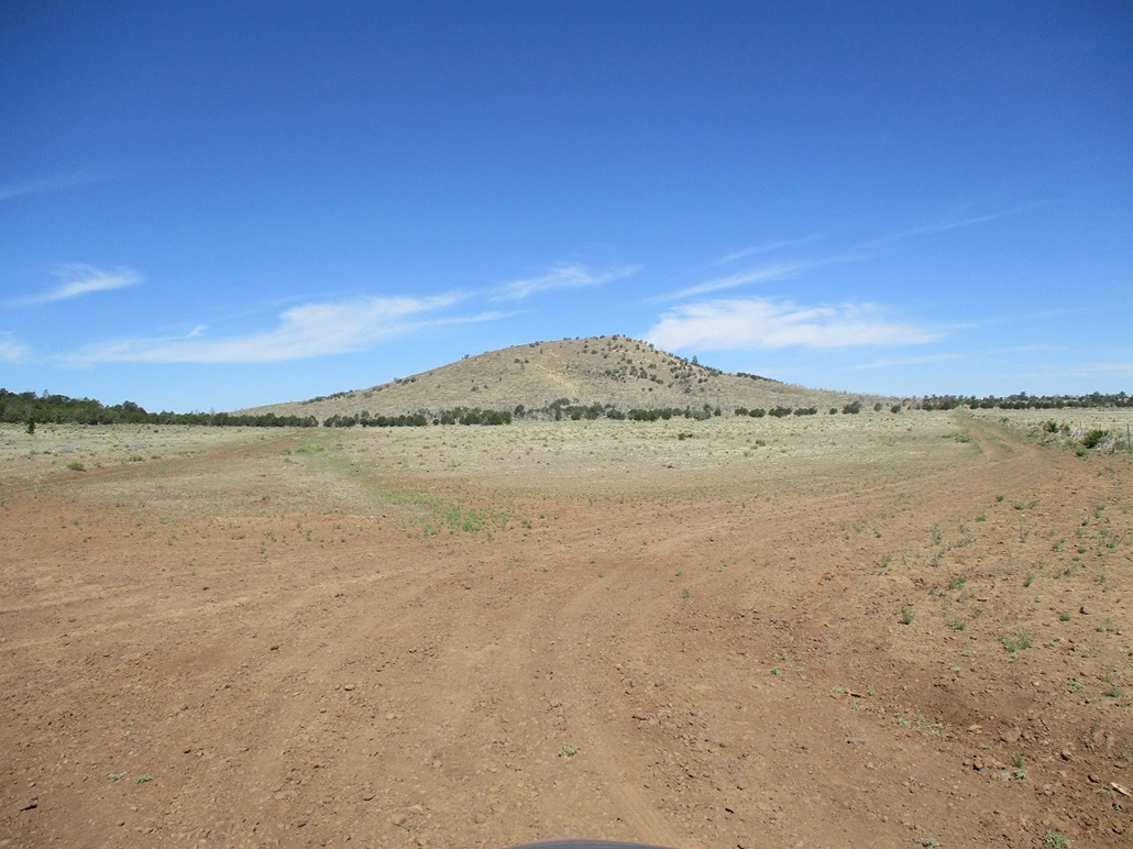
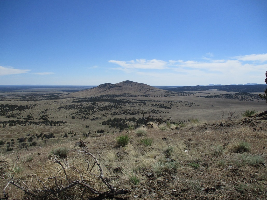
I drove southeast on US-180 for just a few miles, until abeam of Slate Mountain on my right, across which stood Peak 7676. I found the gate alongside the highway, passed through it and drove in about a mile, making a right at one junction and placing myself at the road's apex in a saddle south of Peak 7676 and a lower hill to the south.
Even though it was only 10 a.m., the temperature had risen into the slightly-uncomfortable range, mid- to high-80s. The sun was intense and there was no breeze. I was a little tired already anyway. This hike wouldn't take long, its statistics being no different than the first two. I got properly attired and started up hill. I had to cross over one barbed-wire fence early on.
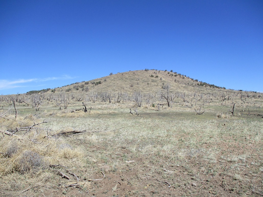
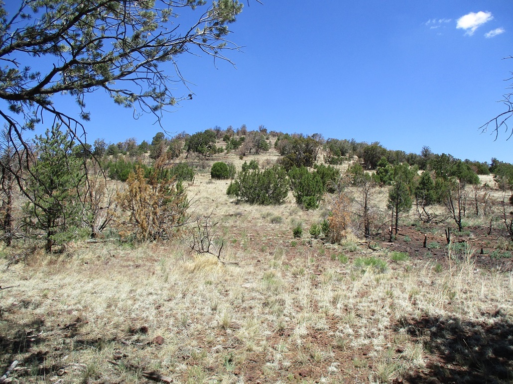
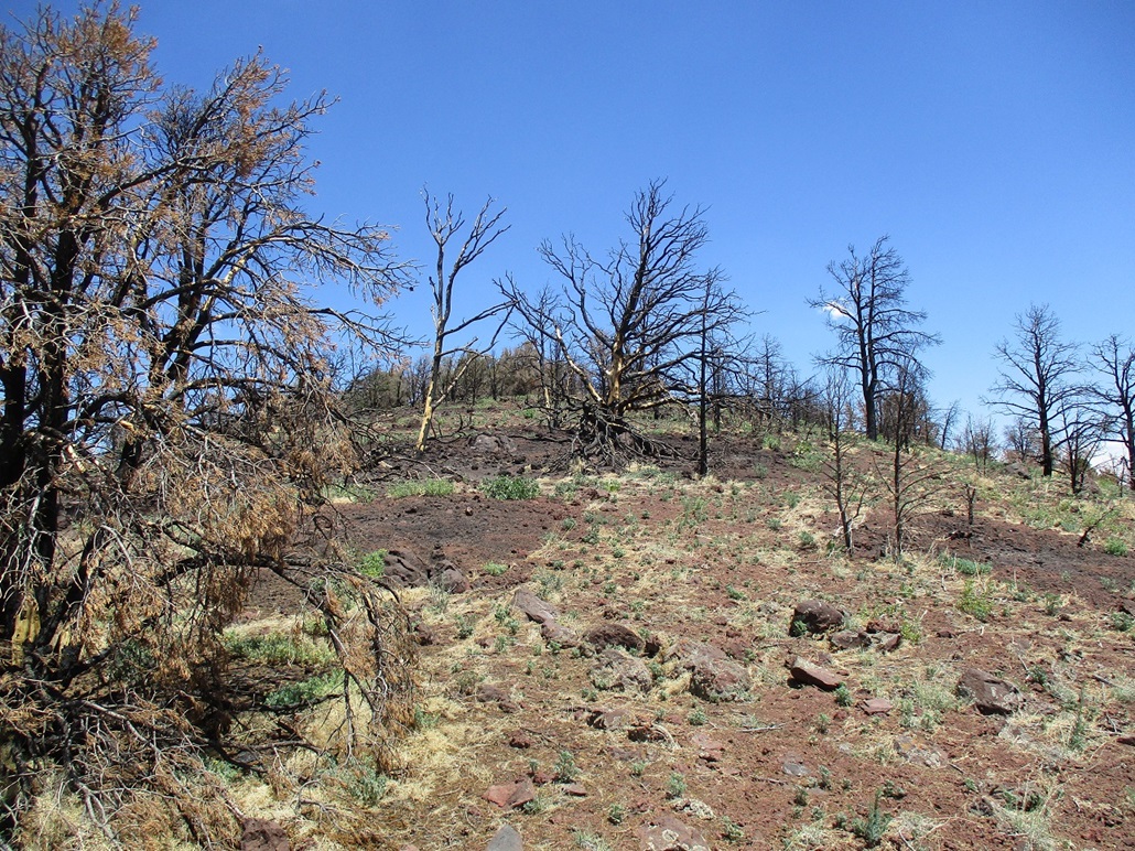
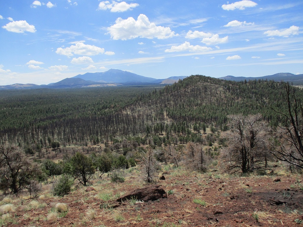
On the south slope, there was more forest here, but low trees, no big ponderosas. The usual junipers and pinñon and probably some oaks too, but I'm just guessing. As I ascended, I noticed spot burns, in which a tree was burned and some surrounding grass too, but otherwise, the nearby trees were unscathed. I hiked up to a small nubbin, where the ridge levelled for a few feet. The highpoint wasn't much farther ahead. By now, I was seeing more burned areas than unburned areas.
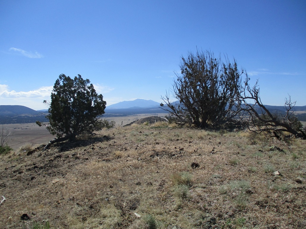
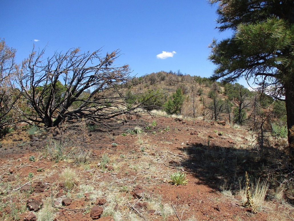
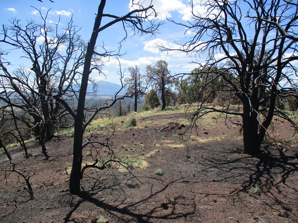
The big Slate Fire of 2021 roared through here. It seems Peak 7676 got zinged by the fire but not entirely. Once on top the summit ridge, which was mostly burned, there were still live trees, bushy and green as always. Looking down, I could see areas of burn intermixed with areas that weren't burned. Interesting fire dynamics.
I determined that the highpoint was probably near one of the larger unburned trees. I saw no registers, but if there was one, it probably got burned. There were a couple large boulders nearby that might have been the highest point, so I dutifully kicked each one.
I was hot by now, and the damn bugs kept bopping into me. Also, the cicadas were roaring here. On the barer trees, I could see them, just sitting there buzzing. When there's a whole forest of them going to town, it is surprisingly loud (one site says 105 decibels, or about that of a lawnmower). I was happy to be back at my car, done with this hike. I was pleased I was successful on all three peaks I aimed for, pleased my knee was holding up well (no swelling), and most pleased to be out of the hot and loud forest.
I had a few hours to spend in Flagstaff handling personal matters. I used up some of that time eating tacos at a Cafe Rio. This was a busy weekend in town — NAU was having its graduation ceremonies, there was a marathon going and some sort of bear festival (or beer? I may have misheard). It was crowded. I took care of what I needed to take care of, and finally left town about 3. Since I had no agenda otherwise, I decided to make this a scenic drive rather than bust down Interstate-17 back to Phoenix. There is never any need to get back to Phoenix in a hurry.
I did follow Interstate-17 for a while, but then got off onto AZ-169, a connector highway that merges with AZ-69, heading into Prescott. I have not been in Prescott proper in many years. Then I remembered why. The twenty-mile stretch of AZ-69 through Prescott Valley into main Prescott is just one effing traffic light after another. It takes forever to get into Prescott. In Prescott, there was a festival going on with tents and vendors in the downtown plaza. I just eased through.
My real plan was to follow AZ-89 southbound, down the curvy highway toward Yarnell. This drive is a treat, but one I have only done a few times. And I do it southbound whenever possible, to take advantage of the downhill grades and great views. By now, there was no traffic at all, just me and a few others going northbound. I went slowly and casually. The storm clouds started developing. A big cell was over the southern Bradshaw Mountains, and I could see virga underneath it. At least it knocked down the temperature a little.
I stopped in Yarnell for about a half hour. I walked its main street and also to the small park dedicated to the Granite Mountain Hotshots, the 19 members killed in the 2013 Yarnell Fire. The park is fenced and gated and it seemed I got there just a few minutes after closing time. So I just looked at it from over the fence.
Once that was done, I drove downhill, catching AZ-93 into Wickenburg and the usual route into Tempe via AZ-74/Carefree Highway and surface roads into Scottsdale and Tempe. A good day was had by all, meaning me. I was exhausted afterwards.
|


|