
The Mountains of Arizona
• www.surgent.net
|
| Dos Cabezas Peak |
• Highpoint: Dos Cabezas Mountains • Cochise County |
|
Date: April 20, 2013
• Elevation: 8,357 feet
• Prominence: 3,257 feet
• Distance: 3 miles
• Time: 5 hours
• Gain: 1,140 feet
• Conditions: Clear
• Teammates: Scott Peavy, Dean Molen, Rick Hartman, Mark Nicholls, Ken Jones & Dennis Poulin
Arizona
•
Main
•
AZ P1K
•
PB
•
LoJ
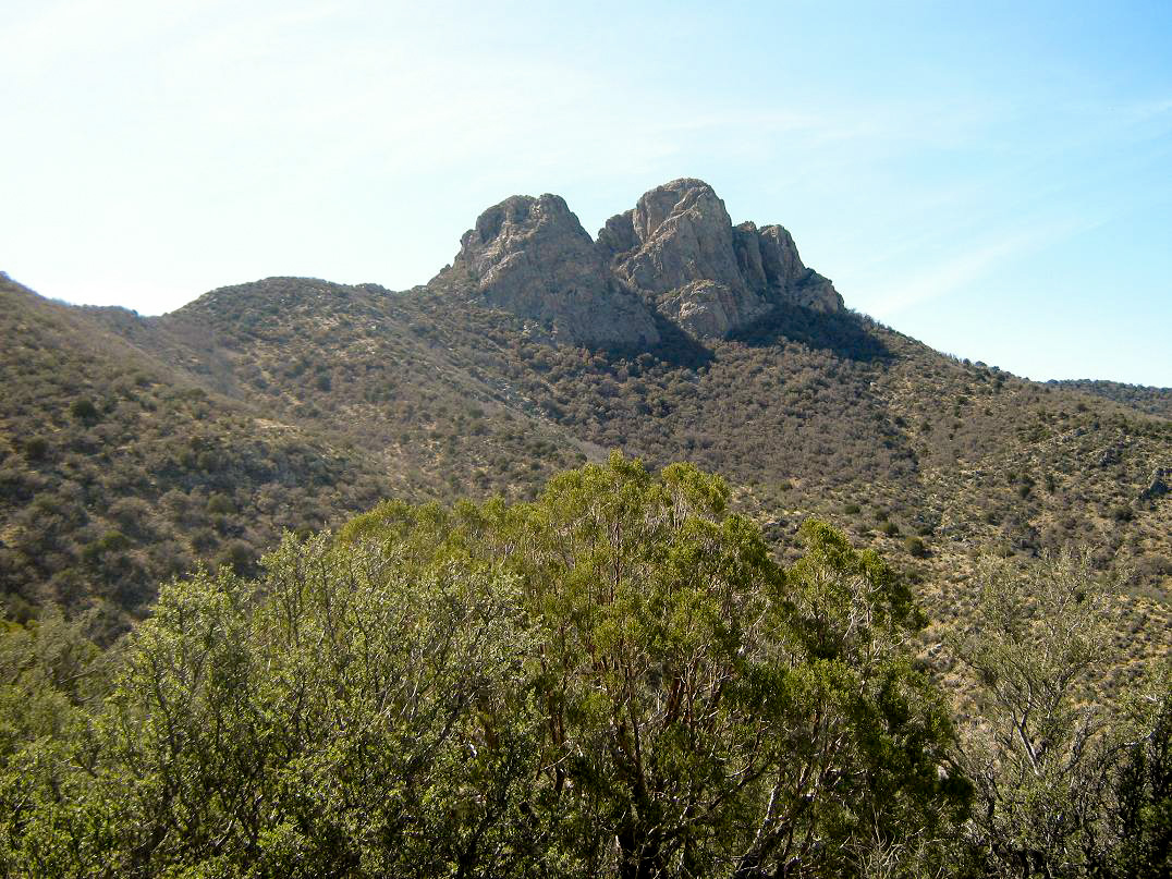
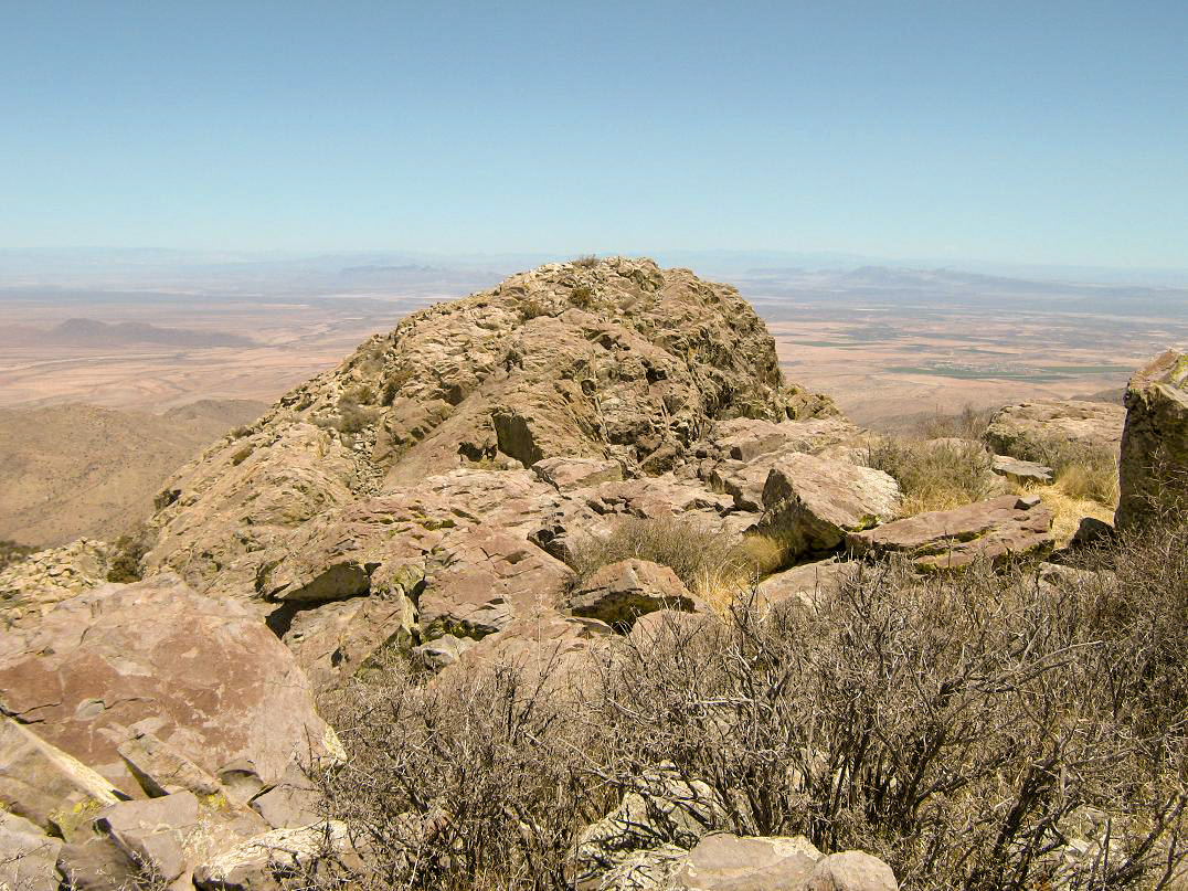
The Dos Cabezas Mountains are in southeast Arizona, not far from the city of Willcox along Interstate-10. The peaks are close enough to the interstate so that thousands of people a day look up and see the distinct rocky, "two-headed" summit of this range. Of the two summits, the southern summit is about 3 feet higher than the northern summit. This has been conclusively demonstrated by many climbers over the years. The topographical map cites the summit elevation as 8,354 feet, but this is on the north summit. Thus, the south summit comes in at 8,357 feet.
Getting onto the range is half the battle. Although much of the range is public (BLM), and a large swath is designated Wilderness (but not containing the summit), private lands surround the range so that one needs permission from the landowners to get past a couple gates down low. Thus, visitation to this range is kept very low. In recent years, only the Southern Arizona Hiking Club (SAHC) had an arrangement with the landowners to enter onto the land. Otherwise, the only options were to not come at all, or climb the range by walking cross country and hope no one sees you.
In December 2008, Ken Jones and I tried to climb Dos Cabezas by glomming in with the Southern Arizona Hiking Club. I was a member back then, Ken was my guest. He had flown in from Washington specifically for this peak. There were about 20 people on this hike, underscoring the popularity of this peak and its difficulty of access. We all hiked to the last hilltop below the South summit, where the guides told about a dozen of us to wait while a smaller group (including both guides) went off to hike the North summit.
So we sat for about two hours. In the meantime, the weather became windier, and by the time the guides had returned, we were forced to abandon our attempt due to high winds. I got as far as the first part of the ledge. Granted, the guides couldn't do much about the weather, and I would have turned back regardless upon feeling the wind, but having to wait for those two hours was very frustrating. I personally was not pleased that we were forced to lay low for those two hours. Another opening in 2011 was met with refusal: the guides were only admitting people they knew personally. I had no choice, and I sensed any further attempts of Dos Cabezas Peak via the SAHC would end in the same result. I let my membership lapse and have not renewed it since.
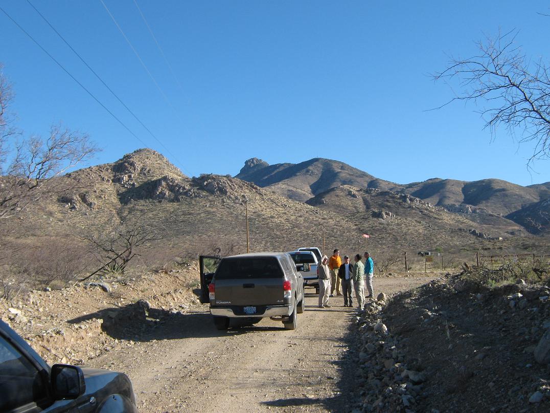
This opportunity came about through the hard work of Mark Nicholls and Rick Hartman. Mark is a legendary peakbagger with hundreds of ascents, someone whose name I have seen in nearly every summit register I have come upon, yet I never met him until today. Mark was able to get the two landowners to allow us passage past their gates, which is no easy task since apparently neither are too keen on letting anyone past their gates. Rick assembled the team and coordinated the connections. Along with Mark and Rick, Ken Jones was down again for this unique opportunity. Dean Molen (whom I first met back in 2005 on Signal Peak), Scott Peavy and Dennis Poulin rounded out the team of seven. It would also be my first time meeting Dennis. I picked up Scott in Gilbert at 3:30 a.m., and we met the rest at the McDonalds in Willcox early this morning. The day was cool with bright blue skies.
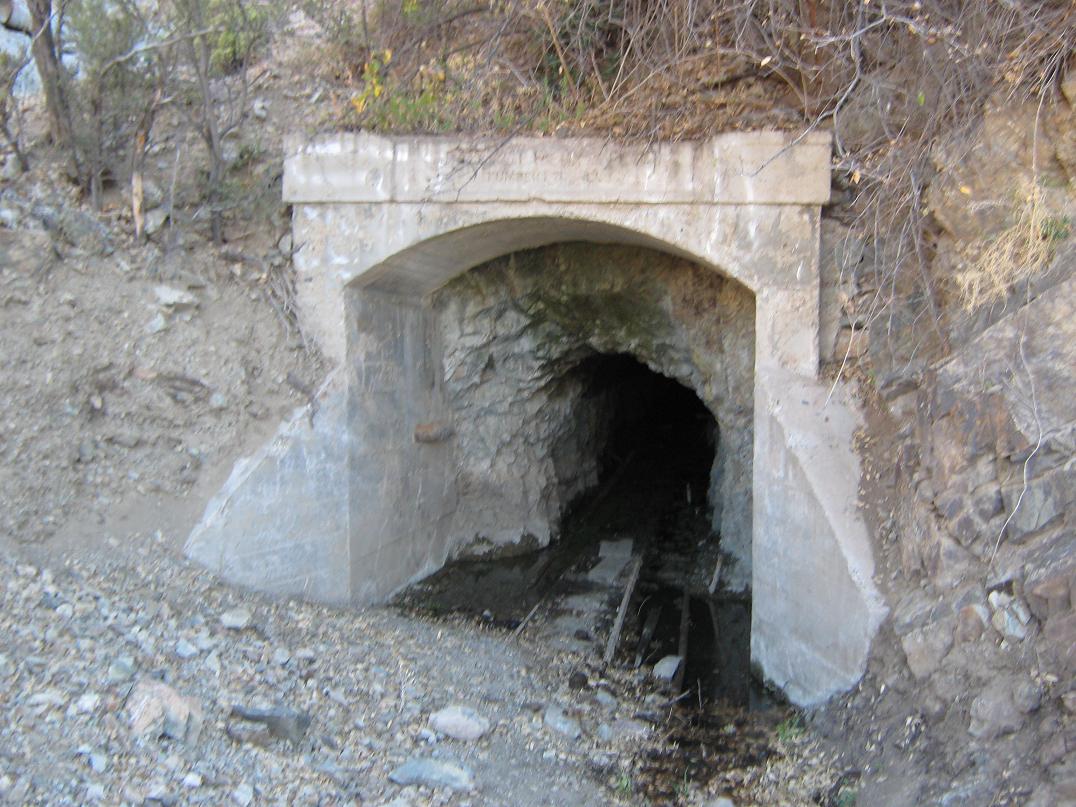
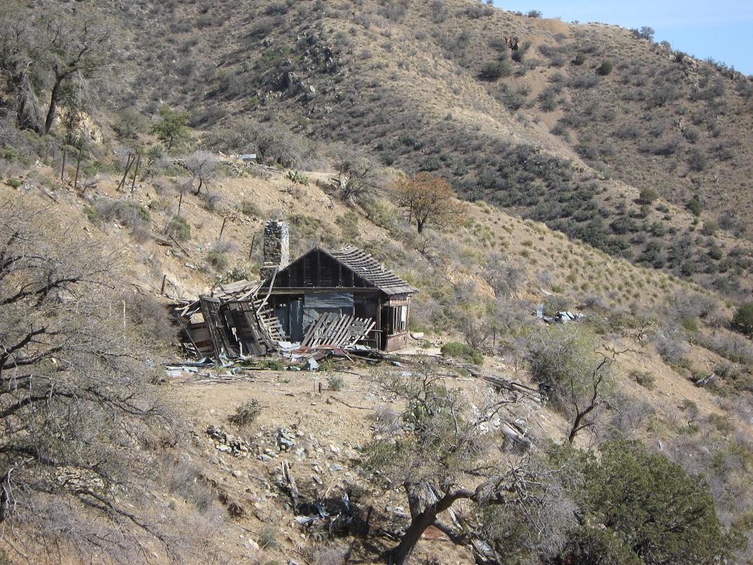
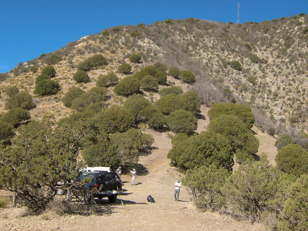
We convoyed (4 vehicles) on state route AZ-186 to the town of Dos Cabezas, about 15 miles south of Willcox. Here, we drove in on Mascot Mine Road to the first gate. It took a little while to track down the landowner to get the key. We got that sorted out and started the drive up Mascot Mine Road. Three miles later, tucked tightly into Mascot Canyon, we came to the second gate, which took some time to open. We got past that, then drove a little more to the old Mascot Mine tailings and mine entrance(s). We parked on a flat area and took photos, amused by some old structures, now in disrepair, suggesting an old mining camp from the olden days. However, I can find no information if one ever existed, although the presence of old relic structures here seems to indicate something was here ages ago.
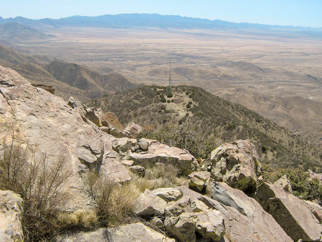
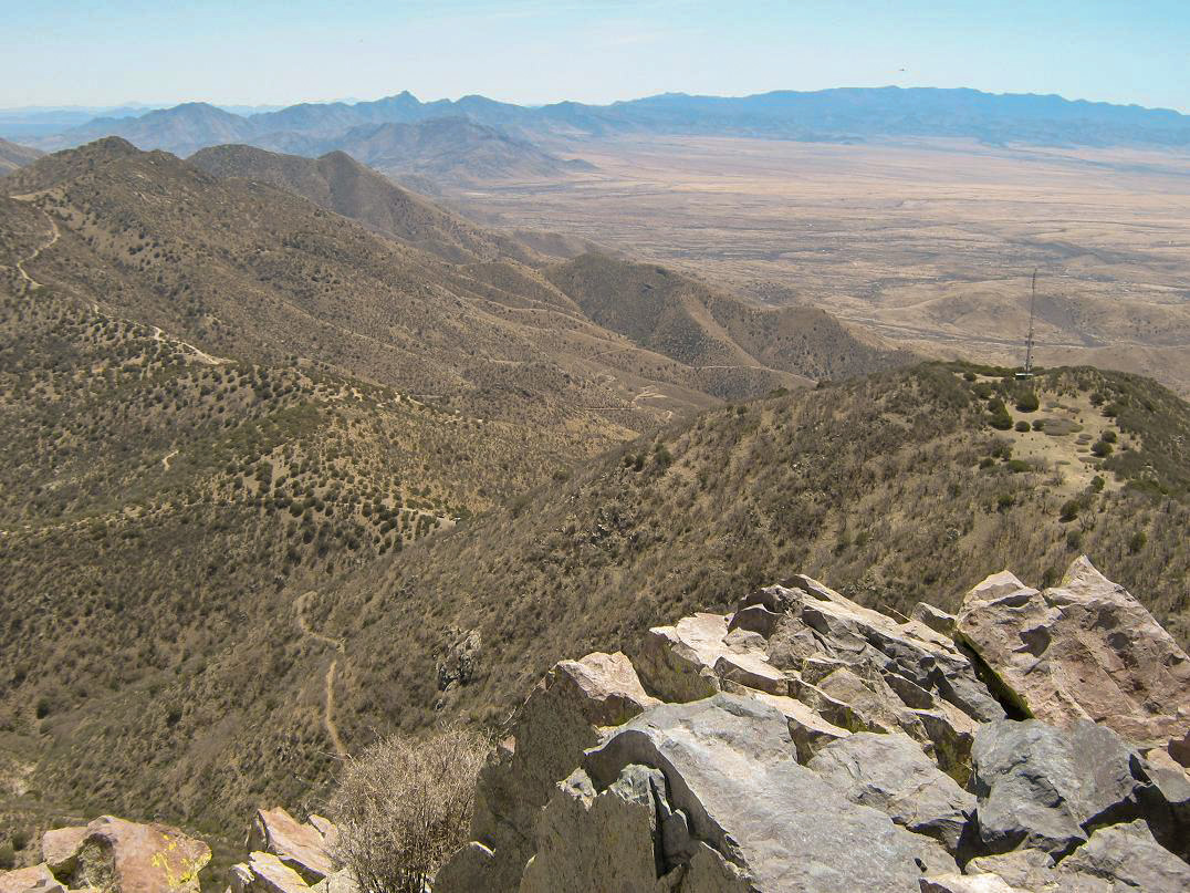
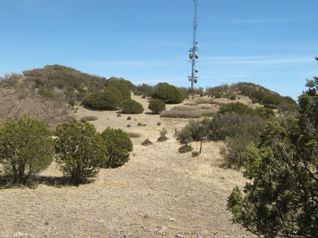
We continued upward, following the narrow road steeply as it contoured up the mountain, eventually reaching up to 7,000 feet elevation. The road was in great shape with no ruts and few rocks. It probably gets bladed semi-regularly, since the road branches out to some active communications towers. However, it is narrow and steep. Although 4-wheel drive may not be necessary, high clearance and a strong engine is. I, as usual, used 4-wheel drive "just in case". We drove until we arrived onto a high saddle, elevation 7,220 feet, directly east and below a radio tower, about a mile southeast of the summit. The views of the peaks along this last road were outstanding. We arrived here a little before 9 a.m., the temperature about 70 degrees with generally calm conditions.
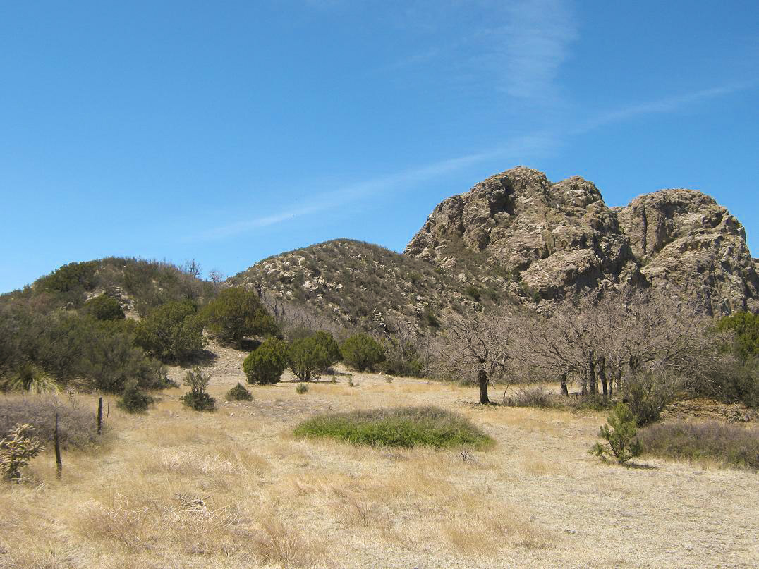
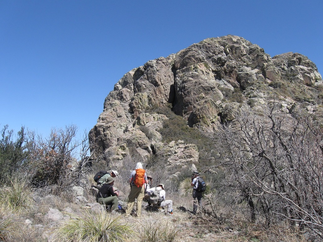
We hiked steeply up the slope in front of us, aiming for the tower at elevation 7,900 feet. The brush was light and the path well-defined. We arrived to this tower after about 30 minutes. After a short break, we walked north cross country through a lovely meadow, then up and down a series of ridge humps, each successive one brushier than the previous. In time, we had climbed onto the last of these brushy hills, elevation about 8,060 feet. This is as far as Ken and I got in 2008. Other than getting caught up in the woody brush, we all did fine, and we took regular breaks to let everyone catch up and rest. We were in no hurry.
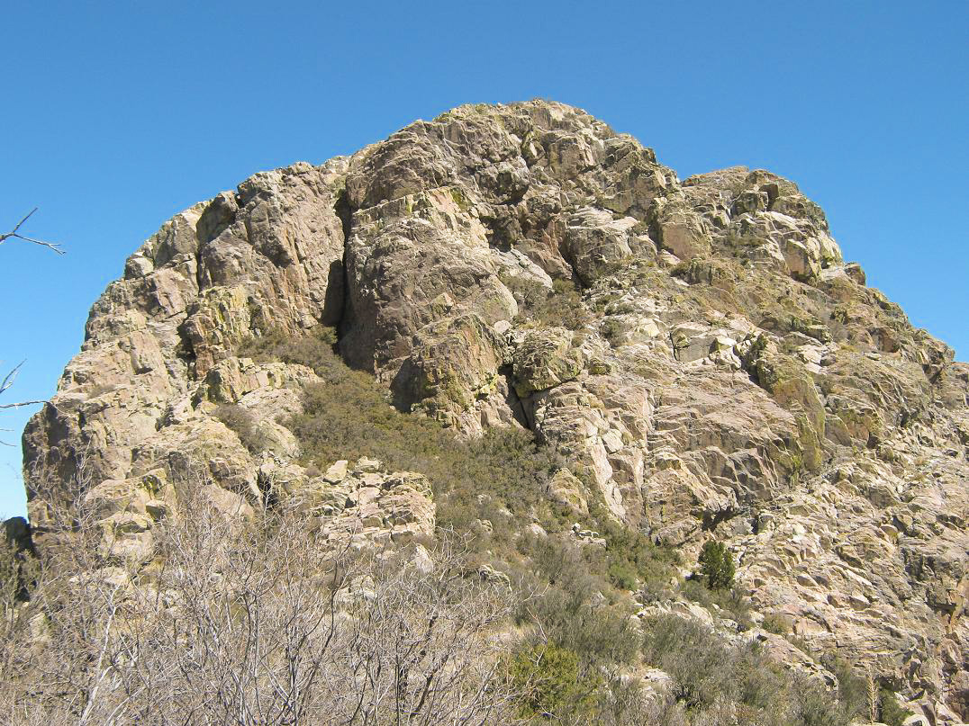
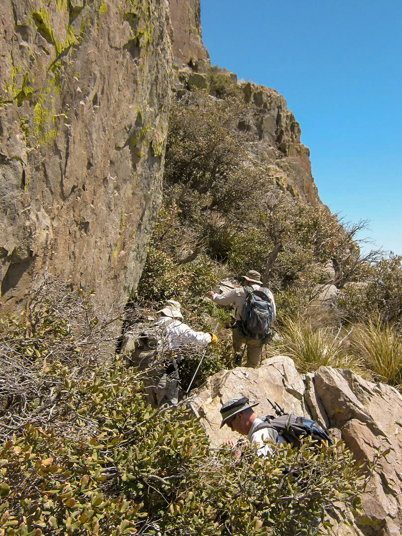
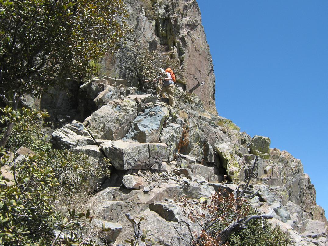
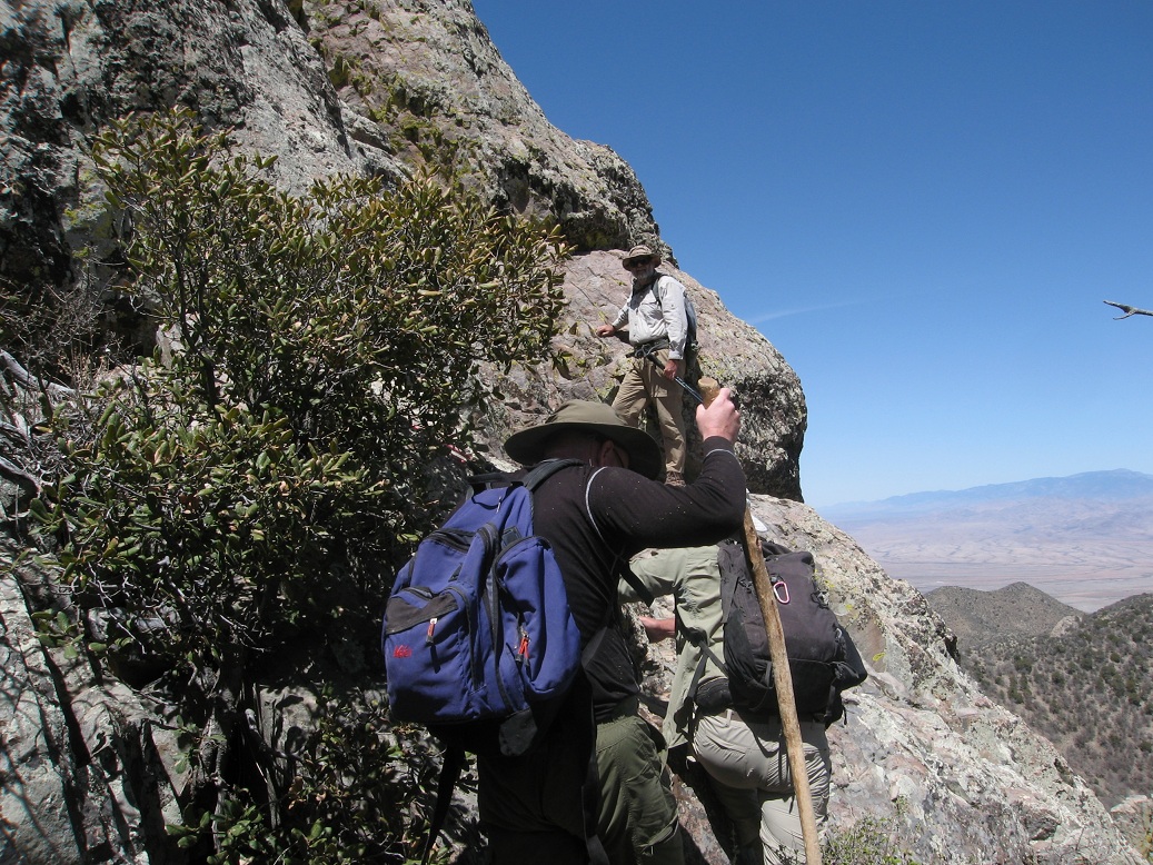
Looking at the summit block, we saw a gully filled with brush, and a lichen-colored rock that was to be the start of the ledge that allows mortals like us a way to the top. From below, it's hard to make out the ledges. We battled the last of the brush to get to the base of the cliff, then eased up onto the ledge, and after everyone was caught up and ready, we started upward, about 150 more feet to gain.
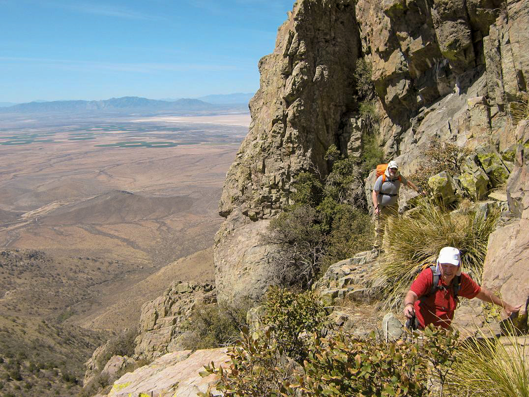
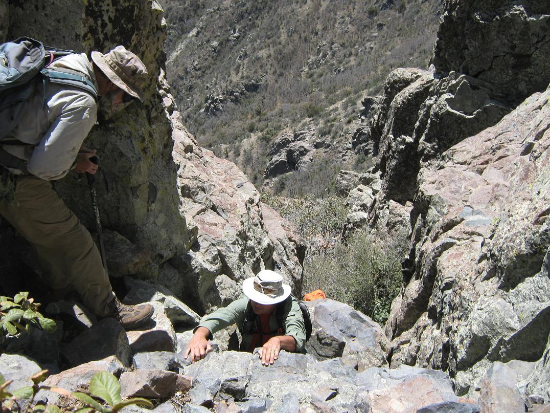
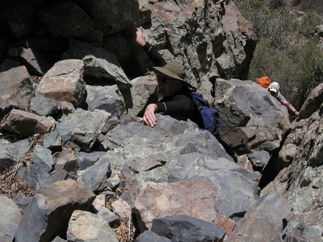
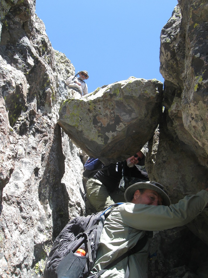
The ledge is fantastic. It's about 5 to 10 feet wide, sometimes just bare rock, other times choked with brush. A few spots were exposed enough to get our attention. We moved methodically and shortly convened at a point about 60 feet higher. Here, we angled left and started up a chute, choked with the same woody brush. This went on for about another 60 vertical feet. The chute tightens and comes to the crux of the climb. Here, a chockstone forms a void under which we passed, then carefully up-climbed through the awkwardly-placed rocks to gain the higher terrain. All of us avoided placing any weight on this chockstone and we eventually wormed our way up this section.
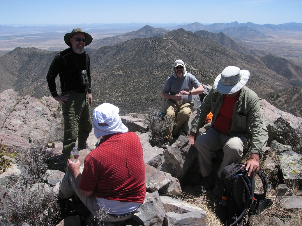
We then battled past a few more yards of brush, then scrambled up more rock to the second, lesser crux, a rocky chute that fed us onto the flat summit. The only issue with the chute was that in the event of a fall, the run-out was about 100 feet of air, given we were overlooking the notch that connects the two "cabezas". However, the holds were plentiful and we scampered up this without issue. And that was it, we were all on top! My thing-that-tells-time read 11:30, a two and a half hour climb. Not bad for us old guys (me being the youngest at nearly 46).
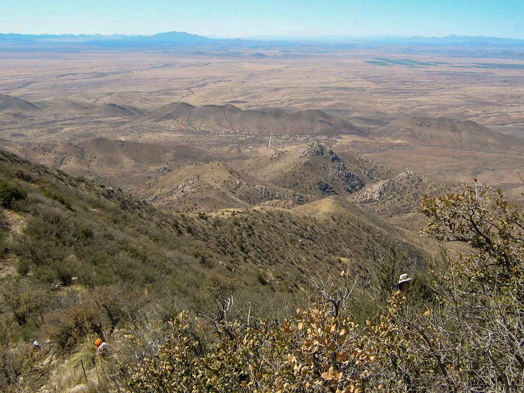
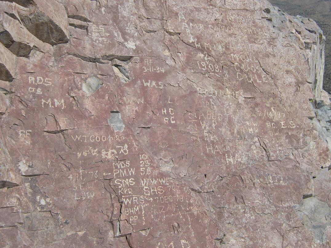
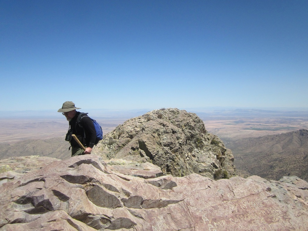
We sat around the broad summit, tagging the top-most rock and reading the names etched into a nearby rock from climbers of yore, some going back over a hundred years. The views were unbelievable, with hundred-mile views even as far as into old Mexico. We sat around, had a bite, signed into the log, got photos, and also studied the north summit. Even without a level, it's obviously lower. In the past, Mark and a friend made a survey where he showed the differential to be 6 feet, 8 inches relative to the benchmark. The actual summit differentials are about 3 feet.
We were on top for about 30 minutes. The plan was to descend to the notch and ascend the north peak. However, I got what I came for: the south summit and the range highpoint. The north summit held no interest for me and I had just enough patience and courage left in me to get down the rocks back into the brush, so I asked if anyone had objections to me going down the way we came up, and soon, Ken and Dean joined in with me. The others went on to the north summit, while we three slowly inched downward off the south summit.
The two crux sections went well. The chockstone segment took some time. Most class-3 chutes are best downclimbed (in my opinion) by facing outward, but here, the opening was too wide to safely shimmy down in that manner. Instead, we had to face inward and eyeball places to catch our feet, still trying to avoid putting any weight on that chockstone, the Aron Ralston story in our minds. I went down first, then helped talk Dean and Ken where to place their feet, and in time, we were below that tricky section. The remaining ledges back into the brush went slowly and without event, which was fine by us. We took a breather once off the rock and back into the brush.
Our hike out when well, if slow, as we tediously managed the thick brush before getting down onto lower, less brushy terrain. We heard a holler, and saw the other four guys atop the north summit. That was cool, to see they had made it, and I guess they may have felt some relief that we had made it down safely. Once past the brush, it was an easy trail-walk down the steep slopes back to our vehicles. We waited for about 30 minutes until the others showed up, descending the lesser 4-wheel drive track that skirts the summits. For us, we had arrived back just before 2 p.m., meaning a total time of slightly less than 5 hours. We all milled around the trucks before rumbling down the roads back to the highway.
It was a thrill to climb this landmark summit, and a great feeling to attain this peak after that frustrating 2008 experience. I cannot thank Mark enough for his work in arranging access with the landowners so that we could drive up these roads, cutting our hiking time considerably.
From here, Mark went on to his home while the rest of us made our ways into Safford, then to our next objective, Pinnacle Ridge in the Santa Theresa Mountains near the Aravaipa-Klondyke area. Scott P. and I stopped for a bite in Safford, then met Scott Kelley at our pre-determined meeting point. We rolled to an open camp, then the others showed up about an hour later.
Alas, I bailed on this climb. The brush was monstrously thick and I just didn't have the motivation to continue on. Ken also bailed, while Dean stayed back at camp, so Ken and I will try again later. The others were successful, albeit scratched and tired. Thus, I traded one vendetta peak for another. I knocked off Dos Cabezas Peak, but now have Pinnacle Ridge to worry about for a later date. Such is the nature of this silly game.
Last comment on the access to Dos Cabezas: apparently in the olden days, as recently as the mid-2000s, one could park at the first gate, which was a hiker's easement, and walk the whole road to the radio tower, then to the top. That land is now in newer hands and they aren't that interested to have an open access route for hikers. Even though the upper mountain is public, the surrounding private lands effectively bar people from the peak. Arizona law favors this activity, so that easements are not required at all. It's frustrating, but I got my summit and have no need to return. I can admire it from the interstate henceforth.
|

|