
The Mountains of Arizona
• www.surgent.net
|
| Diamond Mountain |
• Mazatzal Mountains • Tonto National Forest • Maricopa County |
|
Date: November 25, 2012
• Elevation: 5,120 feet
• Prominence: 1,280 feet
• Distance: 3 miles
• Time: 3 hours
• Gain: 1,500 feet
• Conditions: Clear blue skies
Diamond Mountain is in the Mazatzal Mountains, rising above the community of Sunflower west of State Route AZ-87 (The Beeline Highway). There are many hills and mountains found here, and some of these hills are large enough to be considered as mountains in their own right. Such is the case with Diamond Mountain, which has a prominence of 1,280 feet. It's an attractive peak, one that I had developed an interest in exploring while driving by on previous journeys up and down the Beeline.
This was Thanksgiving weekend, and the weather was stunning, with blue skies with no clouds, cool mornings and pleasant days. Given the lovely conditions, I decided on-the-spot to drive to this peak and explore it, allotting a half-day for the journey. I left home before dawn and drove the Beeline roughly 30 miles to Sunflower. The first views of this mountain come as one descends the highway at about milepost 206, a couple miles north of the Four Peaks turnoff. Here, the highway ascends a hill then makes a long descent into the Mesquite Wash valley. Off in the distance is Diamond Mountain, with a long anvil-shaped ridge featuring small outcrops and cliffs.
The actual turnoff is between mileposts 216 and 217. The highway crests a rise before descending into the "business district" of Sunflower, a tiny community that consists of one or two ranches (including the aptly-named Diamond Mountain Ranch) and a few scattered homes. I first drove by the turnoff and had to drive an extra mile into Sunflower before catching a cross-over to get back onto the southbound lanes. The turnoff is at the top of the small crest, and the road is Tonto Forest Road 1705. I followed this in about one-eighth a mile to a junction with FR-1697. The first road is solid hardpack, but the second road is a steep and rocky track better suited for 4-wheel drive. I parked in the ad-hoc camping area at the junction of these two roads, hiding the truck (sort of) behind small bushes. Shell casings litter the area.
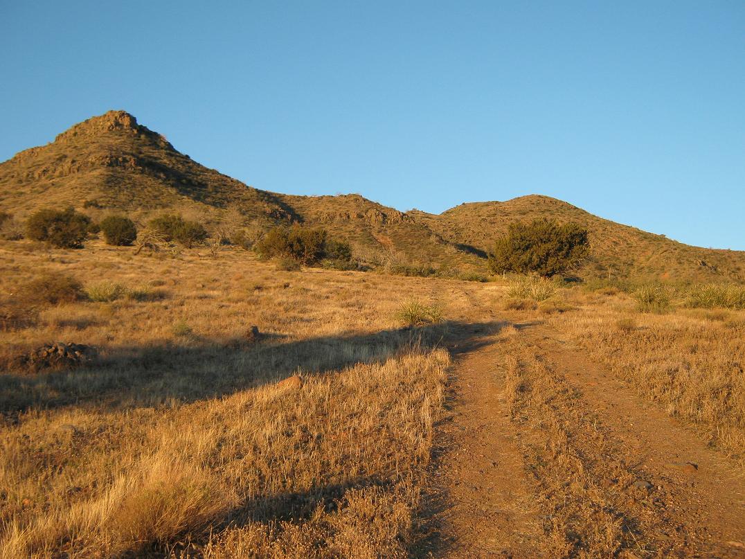
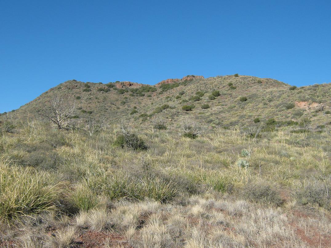
Diamond Mountain rises above this junction. I chose to hike the second road rather than drive it, since it doesn't go that much farther, and I would probably be walking faster than had I eased the truck up it. I had timed my drive well, as the sun was just breaching the mountains to the east as I started hiking at 7:05 a.m.. The weather was still and pleasantly cool, but not chilly. Looking up, two cliffbands and many rock outcrops inhabit the eastern edge of the mountain, while farther behind are the higher ridges including the summit. From below, it is not obvious which bump is the summit. I'd figure that out when I got there.
I walked up the track until it ended at a turn-around near a large juniper. The map shows a trail (#76) continuing from here and staying low in the drainage, aiming west towards Indian Spring Peak, notable for its rocky pillar summit. My default plan had been to walk this trail a mile or so, then barge south, heading cross country up the slopes for the top. The spacing of contours seemed to indicate the slopes weren't that steep. However, I immediately abandoned this plan as I followed an ATV track directly up-slope for another few hundred feet, seemingly aiming for the lowest of the cliffs.
I followed the track as best I could, and when it gave out, I proceeded west through waist-high brush around a couple minor ribs, getting myself high onto the north-facing slopes. Looking up, I had a better view of the summit ridge, while looking down, I could see the trail well below me. There was no reason to descend to this trail now. Instead, I would battle the brush and make a long, angled traverse of this slope to get me onto the highlands. It looked promising, if brushy.
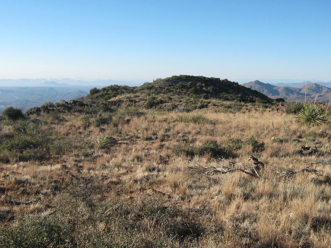
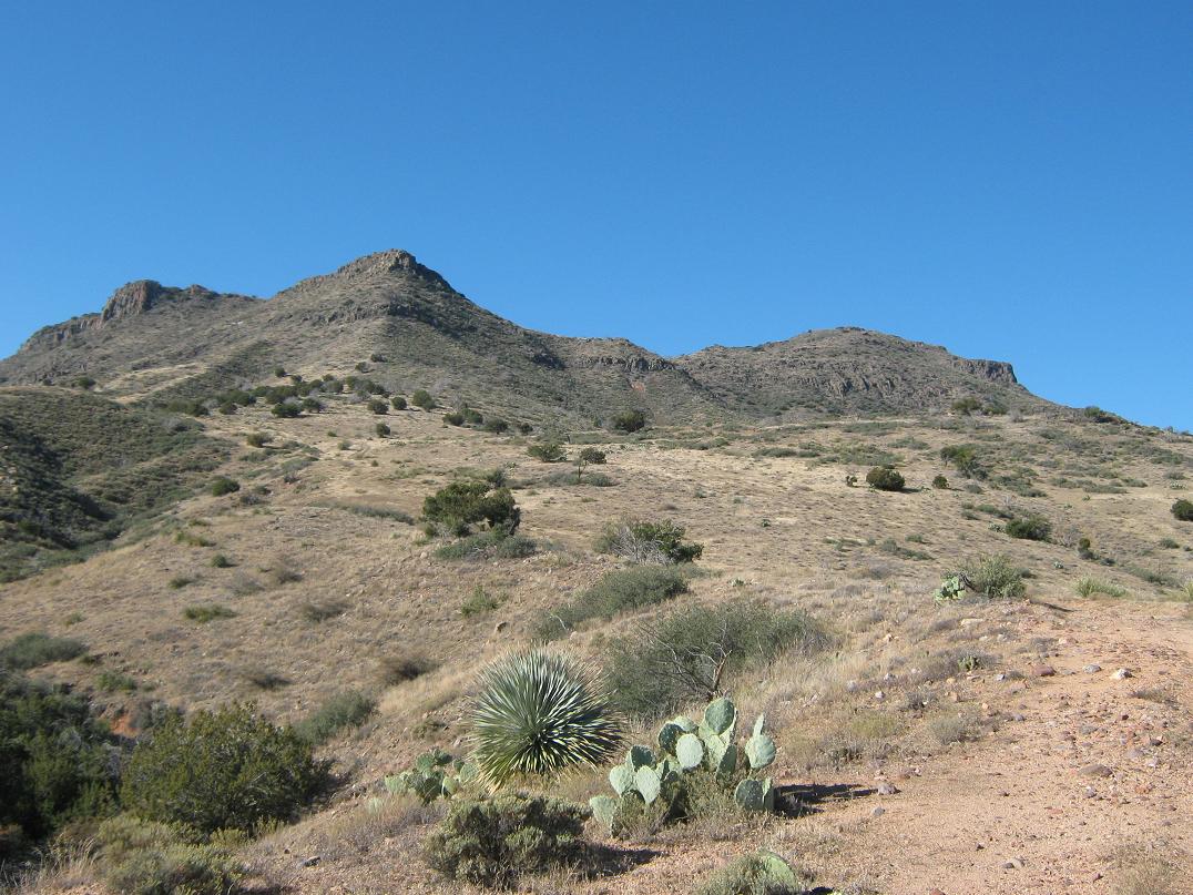
This traverse wasn't too bad. It was only a half-mile, and I was able to find rocky drainages free of brush, or game paths, often enough so that I didn't have to plow through the brush directly all the time. After 20 minutes, I had arrived on top of a small promontory, where the gradient lessened. The summit ridge was closer, and I could see the lay of the land better. The summit ridge has red-colored cliffs, but the actual highpoint is a rounded hill at the left-most (south) extant of this ridge. However, I had no idea of this from where I stood. It all looked equally high for now.
I continued my trek, walking through a stand of thick scrub, then to the main saddle ahead of me, where the brush was much lighter. I made good time, and soon, I was on the slopes below the summit ridge, picking my way upward. I usually followed natural paths, most of them game paths that would run for a few yards then peter out. There were no obstacles, and by maintaining a steady pace, I moved upward through each hilly segment until I was directly below the red-colored cliffs. Here, things got a little steeper. Ahead of me was an outcrop of gray-colored rock, big enough to look like a possible barrier, so I angled left and found a bad path through open slopes, then angled upward until I topped out above this rock outcrop. The slope here was open and loose.
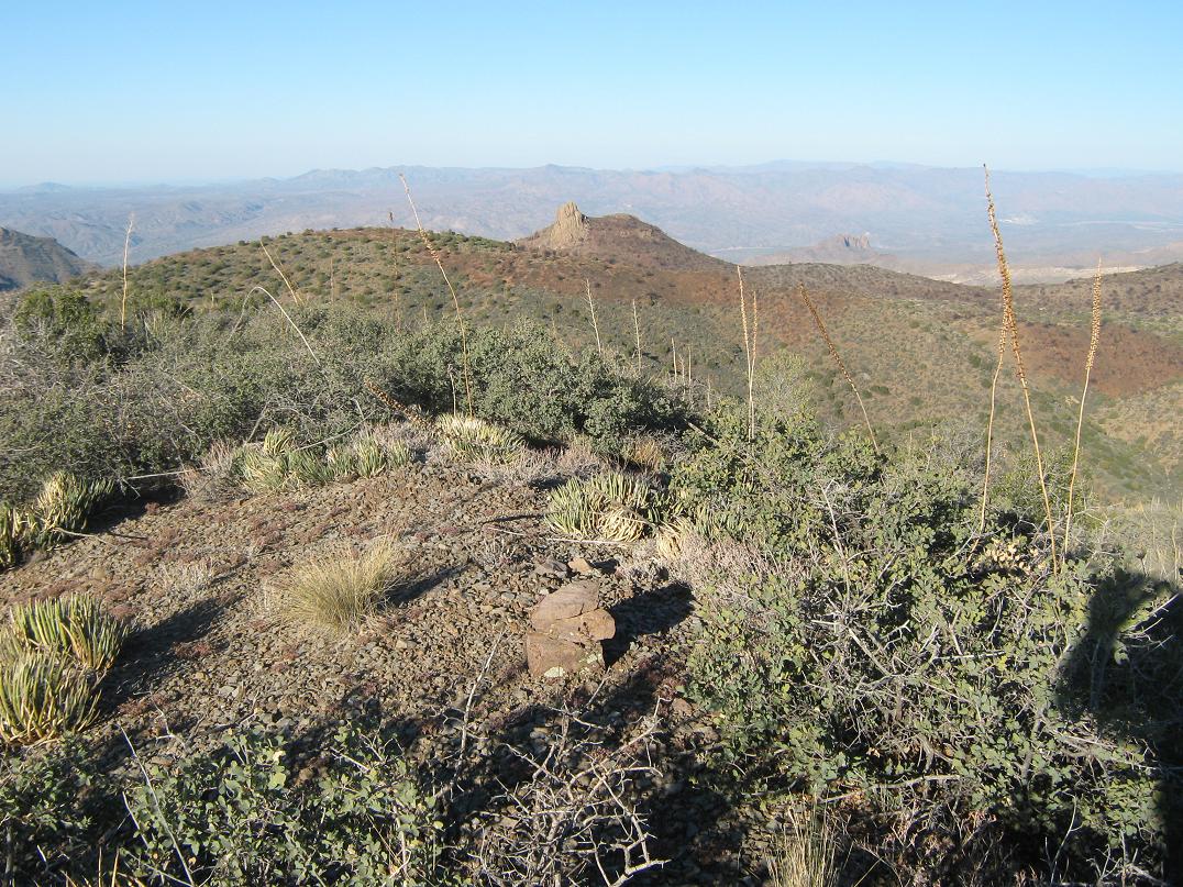
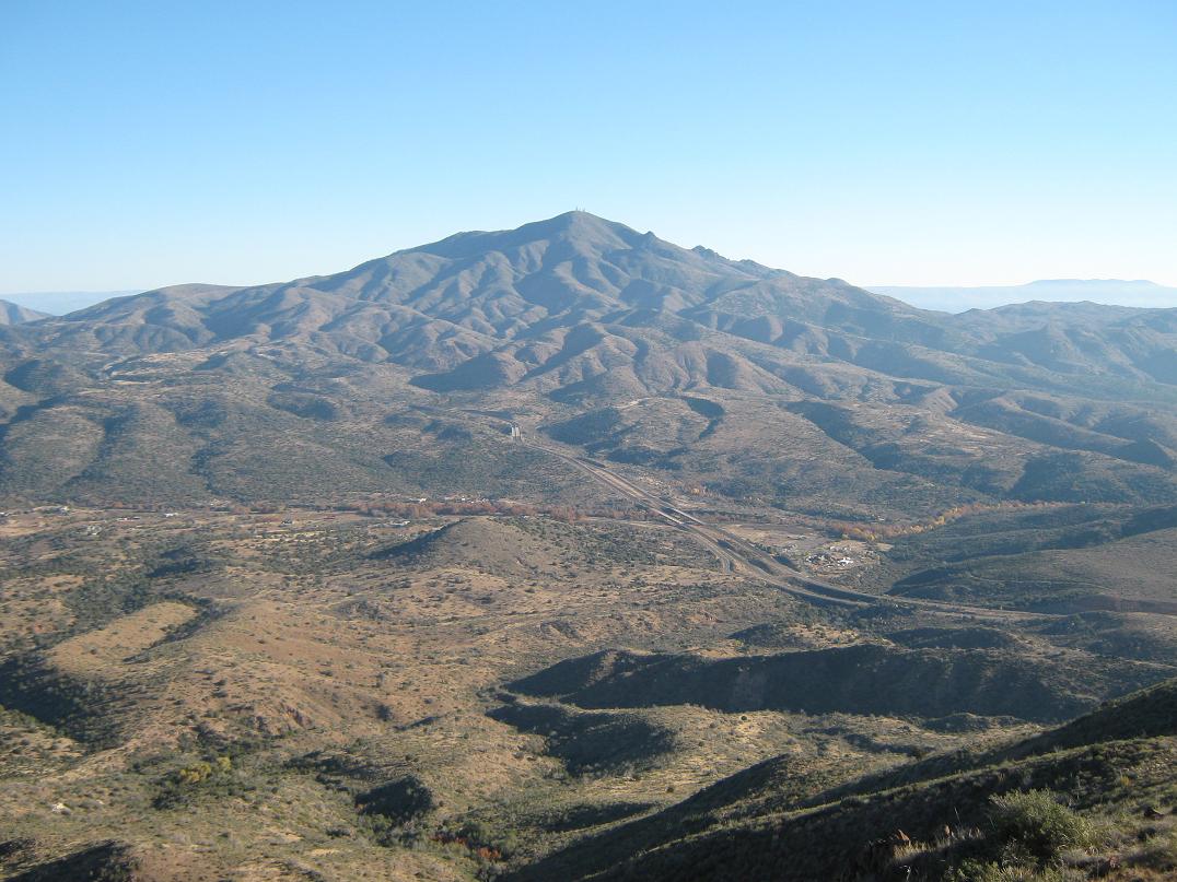
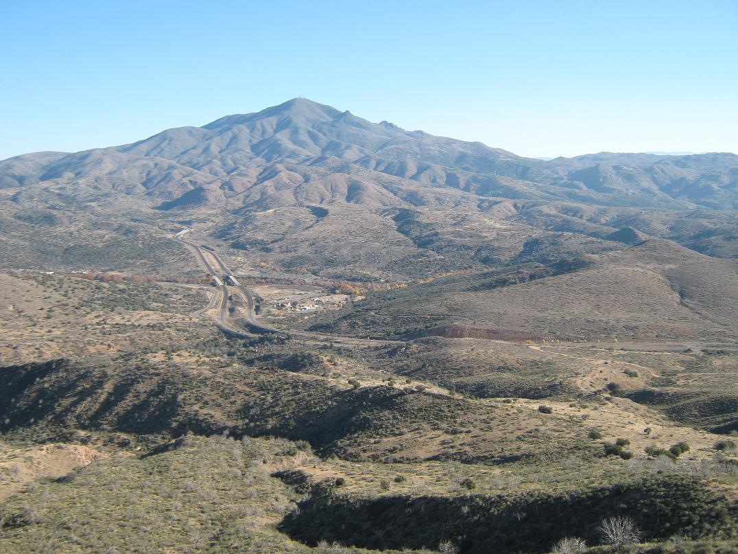
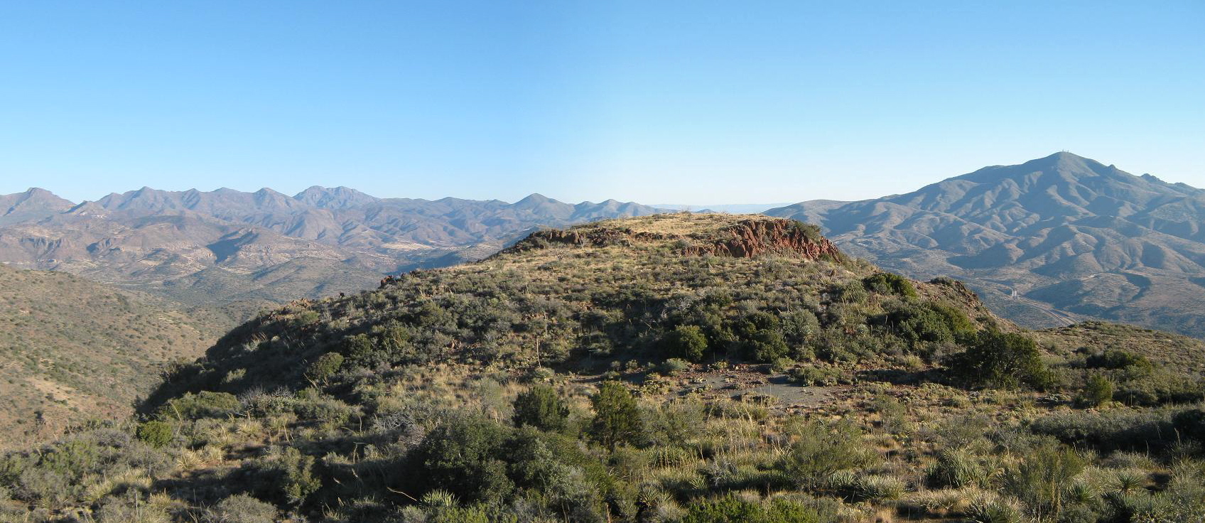
Soon, I was at the base of the red cliffs. I scampered up a couple of easy chutes that required just 15 feet of gain, and nothing with exposure. It was simple, and there I was, on "top". I had come onto the summit ridge, which features two main areas: the northern bump, where I now stood, and the slightly-higher southern bump, about 200 yards away. I spent a few minutes checking out the area and looking for a benchmark, but found nothing. The views north into the myriad of peaks and hills was amazing, along with a grand view of Mount Ord. I could even see my truck way down below.
The hike to the south summit went well, and I topped out at 8:45 a.m., a 1,500-foot gain in about a mile and a half. The day was beautiful, and the sun low enough to provide ideal light for photographs. Looking north were the many hills and mountains of the Mazatzal Range, including Mazatzal Peak. Mount Ord was the most noticeable peak nearby. Looking southeast to southwest I could make out the Superstition, Goldfield, Usery and McDowell Ranges. The Four Peaks were glared out by the sun for the moment. I spent about 10 minutes sitting on the hump of bare rock and light brush. A small cairn marked the top, but after some searching, found no registers. I suspect very few people hike this peak.
I debated descending toward the west and down what looked like nicer slopes toward the trail, but without the certainty of a trail, I decided to retrace my ascent route for the descent. I was able to follow my route down with no trouble, finding better options in a few cases than what I had followed on the ascent. The brush was thick in spots, and the steep downhill traverse took awhile, but in about an hour I had descended below the main mountain mass and to the upper terminus of the ATV track I had followed coming up. By now, it was warm, enough to stir up the grasshoppers and other bugs. I even kept an eye for snakes, not planning to see any this time of year, but one can't be too complacent. I was back to my truck a shade before 10 a.m., a nearly 3-hour hike. Some guy was shooting a gun somehwere nearby, just target practice I assume, but it was steady enough so that I didn't saunter. I changed clothes and started driving back home.
This hike had gone better than I planned. I expected more barriers and cliffs, but overall, it was very simple, if brushy. Even then, it's not the worst brush I've ever dealt with. I am surprised more people don't come here, but given the bigger attractions in this range, most people will probably whiz right past it on the highway. You stand a real chance of seeing no one should you come here.
Update July 2021: Andy Martin makes a compelling case that the north summit is the highest point, not the presumptive southern summit. Using my panorama photo and clever geometry, he feels the north summit if 5 feet higher than the south summit. Since they're so close, I suggest to visit them both. I did, and I really cannot remember what I felt at the time, if one was definitively higher than the other.
|


|