
The Mountains of Arizona
• www.surgent.net
|
| Deem Hills North |
• Deem Hills • City of Phoenix • Maricopa County |
|
Date: April 30, 2025
• Elevation: 1,905 feet ✳
• Prominence: 318 feet ✳
• Distance: 1.5 miles
• Time: 45 minutes
• Gain: 380 feet
• Conditions: Sunny and warm
Arizona
•
Main
•
PB
•
LoJ
•
Lidar
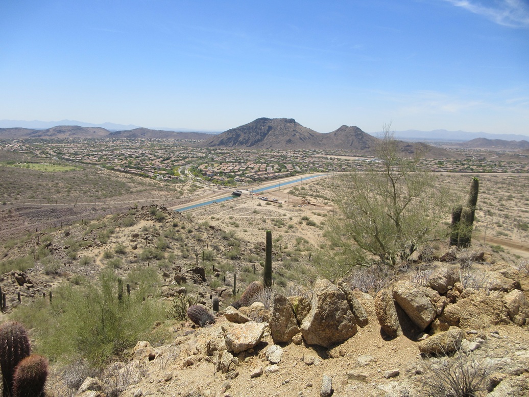
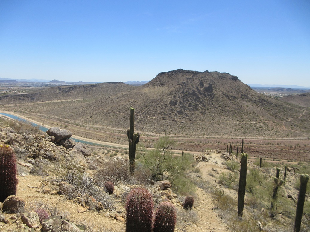
This desert peak rises north of the Central Arizona Project (CAP) Canal in northwest Phoenix. It lies east of Pyramid Peak, the Deem Hills highpoint, and north of Deem Hill. South of the CAP Canal is homes and suburbia, while north of the canal is open desert.
The CAP Canal runs south of the peak, cutting through its low saddle that connects it to the main Deem Hills massif. In digging out the canal, the elevation at the saddle was lowered by about 80 feet. Prior to then, the saddle elevation was given as 1,627 feet, with the summit given by a tiny 1,900-foot contour but no elevation figure. The canal's lower elevation means that the new defining saddle for its prominence value is northwest of the peak, and the peak's prominence rises from its original "natural" figure of about 285 feet, to 318 feet.
I was up north, climbing a handful of peaks in and around the Cleator and Cordes area, with no pressing need to be back in the big city until evening. I was done up there by noon, so I took a look at this peak for something to do as I drove back into town. It was the last remaining ranked hill in the Deem Hills I had yet to climb.
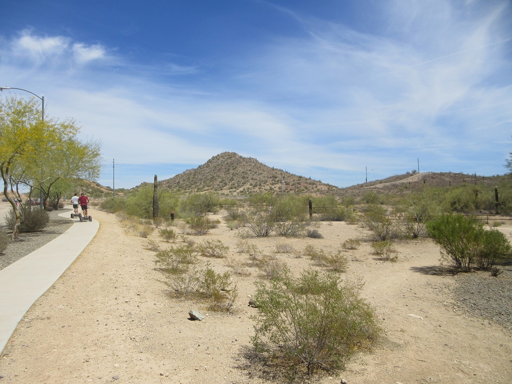
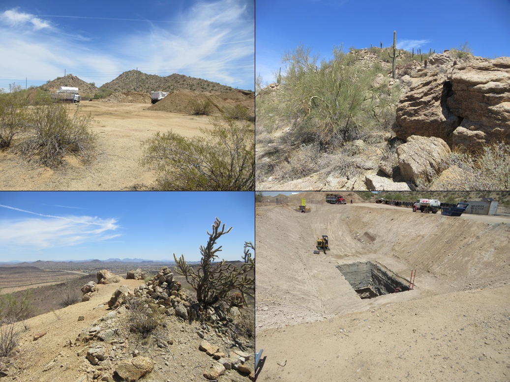
I exited the interstate at Happy Valley Road and went west to 51st Avenue, then north (taking some secondary roads) to where the main road abuts up against the CAP Canal. However, there is some major on-going construction here, the last little bit of the road is torn up, earth movers everywhere, that kind of thing. But access was not barred. I pulled into a side road near a tiny park on Bent Tree Drive and parked. Two other cars were parked here, the two guys trying out some quad scooters. There were no "no parking" signs so we felt it was okay to be here. They even appear in my first image at left.
I walked the road over the canal, then went left to avoid a closed-off area where there were some earth movers moving earth. I had to do an end run around the fencing, eventually crossing back toward the peak where the fencing ended.
I walked up old tracks toward the peak, working my way up to a small saddle, where people in the past have dumped old furniture items. In one place, it looked like someone had found an old couch and set it up tucked in against the rocks and brush. I have to admit, the 17-year old in me thinks this would make an ideal drinking and party spot. I like to see that kids today are resourceful when properly motivated.
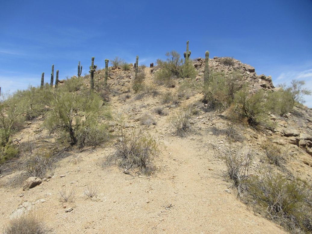
The track I was on then came to the base of what may have been a road once, about fifty years ago. It was severely eroded and steep, but it offered a clear way up the immediate slope. Now I was on a platform within the big rocks. Satellite images show a trail curls from here to the top but I could not locate this trail.
Instead, I just pushed upwards, the climbing being easy with the rocks offering good footing. Brush was moderate and generally easy to avoid. I went up and soon, came upon the trail. I followed this trail up to the top.
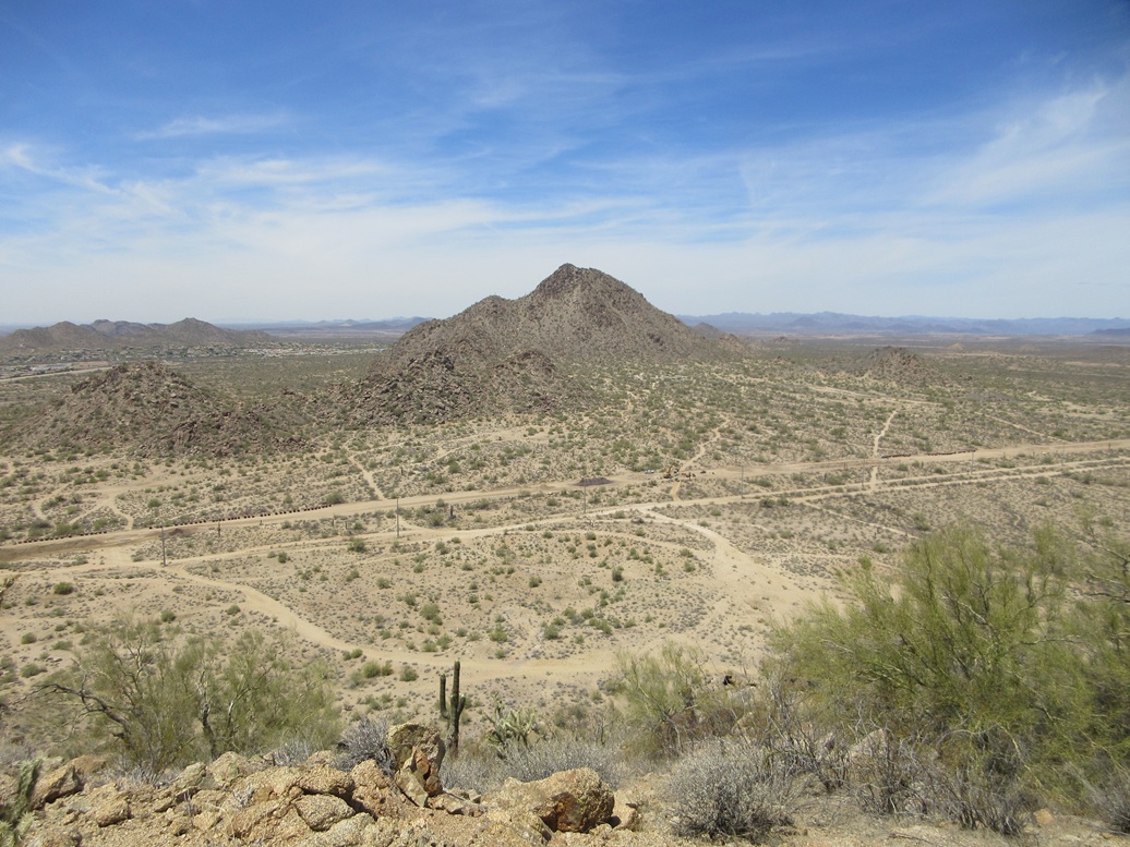
The summit is open with a large cairn and some good vantage points. I got some nice views and images of the surrounding peaks. I could not find a register but did not expect to. This humble peak probably sees a regular stream of hikers and mountain bikers. For people living close by, it's an easy-to-access peak for exercise.
I hiked down the same way, but followed the trail until it curled around and dropped me off back where I had been. Truthfully, I never would have seen the trail from below. It didn't matter as the off-trail portion was easy and short.
I walked around the earth movers and beeping trucks and stopped to look through the fencing at what they are doing here. They had dug out a pit, and within the pit, a deep hole. I took an image of it. I could not tell how deep down the hole went, but this looked like a serious hole they had to blast through bedrock. I'm guessing for future flood control, as it appears they are building out the road north of the canal. Still, it was neat. It must be a cool job to dig holes for a living.
I was back to my car quickly, the round trip taking a little under an hour. This was a fun peak but nothing special, with better options nearby. But for me, it's minorly notable as it is the last ranked peak I had yet to climb within the Deem Hills (I include the East and West Wing peaks, Ludden Mountain, Calderwood Butte and Sunrise Mountain in with this grouping).
The weather had held up. It was warm, in the mid 80s, but dry and calm. It was now about 2 p.m. so I headed to campus and did some work tasks for a few hours, also getting in a workout.
|


|