The Mountains of Arizona
www.surgent.net |
|
Coyote Peak • Peak 3815 Coyote Peak is the highpoint of the Ninety Six Hills, a batch of hills about 20 miles southeast of Florence, east of State Route AZ-79. I was here in November when I explored the backroads — Florence-Kelvin Road, Barkerville Road and Freeman Road. I had hiked three peaks already that day and was a bit beat by the time I drove past Coyote Peak. Last weekend, I came here again as I had a day open. I drove to it and parked, then saw the "no trespassing" signs. I didn't want to take any chances. But I did my homework and learned that the private property takes up just a small portion of the peak's southern slope, and could be bypassed altogether (or mostly altogether). Along with this peak, I also had a map for Peak 3815 to the east. It would be my day's bonus peak. Getting there was a little adventure. I planned to follow US-60 east through Mesa And Apache Junction, but when I got on it, signs said it was closed a few miles ahead. So I bailed onto Alma School Road and followed it south to the Loop-202 freeway. Fortunately, it was still dark and early, and traffic was light. I followed the Loop-202 east then north (counter-clockwise) to the little spur called AZ-24, then followed that to its end at Ironwood Road. It was surprisingly heavy with traffic, especially at the Williams Field exit. No idea why. I went south on Ironwood, then renamed Gantzel, until it connected to the Hunt Highway, which I followed into Florence. I was patting myself on my back for being so clever with my directions, no on-board GPS for me. However, where the Hunt Highway meets state route AZ-79 north of Florence, north of the Gila River, it was clogged with traffic. They're building a fancier bridge over the river, so traffic is limited to one lane where cars take turn going north or south. But there seemed to be a long delay between when the northbound traffic ceased, and us southbounders could proceed. We just sat there, not moving. Well, finally, we moved. I made a note that I won't came back via Florence. I stopped for gas and snacks in town, then proceeded south on AZ-79. Fortunately, there were no more traffic issues (for now).
Date: January 21, 2023
• Elevation: 3,973 feet
• Prominence: 673 feet
• Distance: 2.8 miles
• Time: 2 hours
• Gain: 900 feet
• Conditions: Sunny and crystal clear, very cold
Arizona
•
Main
•
PB
•
LoJ
About 20 miles south of Florence, I got onto Freeman Road, heading east. This is a very wide, well-graded hardpack road, but a storm from about a week ago had left parts of it in haggard shape. There were long sections of mud, which was fortunately (mostly) dry, and other parts had rivulets that crossed the road, where I had to ease over them slowly. It wasn't anything bad, just kind of annoying.
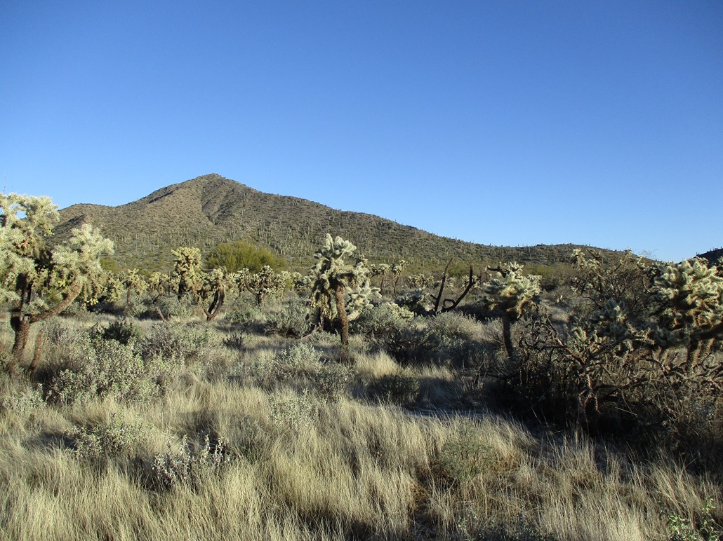
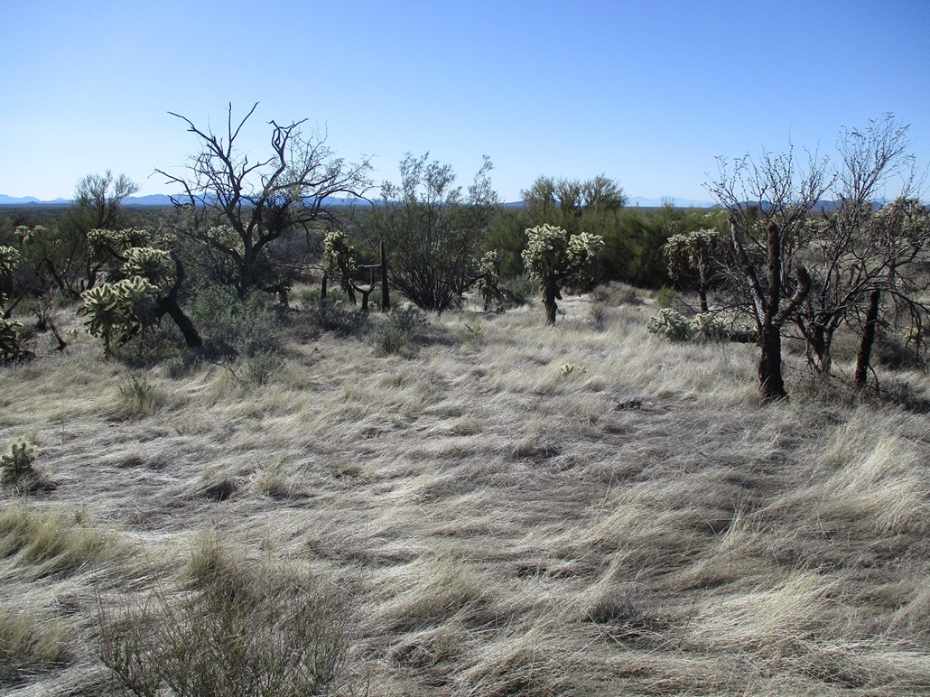
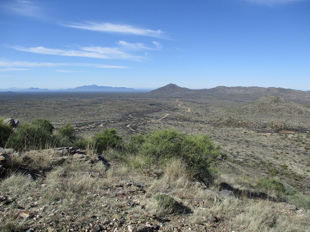
Six miles later, I was abeam of Coyote Peak. I had done my homework. I knew there was a pull-off on the south side of Freeman Road, and directly across from it, there should be a dirt track going north that marks the boundary between the private property to the east, and State Trust land to the west. I rolled in, got properly suited, got my pack in order, and started walking about 8:45 a.m.. It was a clear day, very blue, and very chilly too, temperatures in the high 30s when I started.
I crossed the road, then under a fence, then quickly found a ranch track, then found where it swung north. This is what I wanted. I followed it north about a quarter mile until it ended. The slopes were just starting to steepen to meet the base of the peak, which was right there in front of me.
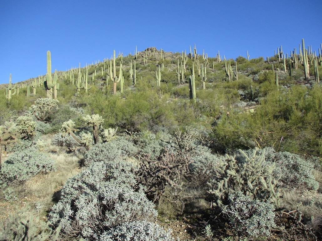
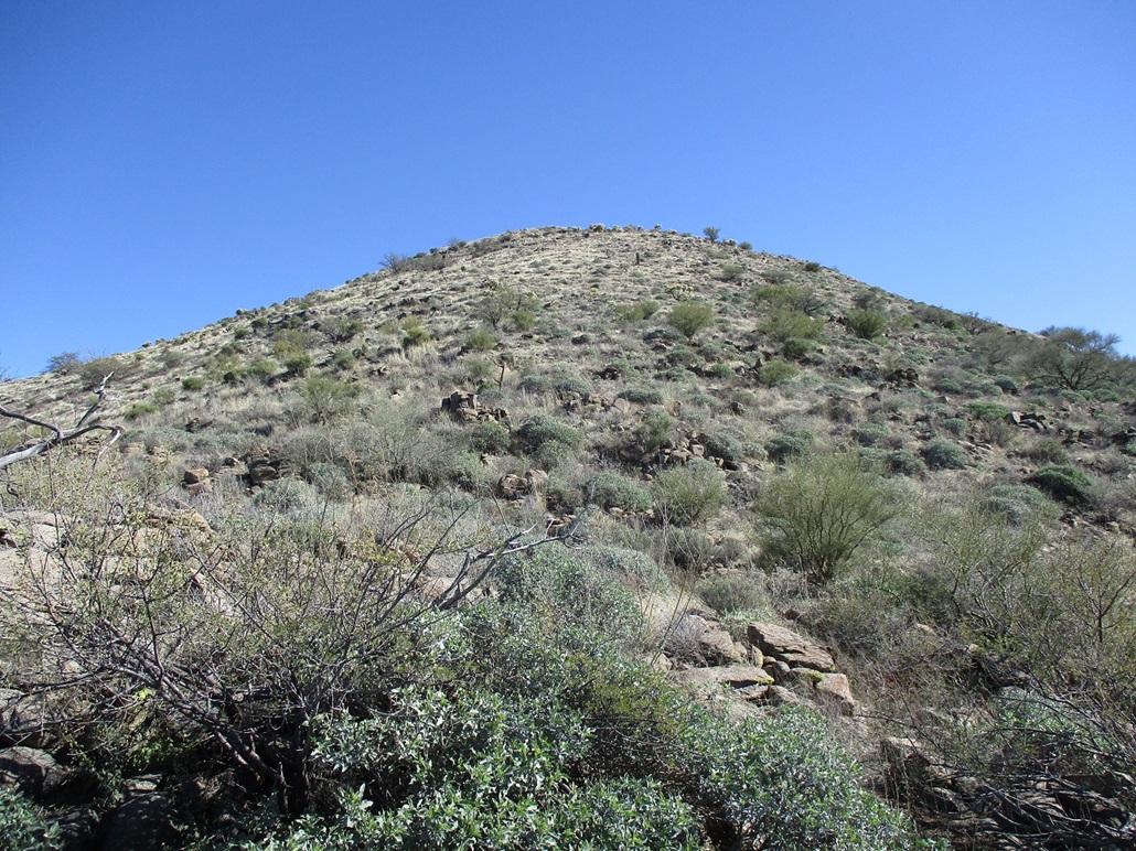
I wanted to catch its south ridge that has a nice long even slope and is the usual route to the top. I angled north and east, crossing into and out of a few arroyos and through one fence, then started up the steepening slopes, a rock outcrop (see 3rd photo) up above. I got onto the main ridge below this outcrop. Now I was on the ridge proper and could study it. What I could see looked realy friendly. I could not see the summit from here, but I could see about half way up. It looked like a lot of fun.
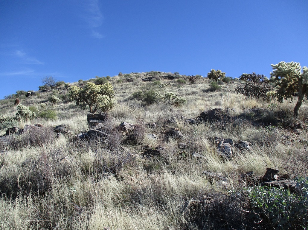
I started up the slope. I found paths and poop, both the result of cattle. I always welcome cattle paths, and generally am indifferent to the poop. I try to avoid it as much as possible. The paths helped, and where there wasn't one, I took what looked like a good line. The ground was mostly open, sometimes rocky, a lot of grass, and spread-out cactus, palo verde, ocotillo, brittlebush and creosote, plus a few saguaro. The fence I crossed a few minutes ago runs up the ridge, as far as I could see at first.
I heard some noise up above and see about three or four cattle (or is it cattles?). As I get closer, they are on the west side of the fence, me on the east side (right). When they saw me, they'd run uphill. I kept my normal pace and scared off these cattle about every five minutes. I was growing a little concerned. Would they just keep running uphill until they reached the top? They never ran orthogonally to the fence, and higher up, the ridge narrowed to where running away from the fence would mean running (or falling) down a steep slope. I actually had a little concern they'd fall down the slopes.
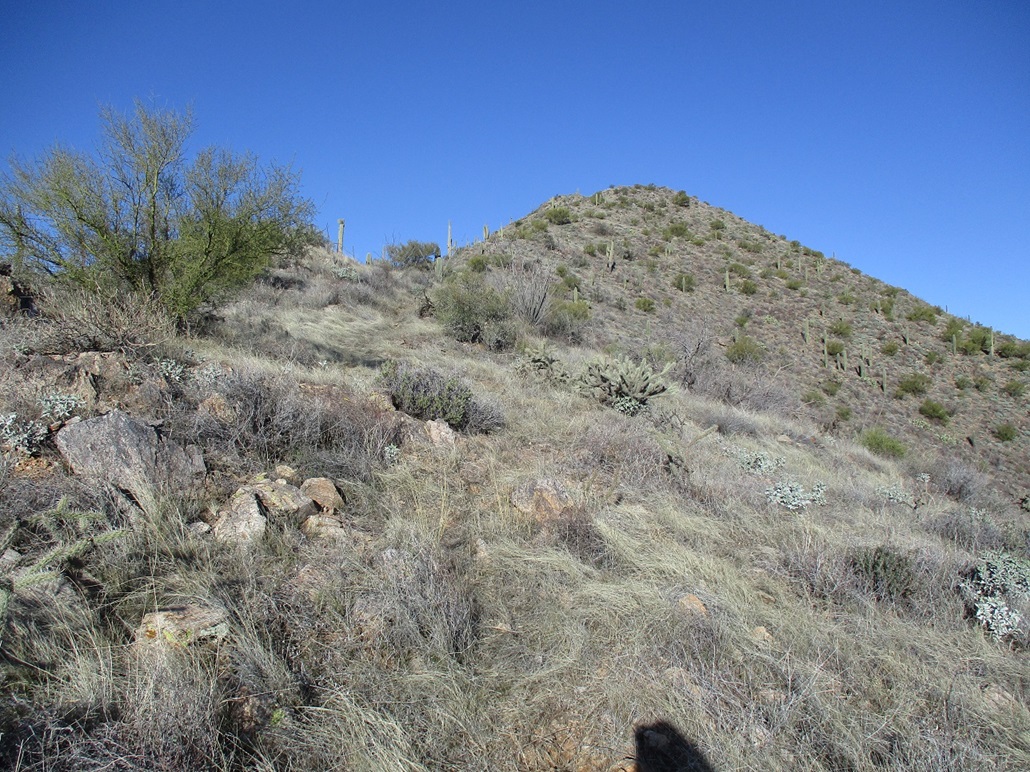
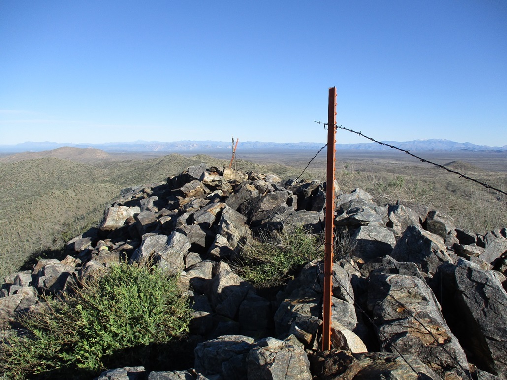
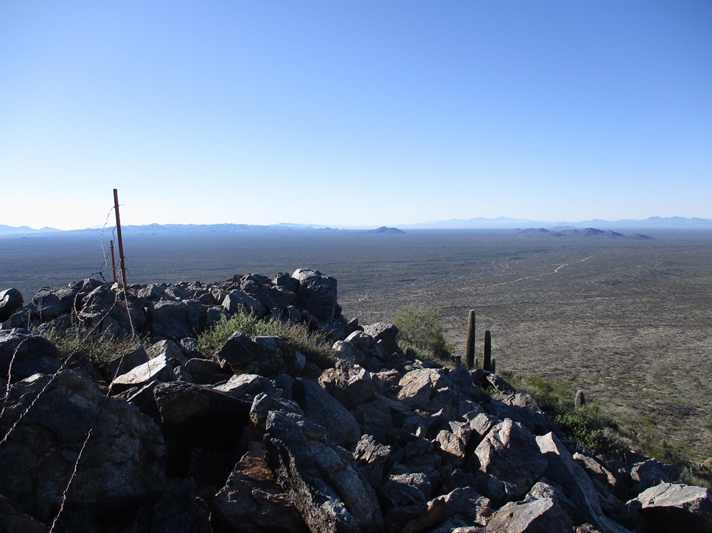
The ridge has slight undulations so that there's always a "point" up ahead, not a false summit, just a small bend in the gradient, but I used these to track my progress. Things got narrow the more I gained, and I never did see those cattle after a certain point. Finally, the summit was in view. Here, it made sense to cross to the left (west) side of this fence as the slopes on that side were much more open. After one more steep segment, I was on top, the summit a big platform of rocks, and interestingly, the fence running across its top and continuing down its other side.
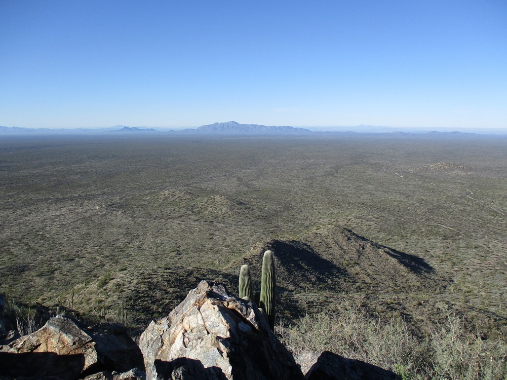
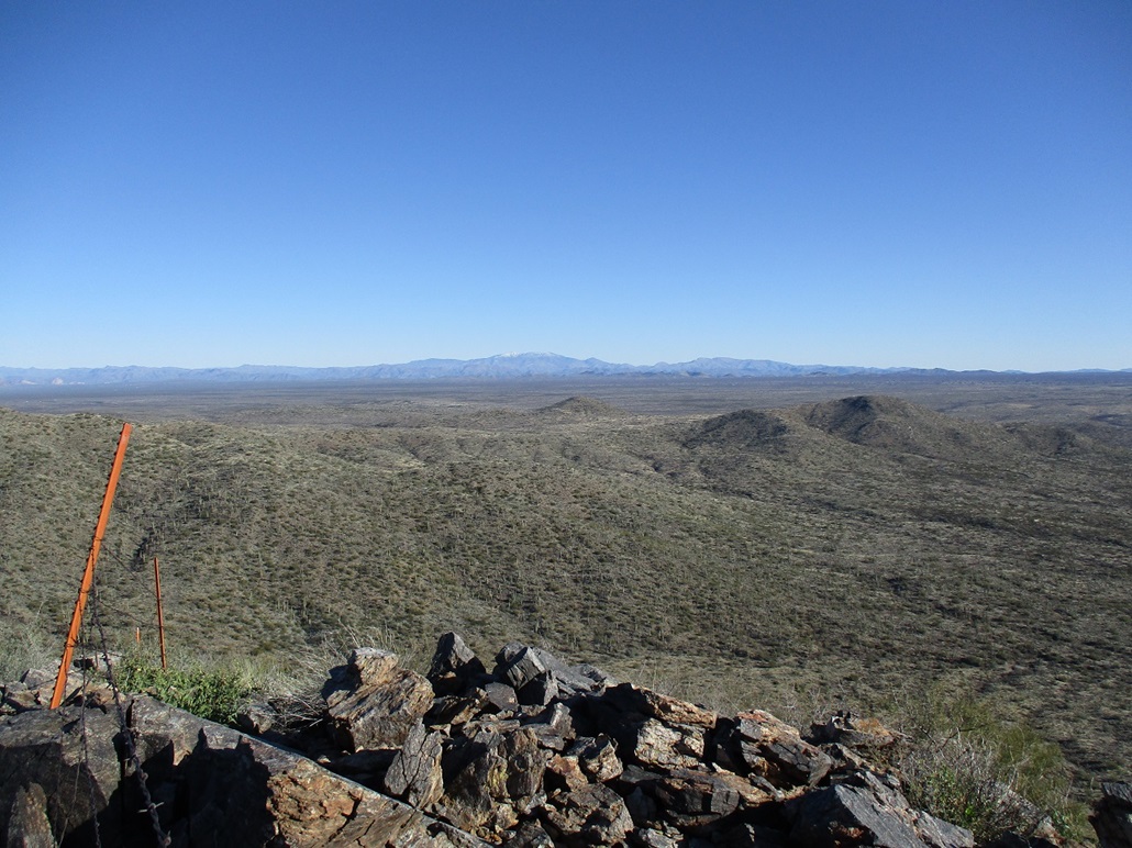
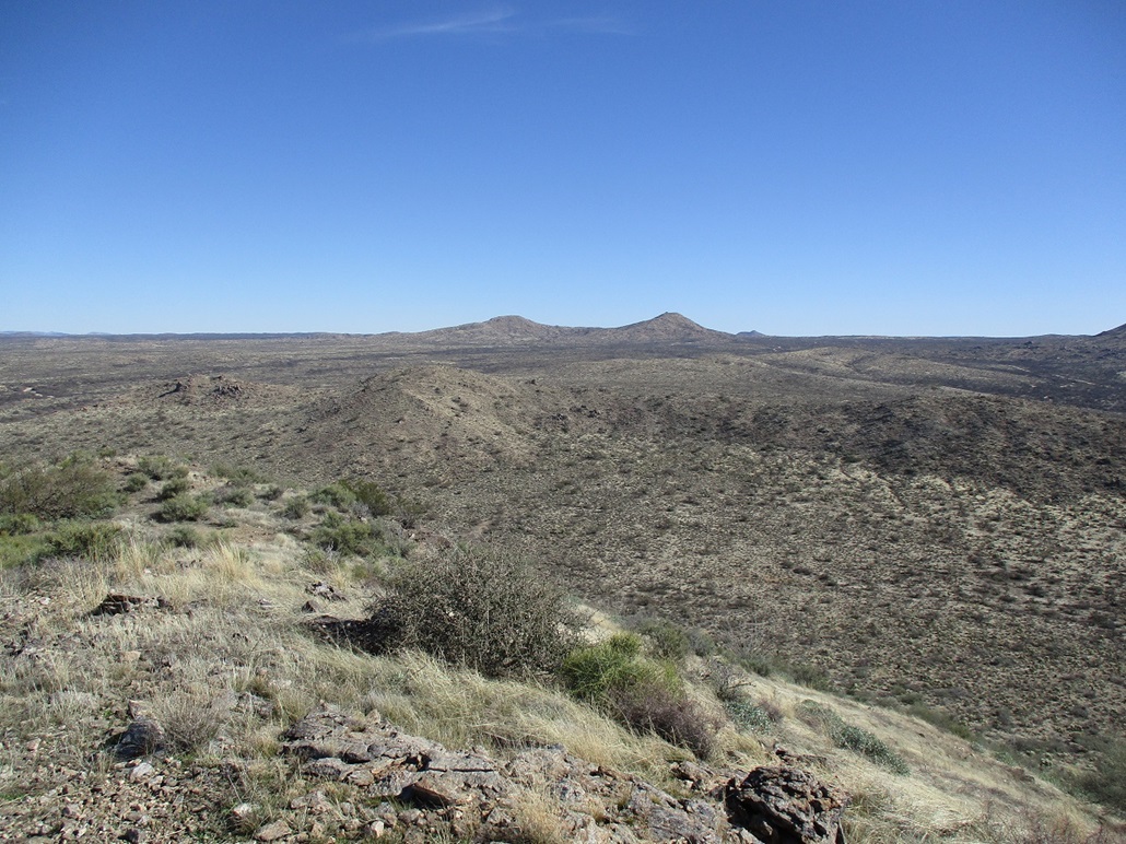
I found a register and signed in. The Southern Arizona Hiking Club came here often, then about 2015 or so, they stopped coming here. Since then, just a few people have signed in, about two or three people or groups a year. The views were outstanding. The air was so dry, I could make out peaks and details over 50 miles away. Pinal Peak was covered in snow. I could barely see Weavers Needle. Looking west, Newman Peak and Picacho Peak were most obvious, then the peaks farther west like Table Top and Gu Achi. I could see the Tortolita Range near Tucson, and the Santa Catalinas, but the sun was that way and provided too much glare. I did not shoot any images that way. I spent about fifteen minutes up here, enjoying the good sitting rocks.
For the descent, I followed the same route, no reason not to. I dropped a little lower on the ridge and had to deal more with the arroyos lower down, but it went fast. I had parked near some people with big RVs so I could see those big shiny things and use them as beacons. I was back to my car a little before 11 a.m., a two-hour hike. And I really enjoyed this one, too. Just a nice, steepish hike through desert-mountain countryside, cold air, no people, brush not too heavy, and cows.
Peak 3815 lies just a few miles east...
Elevation: 3,815 feet
• Prominence: 305 feet
• Distance: 1 mile
• Time: 50 minutes
• Gain: 395 feet
• Conditions: Still blue, cold, clear
PB
•
LoJ
After the moderate workout I got on Coyote Peak, this peak, Peak 3815, looked like a short walk-up. It was not far (4 miles) and near the road, a perfect bonus peak.
By now, more people were showing up, and I would hear gunshots, so I'm guessing shooters mainly. I got in behind two white trucks and they were going real slow for some reason, like 15-20 miles per hour on the road (where 35 is very reasonable) and they'd just stop at times. Not wanting to rush them, I stayed back, but this got old fast. I had to drive 4 miles, to just past milepost-10, and that took almost twenty minutes.
I came to a cattle grate in the road, and beside it on the south is a large cleared area with fire rings. No one was there so I grabbed it. I was already dressed and packed, and was moving in moments.
The natural route (to me, at least) was to hike to a saddle west of Peak 3815 and east of a lower bump. The brush here was thinker than over on Coyote, and a lot rockier too. But it wasn't too bad. I was able to find lanes most of the time. I was at the saddle quickly.
The slope from the saddle to the top was much more open and less brushy, mainly grass. I made good time, and was on the summit roughly twenty minutes from my car. Views were good, and like on Coyote, it was cold and any breeze that picked up chilled me fast. I spent roughly ten minutes up here. I signed into the register, just a handful of signatures, as this peak would not catch most people's attention.
I descended the same way, and was back to my car, a 50-minute round trip. I did not expect to be gone long, and I wasn't. For what it was, this peak wasn't too shabby. I wouldn't come all this way to climb it on its own merits, but it's a good one to tack onto a larger itinerary.
It was noon now and I was pleased with the morning's efforts. I intended to get to Florence, then follow roads through Coolidge and the Gila River Reservation back to Chandler. I would avoid that nasty traffic choke point north of Florence at the Gila River bridge. As I drove north, I saw a sign for Coolidge going left (west) but I ignored it. I was hoping to get into Florence proper for some snacks, then I'd follow the main route, AZ-187, to Coolidge.
However, as soon as I got past that sign, I got in behind a long line of cars going real slow. I was too far back to see what was going on. We were going about 20 miles per hour. Then I saw everyone pulling into a cemetery. Okay, that made sense and suddenly, I felt foolish for being so impatient. To whomever was being interred, my respects.
When I got into Florence, a connector to the Coolidge road was closed... and yes, I got impatient again. All these closures was getting to me. Rather than mess with closures and detours in and around Florence, I bailed and headed south back to that first road I mentioned going to Coolidge. It's not a state highway, just a long local connector called Kenilworth Road. This got me into Coolidge just fine.
In Coolidge, I turned onto Main Street, just to see what was there. It was very low-key, nothing fancy or interesting. It looked like the main street from The Last Picture Show (the movie). I did stop and pop into a second-hand store. This may have been the first time I've ever set foot in Coolidge, other than driving through. I like these thrift stores, in these small towns, you can find some interesting stuff. I was hoping for a complete mint set of the 1972 Topps baseball cards, but no luck. Most of what was there was just cheap used stuff that was probably a Wal-Mart special ten years ago. Nothing historical or rare or peculiar.
From here, I just followed the roads back into Chandler and onto the freeways back home. Overall, a fine day, but the closures and delays were annoying. But, I guess these things need to be done.
|


|