The Mountains of Arizona
• www.surgent.net
|
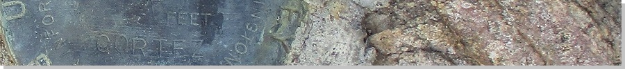
| Cortez Peak |
• Gila Bend Mountains • Bureau of Land Management • Maricopa County |
|
Date: December 7, 2022
• Elevation: 2,524 feet
• Prominence: 1,064 feet
• Distance: 6.8 miles
• Time: 5 hours, 30 minutes
• Gain: 1,274 feet
• Conditions: Cold and cloudy at first, then sunny and warmer later
Arizona
•
Main
•
AZ P1K
•
PB
•
LoJ
•
USGS BM Datasheet
Cortez Peak lies in the Gila Bend Mountains, about 30 miles northwest of Gila Bend and 35 miles southwest of Buckeye. Agua Caliente Road rambles through the region and gets to within 3 miles of Cortez Peak. Thus, access is not a problem. I have been through here a few times now in the past year. There are plenty of interesting peaks that line the road, making access easy, and the peaks tend to be mounds of volcanic rock, or more "traditional" peaks with ridges and small cliff bands.
In the past couple of weeks, I've been on a "get off my butt and go do some of those P1K peaks I've kept putting off" binge. I hiked Peak 4676 down by Kearny, then Aquarius Mountain up in Mohave County. Feeling confident, I new zeroed my sights on Cortez Peak. Now was as good a time as ever to go hike it. The weather's been cool, and a storm that passed through the previous couple of days was mostly gone, except for some trailing high clouds.
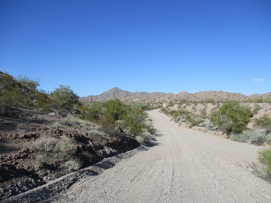
I was up very early, on the road at 5:45 a.m. mainly to beat the rush-hour crunch. I got onto westbound Interstate-10, which was heavy but not bad as I was heading away from Phoenix. The eastbound side, however, was completely stopped. I then got onto state route AZ-85, now in Buckeye. I stopped for snacks and then got onto Old US-80 through the farming towns of Arlington and Hassayampa, then to Agua Caliente Road. I had driven about 75 miles, and the sun was just starting to breach the eastern horizon.
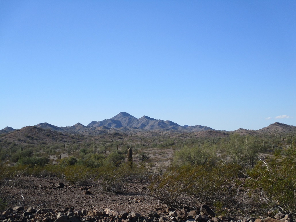
On Agua Caliente Road, I followed it westish-bound, driving 28.1 miles (going by my car's odometer), to Loudermilk Wash, the main wash that emanates south off of Cortez Peak. The peak itself stands out from a distance, being one of the few higher and pointier peaks in the area. I parked in a clearing on the west bank of Loudermilk Wash, an area clearly used as a campsite and staging area by past visitors. It was past 8 a.m. by now, cool but not cold (low 50s), with abundant high clouds and a muted sun.
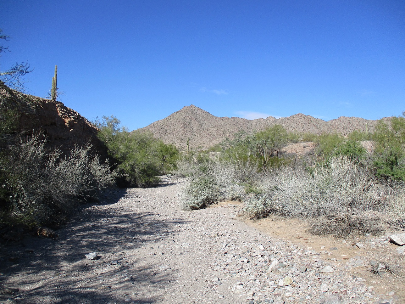
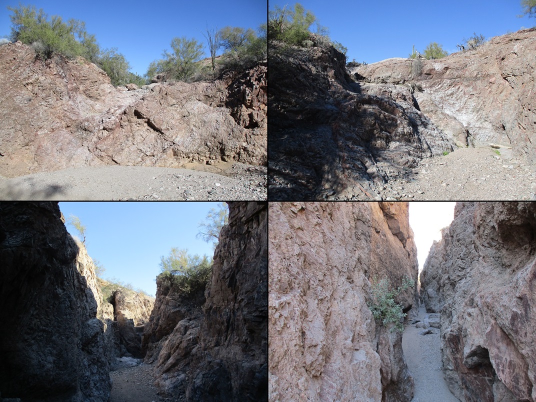
I got everything in order, locked the car and started walking at about 8:40 a.m.. Loudermilk Wash is very wide at first, a couple hundred feet wide, with a broad sandy wash and almost no rocks or brush to get in the way. The washbed is coarse sand and small gravel, and held together well, making the walk go by fast. The wash slowly narrows to about 30 feet wide, then suddenly (about a mile in), narrows to a slot, just a few feet wide. Past the notch, the nature of the wash changes, now more rocky and slightlier brushy, but still wide. The banks were steep and cliffy, sometimes about 40 feet high.
Shortly, I came to a Y-split, the only time I was unsure which way to go. The "better" fork went right, but I soon realized it was heading away too quickly, so I backtracked and took the left fork, which was brushy at first, then widened again. Then, not long later, I came to Seep Tank, the only spot where I was forced to climb out of the wash to bypass the spring, which here had cliffs about 15 feet high. The bypass was easy. Above it, there's a concrete wall presumably used to help hold in the water.
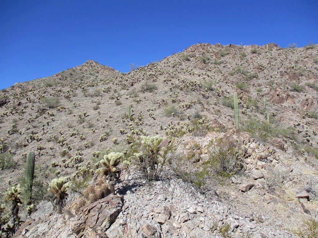
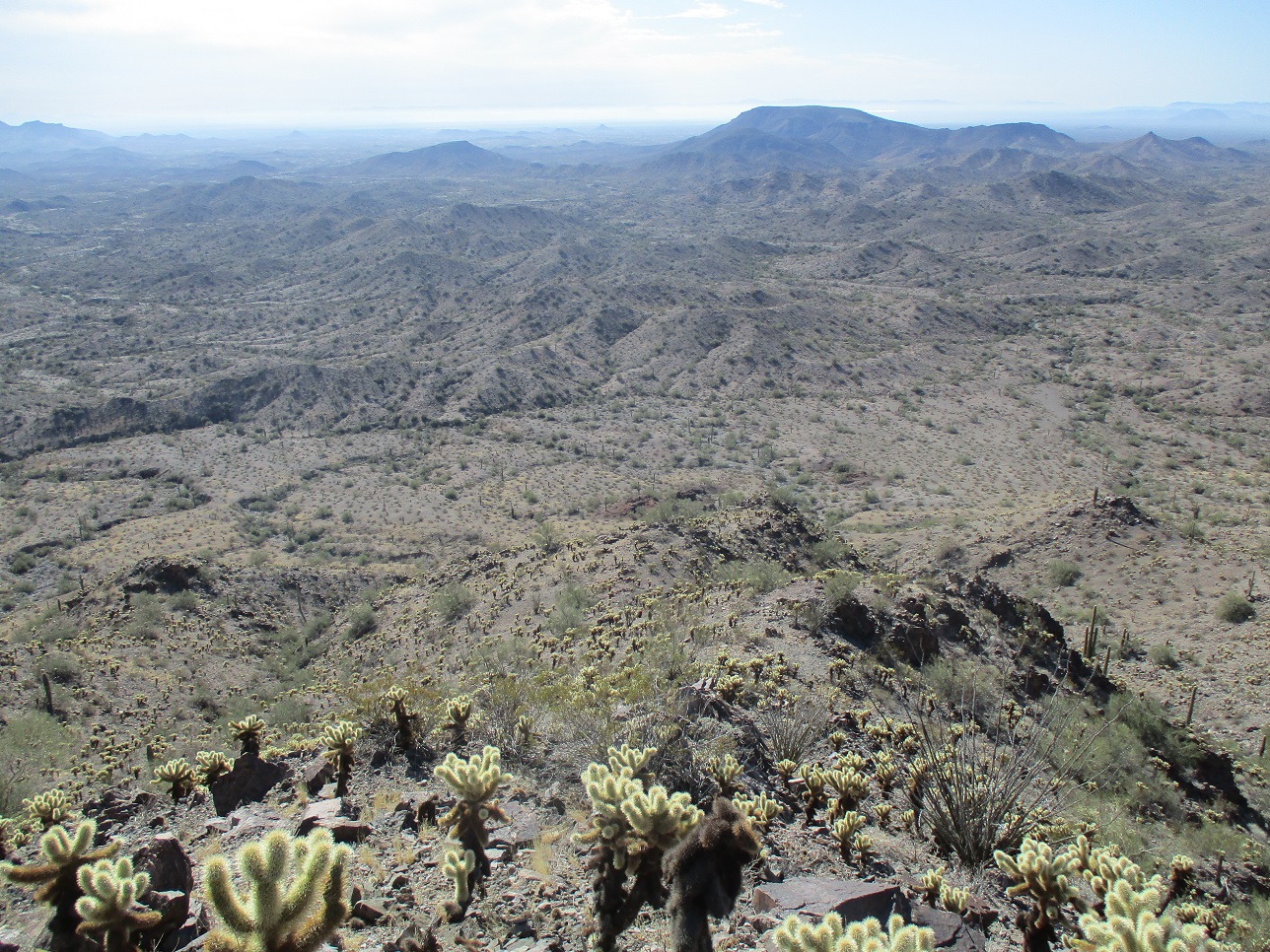
The mountain was mostly out of view during the first 75% of the wash hike, but as I gained higher ground, it came into view, now so much closer. I started to encounter more small rock pour-offs in the wash, some about 4 feet high, then one about eight feet high but with good holds. The wash was narrower, rockier and brushier, but the walls were lower too. After one hard-left bend, I got in as far as seemed practical, then eased out of the wash onto the sloping bajada below Cortez Peak. I even found a weak path here, suggesting others (possibly animals) had exited here too.
I now had a much better view to study the peak and its lines, looking for a way up. It's a steep peak and no one ridge or drainage looked obviously better. Matthias had been here almost two years ago and went up a drainage closer to the high saddle below the summit. I was intending to follow his route, but as I inched closer to the base, I saw a ridge that appeared to go all the way up to the main range crest, and without big cliffs or other obstacles. However, there was no guarantee this would work, as there may have been a showstopper I couldn't see from below. Nevertheless, I went up it and hoped for the best.
The slopes were a loose aggregate of granitic scree, ranging from gravelly pebbles to rocks about six inches in diameter, all of it angular and not holding together well. There was almost no low grass or scrub to hold it together. Even down low, hiking up it was a chore. I gained about 80 feet to the first main rock outcrop, and studied the next portion. I was guardedly confident that this would all "go", but I wasn't enjoying the looseness of the slopes much. I was also encountering heavy cholla, forcing me to weave through them while trying to get good footing.
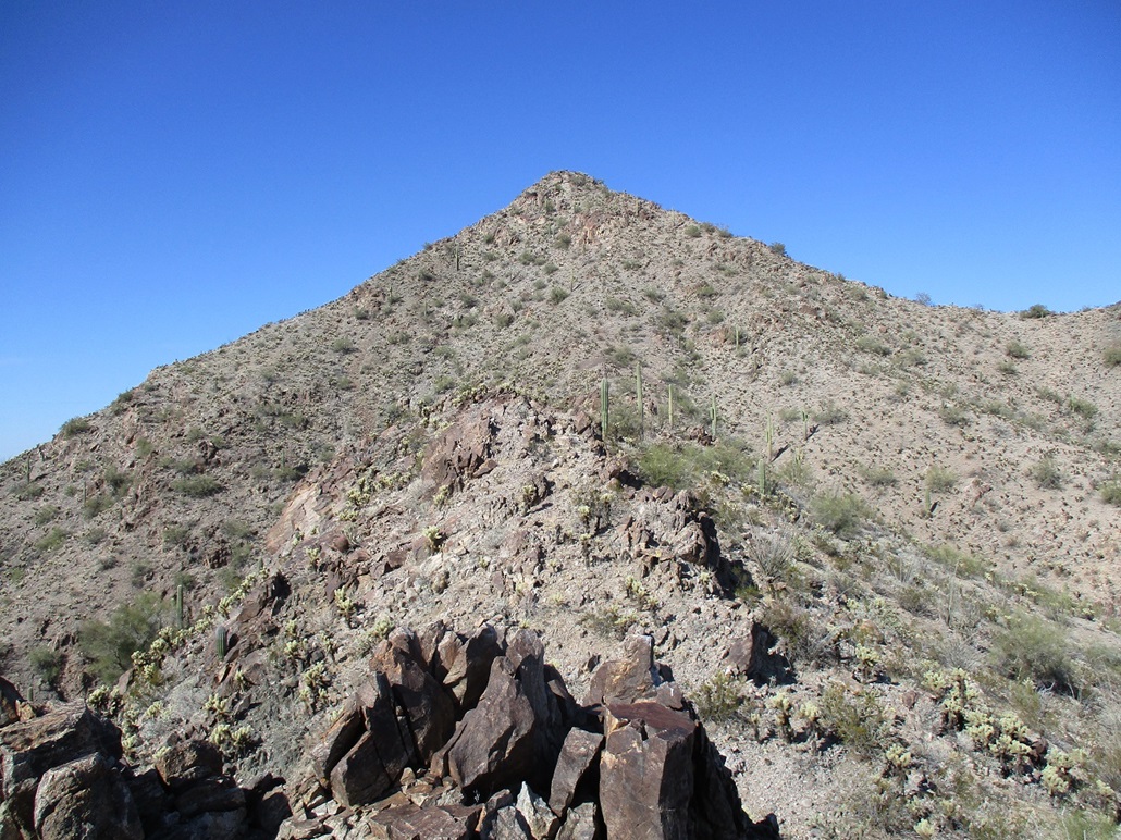
The next couple hundred feet went well. It was more of the same scree and cactus, but not sloped too severely. I got up and down one higher rock knob, then another smaller one, until I was above the handful of rock outcrops and had full view of the remaining uphill slope. It looked steep and choked in cholla, but no cliffs or other obstacles. It was steep, and I've been on steeper slopes, but combined with the loose scree, the two together do not play nice. I was able to grunt up this scree-and-cholla field to the top-most rock outcrop, this being essentially on the high range crest. Getting here was a chore.
I inched around its base going left. There was a ledge about 3 feet wide to walk on. I then came to a chute about fifteen feet high, which I clambered upward to gain the main crest. The rock was loose and flakey. I had to test each one in case it wouldn't move or pull away if I put weight on it. Now on the range crest, I had an unfettered view of the peak, another 300 feet higher and more of that same type of slope I had just come up.
There were three or four rock outcrops between me and the base of the final slope, but each one was easy to cross up and over, or around. At the base of the high saddle, I started up the scree and cactus slopes. Interestingly, I came to a circular pit, what looked like an old mine shaft. I carefully looked into it, and it was closed in, the ground about six feet down. I dared not step into it. Instead, I walked its edge. Beyond it, I found a faint path upward which went for about 50 vertical feet.
The path soon disappeared, and I was on the home stretch, but it was ugly. The slope steepened to about as steep as it could go before the rocks just all rolled down hill. Every step I took would push down a small slide, and I myself would often backslide a foot or two. The footing was unstable and as a result, I was extremely uncomfortable. My goal was a small cliff above me. I was able to get to it, but this upper hundred feet of loose slope I had just climbed officially sucked.
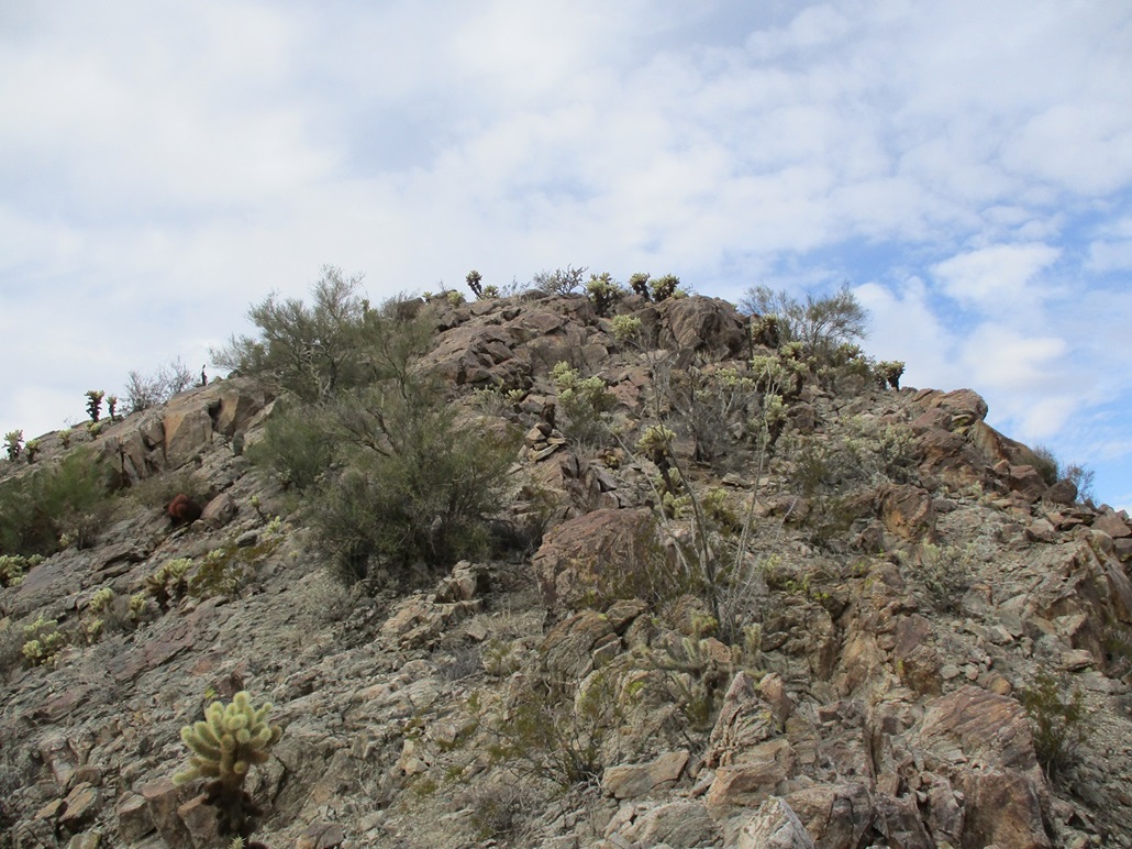
Once at the rock outcrop, I could at least hold onto something, when it didn't flake off in my hands. I still moved slowly, inching along its base to my right, until it topped out. I now had a view of the final rocky slope to the top, but fortunately, it was big rocks now, hopefully more stable. I climbed this, still going slow, eyeballing ways up the small steps and chutes. Finally, I was on top the damn peak. It was a shade after 11 a.m., a two and a half hour hike. The one bit of good news was that the clouds moved on and I had sunnier skies.
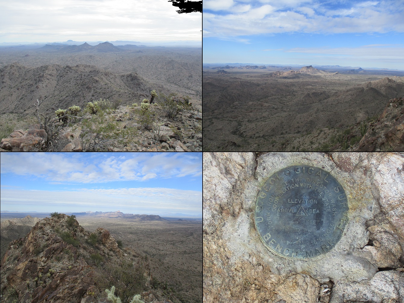
The top features a small cairn, an old wooden "height of light" stick/lathe, some wires, and the benchmark. The register was in the cairn. Signatures went back over 30 years and there weren't that many overall, maybe a dozen. I snapped some images of the surrounding peaks, some still under the cloud cover, so the images were not so great. A point nearby appears to be as high as where I stood/sat. I took a look at it but abandoned the idea when I came to a small knife-edge ridge. Forget it, I was in no mood for more rocky shenanigans. The consenus seems to lean slightly to the benchmark point being highest. As far as I am concerned, it is. If not, the difference can't be more than a foot or two, still good enough for me. I tagged the benchmark and called it good.
I did not stay long, perhaps just a minute or two. I signed the register and then started right back down. I was way too anxious about those steep loose slopes and wanted to be down them as soon as possible. I could not relax otherwise. I inched down the rocky summit knob to the top of the slope, and started the slow slip-and-slide down.
I did not feel comfortable or confident to stand on these slopes, at least not the top fifty or hundred feet. So I sat and slowly scooted down, everywhere my hands, legs or butt touched catching an old cholla ball. I spent a lot of time picking out the barbs. I got so used to this they didn't hurt after awhile. I scooted down far enough to where I felt slightly more comfortable to stand. I took the rest in tiny baby steps and felt very relieved when I was down off that upper slope.
The next portion was to traverse the high ridge around, or up and over, the rock outcrops. This went well. Then I was back to the first outcrop above my ascent ridge. I scooted down the chute, inched around the base, and positioned myself above this lower slope, which was as ugly as the higher one I just got done complaining about. As before, I slowly stepped downward, mostly upright but occasionally on all fives to get down the loosest stuff. Once down below, I finally could feel some relief. I stopped near one of the lower rock outcrops for my first big break for the day. With the sunnier skies, I took a lot of photos. What you see on the left was mostly taken on the descent.
The remaining downclimb went quickly. I was back on the bajada, then back into the wash, for the long walk out. But I welcomed the wash. Its sandy surface felt great after the rocky crap higher up. I just walked and walked, enjoying the day, and was back out and to my car a little after 2 p.m., a five hour and thirty minute hike. I was real happy to be back and done with this hike. I spent time changing and picking out cactus barbs from my legs, hands, butt, lower back, even upper arms and back. How those got bit I don't know.
I had maps for possible second peaks to tag, but I was beat by now, happy with what I was able to achieve, and in no mood for more hiking. I drove back the way I came in, getting back to where Agua Caliente Road meets with Old US-80. Instead of going back via Interstate-10 and through Phoenix, I went south into Gila Bend, stopping at a Shell station for gas, snacks, some Aleve, and to clean up a little.
I sat for awhile in my car, enjoying the Gila Bend vibe. Lots of big trucks, and lots of travelers, a constant din of truck noises. I had a tiny epiphany. I like this bullshit. I was beat and dirty and sore from a peak climbed, I was in the middle of nowhere, it was not the least bit sexy, and for those twenty minutes, I was "in the moment". I wish I could bottle it.
To get home, I followed Maricopa Road to Maricopa, then the usual roads and freeways back into Chandler and Tempe. I was back a little after 5 p.m., the sun already low in the sky and things chilling down a little. And even once home and in the shower, I was picking off cholla barbs from my skin.
I am glad I was successful on this peak, but admit I did not enjoy it, or at least the really ugly slip-and-slide portions. More than once I had feared I had gotten in over my head, whether I could downclimb what I had just come up. It was exhausting. Every step was a chore, and I grew to hate some of it. So I'm happy I climbed it, but I assure you I will never go back for seconds. That's my opinion. Your experiences may differ.
|


|