
The Mountains of Arizona
• www.surgent.net
|
| Cone Mountain |
• McDowell Mountains • City of Scottsdale • Maricopa County |
|
Date: October 12, 2021
• Elevation: 3,061 feet
• Prominence: 341 feet
• Distance: 4.5 miles
• Time: 2 hours
• Gain: 330 feet
• Conditions: Sunny and cool, dusty from overnight windstorms
Arizona
•
Main
•
PB
•
LoJ
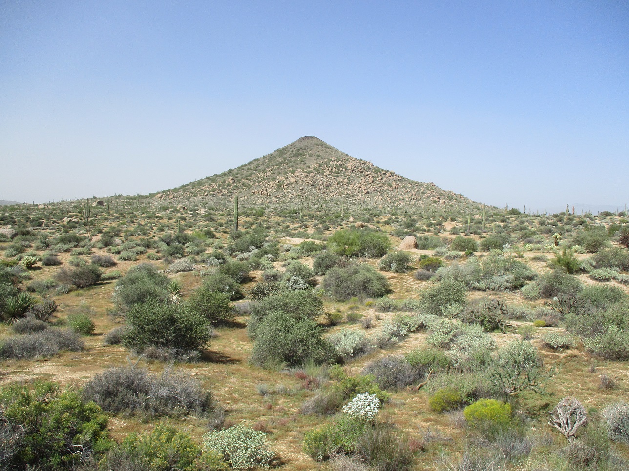
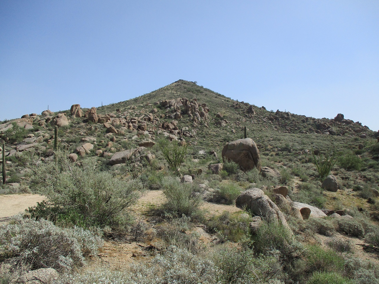
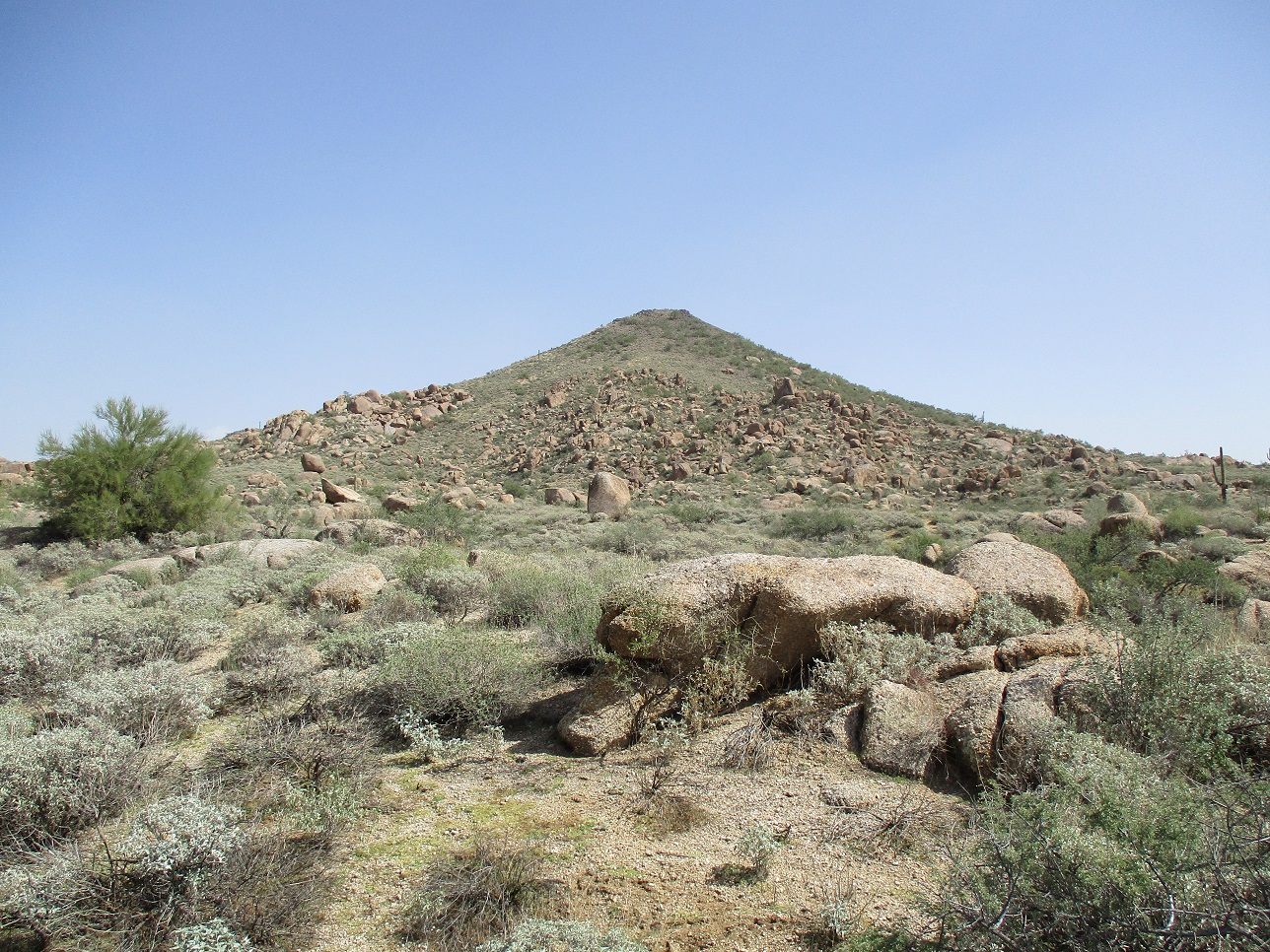
Cone Mountain is in the McDowell Sonoran Preserve, about a half-mile from Brown's Ranch Mountain. The mountain is known as Cone Mountain, probably because it has a nearly-perfect conical shape. The trail around it is called the Cone Mountain Trail.
The weather has finally cooled down; today's high would not even break 70°. Late yesterday into the night, the state experienced some fast-moving storms. I got a Severe Thunderstorm alert on my phone. Flagstaff got its first snow of the season. In the valley, we just got a lot of dust and some rain. The next morning, my car was utterly filthy, as were all the other cars.
I had zoom meetings in the morning, but they were done by 10 a.m.. Since it wasn't already a hundred degrees, I thought about a quick hike, somewhere local. I honed in on Cone Mountain because I knew how to get there, it wasn't too far, and I like hiking in the area. By 11 a.m., I was out the door.
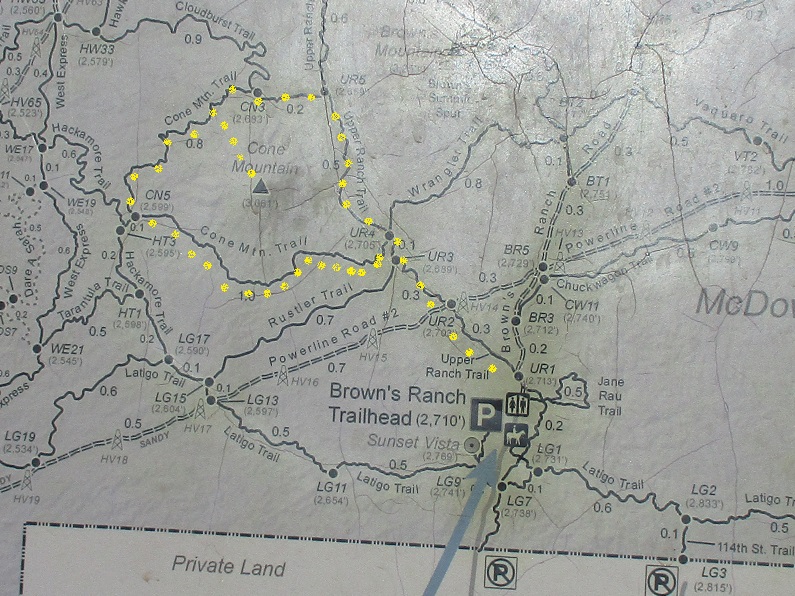
From Tempe, I followed Loop-101 north to Scottsdale Road, north some more to Dynamite Road, then east to Alma School Road and north a mile or two to the big parking lot at the trailhead. It felt like 20 miles. I rolled in close to noon, got things packed and started walking a little after noon.
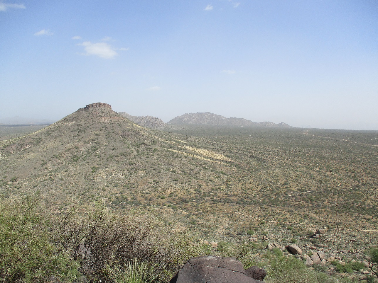
Last night's weather had resulted in a layer of dust hanging over the deserts and mountains. There was no wind now, and it was cool and pleasant ... but hazy with all the dust. It gave the sky a light-blue washed-out color, and peaks about five miles away, normally visible in great detail, were either invisible, or appearing as gray phantasms. See my images at left for some examples.
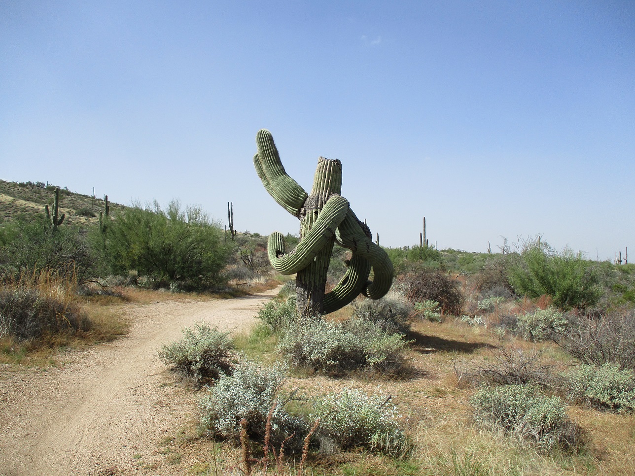
But it was a cool day, and that meant that anyone not tied to a desk was out hiking, biking, running or walking. The parking lot here had about 30 cars, and the trailhead was a hub of activity, people coming and going. Lots of dogs too. I passed through and started on my hike.
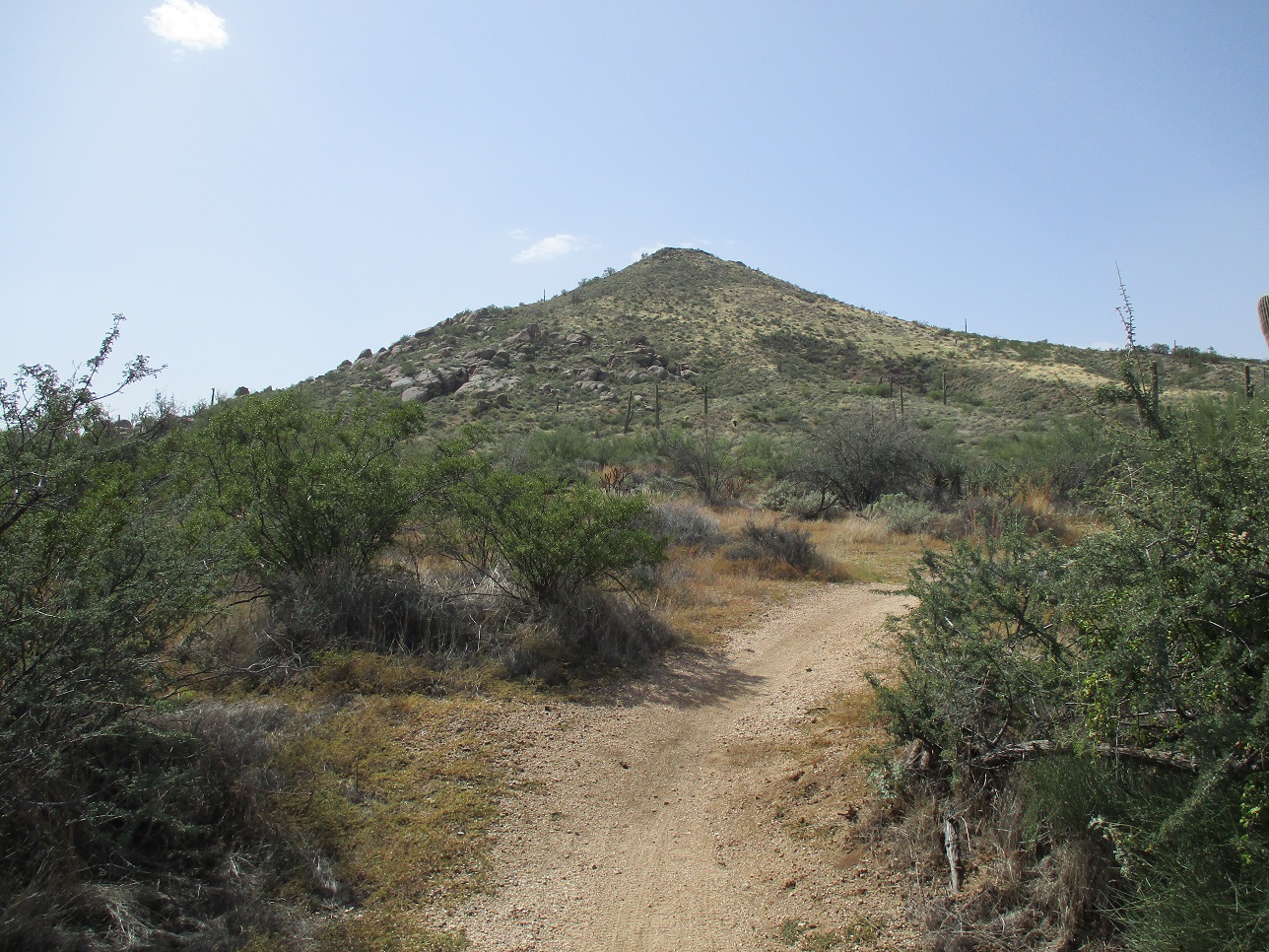
I went in on the main trail, then a quick left onto the Upper Ranch Trail, which heads northwest toward the gap between Cone Mountain and Brown's Ranch Mountain. Despite the dust, conditions were very nice. I had good views of the peaks because they were so close. A few hikers were coming the other way. I didn't get in very far, perhaps a mile, to where I was now roughly northwest of Cone Mountain.
There is no trail up this peak, and most of its lower slopes have large boulders and heavy brush. In studying the aerial images on the web this morning, the northwest slope looked rock-free and I daresay I sensed an old track going partway up the mountain. It makes sense that there would have been a track up this mountain back when it was part of the working ranch. On the image, it looked like a line of vegetation, suspiciously too straight to be natural.
I left the trail and started up the gentle slopes, following openings as I found them. About a third of the way up, I was on that old track. It was a track, but grown over with vegetation. However, there were hints that it was an old track such as rocks placed by hand to act as erosion control, and berms on either side. The track didn't really make a difference, but I felt better being off-trail if I was on an old track.
Toward the top, the track ended and I had a few dozen feet of rocks and moderate brush, and soon, I was on the little summit, a foot-tall cairn of carefully-balanced rocks in its center. The highpoint rock was on its southeast edge. It had taken me under an hour to get here from my car. I took a few minutes to rest and look around. I did not see a register, nor did I expect to find one. I left the cairn alone.
I descended the same general line, and was back to the trail quickly. The round-trip off-trail hike to the peak consumed about 20 minutes and a half-mile of distance. It wasn't a memorable summit but I'm glad I got this one done.
Back on the Cone Mountain Trail, I followed it as it encircled the mountain, snapping photographs from all four directions, showing off the variety of rocks and terrain from each side. The Cone Mountain Trail runs 2 miles in total, then rejoins the Upper Ranch Trail, which I followed back to the trailhead. I covered 4.5 miles in a little under 2 hours. Interestingly, there was no one for the time being at the trailhead. I took advantage of the lull to clean out my pack and relax on one of the concrete benches. Soon, two people showed up, then three more, then a dog or two with their persons, and it was back to being busy as usual. On such a nice afternoon temperature-wise, I can't blame anyone. I was doing exactly the same thing.
I was thoroughly pleased with this short hike. The peak was interesting, but the trails were the real treat. They are well-constructed and a joy to walk (or bike, run, jog...). I suspect most people won't care much about this peak and I don't blame them. If you go, enjoy the trails and view the peak from close by.
I returned to my simple home by taking surface streets, avoiding the freeway. I had to do a shopping run anyway. I was back home about 3:30.
|


|