
The Mountains of Arizona
• www.surgent.net
|
| Red Mountain • Coconino Plateau |
• San Francisco Volcanic Field • Coconino National Forest • Coconino County |
|
Date: August 6, 2011
• Elevation: 7,965 feet
• Prominence: 1,005 feet
• Distance: 4.5 miles
• Time: 2 hours, 45 minutes
• Gain: 1,100 feet
• Conditions: Bright sun and a bit warm
Arizona
•
Main
•
AZ P1K
•
PB
•
LoJ
•
Interactive map
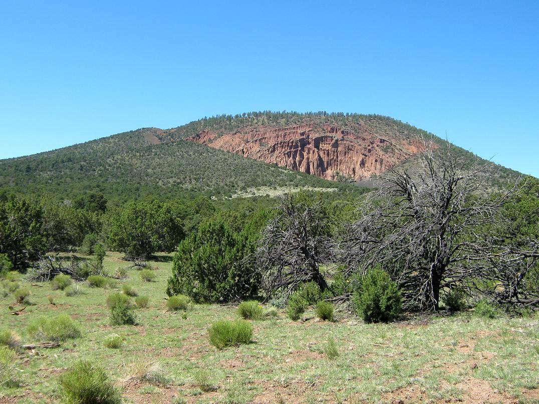
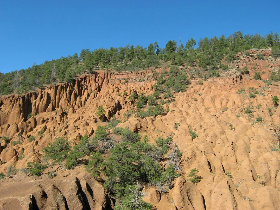
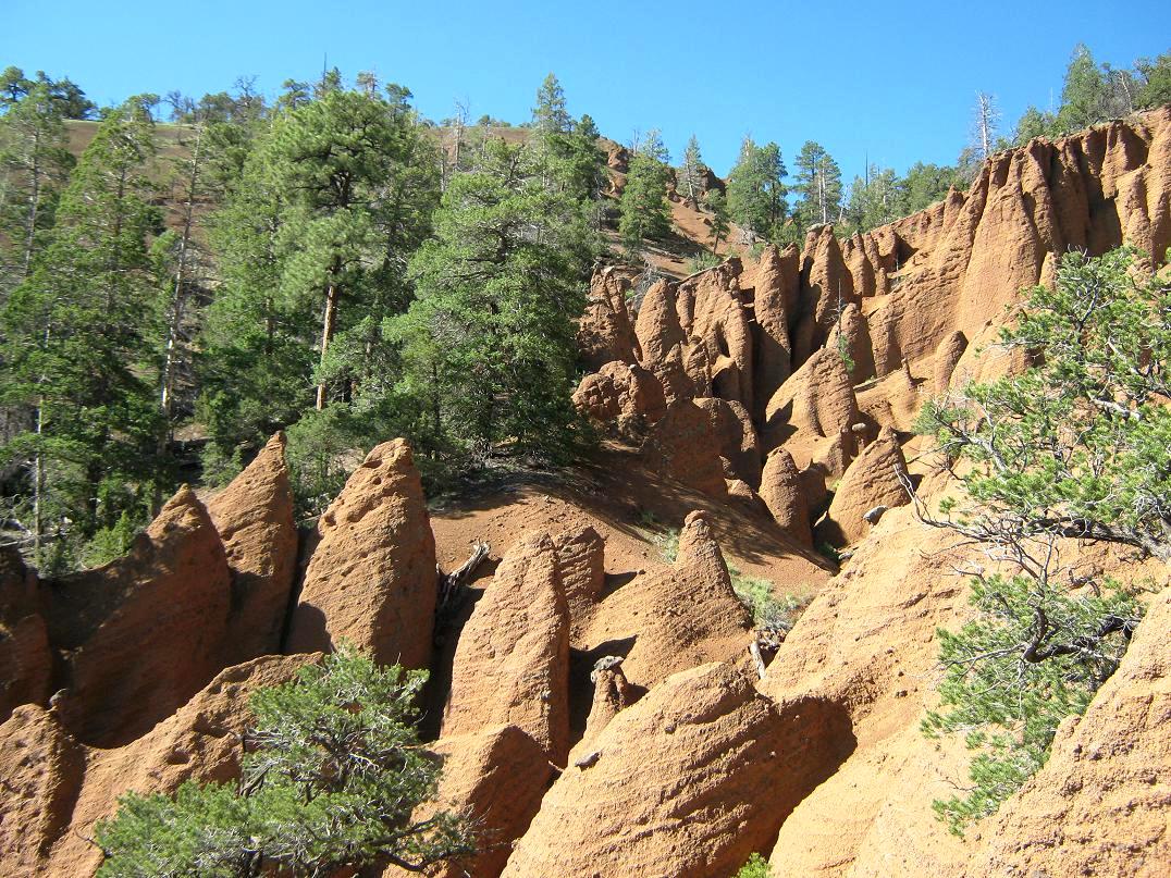
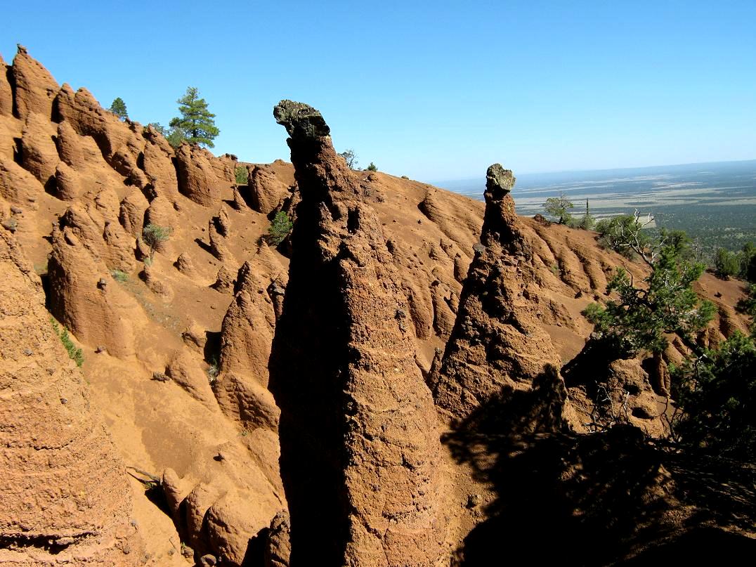
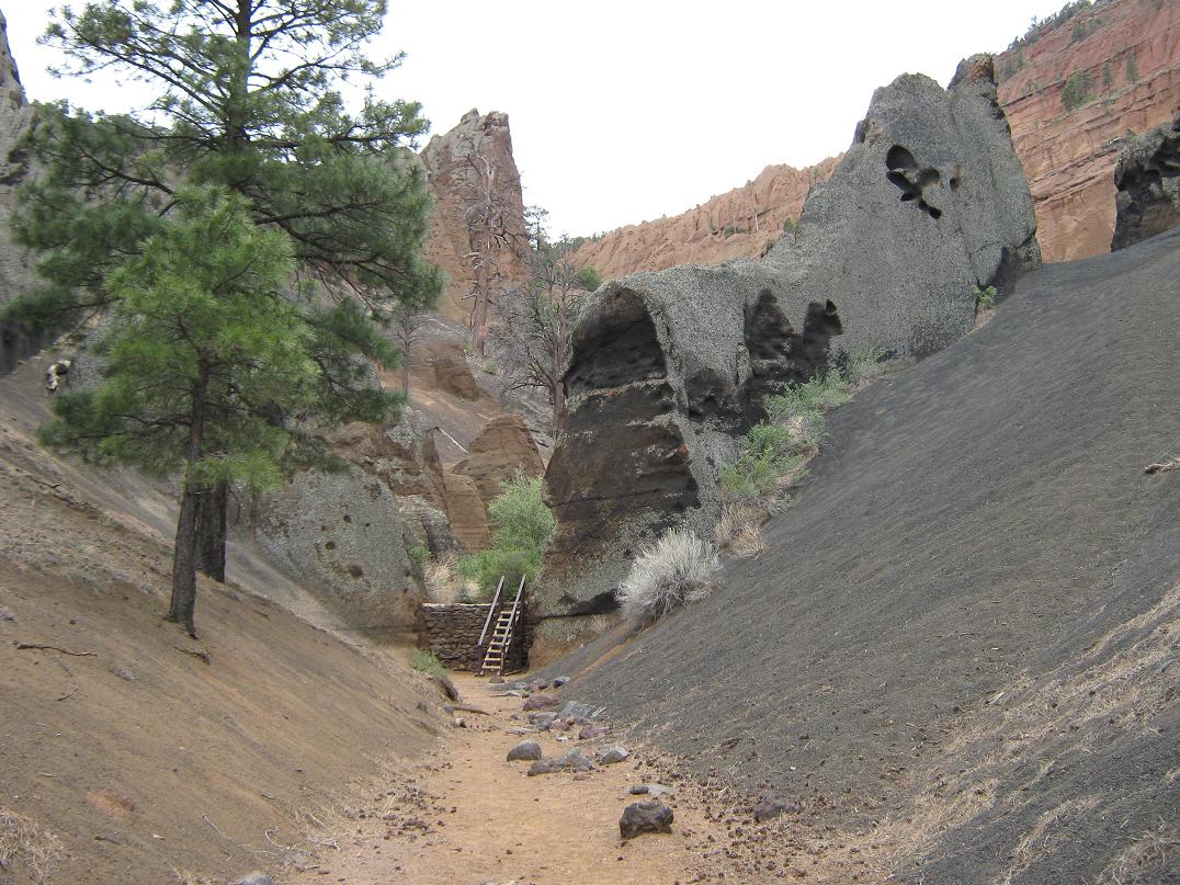
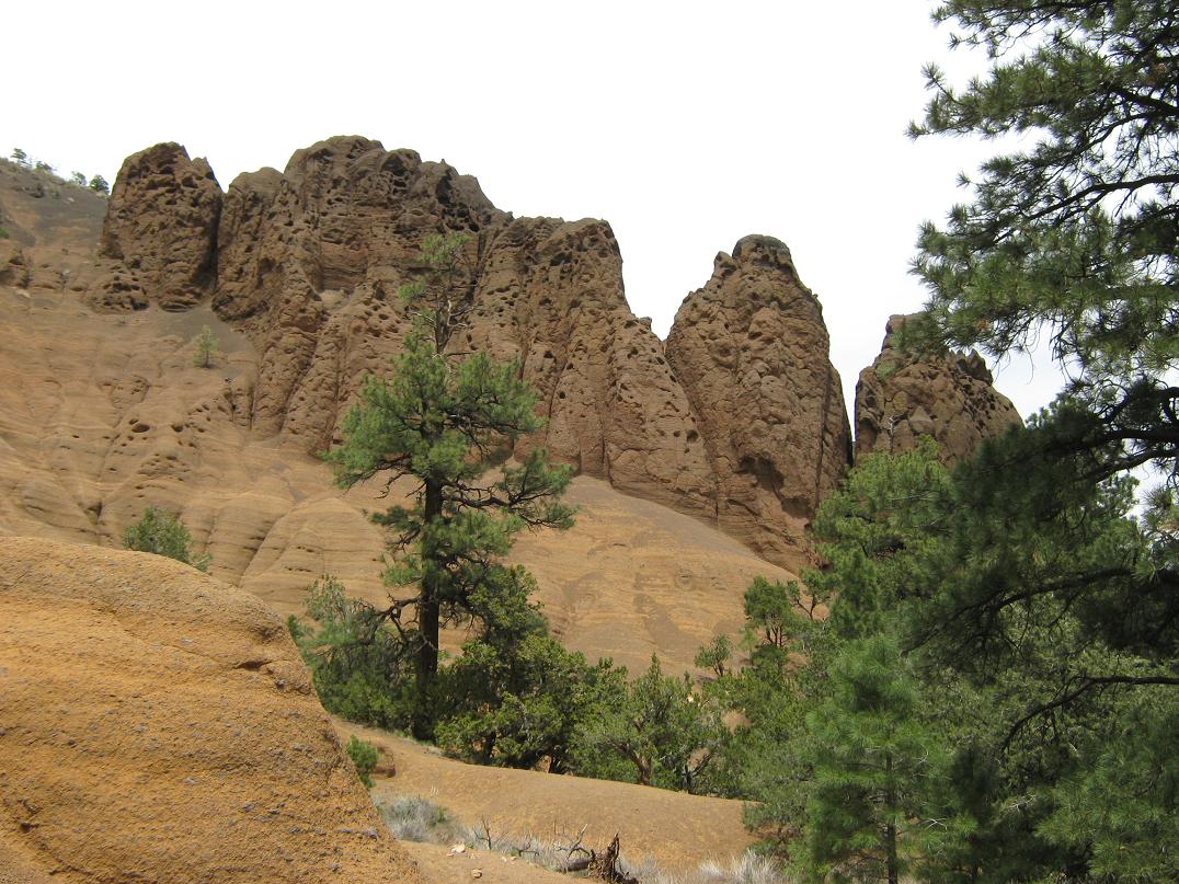
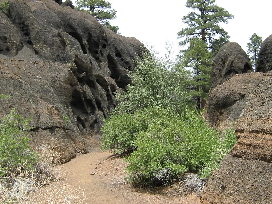
Red Mountain is one of many cinder mounds of the San Francisco Volcanic Field northwest of Flagstaff. It is known for its fascinating eroded "inner canyon" that is visible from the highway. It is not a canyon in the usual sense. It appears to be a slope that somehow eroded away (and is still eroding), leaving behind a cascade of red-colored cliffs, hoo-doos and rock tents, as if the whole thing was pulling away from the mountain in slow motion.
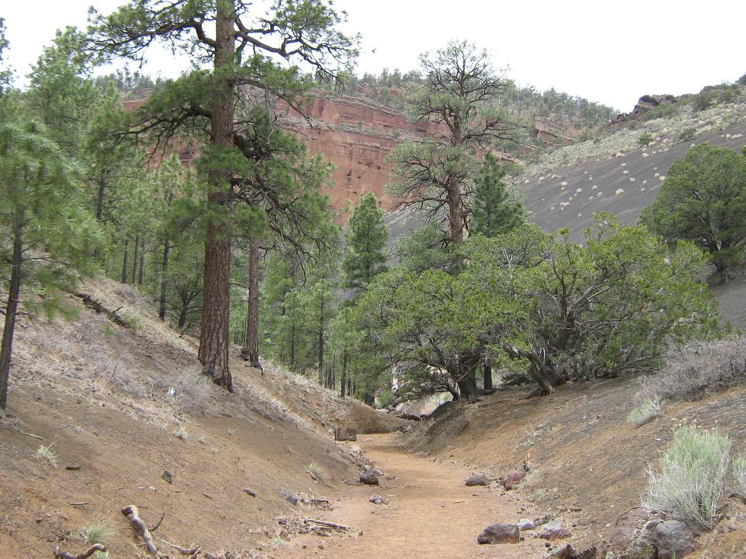
A year ago, we were here on a weekend getaway. I went for a quick hike into this inner canyon. An old road serves as a hiking path through the flat forest, then into the heart of the canyon. It's a popular short hike and I was not alone when I was here. Many others were here, many with dogs. I thought it may be the cinder crater than was eroding away, but the crater is actually on the west side of the mountain. Why this one hillside on this one mountain has eroded away so dramatically while the others have not is a question I cannot answer.
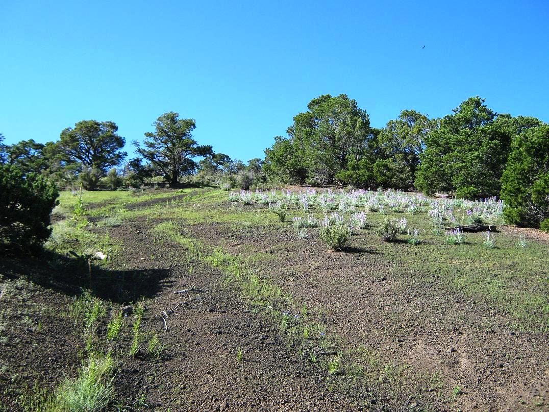
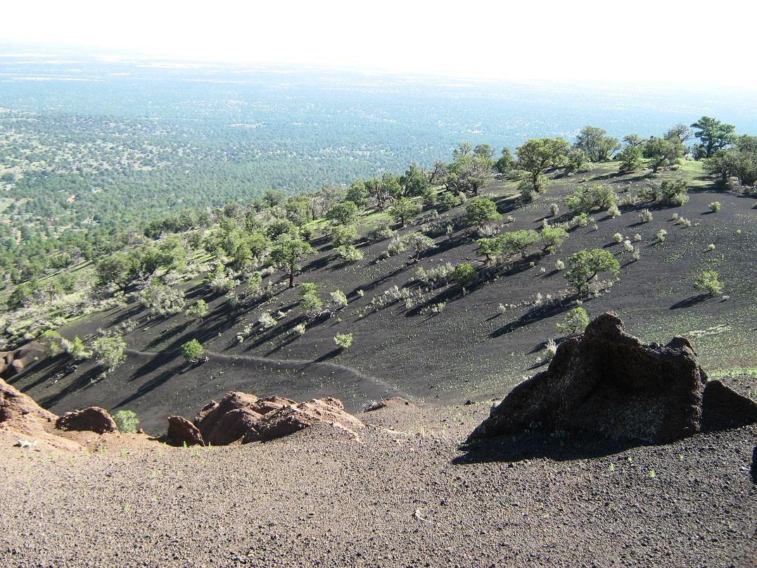
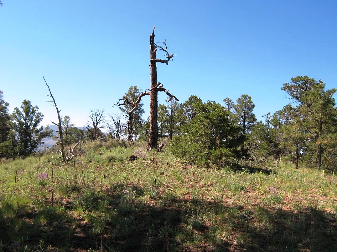
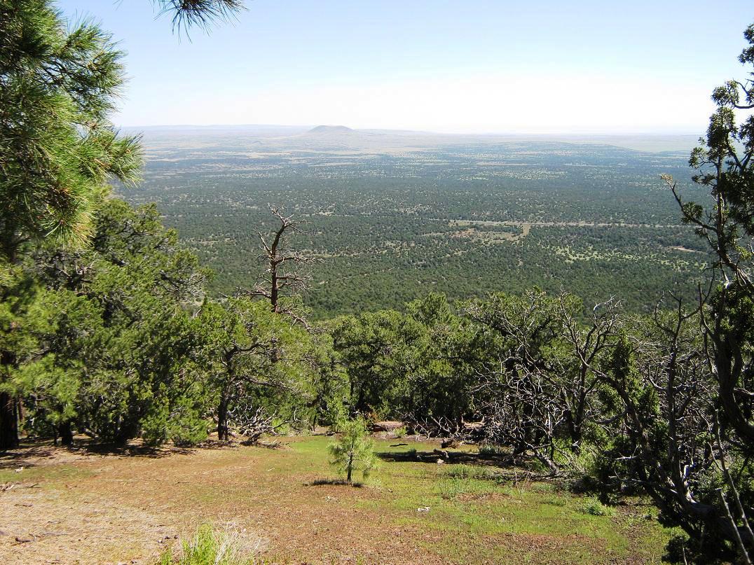
We came back to Flagstaff for this weekend, a quick vacation from the furnace of Phoenix and a chance to get some hiking in before the semester starts at ASU. It was also training camp for the Arizona Cardinals, who trained here at the time. We stayed at a hotel on the south end, near where Interstate-40 and Interstate-17 connect. We left Scottsdale late on Friday to mitigate traffic, but it was heavy in town here, full of Cards fans, here to cheer on the team for an intra-squad match this weekend. I left at 7 a.m. and drove 35 miles up US-180 to the trailhead, which is signed from the highway. I was mildly surprised to be the first one here today. I got my stuff on and was hiking by 8 a.m. I just had to be aware of my right shoulder, as I'd had a little basal cell carcinoma dug out from it yesterday, my first skin cancer ever. It was stitched up and kind of sore. The sign at the trailhead says it's 1.3 miles to the inner canyon, where 99.99% of the hikers go. I covered the first mile in about 15 minutes, hiking across flattish pinon and juniper woodland with intermittent views of the peak and its amphitheater-like canyon. The trail drops into a sandy wash, the one that emanates from this canyon. I went left and followed it for a few dozen more yards, looking for a good chance to ascend out of the canyon and start the uphill portion of the climb. Red Mountain has the usual smooth symmetry and rounded forms that is typical of these cinder peaks. The canyon is hemmed in by two long ridges, like arms hugging the canyon. Eyeballing these ridges, they are smooth and pitched moderately-steeply, and appeared to be mostly cinder, with moderate tree and grass cover. I opted to try the east ridge to the top, mainly since it would put me right at the summit, which lies at the southeast edge of the summit ridge. From the sandy trail within the canyon, I had about 800 vertical feet of elevation to the top. When it felt right, I angled left and started through the light brush onto this east ridge. Shortly, I had come up onto its main spine. There appears to be a very old road or jeep-track up on this ridge, enough to allow for a mostly-open trudge upward, which I did methodically for about 20 minutes, gaining elevation at a good clip. It was just steep enough to tire me every couple minutes, but not so bad as to really slow me down. I was feeling a little winded by the elevation, though. The real treat was a birds-eye view into this canyon, being able to look at its formations from this higher-up angle. The low grass and brush petered out as I ascended this ridge, until I was hiking on barren black cinder. I hiked up until it topped out at a tiny summit, a small 7,460-foot contour on the map. I was concerned when it appeared I had climbed into a dead end, as I was now facing a field of spires and hoodoos ahead of me, or steep cinder slopes if I angled left. I poked my way through the hard caprocks and descended through a couple chutes, losing about 40 feet, to come to a saddle. It looked more promising now. I could see a viable route with mature trees growing on it, suggesting firmer, more stable slopes and footing. I needed to scoot down into one more chute before scrambling up one short but steep slope of cinder rubble. I lost a total of about 80 feet of elevation along this segment. Some of these downclimbs (or down-scoots as is more accurate) were essentially unclimbable going up, given the marble-like nature of the cinder rubble. I came upon the trees and grasses again, now able to get a solid footing and work my way upward again. I was in a broad chute, with very steep cinder slopes on either side of me, while the chute itself was wide with lots of trees, undergrowth and organic detritus. As I climbed this chute, it would open up to where I could walk over to view the remarkable hoodoos and rock tents, some standing about 20 or 30 feet tall. The so-called rock tents were small rocks that sat atop a spire of eroded substrata, the rock on top serving as a barrier against erosion. I had never seen these before quite like this, and it was quite fascinating. You can't see these from down below. To see them, you have to climb up to this spot. It's interesting to ponder how long each rock has been there. It would take perhaps a couple thousand years (if not more) for the slopes to erode as they have. Those rocks have just sat there, all that time, being cool. As I ascended, the trees gave way to cinder, and I had no choice but to scramble and grunt my way up a slope of 50 vertical feet, each time combating a screefall of hundreds of little cinder rubble stones, some getting into my shoes. In some cases, I would take three steps, and slide my way right back to where I started. I finally tried spreading my weight around by crab-crawling up these slopes. It worked, and I was able to get to another slope with grasses and low scrubby growth, where I took a long break as I had really tired myself out. The good news was the summit was just a couple hundred feet higher up, with no more ridiculous cinder slopes to deal with. The final hike was through low brush, some pinon and juniper, while the summit ridge had mid-sized ponderosa growing atop it. I hiked up the slopes to come upon the summit, an anticlimactic mound of shrub and trees, with a big dead ponderosa standing nearby. Another point about 300 feet north along the ridge looked about as high, so I walked over to it also, then walked back to the south point, which is probably the true summit. I could see no cairn, benchmark or other sign of previous visitors, which suggests this peak might see just a handful of fools like myself in a given year. I stayed up top for about 10 minutes. The views were magnificent. North of me was the vast Coconino Plateau, with Red Butte off to the northwest. Big Kendrick Peak stood high to the southeast, a few other cinder summits and ridges also taking up room, while giant Humphreys Peak stood above us all to the east, like a giant wall. It was still kind of early (about 9:45 a.m.) so shooting photos in that direction was not possible. The day was clear and dry. The humid air had been suppressed for the day, as not a single cloud was visible from horizon to horizon, like being underneath a brilliant blue-colored dome. It was beautiful, as was the scent of pine and mint-brush, and the soft breeze. A perfect Northern Arizona summer day. The hike down was as fun as the hike up had been a grunt in dealing with the cinder slopes. I retraced my route back down for the first couple-hundred feet, then followed another northeast-trending ridge slightly more offset to the east than the one I had taken coming up. It was mostly open, with consistent slopes of cinder but with lots of grasses and other organic crud holding it all together. As a result, I could literally jog down the slopes, with the cinder catching my boot and allowing it to slide an extra foot each time. I made fantastic time, dropping about 700 feet in about 20 minutes. I just needed to be sure I got myself back to my truck okay. When I was low on this ridge, I went left (north), cut through a small drainage and got myself onto the slopes of the original east ridge I had taken going up. I traversed its lower east-facing slopes, gaining 50 feet in about a quarter-mile until I naturally merged onto its main spine, where I had actually been just a short while earlier. From here I could see the trails below me, so I descended to them and hiked out to my truck, saying hi to a few people as they were hiking in. Not surprisingly, the parking lot had about 6 vehicles by now. I was back to my truck at 10:45 a.m. and back to Flagstaff by noon. This hike had gone well, with about 1,100 feet of gain (including some of the drops I had to regain). I call the mileage to be 4.5 round-trip, given some indirect paths I needed to follow to get past the hoodoo section, and the deliberate alteration to my route coming down. The climbing had been a little more challenging than I had thought, but it was a lot of fun and it was a real treat to get up close to these hoodoos, where very few people get to. The canyon is very interesting, so I don't blame people if the vast majority skips the hike to the top. We enjoyed our remaining time in Flagstaff. Traffic was heavy, so we stayed close to the hotel, although I made a late-day visit to the Lowell Observatory while βð took an extended nap. The news reports that the scrimmage attracted 18,000 people. Probably 17,500 of them were from the Phoenix area, and we knew they'd all be heading back down Sunday, so we got moving early the next day to beat the traffic. All went well and we were home to our cats by noon. The trip had been a great success. |

|