The Mountains of Arizona
• www.surgent.net
|
| Chiricahua Peak |
• Highpoint: Chiricahua Mountains & Chiricahua Wilderness • Coronado National Forest • Highpoint: Cochise County |
|
Dates: (1) February 20, 2000; (2) November 8, 2003
• Elevation: 9,759 feet
• Prominence: 5,139 feet
• Distance: 11 miles in 2000, 7 miles in 2003
• Time: 6 hours in 2000, 3 hours in 2003
• Gain: 3,300 feet in 2000, 700 feet in 2003
• Conditions: Cold and icy in 2003, drier and nippy in 2003
Arizona
•
Main
•
AZ P1K
•
PB • LoJ
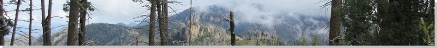
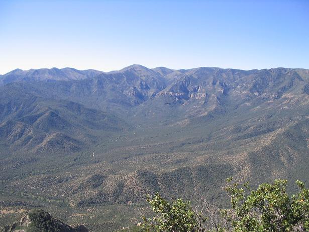
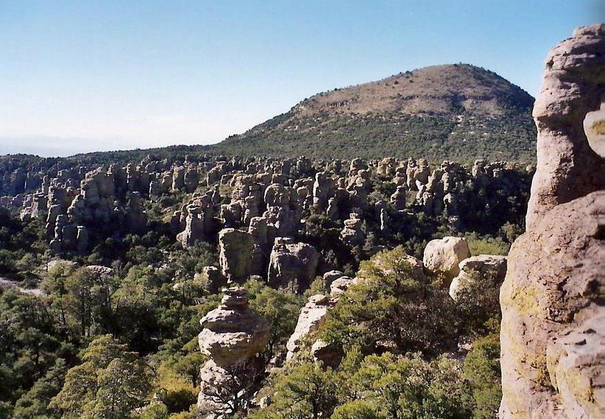
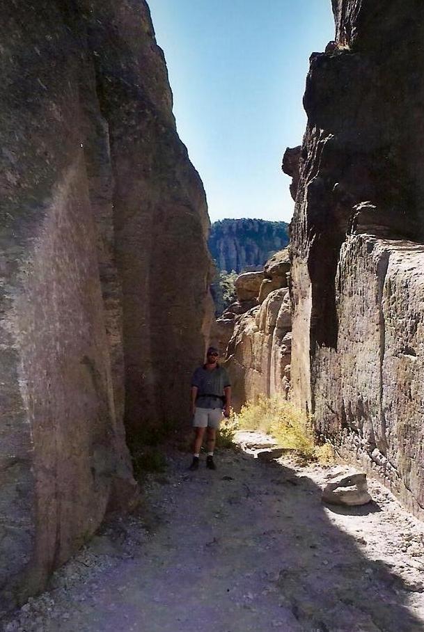
The Chiricahua Mountains dominate southeast Arizona. The range is a result of a massive volcanic event, the Turkey Creek eruption, from 27 million years ago. Chiricahua Peak is the highest peak of the range, but not that obvious from down below. The eruption was so massive, it created a literal wall of mountains, where the range crests stay above 9,000 feet for miles at a time, resulting in numerous bumps of nearly equal height. The other notable attraction in these mountains is the Chiricahua National Monument, which features thousands of spires and "hoodoos", formed by the erosion of the tuff that resulted from the eruption. There are miles of hiking trails amid these fascinating rock formations.
The mountains and the eponymous highpoint get their name from the Chiricahua band of Apache Indians, who lived and roamed these lands for centuries before becoming part of the United States after the Gadsden Purchase in 1854. The Apache, of course, wanted no part of this, and for the better part of 30 years, fought a guerrilla-style war against American explorers and settlers in this region. Led at first by Chief Cochise (for whom the county is named), and after Cochise's death, by Geronimo, the Apache, numbering just a few hundred, fought vigorously and remained at large until 1886, when Geronimo was captured.
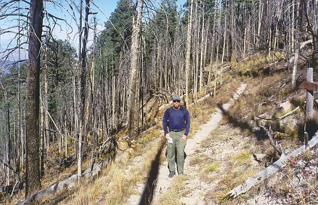
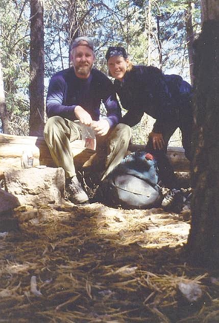
Chiricahua Peak is easy to climb, with a few possible starting points ranging from half-day hikes to longer overnighters. The most popular route comes in from the north via Rustler Park campground, high on the main range crest. Another option are the two Mormon Creek routes, which start lower down. I have climbed the peak twice, in 2000 by myself, and again in 2003.
First Visit, February 2000: I was here in January to hike Chiricahua Peak, intending to hike the Crest Trail from Rustler Park. The day was mild but cold, and snow from a recent storm still everywhere. I hiked a mile in soft snow, but the snow was up to my hips. I wasn't keen on battling this for another five miles, so I abandoned the hike and returned to my truck. I salvaged the day with a drive up the Coronado Highway and a visit to the Greenlee County Highpoint, plus a speeding ticket.
So here it was, a month later. I didn't have any plans, so I decided to go back to the Chiricahua Range on a whim. The weather had been mild and I hoped the snow had melted off. I left home at 4:15 a.m. and arrived to the range by 8:00 a.m. I followed Turkey Creek Road into the range to the Mormon Creek trailhead area. After gathering my gear and talking with some guy camping, I hit the trail. There are two trails that run parallel along the Mormon Creek drainage. I took the "lower" one, the one literally in the creekbed (the "upper" one's trailhead is about a half-mile west of the lower's trailhead, but there is no convenient parking for that trailhead). The trailhead's elevation is approximately 6,400 feet.
The trail begins at the end of the Sycamore campsites off a spur from Turkey Creek Road. It is flat for a few hundred yards, then swings left, where a sign mentions the distance to the peak as 5 miles. From here it was a consistently moderate uphill grade along nice wide trail. After a mile, the trail came to a spring and remnants of an old pump station. Then the trail parallelled the creek on the right as one faces uphill. Parts were nice, parts had downed trees and branches obstructing the way, and all of it was covered under a heavy mat of pine needles, cones and leaves. After another three-quarters of a mile, it crossed the creek bed, then paralled up the left side for another 1.5 miles. Quality of the trail ranged from good to scant. The creek itself had running water down low, fed by springs.
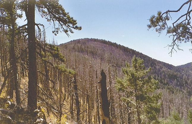
At the top, the trail began a short but steep series of switchbacks. Parts of the trail were completely obscured, but periodic cairns alerted me to the route. After hiking the steep switchbacks, the trail converged with the upper Mormon trail, meeting at an elevation of 8,700 feet. For the first time I had an actual view of the peaks above me, although Chiricahua's summit was still hidden by trees. However, I could readily see some of the nearby peaks such as Anita Peak. A large fire from a couple years ago had defoliated much of this part of the mountain and the burn scars were still evident.
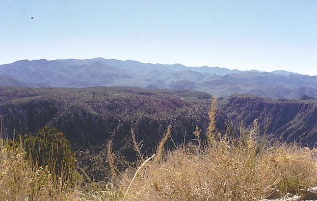
From point 8,700, I proceeded south a half-mile to the Chiricahua Saddle, elevation 9,100 feet. I had a choice—loop south then east and approach the summit from the southeast, or loop north. I decided to follow the Crest Trail (signed) north to the saddle between Chiricahua and Anita Peaks, elevation 9,500 feet. A talus field (with no trees) allowed for excellent views all the way down to the desert floor. It was along this stretch I encountered the first of the treefall. Crossing these obstacles was easy at first, but soon, especially on the final approach heading south of the saddle to the peak, the quantity of deadfall was enormous.
I tried to go underneath as often as I could, preferring not to touch or put any weight on these massive logs. Going up and over them was often impossible. Scrambling through hundreds of trees on their sides is quite difficult, the tangle of logs and branches nearly impenetrable. There were also many standing dead trees, and they creaked in the slight breeze. Thankfully, this segment wasn't too long and soon I arrived at the summit, exactly three hours after starting my hike.
The weather was breezy but nice, with temperaturess around 50. I stayed 15 minutes at the top. The summit is marked by a benchmark in a boulder situated at the base of a large tree. The benchmark's elevation is listed as 9,795 feet, which is probably a mistake. There aren't any views from the summit, unfortunately. In the breeze, I grew chilled quickly, and happy to have summitted, I started down.
I followed the same route as I had come up. I met with a couple of hikers at Point 8,700, the only people I saw the whole day on the route. They had come up the upper Mormon Creek trail and they mentioned there were good views along this route. The hike down was quick, although the loose rocks were more treacherous as I moved downhill. I arrived back to my truck at 2 p.m. The weather was spectacular—breezy and cool, but not cold. It was so nice, I laid in the bed of my truck and took a catnap for a half-hour before packing up, changing into dry clothes and proceeding home. I was back home just in time to catch The Simpsons on TV.
Second Visit, November 2003: We planned to hike another Arizona county highpoint while the weather state-wide remained mild. We drove out to our hotel in Willcox the day before, and enjoyed some authentic Mexican food for our pre-hike dinner that night.
We chose to approach the peak via the Crest Trail, with Rustler Park as our first choice but also keeping our options open depending on road conditions and other factors. From our hotel in Willcox, we followed State Route AZ-186 for 35 miles southeast toward the Chiricahua National Monument, then right (south) another 14 miles up the Pinery Canyon Road toward Onion Saddle and Rustler Park (FR-42 and FR-42D). Past the campgrounds and trailheads at Rustler Park, we drove to the guard station buildings and found the gate to a lesser road leading to Long Park. If I could get us there, our hike would be relatively short. The road segment to Long Park is rough, needing 4-wheel drive, but I took it slow and we arrived at Long Park in cool, clear conditions. We suited up and got things in order, starting the hike at 9:10 a.m.
From Long Park, we followed a mostly-level trail south for two-thirds of a mile to the Crest Trail (Trail 270). We followed the Crest Trail south, contouring past Flys Peak, coming to a meadow at Round Park, then contoured around smaller peaks before coming to Cima Park ("Park" is used in these cases to refer to saddles along the range crest). We hiked up the easy grades, took a breakfast break, and followed the trail past Anita Springs and directly up to the summit, 3.5 miles and 2 hours after starting, in exquisite weather.
Like my first time here, the top is wooded and blocks most views. We spent a little more time here, trying to see things from various points around the summit area. The day was clear and brilliant, with 200-mile views in some directions, or five-foot views into the trees. We enjoyed ourselves and it was nice to be back, especially with B.. After about 20 minutes, we started the leisurely hike out, following the same route as we took coming up.
The exit took 90 minutes, and our hike had required just 4 hours. It was hunting season and we came upon a father and son sitting along the trail, rifles on their laps. We met another group back at my truck at Long Park. Our "hunt" had been a success. I eased the truck down the road and from Rustler Park, we drove down to the Chiricahua National Monument. We drove the roads and took a walking tour of Faraway Ranch, the home of the Ericksons, homesteaders whose efforts led to the formation of the Chiricahua National Monument years later.
Date: November 9, 2003
• Elevation: 7,310 feet
• Prominence: 661 feet
• Distance: 2 miles
• Time: 1 hour
• Gain: 500 feet
• Conditions: Sunny and cool
The next day we returned to the Monument and did two hikes: a 3.5-mile loop through the Heart of Rocks and its spectacular rock formations, and a 2-mile hike up Sugarloaf Mountain and its lookout tower. Later that afternoon, we made another 3-mile hike to the Fort Bowie National Historic Site, where the Army set up camp during the Apache Wars. The fort was decommissioned in 1894 and today is just stone foundations and the occasional adobe walls that look like they're melting into the earth.
|


|