The Mountains of Arizona
• www.surgent.net
|
| China Peak |
• Dragoon Mountains • Coronado National Forest • Cochise County |
|
Date: January 19, 2024
• Elevation: 7,127 feet ✳
• Prominence: 380 feet ✳
• Distance: 7.8 miles
• Time: 3 hours, 30 minutes
• Gain: 1,730 feet
• Conditions: Clear, sunny and cold at first, warming, some high clouds
Arizona
•
Main
•
PB
•
LoJ
•
Lidar
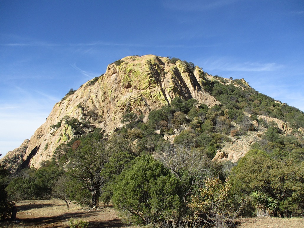
China Peak is a summit in the mid-southern Dragoon Mountains, a little east of the fascinating Cochise Stronghold, and west of Sala Benchmark Peak, which I hiked a couple months ago. The peak rises above a few old mine operations, the San Juan Mine and Gordon Camp, and the name of the peak derives from (is an homage to?) the many Chinese who worked these mines about a century ago.
Today, Friday, was looking to be a fine day with clear skies and calm conditions, with temperatures nearing 60°, a veritable warm spell. Over the weekend, a storm was due to move in, so wanting a peak to hike over the weekend, I pushed up my open date to Friday and looked online for something to catch my interest.
I was aware of China Peak from my visit to Sala Benchmark in November, and knew that the road to it was a good road. I knew from trip reports and satellite maps that there is a track all the way to the summit. After a handful of bushwhacks in the past few weeks, a road hike was welcome. I was still looking at almost 4 miles each way with about 1,700 feet of gain, so I would still have to put in some effort.
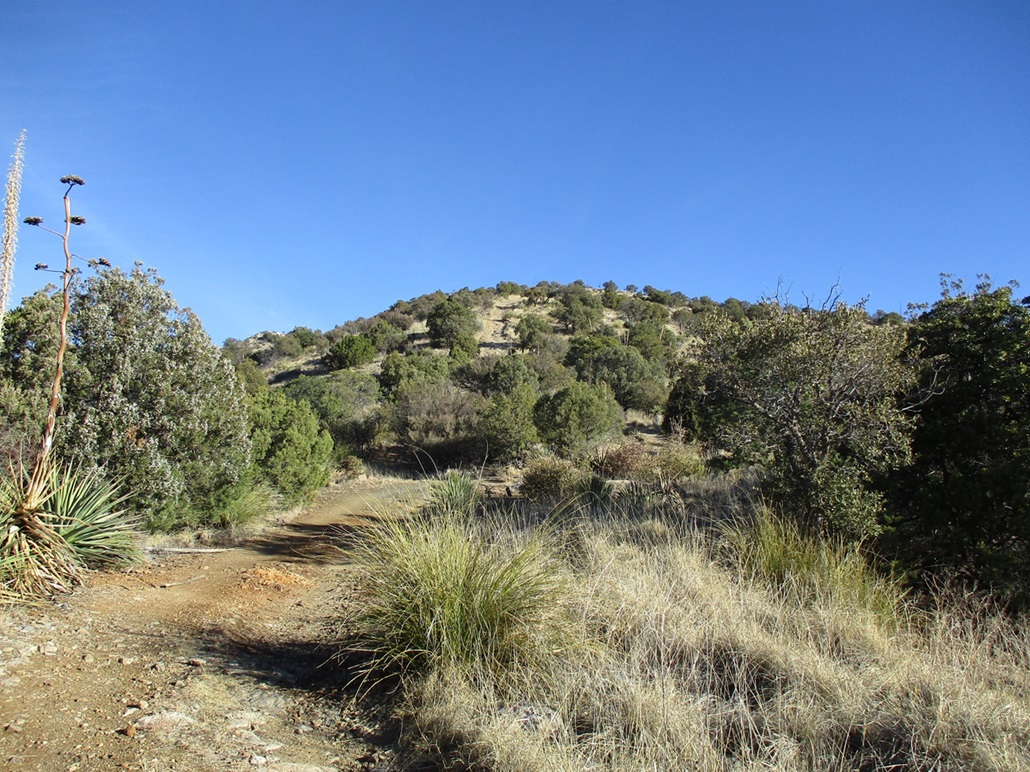
I was out the door a little after 6 a.m., still dark and chilly, but not as cold as it has been. I drove into Tombstone and topped the gas and got a few snacks for the hike, then took Middlemarch Road northeast into the Dragoons, just as the sun was rising. All the timing was deliberate, as I wanted to be at the trailhead just as the sun rose properly. The trailhead is just where FR-697 branches off Middlemarch Road (FR-345). I parked in a clearing off the road, a few dozen yards from some cattle troughs. A couple of cattle were there drinking and looking at me.
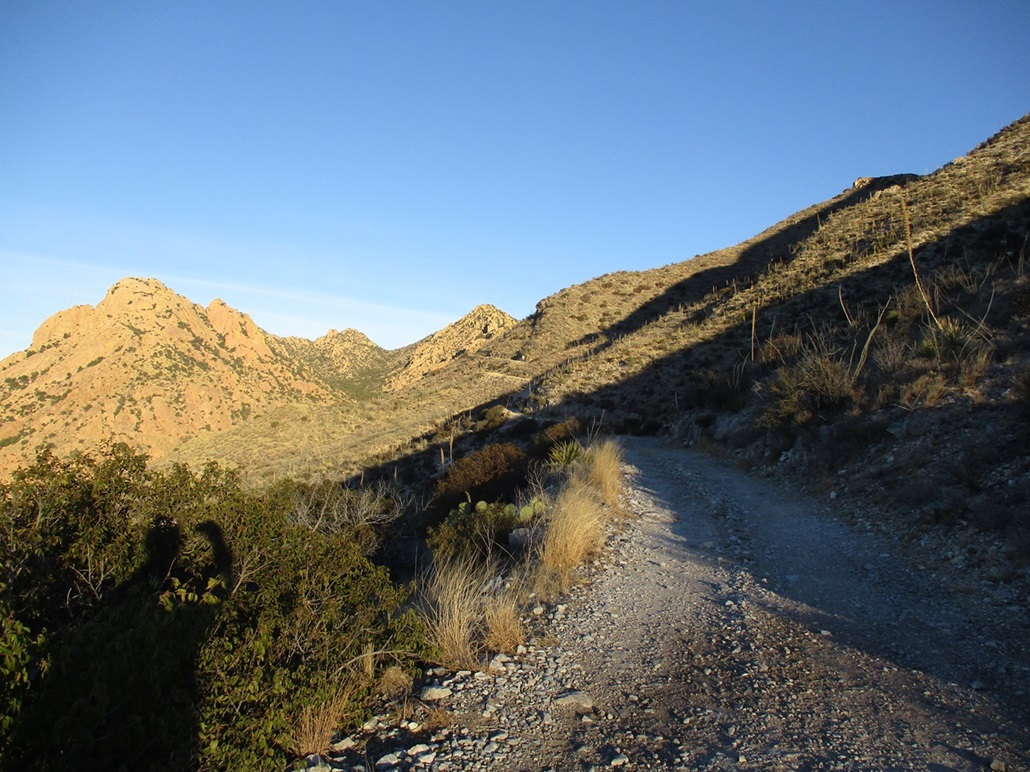
The route to the top is FR-697. The trip reports I had read said this was a rough road, 4-wheel drive mandatory, things like that. As I walked it, it was actually a pretty smooth road. It meandered at first through low foothills, dropping into one drainage that probably would have challenged me in the Forester had I tried to drive it. Beyond this lowpoint, the road angles northwest and makes a long ascending traverse up the hillsides.
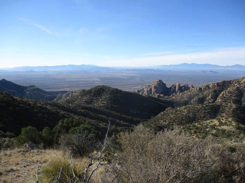
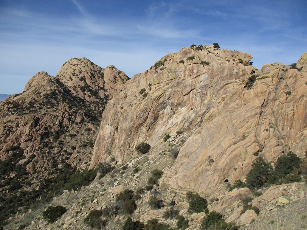
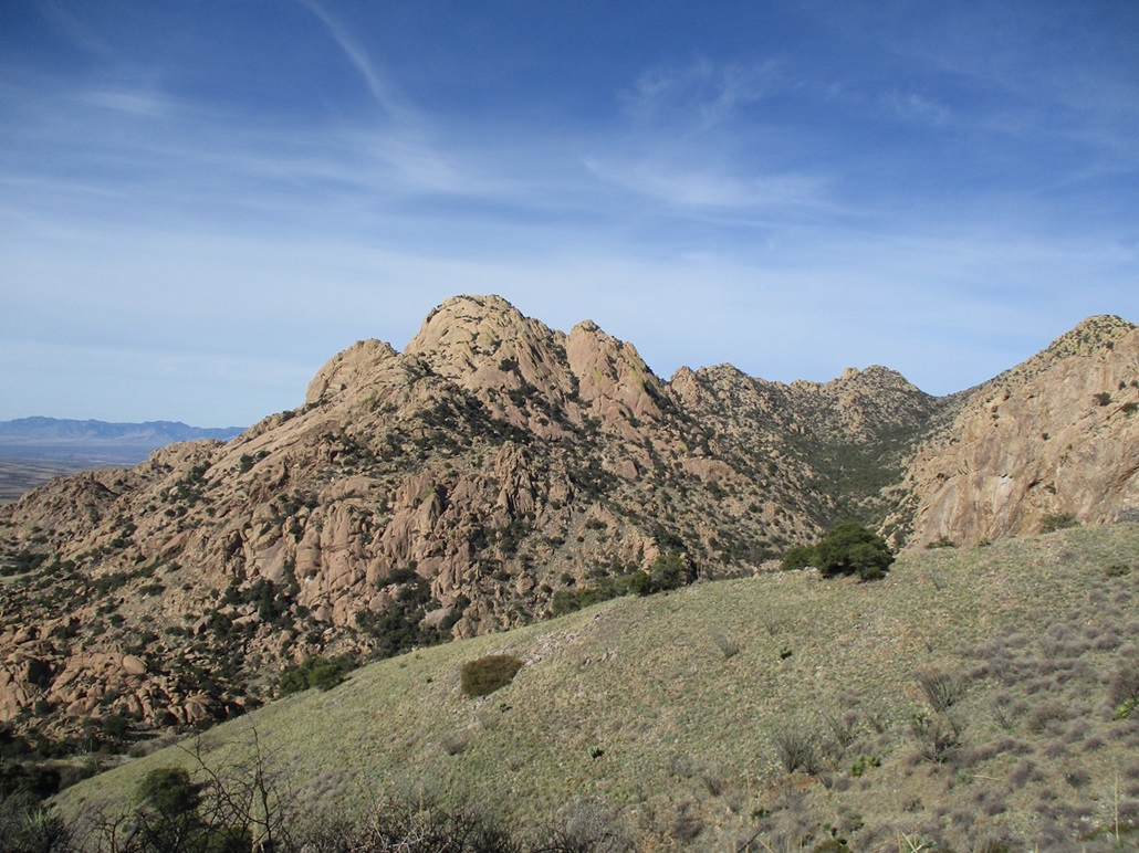
The road was pitched at a reasonably lenient grade (6-8%), fine for walking, and now a shelf road, it was still mostly smooth with a few low rocky sections to manage. But it was narrow. The drops were severe with no shoulder, and there was no place to turn around in a vehicle. But for me on my two legs, it was great, basically a wide trail. The sun was up by now and lighting everything in orange-yellow hues, especially the remarkable rock spires and formations of the Stronghold.
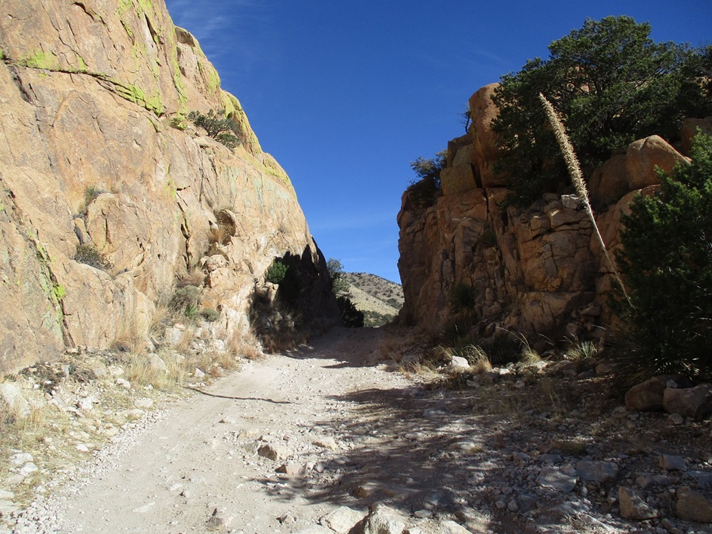
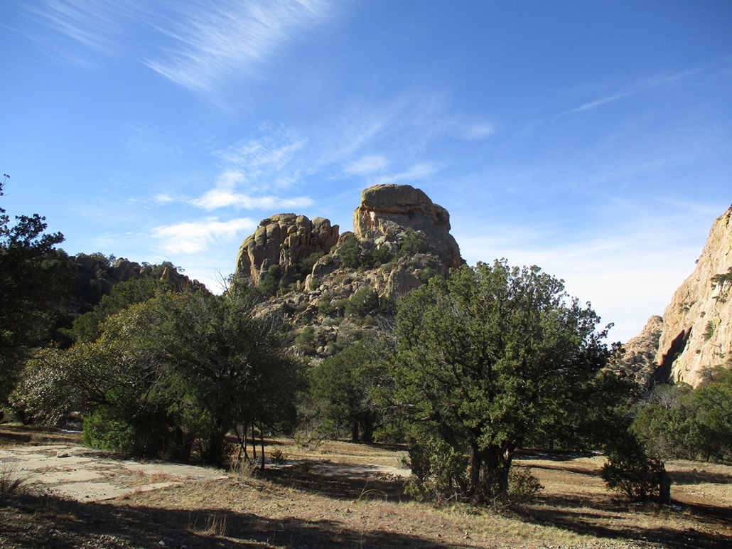
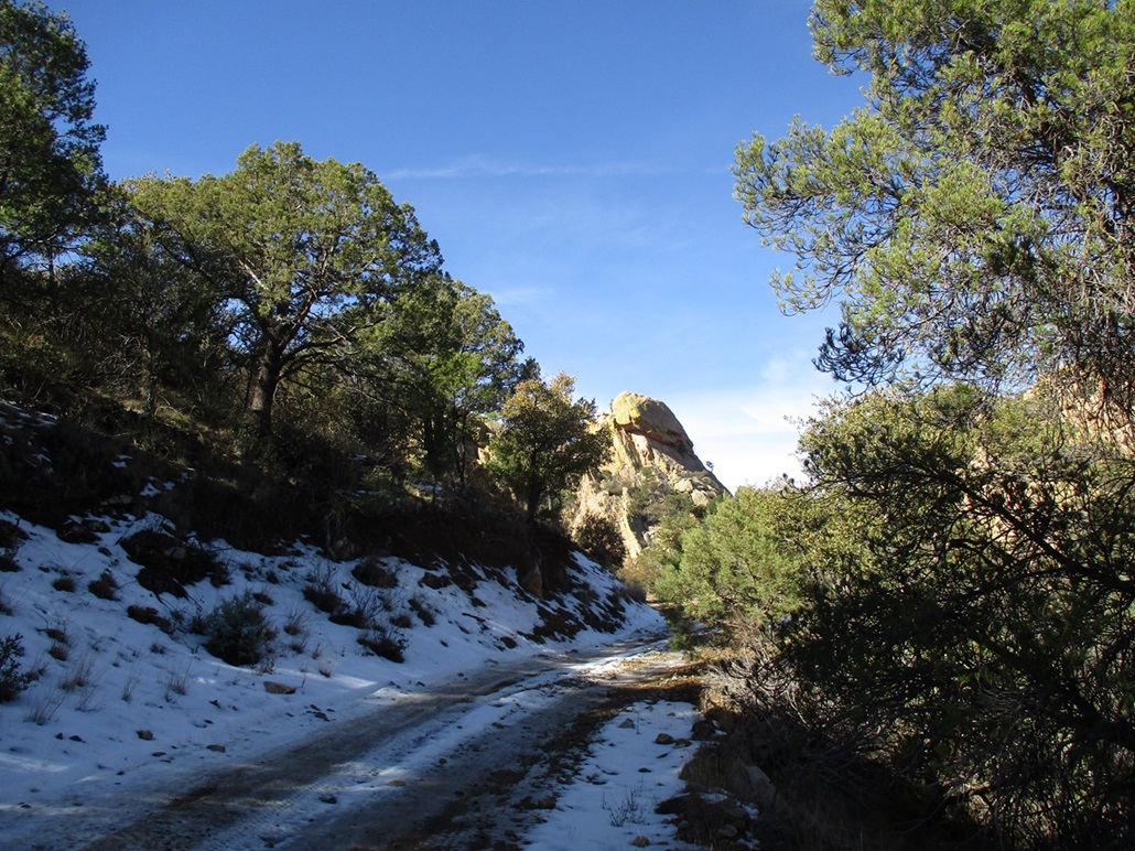
Roughly two miles in (or halfway to the top), the road passes through a narrow opening flanked by massive rock formations. I was told later that this is called "The Gate". The opening was just one vehicle width wide. Was it blasted out with dynamite? Looking at the rocks, it appeared to be natural, maybe some blasting in spots to open it up.
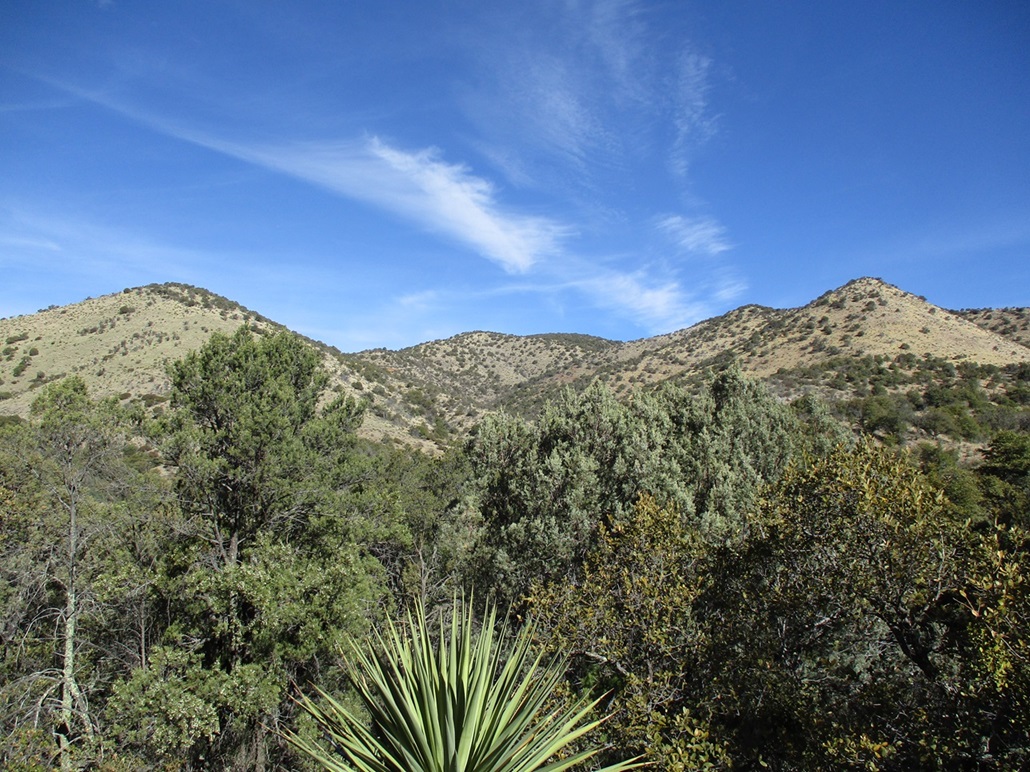
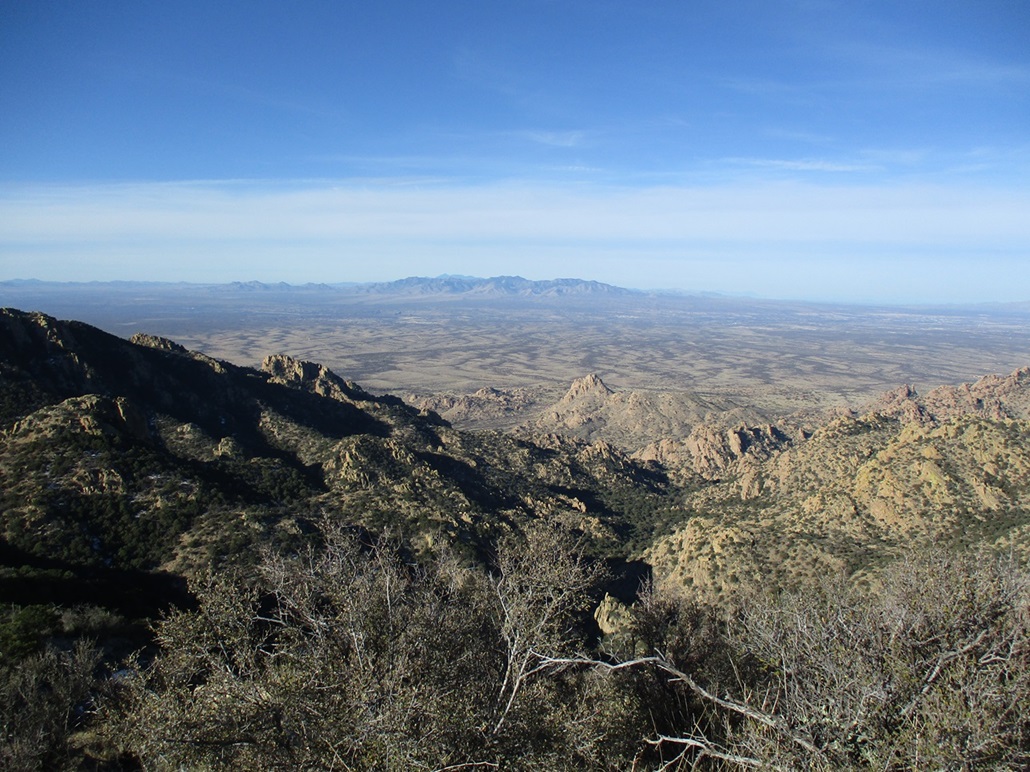
Past The Gate, the road enters into an elevated valley surrounded by the higher peaks, with Sala Benchmark Peak easily visible to the northeast, and China Peak sitting dead center but the peak itself obscured by a foreground ridge. The road drops about fifty feet and here, in the shade, it was covered over in remnant snow and ice from a storm a few days prior. The ice was actually a hindrance, as I had to make sure my footing was solid, lest I slip. Fortunately, this just lasted a few yards.
The road soon passes a handful of concrete pads that I assume were once foundations for buildings related to the mines. A couple of lesser tracks veered to the right, heading steeply uphill to more mine shafts, but the main road was never in doubt. I was making very good time, and soon was at the end of the main track, roughly 3 miles since starting.
The road makes one hairpin left bend at a drainage, then curls a little to the right and comes up to a flat platform, which I believe was the center of the old mining operations. There are no buildings or other artifacts left behind. The main road goes a little more south but soon ends. Directly ahead, as one gains onto this platform, is a track that gains steeply uphill. This was the continuation of the track that would lead to the summit.
In my opinion, the road to here was better than I was expecting. I was expecting big rocks, heavy rutting, bad leans and small slides. Other than some rocky segments, it was generally a well-behaved road. I would not have got the Forester to the end. The road does require 4-wheel drive with clearance. More on this momentarily.
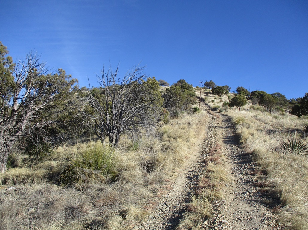
I was still a half-mile short of the top, about 750 feet below. I'd be gaining about 40% of the elevation over the last 15% of the hike. On this lesser track, it gets steep fast and stays steep. It makes a few switchbacks and passes by a couple shafts. The road is very rocky in places, narrow, and extremely steep especially where it makes its switchback turns. For walking, it was a chore, but not impossible.
Once the road gains out of the lower canyon, it then straightens out and makes a straight-shot for the top. It was still steep and full of loose crud, and I was forced to walk these segments slowly, even though I was so close to finishing. The actual summit does not come into view until the last couple hundred feet. The road gains a hill and only then is the conical hump of the summit visible through the trees, looking left. I was on top the peak at 9:30, a two-hour hike.
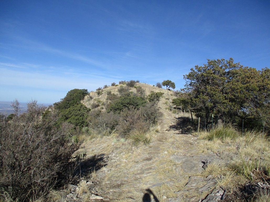
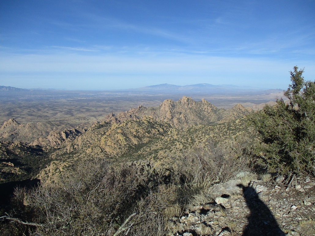
The summit was bare, with a lone bush off to the side and a big cookie tin serving as the register. A fence line runs across the top and curiously, features a gate at the very top. What purpose it serves, I do not know. The day was stunning, so I took a longer than normal summit rest to look around, snap photographs, view the register and enjoy the peace.
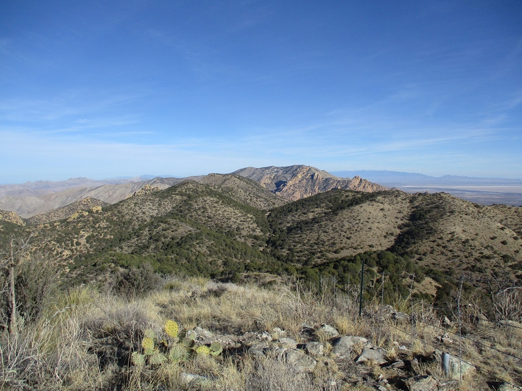
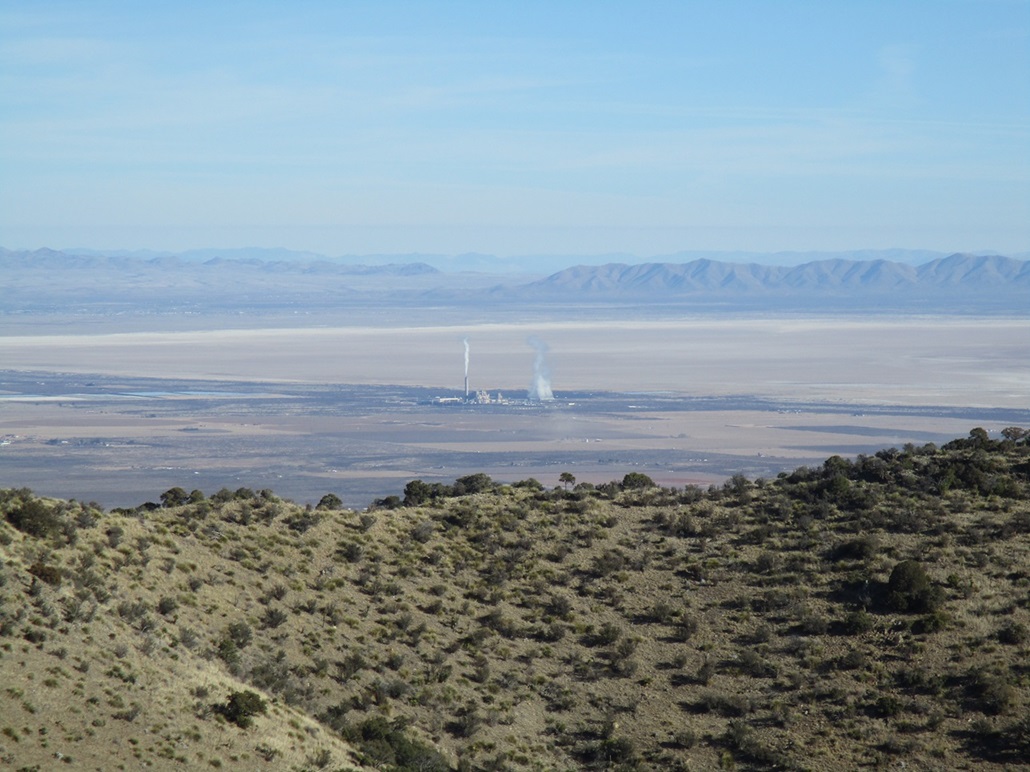
To the north was Mount Glenn. To the west and south were the many rocky formations of the Stronghold. The day was so clear I could see distant ranges such as the Pinaleño, Dos Cabezas, Galiuro, Rincon, Whetstone, Huachuca, Chiricahua and Mule ranges, plus peaks into Mexico. It was pleasant too, being at 7,125 feet, temperature in the 50s.
There is a peak about a mile north on the ridge, with a map spot-elevation of 7,116 feet, whereas the map give China Peak a spot elevation of 7,110 feet. However, it is evident that China Peak is higher, and later review of the 1-meter Lidar data gives an elevation of 7,125 feet for China Peak. Many people combine China Peak into a loop hike with nearby Cochise Peak, but I was content where I was, mission accomplished.
I took some time to eat something and relax, then look into the big cookie tin register which was just laying there below the bush. I opened it, and it was full of junk. The old glass register was contained in it, and within the glass jar was a mash of papers, too packed in to pull out. There was no rhyme or reason. Other items in the tin were bandannas, post-it notes, some money, and various little random items. It looked like a geocache. I signed my name onto one of the post-it notes, knowing full well it will disappear into the randomness of the tin. I closed up the tin and placed a rock on top of it, then started down. I had spent about twenty minutes up top.
The hike down went without mishaps. I had to go slow down the tracks due to the loose tread, but once back on FR-697 proper, made good time, walking at a good pace, but also stopping for more photos as the lighting was better by now. I was soon back to The Gate and past it, now on the long downhill back to my car.
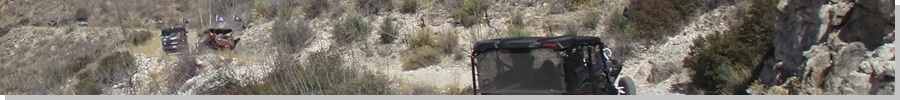
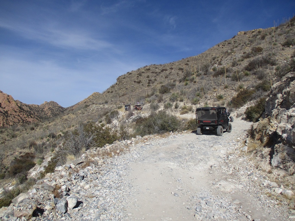
I could hear a distant whine and see dust plumes out on Middlemarch Road. As I walked down, the whine never ceased. It was never too loud, but it was clear it was getting closer. ABout half-way down from The Gate, suddenly I could hear all the whines clearly. A huge group of off-roaders were coming up the road in Polaris-type vehicles (I use the term generically. I did not pay close attention to each vehicle's make and model). The leader stopped when he saw me and we had a pleasant chat. His wife and dog were with him. I asked him how many were in the group and he said eleven. It was a Polaris Parade. After a minute or two of discussion — he asked me about road conditions farther in — he started moving again. He did express surprise that I had hiked all the way to the top of the peak and back. He was a nice guy.
I stayed stepped aside as the other 10 contraptions passed by. Each held between 2 to 4 people and often a dog. Everyone waved. I felt like the tard on the side of the road who forgot his side-by-side. Many of the vehicles had University of Arizona flags and another flag that looked like their club's insignia but I could never get a good look.
After they all passed me, I continued my downhill trek and was back to my car roughly 11 a.m.. There was an older couple parked there, in their hard-core Jeep. I got to talking with them too. They were waiting for the rest of their group to show up. They were "amazed" I had hiked all the way to the top and back. We spent about ten minutes chatting. I was in no hurry and they were very friendly. Soon, another 4 Polaris vehicles came rumbling up. I got to thinking if they all head in, that will be about fifteen vehicles on those roads farther in. It would surely get crowded but also sounded like it would be a real wingding too.
Me, I was happy to be down and finished, feeling pretty good overall. I drove back out to Tombstone and on home to Bisbee, arriving about an hour later. The hike had been a lot of fun and was quite scenic, and it has convinced me that I need to make a proper trip to the Stronghold soon. I was lucky, I guess, to have the peak and the roads to myself for most of the hike. I would not have minded had I run into a few other hikers or off-roaders, but it was nice for it to be just me for those couple of hours.
Here's my opinion on the roads and vehicles, keeping in mind I am not an expert off-roader. A properly-equipped 4-wheel drive vehicle with good tires, decent clearance, short wheel base and low-end gearing should be adequate to get to the end of FR-697. However, that final track to the summit is much steeper and sketchier to where I wondered if some of those Polaris-type vehicles would do it. The tires just didn't look up to it, nor did they have the clearance. However, I felt that guy with the Jeep should be okay if he knew what he was doing. I assume everyone would use common sense and proceed no farther if their vehicle wasn't up to it. I also wondered, if they all pushed it and somehow got onto the summit, there is no room for 11 or 15 vehicles up there. That would be interesting.
Suffice to say, this road is vey popular with Jeeps and side-by-sides, and in season, with hunters. Also, when it warms, the range is famous for snakes.
|


|