
The Mountains of Arizona
• www.surgent.net
|
| Chevelon Butte & East Chevelon |
• Colorado Plateau • Sitgreaves National Forest (part) • Coconino County |
|
Date: November 12, 2016
• Elevation: 6,945 feet
• Prominence: 665 feet
• Distance: 7 miles
• Time: 2 hours and 45 minutes
• Gain: 785 feet
• Conditions: Cool with bright blue skies
Arizona
•
Main
•
PB
•
USGS BM Datasheet
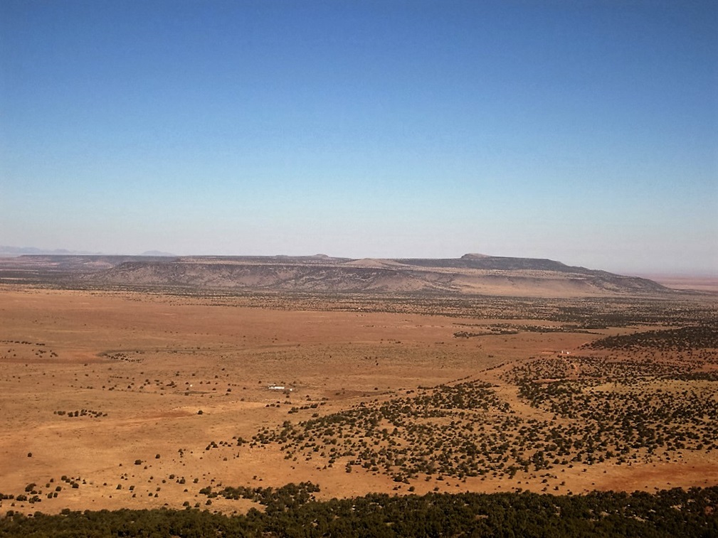
Chevelon Butte is a mesa all by its lonesome on the Colorado Plateau, about 30 miles north of the Mogollon Rim and 40 miles south of Winslow. The Sitgreaves National Forest runs up to and includes some of the southern slopes of this mesa, while the rest of the mesa lies on the 4C's ranch, one of the state's largest.
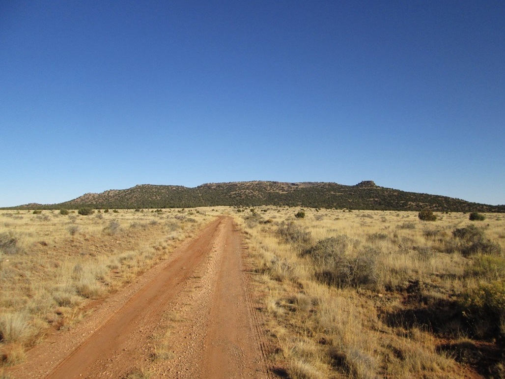
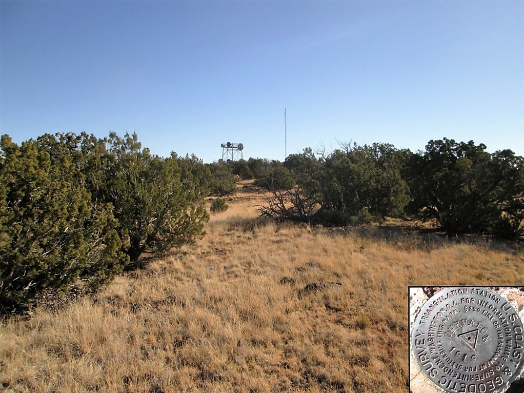
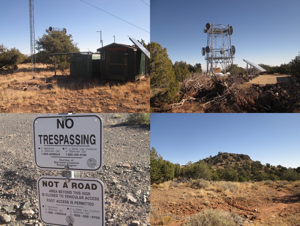
The 4C's Ranch (Chevelon Canyon Cattle Company) encompasses most of the lands north of the Sitgreaves Forest property, extending north toward Winslow. It was founded by — and is still owned and managed by — the O'Haco family, the ranch now over a hundred years old. The land here is flat plateau, sloping gently downhill to the north, ideal for cattle. Chevelon Butte is one of three mesas (the Sunset Peaks being the other two) that rise over this part of the plateau. The top is surrounded by basalt cliffs, suggesting a caprock that stood up against erosion over the eons. These days, the summit features a couple of communications towers. The name "Chevelon" is a surname, but the benchmarks atop the mesa are stamped "Chevalon".
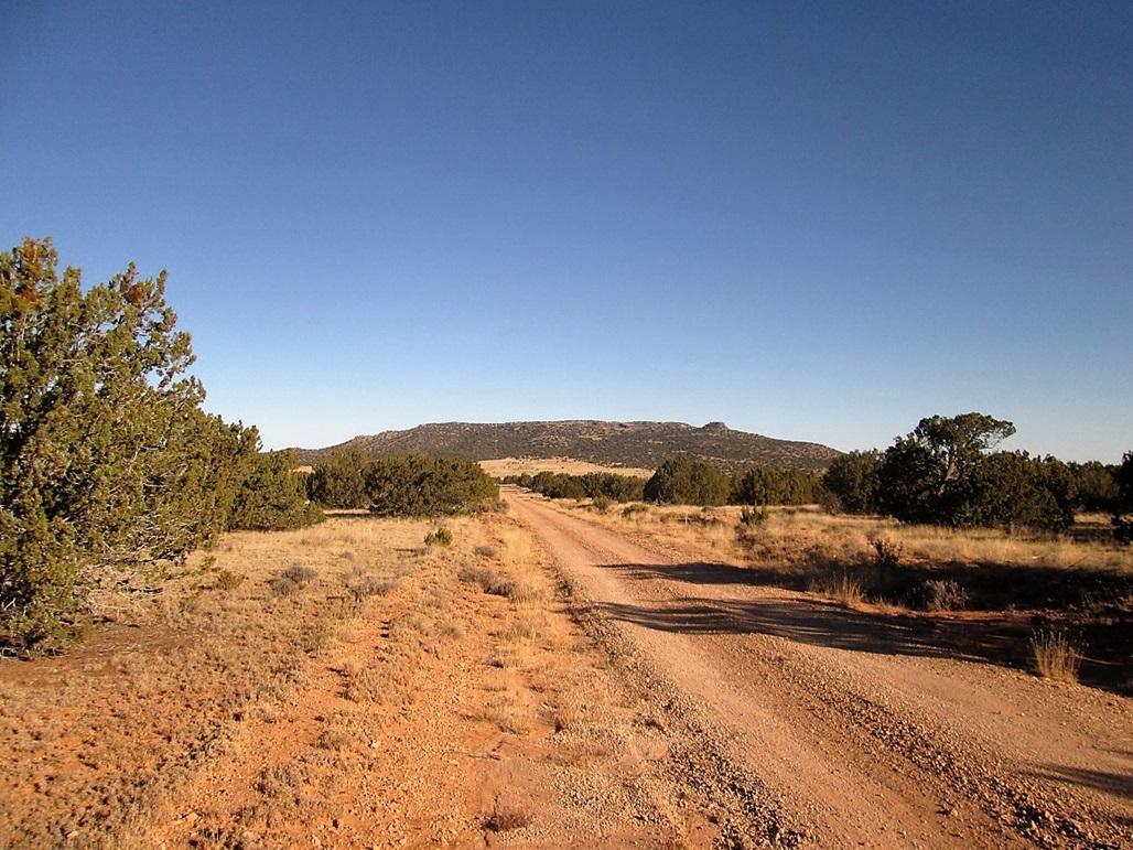
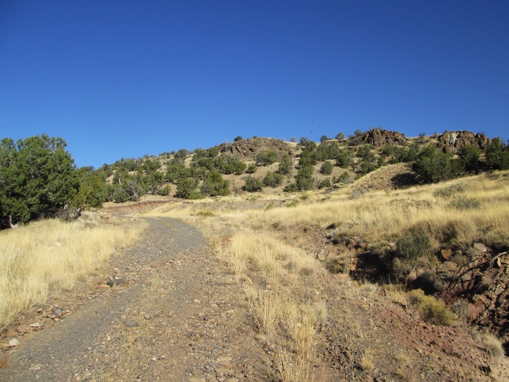
We left home on Friday about 3 p.m., driving north through Payson, then east up AZ-260 to top out on the Mogollon Rim. We turned left onto Sitgreaves Forest Road 300 (the Rim Road) and followed it about ten miles to its junction with FR-34. We turned north onto FR-34 and stayed on it for almost 22 miles. The first 13 miles were unpaved but flat hardpack. Then, it's paved but in bad shape, featuring potholes with sharp edges. The FR-300/34 intersection is about 7,600 feet elevation, in old-growth ponderosa forest. By the time we got to FR-23 at the north boundary of the forest, the trees had reduced to pinon and juniper, the elevation about 6,400 feet.
We arrived here about 5:30 p.m., the sun almost set. I eased onto FR-23 and we went west, then north, going slowly and looking for a place to pull off and camp. We found a good spot about a hundred feet off the road, shielded by piñon. I set up the tent as the sun set, aided by the largest full moon (the "perigee-syzygy" full moon) that we will have until 2034. With no clouds and no humidity, the moonlight was bright enough so that I did not need a flashlight. It was cool and very quiet.
Temperatures that night fell into the mid-30s, cold enough to leave a layer of frost on the car. I slept well but was slightly chilly. The full moon shone into the tent so brightly it was like having a light on all night. At one point, a pack of coyotes assembled nearby then started their howling and yipping. Elk were in the area; we had seen about a dozen of them as we drove the road in.
The next morning, I let the sun rise a little to warm things up, no hurry to get moving for the hike. I didn't start the hike until about 8:30 a.m., the temperature about 50 degrees. We could see Chevelon Butte from camp, the mesa about two miles to the north.
I followed FR-23 northbound for about a mile to where it meets with FR-63, which heads west. This is near Chevelon Tank, and about a hundred feet lower in elevation then where we camped. The land here is treeless, and we did not want to camp near a water source, which is why we camped a little farther back.
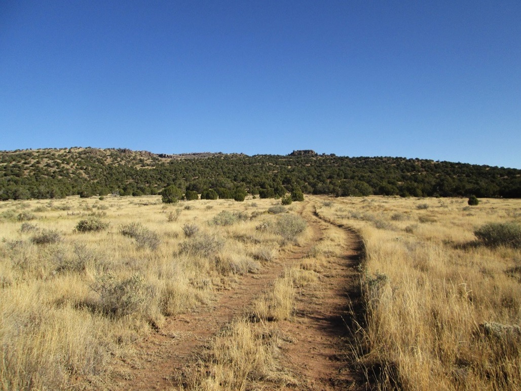
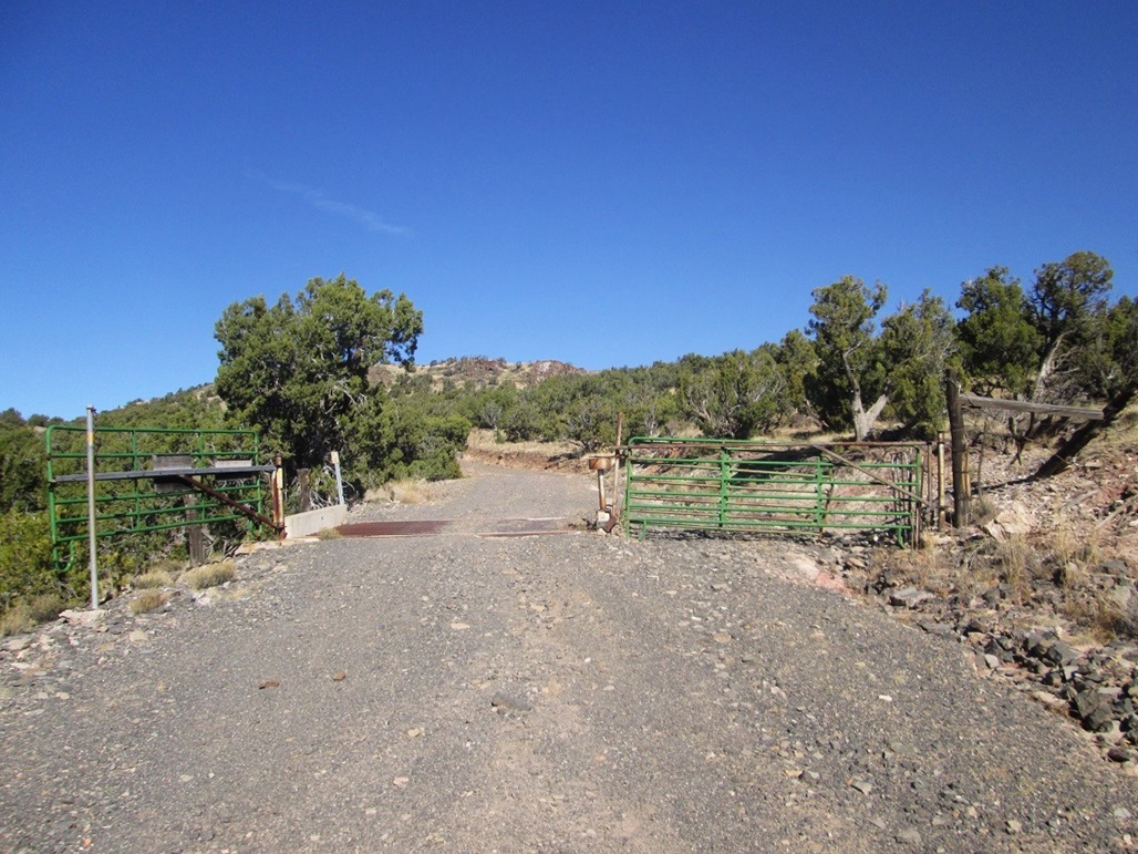
At the FR-23/63 junction, old FR-23 continues north but is no longer maintained as a road. A sign says foot traffic is permitted. I followed this old road north, gaining gently, then slightly steeply, as it entered into another "forest" of piñon and juniper. I stayed on the road until it merged with a newer, more modern road that comes in from the east, to allow workers up to the top to service the towers. Here, I saw a pair of signs which would seem to contradict one another (see left sidebar). One said "No Trespassing", another said foot traffic was permitted.
Before this trip, I could only find one previous report from a visitor who encountered the same signage. I didn't feel concerned about walking this better road (the forest boundary being where these roads met). This part of the ranch seems to participate in the "sportmans access" program. I did not expect to see anyone, and the road bed showed no hint of vehicle tracks, not even old ones.
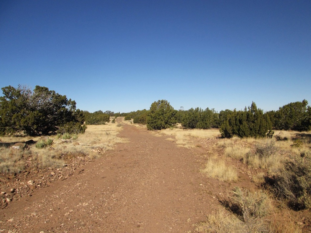
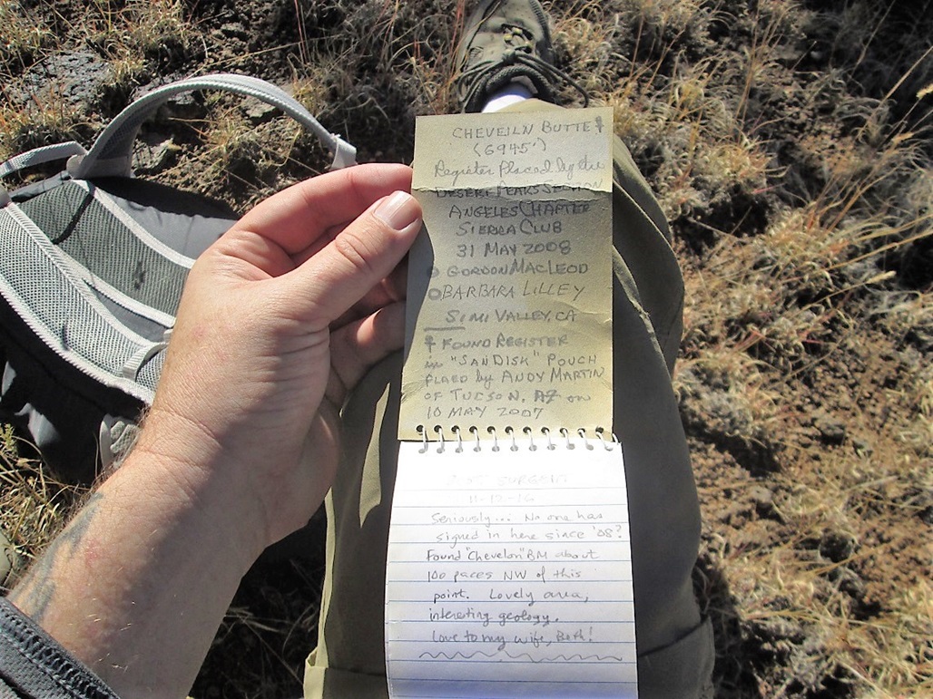
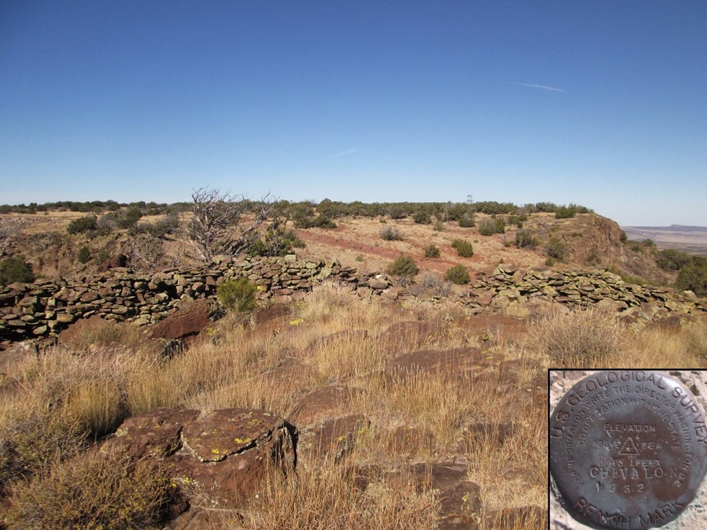
From here to the top was about 1.75 miles, and the road gained quickly, bypassing an old mine, before emerging onto the flat top. I walked the road to its end near a couple of buildings maintained by the Sitgreaves Forest. I then backtracked to the highest area, near the two communication towers. It took about ten minutes to locate the USGS Benchmark, placed here in 1919. The highest point is apparently midway between the two big towers. A glass-jar register placed here by Lilley-MacLeod in 2008 held no signatures until mine in 2016.
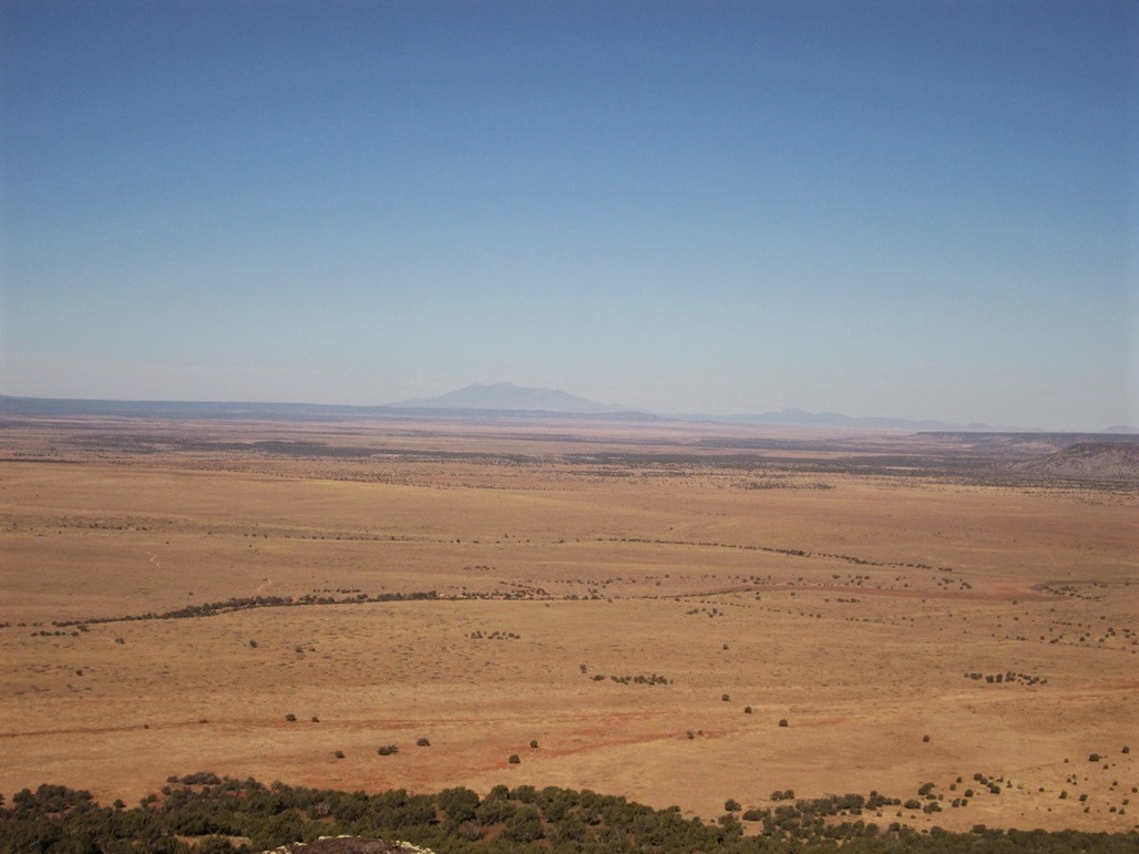
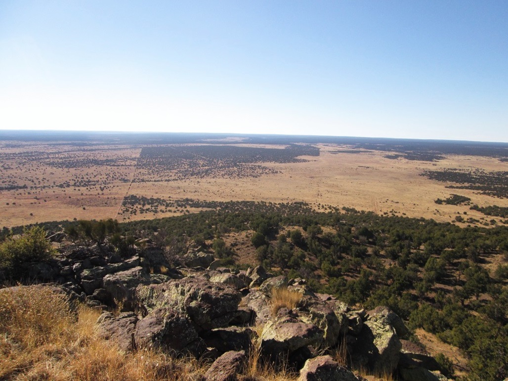
I was in no hurry, and I explored the area, including the north-facing rim where I could see the Sunset Mountains, and way off in the distance, Humphreys Peak. Looking north, I could make out faint outlines of the low mountains that lie north of Winslow on the Navajo Nation.
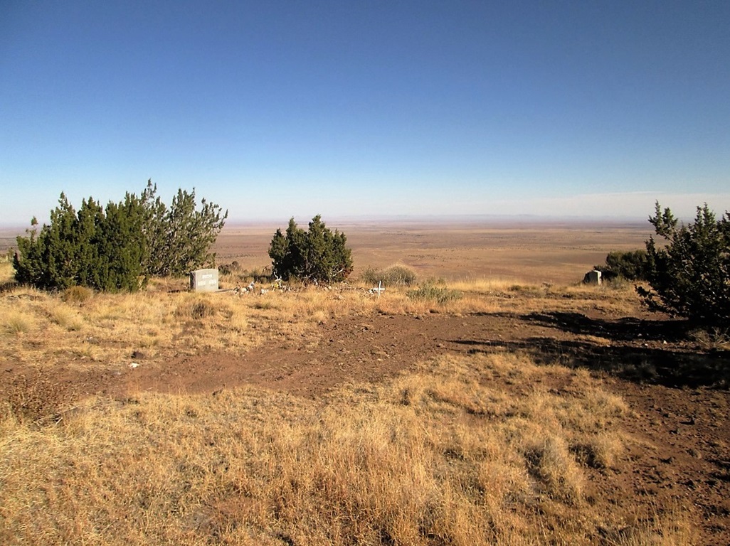
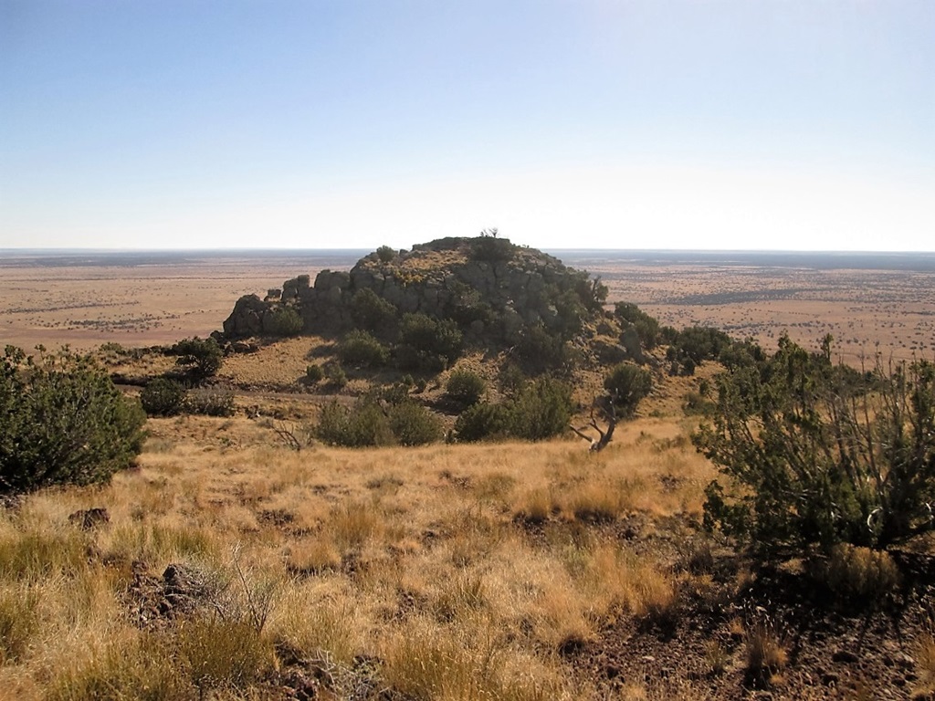
On the hike out, I walked to the O'Haco family cemetery. Out of respect, I got no closer than the photo you see in the left sidebar. The place looks tidy and looked-after. I saw no reason to poke around the area, messing things up. I then wanted to explore East Chevelon, a pointy knob on the mesa's east edge, visible from below. Whereas the hike to Chevelon Butte's top had been trivial with no challenges, East Chevelon was surrounded by a jumble of rocks, and atop it, a man-made stone wall of uncertain provenance.
I walked to the saddle below this knob, then scouted for ways up. The rock lays back but is steep, and on my first try, I got up about 15 feet but then hit actual cliffs. So I backed down and found another way up, scooting over about 50 feet. Soon, I was on top. I found the benchmark, snapped more photos, and inspected this wall. It was basalt rock, fitted together without mortar, just on one side. Its purpose is unknown.
I scampered down off this knob back to the road and simply followed the road down back to camp. As I got back to the good part of FR-23, a truck came rumbling up. Two Mexican woodcutters were driving out, the back filled with firewood. They offered me water, but I said thanks, I was good to go. I was back to camp by 11:30 a.m.
Here is a pictorial report of one other individual's recent (about 2014) visit to Chevelon Butte and the surrounding areas. Note the dramatic topography of the Clear and Chevelon Canyons. We did not explore either, but hope to in the future.
|

|