The Mountains of Arizona
• www.surgent.net
|
| Black Mountain |
• Highpoint: Town of Carefree • Black Mountain Summit Preserve • Maricopa County |
|
Date: June 11, 2011
• Elevation: 3,398 feet
• Prominence: 1,018 feet
• Distance: 2.5 miles
• Time: 1 hour and 15 minutes
• Gain: 1,220 feet
• Conditions: Clear and warm
Arizona
•
Main
•
AZ P1K
•
PB
•
City HPs of Maricopa County
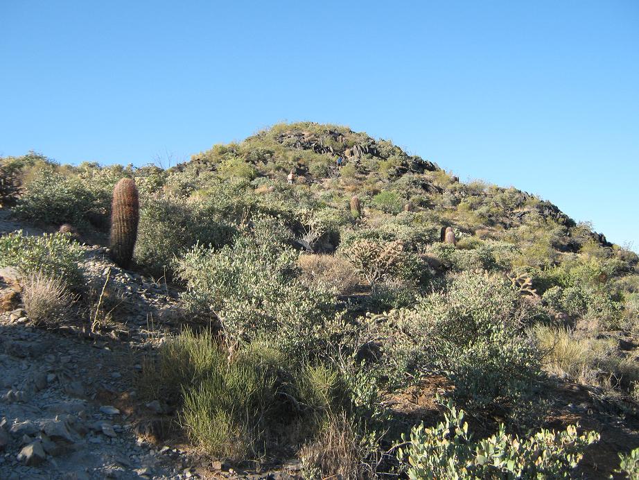
Black Mountain is a popular hike in the Cave Creek area, north of Phoenix. There is a good trail, the hike isn't that long, the views are excellent, and it seems to be a popular exercise hike for the people living in the area. I had lived in the Phoenix area for nearly 19 years before I finally got around to hiking this peak.
The weather is hot about now, but the mornings are still reasonably pleasant. Daytime highs would be near 100 degrees F, but mornings are still in the low 70s, and it is dry. I figured if I got a very early start, I could be up and down the peak before the heat became an issue. Plus, whatever they predict in Phoenix, you can subtract a couple degrees for Cave Creek.
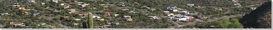
I was out the door at dawn, heading north along Scottsdale Road to the Carefree Highway, which is essentially the north border of Phoenix and some of Scottsdale, and the southern border of Cave Creek and the smaller town of Carefree. Scottsdale Road changes its name to Tom Darlington Road as it crosses the Carefree Highway. There is a big pile of boulders (called "The Boulders") immediately as one enters Cave Creek/Carefree. Black Mountain rises high above to the west.
I angled left and then followed local roads toward Black Mountain, coming in from the north. There is no parking lot for hikers, but there are a few pullouts and open-parking zones along the roads, which is a residential area but spread out enough so that you're not necessarily parking in someone's front yard. I rolled in at 6:15 a.m., and could see about a dozen other hikers walking up the road to the mountain.
Cave Creek itself is an interesting town, a mix of mansions, high-end art galleries, and obvious wealth, and then bars, saloons and taverns, with a strong motorcycle culture here too. Carefree is a smaller, separately-incorporated town tucked in between Cave Creek and Scottsdale. It has street names like "Ho Hum", "Never Mind" and "Huff-n-Puff". Yes, there really is a Town of Carefree and a Carefree Highway. Gordon Lightfoot didn't just make this all up. The summit of Black Mountain actually lies inside the Carefree town limits, and thus is its highest point.
Having never hiked this peak, I had no idea how popular it would be. Most of the parking pullouts were still available, but there was also a fair number of hikers starting up the route. I suspect many are locals who live nearby and just walk here. Summer may scare off others. Overall, it was not crowded at all. I am positive that Camelback Mountain probably had 200 people on it already at this time. I put on my shoes, packed some drinks and started up at 6:25 a.m.
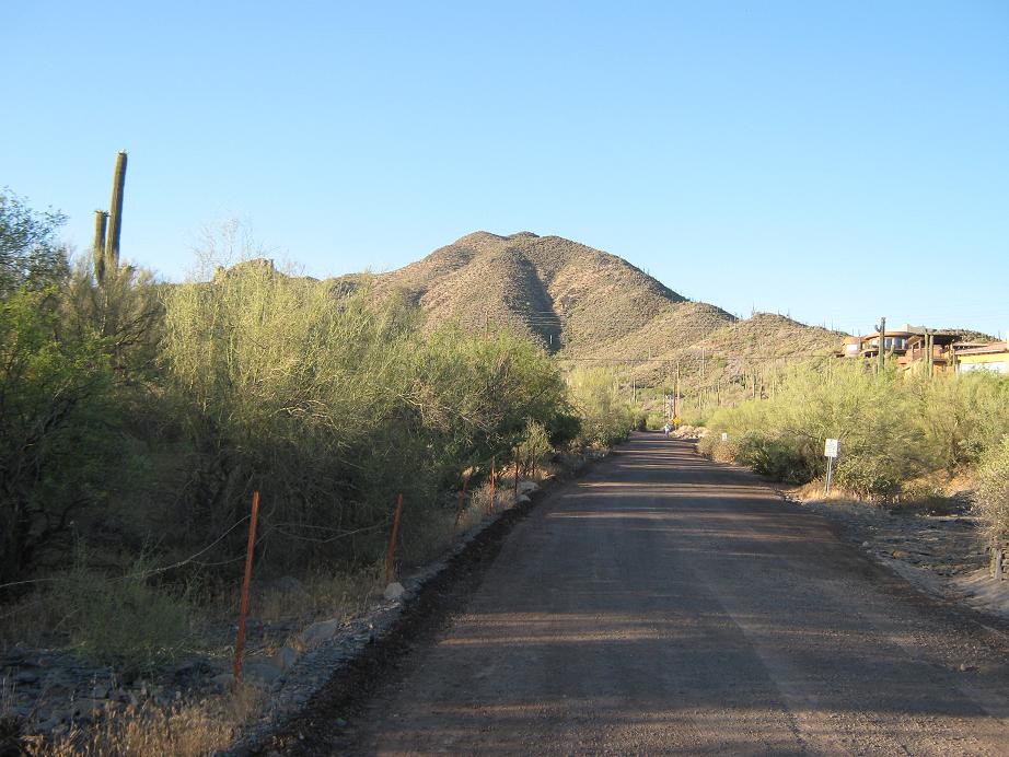
The first quarter-mile is a road walk south along School House Road. It gains steadily, coming to the entrance gate of a nice home. However, a lesser road veers right, and I saw a few people on it, so I followed this road even steeper as it side-hilled up a lower ridge. Only later did I learn I missed the Black Mountain Trailhead. Oh well, it all goes to the same place eventually. This secondary road segment wasn’t terribly exciting but it went up, and in time I came upon a trail let-in point, near where this road makes a hard right toward a water tank.
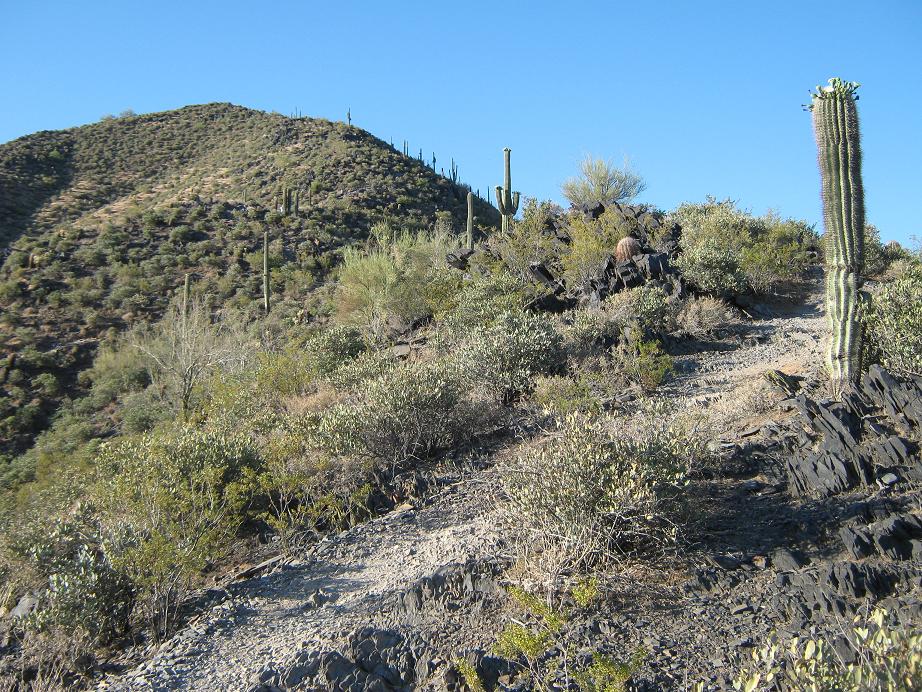
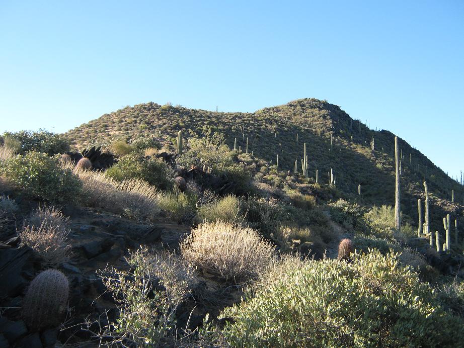
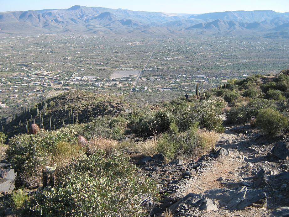
Now on the trail, I followed it up as it stayed mainly on the ridge, sometimes dropping slightly to one side or the other. There’s nothing fancy about this trail. It goes up and often quite steeply. All this was good: if I’m going to burn energy like this, I’d rather go up than do endless switchbacks. The trade-off was some very steep segments, but the rockiness meant that slipping was unlikely.
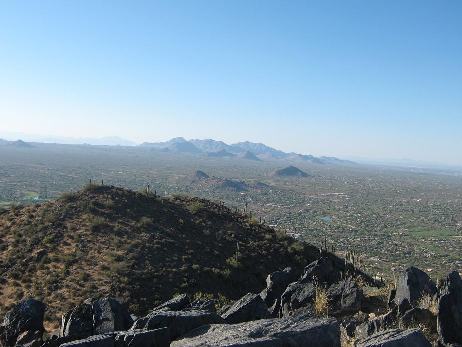
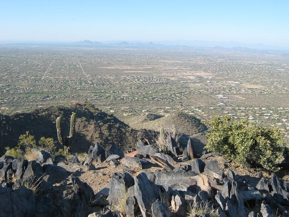
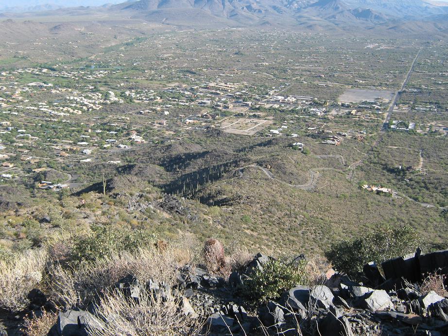
For much of this middle third segment, the summit was hidden behind a lower ridge, but once above it, the rounded top came into view, and after a few more sweaty minutes, I was on top, 7:00 a.m. exactly. Two guys were already there, so I sat to one side and relaxed, checking out the surrounding views and taking a few photos. The views were stunning, especially of the big mesas north of town. I spent longer than usual on the summit, almost 15 minutes, before starting down. The guys were pretty cool, and we chatted a little bit. I told them I’ve climbed Camelback about 200 times, but this was my first time up Black. One guy was just the opposite: he hikes Black Mountain many times weekly, but has hiked Camelback just once as far as he could remember.
The hike down went quickly, and it was warming up too. It was never crowded. Going up, I counted about ten people coming down. And as I was hiking down, just a handful going up. I didn't see any snakes, which was a surprise because I fully expected to see at least one or five. I was back to my truck about 7:45 a.m., and even now it was warming into the "kind of uncomfortable" range, maybe 90 or so. It gets hot fast in June.
I enjoyed this hike because I got a good workout, it wasn't crowded and not full of foolish people holding babies, drinking beer or wearing flip flops, and I got to tick a peak off my list for the efforts. I was back home by 8:30 a.m., so I took a quick shower and did the most logical thing: lay back down to bed and get a couple more hours of sleep.
|

|