The Mountains of Arizona
• www.surgent.net
|
| Butcher Jones Peak |
• Butcher Jones Recreation Area • Tonto National Forest, Saguaro Lake • Maricopa County |
|
Date: October 8, 2018
• Elevation: 2,120 feet
• Prominence: 480 feet
• Distance: 5 miles
• Time: 3 hours
• Gain: 725 feet
• Conditions: Cool, with spotty clouds and blue skies
We had a storm over the weekend which dropped a fair amount of rain over the deserts. On Monday, the storm had passed on, but left behind much cooler weather and sunny skies with some puffy clouds, perfect weather to hike somewhere in the deserts, my first time doing so in months. I set my sights on an officially-unnamed peak atop a peninsula of desert overlooking Saguaro Lake, in the Tonto National Forest. The Butcher Jones Trail begins at the Butcher Jones Recreation Area, "Butcher Jones" being a nickname for an early late-1800s doctor in the region who apparently earned the name. The trail gets close to the peak but not to its top. Some off-trail low-end scrambling is needed to tag its summit.
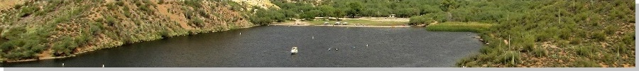
The Butcher Jones Recreation Area is a small beach tucked into a cove where the peninsula is on one side. It is a very popular location to eat, drink, be merry and toss garbage. The parking lot is very big, which should be a hint. I knew this place gets crowded, so I planned to be there very early, before the lot filled with cars. So I get there just fine, and discover I need a Tonto Forest day pass. I did not want to chance a ticket, and the passes cost just $5, so I drove back to a Chevron on the Fort McDowell Nation, 11 miles back, to get one, then back to the parking lot, now a little past 8 a.m.. Fortunately, the lot just had a few cars.
I got my stuff together, locked up the car and started walking at 8:15 a.m.. There were a couple fishers walking in plus a group of hikers from a club, it appeared. The trail starts on the east side of the small beach with a sign. It enters into a brushy drainage with mesquite trees and is a little hard to glean in spots. I followed older boot prints across this segment and up a small slope to place me back on slightly-higher land. Now, the trail angled right (south) and hugged the shoreline. The couple fishers had found spots here and were busy fishing.
The trail runs about a quarter-mile to a far point called Peregrine Point. It passes through a pedestrian stile, then cuts north, aiming into a small cove. Here, the trail is a little narrow in spots. If I fell, I might tumble about 10 feet down into the water. In another quarter-mile, the trail dropped into another drainage choked with heavy brush and trees, forming a canopy to where I was walking in a tunnel of branches.
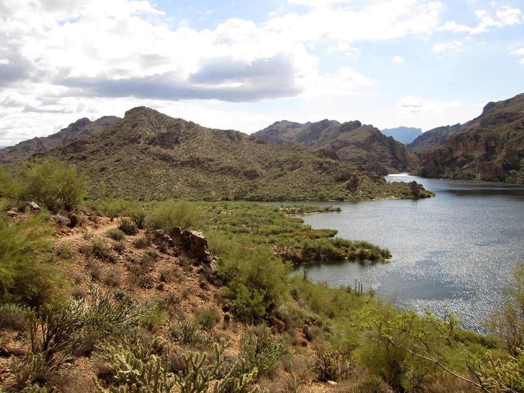
On the other side, the trail gained a small slope and started south again, following the shoreline in and out of the many small coves and indentations. The trail usually stayed about 10 or 20 feet above water line. Shortly, the trail entered into another drainage. This time, I got a little confused as the better trail dropped into this drainage, but then petered out in the brush. I backtracked and found the "main" trail staying high. It eventually curved around this inlet, then started to gain elevation, getting as high as 100 feet above the water.
This segment was scenic but also demanding a little attention. In places, the drop was severe, possibly all the way into the drink if I wasn t careful. Previous visitors have mentioned that they have encountered snakes on these narrow parts, where there is little room to jump to one side. Fortunately, I saw no snakes today.
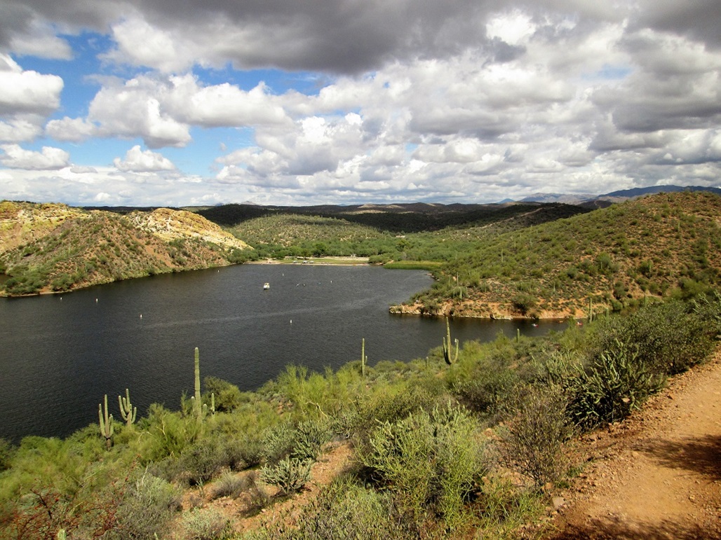
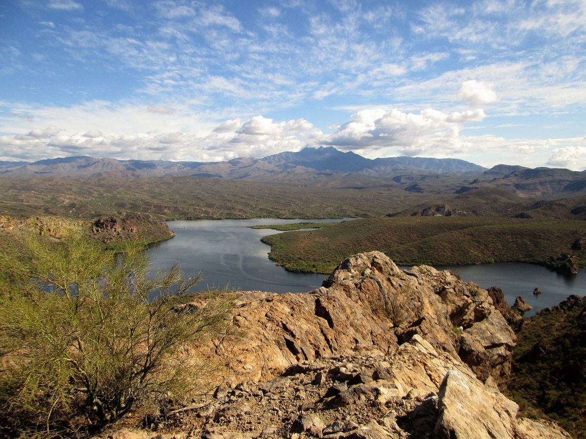
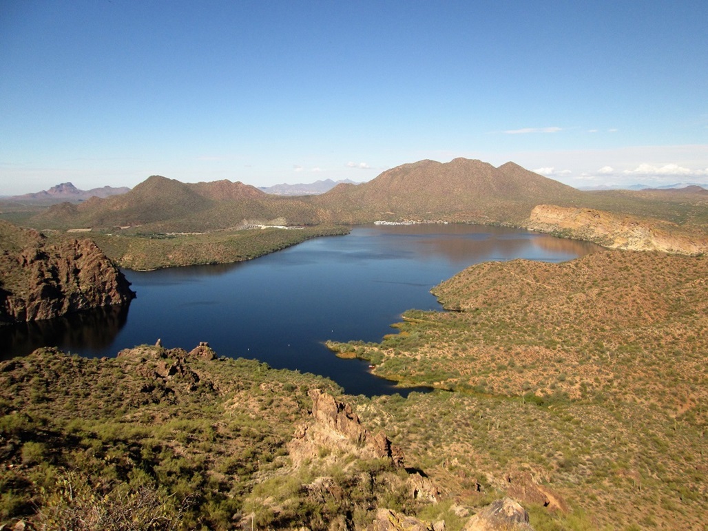
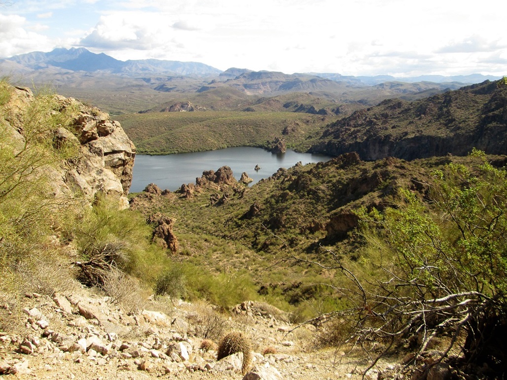
The scenery is tremendous here, with desert flora such as saguaro, cholla, staghorn and prickly-pear cacti, plus palo verde and various woody scrub plants. There are cliffs all around Saguaro Lake. At the far west end was Stewart Mountain, plus Stewart Dam, which holds back the waters of this lake. There were just a couple boaters out today. It was fairly quiet, and the trash problem I had read about was not as bad as I feared. I saw very little of it along the whole path.
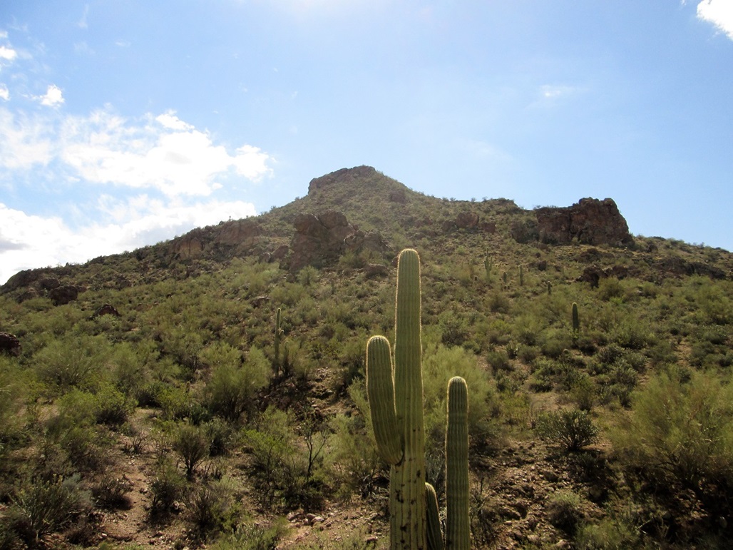
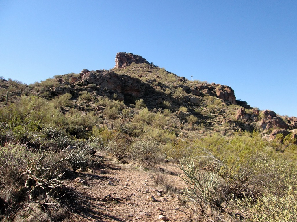
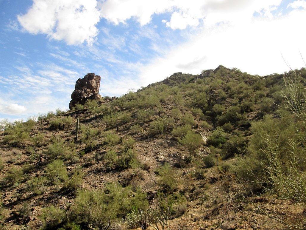
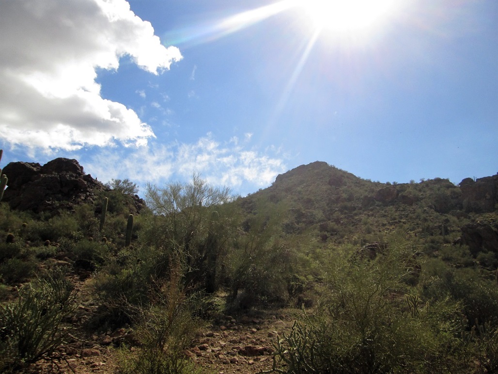
About an hour into my hike, the trail angles inward away from the water. Here, I saw the peak for the first time, topped by a caprock. I stayed on the trail past one junction, continuing east across desert, placing myself northeast of the peak, near another junction mentioning Burro Cove and Shoreline Access. I had hiked about two miles to get here, with a net elevation difference of about 170 feet, but with some drops and regains totaling over a hundred feet. The day was sunny with bands of clouds, and pleasant, temperatures in the low 70s.
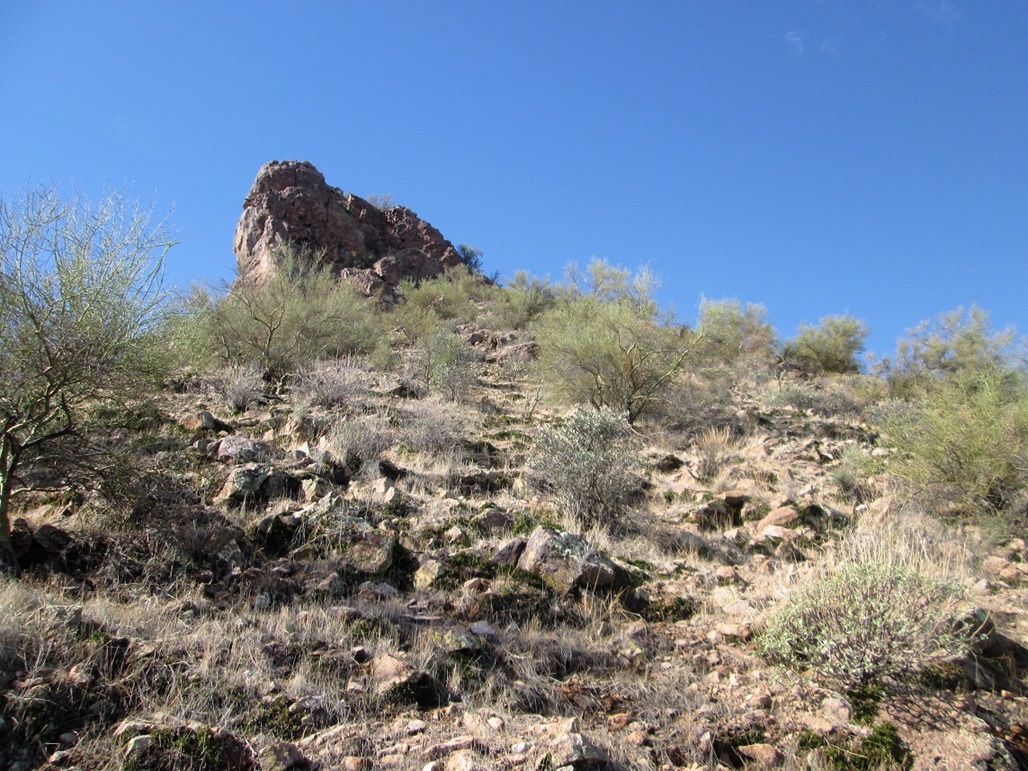
I started up the easy slopes, angling left until I was on what seemed to be the easiest slope toward the top. It was steep and brushy in spots, but solid, too. I gained about 300 feet to put me at the east tip of the caprock, which was about 30 feet tall here. As I got near it, I could see lots of little chutes and breaks in it. Nevertheless, I figured it to be wise to poke my way along the entire base of the rock to see what else opened up. I could always return to one of these chutes later.
I ended up going all the way to the west tip, scampering up a loose slope to get to a small saddle, where to my relief the top was just six more feet above me. I was up in no time, and spent a few minutes admiring the views. The day was sunny with low humidity, and with those puffy clouds that trail a storm. The effect was most pleasing and I enjoyed my time up here.
I was amused to see a small cliff-band by the water on the opposite side of the lake, to the southeast of the summit. Back in 2001, when I was a member of Central Arizona Mountain Rescue, we had a call to rescue a guy who had climbed up to one of these cliffs, intending to jump into the water below, a drop of about 80 feet. Unless you know what you're doing, that kind of leap into water can kill a person. In his case, he discovered the cliffs aren't truly vertical, but lean back slightly, so that a leap would just result in landing on the rocks below, almost certain death, too. He was shirtless, in flip-flops and drunk, which probably doesn't come as a surprise. And it was extremely hot, about 112 degrees.
We got the call and assembled at a small Sheriff's trailer near the boat launch. We got in and they took us to a let-in point near the cliff. We were a team of five or six. The plan was to assemble a lowering system above him, send down one of our guys, get the subject secured, then lower him and the rescuer down to the water below.
At the time, I was usually the anchor-builder and main-line rope boss. So I got to carry the 80-pound backpack that held our ropes, webbing, carabiners, pulleys, brakes and anything else heavy. We didn't have to hike very far, perhaps just a few hundred yards and about a hundred feet of elevation gain to get above the guy. In this heat, just that short hike, couple with an 80-lb weight on my back, wilted me. But setting up the anchor and rope system went quickly. As rope systems go, this one was as uncomplicated as one could be.
We got our guy tied in then lowered him. Me, I just governed the rope through the brake line. It took a few minutes to get the subject secured. Once he was, we got the signal to continue lowering him. He was then taken to the medical shack back near the boat launch. The whole rescue went efficiently, about an hour from start to finish.
We disassembled everything and got it all packed, then walked back down to the small cove. Since the boat was already gone, we all got a lift in a helicopter back to the main buildings. By this time, the subject had been taken to a hospital. We did our usual debrief and also watched as the news channel people with their cameras were milling about. This would be on the news tonight, for sure.
I never actually saw the guy. I was told that he was severely sunburned (no surprise) and severely dehydrated (no surprise), as well as severely drunk (no surprise). On the news that night, they showed him being stretchered into an ambulance, and he was giving air high-fives to everyone around him. Probably didn't learn a damn lesson.
Me, I was completely spent. The extreme heat and physical exertion, plus the fact that even when being still, it was over 110 degrees, did a number on me. From beginning to end, I'd been out in the heat and sun for three hours. I was able to get home okay where I hydrated and rested, but it took a day for me to recover. In retrospect, I should have asked for a bag of ringers. Other guys on the team have done so in the past.
Ah, the memories. Sorry to digress.
I needed to get back down now, and the long west ridge looked attractive, so I followed it and was able to drop about 250 feet easily, before encountering cliffs. The cliffs were only 15-30 feet high, but too high to get down safely. For about 30 minutes, I tried all sorts of things and eventually found a place where I could squirm down and back onto regular slope. I was back to the trail quickly.
Walking out, I encountered hikers every few minutes. Few had come this far in, but closer to the beach, I came upon more of them. I was surprised there would be this many people on a Monday. The trash was not a problem either. But yeah, closer in, things got stupider. Boats blaring bad 1980s rock, and hikers staring at their devices, oblivious to others (like me) walking toward them. I was back to my car about 11:20 a.m., and did not stay long. I changed and drove home, taking the loop-route through Mesa.
So I studied on the web if there was a peak name used in the past. On Peakbagger at the time, it was identified as Mount Pinter. Googling that name I came across some guy with that name who had named it for himself. Such hubris. So I got Greg at Peakbagger to change it to something else. This name is not official by any means but serves it well, in my opinion, so that by its unofficial name alone, people know where it is (if they're familiar with the Butcher Jones area to begin with).
|

|