The Mountains of Arizona
www.surgent.net |
|
Peak 3937 "Last Chance Mine Peak" • Bland Hill Today's plan was to look at two or three peaks in the area between Bumble Bee and Cleator on the road between Interstate-17 and Crown King. I had maps printed for three peaks: Townsend Butte, Peak 3937 and Bland Hill. However, I'd see how things went and how I felt as I went along. I figured I could get 2 of the 3 no problem. This was the first tolerable weekend in the greater Phoenix area since April. Lows in the high 50s at the mid-elevations (2,500 feet or so) and highs in the low 80s. I've been eyeing these peaks for awhile and since they're not that far a drive, knew I could get to them relatively quickly. I was on the freeways a little before 5 a.m., still very dark. Traffic was light and I made good time on the Loop-202 to Interstate-17. On northbound Interstate-17, I was motoring along with the other drivers when two vehicles, a little sporty car and some oversized truck, whiz by in the HOV lane at easily 100+ miles per hour. It was about this time I wondered where Arizona DPS are. They're always on this highway. Two cars going over a hundred miles per hour don't catch their attention but a crack in the windshield certainly does. I felt both the SMH and WTF moods simultaneously.
Date: October 8, 2022
• Elevation: 3,937 feet
• Prominence: 797 feet
• Distance: 3.4 miles
• Time: 1 hour, 40 minutes
• Gain: 780 feet
• Conditions: Cloudy with some sun
Arizona
•
Main
•
LoJ
I got as far as Exit 248, the Bumble Bee/Crown King exit off the interstate. It was still dark. I got onto this road (not sure what it's actually called. I call it the Crown King Road), and drove about two miles, then pulled into a cleared area to kill time and change into my hiking clothes and boots. It was still dark and I needed the sun to come up some more so I could see where I was going better.
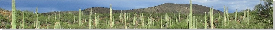
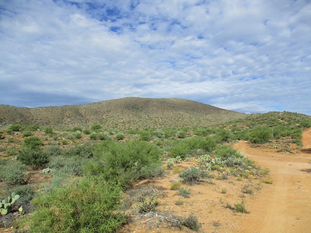
Once things started to brighten, I drove through the village of Bumble Bee, then a few more miles a little past the junction with the roads that go to Bloody Basin. I was looking for a side road on my left (south) that I would follow to the top of my first peak, Peak 3937. This is the highest peak in the immediate area, but has no official name. On Peakbagger, it has an unofficial name, "Last Chance Mine Peak", named for the Last Chance Mine that lies about a quarter-mile southwest of the summit.
I found the road and eased my car in about a quarter mile, parking in a clearing. I was glad to be off the main road, not that I was expecting trouble. This is hunting season and there were many cars, trucks and polarises out and about, and a lot of encampments of big RVs and toy-haulers. Where I was, there was nobody, which was fine with me. Nothing bugs me more than having to bypass someone's camping compound when they've essentially parked and set up on the actual road itself.
The sun was now up but still low in the east. It was a mix of high clouds and clear sky above me, but looking east, it was much cloudier, but no threat of rain. This was both good and bad. It dulled the lighting so that photos would not come out well, but it also kept temeratures lower, too. My car's temperature gauge said it was 60 degrees outside. It felt chilly. I locked up and started walking at 6:40 a.m..
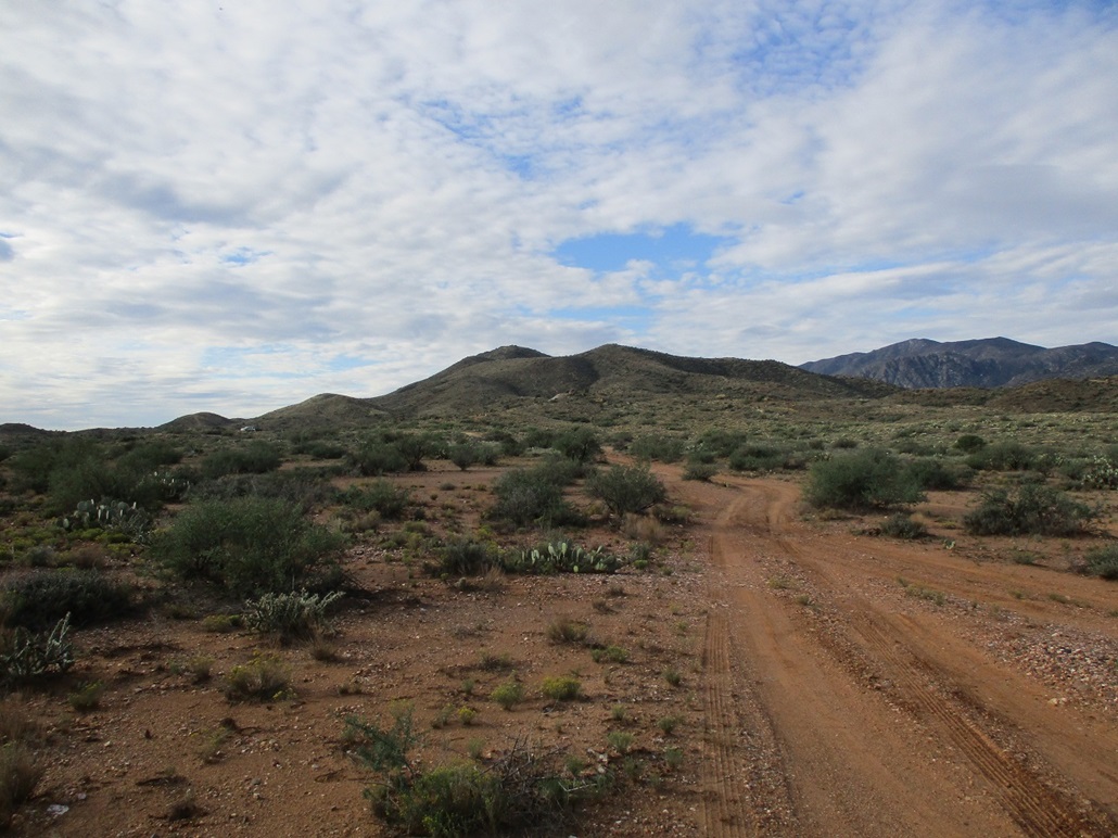
I followed the continuation of the road southbound, then at a Y-junction (marked by a mine claim post), I went right. To the left I could see some vehicles up on a hill. This junction was about the limit I could have driven my car. Hereafter, it would require a Jeep or similar, the shorter wheel-base the better.
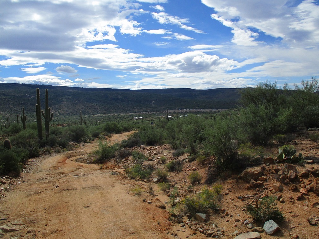
I walked the road as it bent west, then south again, gaining steeply up the slopes to a ridge crest. For walking, the road was fine. It was eroded and loose in spots, the biggest challenge being the parts where erosion has formed v-channels longitudinally within the road.
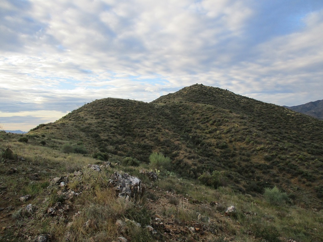
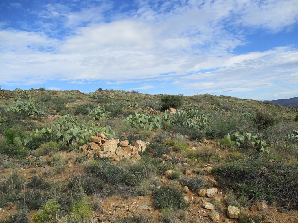
Once at the ridge creast, the road drops down the other side. So I left the road here and started on the last crest to the summit, now just up ahead, less than a half-mile away. I found a path here that, while weak, led about 75% of the way to the top. It wasn't too brushy, but having a path is always welcome. It essentially petered out at the base of the last slope to the top. I grunted up this slope and was soon on top.
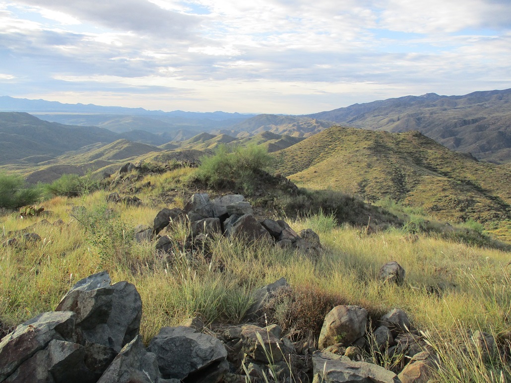
The summit is grassy and flat, with a couple rock outcrops that could be contenders for the highpoint. I kicked each one. I found no register or other signs of human presence, not even spent shells or food wrappers. The sun even came out and allowed me some fine views in all directions and a chance for some photographs.
I didn't spend long here, maybe a couple minutes. I wanted to keep moving. I never actually sat down, I just kind of wandered the top a little. Then I started down. I followed the exact same route down, moving at a good pace for an old guy. When I got back to that Y-junction lower down, the people from those vehicles on the hill I mentioned earlier came driving by in their polaris. They were all in camo, a full family including mom and son. They said they'd been "glassing" me as I was hiking up high. I was amused. They asked me how it was up there. They were totally cool people. We chatted for about a minute.
I was back to my car at 8:15, give or take. I spent a few minutes relaxing and deciding my next action. Townsend Butte was close by, but Bland Hill would require a longer hike, and sensing I may need all the cool morning temperatures I can get, decided to forego Townsend Butte and concentrate my effort on Bland Hill.
Elevation: 3,776 feet
• Prominence: 436 feet
• Distance: 5.4 miles
• Time: 2 hours, 10 minutes
• Gain: 1,140 feet
• Conditions: Mix of clouds and sun, a little warmer
LoJ
I drove back to Bumble Bee, and got onto a rough track just a few yards east of the last home in the small village. This track heads north-northwest toward Bland Hill, which is a long ridge-shaped peak and the most visually obvious feature in the immediate area.
The track is tough and I was able to ease the car in about a quarter mile, just enough to not be on the main road. I parked in the first wide spot I found, locked everything up and started walking. It was warming now, but still pleasant, low 70s. The sun would come out for awhile then get obscured again by the clouds. That would mean a temperature delta of about 5 degrees either way, enough to be noticeable.
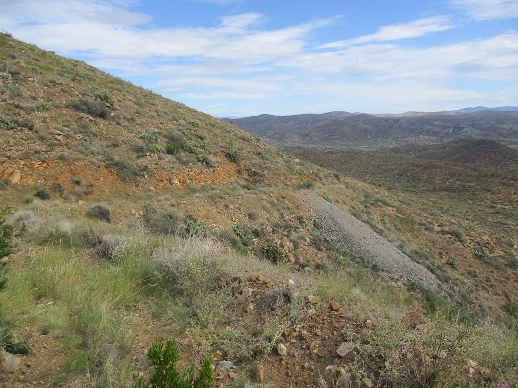
The hike just follows the track north until it comes to a junction high up on the hill's east flank. It's a two-mile hike with about 700 feet of gain. I made good time on the road, which was rough in places and only suitable for a Jeep or beefy truck with good tires. At the junction, a right continues north while a straight (then a fast bend left) heads toward the Bland Mine, for which the mountain is named.
I started walking up this left branch, this mine track hugging the mountainside closely. It was narrow and steep with little room for maneuvering. Sections were full of loose rock and most of it was covered in low grass. I walked it to its end, figuring it would get me another 200 feet higher in elevation and still put me close to the summit.
Toward the end, the road passes by two open mine shafts. All that "protects" them are barbed-wire fencing strung loosely around the holes, and a sign that forbids tampering with the fencing. The holes were ominous. I carefully leaned over one and could not see a bottom. It just darker and darker until pitch black. I don't need no sign to tell me to stay back.
At the road's end, I walked up a pile of crud from where the road grader pushed up the last of the rocks (which made me wonder when was the last time the road was graded, and also, why did the miners know to start drilling holes right here, and not, say, 100 feet in another direction?). Above the crud pile, I eased on to the "natural" slope, steep at first, but its grade lessened quickly.
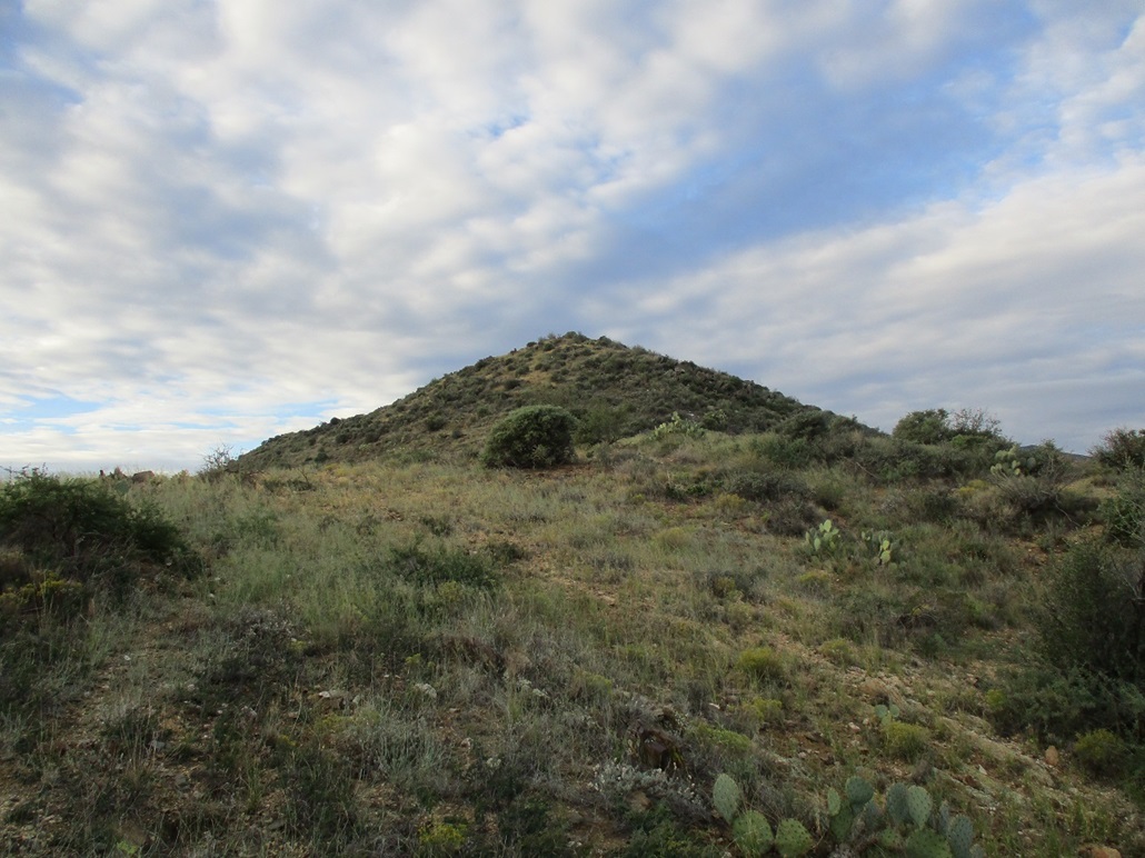
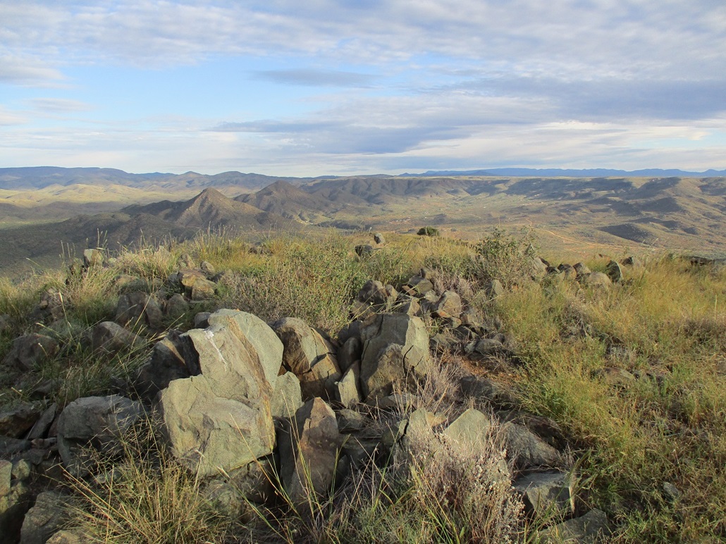
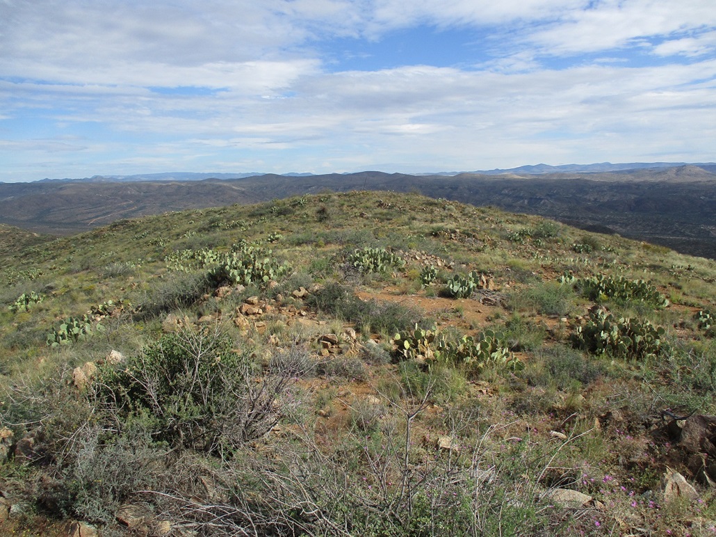
I marched upward through the low scrub and abundant rocks aiming for the high ridge above me. I was soon at this ridge. Ahead of me was a small rocky nubbin, an apparent highpoint, but I couldn't tell for sure quite yet. When I walked to it and atop it, by gum, I was on top! Or pretty sure I was. Another soft rise about 150 feet to the north looked about as high, maybe a foot or two lower. But it had a stick-pole (the height-of-light stick, I assume) held up by old guy wires. Who ever was up here in ages past thought the was the summit. Looking between the two, it felt too close to call, but my sense is the rockier one I was on first may be a tad higher. But visiting both took just minutes.
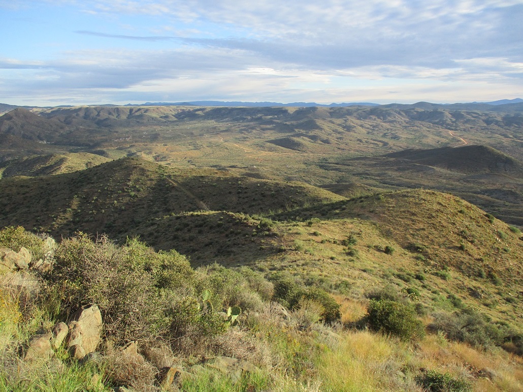
With the sun out, I had good lighting so I snapped a few images. The high southern crest of the Bradshaw Mountains rose to the west, and the plateaulands near Prescott rose to the north. Below me were myriads of hills and canyons. Occasionally I would hear a gun blast, a hunter I hope. I also heard a polaris or two.
I spent a few minutes up top, then started down, doing my best to follow the same line down as I took coming up. This was of particular importance because I did not want to randomly find myself upslope of one of those mineshafts. A rock could give out and suddenly, I'm a goner. I was able to follow my line out exactly, easing down onto that road-grader-crud-hill, then onto the old road itself.
I took a short break to peer into the lower of the two mine shafts. I needed a short rest anyway. These shafts are downright scary. They look so foreboding. Then it was just the long walk back to my car. I was back at 10:40, a 2-hour, 10-minute round trip hike covering a little over 5 miles overall. It was warmer now, into the low 80s, but still very lovely. But I was beat and decided to get moving back to Tempe.
When I got onto Interstate-17, going downhill in the southbound lanes, I saw that the northbound lanes were at a standstill. As I got lower, I could see cars driving northbound, knowing they'd have to be slowing to a stop very soon. I am not sure what or why the stoppage occurred. It sucked to be those people right about now. That's what I was thinking. I've been caught in full stoppages on Interstate-17 more than once. Sometimes you're the cat, sometimes you're the cat litter.
I was back to my place a little after noon. I was beat but happy to get these two peaks in and felt it wise to keep it to just the two peaks. I'll be back but may try to be back on a weekday when it's not overrun with people and their toys. It was much busier than I was expecting, although once on the higher roads, I saw no one.
Bumble Bee is a tiny village consisting of about a half-dozen small homes lining the main road. The surrounding area belongs to, or is leased to, a big ranch, other parts are privately-owned by other people, some of it is BLM land, and there are still a number of mine claims in the area. I must have passed by a dozen markers on my hikes today.
Bumble Bee was originally a stage stop between Prescott and Phoenix well over a hundred years ago, and it was also a supply center for the miners who toiled here before everything played out. The village has apparently been moved more than once as new roads were graded though here over the years. These days, the homes are lined up neatly, not like you would see from something from the 1800s. While considered a ghost town, it's pretty obvious some of these homes are lived in. The surrounding region seems to be dotted with isolated homes. Once off the interstate, it does feel like being transported back 75 years. This was my first time travelling through the area in over ten years.
|


|