The Mountains of Arizona
• www.surgent.net
|
|
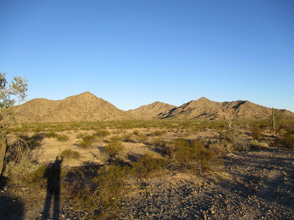
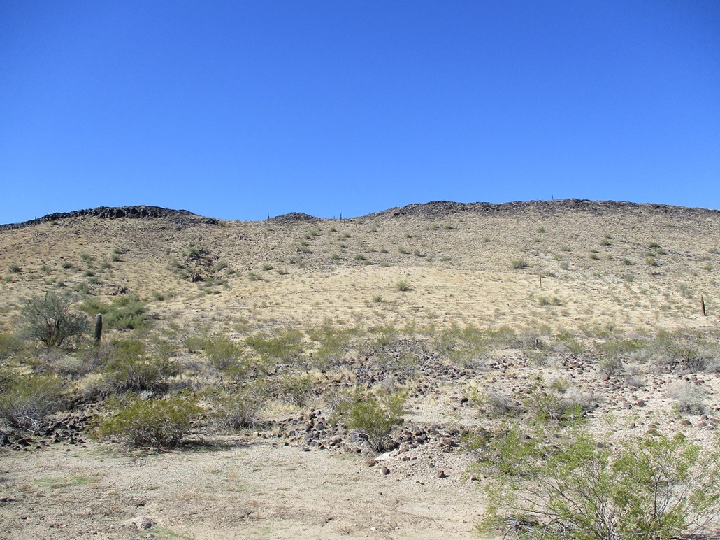
Buckeye Hills Highpoint • Gillespie Dam Overlook I teamed with Matthias today to climb the highpoint of the Buckeye Hills, then whatever else we could do afterwards. The Buckeye Hills are about a dozen miles southwest of the main part of Buckeye, but also still technically within the city limits. There's a Buckeye Hills Recreation Area west of state route AZ-85, but the peaks lie mostly outside this area, which seems to cater to shooters (there being a gun range on the premises) and casual hikers. The main range of peaks lie west, bordered on the north and west by the Gila River, and on the south by open desert. I met Matthias at the Wal-Mart off Dysart Road in Goodyear. I then rode with him toward the hills. His beefy Toyota would be necessary to handle some of the roads. We got onto a gas pipeline road (the El Paso pipeline that spans the state), then followed it west, then onto a lesser track heading northish and westish. He was able to drive us to within a mile of a prominent southeast-facing canyon, the highpoint rising behind it, centered between two framing peaks.
Date: January 2, 2022
• Elevation: 1,952 feet (per LIDAR)
• Prominence: 998 feet
• Distance: 4.8 miles
• Time: 3 hours, 45 minutes
• Gain: 989 feet
• Conditions: Sunny, cold, breezy
• Teammate: Matthias Stender
• Prog Rock Bands Played: The Muffins, Magick Brother and Mystic Sister
Arizona
•
Main
•
AZ P1K
•
PB
•
LoJ
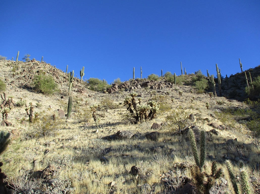
We started hiking about 8 a.m.. It was sunny but very cold, in the mid 30s, with a steady, sometimes strong, breeze. We walked over the gravelly plains on a direct bearing toward the canyon. We had to drop into and out of a steep-walled arroyo early on, the sides about 15 feet high. We then walked into the canyon, and at some point, were forced to drop into the arroyo again.
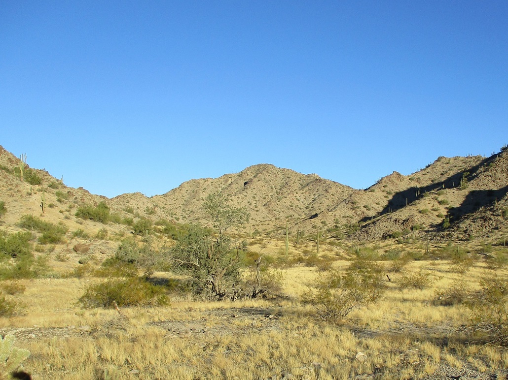
The arroyo wasn't as bad as far as arroyos go. It was wide and sandy, mostly free of brush. and the rocks not too jumbly. We made pretty good time and got deep into the canyon. When it felt right, we ascended out of the arroyo and looked around to see what route we wanted to follow and how to get there.
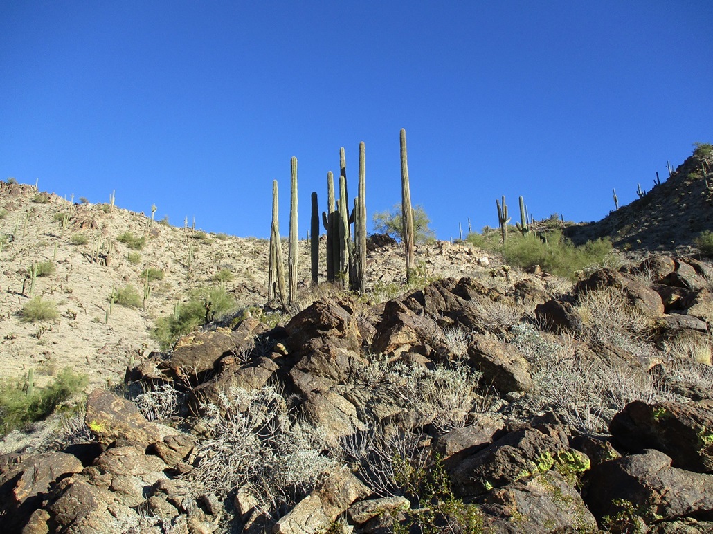
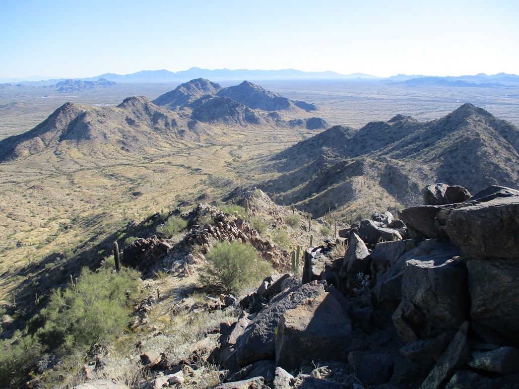
From below, an east-trending ridge looked promising. The slopes did not appear to be too steep. There was a white-colored cliff outcrop on the ridge that we sensed could be trouble. We would have to find out by getting there first.
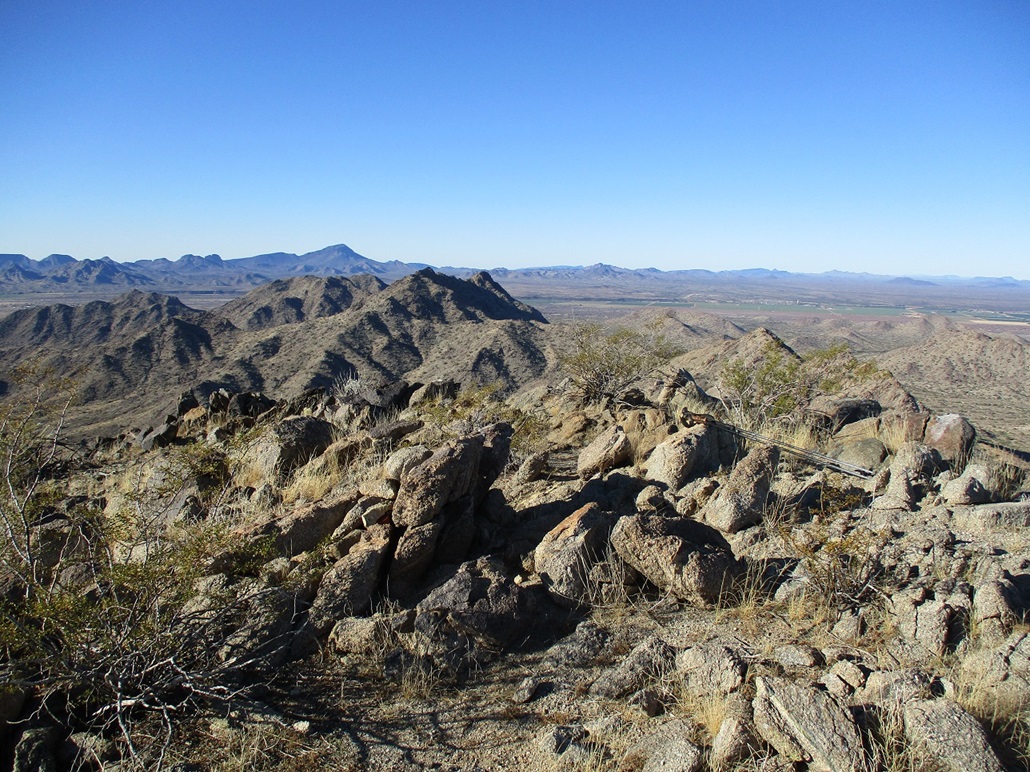
We got onto a slope that appeared to aim for a low point in the ridge above us. We had to make one minor correction to stay on course. This slope was moderately steep, covered in loose rocks and small rock bands that were easy to scale. Higher up, the grade steepened and the rocks were looser. We moved carefully and grunted up to the ridge, where we took just a few seconds to rest and analyze the ridge above us. Up on the ridge, the cold wind hit us hard. It was easier to keep moving than to stop.
The first couple of rocky humps were easy to scale and bypass. We gained about fifty feet quickly. This brought us to the base of the first large rock outcrop. To the right (north), there was a scant ledge below the little cliffs. This ledge was messy, but it worked, and we were able to clamber upwards with just a few moments of terror, when the big rocks would move on us unexpectedly. We gained about 75 feet in bypassing this first rock outcrop. It wasn't pretty, but we got up the darn thing. Now on a small saddle above this barrier, we took a small break, the cold wind still blowing strong.
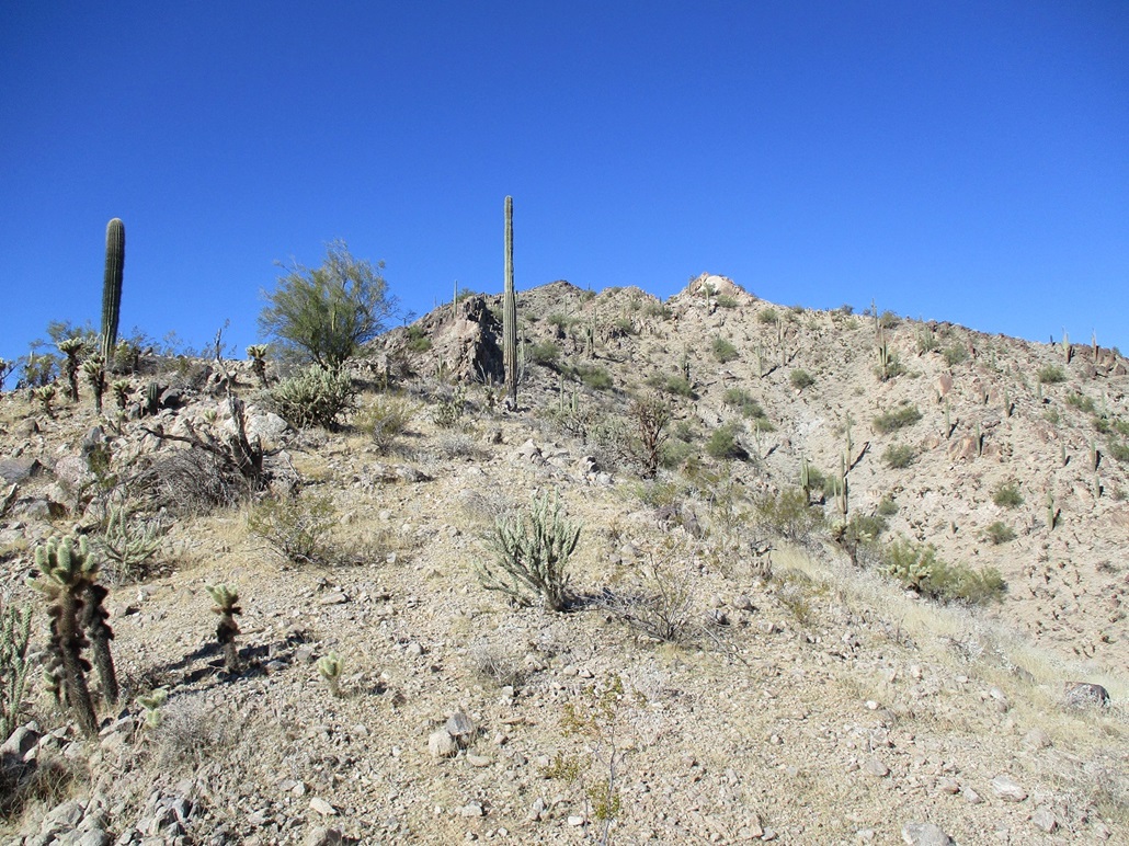
Up ahead was the white cliff I mentioned earlier. Now closer, we could see possible ways up or past it. Sidehilling around it looked ugly, the slopes way too steep and loose to sidehill safely. Going to the right also looked like a fool's errand. We trudged upwards a few dozen feet until we were at its base.
To the left of the small cliff was a jumble of darker-colored rocks, heaped into a loose slope. We slowly got onto this heap and climbed upwards. Now above the white cliff, we were at the crux of the climb, a knife edge that traversed level for about 30 horizontal feet, but with some moderate exposure on both sides. It was just a matter of slowly picking our way through the rocks, easing to one side or the other as needed, and being really careful. Soon, we were past it, now on regular ground again.
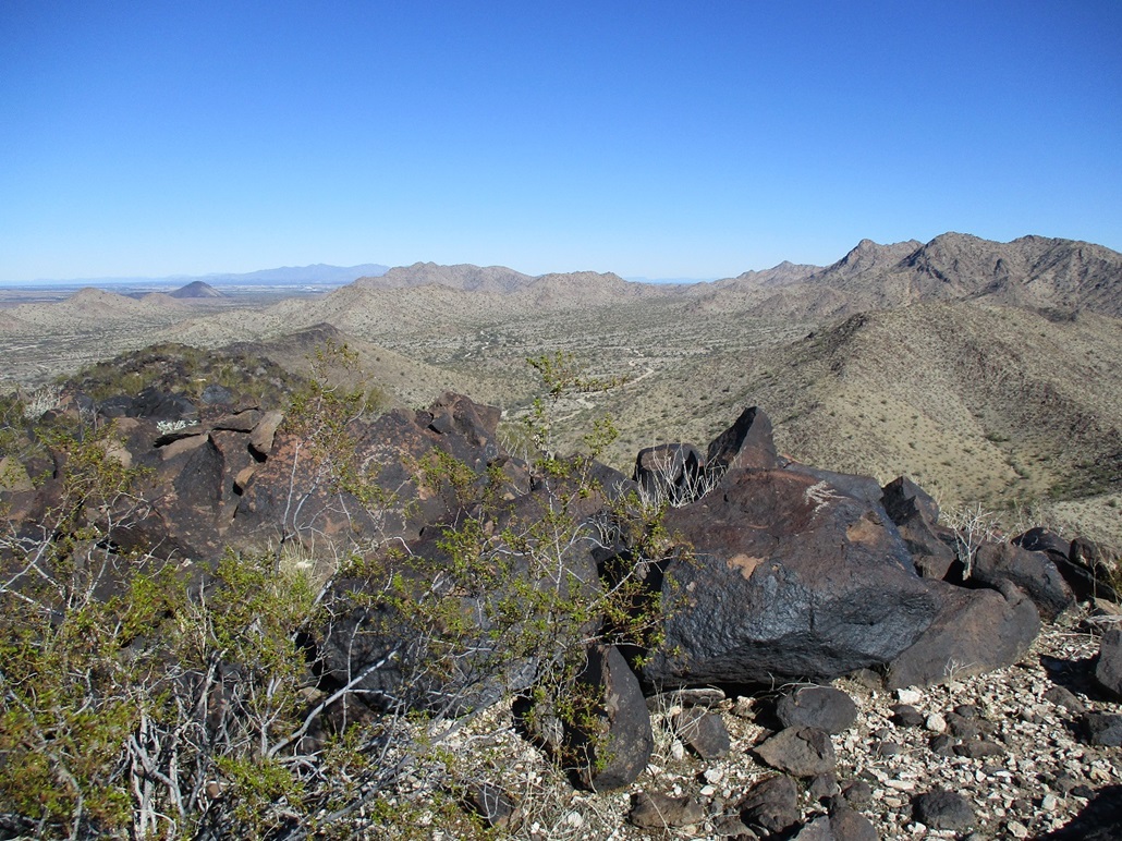
There was still another rock outcrop above us, but it immediately looked friendly, being a slope of big boulders that could be easily scaled. Matthias reported we were just 130 vertical feet from the top, about 80 feet below. We climbed these boulders, angling right, and were quickly past them and on the home stretch to the top. The final few feet was nearly trivial, and we were on top of the Buckeye Hills.
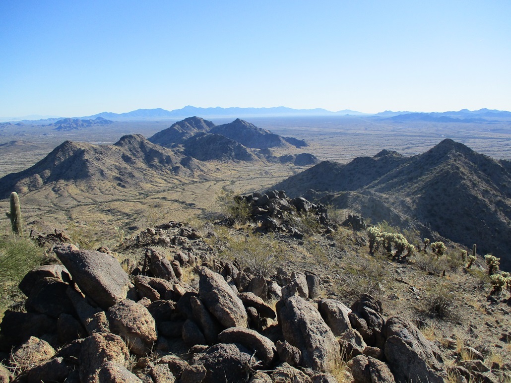
Now, we took a proper summit break. It was windy and cold still, but now, we didn't care that much. The register held a few names going back 25 years, the usual dozen Arizona peakbaggers, but interestingly, no locals. It's not uncommon on these peaks to see the regular peakbaggers who've hiked everything, and then a few names of people we don't recognize, who come from the immediate area. Anyway, there was none of that here. We were the first to sign in since last February.
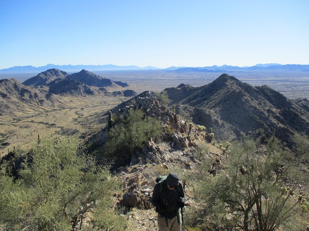
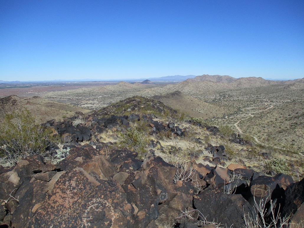
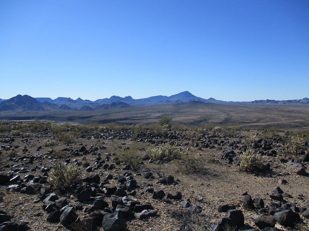
The sky was clear and with no humidity. We could see peaks far off in the distances. I won't list them all. It's another case where we could point out 20 or 30 peaks we've done individually. We were on top the peak for about 20 minutes. I enjoyed it a lot up here. Matthias said we'd hiked 2.4 miles, gained about a thousand feet, and in slightly under two hours.
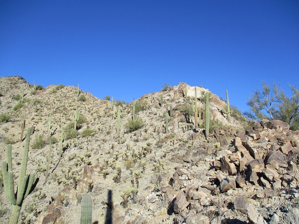
Now we had to get down. We were able to inch down the highest rock jumble with no problem, which brought us to the knife edge. Like a few minutes ago, we moved slowly and carefully and were soon at its opposite end. We then carefully scooted down the ugly rock jumble and were down below the white cliff, which felt good. That had been the crux and it was nice to be done with it.
The lower rock outcrop, where we stayed to its north along its ledge, went well too. It was not fun, everything moved, but we got through it, which is what counts. The nasty rocky stuff was now done. We took a small break at the lowpoint on the ridge, before starting the descent downslope and into the arroyos again.
The descent went well too. Here, the problem wasn't big rocks and cliffs, it was the smaller stuff lying loosely on the slope, too easily moved. We walked it slowly, then the grade lessened and everything was more firmer. Now we were in the basin below the peaks and ridges. We tried not to stay in the arroyo too long, so we'd drop in, then pop out and walk a rise beside it, then be forced back in, and so on. Matthias mainly stayed high and dealt with the downs and ups and downs and ups, while I stayed within the arroyo and walked it farther out, before emerging. By now, we were real close to his 4-runner.
The same arroyo makes a bend southward, so we had to drop into it and out again one last time. I had had enough of steep-walled arroyos by now. We were back to his car a few minutes before noon. The climb had gone well. It was a little more rugged than we were expecting and how it looked from below. But it went. We got the summit and we got back down safely. I enjoyed this climb a lot, but agree it is a tough customer which may explain why few people bother with it.
(In February 2025, 1-meter Lidar data was finally released for this region. It gives a summit elevation of 1,952 feet and a prominence of 998 feet, barely missing out on the 1,000-foot barrier.)
Neither of us wanted to rush home, so we debated a second peak to do, something close and in the area. After some discussion, we agreed on Peak 1253, also known as ...
Elevation: 1,253 feet
• Prominence: 413 feet
• Distance: 1.1 miles
• Time: 1 hour, 10 minutes
• Gain: 484 feet
• Conditions: Warmer, but still breezy
PB
•
LoJ
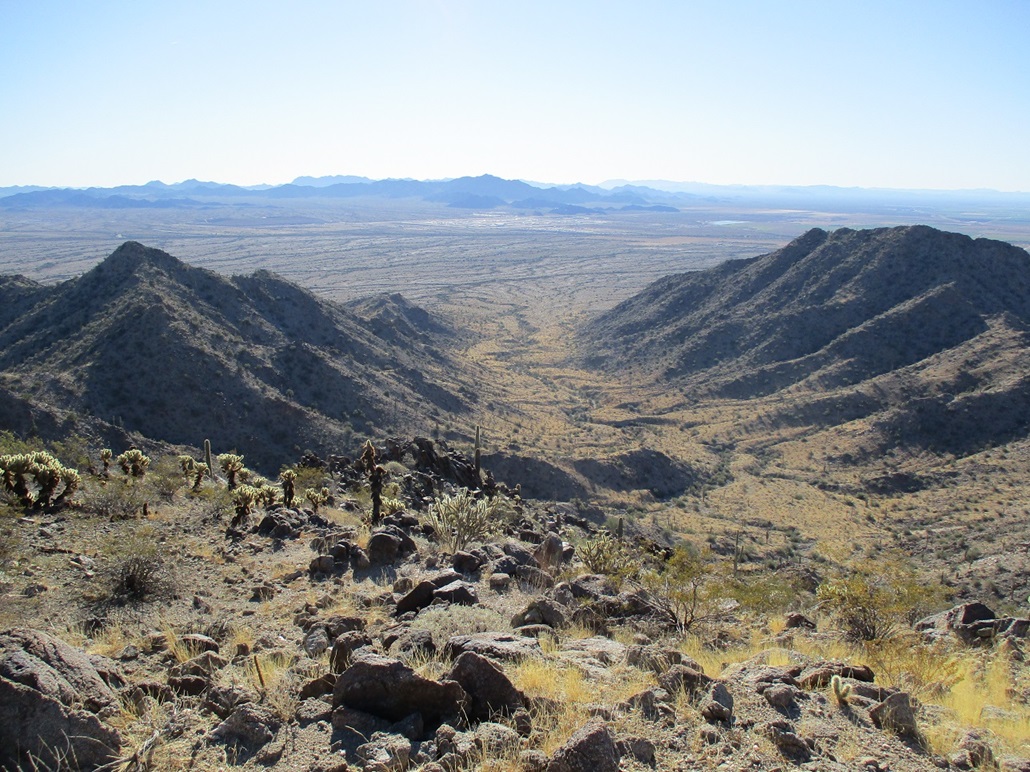
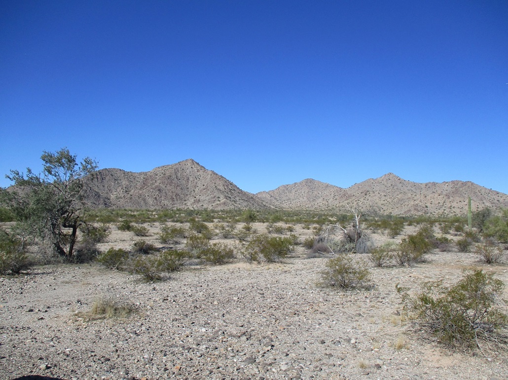
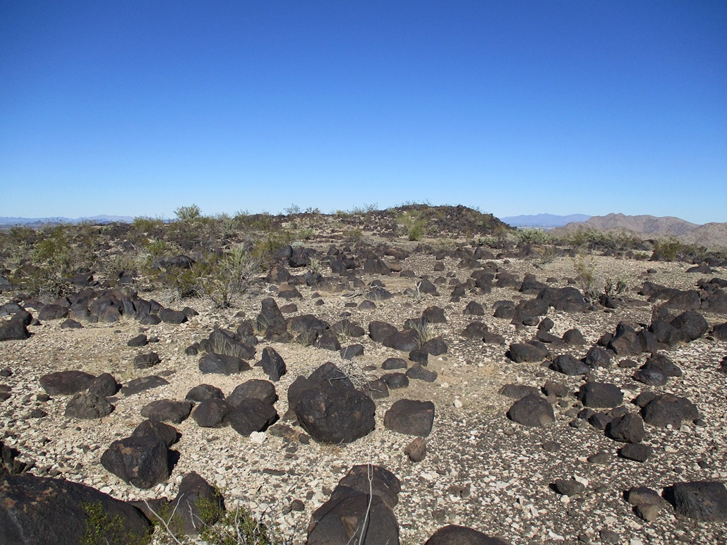
Matthias drove us back to the gas pipeline road, which we followed west for about 3 miles, with Peak 1253, "Gillespie Dam Overlook", in view up ahead. This peak stands out against its neighbors, being a loaf-shaped mound of volcanic rock with a smooth profile (from a distance), as opposed to the craggier, more pointed peaks in the surrounding range. This peak lies east of the Gila River, and northeast of the old Gillespie Dam and the Gillespie Dam Truss Bridge.
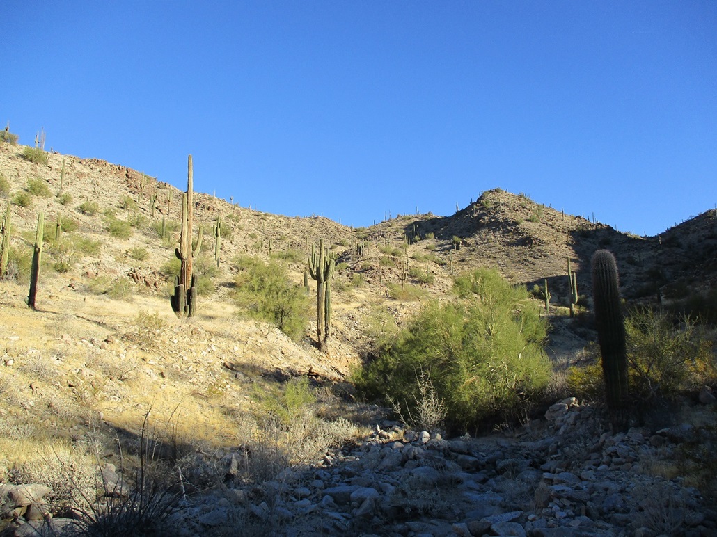
Once at the southeast base of the mound, we drove north on another track about a half mile, parking in a clearing. We would approach this peak on its east slopes, aiming for a lowpoint in the high ridge. From where we stood, it looked very simple: just march up a bouldery slope for 400 vertical feet, then find the top. After this morning's knife-edge and loose-rock adventures on the Buckeye Hills Highpoint, it was nice to be on a peak with rocks that didn't move (most of the time) and no exposure concerns to worry us
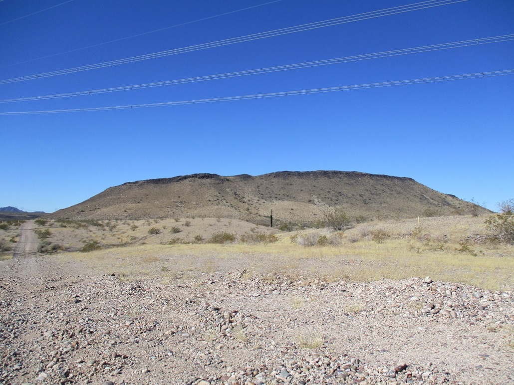
We started hiking and were soon on the lower rock apron, the slope increasing incrementally but never too steep. There was more grass down low, and slightly above us, two roads that have clearly not been driven on in decades. These roads cut across the slope in no obvious pattern and their purpose was not clear. Slightly higher, the grass lets up and we were on the rockier segment of the slope.
The hike up the slope took 15 minutes. We were on the high ridge, more like a little plateau with very lenient grades and plenty of black volcanic boulders. They were spaced out so that we could walk on the ground too, thus saving our ankles a little. In another 5 minutes, we were on the summit, at its north end.
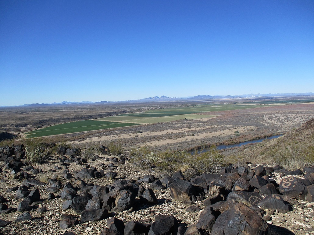
The top features a clump of rocks, a register (again, not many names outside the core of peakbaggers in the state), and some rock art, some of which may be authentic and a lot that looks more recent, as in the past 50 years. The archaeologist in me thinks that this peak would have been a good sentry site for the ancient Native Americans back in the day, and there are petroglyphs on nearby peaks (e.g. Powers Butte), so maybe some of the etching are legitimate. Others are clearly not.
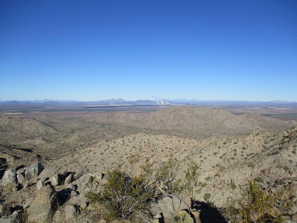
The day had warmed into the 50s, but the breeze stayed strong at times, so despite a fifteen minute break at the top, the wind kept things cooler and slightly uncomfortable. But the views were excellent, the day crystal clear.
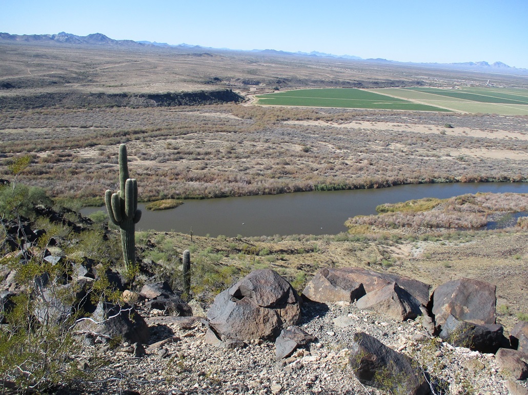
On the hike down, we angled to the west edge of the plateau and looked down on the Gila River, the dam, and the bridge. The dam was built in the 1920s to "slow" the flow of the Gila River to collect water for irrigation (it was not meant to back up the water into a lake like other dams. Water would reach its spillway level then spill over the dam's top, by design). However, in 1993, after a week-plus of storms, a surge of water took out a whole section of the dam, and it has never been replaced and likely never will be. I remember that winter, my first one in Arizona. Among other things, it also took out the new Mill Avenue Bridge being built in Tempe, all the scaffolding and bridge bits being toppled into the waters and down stream.
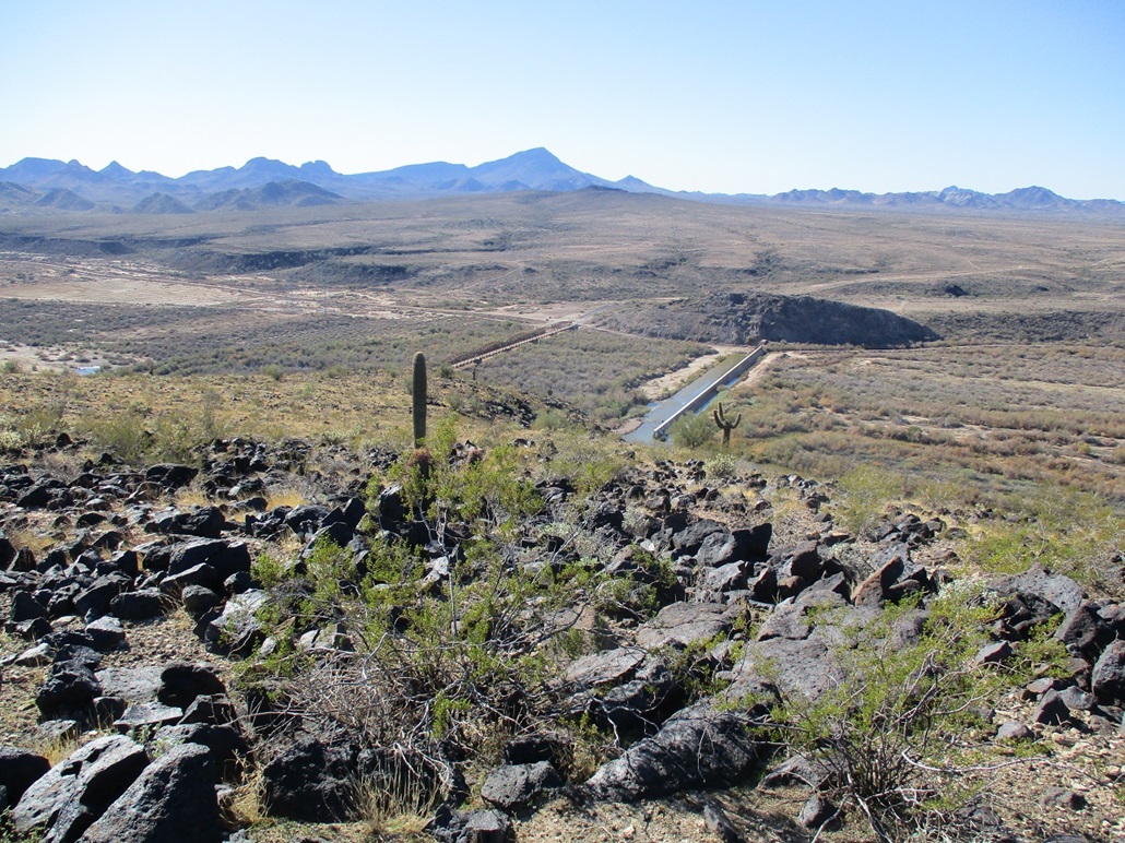
The bridge is a multiple-span truss, which is obvious from viewing it above. It looks like four segments. It too was built in the 1920s and was part of highway US-80 until that highway was decommissioned years later. The road still exists and is an alternative way to get to Gila Bend from Buckeye, with a little history along the way. The bridge was refurbished in 2012 and there is a little parking area where one can read about the history of the bridge and dam, and walk around for photos.
The hike down went quickly, and we were back to Matthias' vehicle after a little over an hour on the hike. This was an excellent second peak for the day, especially considering I'd likely never drive all this way for this peak alone. If you're in the area, have your hiking shoes and it's not too hot, I recommend this peak. But this assumes you can get past the canal that parallels old US-80, which forms a moat.
Speaking of getting past the canal, this proved to be a challenge. The gas pipeline road we were on petered out at its west end, so we turned the other way and followed a road that parallels the canal for about two miles. Finally, we saw an ingress point up ahead and got out onto the highway. (There may be pedestrian bridges nearer the bridge but we did not check that out. Otherwise, drive south on old US-80 and look for the gap in the canal, then double back toward the peak.)
Once back on the paved roads, we drove back to the Wal-Mart so I could get my car, then shook hands and went our ways. Traffic wasn't too bad, and I was home a little before 4 p.m., a foot-long turkey sub on Italian from Subway in my hands.
My thanks to Matthias for driving, his vehicle cutting off a few miles of desert trekking to reach the peaks. Other than the cold breeze, the day was perfect, a nice break from the series of storms we had for the past week or so. On the music side of things, I really enjoyed Magick Brother and Mystic Sister. They're from Spain. After some discussion, we agreed they sounded a little like Pink Floyd (e.g. The Great Big Gig in the Sky), and perhaps a little like the early-1970s R&B music, such as the tunes by Curtis Mayfield. And oh yes, gobs of minor keys. Can't go wrong with minor keys. The Muffins are an American group, much more jazz oriented. Both good bands. How Matthias knows about these bands, I don't know, but I like them.
|


|