
The Mountains of Arizona
• www.surgent.net
|
| Bren Mountain |
• Tucson Mountains • Tucson Mountain County Park • Pima County |
|
Date: November 23, 2019
• Elevation: 3,988 feet
• Prominence: 806 feet
• Distance: 4.5 miles
• Time: 4 hours and 30 minutes
• Gain: 1,020 feet net, about 1,500 feet gross
• Conditions: Cool with blue skies and some clouds
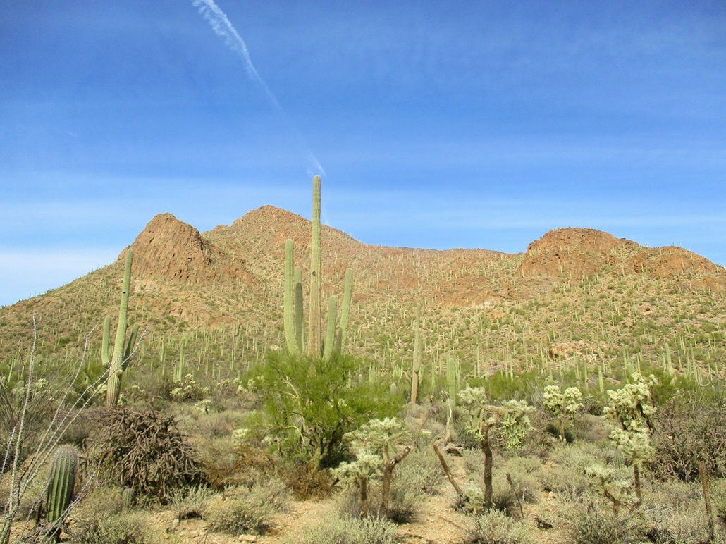
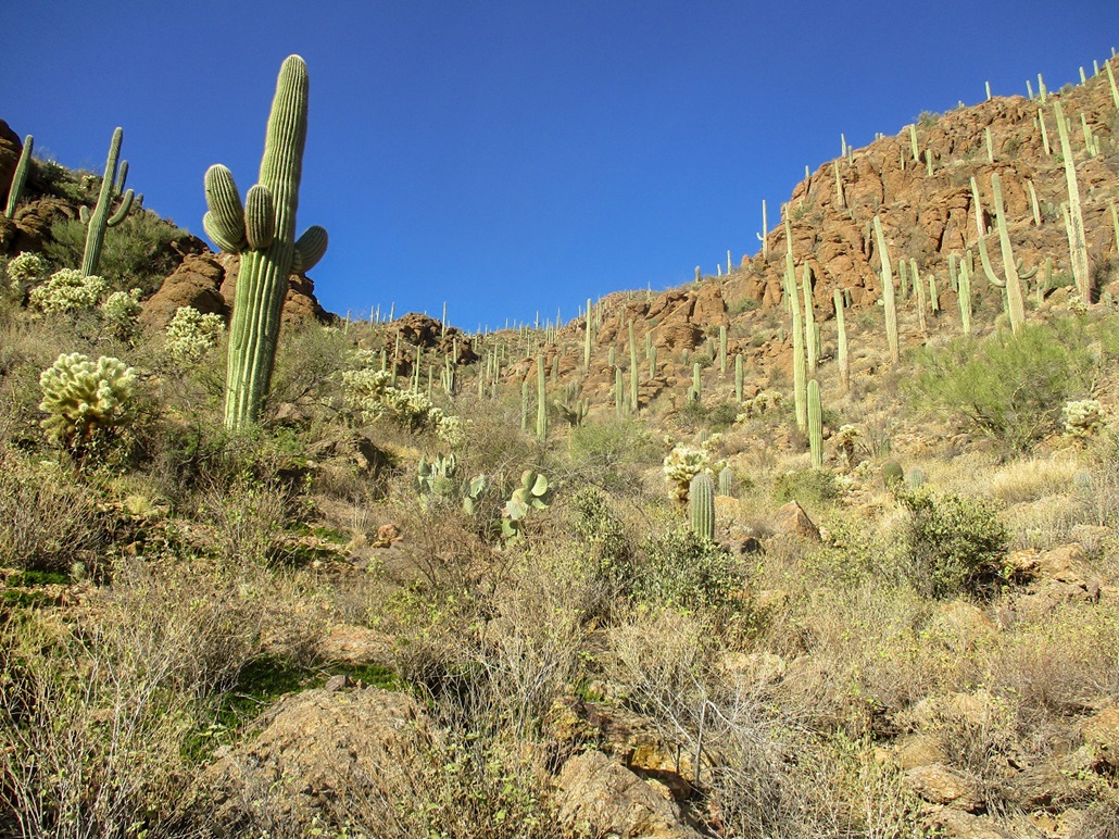
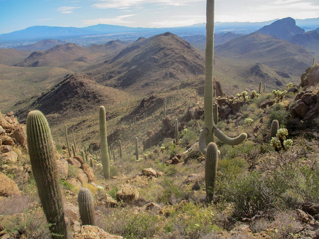
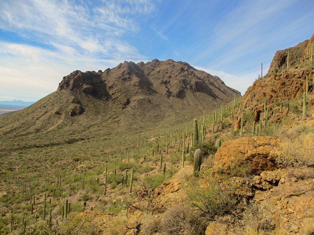
Bren Mountain is the peak "next door" to Golden Gate Mountain in the Tucson Mountains Park. It lies south of where Gates Pass Road drops steeply into the valley to the west, toward the Old Tucson movie studio and Saguaro National Park. It is a popular peak for Tucson-area peakbaggers, but there is no trail. One has to earn this peak, although it is not a difficult climb. The mountain is alternatively known as Bren Benchmark, or Bren's Better, for reasons I don't know.
I had a day planned, hiking a couple peaks in Tucson, with Bren being my main objective. I've been interested in it for a long time. Peavy and I climbed Golden Gate back in 2014, and Beth and I have stayed at the Gilbert Ray Campground many times. But I never got around to hiking the peak. Today was going to be clear and sunny, with cool temperatures, a couple days after a storm had moved through the state. I liked that I did not have to drive any dirt roads to get to the peak.
I left home at 5:30 a.m. and arrived into Tucson about 7:20 a.m., exiting at Speedway Road, which heading west, morphs into Gates Pass Road. As I exited, the offramp and adjoining frontage road were coned off, with no right turns permitted. This was not expected. There were mobile signs about a bike race but nothing about this exit having restrictions. Well, it was early and no one was around, so I turned right anyway. I got drinks and snacks at a Circle K, then continued west toward the Tucson Mountains Park. I descended Gates Pas Road and parked at the small lot at the Yetman Trailhead. The Yetman Trail goes south from here, between Golden Gate to the west, and Bren to the east.
I was the only one here, which was surprising. I got my stuff together. Another vehicle rolled in, the occupant, a young woman, looking to jog the trail. I started walking at 7:45 a.m.. I went south up the Yetman Trail, which gains over 200 feet to its apex at elevation 3,182 feet (the trailhead being about 2,970 feet). The lady jogger came running up at this point. We chatted briefly, then she went on her way. It was chilly and I was in the shade of Bren for the time being.
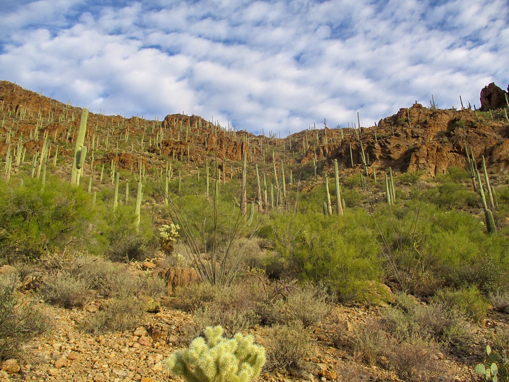
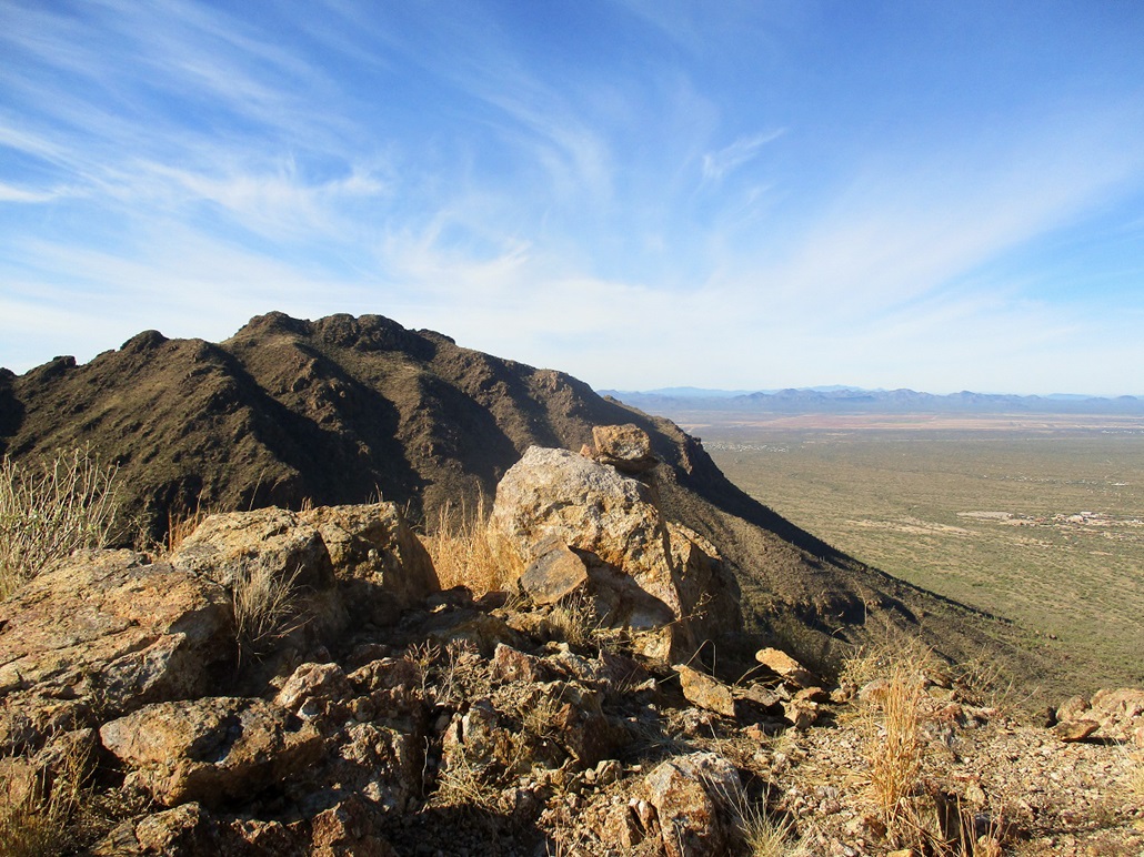
The summit is actually visible early on, looming directly above the trail and parking lot, but a direct assault would be very steep and probably cliffy. As I hiked south, I passed a pair of big cliffs, looking like battlements. There was no going up those, either. My plan was kind of vague: to hike to the lowpoint of the southeast-trending ridge, then, according to a report at SummitPost, I should catch a good use path here. I hiked southbound on the trail, dropping about a hundred feet in a quarter-mile. I was looking for a path that would (hopefully) lead to the lower ridge. But I saw nothing. So I picked an opening at random and started in, now going cross-country on a general southeast tack toward the low ridge.
I was walking across the lower flanks of Bren, going against the grain of the arroyos. I had to cross a number of these, usually a five- or ten-foot drop in and out, but it was tiring. And it did not look any better toward that low ridge. I started to angle upward as I moved, so I gave up the idea of the low ridge and started hiking directly up the slope I was on, the ridge about 400 feet above. It looked promising.
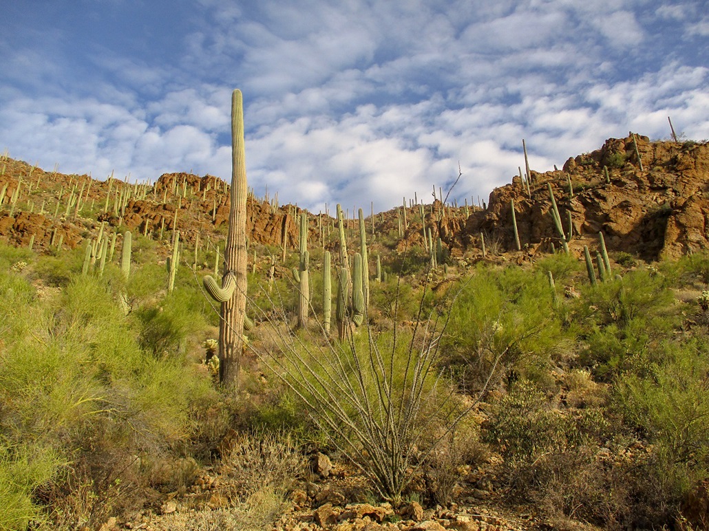
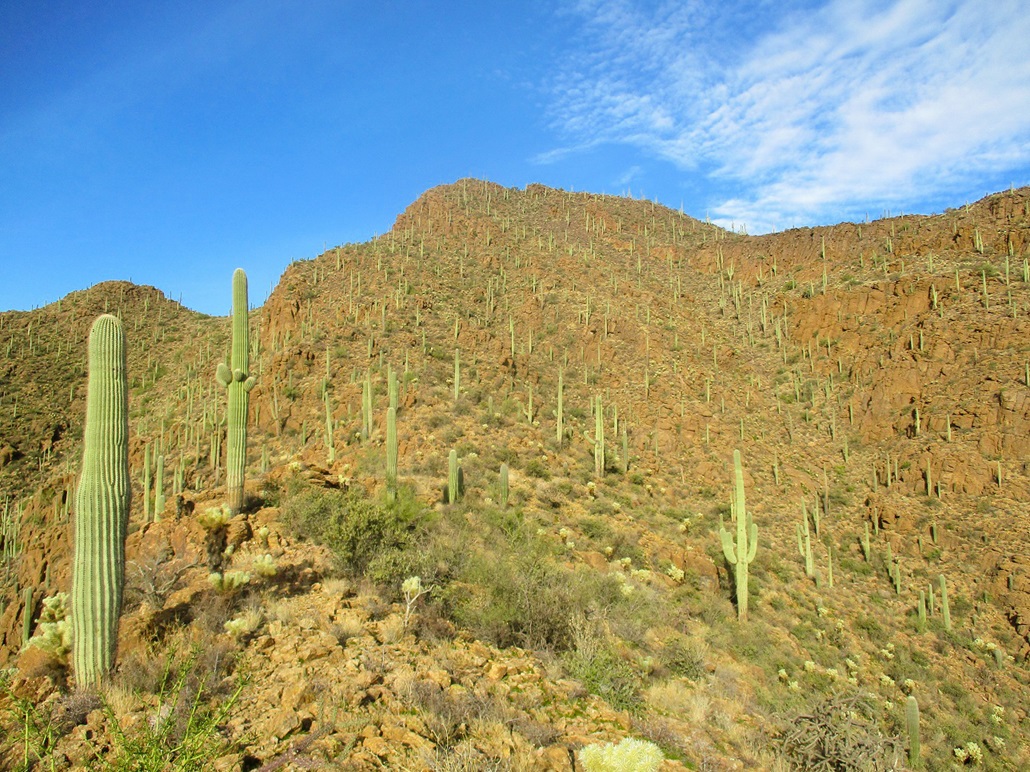
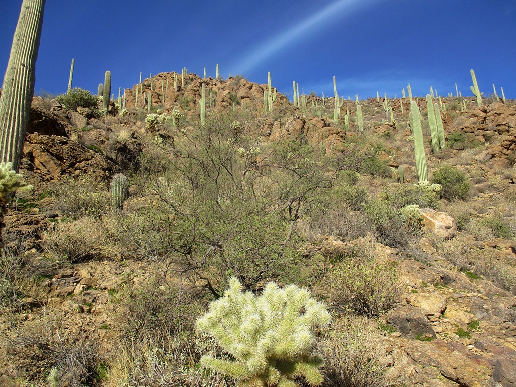
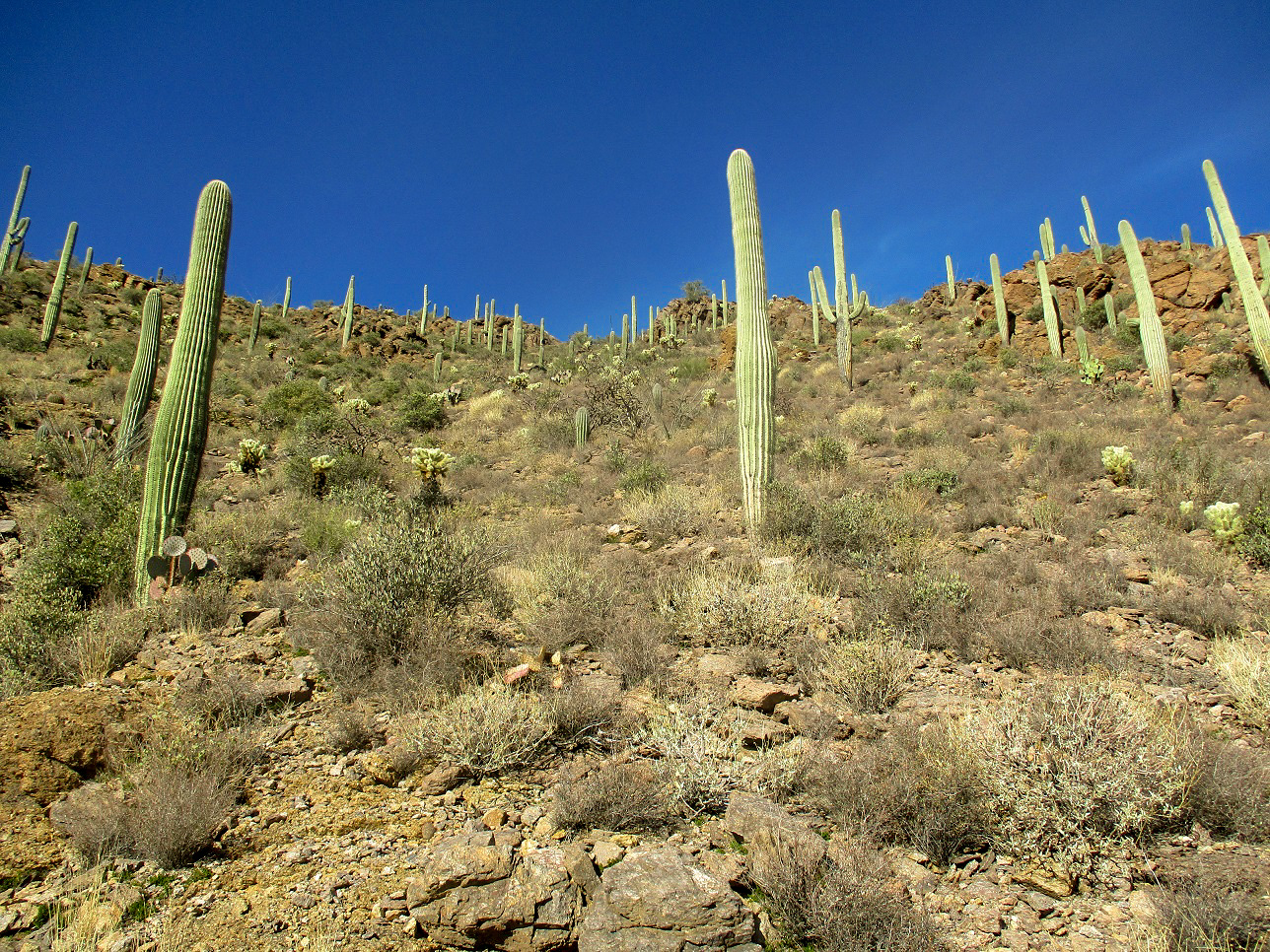
The terrain was mostly open and rocky, with every cactus endemic to Arizona on the slopes. The slopes steepened and I followed whatever looked logical. I ended up going up, then a little over to the right up a side slope. It was steep, and the ground was still soft from the rain. I moved carefully as the rocks were looser than normal. As I neared the skyline, I spotted a bighorn sheep and an ewe (?) amble by. I caught just a glimpse of them. I was on the high ridge soon, elevation about 3,450 feet.
I was now on the main southeast-trending ridge that comes off Bren's summit, which was now visible again. Below me was a gully. I studied the ridge for any possible paths but saw nothing promising. I dropped into the gully and looked for a path or cairns, but saw nothing. I knew I was in the right place, but I think I put a little too much stock in that SummitPost report, expecting more than I should have.
Just to be sure, and not possibly waste time going up the wrong gully, I actually descended down the ridge to the aforementioned lowpoint, elevation about 3,270 feet. And I found a trail. It looked pretty good, so this is what I wanted, apparently. I followed it for a hundred yards or so, and it petered out. I spent time looking around for the trail before growing a brain and giving up on any trail. I was in the gully and it looked friendly and certainly terrain I've hiked in before. I was wasting too much time looking for some ephemeral trail or sequence of cairns.
Now, I just got to the business of climbing, weaving through the rocks and brush in the gully, occasionally stepping out onto the slopes to avoid heavier brush. It was slow-going but easy. The gradient was moderate and there was no exposure to falls. There was a lot of cactus though, and the rocks would sometimes give away from the moist soil.
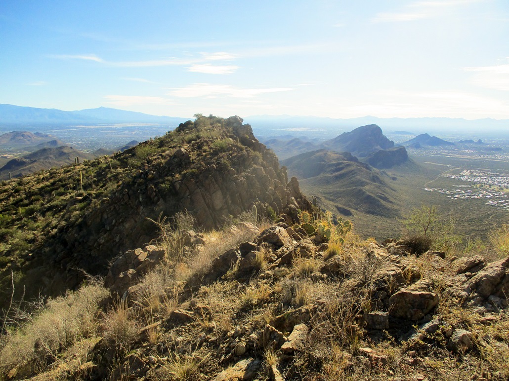
I moved steadily upward, staying in the "main" gully whenever there was some rock-prow to divide the gully, usually by staying left. About two-thirds of the way up, I went right at one such prow, and it worked. Later, as I descended, I came down the other side, so either side would have worked. I was high enough to see the upper ridge with clarity. The slope steepened by degrees and the last hundred feet was a little rubbly and slow. I was finally in a small saddle, the slope to my left (west) leading up to the summit ridge.
I ascended this easy slope and noted the summit could be one of two points, both nearly equal in height (and a third spot about a foot lower). I walked the ridge and tagged the first two highpoint rocks. The third one, I had to drop down about 35 feet into a narrow saddle, then up the steep slope to its top. Fortunately, the climbing and scampering was easy and protected. I tagged these rocks too. Looking back, I could not determine which point was higher. This pair is too close to call. I also looked for the benchmark but could not find it.
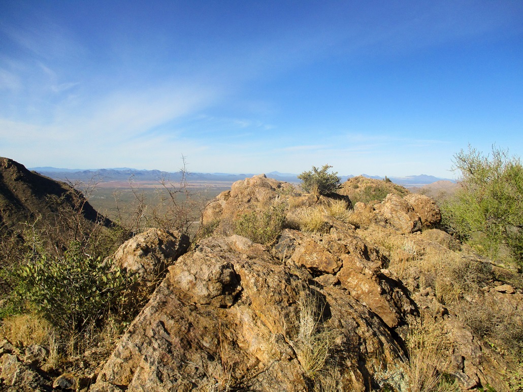
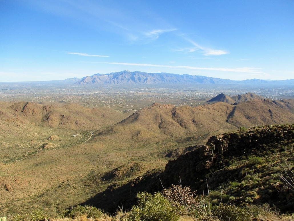
I hiked back down that notch then up the other side, back to the middle possible summit, and here, I found a register, a new one only dating back a few months. I took a break here to rest, drink and sign into the register. The last signature was two weeks ago, and about fifteen people since the register was placed. I could not locate the benchmark here, either. After a few minutes of rest, I started down, and also studied other rocks along the ridge for the benchmark, but never did find it. The views were outstanding on this clear blue day. There was snow on the Santa Catalina range to the east.
I hiked down the same route going up, in no mood to be creative now. I moved very slowly, now aware that by descending, it would be easier to kick loose a big rock. I was about halfway down when I did exactly that. I put my foot on a rock, and boom, it rolled out and lumbered about twenty feet downslope. It was a biggie, too, about two feet in diameter and probably a good 200 pounds. I even yelled "rock", in case anyone cared.
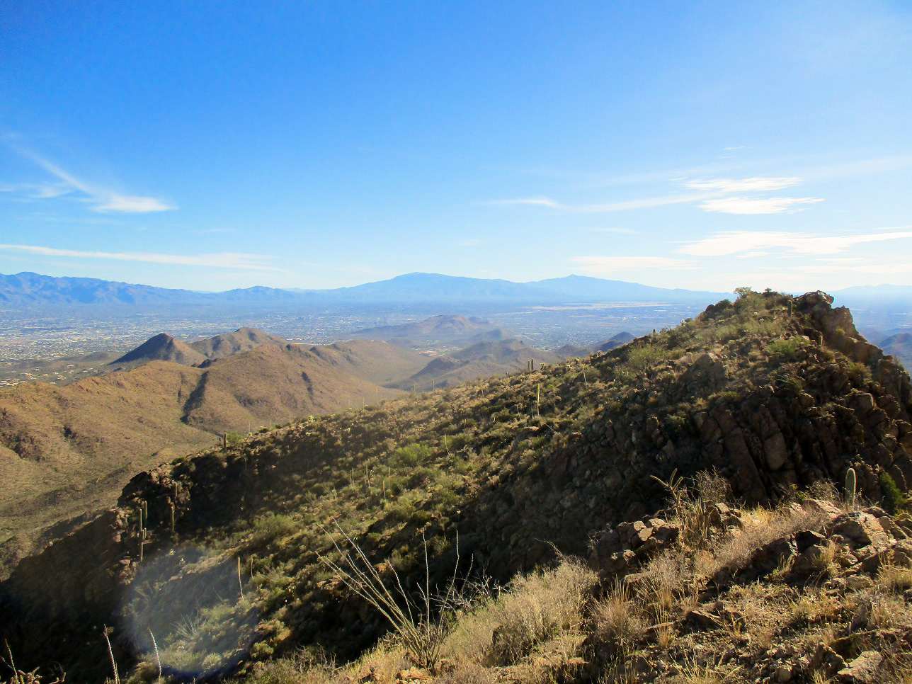
I hiked all the way to that lowpoint, figuring it would be easiest to go out that way. I found some use-paths that did go down, but some were sketchy and I had to try a couple. I found one that descended southwest, toward a small community of homes about a mile away. I knew I was trending away from where I parked, but I was happy to be on a trail for a little bit. I then bailed and started a cross-country trek to get back onto the main Yetman Trail. Lower down than I was this morning, the arroyos here were deeper, some with 15-foot cliffs. I had to zig and zag through these.
I was soon back onto the Yetman Trail, about a full mile south of its apex, so I walked that way, regaining that lost elevation. Surprisingly, I did not see many people. I saw just a couple near the trailhead itself, a family of eight taking selfies in the parking lot. I walked to my car and rested, putting my stuff away and possibly photo-bombing some of those other peoples' selfies. It was 12:15, and I had been hiking for four and a half hours. I was happy to be successful, but way underestimated the time I thought I would need. This altered my plans for the remainder of the day.
I had originally planned to hike Pistol Hill, east of Tucson by the Colossal Caves Park. But that bike race was bollixing access to the freeways. I spent fifteen minutes just sitting in traffic in Speedway as the bicyclists rode by (their route was the frontage road). I respect them and their races so had no beefs with them. But I did not want to just sit idly in traffic. So when the chance came, I made a u-turn and followed a parallel road north (Silver Bell Road), hoping to catch the freeway farther up. Lots of other people had the same idea. But the same problem persisted. I was now on another road to the freeway but having to wait out the bicyclists. This time, I just cooled my jets and waited it all out. I decided to skip Pistol Hill for another day and head home instead.
I did make one small detour, exiting the interstate at McCartney Road north of Casa Grande, to check out Signal Peak near the Central Arizona College campus. I hoped there may be a trail and if so, this could be an easy second peak for the day. The campus was vacant today. I parked at the north end first, walking up a road-cut to a water tank on a hill, figuring there may be a path starting from here, but I saw nothing. I also checked out the south ridge near the library, trying to guess where a logical starting point would be. However, I saw nothing. The actual climbing looked easy, but I did not want any more scrambling today, so I left and simply headed home, happy to get Bren done successfully and safely.
|


|