
The Mountains of Arizona
• www.surgent.net
|
| Blue Jay Peak & West Peak |
• Pinaleño Mountains • Coronado National Forest • Graham County |
|
Date: September 28, 2013
• Elevation: 8,840-8,860 feet
• Prominence: 1,680-1,700 feet
• Distance: 8 miles
• Time: 4 hours and 20 minutes
• Gain: 1,240 feet net, 2,050 feet with all ups and downs included
• Conditions: Bluebird skies and pleasant
• Teammates: Scott Peavy
Blue Jay Peak is the western-most peak in the Pinaleño Mountain of Graham County. However, it is separated from the main range by a low pass, enough to give Blue Jay Peak nearly 1,700 feet of prominence and the appearance of being its own singular mountain. The Coronado Forest Service maintains a seasonal lookout on nearby West Peak, so a road goes near the top. However, not many people climb this peak or visit this part of the range. Scott Peavy and I teamed to hike this peak. For me, my first significant hike since last May. The weather had started to get nicer throughout the state, so we were both eager to get back to the mountains.
I met Scott at his place in Gilbert at 5 a.m., then he drove us through Globe and the San Carlos Nation into the town of Pima on US-70, about 10 miles west of Safford. We stocked up on supplies, then started the off-pavement portion of the drive, a 25-mile journey up Tripp Canyon Road. We started this segment at 7:30 a.m., the day clear, blue and gorgeous.
Tripp Canyon Road is signed off of US-70, on the west edge of town. We followed this first road (named 200-N) to Road 1200-W, then south on that briefly to Center Road, which was dirt. Ignoring signs about private property, we continued on the road past some homes, then into a wash, left at a Y-junction, and up a slightly-steep hill to top out on a mesa overlooking the town. The road was actually kind of rough here, and not well-signed once off the highway. This may partly explain why few people venture to Blue Jay Peak. Those spurious "Private Property" signs may spook off others, too.
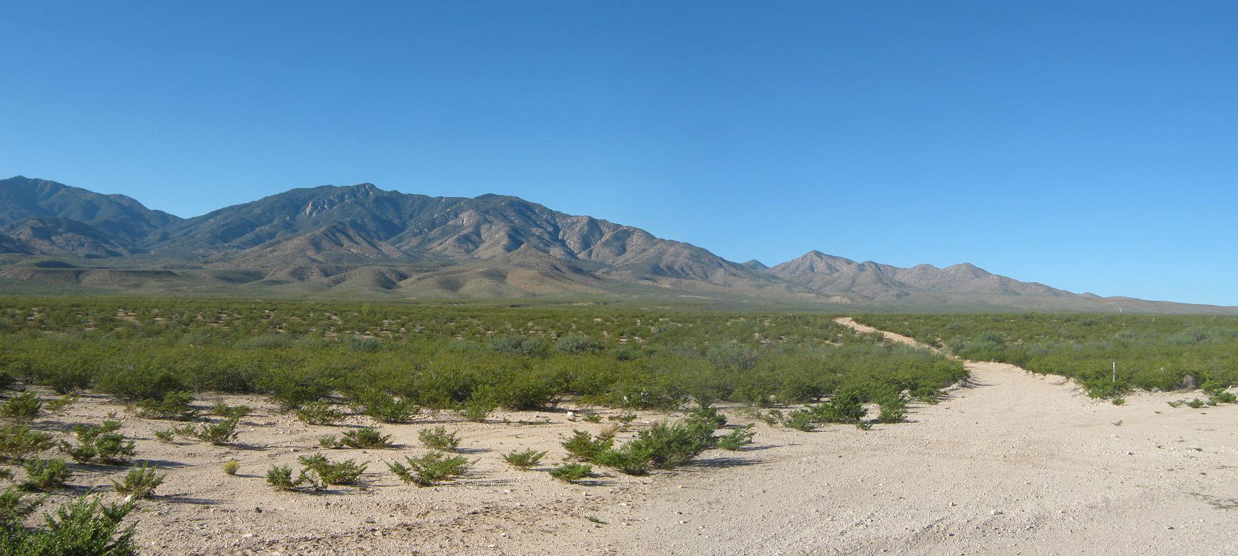
Once on the mesa, the road improved and the next 12 miles was across "flat" high desert, Blue Jay Peak right there in front of us. We stopped at one point for photos, plus a chance to look down from where we had come. In truth, we'd gained a few hundred feet of elevation, the mesa sloping gently to the north toward the Gila River Valley. Beside us were some deep-cut canyons and badlands.
In time, the road gained to the base of the foothills and started through these, the gradient slightly steeper. We crossed the Coronado Forest boundary, then through a gate and through a section of private property. We were now within Tripp Canyon, and the road ran in and out with the terrain, but the quality was still pretty good. Roughly 19 miles from the highway, the road crosses a neat stone bridge, then comes to a Y-junction shaded by large trees, closely hemmed in by the canyon walls. Although it looks like an ideal camping spot, the area is part of a ranch and cattle roam around.
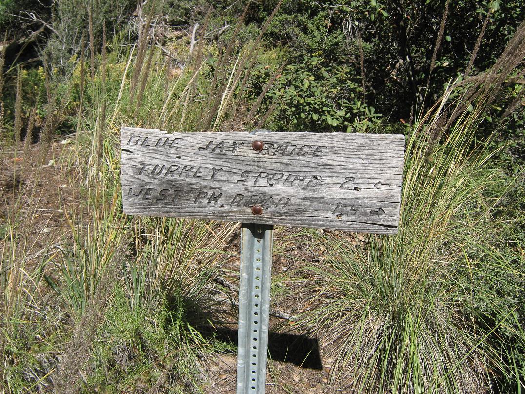
At the Y-junction, we went left, now up Sawmill Canyon. The road gets narrower and steeper. Scott kept his vehicle mostly in low gear and we inched the final 5.5 miles to the trailhead near Turkey Spring in about 45 minutes. We were at the Blue Jay Ridge Trail (#314), elevation 7,600 feet, nearly a full vertical mile above where we had started in Pima. We were within shady old-growth pine and fir forest, with temperatures about 50 degrees. It had taken us close to 90 minutes to drive this road, a full 25 miles from the highway. We saw not a soul.
From our parking spot, we could either hike up the road to West Peak, then on over to Blue Jay Peak, or hike the trail north, then follow it back south along Blue Jay Ridge to the peak. We chose the trail option, meaning we could then follow the road back to the car for a true loop hike.
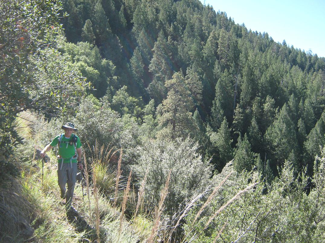
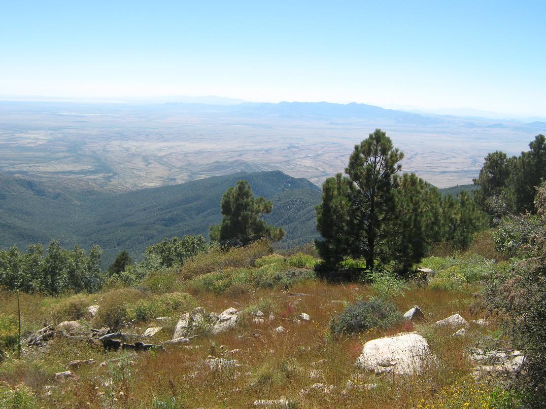
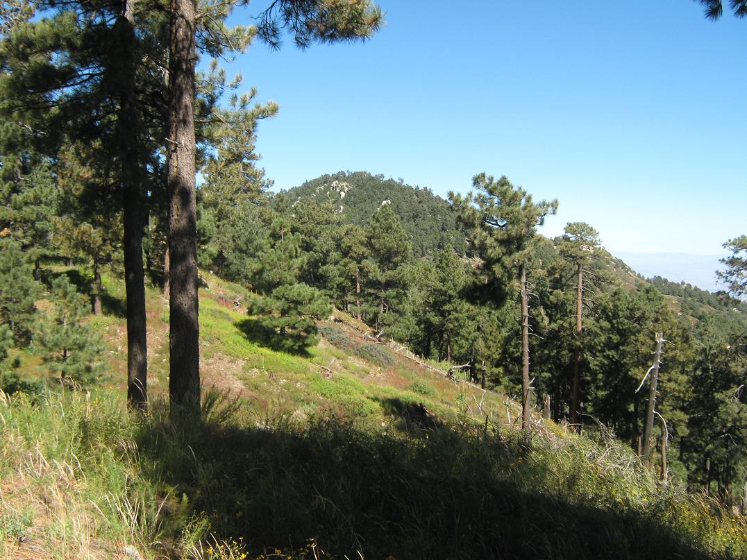
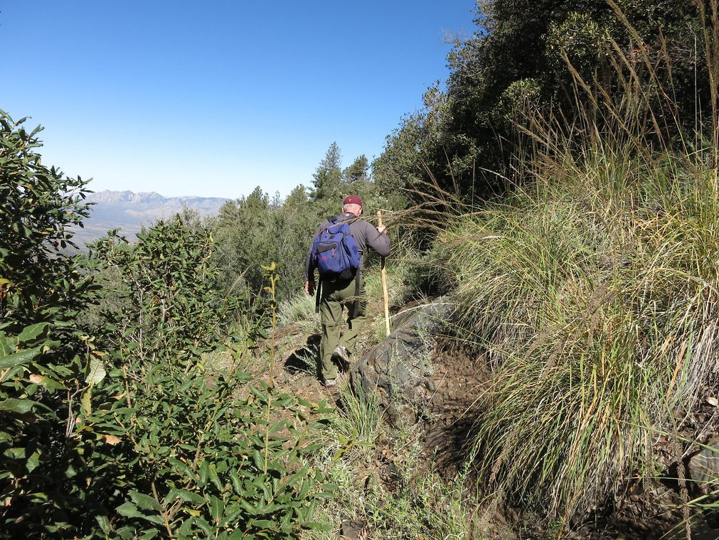
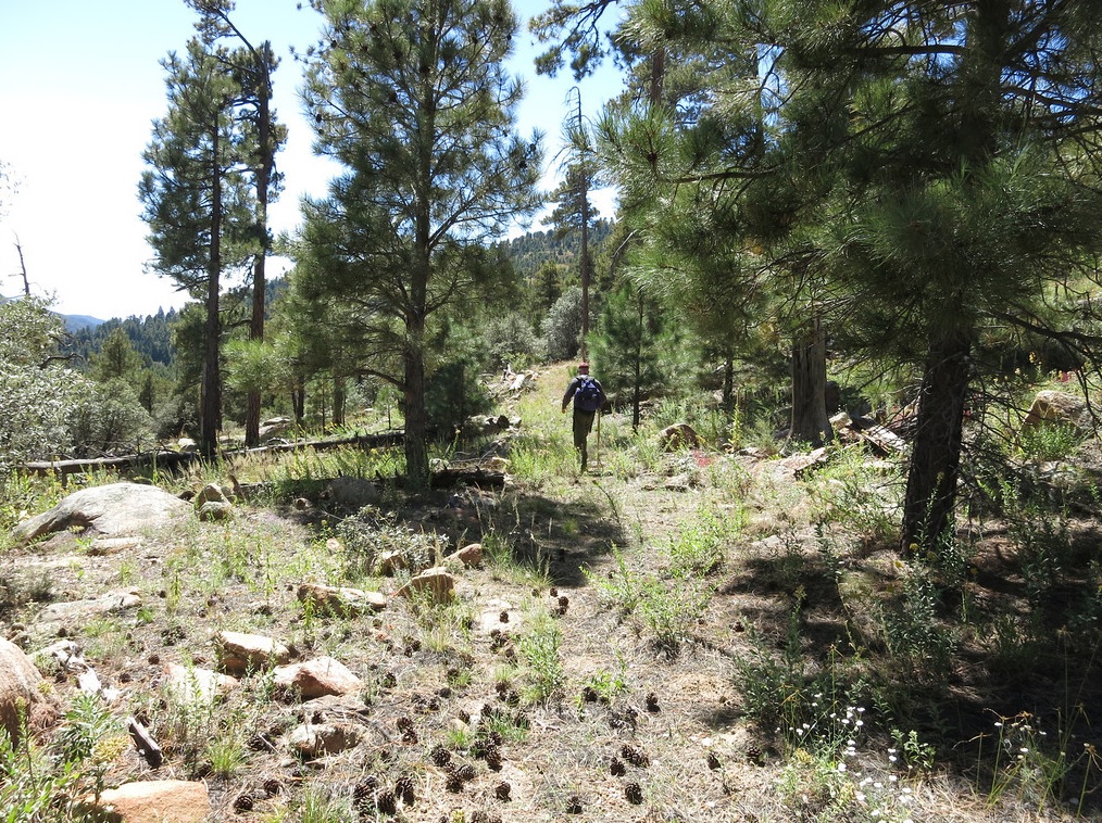
Trail 314 begins steeply, but then levels as it traverses northward along the west-facing slopes of Blue Jay Ridge. In places the trail is just a foot wide and often overgrown, but following it was never a problem. The nature of the forest would change every few yards, from tall pines and a carpet of grass and clover to scrubbier brush and mountain oak, then back again. Views were often remarkable, with the Santa Theresa Range (Pinnacle Ridge and Mount Turnbull) off to the west.
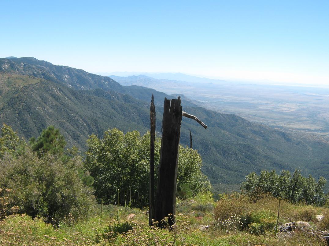
In about an hour, we arrived onto a saddle, slightly over two miles from the trailhead. Although we had been moving up and down the whole way, the saddle had the same elevation as where we started, 7,600 feet. We took a break here, sitting within some shade afforded by the pines. Immediately, we had excellent views north and east into the Gila River Valley and the line of mountains behind it, such as the Gila Range and other distant mountains way far to the north. The wind picked up a little here, too.
Now on the northeast-facing slopes of the ridge, we continued south along the trail, which was now much steeper in spots, and often overgrown. It was along this mile-long segment that we would be gaining all of our elevation. Although usually easy to follow, we'd often lose the trail in a thicket of grass and saplings, and have to look around for its continuation. The trail works up and down the many little bumps along the ridge, gaining a couple hundred feet at a time, then losing 50 to 100 feet of it again.
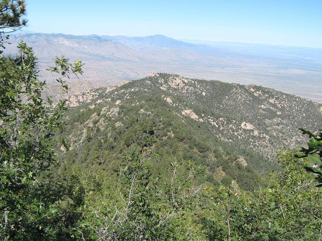
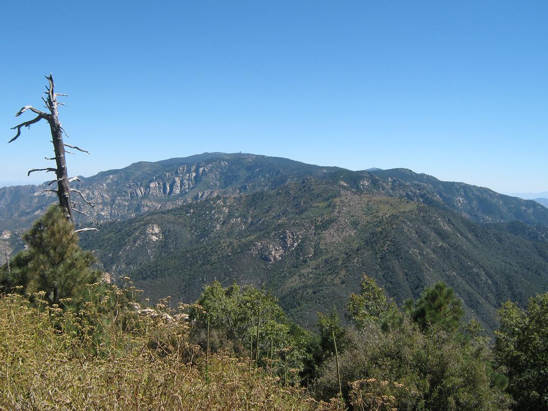
We moved slowly along this segment, but the views were wonderful. Mount Graham was visible to the east, the observatory building easily visible along the highest ridge. We came upon Point 8529, shown on the map holding Blue Jay benchmark. On its west were rocky cliffs, while on its east and north slopes was thick forest. Our trail wormed through the rocks and forest, often very steeply, until finally emerging onto the ridge just east of Point 8529. Blue Jay Peak was still about a mile south of us. We took another break here, pleased to be finished with those steep sections.
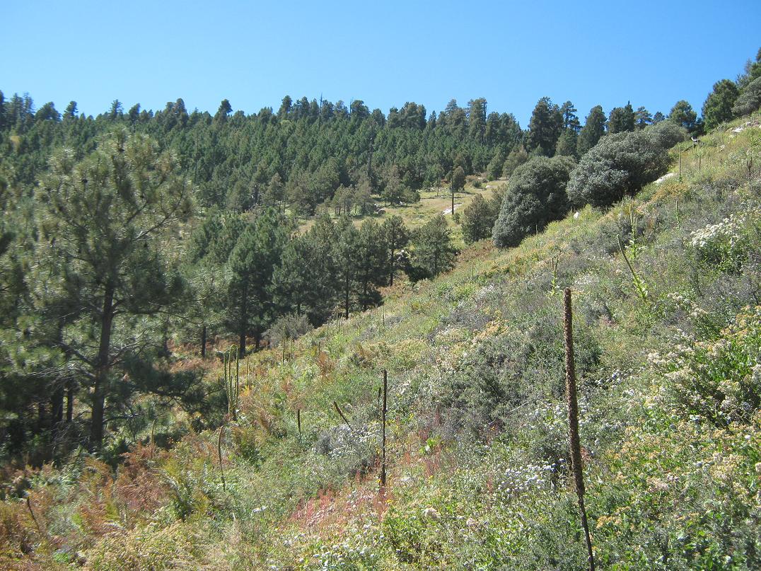
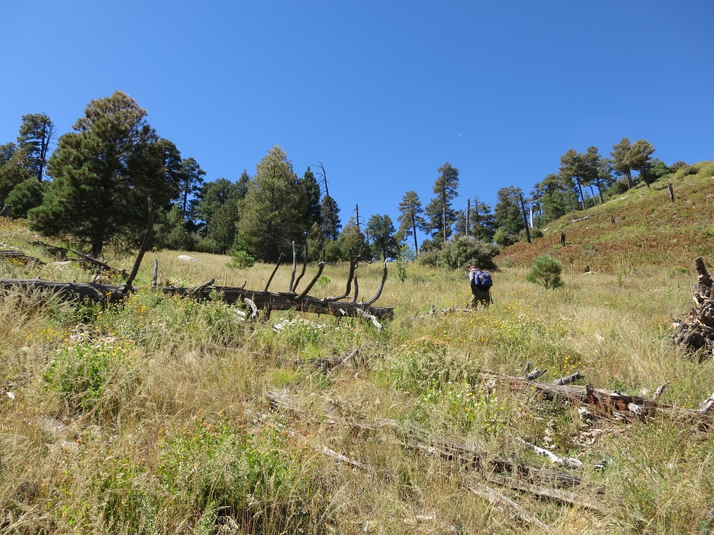
The trail continued, and we kept with it, but it seemed to angle a little more left (and down) than we wanted. The forest was a little more open here, so we had good views of the ridge and the peaks. After about a half-mile, in which we'd dropped about 200 feet, we were now due east of Point 8681, a small bump on the ridge immediately north of Blue Jay Peak itself. Supposedly the trail meets with the end of the road down below somewhere, but we decided to leave the trail and embark up the grassy, open slopes. We regained our lost elevation and once again took a small break in the small saddle between Point 8681 and Blue Jay Peak. We took some GPS readings to be sure.
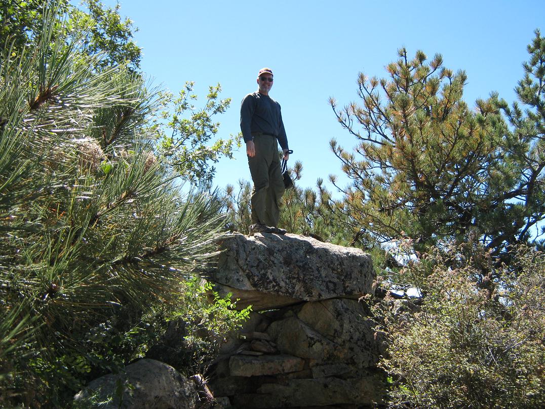
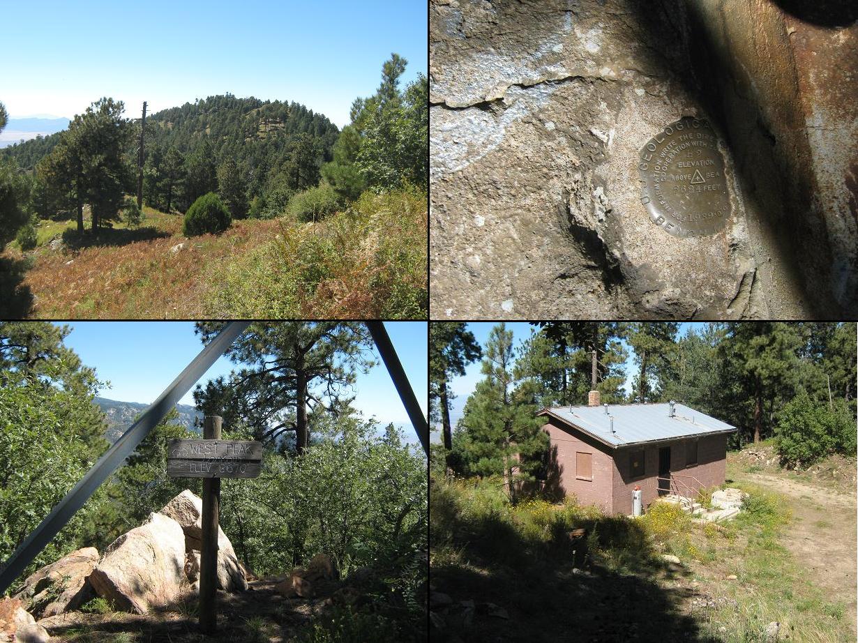
From here to the top, we worked through the trees, angling to avoid some deadfall and other sections of scrub and rocks. We gained the final 250 feet and came upon the wooded summit. It took us a few minutes, but we were able to find the presumed highest rock outcrop, although a couple other rocks hidden in the trees looked like contenders too. I tagged everything, plus another rock outcrop about 50 feet to the north. We signed into the log, the first since this past April. Although the bottle was crammed full of papers going back over a decade, the frequency of visitors, going by the register, wasn't more than a handful of groups per year.
Our ascent took 2 hours and 30 minutes, covering just under 4 miles with a net 1,240 feet of gain, but possibly as much as 2,050 feet when all the drops and regains were accounted for. The views from the summit itself were blocked by trees, but a few feet to the east were open slopes with some unreal views of the Pinaleño Mountains with Mount Graham and Heliograph Peak, plus distant ranges such as the Dos Cabezas and Galiuro Mountains. The conditions were wonderful, not a cloud in the sky, and humidity levels below 10 percent.
We spent about a half hour at or near the summit, having a lunch but also walking around to be sure we hadn't missed any other rock outcrops. We then continued north and down the brushy slopes, surmising there might be a use-path somewhere in here since it would be logical that one might come this way from the road. But we saw nothing, and once we saw the road itself about 250 feet below us, we just decided to beeline directly to it, crossing through slopes of waist-high grass and woody brush. It was nice to be back on unobstructed road again.
We trekked north, and shortly we were beneath West Peak, which holds the lookout and residence. We walked up a spur road to the tower, but it was boarded shut and the steps covered over to keep people off them. We milled around here for a few minutes, and also walking over to the residence area for some excellent views of Blue Jay Peak, which looked a lot higher and rockier from this angle. We never did find any sort of trail to the peak, nor some other features supposedly here somewhere as shown on the map.
From the lookout, we had an easy 30-minute walk down the last 900 vertical feet of road back to Scott's vehicle, arriving at 1:50 p.m. Along the way we passed by an older couple camping, telling us that they've come up here to the same spot for 20 years running. We were the first people they'd seen since they arrived over a day ago. Back at Scott's vehicle, we changed and started the slow roll down, taking 45 minutes to get down those 5.5 miles of rough road into Tripp Canyon, then another hour back into Pima, where we celebrated with fattening but delicious burgers, tacos and cokes at the Taylor Freeze. We were back in Gilbert by 6:30 p.m, and I was home a shade past 7.
Blue Jay Peak was easy but not as simple as we had first assumed. I figured that with a road going to West Peak, more people would come up here and have beaten in a path to the top. But the road itself, ironically, may keep most casual visitors out, since (a) it's hard to follow while it works through the residential parts of Pima, and (b), gets rough in spots. But it's not a bad road: Scott's Subaru Forester handled it very well, and I would imagine most vehicles with high clearance would be fine to Turkey Spring. Past that point, it does get steeper and chunkier as it approaches the lookout area, where 4-wheel drive would be warranted. Lower down, 4-wheel drive would be a nice option, but not absolutely mandatory.
I was pleased to finally get in some real hiking and a cool peak after months of laying low due to the summer heat and thunderstorms. My legs and knees were paying for it afterwards, though. I'll get back in shape soon.
|


|