The Mountains of Arizona
• www.surgent.net
|
| Blair Benchmark |
• Highpoint: Hog Mountain • San Carlos Indian Reservation • Gila County |
|
Date: October 31, 2021
• Elevation: 5,757 feet
• Prominence: 1,597 feet
• Distance: 8.3 miles
• Time: 4 hours, 45 minutes
• Gain: 2,294 feet (gross)
• Conditions: Sunny and pleasant, sometimes warm
• Teammates: Matthias Stender, Scott Peavy
Arizona
•
Main
•
AZ P1K
•
PB
•
LoJ
•
USGS BM Datasheet (stamped)
•
USGS BM Datasheet (unstamped)
Blair Benchmark is the highest point of Hog Mountain, on the San Carlos Indian Reservation about 15 miles southeast of Globe. Hog Mountain isn't a range, but a small clump of peaks of which Blair Benchmark is the westernmost and also the highest. It was a team of three: me, Matthias Stender and Scott Peavy. I hadn't seen Scott in almost two years. It was good to get the band back together.
The approach roads toward Blair Benchmark are not maintained and are pretty rough, so we'd need Matthias and his beefy Toyota 4-runner to get us within reasonable walking distance. The three of us met at the Wal-Mart off of Signal Butte Road in Mesa at 6 a.m., and from there we drove into Globe so we could get our San Carlos recreation permits, and then onto the San Carlos Indian Reservation.
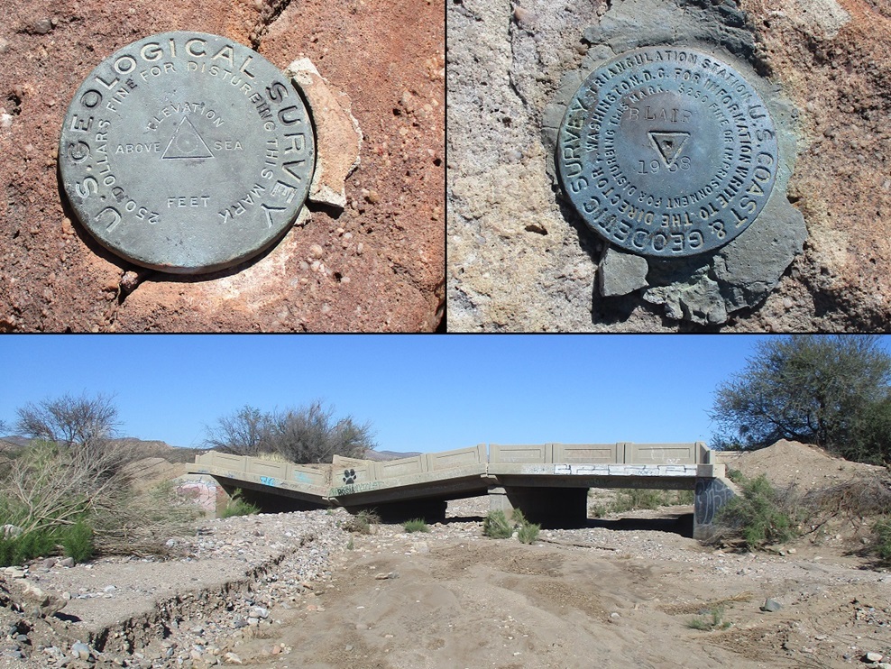
Just past the interestingly basic San Carlos airport which is itself just past the modern Apache Gold Casino, we got onto a road that leads toward the Coolidge Dam. We had to bypass a bridge that was partially collapsed. We were on this road a few miles, then we turned onto Road 610, which heads southwest and south toward the mountains.
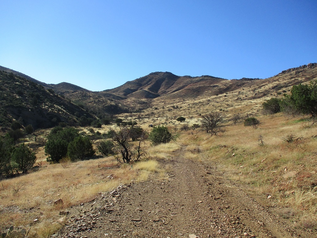
Matthias was able to get us in about two miles on this rough road. Being on the San Carlos, it likely never receives any maintenance. It was rutted and uneven, with some rocks and a couple of steep uphills and downhills. We parked at roughly 4,000 feet elevation, figuring we were close enough to walk the rest. We got suited up and were walking about 8:45 a.m..
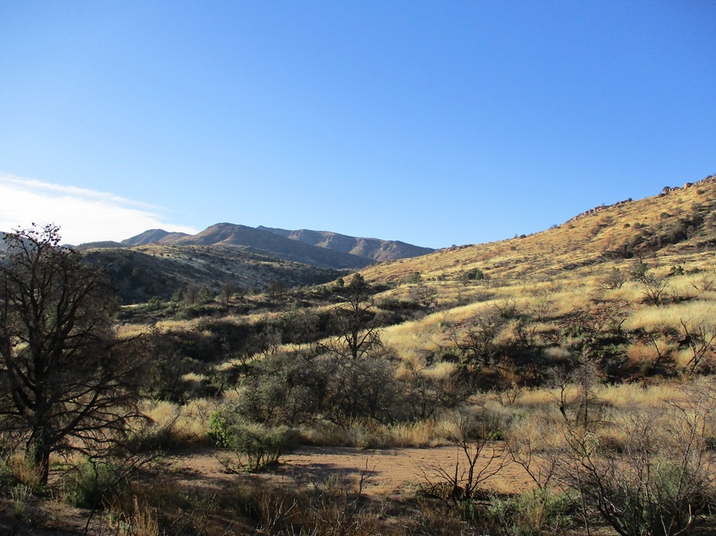
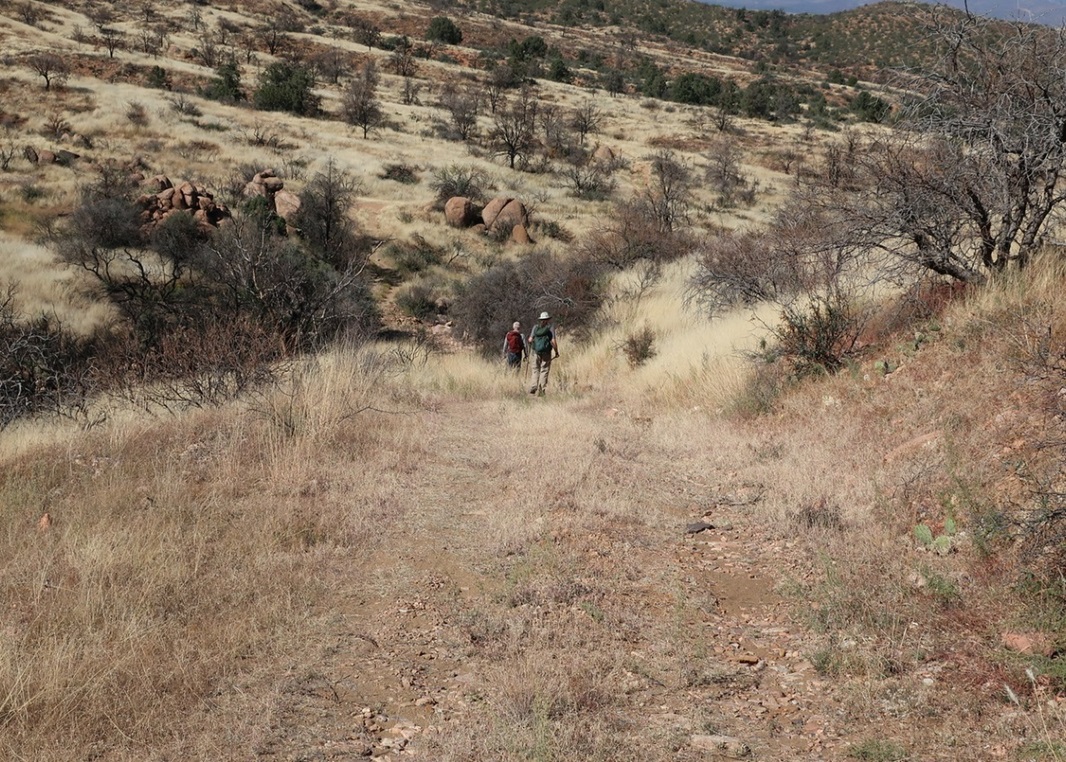
We followed the road through grass meadows, down into drainages and up the other sides, and up onto higher ridges. For most of the hike, the main summit was hidden behind a foreground peak, Peak 5460, which lies north of Blair Benchmark. The weather was warm and there wasn't much of a breeze.
A couple miles in, we saw a black truck parked in a meadow. We approached and a woman from the San Carlos Nation was sitting in the passenger seat, her husband up in the nearby hills hunting. She was friendly and we talked with her for a minute, a good excuse to stop briefly and rest.
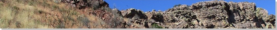
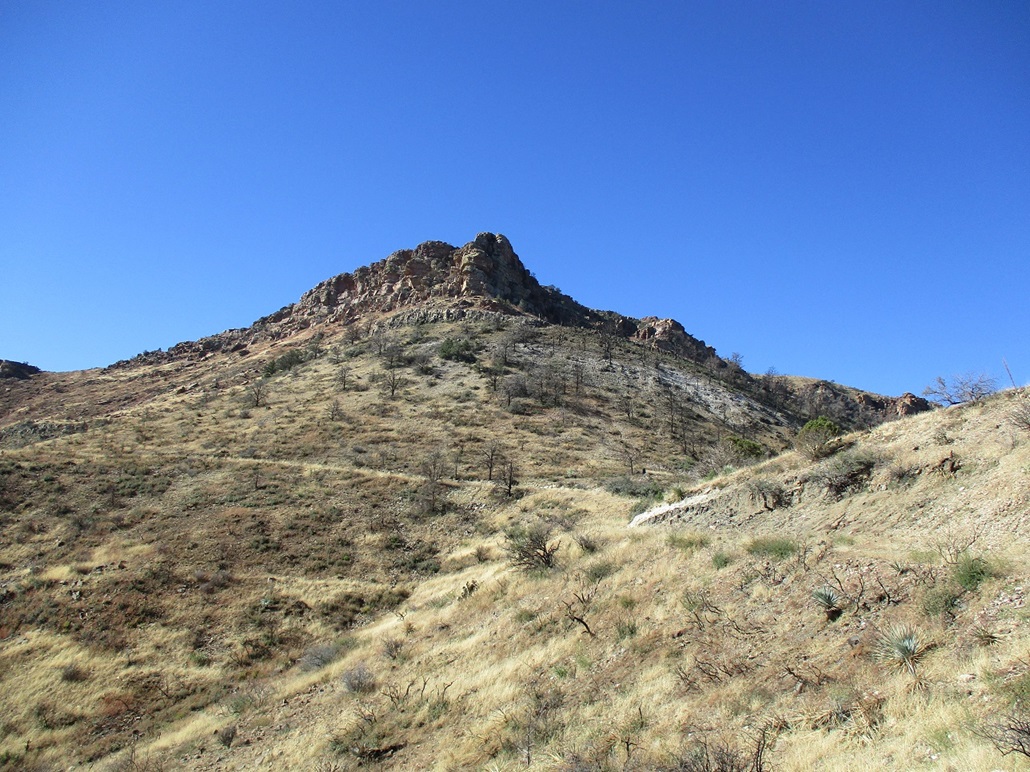
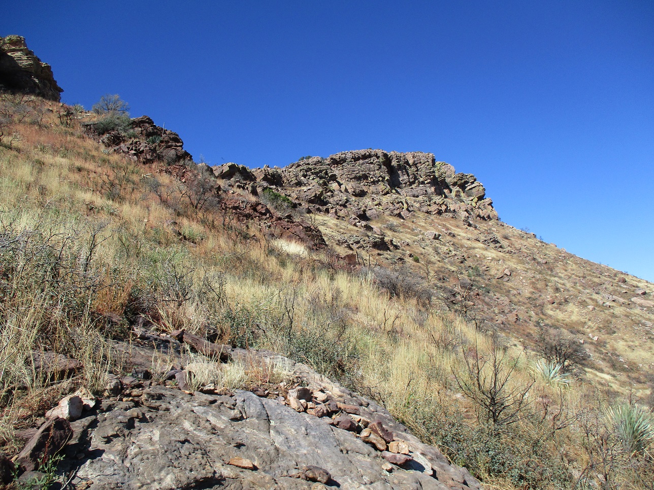
We then walked the road up to a pass east of Peak 5460 where we took a break and also waved hi to the hunter, that lady's husband, who was up on the hills opposite us. We then hiked down the other side, a loss of about 200 feet. At the road's lowpoint, it rounds a bend and for the first time, we saw Blair Benchmark Peak and its impressive crown of cliffs lining its summit and highest ridge.
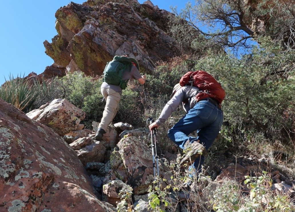
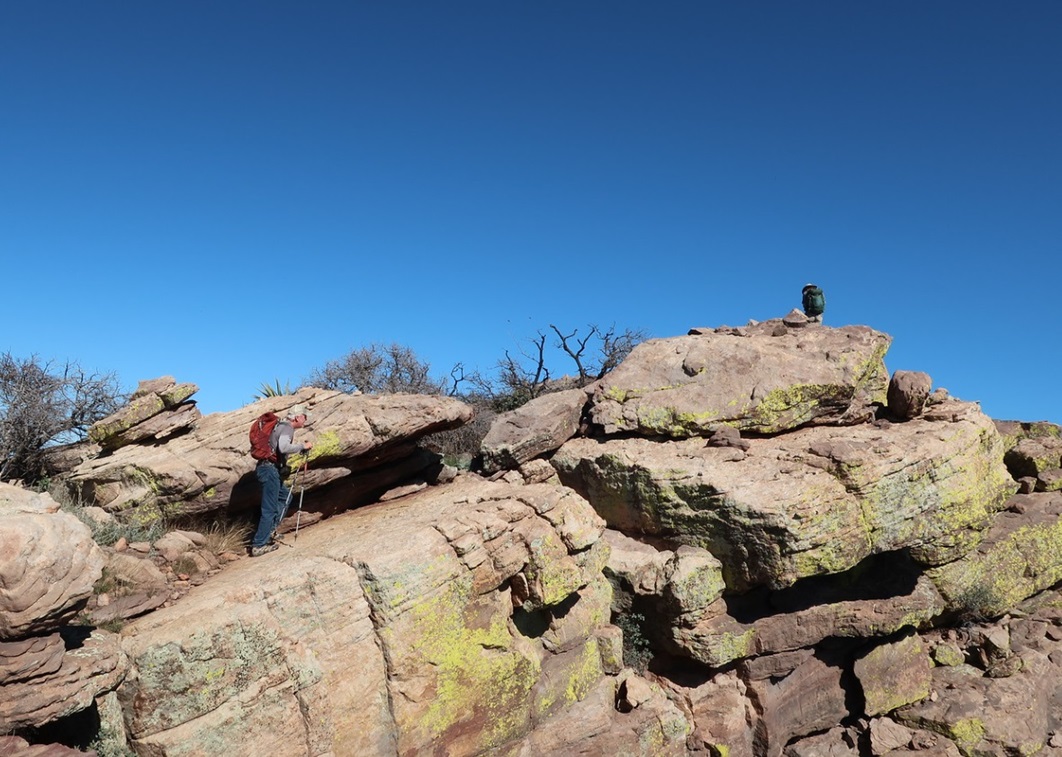
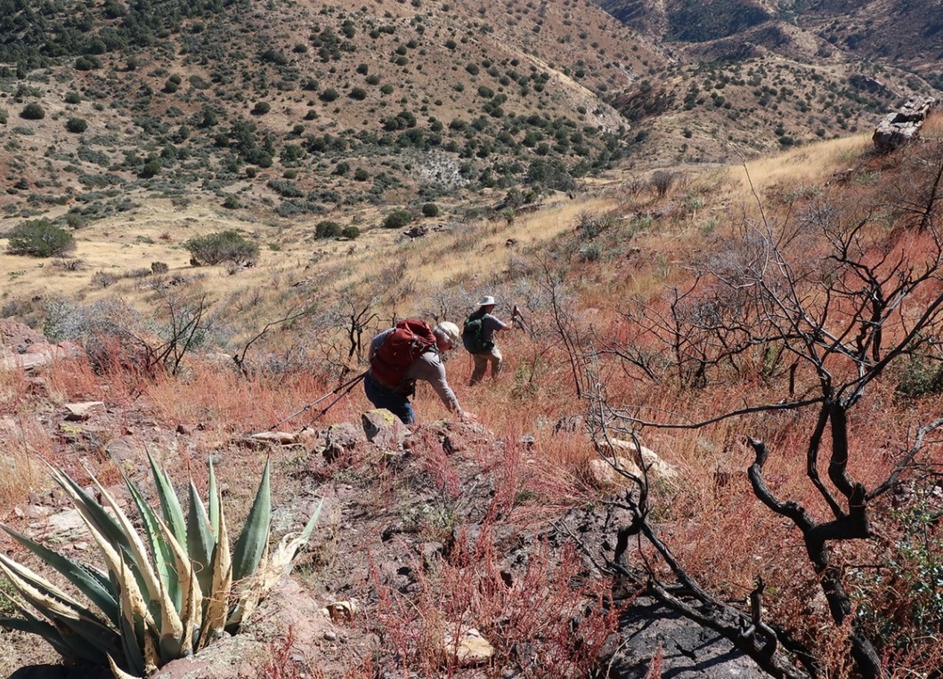
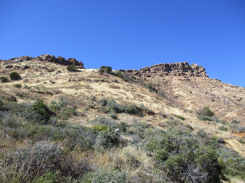
We walked the road uphill to another saddle, this one between Blair Benchmark and Peak 5460. The only trip report we had was Paul McClellan's from a couple years ago. They charged straight upslope from this last high saddle, but a fire from this past summer had charred a lot of the slopes and it looked steep and loose. Instead, we walked a little more on the road, then picked a slope slightly south and east of the highpoint. The upper cliffs drop down to a lowpoint on the high ridge where there are no cliffs, and we aimed for that lowpoint, but also looked at possible weaknesses in the cliffs as an option, too.
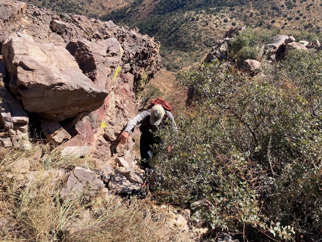
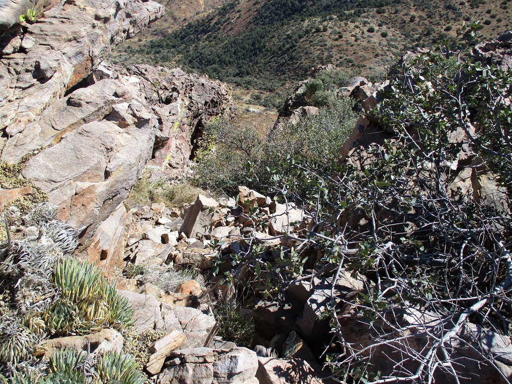
The hike upslope was steep and not difficult, but higher up, nearly at the base of the cliffs, the slope got a little too steep for comfort, and very loose. We had to traverse a short ways laterally to the cliffs and frankly, I didn't like it. A slip could have meant a long slide downhill. We assembled at the base of one chute that looked promising. Matthias started up, I followed, and Scott was right behind. We got up about ten feet, then debated a right option (rocky scrambly) or a left option (brushy). We went left, pushed through one short stretch of brush, and now were within the chute itself. It was sloppy and loose but also protected and pitched reasonably gently. Getting up it only took a few minutes, and we were soon on top the ridge, above the cliffs.
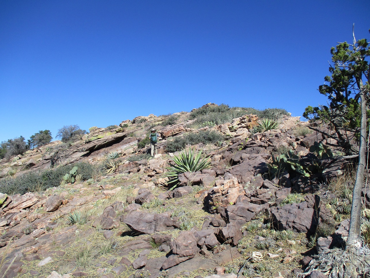
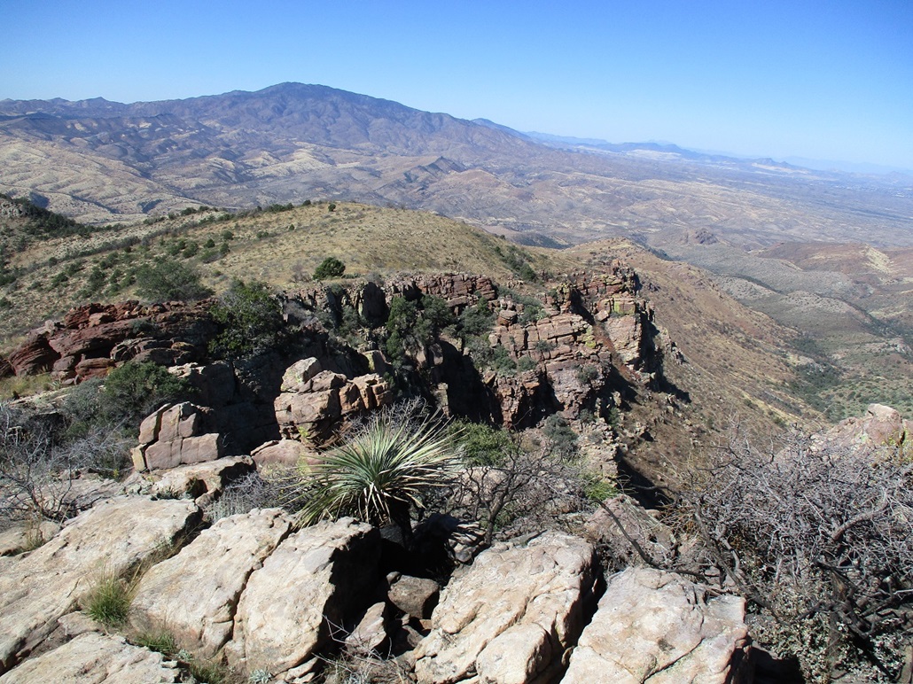
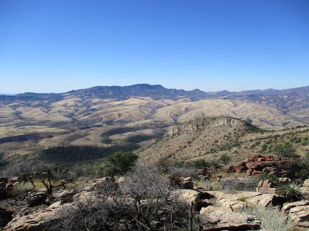
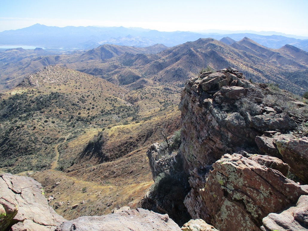
From here, we walked the sloping rock toward the summit, arriving a few minutes later. The views from up top were outstanding. We had clear and dry conditions and could make out a myriad of surrounding peaks such as Pinal and El Capitan to the west, the Natanes Rim and Turnbull to the east, and way in the northeast in silhouette, the big mound of the White Mountains. We could see peaks to the south and the waters in the Coolidge Dam.
There are two benchmarks on the summit, one unstamped and one stamped. We took images, and also signed into the register, the first to do so for 2021, the last person here in December 2020. We spent about thirty minutes up here. It was a very lovely summit, not one we wanted to be rushing off of too quickly. I use Matthias' GPS readings for the statistics on this page. It was a little over 4 miles one way with about 1,760 feet of net gain.
Going down, we stayed on top of the cliffs going south, down to the lowpoint in the ridge with no cliffs. We angled down and to the right into some rocks and brush to get below a rock outcropping, where a good-looking slope dropped all the way to the road below. Scott Peavy suggested it and we quickly agreed to it. The downhill hike was slow and we had to be careful due to the steepness and loose rocks, but it worked well. We were back to the road after about twenty minutes.
This placed us about a hundred feet lower than where we had left the road to start upslope. We hiked the road regaining that hundred feet, then the 200 feet we lost earlier back to the saddle next to Peak 5460. The extra distance we hiked wasn't much, about a quarter-mile at most.
The remaining hike back to Matthias' car went quickly. We had downhill grades almost all the way, and we were back a little over an hour later, arriving about 1:45 p.m., a 4-hour, 45-minute round trip hike. I was surprised it was not yet 2 p.m. as it felt like we'd been hiking a lot longer. We got things packed and changed out of our hiking clothes, then drove slowly back out to the highway, into Globe for a stop at a Circle-K, then back to Mesa.
I really enjoyed this peak and the hike to it. This was my first time on the San Carlos Nation in four years (they only just re-opened access after the Covid shutdown recently). The San Carlos Apache leave things as they are, so other than the roads, you'd think this was Arizona in 1821. The cliff band looks impressive but we were able to wiggle up a chute to get above it. It gave the climb a little extra spice. It was also good to see Peavy again, and to be hiking again with these two jokers. Thanks to Matthias for driving and getting us close to the peak!
|

|