
The Mountains of Arizona
• www.surgent.net
|
| Black Mesa • Salt River Area |
• Sierra Ancha • Salt River Wilderness • Gila County |
|
Date: April 29, 2012
• Elevation: 4,354 feet
• Prominence: 1,074 feet
• Distance: 6 miles
• Time: 3 hours and 15 minutes
• Gain: 1,220 feet
• Conditions: Sunny & pleasant
Arizona
•
Main
•
AZ P1K
•
PB
This particular Black Mesa is a promontory surrounded by cliffs in the southern Sierra Ancha near Lake Roosevelt. We were on a weekend of camping and hiking, getting out of town for a couple days. Yesterday I hiked Kings Crown (Northeast) Peak near Oak Flat between Globe and Superior. We stocked up on goods in Globe and drove north out of town, heading north toward the Anchas.
Our intended highway was AZ-288, which spurs off of AZ-188, the main "back way" between Globe and Payson. As I drove north on AZ-188 out of Globe, we were merrily talking and somehow I missed the turn-off to AZ-288. I didn't even realize something was amiss for another 15 miles, at which time we had come to the Roosevelt Dam. How embarrassing it was to realize not just the error, but the magnitude. But the day was still young and we weren't pressed for time, so we drove back, got on AZ-288, and all was in balance with the universe again.
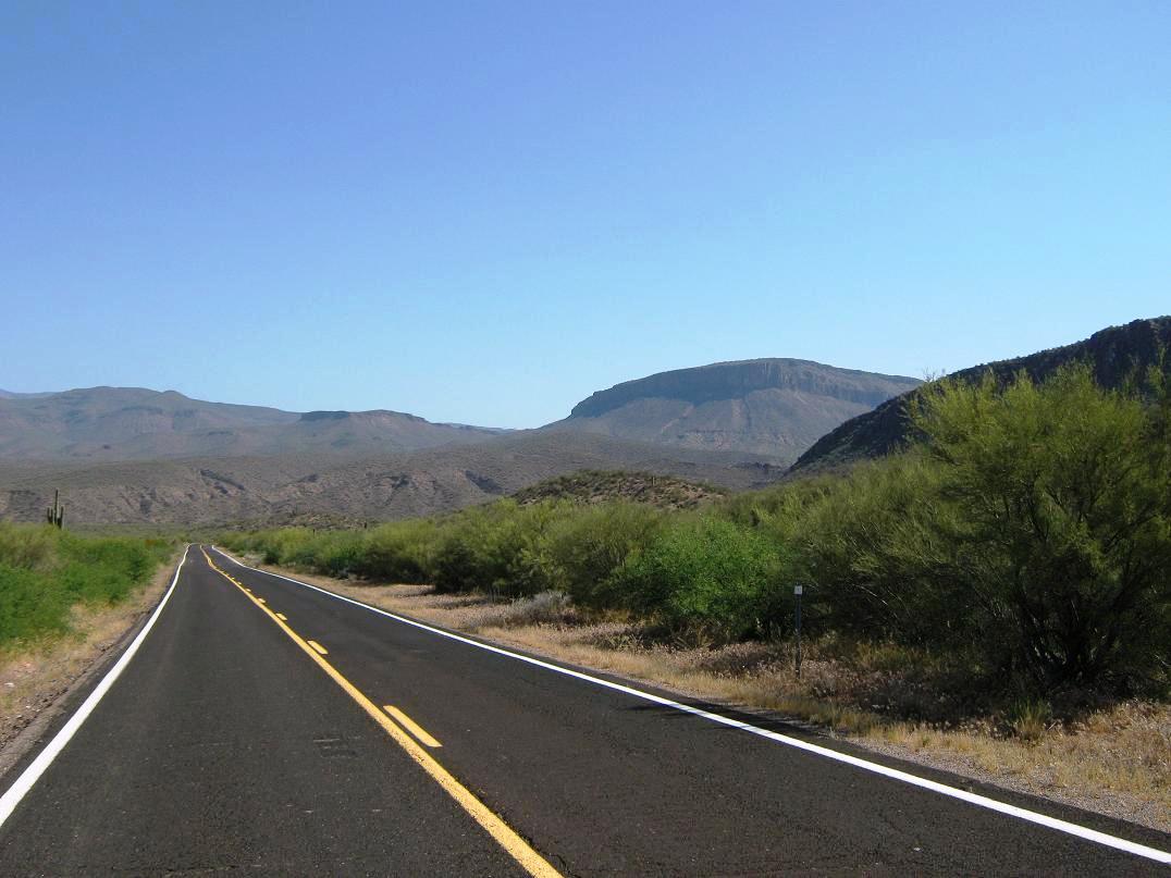
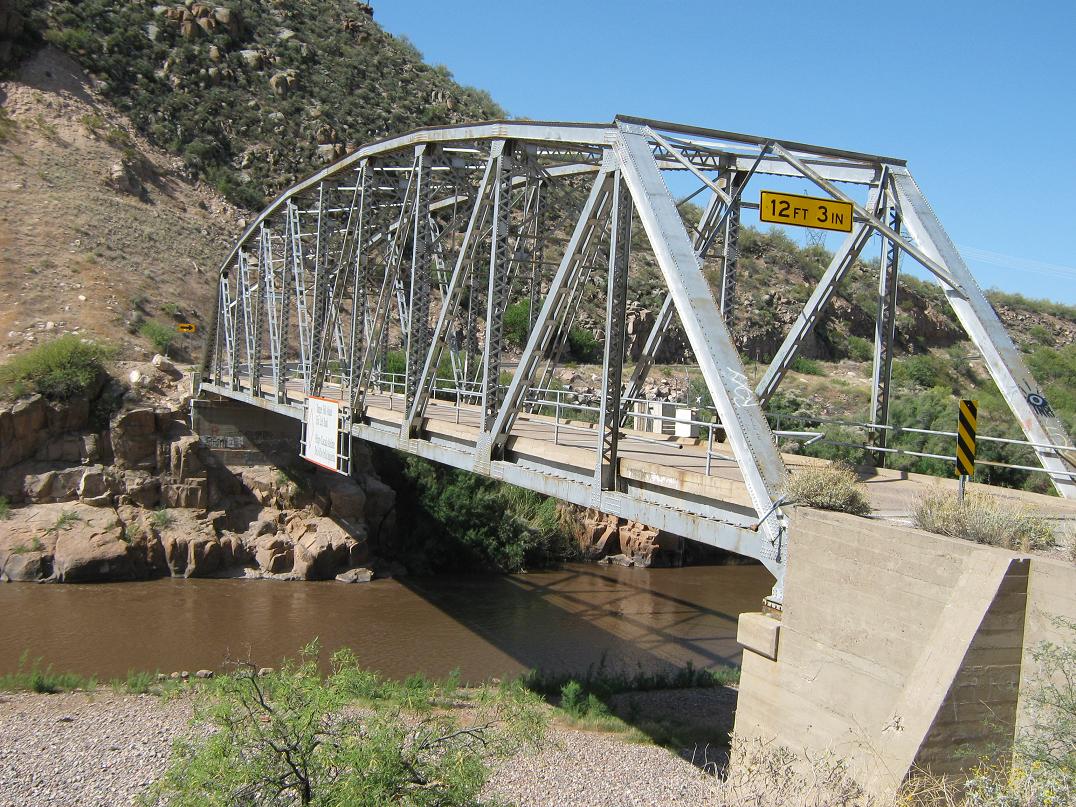
The drive down (literally) AZ-288 is quite scenic. It's a narrow road and it drops steeply for about five miles until it comes to an relic single-lane truss bridge spanning the Salt River where it feeds into Lake Roosevelt. Along the way, we had outstanding views of Black Mesa and the bigger peaks in the Anchas. Another highlight was an old derelict bus dating from about the 1960s sitting abandoned along the highway. It was colorfully painted in many styles: graffiti (the artistic kind), psychedelic, partridge family, and so on. It was in good shape and not completely thrashed and shot out as one would expect for anything standing alongside a road in Arizona. (Update 2015: It's not there anymore. Update: 2023: Still not there any more)
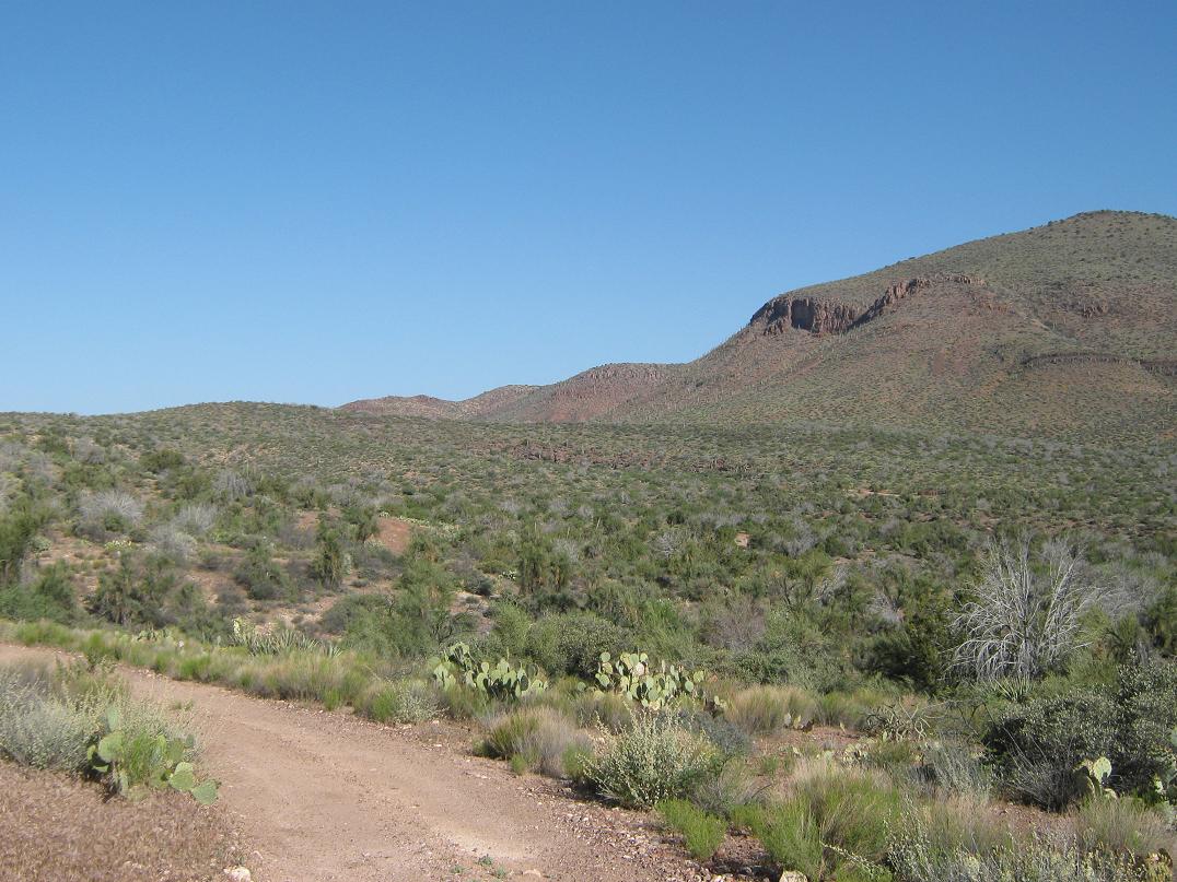
Past the bridge, we drove through the community of Rock House, then another mile to Cherry Creek Road (Forest Road 203). We went right (northeast) onto Cherry Creek Road, which is wide and dirt hardpack. It's well-maintained and sees consistent traffic, so it degenerates into washboard quickly. It was a slight chore to drive, but it was short, only four miles, the last couple steeply up a small canyon.
The land here is desert with saguaro, some that were blooming. We topped out on a rise then dropped briefly into the Chalk Creek drainage. Here, we turned right onto lesser FR-3271, drove about 300 feet and parked in a clearing with a fire ring. This would be our camp for the afternoon and evening. The roads were good, but a deep-cut ditch where FR-3271 veered off of FR-203 would probably stop most small vehicles.
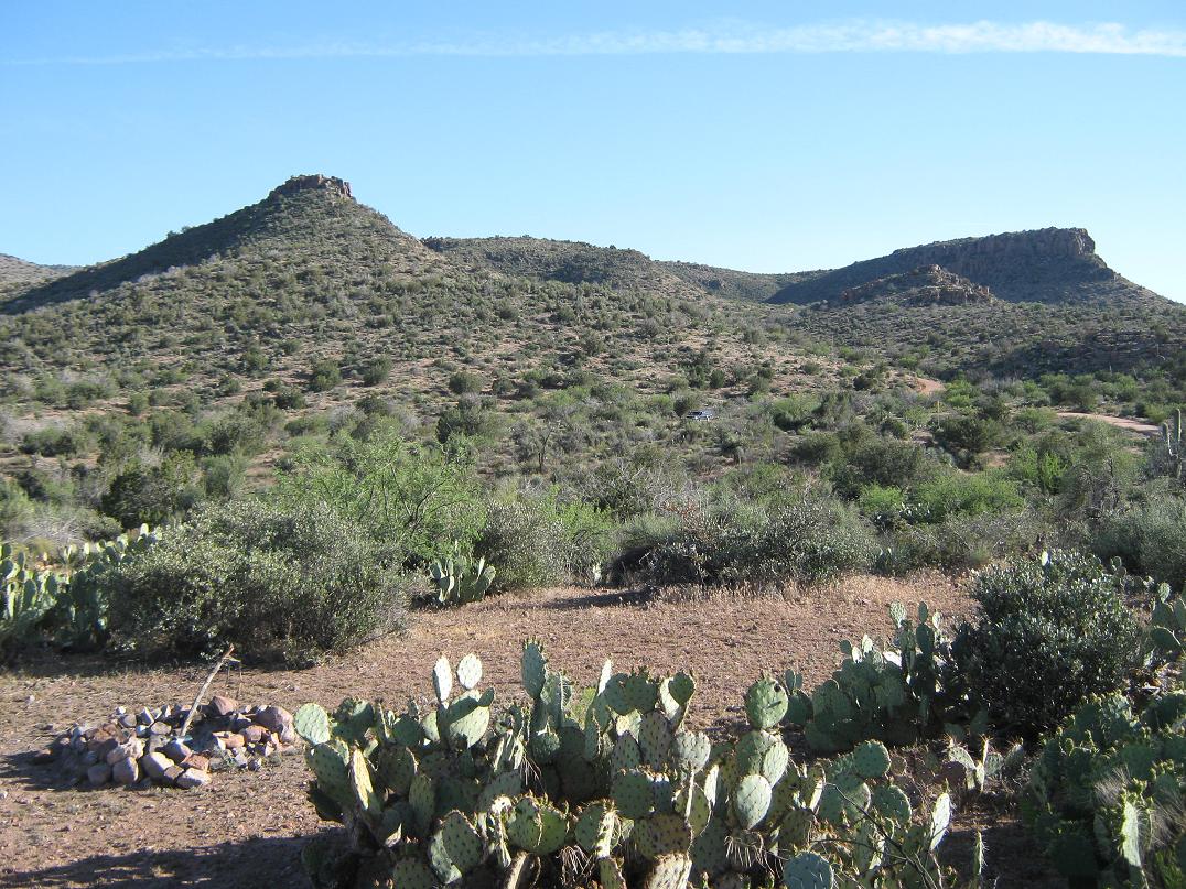
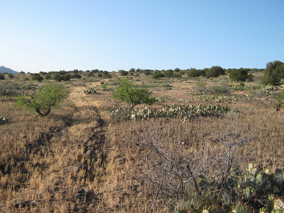
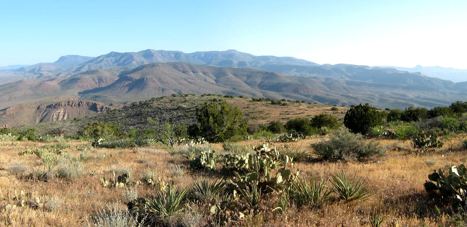
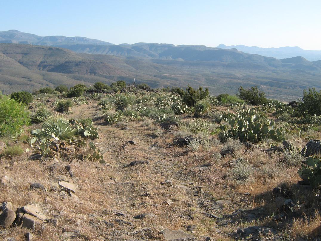
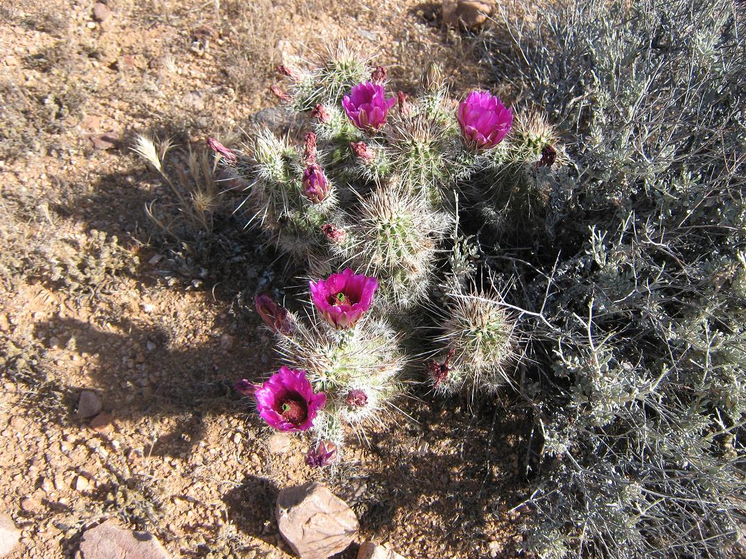
We arrived here at 1:30 in the afternoon and spent the day exploring and relaxing. The whole area was stunning. Big desert summits and hills surrounded us on two sides, while we were elevated enough to have 40-mile views north and east, looking at innumerable nameless summits as far off as the Fort Apache Nation. This was a real treat as we had no real idea what to expect before we came. The immediate area was covered in desert grasses, hedge-hog cactus, ocotillo, prickly-pear and scraggly junipers. Many of the lower cacti and flowers were blooming. It was extremely lovely.
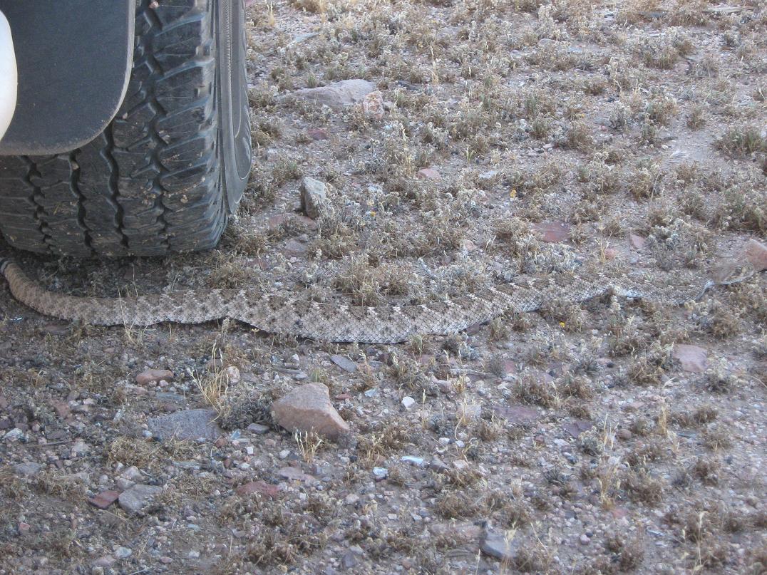
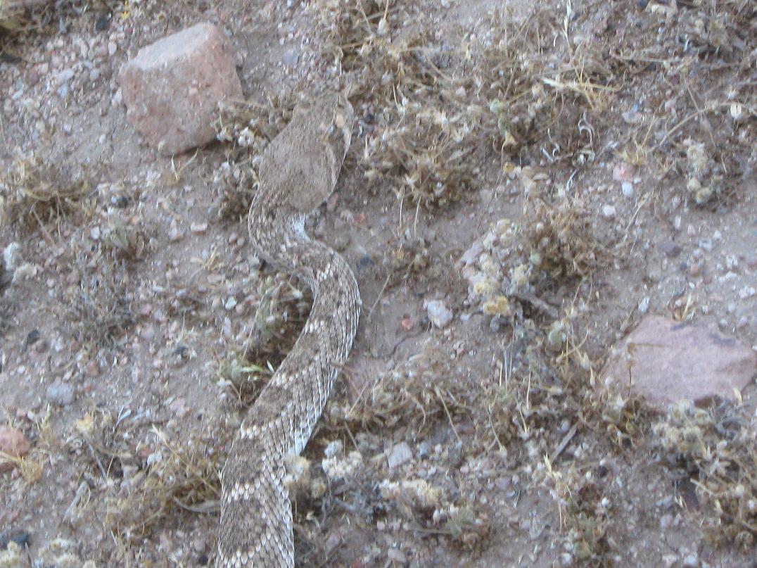
I was bushed from this morning's hike and had set up my campchair in the shade of the truck, while βð was in her usual spot, the passenger seat of the truck's cab. At one point I dozed, propping my feet up on our cooler. When I awoke I saw a "pattern" on the ground near my truck's tire --- it took me a couple moments but I realized quickly that I was looking at a two-foot long diamondback rattlesnake! He (she?) was just minding its own business, enjoying the shade while it slithering from point A to point B in search of tasty mice to eat.
Seeing one snake made me wonder if there was a whole pack of them. I scanned the area for others but saw none. I told her about the snake and she watched it from her seat. We took photos of the snake with the camera. Enough of the snake. It was time to compel it to move along. I stomped the ground from my seat, about 5 feet away. It just coiled back a little (too far to strike) then started to circle around the tire and nose up into the axle area. I hustled around to the driver's seat and started the engine, and it promptly slithered off into the nearby brush.
We had no more snake encounters but we kept an eye out for them. Normally, just regular walking around camp would have scared him off, but as I was dozing, the whole place was still, and he probably had no idea we were even there. As the sun set and the day cooled, I walked some of the nearby roads for photographs and possible other snakes to look at. Once darkness fell, I went to sleep in the back of the truck, the plan to be up and walking at first light the next morning. Not that this is a long hike, but it was going to be warm, and I wanted to be done so we could be back home in mid-afternoon.
The next morning came and I was suited up and walking at 5:45 a.m. as the sun was still shielded behind the eastern peaks. The hike looked easy: a road most of the way up lenient slopes, then cross-country to seek out the summit. I followed the road about a half-mile to a gate, dummy-locked with a chain. The road to here was good, but after the gate, it worsened. It passes below power lines, then comes to another gate. After this second gate, the road gains up a hillside and traverses across a slope, coming to a bend after about a mile from where I had started the hike.
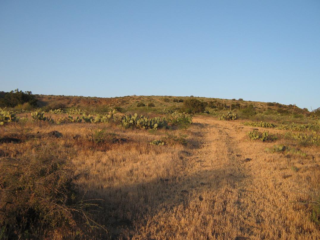
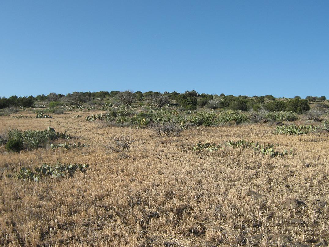
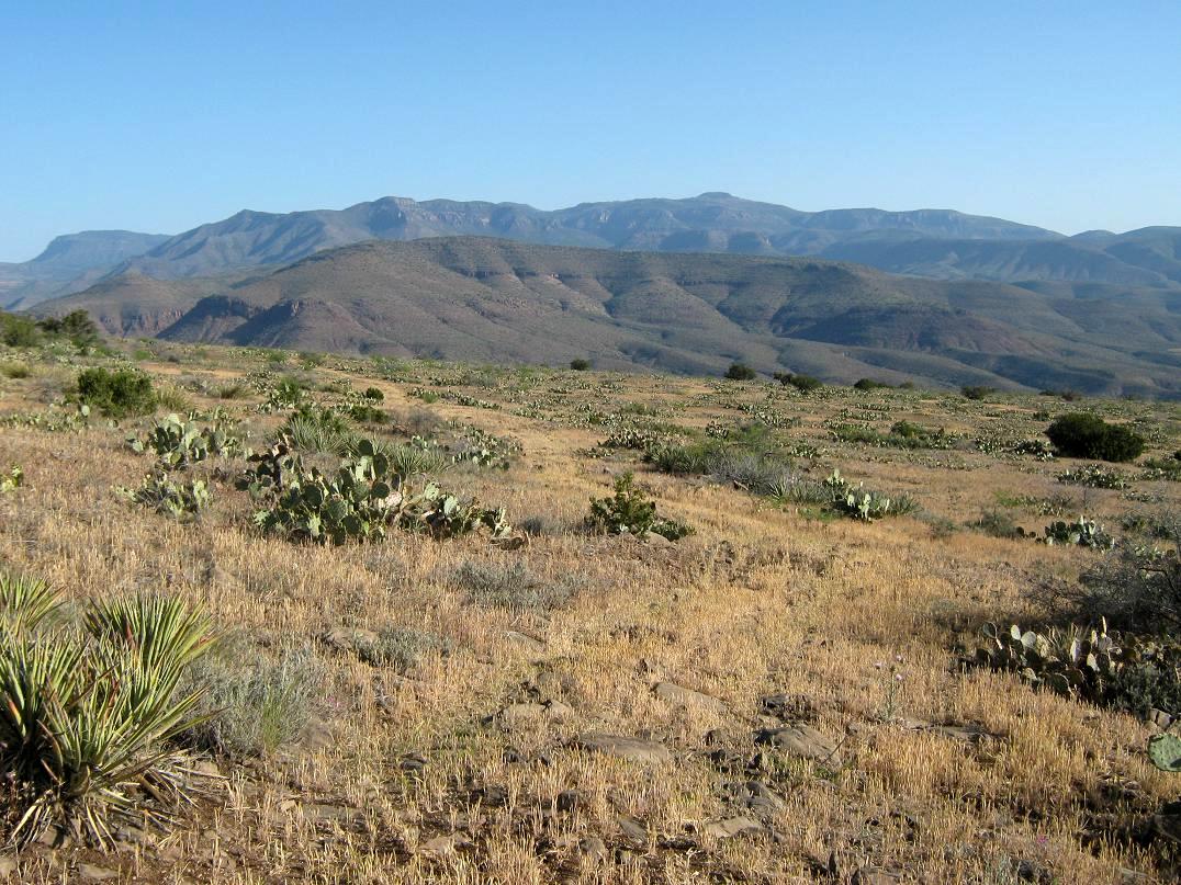
The road turns right here, continuing south up the long, consistent slope of the mesa. By the looks of it, the road seems to not have seen a vehicle for years. The whole hillside, including the road, was covered in a low grass of uniform height, including the ruts which usually suppress any growth even years after the last vehicle. The hillsides were also covered in prickly-pear cactus, agave plants and wildflowers, but few actual trees.
The uphill slope was very gentle, and most of the hike had the effect of being on "slightly sloping" flat ground. I made great time, never stopping at all except to remove layers. Higher up, the road Y's a couple times, and in time I started to sense the summit in the distance. The trees started to increase ever so slightly. When the road started to angle across the slope rather than up, I left the road and started the easy quarter-mile off-road segment toward the top.
I didn't get more than two steps when I heard some rustling. Rousting some deer is not uncommon, but this rustling was louder. Next, I hear "boom-boom-boom" hoof-prints, then I see the critter: an adult male javelina, bolting down the slope about 100 feet ahead of me. My first javelina sighting! They look like hairy wild boars. They can be mean and protective of their brood and their territory. The males have tusks and can weigh 70 pounds, and they will fight. This guy was running away and there were no others, suggesting he was alone, which was great news for me.
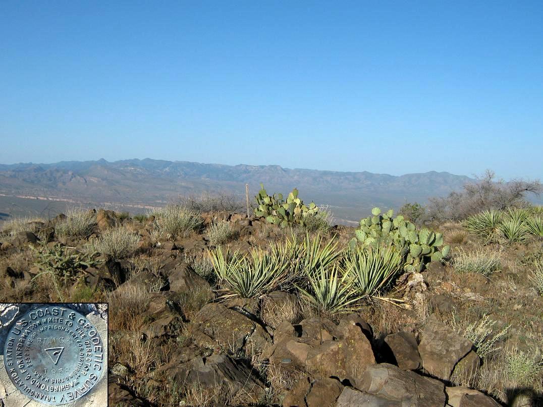
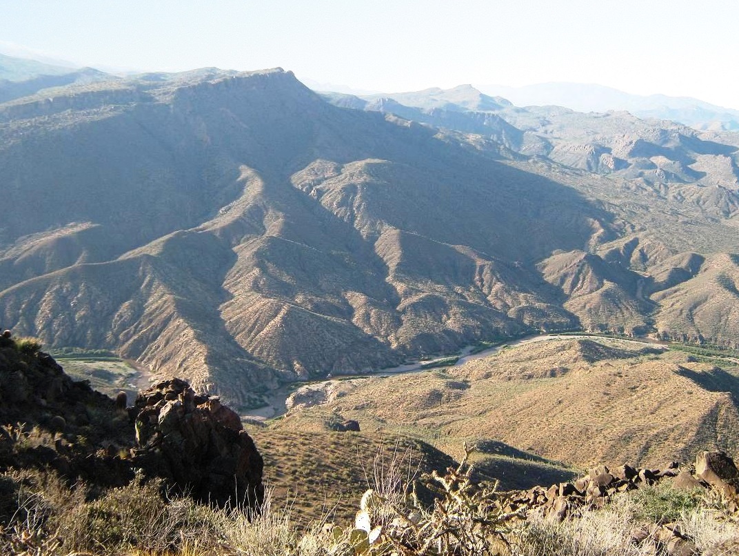
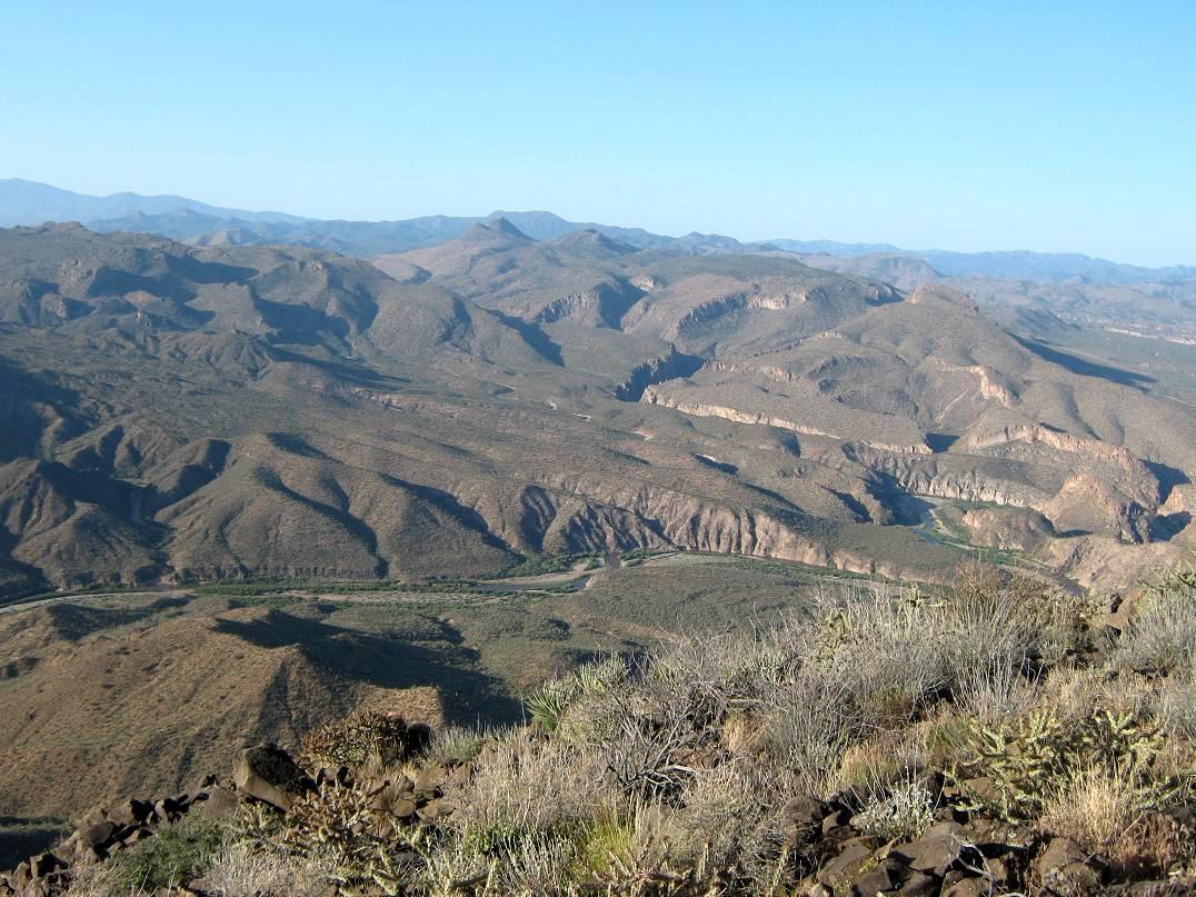
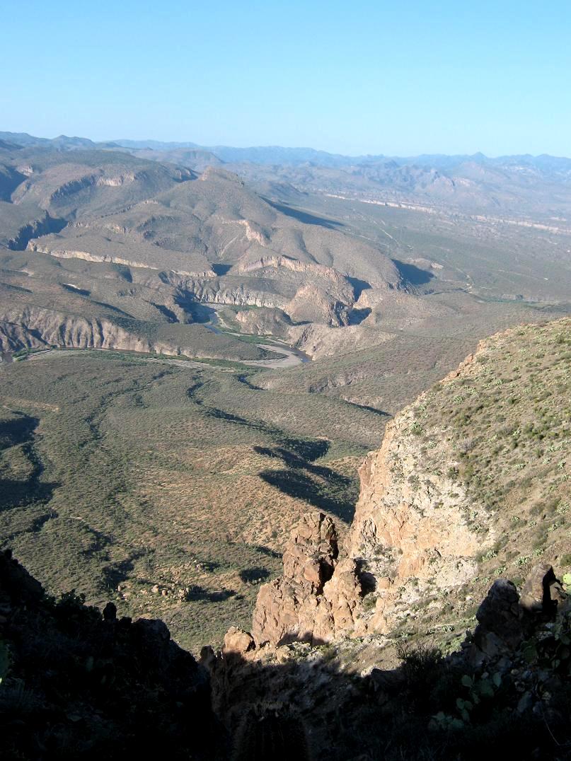
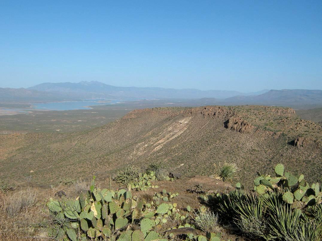
I let him bolt downslope and out of sight, then I stood for a few moments in silence in case there were others. Fortunately the terrain up here was open and I could see most everywhere. Still, I made extra noise as I hiked, making hand-claps, shouts and banging my staff against rocks. I saw no more javelina, and in a few moments had arrived to the lip of the mesa, a ragged edge of rocks and brush set atop the cliffs with million-dollar views down onto the Salt River and the canyons and ranges beyond.
The top is flat, so it took me a few minutes to walk it and locate the top-most rocks, the bench-mark and a summit log. Someone was here a couple months ago, but going back to 2004, I was about the 10th person to sign in. The views down into the Salt River Gorge were remarkable, and even from this high up I could hear the gentle low roar of the water. The Salt is fairly energetic here (Beth and I rafted it in 2003). It can have white-water sections and other challenges like any other major river. Looking south and west, I had uninterrupted views over Lake Roosevelt and the Mazatzal Mountains with Four Peaks way off in the distance. I stayed for about 20 minutes, to enjoy the views and rest a little, before heading back.
Going down was easy. I was back to the road in 10 minutes, then I jog-walked downward, stopping once or twice for photographs. I was back to the lower road and the gates after an hour, and back to the truck at 9 a.m.. The round trip had taken me 3 hours and 15 minutes. I was truly impressed by the views up top and wonder why this hike doesn't get the press that others do. After packing up, we left the area and drove home via Globe and Superior. It had been a good weekend and we were well rested and energized from our brief trip.
|

|