The Mountains of Arizona
www.surgent.net |
|
Black Mountain • Peak 2249 Being Christmas and with nothing going on, I headed out for more hiking. There'd be no traffic, which was attractive. I didn't want to go very far anyway. Last week, hiking Syenite Peak, I stopped by these hills on the way home to check out the access situation. It looked promising, so I put these on my back-burner list. These two peaks are large loaf-shaped mounds of black volcanic boulders. They lie east of Lake Pleasant, in a string of peaks that include Whiskey Spring Head to the northeast. Black Mountain is much bigger than unnamed Peak 2249. They lie side by side, with convenient parking. I was on the road about 8:30 a.m., the day sunny and much clearer than two days ago, when the whole valley was socked in by an ugly layer of smog inversion. I located myself onto state route AZ-74, going west of Interstate-17. I then turned north onto Pleasant Harbor Boulevard (87th Avenue), east of Lake Pleasant. The two peaks stood directly ahead. According to the maps, Peak 2249 lies inside the boundaries of the Lake Pleasant Regional Park, and Black Mountain lies outside, on State Trust land. These peaks, I believe, are part of the Hieroglyphic Mountains, whose boundaries are not well defined. Both peaks lie within Peoria city limits.
Date: December 25, 2022
• Elevation: 2,490 feet
• Prominence: 490 feet
• Distance: 3.5 miles
• Time: 2 hours, 30 minutes
• Gain: 720 feet
• Conditions: Sunny and warm
• Wildlife: Garter snake & burros
Arizona
•
Main
•
PB
•
LoJ
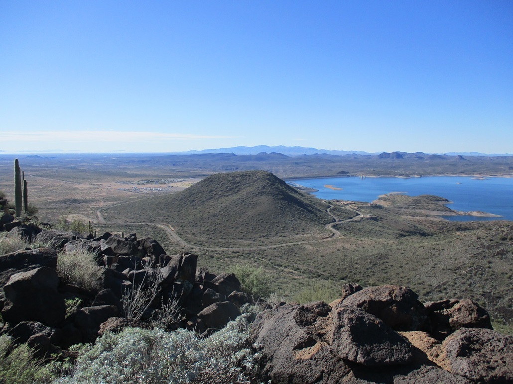
The paved road ends at a gate, where people can only pass with permission if planning to visit the Desert Outdoor Center, which lies at the end of the road and west of Peak 2249, on the shores of Lake Pleasant. Most of the action here is west of the main road, where there are marinas, jetties, an RV park, storage, stores, more parking, places for boats. East of the road is open desert.
Just before the gate, there is an opening to the right (east) onto the State Trust land. I drove onto this road, going in about a half mile to a mound of rocks piled up by the bulldozers. I parked off the road in a pullout. I was southwest of Black Mountain, which I would tackle first. I started walking at 10:05 a.m., temperatures warming into the 60s.
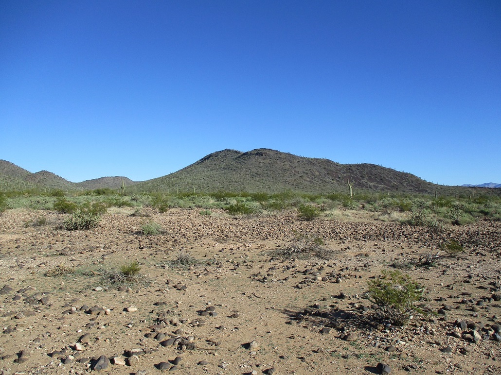
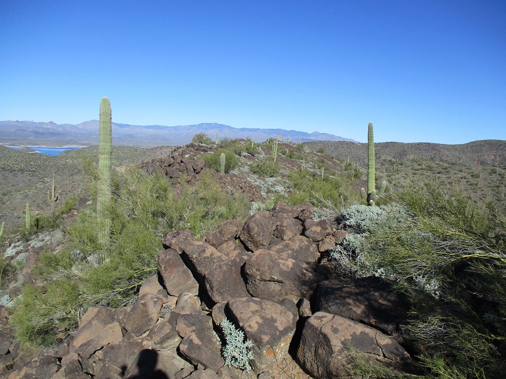
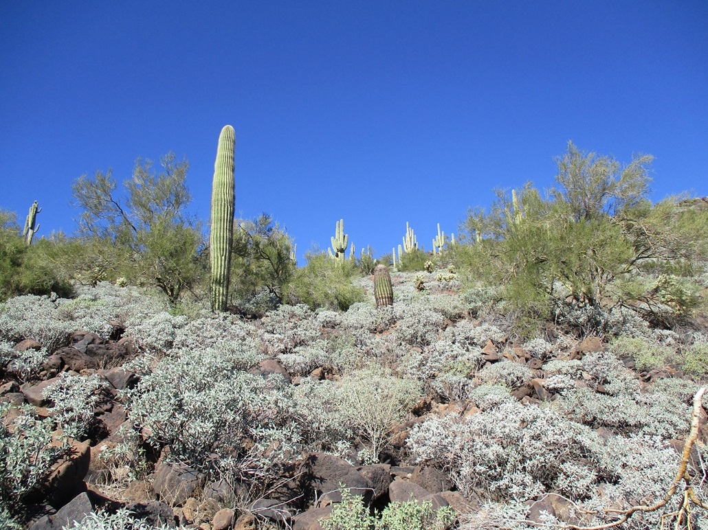
I had about a mile-long walk across the "flats" toward a low saddle on Black Mountains southeast tip. The mountain has a long slope going northwest to southeast, offering the best option for a route. Between my car and this low saddle was a lot of rocks, all about the size of softballs, footballs and soccer balls. There wasn't much room between them so I had to walk on them, slowing me down. There is also abundant cactus (saguaro, cholla), creosote, brittlebush, palo verde, and low grass in spots.
I got onto this low saddle, then just started the uphill march, going northwest. The rocks now piled into heaps with usually-dependable footing. The grade was lenient so the rocks tended to stay put. I still walked carefully. I wasn't concerned with moving a big rock. Now, the concern would be to stick a leg in an opening between two rocks, then move funny and bust a bone.
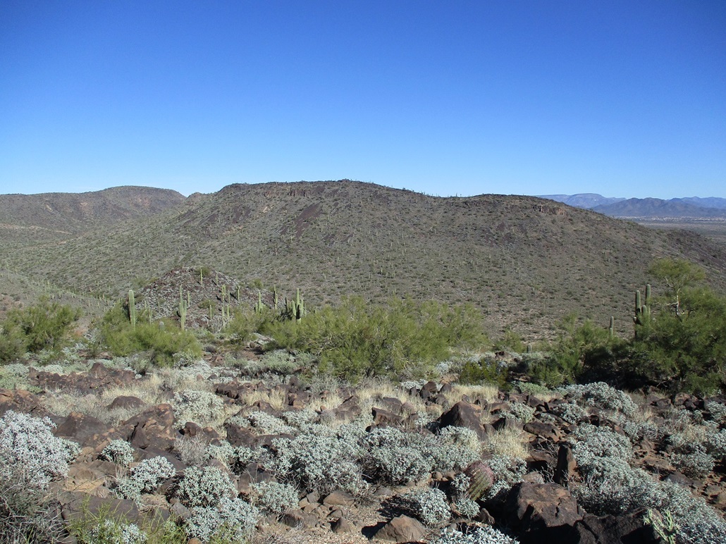
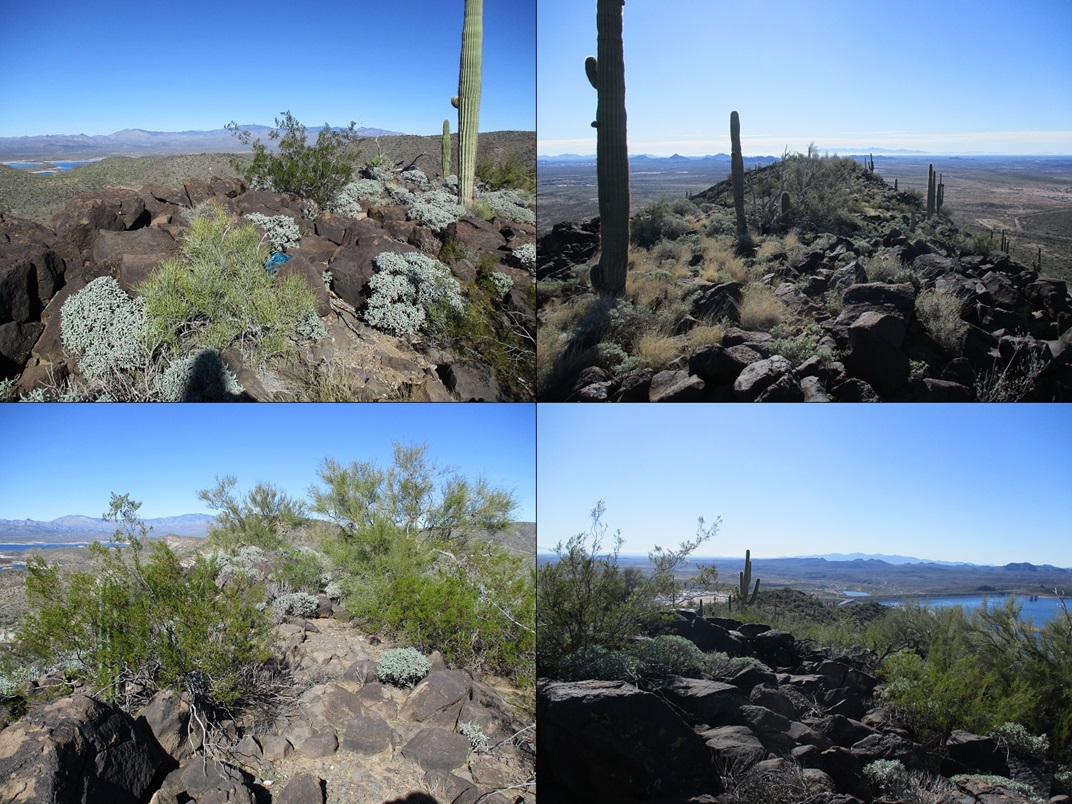
The uphill hike went well. I just went from one slope to the next, interspersed with short flat parts. The views were very good, and up here, a steady breeze cooled me, which was good because today was turning out to be a rather warm day (close to 80, as it would develop).
I emerged onto the summit, or so I thought. I was on the south end of a ridge that held about six knobs, of which all looked like contenders. So I simply walked to the farthest one, then back. I stopped and shot images, plus had a drink, but I found no registers, and a cairn only at the southern-most knob. I can't say for sure what knob is the highest.
For the descent, I walked essentially the same way down. I got to a lip still about 250 feet above the flats. I convinced myself this was the way I had come up, so I started down. Well, it wasn't the way I had come up. But since I'd dropped a few dozen feet already, I just kept with it all the way down. On this slope, the rocks were close to their angle of repose, and I was mindful of rocks rolling or tumbling from under me. I rolled a couple anyway, not intentionally.
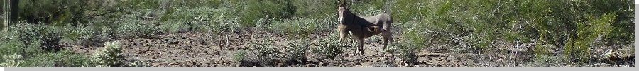
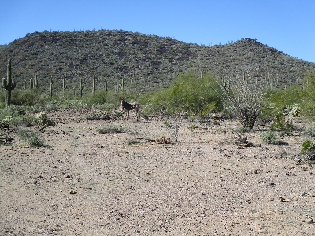
I was back onto the flats. I started aiming for Peak 2249. Some burros were in the area. I heard braying at times, as these hills have plenty of burros. These guys just stared at me. I hung a left to do an end-run around them, and in doing so, scared up a garter snake! It wiggled into the brush quickly. It was pretty obvious the way it moved it wasn't a rattler, even before I could see its tail end. Nevertheless, I kept an eye open for possible rattlers.
As it was, I was trending toward my car anyway, so I hiked back to it. I had some more drinks inside, and given the day's warmth, I could use an extra bottle. I also got lazy and drove back out toward the paved road, parking nearby. This would shave off a half-mile of walking each way for Peak 2249.
Elevation: 2,249 feet
• Prominence: 349 feet
• Distance: 2.4 miles
• Time: 75 minutes
• Gain: 475 feet
• Conditions: Warmer now
PB
•
LoJ
From where I parked, I walked north into the desert brush, parallel to the road, tracking slightly west. I was studying the slopes to eyeball one to follow up, but it became clear that just about any slope would suffice. I picked one roughly "centered" on the peak's southeast flank, near a small saddle and noticeable bump.
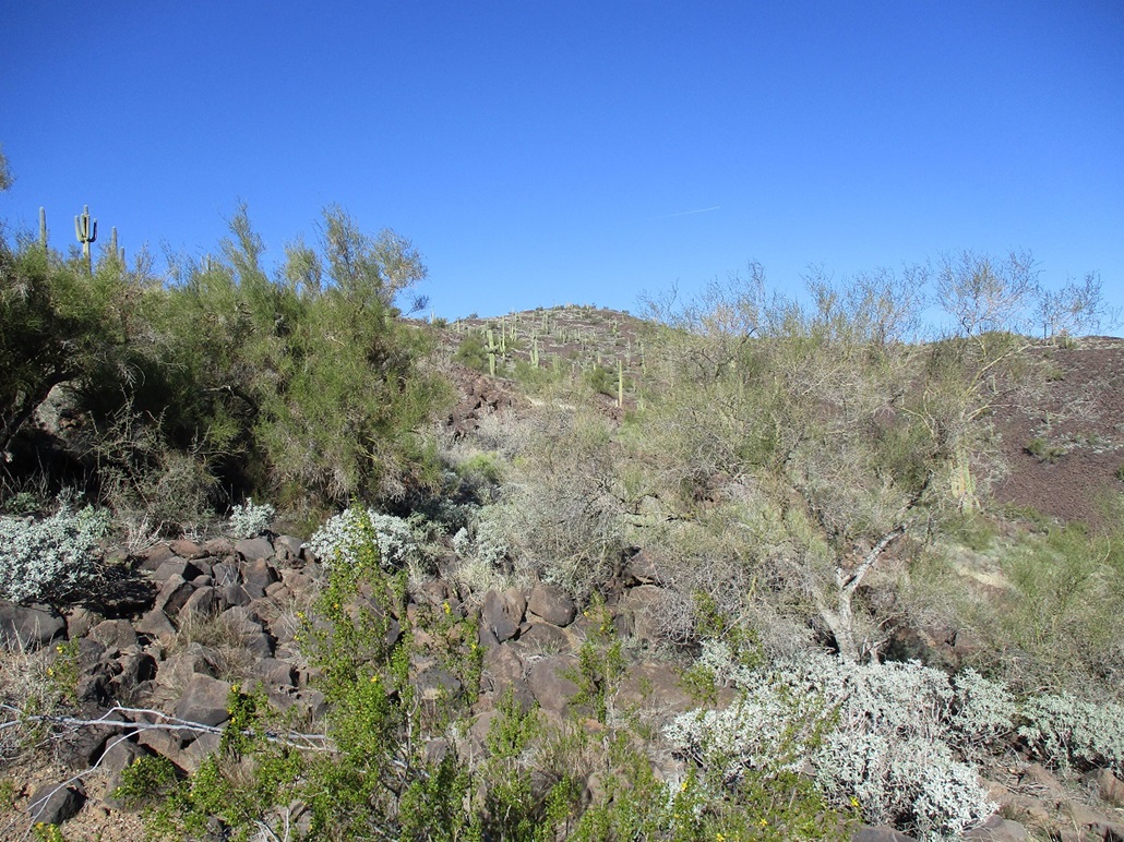
I was obliged to cross a barbed-wire fence, so I shimmied under it, then briefly onto the road, then off it and onto the slopes. The lower slopes featured more of the smaller rounded volcanic rocks, more prone to rolling. The brush was much thicker here, more brittlebush and creosote, and lots of saguaro. It was very pretty. These did not impede me, as I was able to zig and zag past any obstacles. In about 15 minutes, I had gained onto the top ridge.
The highpoint was still to the north. I ascended an easy slope of big boulders, then onto more flattish ground, and quickly, at the highpoint. Here, the "highpoint" was much more compact than on Black Mountain, but I still felt it necessary to tag a half-dozen rocks. I found no cairn nor register.
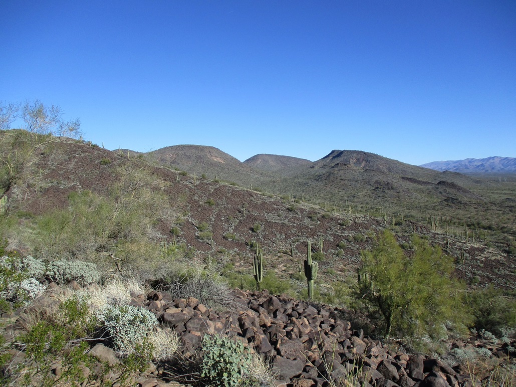
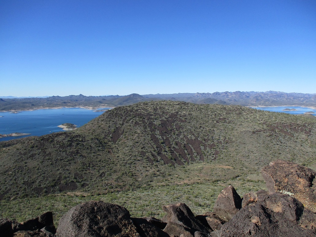
The views from up here were excellent. I could view dozens of peaks in the Hieroglyphics, Buckhorns and Bradshaw Ranges looking west, plus a great view of Lake Pleasant. I spent about ten minutes up top, looking around, chillin.
For the descent, I once again kinda-sorta followed my ascent route, but it didn't really matter. All the slopes looked equally friendly, and I was down and back to my car soon, this round trip taking a little over an hour.
I sat for a spell and relaxed, changing out of my hiking clothes into looser, more comfortable clothes. It was about 2:30 p.m. now, and warm, nearing 80 degrees. A huge snowstorm was raging over essentially the eastern half of the country, including a nasty hurricane-blizzard in Buffalo. And here it is, 80 degrees. I'm not gloating. It's just hard to fathom sometimes.
This was a fun and distracting way to spend the holiday. These two peaks likely don't see much visitation. I assume that most hikers will want to give this area a miss due to the traffic and the boat crowd. Access does not appear to be restricted. The road-access restriction seems to be directed at cars only. As I was exiting, a work truck was coming down that road. They paid me no mind, which suggests that the occasional hiker is probably to be expected, or at least tolerated.
|


|