
The Mountains of Arizona
• www.surgent.net
|
| Bill Williams Mountain |
• San Francisco Volcanic Field • Highpoint: City of Williams • Kaibab National Forest • Coconino County |
|
Date: June 3, 2006
• Elevation: 9,256 feet
• Prominence: 2,296 feet
• Distance: 7 miles
• Time: 6 hours
• Gain: 2,350 feet
• Conditions: Clear and warm
Arizona
•
Main
•
AZ P1K
•
PB
•
City HPs List
•
Interactive map
Bill Williams Mountain is the western-most of the "Big 4" volcanic peaks of the San Francisco Volcanic Field, along with (from west to east) Sitgreaves, Kendrick and the biggest of them all, Humphreys Peak. It is near the town of Williams, all named for mountain man Bill Williams of the 19th Century. Mr. Williams got around, as the Bill Williams River near Lake Havasu City is named for him, too.
For this trip, it would be a chance to get out of the heat of Phoenix, where the temperatures had reached 112 degrees the weekend before. This meant nicer, if warm, conditions up on the Plateau. We arrived in Williams the day before.
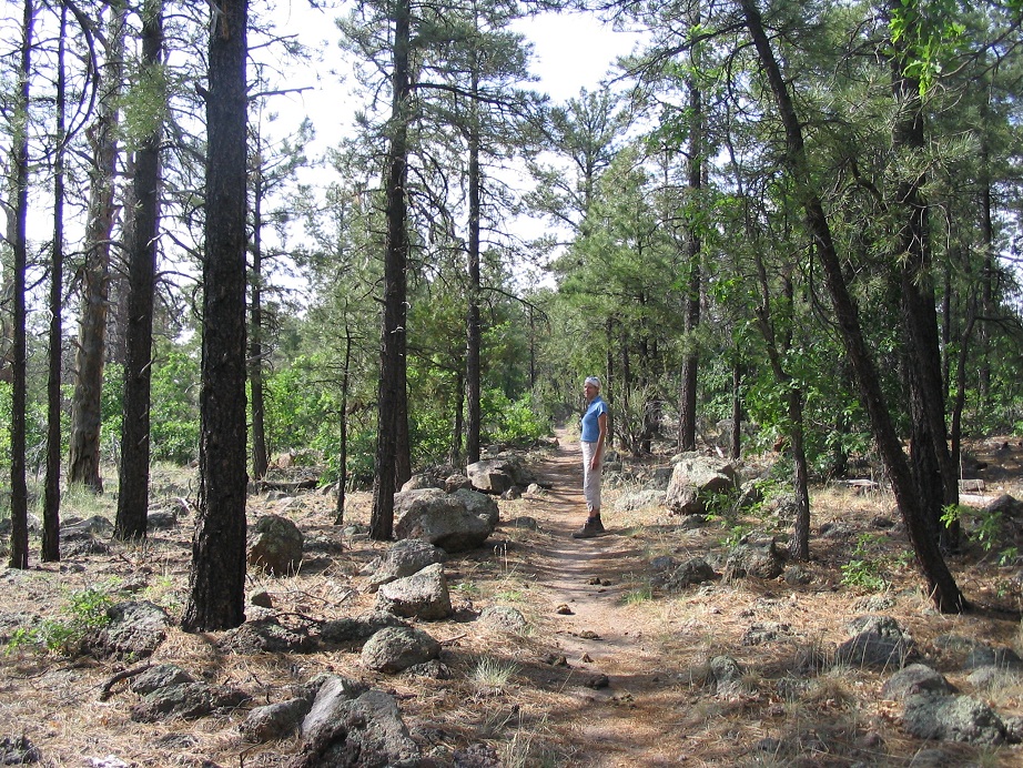
There are two options to reach the summit: a service road around the backside of the peak, or a trail (#21) up the north slopes. We wanted the trail, which was conveniently no more than a mile from town and easy to find. We drove to the trailhead about 10:00 a.m. after sleeping in, and started hiking at 10:30 in mild but warm weather, with no clouds.
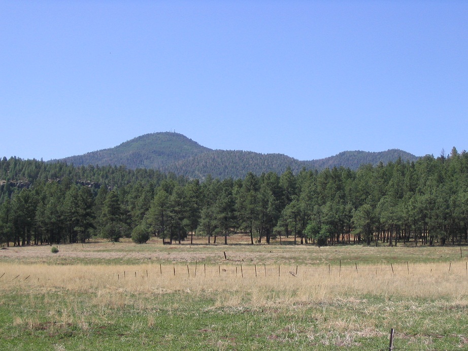
The initial segment runs across a flat meadow, the trail full of small rounded volcanic rocks. Shortly, the trail works up a series of short switchbacks that gains 400 feet to let out onto a higher plateau. Here, the bigger trees dominate, with ponderosa and spruce. The ground is rocky with many outcrops, but the trail itself was relatively rock-free. For this stretch, which covered about a mile, the gain was very lenient and even downhill in some places. The trees were just thick enough to block any views of the peak above us. Still, we made great time and were enjoying the hike. We took a break about 1.5 miles from the trailhead, having gained 700 feet. We'd been hiking 50 minutes.
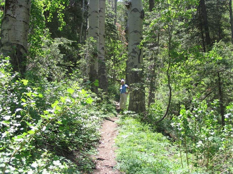
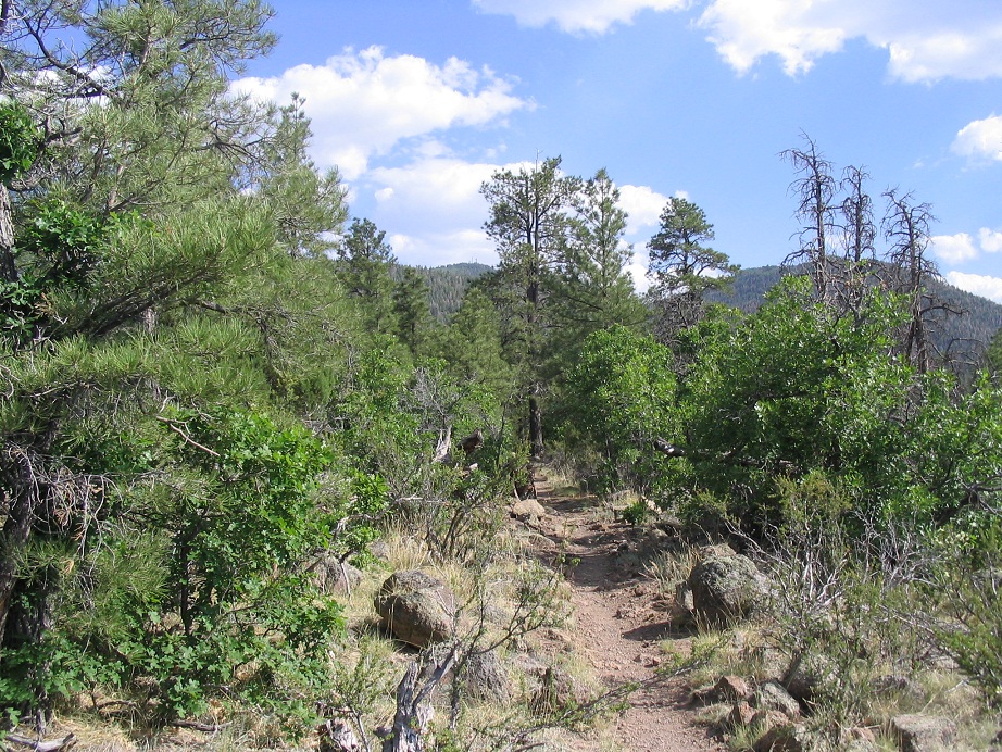
We resumed our hike as the trail worked its way in and out of one drainage, then up a gentle rise to a ridge before entering into a prominent drainage/canyon called West Cataract Canyon on the map (lower down from us, but still the same drainage). Quickly the trees and brush became more dense, with stands of aspen, fir and spruce, some of the largest we've seen in the state (see the photo at left, second one on the list). The undergrowth was thick, with many sections of clover brush hemming in the trails.
Although no water was flowing, the canyon was humid with all the greenery and transpiration, and the insects were abundant. The trail became steeper here, but not too bad, and always in great shape. We took another break at 8,500 feet, at the base of the final set of switchbacks that lead to the headwall. I tried to "be sure" with my GPS but I could not raise a signal. With the shade and the higher elevation, the temperatures had mitigated very nicely.
We followed the switchbacks up the canyon headwall, gaining the last 500 feet needed to come to the ridge and onto the forest road, from which we could see the summit (and its towers) again. We stopped again to rest, sitting on some benches. From here it was just a half-mile of easy road walking to the top. As we walked we could hear the buzz of distant motors, coming closer over time. It was a threesome on quadrunners: two kids and their dad. They motored on up to the top, and we walked up not long after.
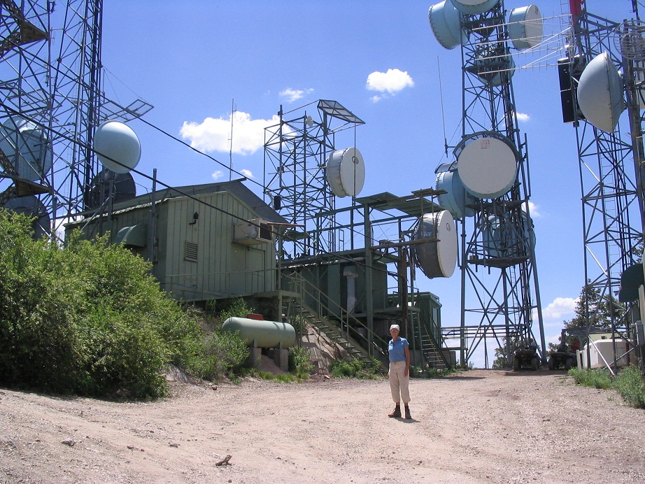
The top is choked with buildings and towers. The lookout was manned, his truck parked nearby, but we didn't want to bother him. We spent a few seconds seeking out the natural high ground. It seemed to me to be in two possible places: beside (or inside) a green building just south of the tower, or possibly, some rocks hidden in the brush north of the tower. We spent a few minutes kicking rocks, but the views were blocked by trees. The hike had been great but the summit itself was homely. Shortly, we began the downhill hike.
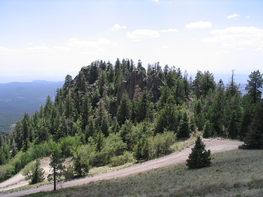
The man on the quad offered us a ride but we told him we were hiking down the other side. They seemed pretty cool. We walked back to the benches for another break. It had taken us about three hours to get to the top, going at a moderate pace with three extended breaks. Views of the countryside from the top are limited by the buildings and trees, but at points along the road we had good views, mainly looking south. Finger Rock, an interesting rock outcrop nearby, was worth a photograph. The trailhead sign says the trail is 3 miles, but we weren't sure if it included the 1/2-mile road segment to the top. My hunch is the hike was more than three miles one way, but definitely not four.
The walk out went well, taking it slowly, and having one long rest halfway down. We could feel the warmth again of the lower slopes, but overall we had no trouble at all, and were back out to the car about 4 p.m. We drove back to the hotel for showers and a dinner at an old 50s-style diner in town. While we knew it would be a fine hike (it's one of the most popular trails in the state) we were still surprised by the abundant green of the high canyon, and the overall fantastic shape of the trails. None of that annoying loose rubble anywhere. It was warm and we only saw about 10 other people, but I can imagine this being packed on a cooler, pleasant fall day.
|

|