The Mountains of Arizona
www.surgent.net |
|
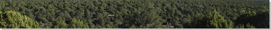
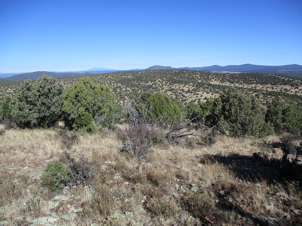
Big Hill • Oak Hill • Bald Hill Cedar Flat is a plateau rising east of Camp Verde, abutting the higher Mogollon Plateau to its east. Highway AZ-260 crosses between the two locales and south of Cedar Flat. Steep canyons such as Clear Creek and Wet Beaver cut the lower plateau, draining westward into the Verde River. Surrounding Cedar Flat are a number of hills, all with very broad profiles covered in piñon and juniper, too low for the bigger ponderosa pines. The ground cover is grass with some cactus, and scattered brush. Combined together, this is very lovely, somewhat remote country. Our main objective today was a pair of ranked "peaks", Big Hill and Oak Hill, both lying adjacent to one another. Back in July, Matthias and I teamed up to climb Horse Knoll, which lies about 4 miles east. We had intended that day to visit these two hills as well, but the roads from that direction were abysmal, so we cancelled the hills and concentrated on Horse Knoll. Matthias picked me up from the Denny's on Carefree Highway near Interstate-17 about a half hour before dawn. About an hour later, we exited onto AZ-260, stopped for gas and snacks, then drove east on AZ-260 a few miles to Coconino Forest Road 618 "Beaver Creek Road", heading north. About four miles later, we turned right (east) onto FR-214, signed as "Cedar Flat Road". This road gains steeply about 1,800 feet over four miles to top out on the south edge of the Cedar Flat. Much of this road is a narrow shelf road with no room for error, drops of many hundreds of feet into the Clear Creek Canyon below us. But the road itself is in decent shape, 4-wheel drive not necessary, although reasonable high clearance is. Once above the canyon, the road swings north and gains gently toward Bald Hill, which would be our last hike as we exited for the day. The road achieves an apex, then drops into the actual Cedar Flat, a big expanse of meadow and woodland. The road continues northeasterly for a few more miles to a point where it makes a hard right at milepost 11. Big Hill rose to the north, Oak Hill not visible behind it. The road's condition stayed about the same, mostly smooth with segments of mid-sized rocks and a few ruts. A Subaru Forester would be able to handle it if driven with care. In wet weather, this road gets muddy. Matthias eased onto a lesser track, FR-9246J, which we hoped would cut off some walking mileage. We got in about a half mile, passing a gate along the way. The road became too rocky to continue, so he parked in a clearing. It was 8:40 a.m., clear and sunny, and a stiff breeze. Outside temperature was in the high 30s, so it was a cold breeze too. We bundled up and started walking.
Date: November 19, 2022
• Elevation: 6,608 feet
• Prominence: 348 feet
• Distance: 8.8 miles (includes Oak Hill portion)
• Time: 4 hours, 30 minutes
• Gain: 750 feet net, about 1,550 gross
• Conditions: Clear, bright blue skies, cold and often breezy
• Teammate: Matthias Stender
• Prog-rock bands played: Wobble, Stick Men
Arizona
•
Main
•
PB
•
LoJ
We followed the road northward. Any thoughts that we could have driven farther were quickly dispelled. The road drops about a hundred feet into a drainage and is very rocky, including big ones that would require very high clearance. As we crossed this small drainage, a small pond was iced over.
The road ascends upward, crosses through more light forest, then drops into a second drainage, another hundred-foot drop. Ascending its opposite bank, the road branches and one track curls east toward Anniversary Tank. It looked like the better road so we followed it briefly, but the other branch was the one we wanted. We just went uphill through the grass and trees until we met the road again.
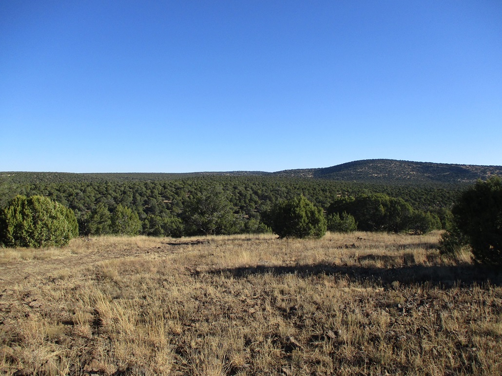
The next mile or so is a gentle uphill slope through more meadow than trees. Big Hill was visible in front of us, Oak Hill still kind of obscured. We passed another gate, and came to a junction with FR-214C. We stayed straight with a slight right, and kept walking until we were within the crook separating Big Hill and Oak Hill. On the map, this is called Fivemile Pass. To here we had walked about two miles and gained about 400 feet net, or close to 600 if the regains out of the two drainages are counted. The sun was higher now, warming things slightly, but it was still chilly and occasionally a breeze would kick up and remind us of that.
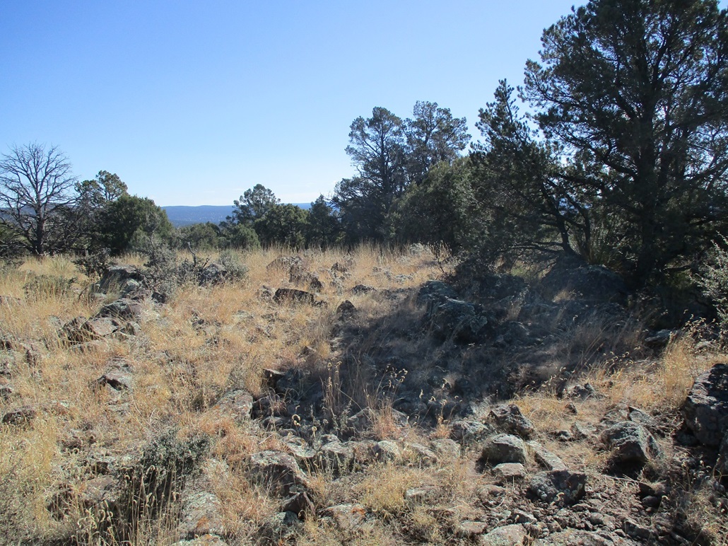
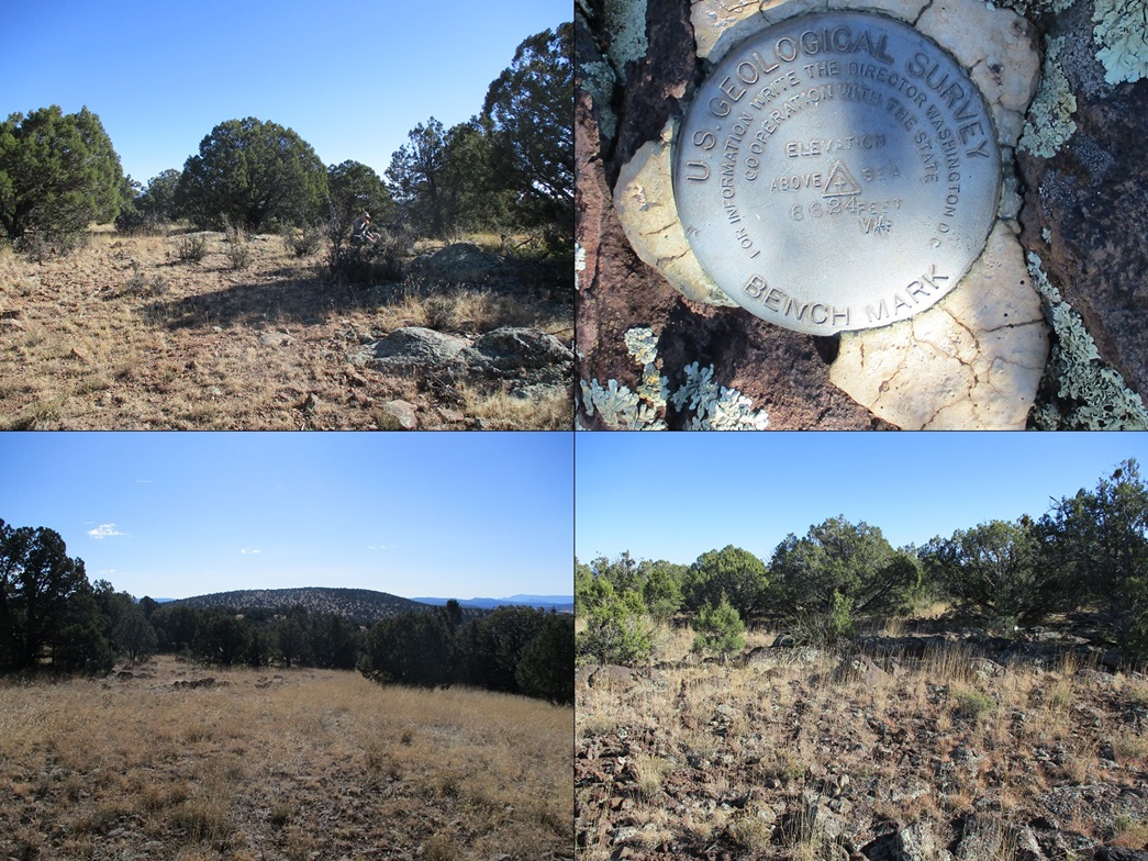
After a break, we turned south and started up the easy slopes toward Big Hill's summit, about a half mile away. We came upon a fence, which was not expected. This fence was well constructed with posts every 5 feet and very taut. We had to find a spot to wiggle underneath. The rest of the uphill hike went well. In about fifteen minutes, we were on top of Big Hill, the top, not surprisingly, being broad and indistinct. Three or four rocks could be the highest point. One contained an unexpected surprise, a benchmark. There is no marker on the map, and looking it up later on the USGS websites, it is not documented. It was just stamped with an elevation and "VA". It states the elevation to be 6,624 feet, differing from the spot elevation of 6,608 feet on the map.
We lingered up here for a few minutes and took a break. The trees helped shield us from the breezes. There were no views from the summit itself, but from points along the slopes, we had fantastic views of the surrounding countryside. Oak Hill took up most of the view looking north, but we could also see Humphreys Peak clearly, and the silhouettes of Kendrick, Sitgreaves and Bill Williams easily, and way way off to the northwest, Picacho Butte.
We hiked downward, and re-wiggled our way underneath that fence back toward the road. A small drainage ditch parallel to the road is, I suppose, the super-technical place where Big Hill morphs into Oak Hill. So we stepped over the di...
Elevation: 6,589 feet
• Prominence: 309 feet
LoJ
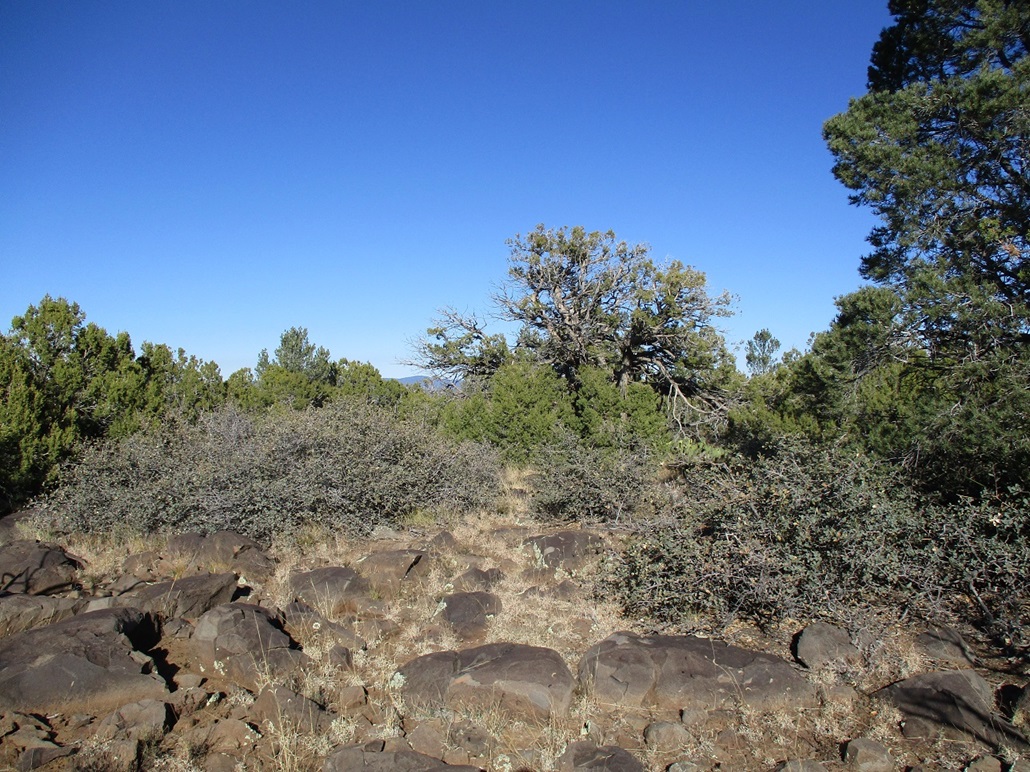
..tch, and started up the equally-gentle slopes toward Oak Hill's summit, which Matthias said was about 0.6 miles away. The shape of Oak Hill required us to curl around its summit ridge, and in fifteen minutes, we were on top of Oak Hill, a small flattish platform surrounded by rocks. Again, any one of about ten of them could be the highest point.
The only indication that this may be an important place was a small iron bar driven into the dirt near a rock, possibly from the surveyors of yore when they determined the spot elevation. However, I pulled it right out (I was testing it to see how firmly it was placed). So I stuck it back in. Given how few people come here, it's possible this bar has always been placed this way, and no one's come by to take it. Who would want to walk off with a foot-long iron bar? Ace Hardware sells these things for a buck or two anyway.
The summit contour is big enough to make us suspect that a higher point may lie north a little bit, so we walked that way too, and tagged rocks. There was no easy way to sight between the two areas, nor did we want to. Tagging these rocks covered all bets.
We descended on a southwesterly tack and re-met with the main road slightly west of where we had left it about an hour earlier. Our task of climbing both Big and Oak Hills was now complete. I doubt these hills see much visitation. Hunters probably, and they would not be necessarily interested in their respective highest points. It's entirely probable that more people have stood atop Mount Everest than on these hills.
Once back on the road, we walked it back to Matthias' vehicle, arriving at 1:30, a four and a half hour hike. Although the net difference in elevation from the car to Big Hill's summit was about 750 feet of gain, when the gain to Oak Hill's top, plus the two losses and regains in those drainages is accounted for, our overall elevation gain was closer to 1,550 feet. Matthias said we'd hiked 8.8 miles. To see our path, click here.
Elevation: 6,182 feet
• Prominence: 382 feet
• Distance: 1.1 mile
• Time: 40 minutes
• Gain: 163 feet
• Conditions: Cool and breezy still
PB
•
LoJ
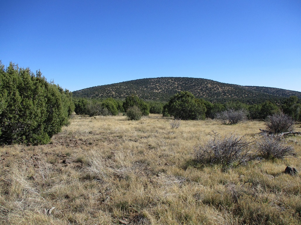
For the drive out, we would be passing over Bald Hill's northwest slope, so we agreed to stop and hike this hill as our bonus peak for the day. Bald Hill is extremely broad, the slopes nearly imperceptible. And it's not bald. It is covered in piñon and juniper all the way up. Ironically, it has higher prominence than both Big and Oak Hills.
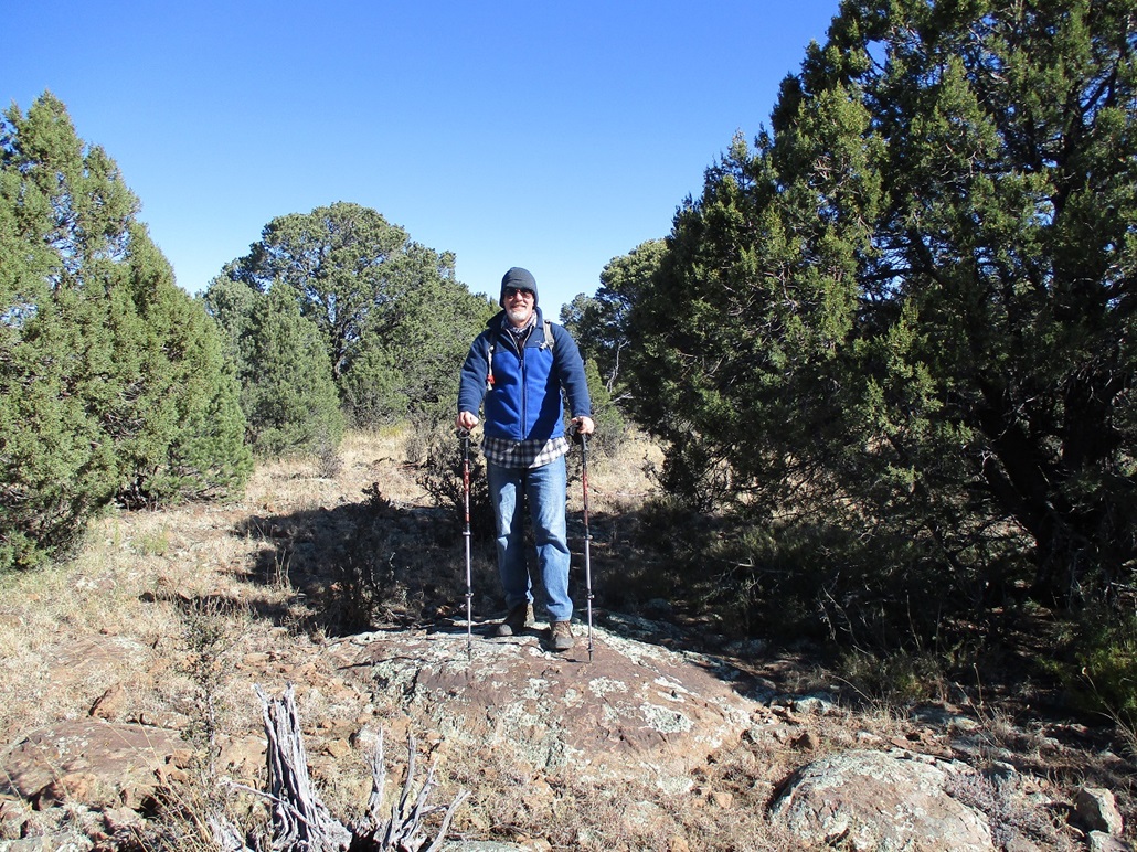
We parked along the road at its apex, figuring it would mean less elevation to gain. The hike was quick and unexciting. We hiked on a southeast bearing to the top, and once there, had to determine if this really was the top. Trees limit views, so we spent time checking out anything that looked promising. It's rocky up here, lots of boulders jutting up from the ground, but no rock formations taller than waist high. We spent perhaps five minutes stepping on things. Since the top was anyone's guess, I chose an image with a tall juniper in it as my summit shot.
We walked out the same way, egressing onto the road a little south of where we parked. We were gone just a half hour or so. This was not an exciting peak nor one I would recommend unless you already happen to find yourself on the road nearby it. We changed out of our hiking clothes and got things packed for the drive out. Just then, a Jeep came rumbling up, then a minute later, someone pulling one of those massive 30-foot camping trailers.
I mentioned the road was decent, but I'm not so sure for a big trailer. It is bumpy, and a trailer of that size and with its high center of gravity would lean and jiggle more than a truck or Jeep with a low center of gravity. That road is narrow with hundred-foot drops, and even a tiny yaw would be terrifying. I would never drive such a trailer up such a road, but that's moot because I would never buy such a stupid thing to begin with. Had we been driving down five minutes earlier, we would have met this person coming up, and bypassing one another would have been difficult on some of the narrower segments. I really do wonder about the judgement skills of some of these trailer-hauling people.
This hike covered 1.1 mile, says Matthias. That means we hiked 9.9 miles today. These were some of the easiest 9.9 miles I've ever hiked. I was not sore at all afterwards, and I barely broke a sweat the whole time. We looked at a couple more peaks in the area that we'll likely come back for in the future, but we were happy with the three we got today. It's a pretty area with almost no people to get in your way.
The drive back to Phoenix took a little over an hour. Traffic wasn't too bad. Matthias dropped me off at my car, and after handshakes, he took off while I stuck around to get me a Pho meal from a Pho place nearby.
|


|