The Mountains of Arizona
www.surgent.net |
|
Peaks 3279 & 3260 • Peak 3069 I hiked these three peaks on two different outings in November and December 2023. I had planned to do all three on one hike but the first hike ran long and it was warm, so I put off the second hike another couple weeks as things cooled down.
Date: November 15, 2023
• Elevation: 3,279 feet & 3,260 feet
• Prominence: 219 feet & 310 feet
• Distance: 3.5 miles
• Time: 2 hours, 40 minutes
• Gain: 1,100 feet (gross)
• Conditions: Warm and overcast
Arizona
•
Main
•
PB
•
LoJ
I returned here almost two years after climbing Peak 3342, to try my luck with Peak 3260, which lies less than a mile away from Peak 3342, but separated by a deep canyon and cliffs.
This was completely impromptu. I spent the morning doing actual work (from home), but by 11 a.m., I was feeling antsy to do something. The weather was overcast and slightly warm, about 80° in town. But it wasn't too hot to hike. I got online, looked for some peaks I hadn't yet climbed, saw this guy, and decided to go for it. I did not want to drive very far.
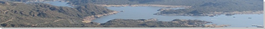
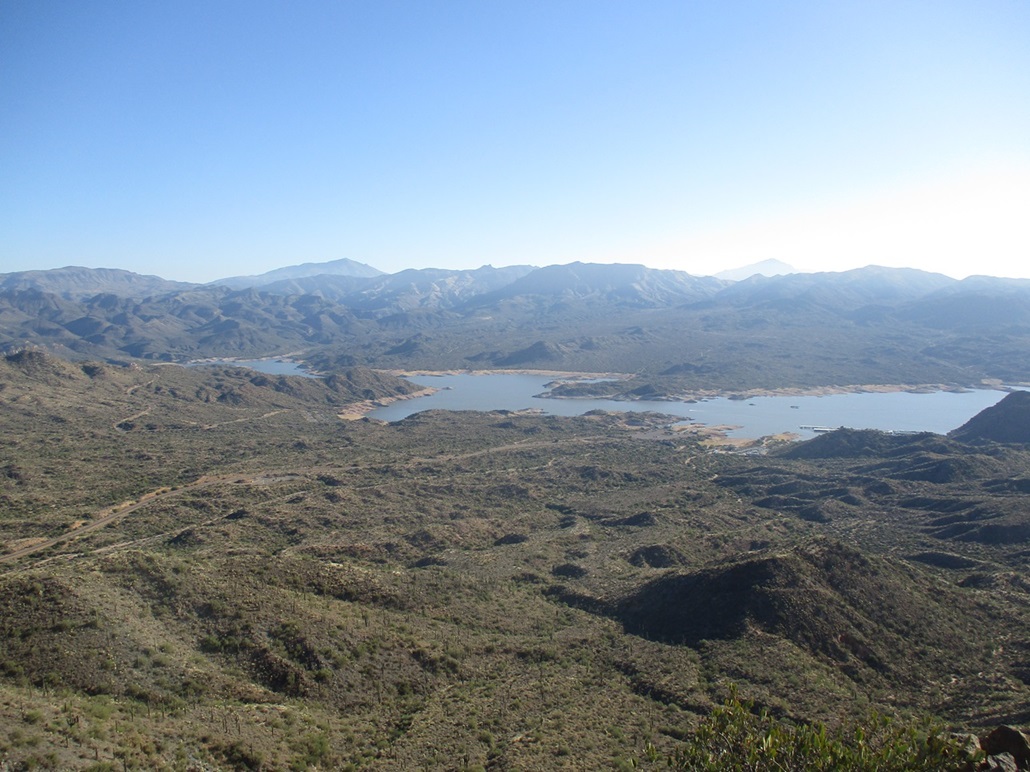
I was on the road about noon, driving north on the Loop-101 freeway to Scottsdale Road, north to Cave Creek, then north and east, onto Bartlett Lake Road. I drove to the Indian Springs Wash pullout. The peak rises a half-mile south but peering down the canyon (called Bootleg Canyon) formed by this wash, the sides are cliffs or way too steep a slope to hike safely. The peak was easily visible, but was not approachable from this way.
I drove back west a little and inspected the slopes, looking for a way up the wall of cliffs that line the road. I found one I liked, so I parked (at roughly milepost 7.5), got suited up and started walking at 12:45 p.m..
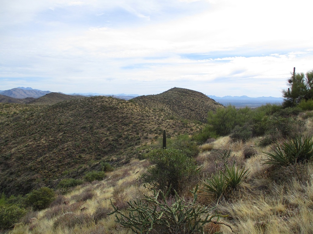
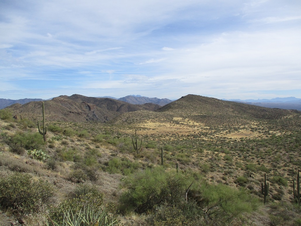
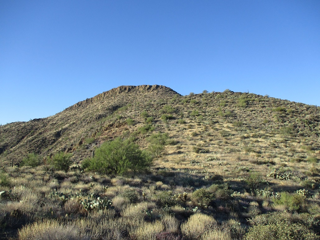
I was across the road from a hill marked by spot elevation 3,274 on the topographical map. There was a steep but uncomplicated slope up to this peak, which I followed. When I was about 75 feet below this hill's top, I angled left and sidehilled. I could see a big blocky peak in the near distance. I assumed it to be Peak 3260, which was my intended goal for today.
The terrain was the usual blend of loose and rolling rocks, brush and grass, and plenty of cactus and rock outcrops to keep things interesting. It was warm and humid due to the low cloud ceiling. I watched the ground carefully for snakes.
I descended to a saddle, then ascended and sidehilled right of the next hill, placing me on the ridge toward Peak 3279. The brush and rocks were more abundant on this ridge, but I was able to summit this peak about 40 minutes after starting, feeling proud of myself. Then I looked across the way and saw Peak 3260. I had climbed the "wrong" mountain. Yeah, I was a little annoyed with myself at that moment.
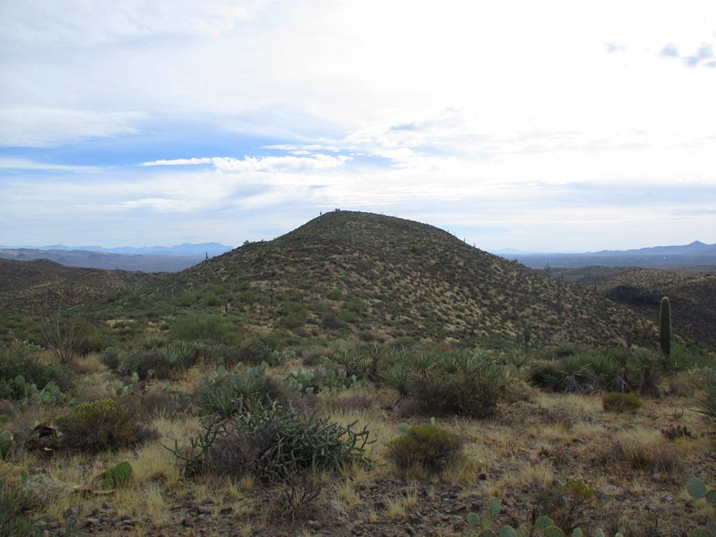
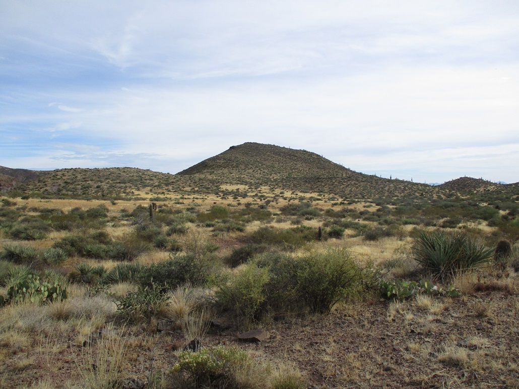
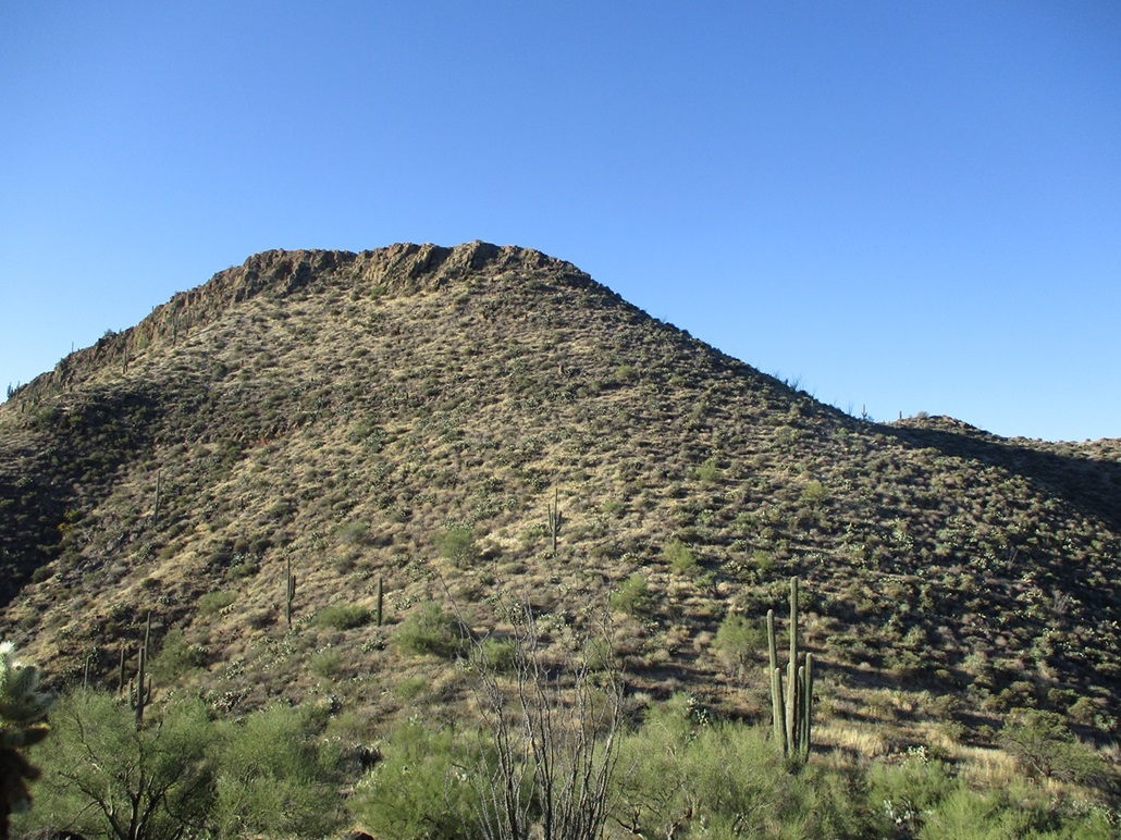
I descended north and then eased east and dropped more elevation to place myself in a broad flat meadow northwest of Peak 3260, then walked up its slopes to the top. The summit features a few rock piles, the northernmost one with a noticeable pointy rock being the highest. I tagged anything else that looked as high. I took a break beside the top rock and found a register well hidden in a rock pile below the top, in a rock crevice. I was the first to sign in since 2018, only the second overall. Lists of John only reports about 6 or 7 visitors to this humble peak.
I rested a few minutes up here and looked around, having a drink break. Views were okay, everything muted due to the cloud cover. I did not realize it at the time and only noticed later when looking at my photos, but Weavers Needle could be seen rising above the Superstition ridgeline about 45 miles to the southeast.
For the hike out, I followed any open lanes or game paths I could find, then reclimbed the sequence of low hills necessary to get me back to Peak 3274. I looked at possible bail routes from up here but could not be sure they would work and I didn't want to descend most of the way down only to be cliffed out. So I grunted upward and downward and upward until I was above my initial ascent slope, which I followed down to my car.
I was beat after the hike, taking a lot longer than I expected it would. It was 3:25 p.m. now and I was soaked. I changed into drier clothes then drove out, following the same city streets back to Scottsdale and the 101 Freeway, where I sat in traffic until I could leave the freeway closer in to Tempe. My reward: a falafel gyro from the Haji Baba grocery in Tempe on Apache Road.
In retrospect, I am happy I erroneously climbed a different peak. It actually has higher elevation than Peak 3260 and a prominence figure of about 220 feet (mean). I was happy to tag Peak 3260, and other than the general warmth, had a good time, and surprisingly, saw no snakes.
Date: December 8, 2023
• Elevation: 3,069 feet
• Prominence: 309 feet
• Distance: 2.4 miles
• Time: 2 hours, 15 minutes
• Gain: 990 feet
• Conditions: Cool, sunny and blue
PB
•
LoJ
I had a day open after cranking out 90 graded exams late last night at a Denny's, my last final exam of the semester. I wanted a local peak so I could be back to my Tempe-apartment-for-just-one-more-day before noon to take care of submitting grades and the many students emails that invariably follow. So I focused on this peak, which lies a mile east of Peak 3260. The weather was expected to be very lovely, with blue skies, no clouds and temperatures in the 60s.
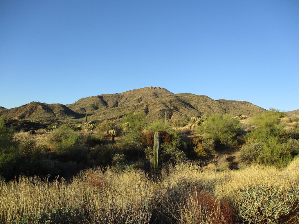
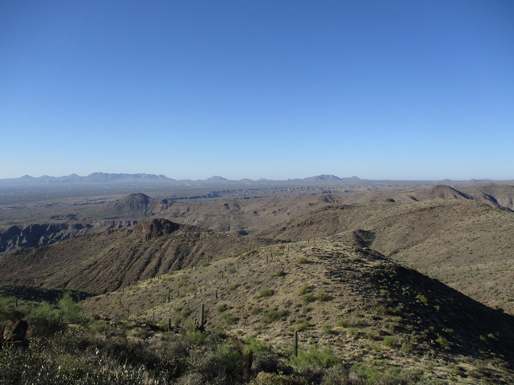
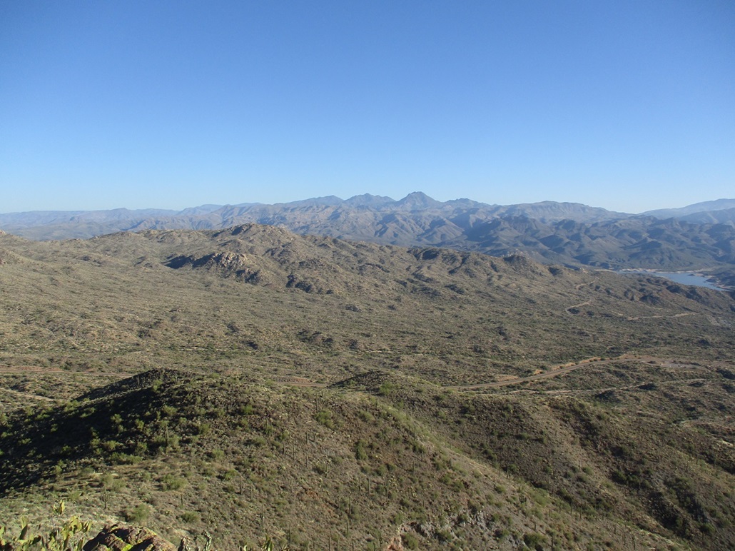
I was on the freeway at 6:30 and onto Bartlett Lake Road about 45 minutes later, traffic in town being heavy but not atypical. I bought a day pass at the self-serve kiosk, then drove Bartlett Lake Road most of the way to the actual lake, about a dozen miles. Peak 3069 rises about 1,300 feet above the lake, fronted by a wall of cliffs on its highest ridge.
I drove first to what looked like a bus/RV parking lot, but it was empty. I then drove back a mile up the road to look for a place to park and to study the ridges better. I didn't want to park alongside the road so I drove back to the bus/RV lot, which was still empty, and parked on a dirt shoulder. I got dressed for the hike and started walking at 8:15 a.m.
I followed the road back west about a half mile, then dropped into the parellel arroyo, pushing my way through some tangly brush. Then I searched for a way up onto the slopes. The arroyo over the years has cut the base of the slopes into loose and crumbly 10-foot high "cliffs", and finding a way up and past them took a few minutes. I finally found a spot that was merely steep, loose and choked with brush, but it worked and I was now up onto the slopes, where the gradient laid back and the walking became much easier as a result.
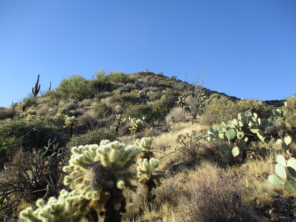
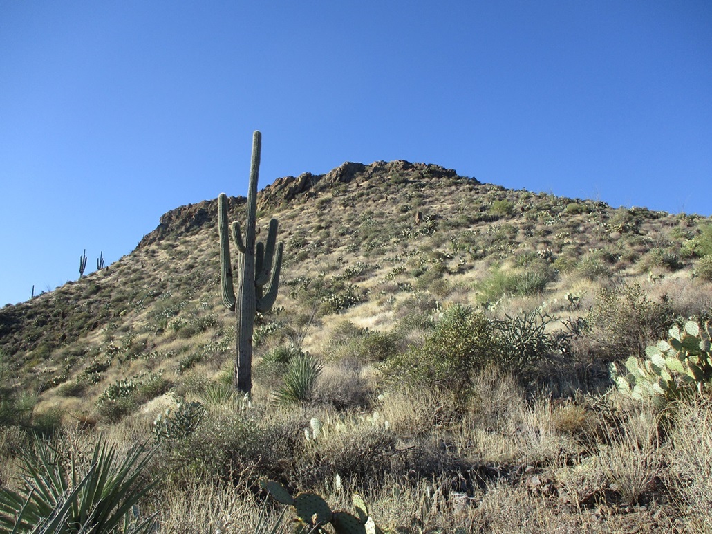
The slopes feature the usual mix of grass, palo verde, prickly pear, pencil cholla and regular evil cholla, and rocks of various size and rollingness. But there were lanes virtually the entire way and wandering through the plants and rocks was easy. I gained the first slope to top out on a rocky knob, where I could see the peak again. I was about a third of the way up.
I angled right and started up another slope, again topping out onto a rocky knoll, then down about 30 feet. The peak was much closer now, its cliffs much more evident, but also, ways around the cliffs became clearer too.
The last slope got steep as I closed in on the base of the rocks. I angled right but also followed any chutes or ramps upward as I found them. The rocks were big volcanic things, some covered in colorful lichen. The scrambling was normal Class-2, maybe 2+ where I had to work up a 6-foot section and being too lazy to find a work-around.
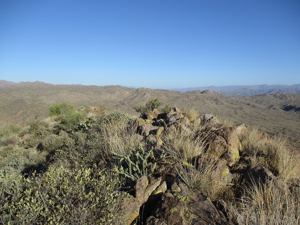
Now on the "back side" (the north and west-facing slopes), the scrambling became much easier, and I was soon on the north tip of the summit ridge, the summit visible about a hundred feet away, maybe 15 feet higher. I was at the top in minutes, and took a seat on a good sitting rock near the cairn that held the register. I was the first to sign in for 2023, and only the fifth overall to sign in since 2012.
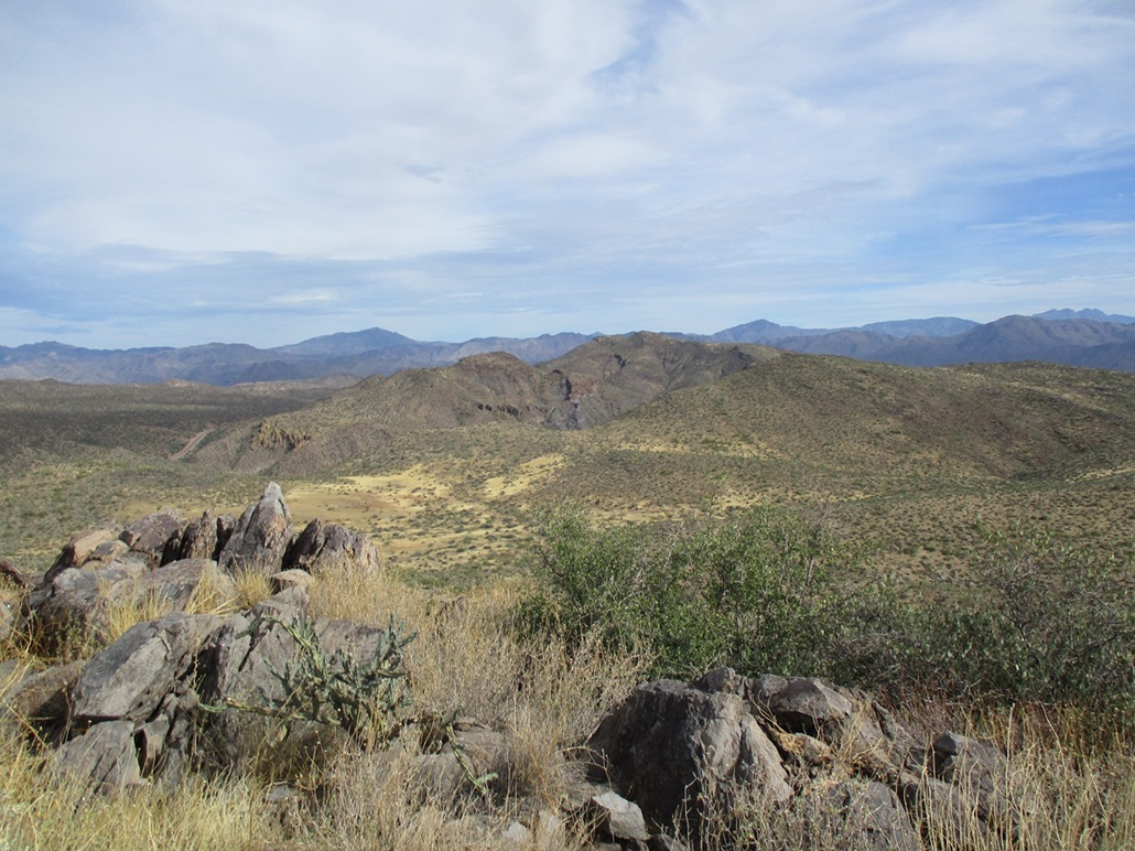
Views were fantastic, the air so dry that shadows and detail could be seen on peaks miles away. I spent about fifteen minutes on top, enjoying the views and the conditions. There wasn't any breeze to chill me, the temperature now in the mid 60s, all very comfortable.
I descended the same way, there being little room for variation. I even found my own bootprints and pole holes in the ground from an hour earlier. It had taken me 65 minutes to make the ascent, and 55 minutes to descend back to my car.
This was a fine hike with few obstacles. I did catch a couple cholla balls on my pants leg and also brushed up against a prickly pear which resulted in the hair-like needles in my skin that I was pulling out two days later. I enjoyed the hike and appreciated the fine conditions. This will likely be it for me for these Bartlett Road peaks. There are just two that remain, one is a boring ridge that doesn't interest me and the other is a spire that may be too much for me.
I got back to my "place" in time to submit grades and address student concerns, then spent the rest of the day getting stuff organized for tomorrow's all-day marathon of renting a U-haul, ferrying my big furniture items to my new place, then returning to Tempe to drop off my truck. The truck's brakes did not work well and more than once I got my adrenaline going, wondering if I was going to run into the guy ahead of me. I had to put all my weight on them to get them to respond.
I type this now sitting in my Tempe apartment, the last night I will spend here. Tomorrow the 11th, I will pack the remaining small stuff into my car, and clean up the place, and leave it except to return in a week to formally check out. I moved here in July 2021 under very difficult circumstances and spent 29 months here. I am happy that this chapter of my life comes to a close. The apartment wasn't bad, but I need to move on from what it represented.
|


|