The Mountains of Arizona
• www.surgent.net
|
| Bart Benchmark |
• Verde River Valley - Bartlett Lake • Tonto National Forest • Maricopa County |
|
Date: December 21, 2019
• Elevation: 3,127 feet
• Prominence: 327 feet
• Distance: 2.5 miles
• Time: 2 hours
• Gain: 970 feet
• Conditions: Sunny and cool with a steady breeze
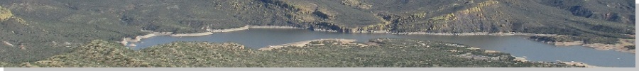
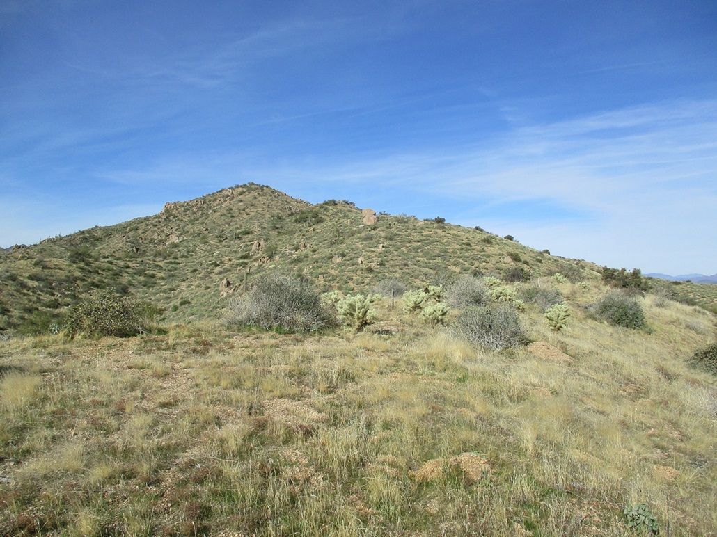
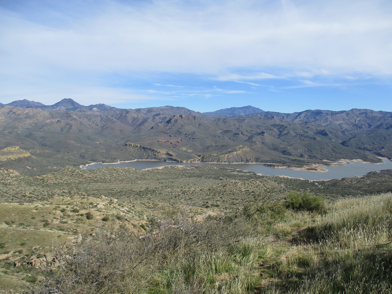
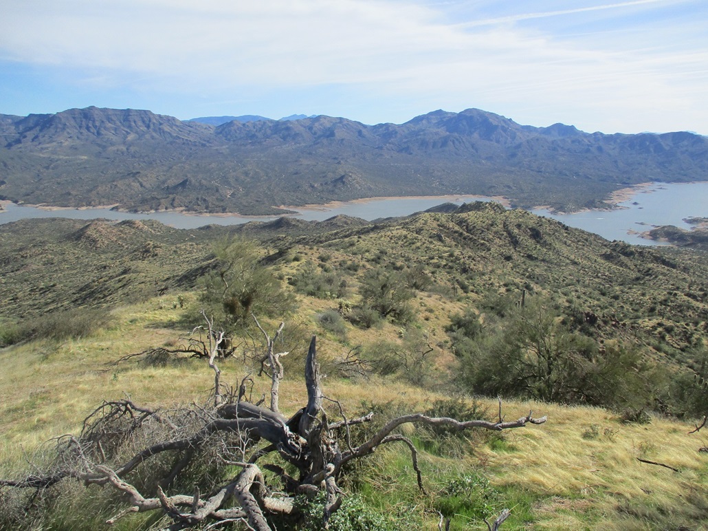
Bart Benchmark is a hill on the slopes rising west of Bartlett Lake. It's summit elevation is 3,127 feet, but is over 1,200 feet higher than the lake waters, so it is a good perch to view the area. I was vaguely aware of this hill in my studies of the maps of this region, but then I saw a description on HikeArizona and that was enough to prompt me to go hike it.
Today was like recent days: a couple hours of work-from-home at the computer, then a desire to get the hell out of my home and go do something. I got some maps together and was on the road a little before 11 a.m., grateful that I don't have to be rolling before dawn to beat the heat. Today was sunny with some high clouds, the front of a storm that would move in two days later.
I drove up to Cave Creek, got gas and food, plus a Tonto day pass just to be safe. I followed the usual route toward Bartlett Lake. As the road descends toward the lake, about 14 miles from where it left Cave Creek Road, I turned onto northbound North Lake Drive (Tonto FR-459). I went north a mile or so, to where the road tops out at an apex in a road-cut through a hill. I parked slightly beyond the apex, in a small dirt pull-out. Traffic was light today, and not many people come up this specific way.
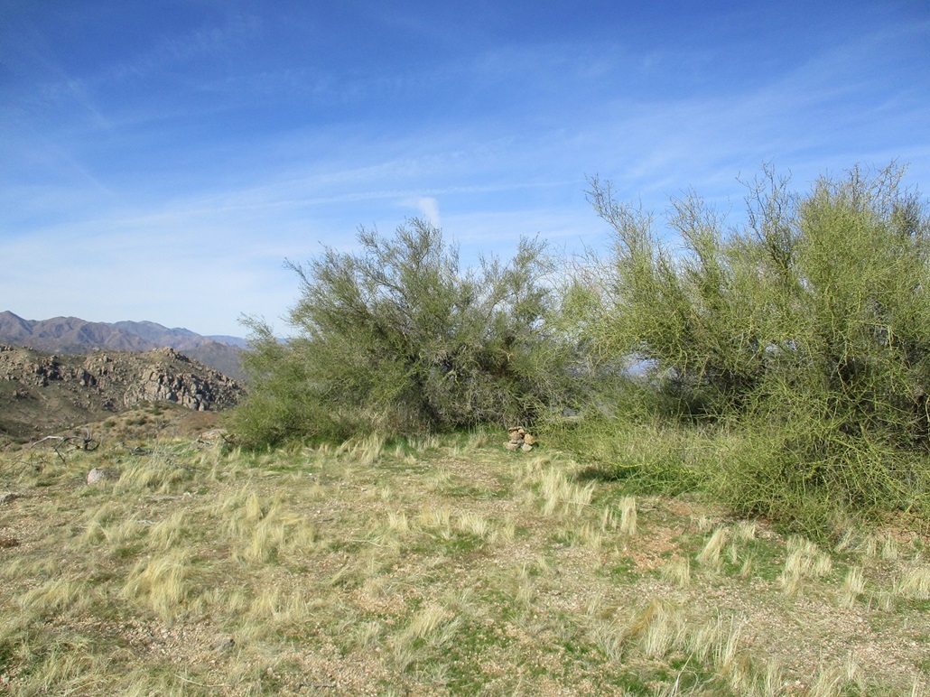
This hill with the road-cut was the main southeast ridge of Bart Benchmark hill, so it made sense to get onto it as soon as possible, and just follow it to the top, about a mile to the northwest. I entered into the brushy desertscape and then up a slope, gaining steeply to one small hilltop, then down to a fence-line, which was easy to cross.
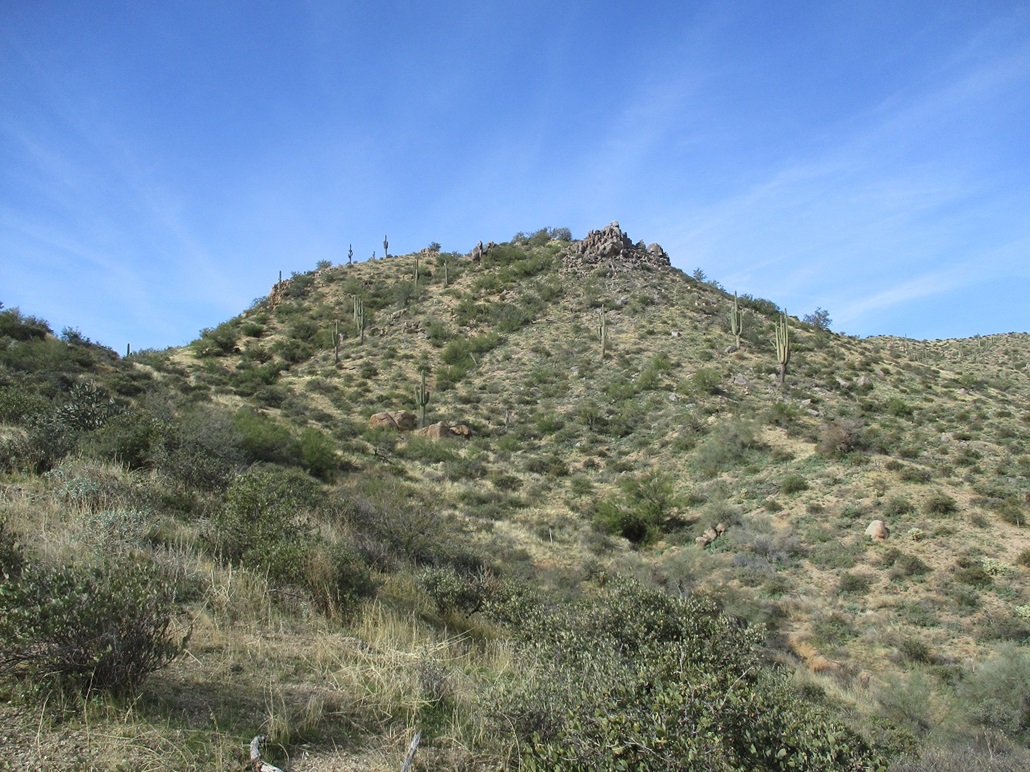
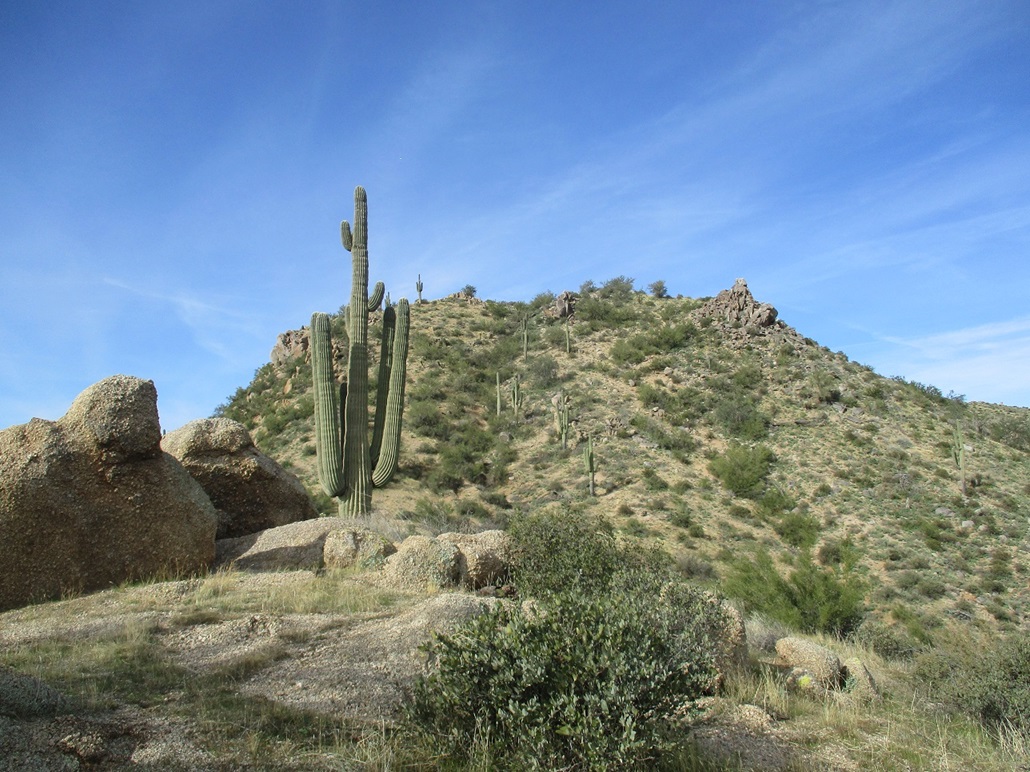
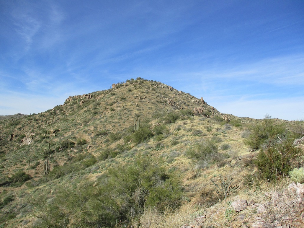
Beyond lie a steep slope, this hill notable for a rock formation on its north side (right, looking up). I stayed somewhat to the left and walked up the slope, which was very steep and covered in coarse gravel and scree, with scant vegetation to hold it together. It was a chore to get up this portion and I did not like it.
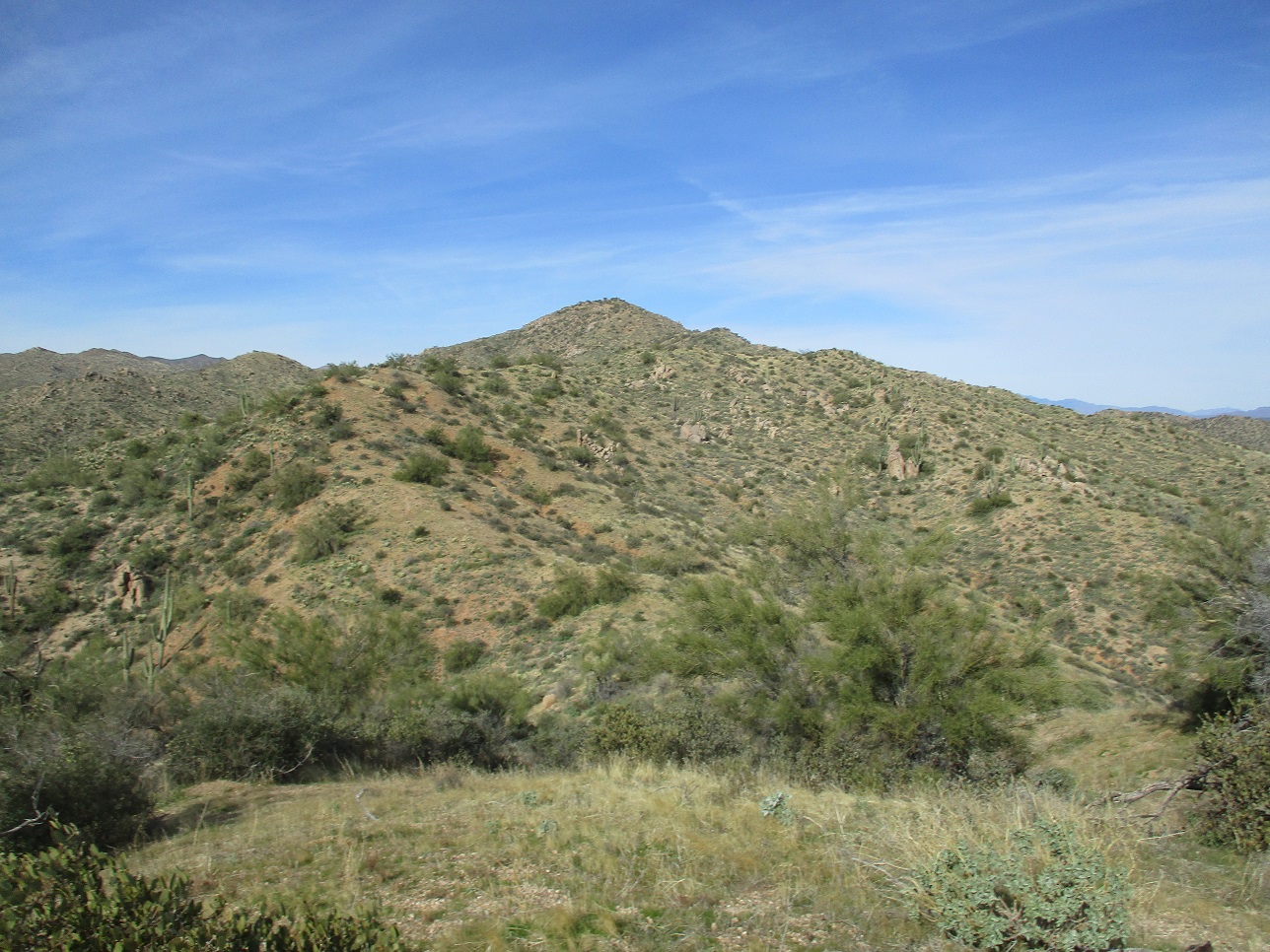
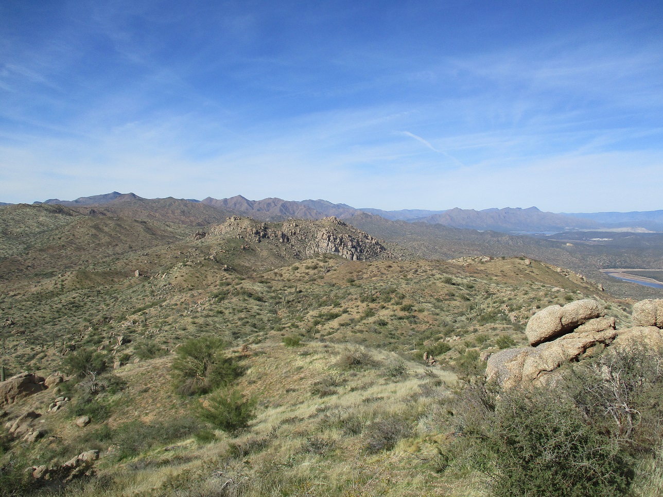
However, one above this hill, the whole ridge opened up and the top was up ahead, now slightly under a mile. I found narrow game tracks that stayed suspiciously close to the ridgeline suggesting some of the game may be the two-legged variety. The slopes were gentle with solid footing. The route would gain a bump on the ridge, then drop 10 or 20 feet, and continue upward. I enjoyed this segment very much.
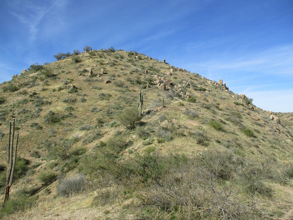
In time, I was directly below the summit hill. This hill was steep, about the same as that lower one I didn't like. However, it was covered in a low grass which made footing a little more sure. I was able to scamper up this hill quickly. Once above it, the summit ridge ran about another 150 feet, and I was soon on top of Bart Benchmark, two large palo verdes covering the summit.
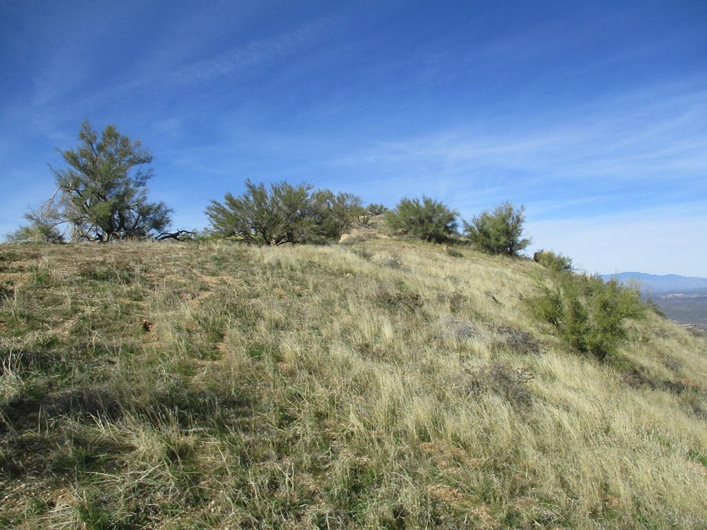
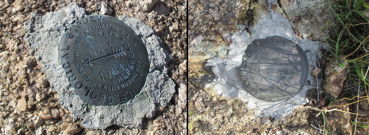
The top is broad and open apart from those palo verdes. There were good views in all directions, so I snapped a few images and sat for a break on one of the few good sitting rocks I could find. I found the two witness markers in small rock outcrops nearby, but could not locate Bart Benchmark itself. I pawed in the branches of the palo verde with no luck. I signed into the log, the third person here in three months. I spent about 15 minutes up here.
For the hike down, I followed the ridge all the way back, but stopped short of that steep hill. Instead, I followed a nicer-looking ridge down, angling more east than southeast. There were a few I could have followed so this one was not special, but it worked. I was able to get all the way down without any barriers, dead ends or brushy minefields. This put me onto the road about a quarter-mile north of where I parked.
I was back to my car quickly, the whole round trip taking just under two hours. Now knowing the route, I would not recommend to get on the ridge too early. Instead, note the rock formation (it will be obvious) and just follow some other ridge up, bypassing that formation on your left as you ascend. This will put you on the main ridge, from which it is a straight-shot to the top.
As usual, I had maps for other small hills in the area, and as usual, I was not interested once back in my car with the tunes playing. I was pleasantly surprised by this peak, as it was an enjoyable hike and had good views. I decided I did well for today and just drove on home, in time to do some more work-related email-answering.
A few weeks later, a guy on HikeAriona found the benchmark: it was buried under about 4 inches of dirt and grass, at the very top where the small cairn was built. I would never have thought to dig down, nor would I have had the tools to do so. But it's up there, apparently.
|

|