
The Mountains of Arizona
• www.surgent.net
|
| Aztec Peak |
• Highpoint: Sierra Ancha • Sierra Ancha Wilderness • Tonto National Forest • Gila County |
|
Date: September 17, 2005
• Elevation: 7,748 feet
• Prominence: 2,468 feet
• Distance: 6 miles
• Time: 3 hours
• Gain: 1,500 feet
• Conditions: Sunny and clear
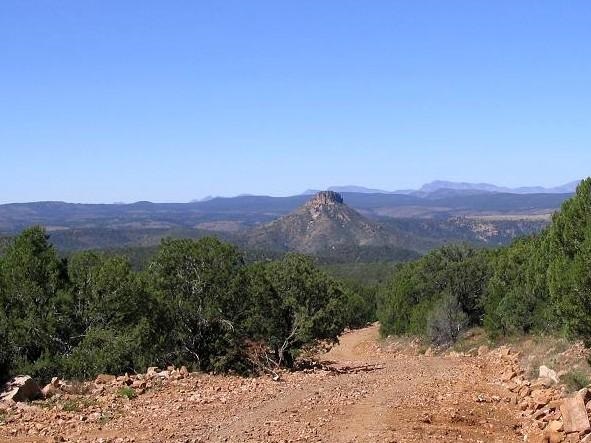
Aztec Peak is the highest point in the Sierra Ancha, north of Globe and east of Lake Roosevelt, merging in with the Mogollon Rim to the north. The main route through the Sierra Ancha is state route AZ-288, which is unpaved for long segments as it winds through the heart of the range. The highway's designation ends at the town of Young, a remote locale of a few hundred people. Beyond Young, the road narrows into a Forest Road to where it meets State Route AZ-260 atop the Rim.
The summer heat had mitigated for the first time in months, and a dry cold front (by relative standards) was moving through the state, with highs around 90 in the deserts, 70s in the high country. Coupled with the stable weather and dry conditions, we were eager to spend a weekend in the high country to revel in the gorgeous conditions. I've said it elsewhere in my pages, but it bears repeating: the best weather anywhere on the planet is found here in Arizona about this time, as summer turns to fall. Bright blue cloudless skies and near-zero humidity results in crystal-clear conditions, so clear that detail on mountainsides 50 miles away can be seen.
Aztec Peak itself is an easy peak to climb. A forest road goes to the top, where a manned lookout tower stands. Normally, this road is open to vehicles, but even when not (as it was on our visit), it is an easy hiking route. The actual hike shouldn't take much more than a few hours, so we built in other plans too: a lat-long confluence that was also in the region, an excuse to drive AZ-288, a visit to Young, and some harrowing drives up the road to where it meets the Mogollon Rim.
We left our home on Saturday (today) at 8 a.m., stopped in Globe for gas and supplies, and then drove north along AZ-188 to the AZ-288 turn-off. The first few miles of AZ-288 are paved is it descends toward the Salt River, crossing it over a single-lane old-time truss bridge. On the other side, the route passes through the community of Rock House, gains into the desert foothills, then, where the road starts some switchbacks, loses the pavement (update 2015: the road is paved here but not marked with lane lines. The pavement actually ends farther north where it crests a pass near the Sawmill Flats campground). The condition of the road is still very good (being a state highway, it is graded regularly and is very wide). Nevertheless, we drove the road slowly. Trucks come up and down this road and we had to keep an eye out for them.
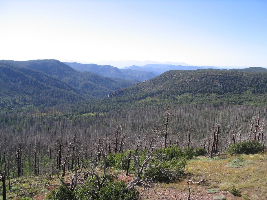
After about a half-hour on this road, we eased onto Workman Creek Falls Road (Forest Road 487), and followed it a few miles east to where it "ended" at a locked gate spanning the road. A fire from a few years ago had cleared some hillsides of their trees, and the erosion had slightly undercut the road beyond the gate. Although forest personnel could drive past the gate, the general public could not. Luckily, the Falls campground was nearby, so we found a spot and called it ours for the day and following evening. It was about noon when we rolled into camp. We set up chairs and sat around for a little while, debating our plans. At 2 p.m., βð opted to stay here at camp, while I went forth with the hike.
I walked back up the road and past a number of vehicles parked in and around the gate, then walked past the gate and inspected where the road had been partially washed out. The Workman Creek Falls were a little farther up the road. Not counting the waterfalls in the Grand Canyon, the Workman Creek Falls are possibly Arizona's biggest, with nearly 100 feet of drop. Even now, in the dry conditions, there was a small stream of water moving over the falls. After a heavy rain, I am sure the falls here are amazing. Workman Creek Falls holds the "official" 24-hour rainfall record for Arizona, when a foot of rain fell in one such period. The unoffical record is about 14 inches in 24 hours over at Harquahala Peak in La Paz County.
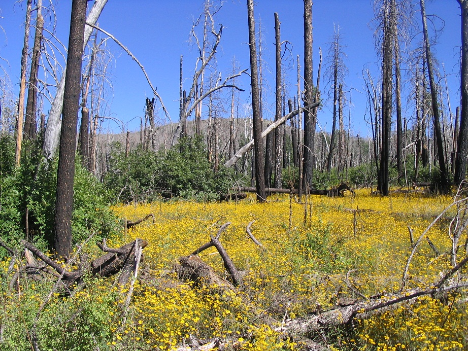
The Falls are a popular short hiking destination and most of the people here were coming to the falls and no farther. There was also a large group of boy scouts coming down from Aztec Peak, and they had been "heliographing", sending signals using sunlight and mirrors, to other scouts on other summits. Once past the falls, the number of hikers dwindled to near zero. I continued up the road about a half-mile to Trail 151, "Abbey's Trail". This was unexpected and not shown on my map, but I followed it for a few hundred yards up over a soft rise and into a big cleared area with numerous burned trees. The trail grew indistinct here and rather than chance fate, I walked back to the road and decided to follow the safe route to the top.
The road bends south and passes an open marshy area. The Carr Peak Trailhead is located here. After this trail junction, the road bends east again and gains the main range crest. The forest was thicker, these stands having been spared by the fire. I saw no one except for a single quad-runner parked in an open area, but no actual people. I bypassed the Moody Trailhead and a partially-burned cabin, and stayed on the main road as it traversed up the "backside", the east-facing slopes of Aztec Peak. I came to another junction, a sign pointing to Aztec L.O. (lookout), saying it was still 1 mile away. That didn't seem right, and it wasn't; the last segment covered a half-mile (and that's being optimistic) and quickly, I was at the top of Aztec Peak, which is flat, and topped by a very substantial tower. I climbed the steps but the top hatch was locked, so I sat at the top steps and took in the views. I stayed up here for 15 minutes, but a stiff, cool breeze motivated me to start the hike down.
The hike down took exactly an hour, and I was back to camp at 5 p.m. as the sun was setting behind the ridges near camp. We built a fire and had a dinner of cheese, packaged salmon and french bread. We had a good night's sleep in the bed of my truck.
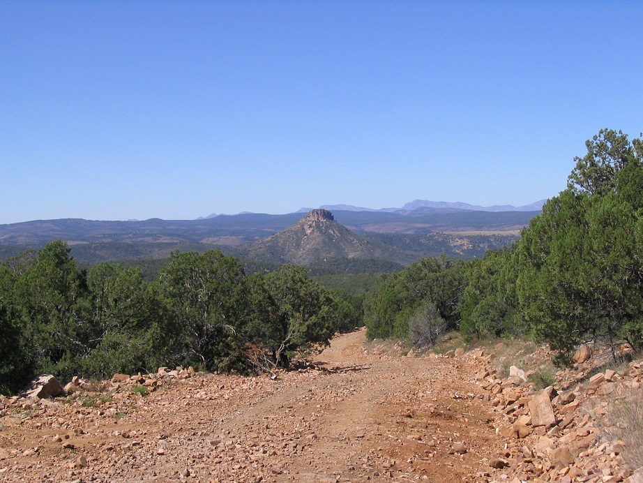
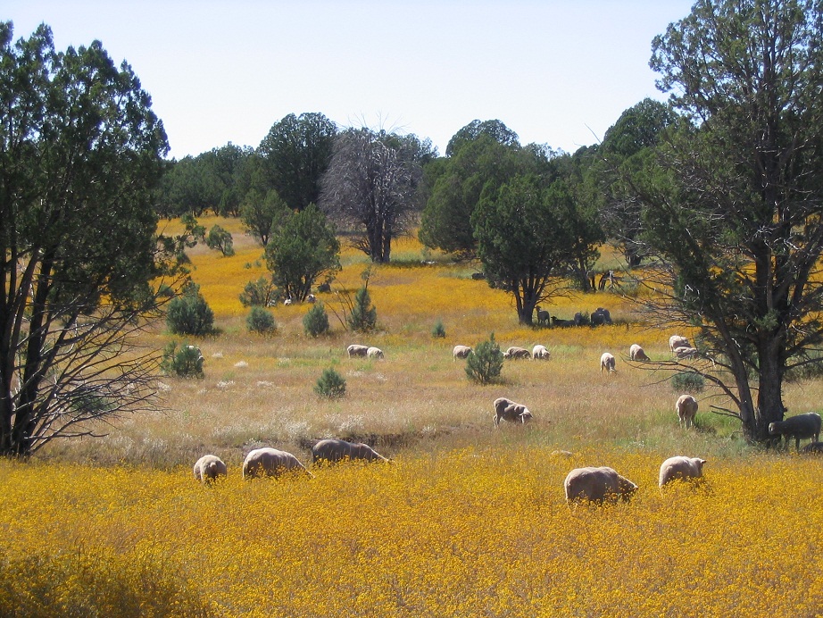
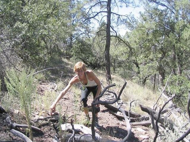
The next day we drove to Young, taking a side tour to visit a confluence at North 34, West 111. This involved a hike of abouta mile each way into a ravine, where the actual point was on the slopes choked in brush. Farther up the road, more toward the town of Young, βð snapped a photograph of sheep grazing in a pastoral meadow (see left sidebar). It was published in the Arizona Republic newspaper in February, 2006. You'd never believe that was taken in Arizona, but it most certainly was. We stopped in Young for a brief visit. It's as we expected: an old-time town with a basic business district, surrounded by farms and ranches. The state route designation end here. After Young, the road to the Mogollon Rim is narrower and in places, a lane wide and etched into steep hillsides. We were careful here, awed by the great views and mindful of the drops below us. In time we came up to the Mogollon Rim itself, merged onto highway AZ-260, and drove home via Payson and the Beeline Highway.
|


|