Aspen Peak is in the Hualapai Mountains, near Hualapai Peak. My last time here was in October 2003, when we hiked Hualapai Peak. It's hard to believe 15 years would pass before I came back.
We left Scottsdale on Thursday, watching the end of the Stanley Cup playoffs before leaving. Being a Thursday and being late, we had all of US-93 from Wickenburg to Interstate-40 to ourselves. We had a dinner at a truck stop at midnight, and got in to Laughlin about 2 a.m.. The next day was a relax day. Saturday, I went on my hike.
From our place in Laughlin, elevation about 600 feet, I left soon after dawn and drove through Kingman to the Hualapai Mountains Park. The drive up Hualapai Mountain Road is scenic, and very steep (about a 10% grade) for the mile or so before it tops out at the ranger station. I paid the day-use fee ($7) and drove up the narrow camping roads to the trailhead, elevation 6,800 feet. I rolled in at 6:40 a.m., the day sunny and clear, slightly cool at this high elevation. The winds were strong.
Aspen Peak is the closest peak to the trailhead. Trails (and a service road) encircle the peak allowing access to Hualapai Peak and nearby Hayden Peak, which lie southwest of Aspen Peak. I chose to follow the trails for the ascent.
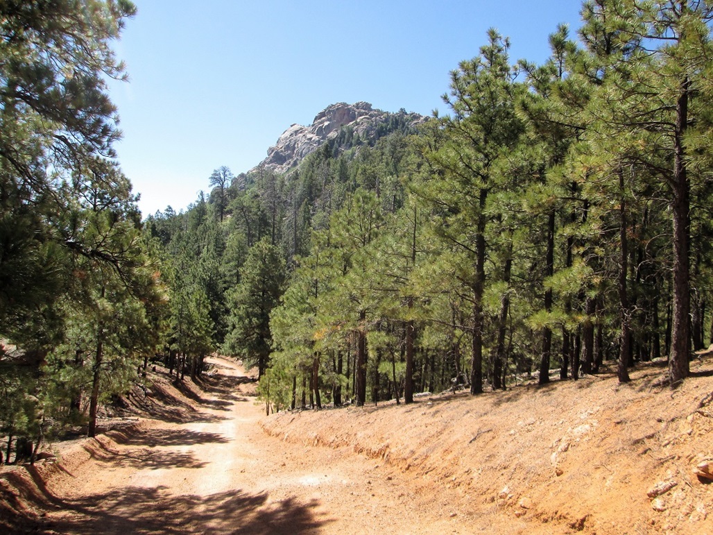
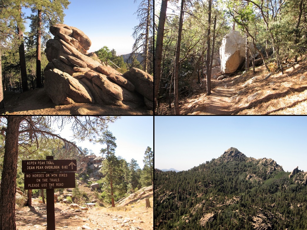
I started up the trails, following the signs. I was going slow, seeing that I had started the day at 600 feet elevation and was now pushing 7,000 feet. It took me a little longer than usual to get my breathing and walking into a rhythm. I went slowly and enjoyed the massive rocks that just stand there beside the trails.
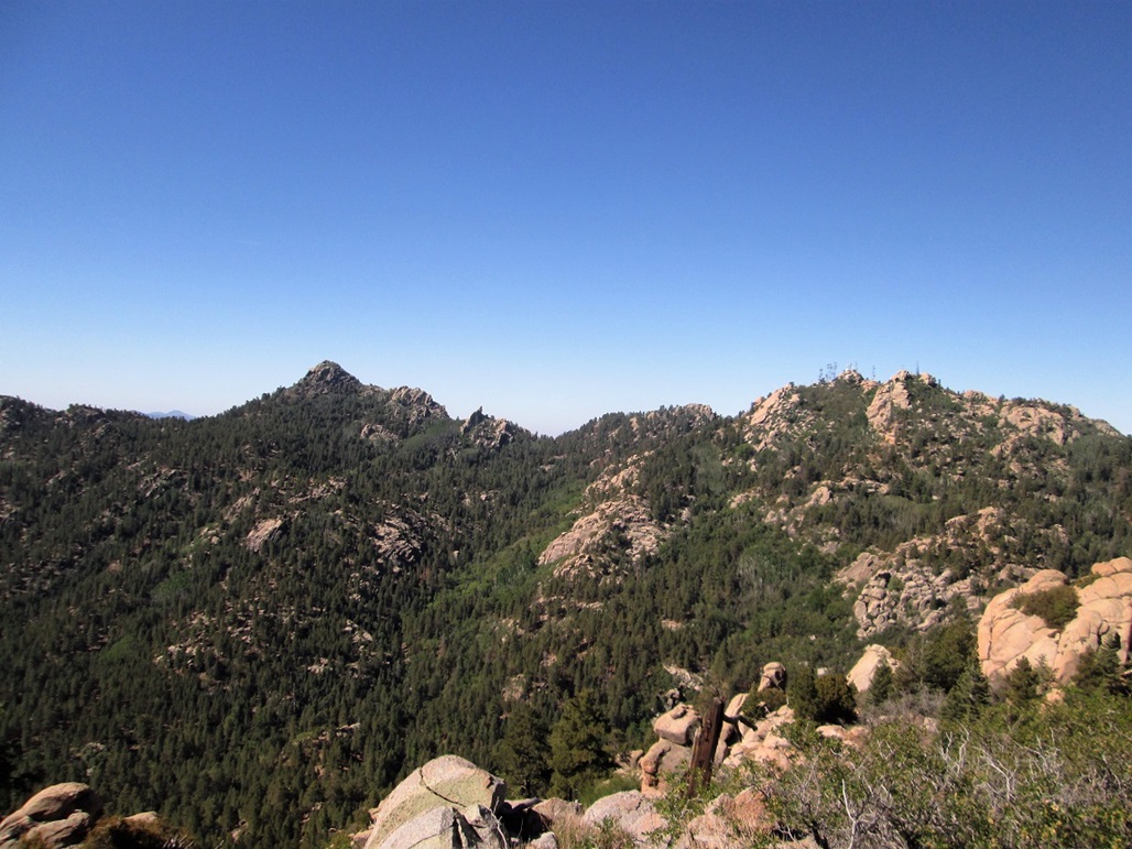
Going by the signs, it's slightly less than two miles to the Aspen Peak Trail. I followed the trails upward, generally trending west along the peak's north slopes. Only once did I have an unobstructed view of the peak. The summit is a jumble of cliffs and rock outcrops, and I had no idea which one was the top from this lower vantage.
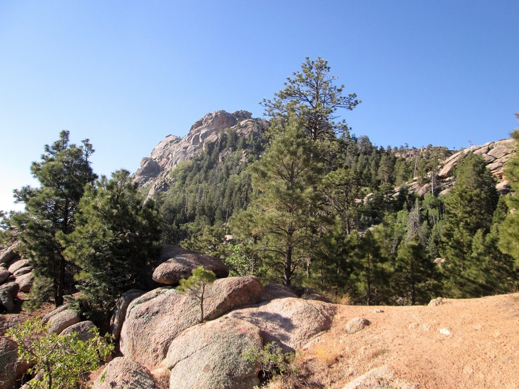
In an hour, I had descended into the Camp Levi area, where one can pack in to camp. Scouts use it often. The trail let on to a side road, then quickly, the actual Aspen Peak trail picks up from here. I followed this trail down a little, across a wobbly wooden bridge, then upward as the trail turned south, then east, traversing Aspen Peak's south slopes. Here, I had excellent views of Hayden Peak and of Hualapai Peak.
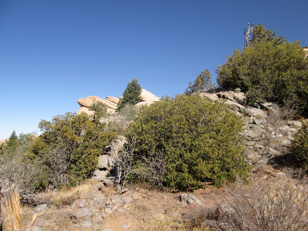
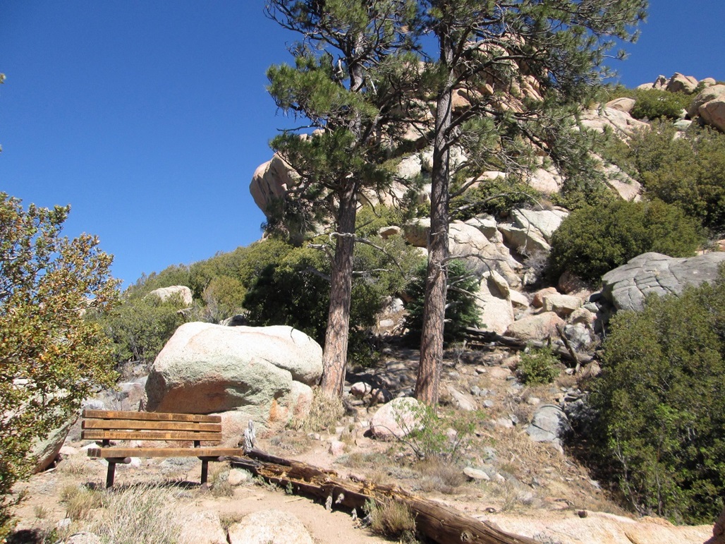
Soon, I was at the trail's end, at the Dean Peak overlook. Here, there is a bench one can sit on, a massive stone pillar, and Dean Peak across the valley to the east. The summit was still about 150 feet higher, somewhere up on the rocky crown above me.
I found a narrow path that led into the trees. This path somehow snaked up through the rocks and heavy brush, featuring mountain oak. It was steep and narrow, but never exposed or too loose. It was like hiking in a tunnel. In a few minutes, I emerged onto the upper plateau. I still had no idea where the top was.
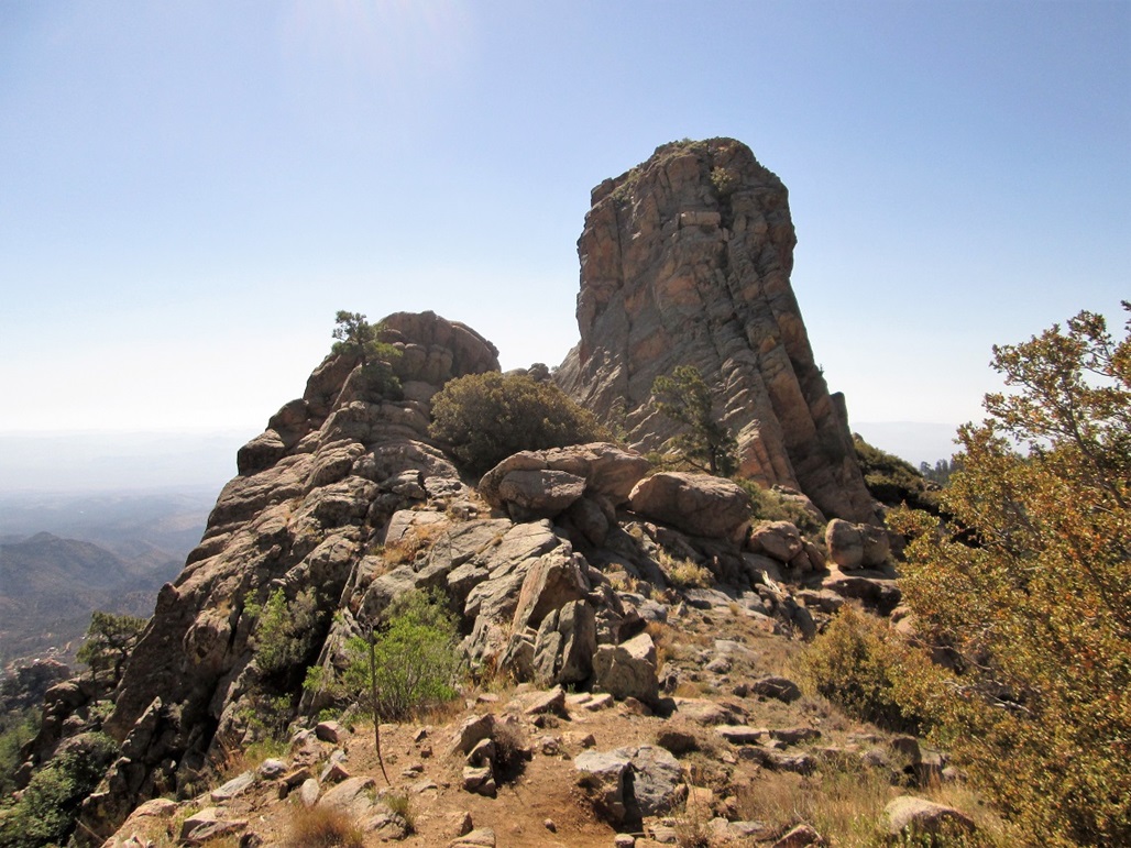
I followed faint paths westward, always going up. Up until now, I never needed hands, but now, I found myself doing some short scrambles to clamber up the jumble of rocks. The path, when I could find it, led to a small flat area hemmed in by three rock outcrops. From below, it's difficult to tell which is highest. But I had done my homework and already knew that the one with a nice sloping profile was highest. I dropped the pack and relaxed.
Now, to climb that rock. I got seduced by a gully-crack on this sloping rock's west side, and carefully clambered up this crack. This put me below the top-most rock, but about 6 feet below it, too high to tag and clearly no way to get up it safely. So back down I went.
Back at the base, I just walked up the sloping rock, traction being very good. I got to a small lip where the top rock rises, leaned in and gave the top a tag, then sat at this lip for photographs and a ten-minute rest. It had taken me just under two hours to get here.
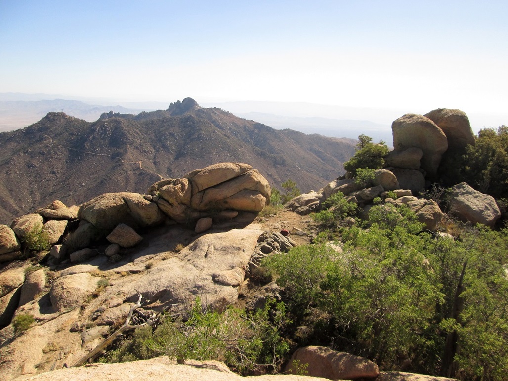
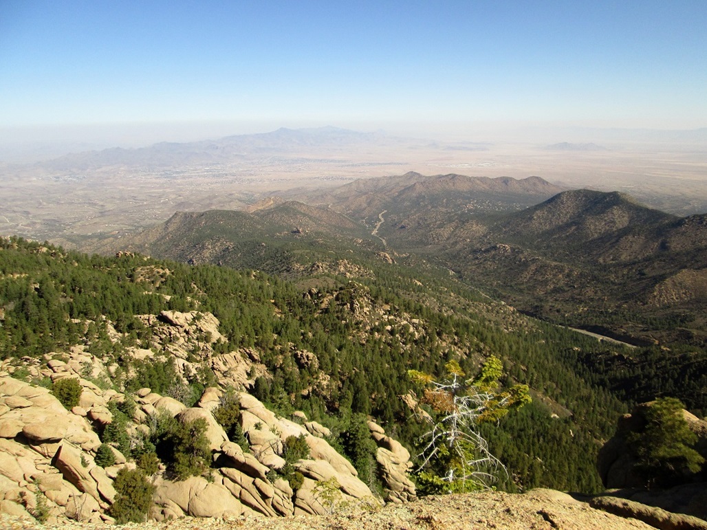
From the top, I could see the main peaks in the Hualapai Mountains all around me, each covered over in a pile of boulders and pillars, every single one of them. The deserts below were a full mile lower in elevation. The day was clear but breezy, and the lower elevations were occluded by dust in the air.
For the hike down, I followed the same routes down, having trouble with one 6-foot sloping boulder that I had got up with no problem. I just couldn't situate my feet and butt and hands to get a firm hold. I ended up sliding down it a little. Once back to the maintained trails, I walked quickly back to the Camp Levi area. I thought about hiking Hayden Peak, but wasn't that interested for the moment. I'll come back some day for that one.
I opted to descend to the trailhead via the service road, which lies lower than the trails, is more open and steeper. It wasn't very pretty, but it went fast. In an hour, I was back to my car, the time about 10 a.m.. People were getting suited up for their hikes. I only saw four people on the hike: a couple while hiking up, with their dog, and another couple while hiking down, with their dog.
I enjoyed the hike and was happy to be back after so many years. It's not a peak I'd drive 200 miles to do, but from our place in Laughlin, suddenly it's convenient. I descended into Kingman, then back to Laughlin, arriving there before noon. By now, temperatures were about 102 degrees F, and later, would reach 112 degrees F.