The Mountains of Arizona
• www.surgent.net
|
| Ash Peak |
• Black Hills • Bureau of Land Management • Graham County |
|
Date: November 13, 2021
• Elevation: 5,585 feet
• Prominence: 1,185 feet
• Distance: 3.4 miles
• Time: 2 hours, 45 minutes
• Gain: 1,625 feet
• Conditions: Cool, then warming, very sunny
Arizona
•
Main
•
AZ P1K
•
PB
•
LoJ
•
USGS BM Datasheet
I was in eastern Arizona for a couple days hiking two local high-prominence peaks and whatever else I could scare up. I had arrived in Safford two days ago, then hiked nearby Peak 5966 yesterday. Ash Peak is close, and I had planned to hike both on the same day, but once done with Peak 5966, felt it wise to postpone the Ash Peak hike until the next morning when it would be cooler. I had no reason to hurry and no reason to rush back home. Another night in Safford would do me well.
I was up before dawn this morning, heading back eastbound on US-70. I had scouted the entry gate for Ash Peak yesterday, so I knew where to go. It is found between mileposts 367 and 368, on the south side of US-70 near a hill and an old mine digging. I let myself in past the gate, and drove in about a quarter mile, parking in a clearing on a bluff. The sun was up by now, and once I got things packed and locked up, it was 7 a.m. on the dot when I started walking. Like yesterday, it was cold for now, about 40°, but sunny and expecting to warm up quickly.
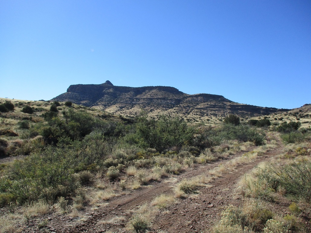
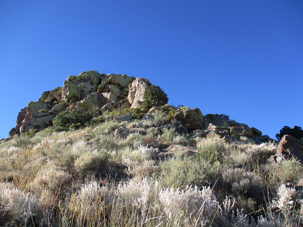
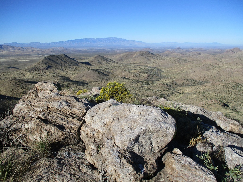
Ash Peak has a very enticing profile. It is a pointed summit atop a hill composed of a few bands of cliffs, giving the whole mountain mass the appearance of a dollop of frosting on top of a layer cake. The easiest route is to first aim for a lowpoint in the main west-trending ridge that emanates off the summit, the one with the cliffs. This saddle is about a mile west of the summit.
I walked the remainder of the track another quarter mile, to its end in a small clearing abutting a hill. I then left the road and started southbound cross-country through grass and rock, sidehilling this hill. Sidehilling is never fun, and this wasn't either. Rocks roll every step, and although short, I grew weary of it quickly. The small drainage that leads to the desired saddle makes a bend to the southwest, and I just hiked into it, losing about 50 feet. But at least it was easier walking, and I even found paths here, likely from cows but possibly from hunters too.
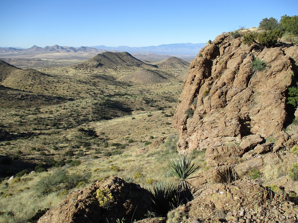
I was at the saddle quickly. Now on the "backside" of the mountain, I angled now southeast, up and down then up again across very broad ridges, to place me on a ridge that parallels the main west one I mentioned, with all those cliffs. Once on this parallel ridge, I hiked it uphiill, passing through one easy rock barrier along the way. At first, the summit is hidden. All I saw were the cliffs on the main west ridge. Then, slowly, the summit bump starts to poke above the far ridge. Suddenly, I got a sense of how the route would unfold.
This parallel ridge merges in with the main west ridge, and gets rather steep too. I started up the steep slopes, generally angling right as I ascended. These slopes were loose and steep, and I tried to keep to rock outcrops whenever possible. I was aiming for the most obvious cliff band, these cliffs easily 50 feet tall. Soon, I was above the steep slopes and now on the margin directly abutting the cliff.
I then walked east along this margin, which was fun. Massive rocks lay in a heap in spots, obviously having fallen from the cliff some time in the past. I hoped none would fall for the fifteen minutes I was passing through. I was soon on the far side of this cliff. I then resumed going upslope, finding a grassy ramp that fed me onto the west ridge, past one more smaller cliff band. So far, things were going to plan, and it was warming up nicely. I had been hiking about an hour.
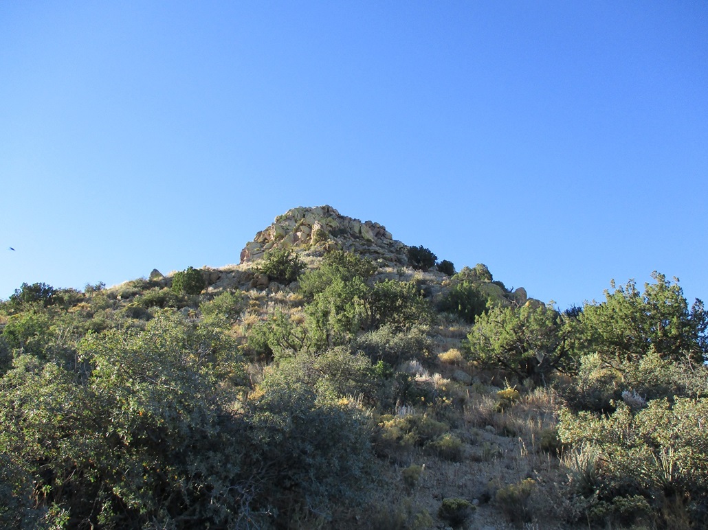
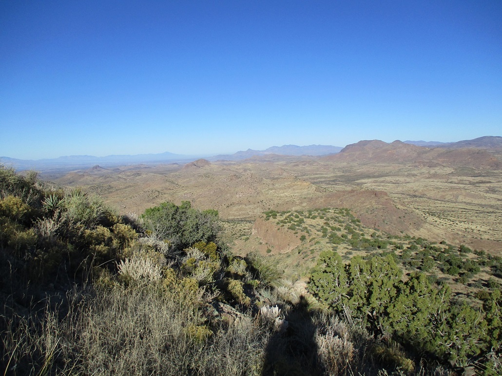
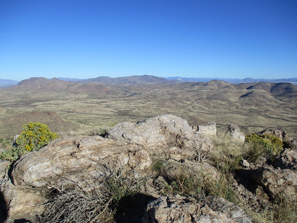
The summit now stood tall, not far to the east. I could see the lay of the land, the slopes rising to meet the summit rock crown. The sun was rising now and glaring everything out. I could not study the summit because the sun was too much for the time being. So I walked through juniper forest to place me at the base of the steep slopes to the top. I was about 150 feet below the summit now.
I angled a little east so that I was as north of the summit as possible. This allowed me to view it without looking into the sun. The rocks appeared to be in a huge heap, not a wall of cliffs. I walked uphill until I was at the base of the rocks. Now to find a route up this maze. I first angled left, putting me on the northeast flank. I thought I saw an opening from below. Upon closer inspection, it may have worked but required about a 10-foot scramble to get into it. So I backed off and looked for another option.
I walked about a hundred feet west, now slightly on the northwest flank. I came upon darker-colored rocks that had fallen into a heap such that they formed easy stair steps. This looked real promising, so I followed it up. Soon, I was at a small cliff, needing to get up about 4 feet. This was sloppy and loose, but I was able to ease up this step, my long arms and legs coming in handy. Here, I stashed my poles and pack.
I walked a couple feet to place myself close to the main walls. Openings would suddenly appear, the route revealing itself in 5-foot segments. I scooted up one chute, this one also needing me to manage another 4- or 5-foot step up. Once in the chute, I was sheltered. Another chute opened to my right, and I scooted up it. I then crossed a few feet along a wide ledge to one last chute and presto, I was on top. The scrambling had gone splendidly. I'd rate two of the moves as low class 3. If you have stubby little arms and legs, you'll have to work hard to get up the couple steps I mentioned.
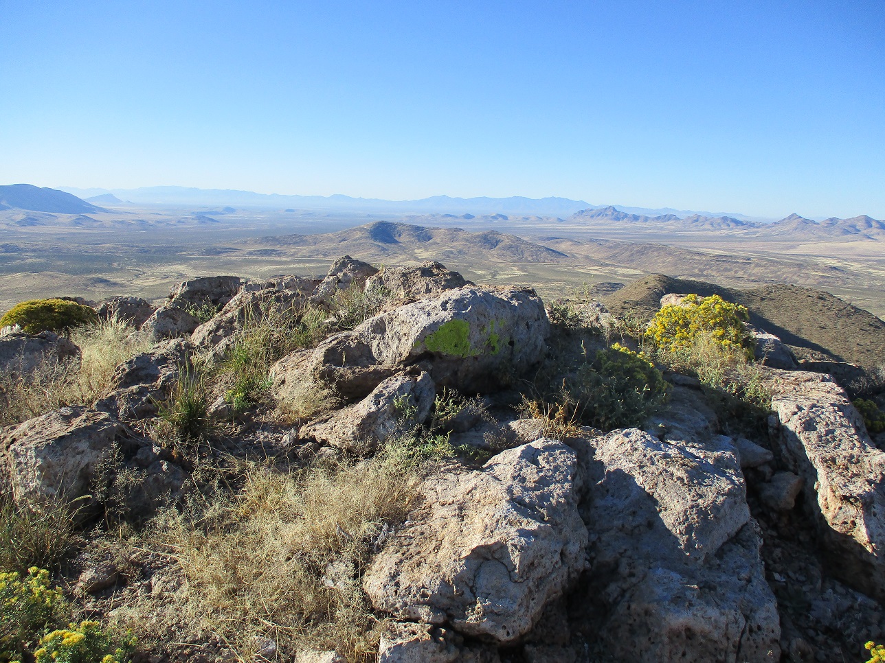
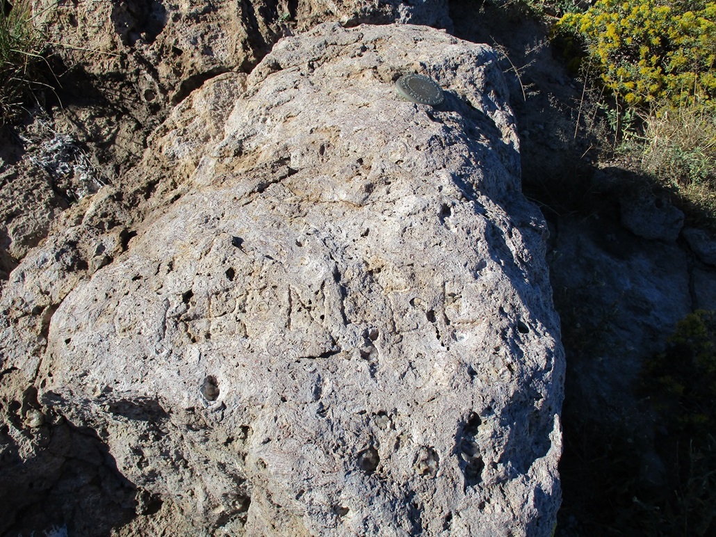
The summit was small and rocky, a very aerie feeling. The benchmark was cemented into the highest boulder. It was stamped with a cross shape formed by the letter L. It makes no sense. It was placed here in 1945, and who knows what they were thinking (or drinking). I could not locate a register. I snapped some photos, and also studied the etching into the top-most rock. I took an image which you see here. I can't make it out fully, but noted that they took care to get the letters in neatly. I have no idea the story behind the etching. Maybe the guys from 1945 were behind it.
Going down, I eased down the exact same chutes easily, back to my pack and poles, then back down off the rocks and onto the slopes. I hiked out essentially the same route I had hiked in. Once back past the saddle and on the "front" side of the mountain, I kept mainly to the drainage, which worked well, finding more paths to follow too. I was back to my car just shy of 10 a.m., a three-hour hike with almost 1,700 feet of gain. I was very pleased how well it went and that the scrambling at the very top went so cleanly. I daresay it was actually fun!
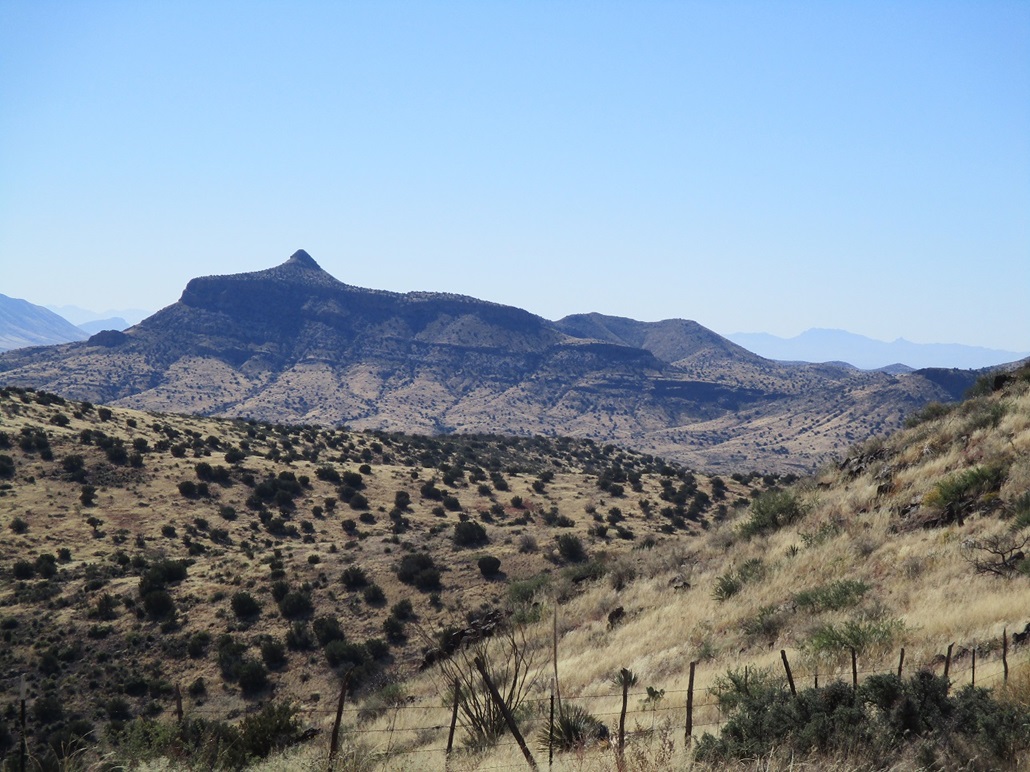
It was still early, and last night while vegging at the hotel, "discovered" the Sheldon Mountains on the north side of US-70, near where I had been yesterday. A jeep track that leads to the saddle between the two peaks of interest sealed the deal. It would mean easy hiking and potentially two peaks for the effort. I was there quickly.
|


|