
The Mountains of Arizona
• www.surgent.net
|
| Apache Peaks HP • Peak 6940 |
• Highpoint: Apache Peaks • Tonto National Forest • Gila County |
|
Date: February 17, 2008
• Elevation: 6,940 feet
• Prominence: 2,580 feet
• Distance: 8.4 miles
• Time: 6 hours and 15 minutes
• Gain: 2,740 feet
• Conditions: Snow on the ground, warm and dry day
• Teammates: John Hamann
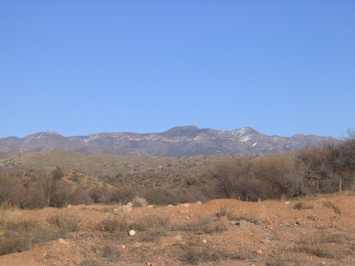
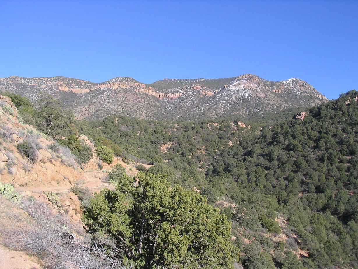
The Apache Peaks rise north of Globe in central Gila County. Viewed from the city, there appear to be two summits of near-equal height: the highpoint at 6,940 feet, and a nearby peak at 6,910 feet, which presumably begets the plural form of the name. When viewed from the west, the summit is atop a trapezoidal-shaped hill atop the summit ridge. The name of the range is unclear. It may be part of the Blackjack Mountain, or may not have a name at all.
Although prominent, the Apache Peaks seem to attact little attention, likely due to the surrounding private and state lands that make access confusing, even though the peaks are on Tonto National Forest land. The most common route comes in from the west and crosses private property. Most come here for the hunting and some for the ATV and Jeep roads, but few seem to come here to hike. The Southern Arizona Hiking Club seems to schedule one trip a year here.
I had scouted this peak and the general area on past trips, but had no great idea how exactly to go about climbing to the top. John Hamann from New Mexico suggested we team together and make an attempt. He drove from Tucson and we met at the Wal-Mart in Globe around 9 a.m. We then started the drive into the range, coming in from the west. A moderate storm had moved through the state in the past two days and the upper ridges of the peaks were covered in snow. Naturally, we were curious what effect the snow might have on the hike.
From the Wal-Mart, we went east on US-60 to the AZ-188 highway turn-off. I zeroed the odometer here. North on AZ-188, we went 4.4 miles to Wheatfields Road, then 2 miles to Hicks Road past a steakhouse, then right (and straight north) on Hicks for another couple of miles past a big ranch to the first gate we saw on our right, a total of 8 miles. This gate marks a private-property parcel, but the public can pass through along an easement. We had to sign in on the log sheet.
Past the gate, we followed a sandy road for two miles to its junction with Tonto Forest Road 220, then east another 2.8 miles to a corral and gate near Procopio Spring. Past that, I eased the truck another half-mile up the worsening road, which ran along a stream bed here. With the recent storm, the road was muddy and slick. I parked on a sand-bar elevated above the stream bed by a few feet. We were at 4,200 feet elevation, and we started the hike at 10:11 a.m., said John's watch.
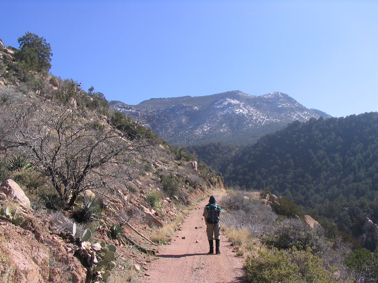
We walked the road another half-mile to another gate, which marks the practical end of the road for larger vehicles. Past the gate, the road narrows and has some outward leans to it, and is best suited for smaller recreational vehicles. For walking, it was very nice. We stayed on the road until it bent north and came to a junction. To here we had walked 2 miles with a thousand feet of gain. Higher up, we had to side-step some snow patches and contend with very muddy ground. The summit was directly above us, the higher slopes covered in snow.
After a snack break, we debated ways to get onto the summit plateau. A lone trip report from a past climber suggested a direct route up the immediate hills to the east, where we could make out a break in the cliffs. However, the snow up there was thick and we figured it may be enough to make that approach too treacherous. Instead, we followed a long ridge that went more north than east, that if successful, would place us on the plateau about a mile north of the summit.
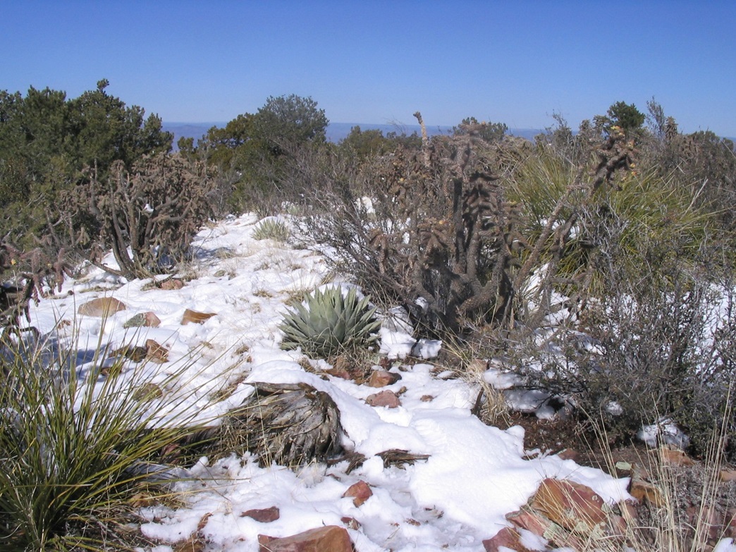
Getting onto this ridge took some time as we had to descend into some drainages, then battle thick brush in ascending out of these onto the slopes of our intended ridge. Once on the ridge, the brush lightened and we had better line-of-sight views. We could see how the route would unfold, and it looked promising. We generally took the ridge in segments, aiming for a point or a rock band, then deciding how to proceed. The ground was brushy and rocky, and with the melting snow, very muddy. Higher up, the snow was more consolidated. It hid dangers such as rock crevices or thorny plants. We moved carefully as we ascended.
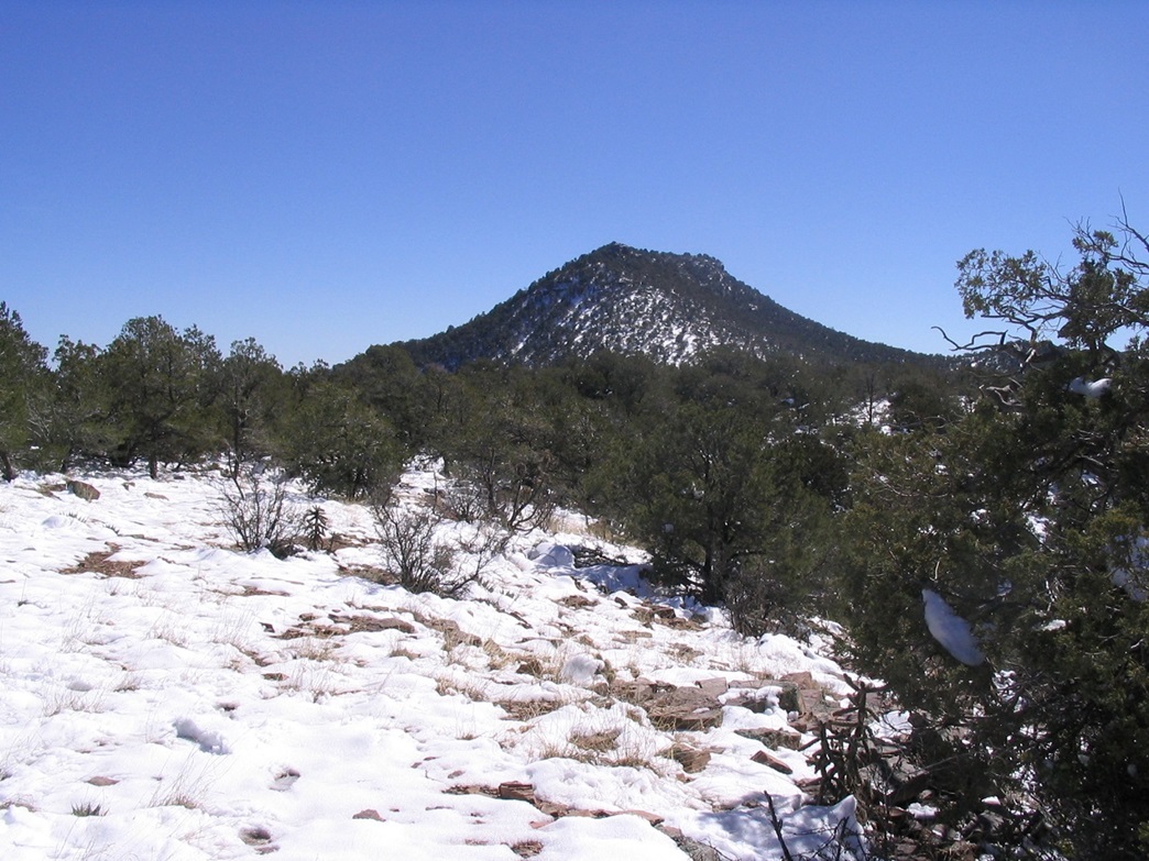
After an hour on this ridge, we were approaching the top of the slope and the upper plateau, but between us and the top was a small pallisade of broken cliffs. By now, the slopes were rather steep, and combined with the muddy ground, we slipped often. Getting up these cliffs was easy. There were many weaknesses in the cliffs, even forming small stair-steps for us. However, cactus seemed to grow in any open space, the snow was inconvenient, and the rock was completely rotten. Hiking carefully, we worked our way up this segment, and onto the broad summit ridge, elevation 6,400 feet. The summit was only 0.7 miles south of us. We marked this position so that we could find it on the return hike.
After another short break, we started south across the flat plateau, working through a sparse forest of juniper toward the hillside directly ahead of us. We made our own path through the slushy snow and occasional mud bogs. In time, the gradient steepened and the forest thickened. The snow was quite deep and fairly solid, being shielded as it was by all the trees and the north-facing slopes. We "post-holed" to about mid-shin at the worst, and overall the snow was solid enough to hold our weight. The snow helped us, allowing us to literally step over rocks and brush hidden under the snow cover. John had struck out ahead of me and was blazing a path up the slopes, while I ambled behind and tried to step into his boot prints as often as possible.
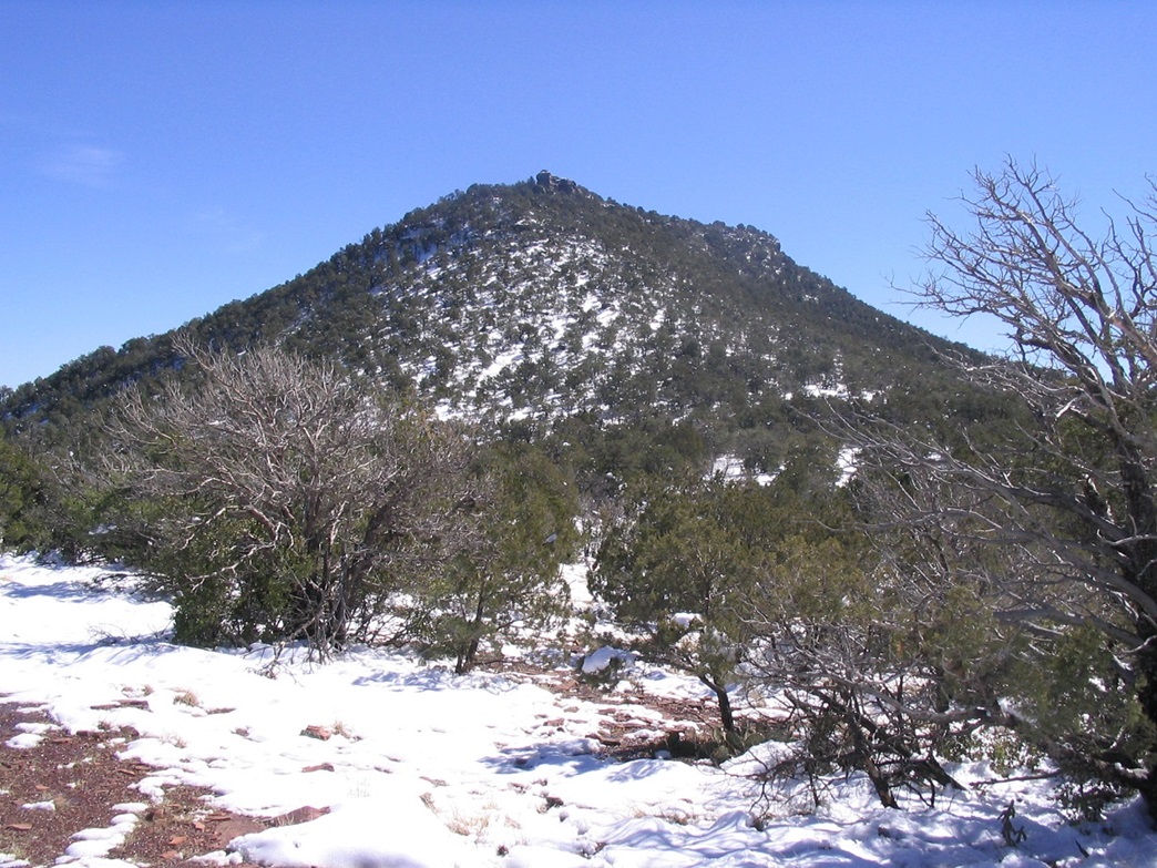
The steep going is short, and we aimed for a set of pillars set at the northern edge of the summit hill, the summit itself being at the south end. At these pillars, we had to squirm through some clefts and brush (and snow) to get above these and onto the final summit hill. From here, the final walk was an easy 300 feet south and mostly level. I followed John's prints, noting he had dead-ended a few times in the brush. I arrived on top at 1:30 p.m., John having beaten me by five minutes.
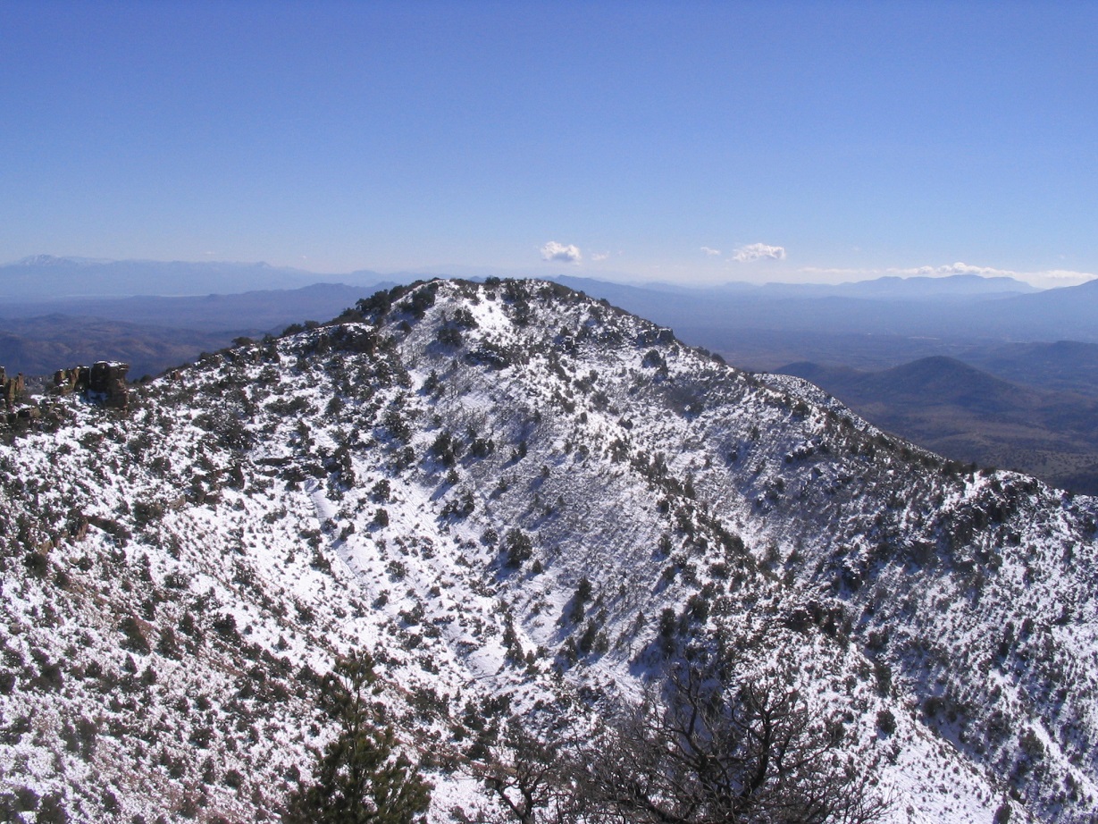
The day was beautiful and clear, if cold. We had excellent views in all directions. The lower 6,910-foot summit is separated from the top by an imposing ridge of pinnacles and cliffs, and we wondered how difficult it would be to get there even when dry. We did not bother, and after about 20 minutes, we started the trek down. I was happy, of course, to have made the summit, but the conditions were such that I wanted to be moving sooner than later.
The hike down from the summit hill to the upper ridge was easy and aided by the snow, which allowed us to "long-step". In minutes we were back to the flat ridge, and even in the hour we had been gone, the sun and dry, windy weather had melted much of the snow. Whole sections were simply gone, magically converted into big fields of goopy mud. We were able to find the point at which we'd ascended the cliffs onto the plateau. Descending this, we had no trouble except for melting snow, loose rocks, cactus and mud.
The long descent of this ridge back to the road was an exercise in "how not to fall". In dry conditions, it would be rocky and easy to trip and stumble. With the wetness, rocks would slide out, or we'd slip on the mud directly. I fell twice, and avoided a few more falls by somehow performing some wild balancing acts. I dinged my hand and also gave myself a small charley horse. Finally, we were back to the road, from which it was an easy, eventless walk back to my truck. We arrived at 4:25 p.m.. I changed clothes, noting the mud I had collected.
The drive out went well, and we stopped a few times for photographs. In about another hour, I had driven us back to the Wal-Mart where John's car was parked. We transferred gear, said our goodbyes, and began our drives, him to Tucson and me to Chandler. This was one of those peaks where success was uncertain even in good conditions, less so with the snow. I would say that in dry conditions, this is a fairly easy hike, but brushy and requiring some navigation skill. It's not trivial, and does require a day's effort. I was happy to be successful, and thank John for being a good teammate.
|


|