
The Mountains of Arizona
• www.surgent.net
|
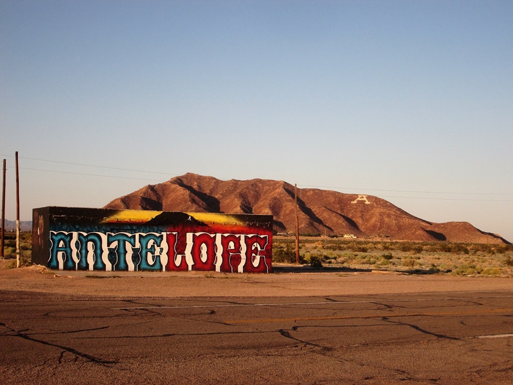
| Antelope Hill |
• Mohawk Valley • Gila River Plain • Yuma County |
|
Date: November 9, 2018
• Elevation: 815 feet
• Prominence: 490 feet
• Distance: 1.4 miles
• Time: 45 minutes
• Gain: 480 feet
• Conditions: Clear and cool
I was driving toward Yuma, planning to meet with some of my usual hiking buddies for a hike up Tinajas Altas Peak the next day. Since I had Friday open, I left home around 1 p.m. and two hours later, had arrived in the general area around Wellton, about 30 miles east of Yuma along Interstate-8. I had a hotel room waiting for me in Wellton.
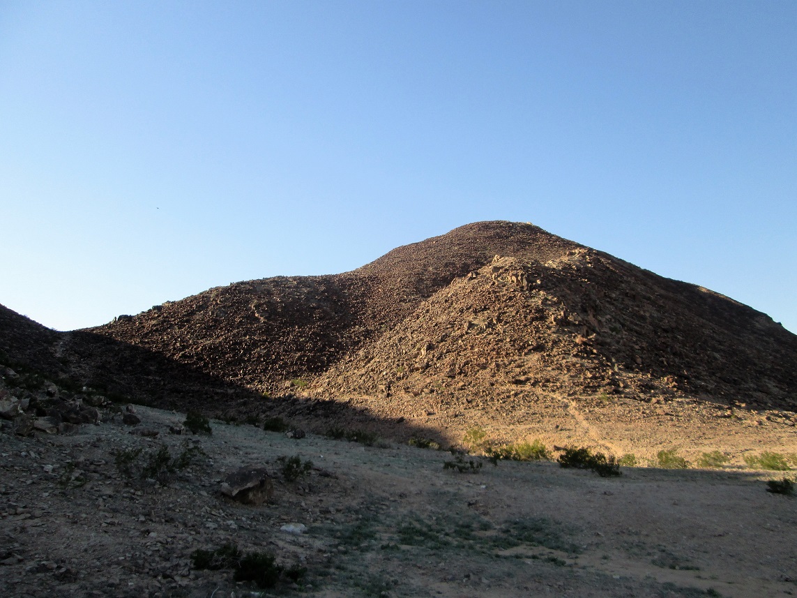
I had enough time for a short hike up an isolated mount called Antelope Hill, which rises nearly 500 feet above the Gila River Plain (this whole area being the Mohawk Plain). The small mountain is located in the community of Roll, at the Ave-30E exit off Interstate-8, about 7 miles east of Wellton. Today, there’s a big "A" painted onto its southern slopes. Back when the Gila River flowed, it was an obvious landmark and waypoint for travelers along the river.
From the interstate, I went north a couple miles on Ave-30E past the Antelope High School, turning right onto East Antelope Drive in a small housing development directly below the mountain. The road goes east then bends south, going past some empty lots that look like they'll never be built upon. The pavement ends at a T-junction with the Lewis Road alignment. I went east on this sandy road, then north on another road. The roads were sandy but solid, and I tried to stay away from the obvious soft areas.
I see this guy walking along the road, and so I stopped and said hi, and asked if it was okay for me to be here, e.g. that I was not on private property. He said it was open and that he'd just finished hiking the mountain. He says he comes here almost every day. This was great for me because now I could get information from the local expert. He told me where to park, which trail to follow, and so on. We talked for about a minute. I would have found the parking area and let-in points anyway, but I was relieved to know that I was on open land.
I rolled into the little "lot", just a sandy turn-around, me the only person there. I got my boots and my day pack on, locked up the car and started walking about 3:45 p.m., me already in shadows on this eastern side. The day was sunny and bright blue, with temperatures in the mid 70s. When I was in the sun, I could feel the warmth, but in the shade, it was chilly.
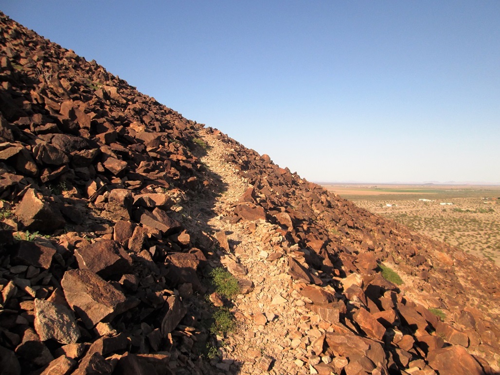
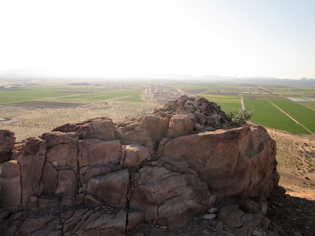
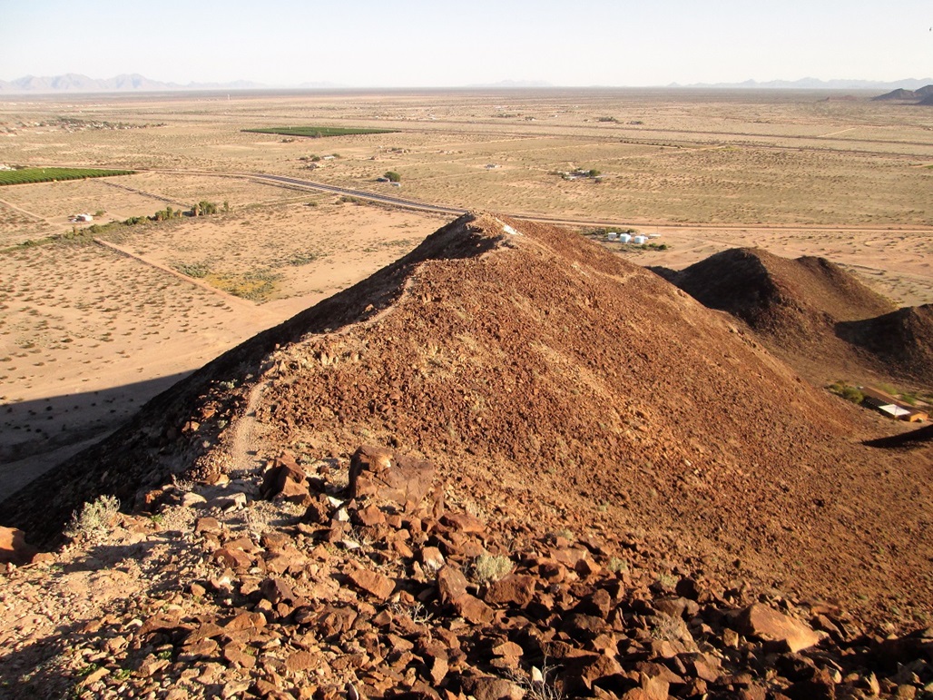
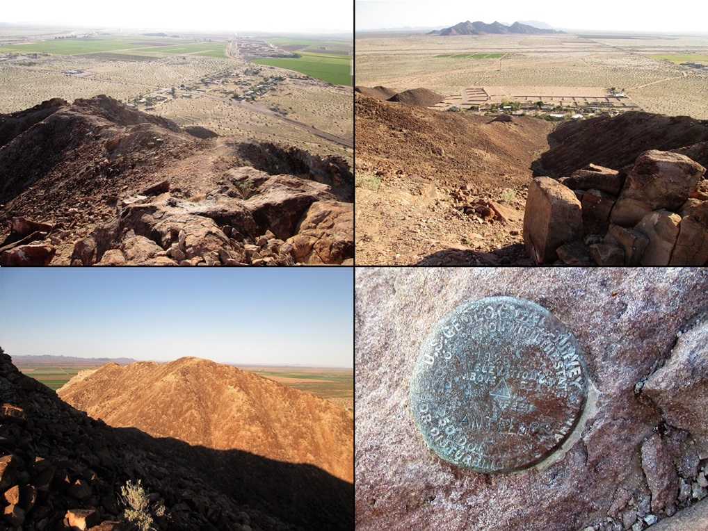
There are two let-in points: a wide and ragged trail that goes up a gully, leading to the white "A" on the mountain, and a more traditional-looking trail to the right. This is the one I followed. It hangs a left, then starts up a series of switchbacks. The slopes are all basaltic lava rocks, and whoever built the trail should be commended, as it is in excellent shape. The trail was built, so to speak, by moving aside rocks to form an obvious path. It was solid the whole way up. My only concern was passing by a couple rocks humming with bees. I did not linger here, and the bees weren’t interested in me, which was good.
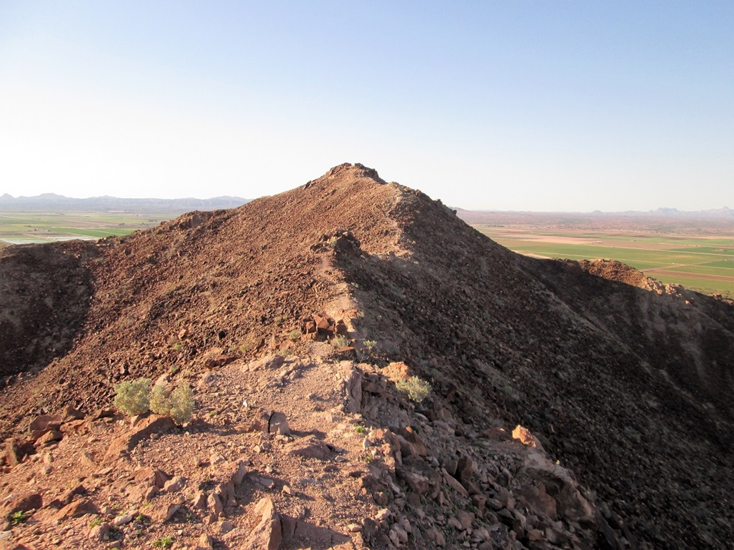
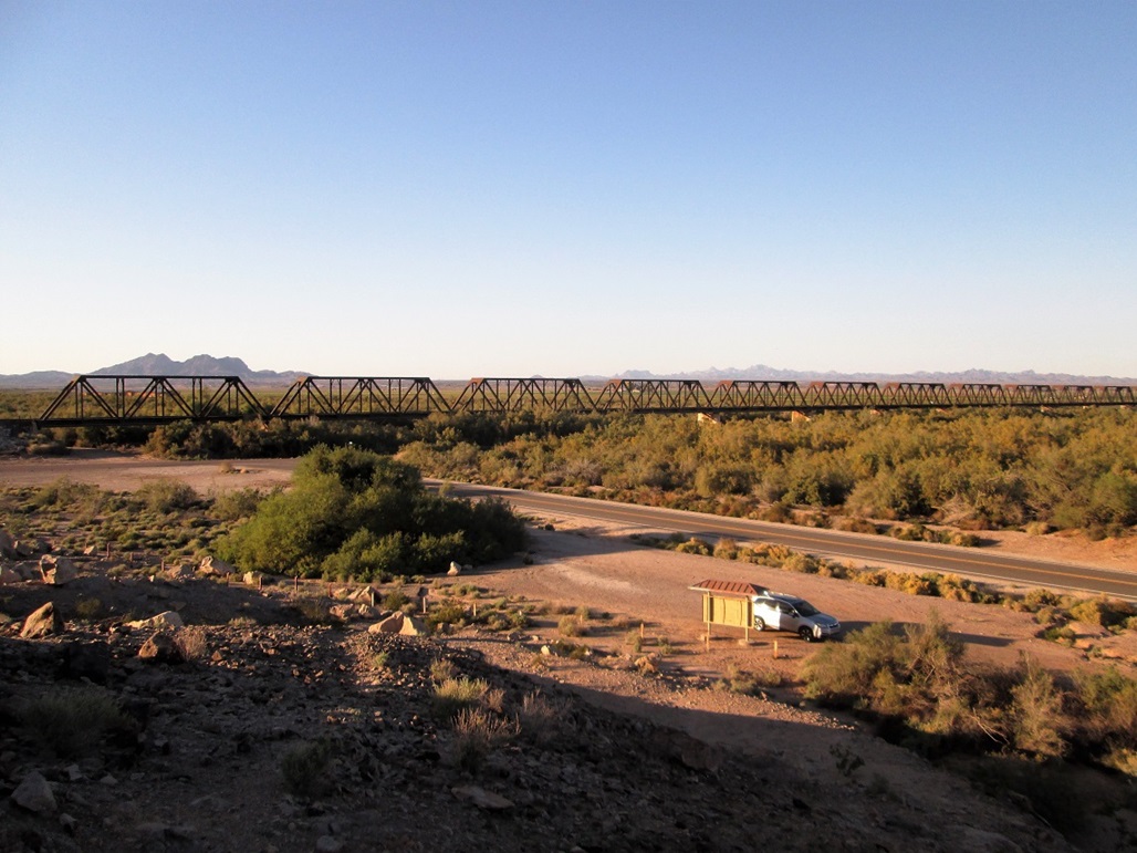
The trail generally stays on the east and north slopes, opposite the "A". It swings west, then gains steeply to the ridge above the "A". The top was in view, not far away. The trail then stays on the very ridge, straddling it the whole way up. Within 20 minutes from starting, I was on top, there being no challenges other than not to fall. The benchmark is affixed to a rock below the top, and is badly scratched up. I spent about ten minutes up here, looking around. I had good views south toward the Baker Hills and the distant Cabeza Prieta Mountains. East were the Mohawk Mountains and north were the hills separating us from the Yuma Proving Grounds. The Gila River, which these days is dammed so it does not flow, was choked with greenery, and there was an interesting old-style truss bridge spanning it, still used by the trains.
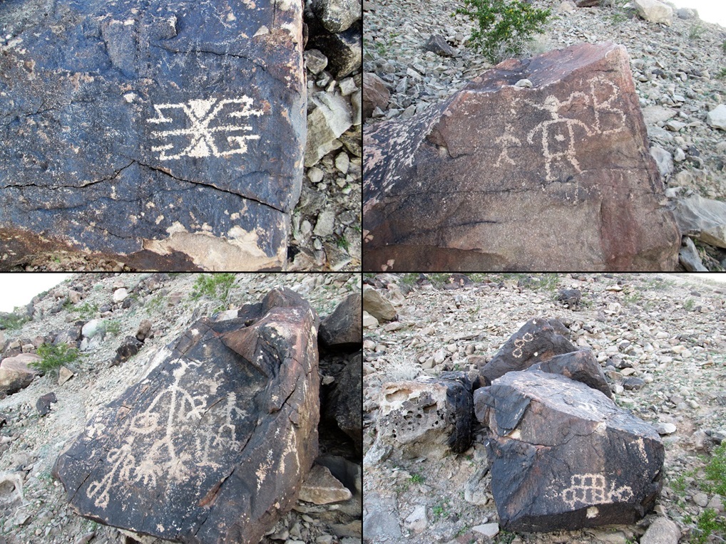
I hiked back the same way and was back to my car soon, a total hiking time of 45 minutes. I drove back out to Ave 30E and went north, then east a little bit to an old BLM kiosk near the northernmost toe of this small mountain. Here, there are scattered petroglyphs put in by the Indians from the past many centuries (the west face is an old modern mine, now inactive). I parked and walked the immediate area, looking for petroglyphs. They’re scattered about, so finding them was like hunting for easter eggs. But I found a few, some etched over by more modern visitors (i.e. one from 1908). I spent about 15 minutes here.
From here, I drove back to the frontage road directly north of the interstate. Just then a train comes rumbling by, blocking my access to the interstate. So I decided to follow the frontage, which is old US-80, into Wellton. I stayed at the Desert Motel in downtown Wellton, the hotel dating back to the 1940s.
The next day, Matthias would come by and pick me up and we’d meet up with five others to hike Tinajas Altas Peak located far south on the Barry Goldwater Range, nearly on the Mexican border.
|

|