
Peaks & Highpoints of Virginia
www.surgent.net |
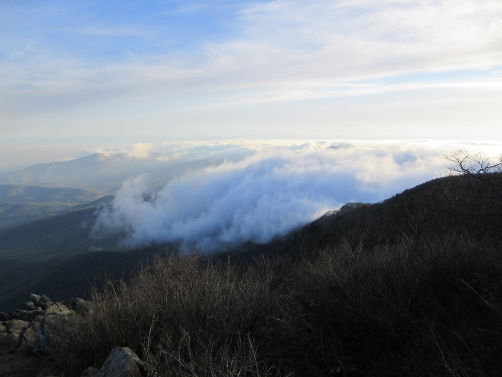
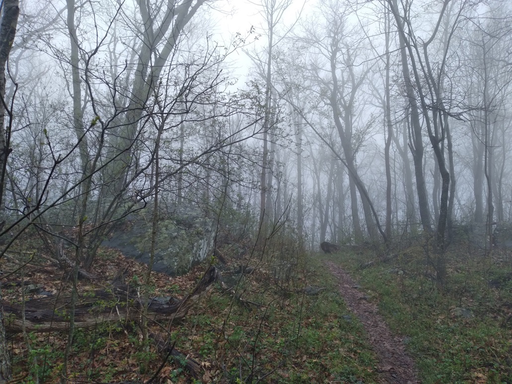
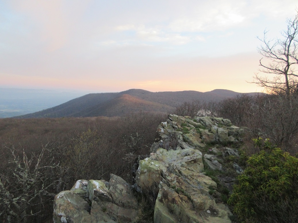 Stony Man as seen from Bettys Rocks
|
Stony Man • Beahms Gap North Peak • Pass Mountain Today would be my last day in Virginia, flying home later in the afternoon back to Arizona. I had arrived late Monday, then on Tuesday morning, hiked three peaks in the Shenandoah National Park up by its northern entrance by Front Royal. Wednesday was the big day, my father's funeral and interment at Arlington National Cemetery. I spent the first half of yesterday (the 18th) on the "M" train into Washington, to meet with my sister, her friend and two family friends from way back. We would tour the White House. The tour takes about an hour, and the train ride back to where I boarded it about 45 minutes. I was back to my hotel in Chantilly about 1:30 p.m.. The past couple of days had been enormous in terms of the emotions I was experiencing. It's hard to describe — I wasn't doubled over in grief, necessarily. I had grieved throughout the year and a half my father was on his way out, and the two years since he actually passed away. It was a cathartic event. I felt both sad and happy simultaneously. Happy and grateful, to be able to say goodbye, and know my father now has a place of honor in Arlington. So back at my hotel, I got this anxious feeling to do something. I am not good at just sitting and watching television. The day was mild and lovely, about 70° and barely humid, with random puffy clouds. I had no plan, so I got on my device and looked for a peak to hike. The closest one (about 40 road miles) was Sugar Loaf in Maryland. It had a developed parking lot and trails and it looked like something I could do in less than an hour. Honestly, my heart really wasn't into it, but I thought it was better than sitting in my hotel room. Besides, I looked at it more as a scenic drive. So I got onto VA-28 (which goes by Dulles Airport) and followed that north to VA-7, Leesburg Pike, then that west a few miles to US-15, signed for Frederick, Maryland. So far, I had covered about 15 miles, traffic was heavy but flowing, and I had no complaints. On northbound US-15, the highway narrows to a single lane each way and was absolutely clogged with traffic, especially northbound. It took a half hour to go five miles, to the tiny village of Luckett. Traffic lightened slightly afterwards. I crossed into Maryland, then got on MD-28, then that to Ephraim Mountain Road, then that north to the Sugar Loaf Mountain area ... only to discover it was closed for the day. They closed at 4 p.m., it was now 4:15 p.m.. That traffic had held me back, and I was disappointed. Funny, I wasn't that disappointed. I was unaware this was a privately-run outfit. I was annoyed a little, but not bummed. The drive had been very pretty, and it wasted an hour of my life which was good. I'd rather do this than watch stuff on TV. So I drove back to Chantilly and got me a Korean rice dish from a nearby hole in the wall. I had not planned anything for today, but my flight wasn't until 4:35 p.m.. Once again, I looked online and zeroed in on the Shenandoah National Park again. For one thing, my $30 pass I bought Tuesday was still valid. I looked at the Thurston Gap entryway, one of a few spots where one can access Skyline Drive. The online distance calculator said just under 70 miles each way. I was up at 3 a.m. this morning. I was too amped up to try to go back to sleep, so I just got up. There would be no point in leaving too early, as I wanted to time my drive there to arrive as the sun was rising. I killed time, got my stuff together, and hit the road at 4:30 a.m.. Getting there would be another adventure in Virginia highways. I knew exactly what routes to follow: VA-28 south to US-29 in Centreville, then US-29 southwesterly through Gainesville into Warrenton, where I would catch US-211, then follow that about 40 miles to Thurston Gap. This early, there was very little traffic, so that wasn't a problem. I got into Warrenton just fine, then came on a confusing intersection of highways and a sign with an arrow saying US-211 to the left. I failed to see the tiny "Business" rocker above it, so I ended up driving through downtown Warrenton then back to the main highways, utterly confused now. I stopped at a gas station and asked a guy where US-211 was and he said right there, pointing to it. Thanks, I said. I discovered in my Virginia drives that the signs often come at the last moments. There's no sign saying "US-211, stay right" or "junction 1/2 mile". You're just already supposed to be in the correct lane. I always had the feeling I was in the wrong lane. Anyway, I was on US-211 now, and all was well. It was still dark but not cold, in the 50s. I was in rural Virginia now and only saw a car coming the other way every five minutes or so. The highway became curvier and hillier, and then really steep and curvy as it gained toward Thurston Gap. Of concern was the fog that I encountered. At first, it was just wisps of fog that would pass in front of my headlights, but by the time I was at Thurston Gap and the ingress point for Skyline Drive, it was heavy, dense, 50-foot-visibility fog. I was not expecting this, but then again, it could be highly localized and a temporary thing.
Date: April 19, 2024 • Elevation: 4,011 feet • Prominence: 651 feet • Distance: 1.5 miles • Time: 40 minutes • Gain: 320 feet • Conditions: Cool, clear to the west
Main
•
PB
I went south on Skyline Drive, my destination the Crescent Rock scenic pullout near a small peak called Betty's Rock. This is south about two miles from the larger Stony Man peak, and the old Skyland resort now repurposed as a National Park visitors center. From Thurston Gap, I was looking at 12 miles.
I drove slowly and carefully, stradding the center yellow line. Not only was the fog extremely thick, I was on the lookout for deer, who like to be up at this early hour. It was still dark but the barest amount of dawnlight was starting to appear. Much to my relief, about seven miles in, I had driven high enough to be above the fog layer. It was clear above me, and lighting up as the sun rose. I arrived to the Crescent Rock pullout about 6 a.m., and parked.
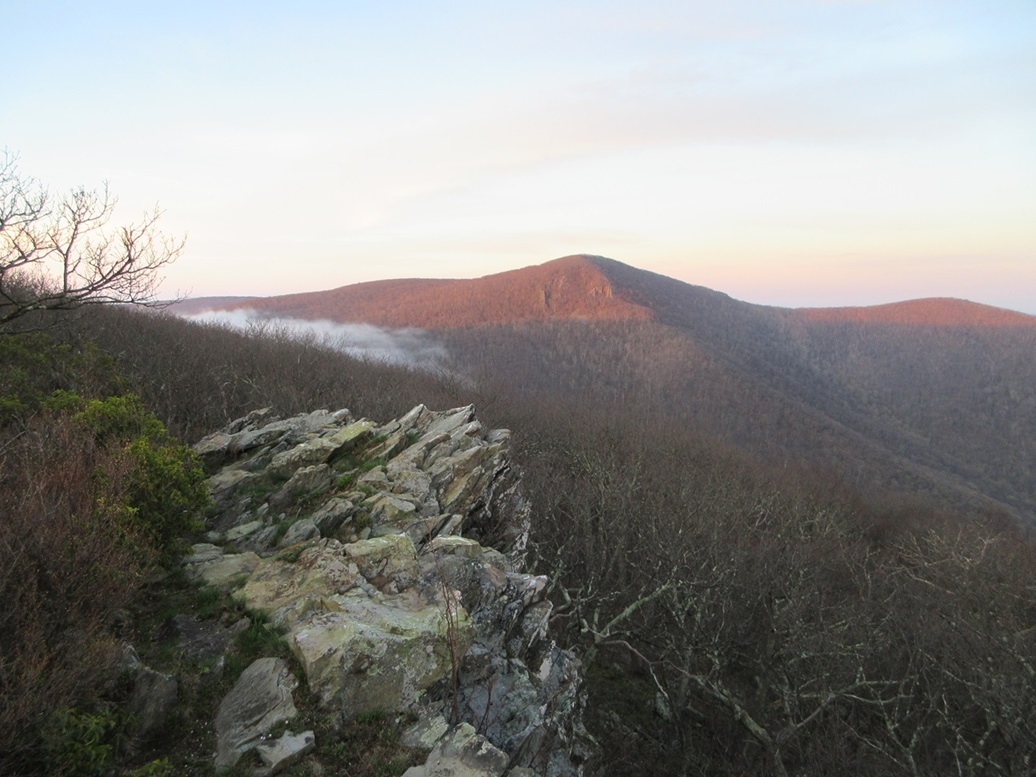
I "climbed" Betty's Rock by busting into the forest and to the rock outcrop on its western edge, a one-way hike of about a quarter mile and a hundred feet of gain. Views were very good, and there was a long drop below the outcrop looking west. Big Hawksbill rose to the south. The fog was trying to creep through a low pass to Hawksbill's east.
I hiked back to my car, getting a couple of free scratches after bashing through the trees, the hike taking about 25 minutes. I felt an itch on my knee and saw a tiny tick on it. It was just crawling, so I swatted it into oblivion, got back on the road and drove a couple miles north to situate myself for the Stony Man hike. Later, I would discover that I missed the highpoint of Betty's Rocks. It was in the trees a little bit, and I did not notice. Oh well.
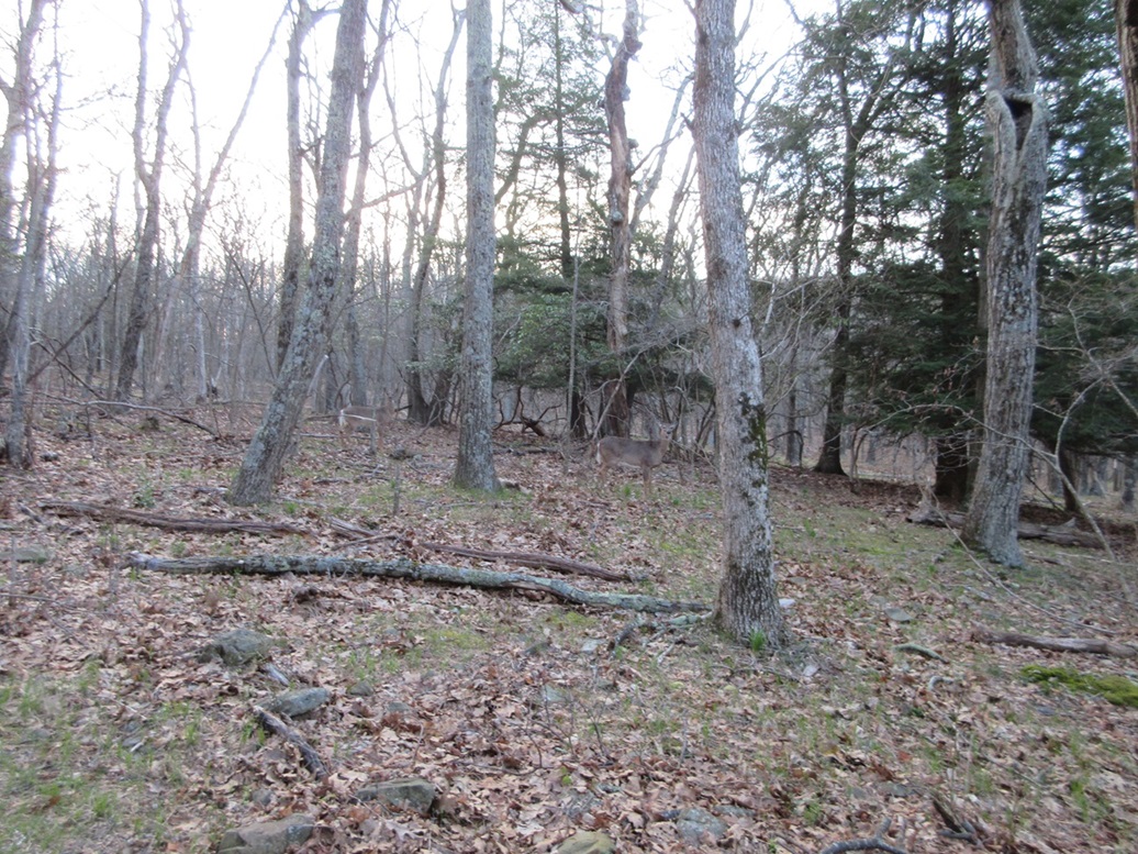
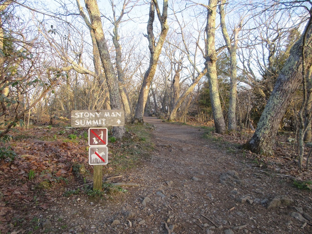
I found the Stony Man trailhead parking lot, and parked, just me at this early hour. I started walking the trail, rustling up a group of deer who jogged off but some stood around to watch me. The trail is wide and well maintained, and I was at the summit about 20 minutes later.
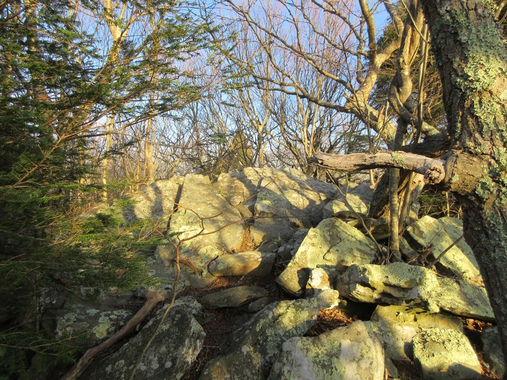
A couple of big rock outcrops look to be the highest, so I entered into the light underbrush and woods to seek out the top(s). I clambered up one rocky slope and tagged its highest rock, then walked to another nearby rock and tagged it too. I then followed the trail to the overlook to the west.
On the hike back, I checked again to be sure I hadn't missed anything. When I felt good to go, I started down a different trail. As long as it went down and generally south, I knew it would lead me back; at worst, maybe feed me out at a different spot from my car. It didn't matter as the trails merged and I was back to my car quickly, the round-trip hike covering a mile and a half, taking just 40 minutes.
Since I was near Skyland, I drove to it and used its facilities, plus to check for more ticks in the mirror. They were just gearing up for breakfast but it wasn't crowded. I asked a guy at the coffee stand if the fog below was "typical" and if it would blow over as the sun rose.
He told me I should go with it and "experience" the fog, giving me a short lecture how the mountain creates its own weather and so on. I smiled and nodded. I was going to experience the fog whether I liked it or not, but I was hoping for some useful knowledge from a local about what was typical. For example, if it commonly dissipates, I might just hang out for an hour and have something from his stand. But nah, I figured I would just go and experience it now rather than later, and not have to listen to this pedant.
I drove back to Thurston Gap, and descended back into the heavy fog layer. Now north of Thurston Gap, I was aiming for Beahms Gap scenic pullout, a little under three miles each way. I rolled in, just me of course. The fog was still thick but now allowed about a hundred feet of visibility, barely an improvement. It was chilly but not cold, still hovering about 50°.
This parking spot would allow me access to two peaks, an unnamed summit just to the north, and Pass Mountain to the south. I sat in my car for about fifteen minutes, hoping the fog might break, but it never did.
Elevation: 2,840 feet • Prominence: 360 feet • Distance: 1.4 miles • Time: 35 minutes • Gain: 360 feet • Conditions: Dense fog
PB
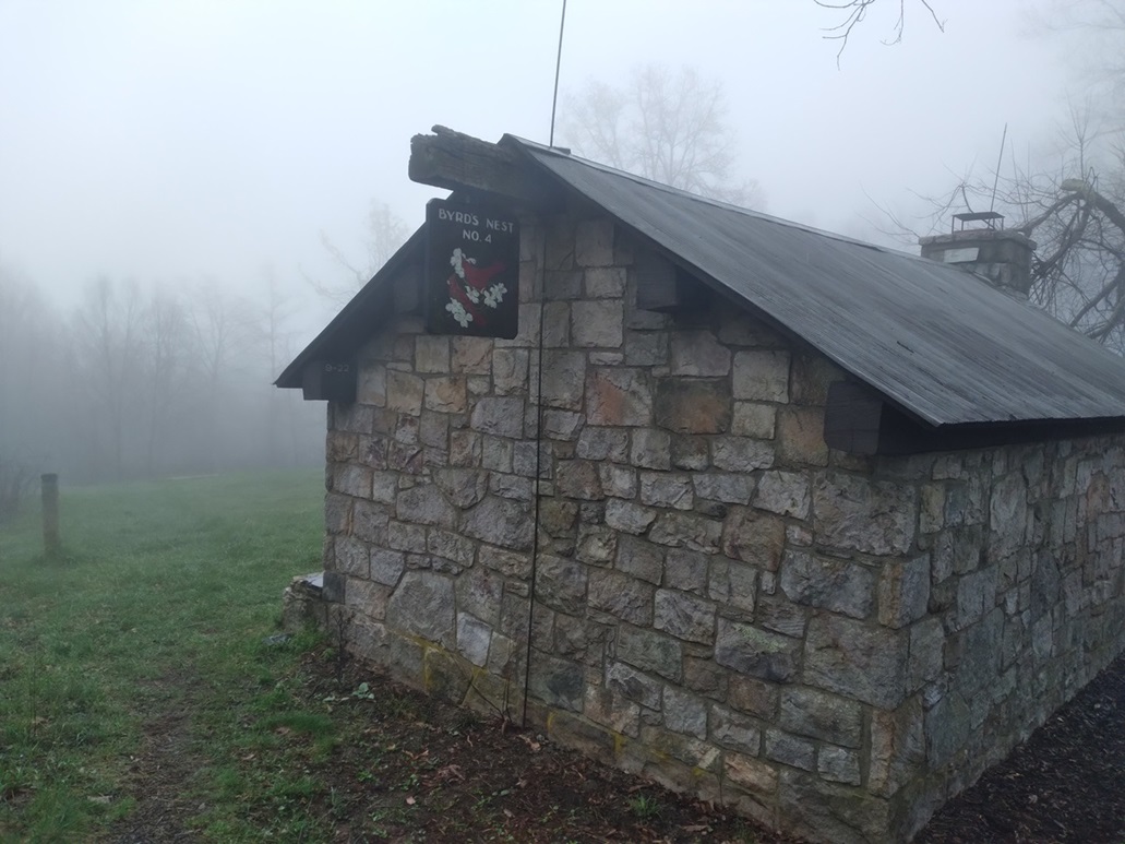
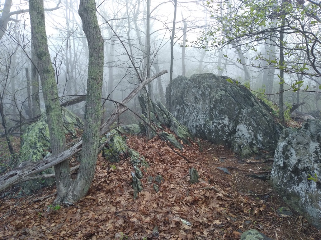
Fortunately, these two peaks have fool-proof routes to their respective summits, with this one having an old road to its top, where there is a shelter called Byrds Nest #4 on its top, the Appalachian Trail passing close by.
I walked on Skyline Road itself for a quarter mile, then came to the road entrance, closed with a simple link chain, and a sign saying "Neighbor Mt Tr". I stepped over the chain and walked up the road, which was steep at first.
This road makes a couple turns, but soon, I was at the shelter, appearing through the mist, which gave the whole place a spooky look. The highest point is behind the shelter, about another twenty feet higher. I walked up a footpath to it, then through the leaves and twigs to the rounded top. I stepped around for a minute or so, but turned right around and started down. There were no good views to be had.
The hike down didn't take long and I was back to my car in a little over a half hour.
Elevation: 3,052 feet • Prominence: 562 feet • Distance: 2.4 miles • Time: 50 minutes • Gain: 612 feet • Conditions: Fog
PB
I walked past my car and south on the road a little to locate where the Appalachian Trail crosses the road and starts up Pass Mountain. There was no reason for me to stop back at the car for a break. Part of my thinking was the sooner I start, the sooner this is over with. I wasn't enjoying the heavy fog very much, but here I was.
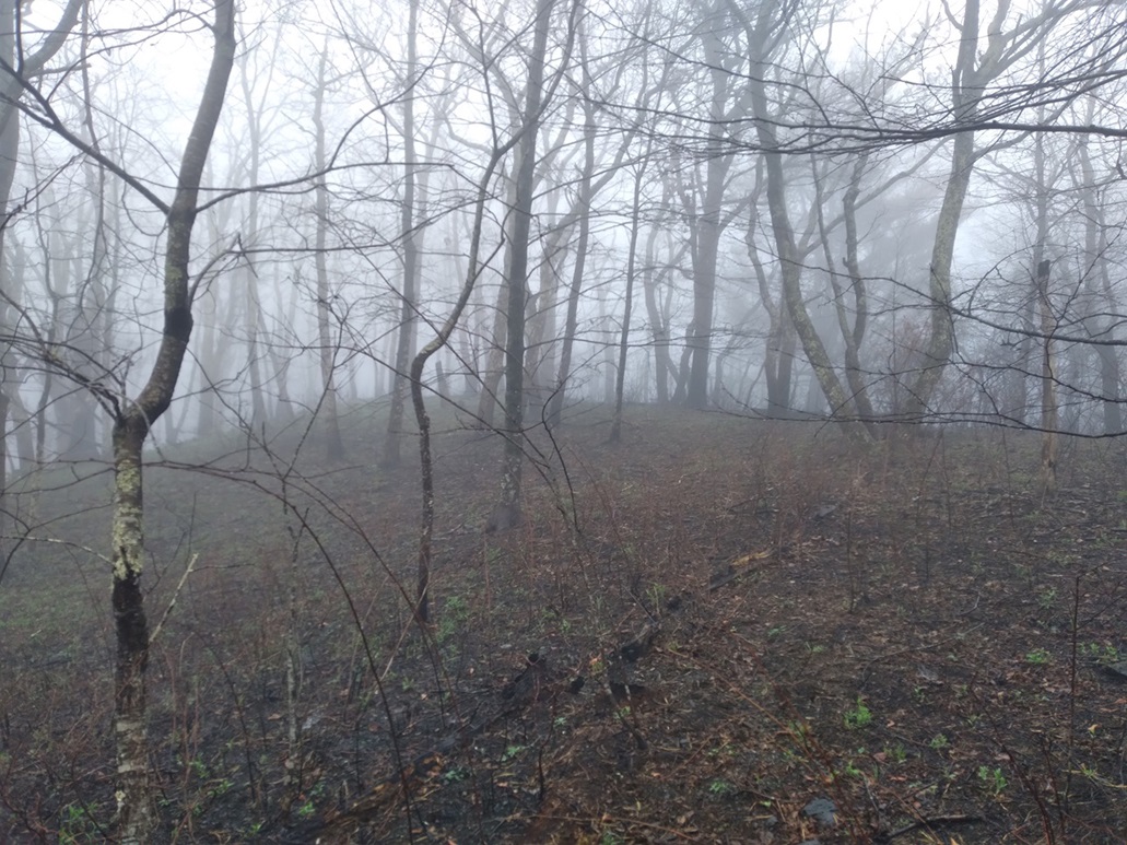
I found the trail and started walking up it. It goes in a little ways then hangs a right and starts uphill, the top a little under a mile away. Walking the trail went well, it being well maintained and easy to follow. The trees were capturing the foggy dew and turning it into "tree rain", so I got a little wet, but not too bad. The temperature was holding steady, in the low 50s.
In about fifteen minutes I was on the top, or so I thought. I had no idea. The trees would block views on a good day, and with the fog, I still couldn't see more than 75 feet ahead of me. Anything farther was just a gray-black mush.
I thought I was on top because I came upon a very large rock outcrop, and the trail flattened. But I knew better to be this complacent. I walked farther, and the trail even dropped a little, but then it started to gain some more. I came upon another "top" but still thought it wise to continue walking. Sure enough, the trail gained another short steep hill, there being a few rocky protrusions up here.
I kept walking and finally, the trail started to drop consistently, so I knew I was at the proper summit. I doubled back and tagged any rock that looked highest. Sighting between them was pointless given the fog. This satisfied me and I headed right back down. I was back to my car, total time gone a little under an hour. This was the longest hike of the four I did this morning, at just under 2.5 miles.
It was barely 10 a.m., but I was done. I got what I came for and a little extra bit of adventure. I needed to clean up. I planned for this, so I had some basic supplies with me and a bottle of water, and I took a water bath/shower right there in the parking lot. It wasn't perfect but at least I would be comfortable for the plane flight home.
I returned to Thurston Gap then back onto US-211. As I lost elevation, I dropped below the fog layer, now just under a lot of heavy, gray, cool clouds. I drove back to Warrenton then stopped at a Sheetz in Haymarket to clean up some more, get my bag properly packed, and to kill a little time. It was about 11 now, and I did not need to be at the airport until 2.
I drove back into the Chantilly/Fairfax area and stopped at a Barnes & Noble to get a couple books for the flight home, then drove to the airport to drop off my car. Yeah, I was early, but I had nothing else to do, so I just waited in the gates area and read my books.
The flight home went well. We landed at 6 p.m. Arizona time, or 9 p.m. Washington time. I still had 220 miles of driving back to Bisbee. I got to my car, and started the drive, thinking I might pull off somewhere halfway to camp, but once I was past Tucson, I just decided to bust home, inspired by the thought of sleeping in my bed in my house. I was home at midnight, or 3 a.m. Washington time. This had been a 24-hour day, and by the time I stumbled in my front door, hiking these peaks felt like a week had passed.
I was happy to be home. What a week. I was exhausted but still a mix of strong emotions. In a very real sense, tonight, this very moment, felt like the start of a new chapter in my life. Seeing my dad off allowed me closure, and a chance to move on in my life. I miss him now as I type this, but am at peace.
|


|