
Peaks & Highpoints of Virginia
www.surgent.net |
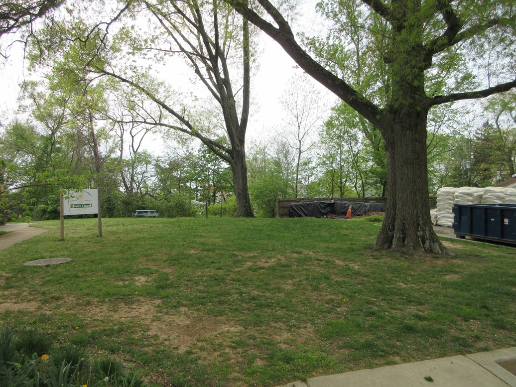
 Fairfax City Highpoint
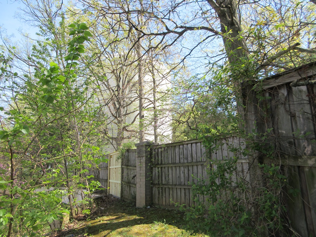
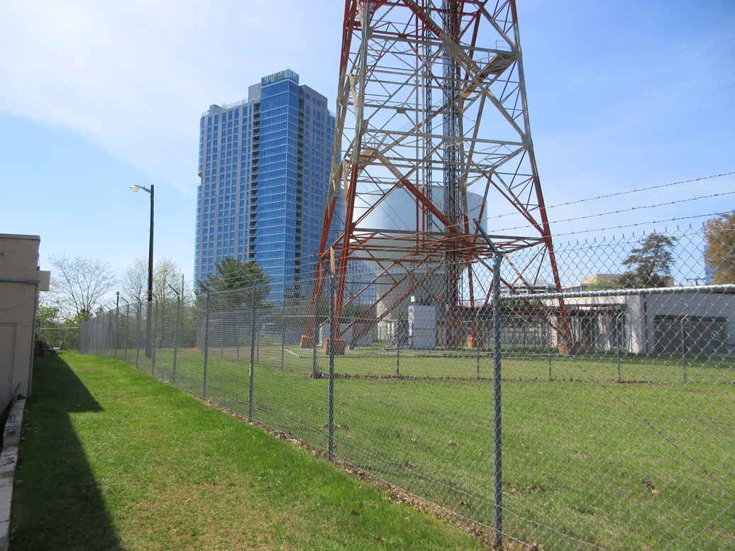
 The radome tower 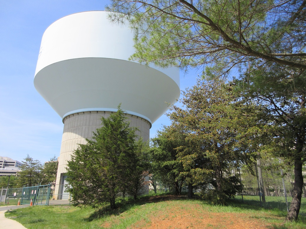 The water tower
|
Fairfax City • Tysons Corner I was here in Virginia to say goodbye to my father. He passed in 2022, and in keeping with his wishes, he was to be interred at Arlington National Cemetery. But the waiting list is long and he would have to wait his turn. Thus, it would be exactly two years and one week before he would be finally interred, the date April 17, 2024. I flew in yesterday into Dulles International Airport, which is about 20 miles west of Arlington, in the western suburbs of Washington D.C.. Early today, I drove west about 70 miles to hike three easy peaks in Shenandoah National Park, entering the park from the town of Front Royal. I was finished by mid-morning, and back to my hotel in Chantilly (just south of Dulles) by 11 a.m., with the rest of the day open. The plan for the rest of today was to do a "test drive" to Arlington Cemetery, so that I would not miss it tomorrow for the actual funeral. I had printed off maps of the region and studied them before leaving. This whole area is covered in freeways, highways, pikes, parkways, toll roads and boulevards, in an incomprehensible tangle. I felt like I would had this been a final exam: hopeful, but not terribly confident. Thus, I allotted the rest of the day for this task. I had to cover just 20 miles from my hotel to Arlington Cemetery, but I fully expected to get lost at least a few times. So I figured I may as well make this into an adventure. There are two county highpoints and one independent city highpoint (county equivalent) in the area. In my previous visits to Washington and Northern Virginia back in the 2000s, my wife and I came here often, and I was aware of these highpoints, but had zero interest to find them, not wanting to deal with city streets and who knows what. But today, why not. I was already mentally ready for a day of driving a warren of streets and freeways, so I included them into the itinerary.
Date: April 16, 2024 • Elevation: 480 feet • Distance: 50 feet • Time: 3 minutes • Gain: 2 feet • Conditions: Nice
Main
•
PB
I originally was not going to bother with this "highpoint", but looking at maps online, I saw that it's just a few miles down the road from my hotel, and I would be heading in this direction anyway, so I included it. Fairfax City is a separate entity from the surrounding Fairfax County, an independent city common in Virginia. This would be my first county highpoint (or equivalent thereof) in almost 4 years.
From my hotel, I got onto US-50 and followed it southeast past the interchange for Interstate-66, then an immediate right (south) onto Waples Mill Road. A half-mile later, I went left onto Main Street, which is also signed as US-29. Just past Jermantown Road, I pulled into the parking lot for Haverty's Furniture, and drove around back, toward the big obvious water tower.
I parked, and just then, a Haverty's truck and a Haverty's van come rolling in, backing into the loading bay on the store's backside. My hike, such as it was, would be to wander near the loading bay and up a tiny swell of grass to a fence line surrounding the water tower. Would these guys stop me or even care? I walked anyway up to the fence and these guys ignored me, which was fine by me.
The walk covered just a few dozen yards with about two or three feet of gain, getting as far as the fence. There may be land a foot higher behind the fence, but this was as far as I would get, and I considered this good enough. The whole journey took just a few minutes. I saddled up in my Kia Sportage and got back onto Main Street/US-29.
Date: April 16, 2024 • Elevation: 520 feet • Prominence: 230 feet • Distance: 0.1 mile • Time: 5 minutes • Gain: 2 feet • Conditions: Still Nice
PB
I followed Main Street east past the light, where it crosses US-50. Staying straight through the light, I went another mile to Chain Bridge Road, also signed as VA-123, and took a left. This road appeared to make a straight shot northeast toward Tysons Corner about seven or eight miles away.
I was quickly learning the nuances of the road grid here. First, there's not a right-angle anywhere in the city. Roads Y apart constantly so I had to pay attention to what lane I was in, lest I inadvertantly get fed onto a road I did not want to be on. Signage is cursory and often seen too late to be useful, and I would suddenly find myself needing to make a sudden lane switch to stay on course. My rental had Florida plates, so I am sure the locals thought I was some drunk fool, which may have worked in my favor. No one honked at me and usually gave me space to merge.
In about fifteen minutes, I was closing in on Tysons Corner, which despite its homey-sounding name, is a clutch of massive buildings, shopping malls and restaurants, all crammed into about a square mile of space. Some of the biggest firms have their headquarters here. The highpoint lies on what was known as Gantt Hill, but due to construction over the years, has been altered so that its accepted highest point is near a massive tower northeast of the junction of Chain Bridge Road/VA-13 and Leesburg Pike/VA-7 (every "major" road here is also numbered as a Virginia state route).
I went north on International Drive/VA-6034, then left (west) onto Greensboro Drive/VA-5063, then another left (south) onto Pinnacle Drive, which for those keeping score, is also signed as VA-5064. Up ahead is the obvious tower, which rises a couple hundred feet into the air, and is topped by what looks very much like a FAA-style radome. I parked in a lot near an Italian restaurant and a FastSigns store.
A fence surrounds the tower, no doubt to keep people from tampering with it. I walked the area behind the restaurant and outside the fence, which rose a few feet and is one of the probable highpoints. I also walked a little more to a clump of trees on the west-facing fence, which looked about as high. Good enough. I was back to my car quickly.
These highpoints certainly don't require much physical labor or skill, but the ordeal in battling traffic and confusing street layout and signage just to get to these points makes it feel kind of like an accomplishment.
So far, things were going well. I had not got lost yet, and I managed to stay on course, and traffic was heavy but not clogged. The day itself was pleasant, in the mid 70s, sunny with high clouds, and that slightly-humid "smell" that I equate to the east coast, versus what I am used to in Arizona.
Date: April 16, 2024 • Elevation: 464 feet • Prominence: 84 feet • Distance: 0.4 mile • Time: 20 minutes • Gain: 50 feet • Conditions: Pleasant
PB
Next up is Minor Hill, or sometimes known as Minor's Hill, which lies on the west edge of Arlington County. From Tysons Corner, it is about four or five miles as the crow flies, but as the Scott drives, I would soon find out, and in the process, experience my first "got slightly lost" event of the afternoon.
I got myself onto Leesburg Pike and followed that southeast, intending to get onto Interstate-66. All was fine until I realized I missed the turn to actually get on Interstate-66. When I saw the sign, I was one lane over too far and couldn't make the merge quickly enough.
Now I was at the mercy of the city streets. I knew that if I could get onto North West Street, that should segue into Williamsburg Boulevard, but somehow I bolluxed that up too. Next thing I know, I'm on smaller residential streets, with the interstate to my left. I knew if I stayed close, I should not get too lost. I had to make some turns on instinct alone and really cannot tell you what I did. By staying close to the interstate, I found myself suddenly on its frontage, which then led up to Langston Boulevard/US-29. This was all by luck mind you. But this worked well because Langston would also get me to my objective.
I took a left (northeast) onto Langston, then a left (northish) onto Sycamore Street, to where it merges with Williamsburg, which is what I wanted to be on originally. Where Sycamore and Williamsburg meet is a very confusing intersection because there's another major intersection just yards ahead, essentially a five-way intersection. I rolled the dice and tried to drive it. I took a left onto Powhatan Street, then found Rockingham Street, then the tiny Pocomoke Street, location of the highpoint!
I parked but felt uncomfortable parking on a residential street. This is a nice area, but I decided to go back just a quarter mile to where Williamsburg and Sycamore meet and park in the lot of a strip mall that featured as best as I can recall a Chinese food restaurant.
Thus, I would make this into an actual hike. I crossed the busy streets using the crosswalks, walked alongside Minor Hill Park with its flowers, then up Powhatan to Rockingham to Pocomoke. The highpoint is at, near or possibly in a house on the corner of the latter two streets. I walked to this corner, noting that the land rose a foot or two to meet the house. A tree was planted mere feet from the sidewalk with berms about a foot high. I tagged the berm and called it good. I felt it wise not to be traipsing onto someone's lawn.
The hike back took a few minutes and actually, I liked this little jaunt. It's a pretty area and if I did not feel so rushed, I would have walked the little park and viewed the flowers a little more. So far, things were going well. I had succeeded on the three "highpoints" for this little sortie, had only got lost once, the weather was holding steady, and I still had plenty of time to get to Arlington Cemetery.
I was now just about six or seven miles from the Cemetery. I retraced my route back to Interstate-66 and this time, got onto the darn thing, following it eastbound. I had printed off directions from the Arlington website explaining what roads to follow to get to the Cemetery.
I wanted exit 73, which the directions said were for Lee Road, which is not true. It actually feeds onto Langston Boulevard, which by now is a frontage to the interstate. I got into the community of Rosslyn and went south onto Fort Myer Drive, down below a bridge, then up to a light, then past that and onto US-50, also known as Arlington Boulevard. So far so good.
Then I missed a turn. I got onto Arlington Boulevard/US-50 and was so concerned about merging properly that I did not notice that at a Y-split directly ahead, I needed to stay right which would put me onto the George Washington Memorial Parkway, which is what I wanted to be on. Now I am on US-50, which re-merged with Interstate-66 and crossed the Potomac River on the Theodore Roosevelt Bridge. Cripes, I'm heading into Washington whether I like it or not.
I had no desire at all to try my luck with these roads. This is not like Arizona, where if you miss a turn, just go up to the next one, and double back. Here, you're at the mercy of where the street takes you. The intersections are all signed against U-turns. I got fed onto Constitution Avenue actually quite close to the Vietnam Memorial. At the first light, I went left onto 22nd Street, then noting I had a chance, made a U-turn.
My Subaru Forester is wonderful with tight turns, having one of the smallest turning radii of all vehicles. Kia Sportages, not so much. In my Soob, I could have pulled the U-ey before anyone noticed, but in the Kia, I had to make it a three-point turn, naturally blocking traffic. I did not care. I had my Florida plates as my excuse. People would think I can't read the signs. I got back onto westbound US-50, over the bridge, and back on westbound Interstate-66. I took this to Exit 73, where I had been about fifteen minutes earlier. At least I knew where I was.
I retraced my route exactly as before, but now wiser, took a right at that Y onto the George Washington Parkway, then exiting onto the Richmond Highway/VA-110, which leads right to the Cemetery. Success at last!
I pulled up to the guy directing traffic and told him I was going to be here tomorrow for my father's funeral. He directed me to park in the day lot for tourists. As I was tired by now of all the driving, I was content to get out and wander a little, although I never actually entered onto the Cemetery grounds. I stayed mainly outside, but I talked to some docents there and they told me where I would go tomorrow, and they were most helpful. I spent about a half hour here.
Friends of the family live nearby, just a couple miles south of the Cemetery. I had texted with them and they invited me to come by, which I accepted. They knew my folks back in 1969-70, when we were all stationed at White Sands in New Mexico. They would be attending the funeral too. I had not seen them in over twenty years, so it was good to visit with them for a couple hours to relax, catch up on old times, and have some memories of my father. I appreciated their kindness to allow me to come over and hang for awhile.
The drive back west to Chantilly went well. I stayed on Interstate-66 the entire way and just had to deal with traffic, but it was never too bad. We were able to keep along at about 50 miles per hour. I was back to the hotel about 7 p.m.. It had been a long day of peaks on the Shenandoah National Park, lame highpoints in the Washington suburbs, getting lost a couple times, and meeting family friends.
My hotel in Chantilly was near a shopping center. The population here seems to be heavily weighted toward Indians (from India). The shopping center had a huge supermarket with Indian foods, which I love, and the nearby smaller restaurants were a variety of ethnic and foreign cuisines. Last night, I had got a great Korean ramen dish, plus some basic groceries from the Indian supermarket. Tonight, I wandered until I found a Thai restaurant, and got a Thai meal. I had really not eaten at all today, so I wolfed down that meal in the comfort of my hotel room, watching The Green Mile on the telly.
My father, Joseph Roderick Surgent, was born in 1942 in New Jersey, where he was raised and went to college at Rutgers, graduating in 1963. As a member of the ROTC, he was immediately a commissioned officer in the United States Army. His first posting was at a Nike missile site in Southern California on Oat Mountain, which at the time was in the hills north of Los Angeles but these days is near the suburbs of Santa Clarita.
Later in his life, he told me of his time at the Nike site. This was at the height of the Cold War, and he and his mates there were in charge of whatever nuclear missiles they had buried in the silos there. It was very much the real deal.
The area at the time was remote so they would go hiking and explore the nearby hills and canyons. He told me there was a rancher there who was friendly with the Army men there and would have them over sometimes, and allow them to explore on his lands. He told me they all once helped put out a fire that had built in the hills nearby. This wasn't just out of kindness, as they were also trained for basic firefighting since a fire on the missile site wouldn't be a good thing tactically. He spent a year there.
It was during this time he met my mother, who was born and raised in Southern California. They met through mutual friends, who remained their friends for the remainder of their lives (and became my godparents when I was born). The American involvement in the Vietnam War was still relatively small scale at this time, but my father knew he was going. As he told me, he had two choices: go now, or go later. He chose to go now. My folks married in 1965 and within months, he was on a plane to Saigon.
He was an adviser. He was stationed in Cao Lanh Province, about two or three hours southwest of Saigon, along the Mekong River where it re-emerges from Cambodia back into Vietnam. He was assigned to a South Vietnamese (ARVN) unit, to "advise". He said most days they just did patrols along the river, or alongside the rice fields, or the small villages. He said it was unbelievably hot and humid the whole time. He said they would go into Saigon about once a month to stock up on supplies. Saigon at the time was relatively safe, but the roads to and from there were not. He said they'd speed like crazy to and from, fully armed and ready for combat. Apparently, they never had any grief on these Saigon runs.
He told me of one of his first sorties with his ARVN unit, he got camouflaged up with clothing and facepaint just like the rest of his Vietnamese unit, and they all busted out laughing. All the camouflage would not hide a 6-foot, 1-inch man standing amid his 5-foot tall Vietnamese companions. "Just aim for the tall one" he told me was a common tactic used by the North Vietnamese.
He was in Vietnam from September 1, 1965, through the end of August 1966. He said that while it wasn't hellfire all-day and all-night, it was still war. They could have ten or twenty days in a row where nothing happened, then suddenly be mortared or shot at by the NVA guys hiding in the bushes.
He told me of one day when his unit were trooping along a canal, looking for a place to cross it. They came upon a nifty bridge, but the ARVN commander felt it too good to be true, that it might be rigged or mined. So he ordered his unit to go ahead, and they found a lesser crossing. My father told me he had a bad feeling about this, and suggested not to use that crossing, but he was over-ruled. They used it, and sure enough, that crossing had been mined and a couple guys were killed.
Since he was so close to Cambodia, I asked if he ever was "in" Cambodia. His stock reply was that he took a piss in Cambodia once. But the real story was that they were doing their patrols and somehow actually found themselves a few miles inside Cambodia, which would have been very very bad news, since Cambodia at the time was strictly not part of the war. He says they hauled ass out of there and hoped no one noticed.
On his birthday in May 1966, he was on a patrol with his unit when they started being bombarded by small arms and mortars. The NVAs had taken up a position and had caught my dad's ARVN unit by surprise. They settled into a defensive position and started firing back. My father told me he took a bullet off of his helmet. It clanged off of it in the lower edge. One inch lower, and he would have been killed and I would not have existed. My father had to engage with the NVA directly as well; he couldn't stand back and merely "advise". He called in for air support and the skirmish was quickly quelled and the NVAs flushed out of the jungle. This was the biggest battle he found himself in while in Vietnam. He almost punched his ticket on his birthday in 1966.
He was rotated out of Vietnam at the end of August 1966, and eventually flew back to Los Angeles, where my mom greeted him. Nine months and four days later, I was born. He stayed in the Army as a full-timer, working on missile systems (he had graduated with an engineering degree from college). They moved him from Fort Sill, Oklahoma, to Fort Bliss, Texas, to White Sands, New Mexico. Then he spent a year on Kwajalein Atoll in the South Pacific. That was 1970-71. By this time, I was four and my sister was two.
He left the Army full time in 1971, spent three years working for Avon Cosmetics in Monrovia, California, then began his second career in law enforcement, eventually spending twenty years with the Los Angeles County Sheriff's Department, where he rose to Lieutenant and oversaw the Child Abuse Division. Any crime committed against or by someone under the age of 18 went to his people. He later was a Chief of Police in Sierra Madre, California, before retiring for good. During this time, still maintained his involvement with the military, as a member of the California National Guard. He rose to Colonel, and was the commander of the Los Alamitos Armory in Arcadia, California, in the 1980s. He formally retired from the military in 1992.
When I was still a child and teenager, Vietnam was still very much in the news even after the war had ended in 1975. Vietnam vets at the time would have been young men, in their twenties and thirties. I knew my father had fought in Vietnam. Many of my friends had fathers who had also fought in Vietnam. He never talked about it, though. He had a few things on the wall from his service in Vietnam. I know it had an effect on him, as it would anyone. He lost a close friend in battle over there. He came back and did his best to get back to normal, but one unwritten rule was that he wouldn't talk about it, and I should not ask. So I did not. To me, unfortunately, it was all an abstraction.
About ten years ago, I asked him to write up his memoirs on his time in Vietnam. He at first declined, but I pointed out that his experience would be valuable knowledge to anyone interested in the war. I told him there will be a time when you all will be gone, but that the stories need to be known. And I told him, frankly, that as a man in my mid-40s now, I'd like to know more than the crumbs he's told me over the years. I'm not some kid any more who wouldn't understand. Then I shut up and never brought it up again.
A year later, he surprised us all with a memoir! It ran about 60 pages and included photos he had taken. I had never seen these images, and he had taken many hundreds of them, and I never knew that. He had my mom type it all up, and it was utterly fascinating! I was so grateful, and so fascinated by what I read. I knew for the first time what he had actually faced down there, how he had felt, his losses, his fears, everything. He told me later that he mulled on my request for a few months and realized that yes, his story needs to be told, and that it was a cathartic experience for him to write it all up and get his photos out. It wasn't some half-ass term-paper either. It was very well written with a nice flow and narrative style. My dad's a writer. Who'd of thunk. He was even humorous, too.
One story was that he and some guys were tasked to dis-assemble a bunker in the center of their compound, basically a bunch of sandbags forming a wall partially sunk into the ground, with a roof. They'd hunker there when they were facing some fire from the NVA. So he and his guys are pulling it all apart when they spooked up a ten-foot cobra, who had apparently been using the compound as his home too all that time.
In his later years, he spoke more freely of his time in Vietnam. I think this memoir helped him come to peace with it, as much as it was possible to do so. I loved hearing his stories. The actual battle stories were fascinating, no doubt, but it also helped me see my father in extra dimensions, as a man with strengths and weaknesses and concerns and fears just like every other person on the planet. I saw him as more human, if that makes sense. What had been a closed chapter in his life, and where I had no business sticking my nose into, he now shared all this with me freely, and I am forever grateful that he did.
The next day, April 17, was his funeral ceremony. It would be at 1 p.m., and we had to be there at noon at the Admin Building. I was up early and very restless. I went for a walk in the area, even worked out in the tiny gym at the hotel. My plan was to leave early and hopefully get there early. I wanted to build in extra time in case I hit traffic. Of all the events in my life that I did not want to miss, this ranks at the very top. I was taking no chances.
I was also coping with the emotional enormity of the day, of the ceremony, and of his loss. When he passed in 2022, he was very ill and we knew it was imminent. When he did pass, it was not a surprise, and I certainly cried, but then ... there was a long wait, no opportunity for closure. I got on with my daily life. I thought about him often. We simply had to wait until Arlington would schedule him. In January of this year, my sister informed us that April 17 was the date. I immediately made plane and hotel reservations. But it was still three months in the future. So back to my daily mundane life, me.
For whatever reason, when April 1 came around, suddenly it felt "real". It was imminent, it was going to finally happen. The emotions came back again. I found myself easily distracted. I still attended to my daily duties but also would just stop and go into thought mode. I realized I really needed to be there and say goodbye to my pop.
I got to Arlington Cemetery about an hour ahead of time, which was fine with me. At least I was here. My dad was like that: he'd show up four hours in advance at an airport to be sure to be on time. I guess I inherited it from him. I sat in my car and vegged, walked around. I was in a suit. I had not worn a tie in over 25 years, but I still remembered how to tie one.
We all convened at the Admin Building as directed at noon. My sister and her friend, and my brother and his family, appeared shortly, as did another dozen or so attendees. It's all very formal and they have this down to a science. They tell you exactly where to go, what to do.
We convoyed in our vehicles to the ceremony site. We sat in some chairs while a band was nearby. The Honor Guard were nearby, first unfurling, then refolding, the flag, as the chaplain led us through the service. A twenty-one gun salute followed. Wow, this was so wonderful, and heavy, and beautiful. I was in tears. I was so proud of my father and to have been his son. It was what I had hoped for, a chance to really let the feeling and the love flow out and not be kept under wraps inside me.
We then walked to where is actual burial plot will be. We stood around for photos and to talk, allowing everyone a chance to mingle. I was seeing people I had not seen in almost 40 years in some cases. I was grateful and appreciative that we had people here from his past, family friends going back to the 1960s and 1970s, honoring him. I hope he was able to sense this somehow, wherever he is.
The ceremony lasted about thirty minutes, maybe 45 counting the mingling. We were then directed back to the main entrance to be sent on our way. It was a beautiful moment in my life, one I will never forget. I did not lament his loss, but instead celebrated his life, and said my proper farewell. I loved my father dearly, and do so now, and always will.
My sister informed us that there would be a get-together at a nearby restaurant at 4 p.m.. It was now 2 p.m.. I did not want to go back to my hotel only to come back battling the traffic and the roads. My sister and brother were staying closer in so this was not a concern for them. I had two hours to use up.
I will be the first to admit that I had no intention of doing some lame "highpoint" today, but I needed to go somewhere for a couple hours. A highpoint candidate for the District of Columbia was nearby. I couldn't believe I was actually going to do this, but I did.
Date: April 17, 2024 • Elevation: 412 feet • Distance: 0.1 mile • Time: 5 minutes • Gain: 5 feet • Conditions: Cloudy
PB
I got onto the George Washington Memorial Parkway, and headed northwest. This parkway fronts the Potomac, but is flanked on both sides by stately trees. It's a very pretty drive meant to be taken leisurely. Maybe on a weekend, yes. On a weekday, it's just as busy as any other freeway.
I was on the parkway for about ten miles. They're doing construction so there were some lane restrictions and plenty of pylons to direct us. Somehow, this went rather well, no clogs of cars. This put me on Interstate-495, the famous "Beltway". This was clogged, but I was only on it for a couple miles. Once over the bridge and inside Maryland, I exited onto River Road, and travelled east on it until I was back inside the "DC".
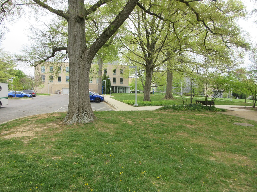
Suddenly, I was forced off the main road due to construction, shunted onto residential streets. I was "lost", so I followed roads and took turns on instinct, mainly trying to "parallel" the main road. Then I caught a break. I found myself on Yuma Road (how ironic, a street named Yuma in Washington DC). Why, this is the street that goes right to American University! This is what I wanted to be on anyway.
The presumptive highpoint of the District of Columbia is at Point Reno, a half mile to the north, and a spot where I visited back in 2005. But Lidar data shows that a point on the American University campus may be as high, if not higher, since the land over by Point Reno has been reworked to accommodate a reservoir. Point Reno is 415 feet elevation, and this point is 412 feet. The consensus is that this point is probably higher.
I parked on Yuma Street, walked onto the campus and to the southwest end of a parking lot, to where the grassy lawn rose a foot or two near some large oaks. This looked good, so I stepped around and snapped a couple images. Now I can forever be assured I have visited the DC highpoint. No time to celebrate. It was a little past 3 now, and I had an hour to get to the restaurant.
I retraced my route, which went fine until I was on the George Washington Parkway again, where I had heavy traffic. I spent twenty minutes going a couple miles. There was no way I'd be on time to the restaurant, but as it turned out, that was okay. I made it to the restaurant at 4:20 p.m., and was surprised to see that I had beaten most everyone there. I guess the traffic gremlins caught everyone else too.
We had a three hour meal, a chance to just enjoy each other's company and eat some good food. It was low key, or about the right key, as my father would have preferred it. I'll admit by the end of this, I was utterly exhausted. What an incredible day. Surely one of the most significant, emotional days of my life. I went back to my hotel and relaxed. We had done it. It all went off without any hiccups. My sister should be commended for being the point person throughout all this and handling the logistics.
The next day, I took the "M" into Washington to meet up with my sis and some family friends to tour the White House. Two days later, I'd hike some more peaks in the Shenandoah National Park before flying back to Arizona that evening.
|


|