The Mountains of Utah
• www.surgent.net
|
| Murdock Mountain West Ridge |
• Highpoint: Wasatch County • Uinta Mountains • Wasatch National Forest |
 The gentle west slopes of Murdock Mountain
|
Date: August 15, 2006
• Elevation: 10,840 feet
• Prominence: none (liner)
• Distance: 1 mile
• Time: 1 hour
• Gain: 400 feet
• Conditions: Unsettled, storms building
• Wildlife: A moose!
Utah
•
PB
Two days after an exhausting hike up Ruby Dome in Nevada, I returned to Utah and was looking for something to do. I first looked at Willard Peak (highpoint of Weber County), but that venture came up short: my first try was via the forest road from the north, but I was concerned its quality was bad enough to possibly ding my vehicle, a rental. I didn't want to chance that. So I camped somewhere on the east side near the town of Liberty and followed the Ben Lomond Peak trail the next morning. However, the day was misty and drizzly, and the trail was overgrown. After 90 minutes, with just about 15% of the hike finished, and given the weather, I bailed. The conditions were just not in my favor.
The hike was not a total loss, however. I saw my first moose ever while hiking down. Yes, moose live here! I saw him in the brush off the trail; he scampered away as he saw me. That was worth it.
It was about 9 a.m. when I came back to my vehicle, so now I had a full day to kill. Too late to start any long hikes (and the weather was staying kind of unsettled), I turned my attentions to the only "easy" county highpoint in the region, the liner in Wasatch County. It's not a trivial highpoint, but neither does it require a full day or thousands of feet of gain. It'd be a perfect way to kill time and explore the pretty areas in eastern Wasatch County.
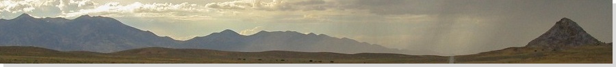
I drove into the interior mountainous regions, entering Coalville, where I stopped at their library for maps and information, and then later in Kamas, where I got further information from the Forest Service. They require a $3 fee to park along the highway up in the mountains, so I paid the fee, got a pass and all sorts of brochures. I drove east along UT-150 into the heart of the mountains, following the highway for 28 miles as it gained steadily to just below 11,000 feet elevation. Along the way I was treated to vistas of high mountains, endless forest and gorgeous waterfalls.
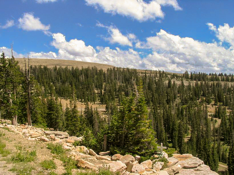
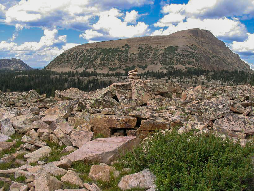
In about an hour I had driven to the mile-marker 28, which put me close to the Wasatch County highpoint. From the pullout and viewpoint below Bald Mountain, I could see my objective: a broad talus ridge emanating west off of a gentle peak called Murdock Mountain. I backtracked a tiny bit and parked in a gravel clearing near the mile-marker post. This put me just across the highway from my objective.
The highpoint of the county is a result of a random boundary placement. It's not the summit of a peak, but a point along its west ridge at 10,840 feet elevation. This required a GPS and map, plus a compass for bearings. I walked into the trees and up the steep slopes, gaining about 300 feet quickly, but soon coming onto some gentle slopes and the talus-forest margin. I clambered up onto the talus and worked by sight south until I had surmounted the obvious (by sight) "ridge", as best as I could determine it.
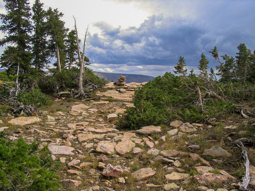
I had pre-programmed a waypoint into my GPS for the highpoint, so when I checked my position I was too high by 100 feet and too far east (inside Duchesne County). I walked west along the rocks and through small tree stands until the GPS seemed to say I was in the right area. Knowing that my GPS coordinate may have some error to it, I started seeking out anything that looked like a cairn, or any hint of previous visitors. I stayed on the ridgeline as best as I could. I walked west and then started finding cairns. Which one was correct? Who knows. To be sure I visited three cairns, and essentially walking the ridgeline faithfully so that at some point I had to have crossed the highpoint, even if I didn't know when for sure.
By the time I came upon the third cairn, I felt I had given the area good coverage overall, and had spent about 45 minutes already on the hunt. I can't say which cairn, if any, is the right one. I do feel that I stayed on the ridgeline enough so that I did the highpoint, even if unbeknownst to me exactly. Above me were puffy clouds, and one set nearby dropping rain and lightning, so I got moving and back to my car. I had an enjoyable drive back into Kamas, stopping to have lunch near a set of huge waterfalls just down the highway.
This particular county highpoint essentially completed my county-highpoint project, or more accurately, addiction. When I got the bug in late 1999, I had a general plan to hike/visit all the county highpoints of the states of Arizona, New Mexico and Nevada, plus anything else convenient as opportunities arose. When I hiked Ruby Dome a couple days prior, that finished Nevada for me, and thus, my primary goals (I completed New Mexico in 2004 and Arizona in 2000). Suddenly, I felt done, and no longer that interested in pursuing county highpoints. It was funny how fast the feeling went away. I had been consumed by this hobby for 6 years, and suddenly, that interest was gone. This county highpoint remains the last western county highpoint I have visited (as of 2023). Since this one, I have added on about another 30 nationwide, but these have been as add-ons when I find myself in a different part of the country for whatever reason, e.g. a handful in Virginia visiting in-laws, some in Massachusetts while on business, a batch in Minnesota while on a medical run to the Mayo in Rochester, and so on. I'll continue to keep an eye out for the easy ones as opportunities arise, and maybe bag a few more peaks out west that are county highpoints.
Update 2022: Newer LIDAR data shows the highpoint may be a point 0.2 mile north of the contour shown on current topographical maps. I would have likely walked on or very close by this point because it is on the way to the southern de-facto highpoint, but I cannot guarantee I stepped on "it". But neither can I guarantee I stepped on the correct southern point(s) either. This highpoint is unavoidably vague, but I still count it as completed because I roamed the whole area in good faith and would have stepped on anything remotely high.
|

|