The Mountains of Nevada
• www.surgent.net
|
| Ward Mountain |
• Highpoint: Egan Mountains • Humboldt-Toiyabe National Forest • White Pine County |
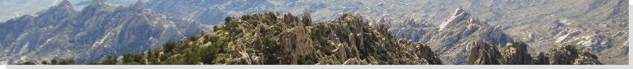
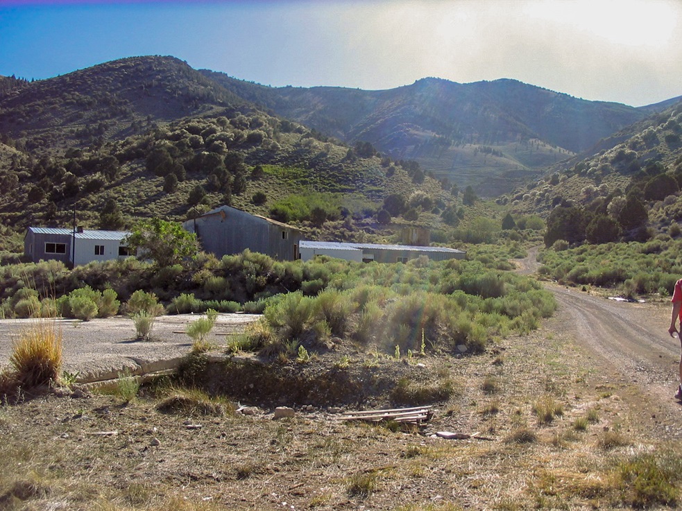
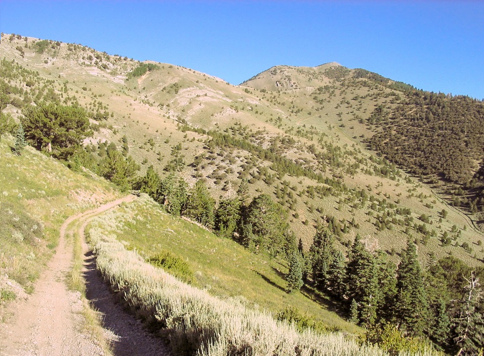
 Ward Mountain: the summit is toward the right
|
Date: August 3, 2008
• Elevation: 10,936 feet
• Prominence: 3,676 feet
• Distance: 10 miles
• Time: 6 hours
• Gain: 3,500 feet
• Conditions: Clear and warm
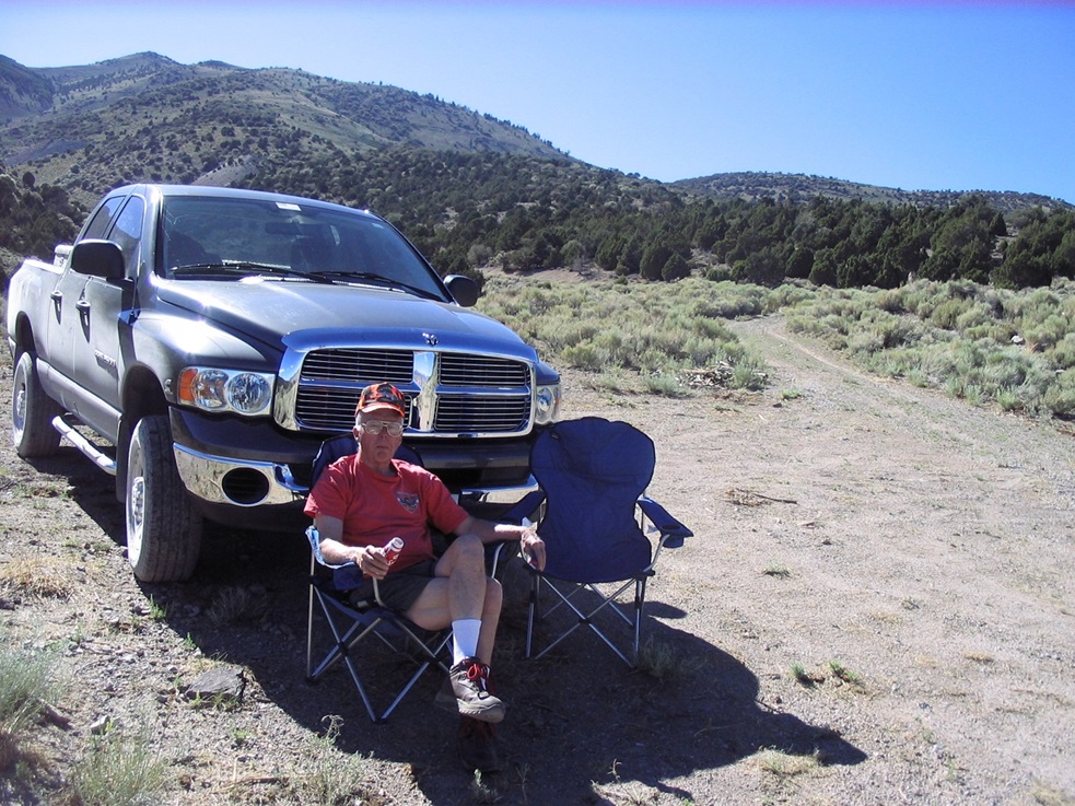
• Teammates: Joe Surgent (base camp manager)
Nevada
•
PB
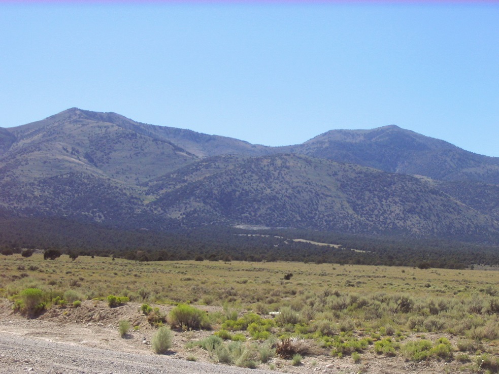
A few days after hiking Arc Dome, my father and I drove up the east side of Nevada to Ely, planning for a hike (me), exploring old ghost towns and ruins (both of us), and enjoying the scenery while shooting at rabbits (my dad). On my agenda was Ward Mountain, the highpoint of the Egan Range, south of Ely.
My dad and I enjoy Ely (pronounced Ee-lee), which is the biggest city in eastern Nevada, about 6,000 people. It's about 250 miles from Las Vegas and almost 300 from Reno, situated in the high desert of the Great Basin at over 6,000 feet elevation. Ely is high enough to be up in the junipers and cooler temperatures, usually low 90s at the hottest. It's also the gateway to Great Basin National Park, about a hundred miles to the east. Suffice to say, Ely is in the middle of nowhere. It wasn't hard to talk my dad in coming along for the trip.
Heading north from Las Vegas, we followed US-93 where it split from Interstate-15. We passed through the Pahranagat Wildlife Area, an area of flowing springs and a natural lake in the middle of the desert. At Ash Springs, we turned left onto state highway NV-318, signed for Hiko and Lund, and eventually, Ely. This is a short-cut to Ely, about 40 miles shorter than via US-93. Hiko is just a small collection of homes and ranch properties. Lund is another hundred miles from Hiko, consisting of about 500 people. It's a Mormon town, with a small grid of streets, neat orderly homes, a small "downtown" and the main LDS building. Traffic was light.
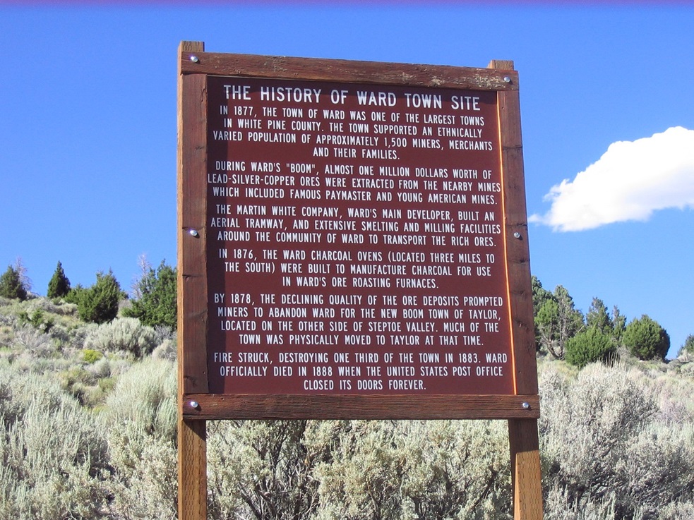
Thirty miles later, we were in Ely, where we got food, gas and basics. From Ely we went south on US-93 to Cave Springs Road, then south to the Ward Historic District sign, then west up the alluvial fan on good roads to the base of the range. It was about 4 p.m. when we arrived, sunny and warm.
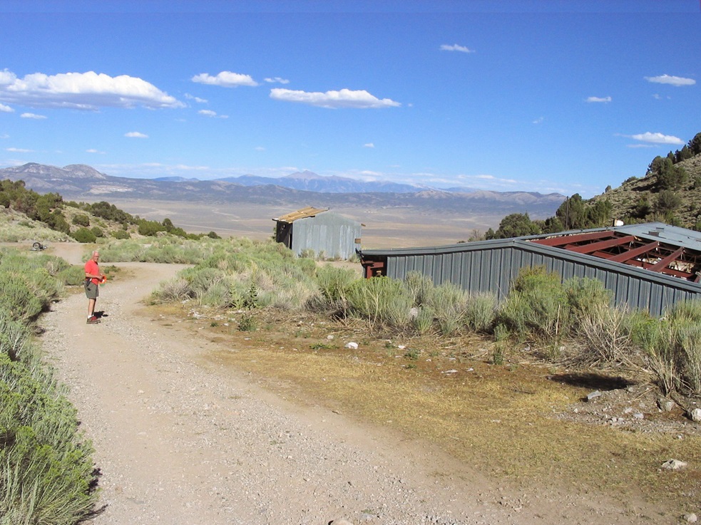
Not surprisingly, there were some trucks parked up here with ATV trailers, and we could hear their occasional buzzing as their humans rode the roads high up on the mountain. We had driven about three miles up the final road and parked in a clearing below the "Ward Townsite" sign, near the turn-off to the road that leads to the summit.
With a couple hours of daylight to kill, we walked up the road to buildings we could see farther up the canyon a quarter-mile away. These buildings were trashed. We walked inside to inspect. Thousands of cylindrical rock core samples had been stored here, plus lots of paperwork, which was everywhere. Shelves had been pulled down, or collapsed on their own. Windows were shot out. We judged the buildings and their contents to last have been active about 50 years ago.
As the sun set, the ATVers had come off the mountain and left, leaving my dad and I alone up here, the mountain to ourselves. He camped in the bed of his truck while I slept on a cot. It was a new moon and the sky was crystal clear. We literally slept under the stars, and that night the stars shone like I have rarely seen: millions and billions of little specks of light covering the sky. I was able to find the usual constellations: the Big Dipper, Orion and Cassiopeia. With the abundance of stars I could form any shape I so desired, and invent my own constellations such as Scott the Warrior, and so on. We both slept well despite the glare from all the stars.
I had set my alarm for 4 a.m., which actually was too early, so I slept in until almost 5 a.m. Knowing it would be warm and that I'd be on the east-facing (i.e. sun-facing) side of the mountain, I wanted to be moving at sun-up. Apparently others had the same plan as by 5 a.m. two trucks had driven up the road into the mountain. I was hiking at 5:30 a.m. I walked up the road and saw one of the guys was parked at the end in a clearing, getting his bow set and ATV ready. We had a 5-minute chat, mainly to be sure we wouldn't get in each other's way. He pointed where he'd be heading, and I to mine, and it turned out we'd be apart from one another.
The hike to Ward Mountain's top follows a road the entire way, so I knew I would make good time even though I had 3,200 feet of elevation gain in about 5 miles to cover. I told my dad I'd be gone about six hours. At first the road is wide and moderately rough, so that most stock 4-wheel drive vehicles would be okay for the first mile or so, but not littler trucks or passenger cars. Higher up, the roads narrow so that ATVs are preferred. Feet work well, too.
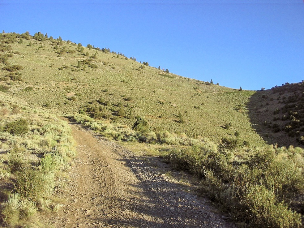
The mountain itself is broad, slopes of sage and grass interspersed with stands of aspen, birch and limber pine, bristlecone higher up. Most of the hike is in the open. The first mile gains 1,200 vertical feet to a saddle at 9,100 feet elevation. To here, the road is still wide enough for most vehicles and the saddle itself is broad with room to park and possibly camp. I took a break here, having walked for about an hour. Ward Mountain was visible to the northwest, plain as day, and even the roads were visible. It was nice to be able to see my destination, but I knew I had a lot of work ahead of me.
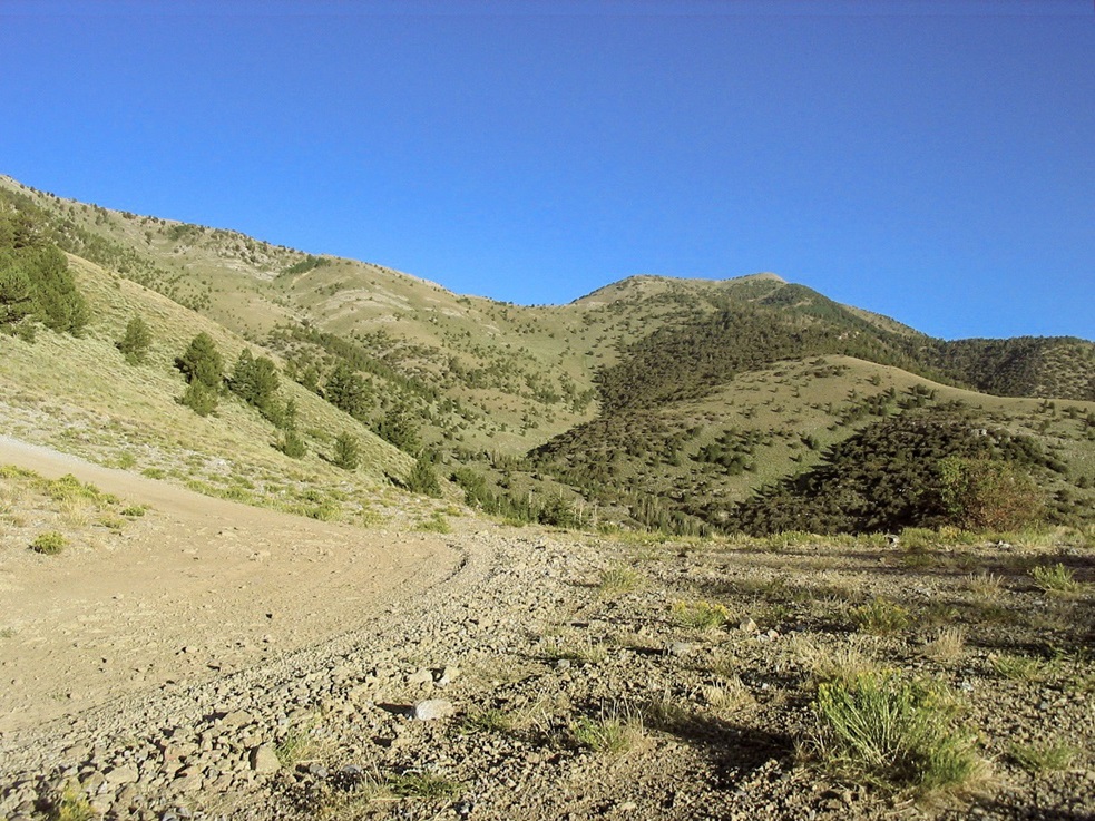
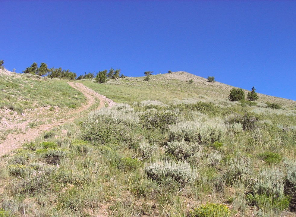
From here, the main road angles left up a prominent ridge, then switchbacks once, angling back right (north), and I gained another 400 feet. I came upon a road junction, staying straight on the lesser-quality track, back onto the north-face of the ridge with Ward Mountain in view. The road drops about 150 feet, entering into a pretty (and shaded) stand of birch and aspen, roughly 9,300 feet elevation. I saw a lot of deer up here. Staying on the main road, I left the shade, took a left at a Y-junction and went steeply up the track, which angled up and then to the right, again coming into limber and bristlecone pine, which offered more shade. Even this high (9,900 feet), and this early in the morning, the sun was warm. There was no breeze, and conditions were spectacular.
I still had 1,100 vertical feet to gain to the top, covering a mile, so I got moving again. After another long moderately-steep stretch of trail, I entered onto a flat stretch of road, and spooked more deer. The final 600 feet to the top was up steep road, way too steep for most vehicles and probably fit only for an ATV. This uphill section was loose and it sucked, but it went fast. Then it was just a matter of hiking up the remainder to the top. Even the last 100 feet was steep: I was really huffing and puffing right to the very end.
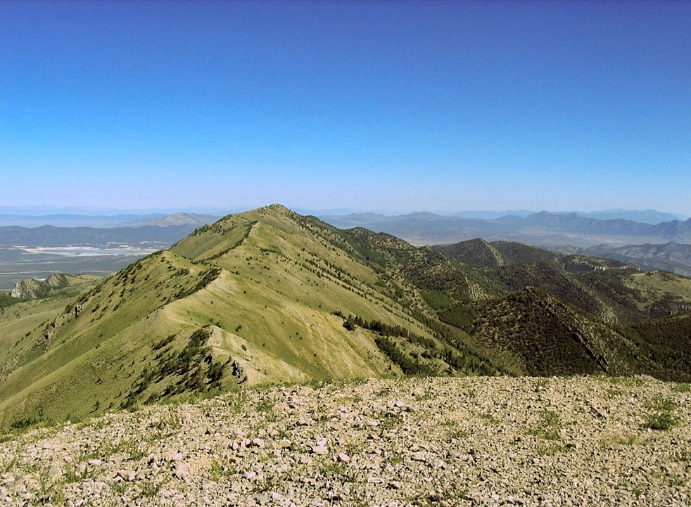
At 9:00 a.m., I was on top, a bare hump of grayish rock, topped by a tiny little box and solar-panel slightly off-set from the top. I had a cell signal so I called my dad to tell him where I was. The views were tremendous in all directions. I stayed for about 10 minutes. There was an active fire in the Schell Mountains about 60 miles away. I was pleased to be here atop Ward and I took a few moments to shoot some photos and relax amid the glorious scenery.
The hike down went very quickly. It was getting hot the lower I descended, so I was happy to arrive back to the truck at 11:30 sharp, tongue hanging out, exactly 6 hours on the hike. I changed into dry clothes and we got moving. My dad had spent the morning walking the lower roads and as he put it, nearly getting himself stuck in a steep drainage when he couldn't manage the rubbly slopes to get out (he did, obviously).
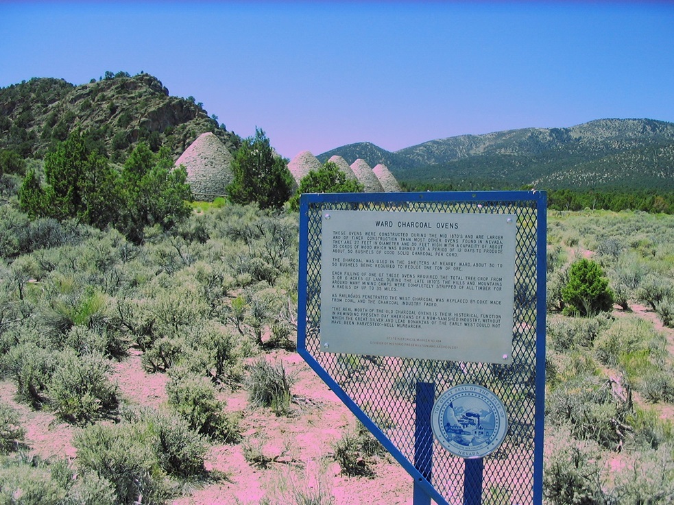
We drove down, then south to the Ward Charcoal Ovens, which date from the Ward townsite era. They were well-preserved after 120 years. The visit was interesting and short, and we drove into Ely to the Ramada Hotel where we've stayed in the past. I took a shower then crashed. We both rewarded ourselves with good burgers and prime rib that night at the hotel restaurant. The next day we drove back to Henderson.
The hike up Ward was fun and easy, insofar as technical requirements go, but tiring as far as effort went. The area is classic high-desert Great Basin Nevada, and we both had fun. There is a lot of history in these hills, plus hunters and also, open mine shafts near some of the roads, so watch out.
|
|