The Mountains of Nevada
• www.surgent.net
|
| Shark Ridge • Peak 3339 |
• Spring Mountains Foothills • Village of Sloan • Clark County |
|
Date: May 28, 2021
• Elevation: 3,339 feet
• Prominence: 619 feet
• Distance: 4 miles
• Time: 1 hour, 15 minutes
• Gain: 684 feet
• Conditions: Cool in the shade, sunny and warming fast
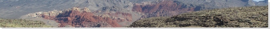
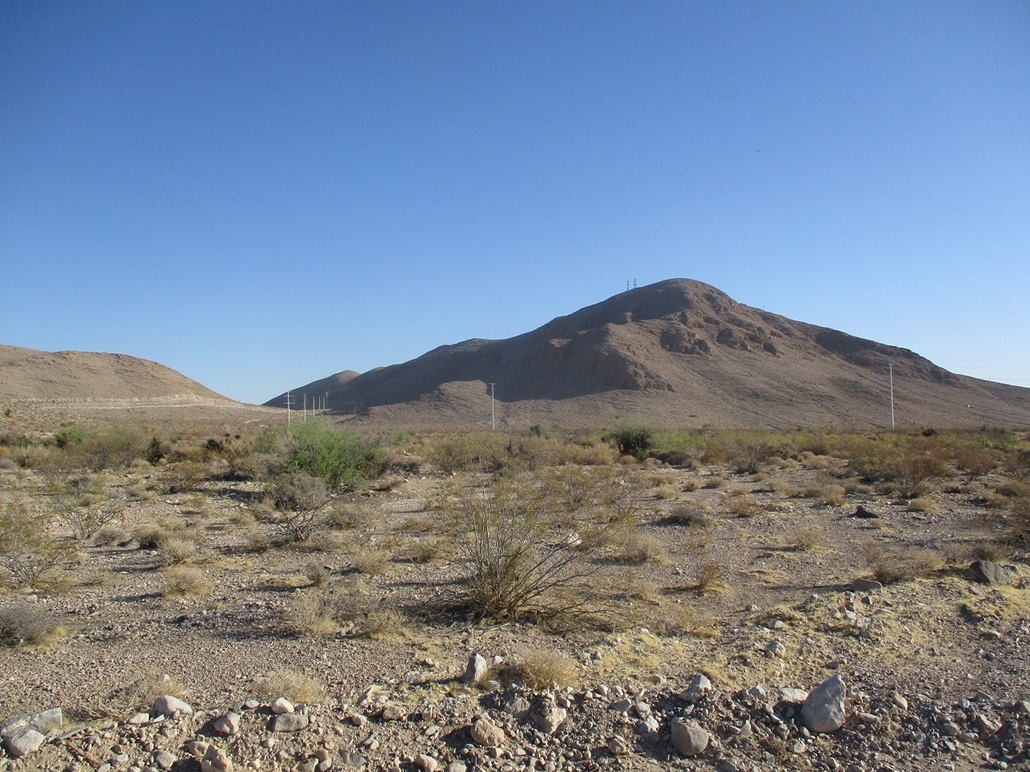
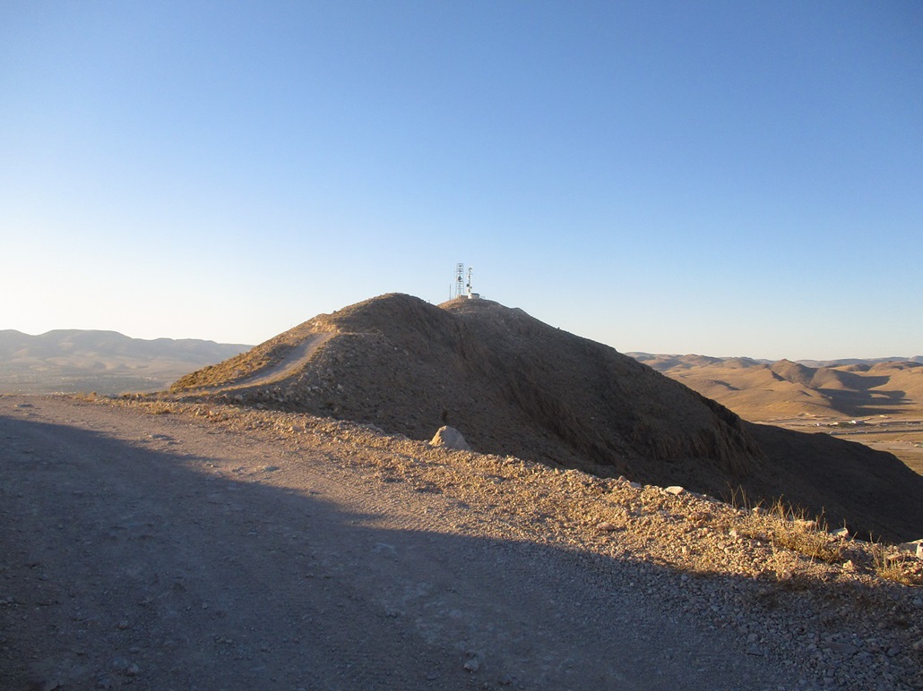
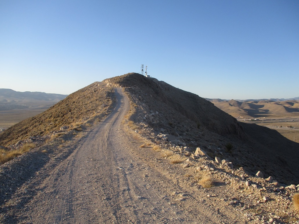
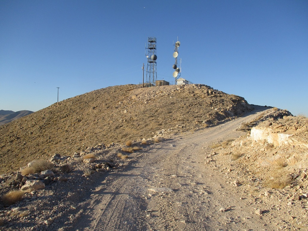
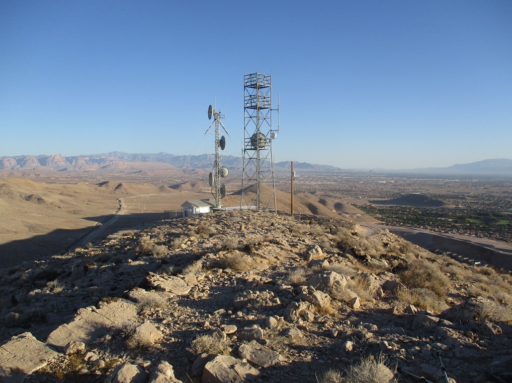
This peak has no official name, going by its summit elevation "Peak 3339", but apparently a local name is Southern Highlands Peak because it lies south of a new development called the Southern Highlands (or maybe not, see note at the end). It sits west of where the St. Rose Expressway (NV-146) meets Interstate-15, and north of the Sloan Road Exit. The small town of Sloan lies south of this peak. A good gravel road off of Sloan Road goes up the peak and to the communications towers near the peak's south tip. The highest point is about a hundred feet south of the towers.
Today was my last full day in Henderson with my father, as I would be leaving tomorrow morning for Utah then back to Arizona. The weather was becoming more typical for Las Vegas in late May, warming into the high 90s with dry and cloudless conditions. It was still possible to do a local hike if I started early enough in the morning, and if it was short. I chose this peak for that reason, plus it had a road and was pretty close by.
From my father's place, I got onto the 215 Beltway, then exited onto St. Rose Expressway, heading southwest. It's not a freeway, but is huge, about 10 lanes wide. I then got onto the interstate southbound for a couple miles, exiting at Sloan Road, going west. Sloan's main industry is a huge mine, and never was more than a village of company homes. It used to be off by itself, but as Las Vegas expands and new homes are built, Sloan is now close to being absorbed into the Las Vegas borg.
Following directions from Peakbagger, I was on Sloan for less than a mile, then on Cameron Street to its corner with Roark Avenue, this being the residential part of Sloan. A dirt road leads north from the corner and should have headed north into the valley west of Peak 3339, where railroad tracks pass through. But the road was blocked. This must have been a recent development. So I backtracked back to Sloan Road.
I drove toward the interstate, but then went north on an unmarked road (called Schuster Street on the online maps, marked by a sign for Hellas Construction), and drove in as far as I could. I came to an army depot, so I turned around and then got my phone out and looked up the online maps and satellite images. It suggested I follow Schuster toward a residence, then there should be a track that leads from there. This worked well, and the track was in pretty good shape. I was able to drive it in about a half mile. A sturdier vehicle could easily go farther, potentially to the top.
I was in the shade for now, the time barely past 6 a.m., weather cool in relative terms, in the low 70s. It was sunny and still. I would be in the shade for most of the ascent. I locked up and started walking the road, parelleling the railroad tracks. The road reaches its apex then drops slightly. Looking ahead, an obvious track then startes up the hillside. There are numerous side roads and junctions here, but navigating by sight was not a problem.
The track up the hillside was steep but in fine shape, with a steady gradient. Not long, I was now on the top-most ridge, and now in the sun. The summit was not far ahead, the towers poking above one foreground hill. The road bypasses this little hill to the east, then swings upward to the towers. I walked past them and up the last 15 feet to top out on the bare highpoint, just a gentle hump of rock and light brush. I covered 2 miles in about 40 minutes.
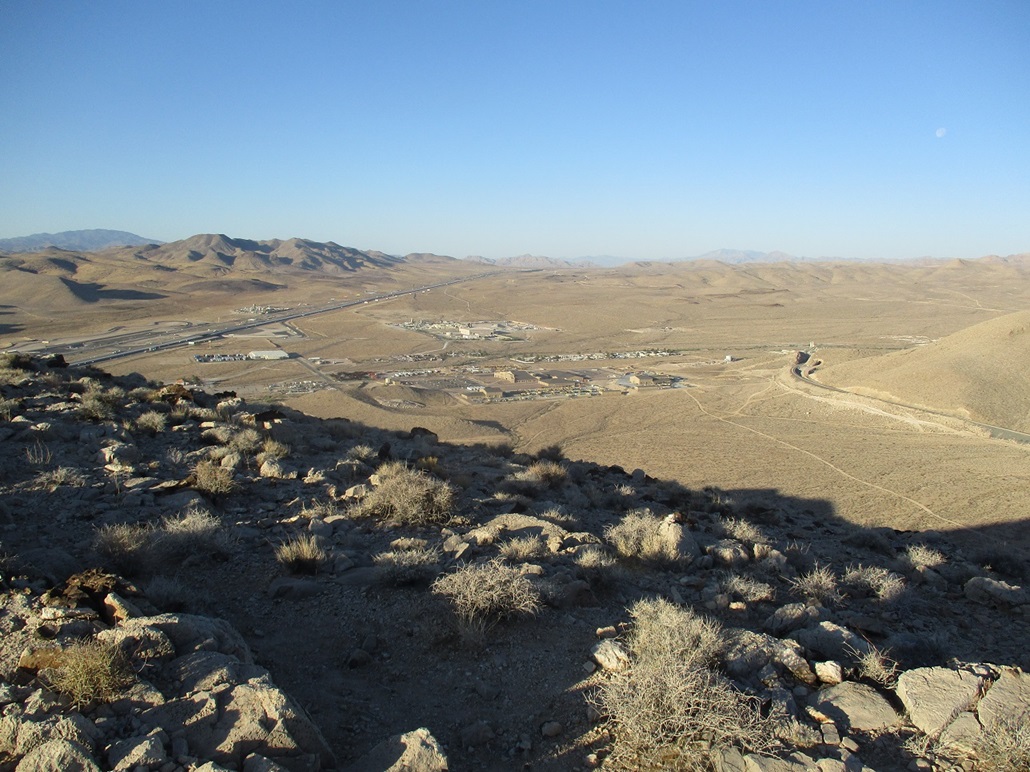
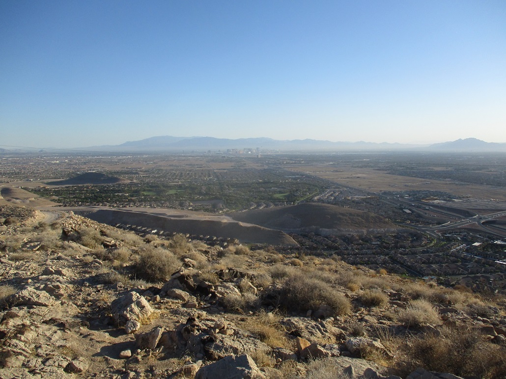
It was warm but comfortable, in the low 80s now with a steady breeze. I stopped for ten minutes and snapped images of the surrounding areas, with excellent birds-eye views toward the big mines by Sloan, the interstate, the new homes north of the peak, and of Las Vegas itself. The hike had gone well and I was happy to do it. This may not be a sexy peak, but it was fun with easy logistics, and ideal for this time of year.
The hike down went quickly and I was back to my car in about 25 minutes, by now in the sun. I changed and drove out to pavement, then onto the interstate for just the couple miles to the St. Rose Expressway. Today being the Friday before The Memorial Day weekend, and with the various Covid restrictions being eased or erased, the highway was already crowded with Californians. I could tell because they do stuff like cut gore points or don't let you merge. I used to live in SoCal so I know their habits. Later on the news, one of the weathermen showed a live-cam overlooking Interstate-15, mentioning the "invasion from California" has already begun.
I was back to my dad's place still fairly early. So I showered and took a nap. I spent the rest of the day getting stuff packed and planning my short Utah excursion. The eight days I spent with my father were relaxing and very healing. I needed this time, to get out of Payson and get my head right, and he was happy to have me, now suddenly alone in the house. It was a healthy and enjoyable week, but with melancholy mixed in.
I left early the next morning for a nonet of peaks in and around St. George, starting with Veyo Volcano.
Upon further investigation, this hill/peak seems to be commonly known as Shark Ridge, popular with both hikers and mountain bikers. Not that I'm an expert, but this usage would indiacte this is the de-facto name for this feature, so I'll go with it here.
|

|