|
|
|
Date: December 15, 2021
• Elevation: 3,998 feet
• Prominence: 563 feet
• Distance: 3.4 miles
• Time: 2 hours
• Gain: 890 feet (gross)
• Conditions: Cold and very windy
Nevada
•
PB
I was in Henderson, Nevada, hanging with my dad for a few days, an early Holidays getaway for me. I arrived here four days ago and would be leaving tomorrow. My first day here, I hiked a quickie leg-stretcher, Lone Mountain in northwest Las Vegas. Then a day later, I hiked my "big" peak for the visit, Crescent Peak, barely inside Nevada northeast of Nipton, California.
Then yesterday, a storm was supposed to come in. This was a big wet winter storm that had clobbered the Pacific Northwest, and also dumped feet of snow in the Sierras in California, which is good, because we need the water and also, it was being dumped on them, not us. By the time it got to Nevada, it was still cold, cloudy and gloomy, but mostly just a light drizzle here and there. I did not plan any hikes for yesterday. But I still had an adventure.
See, what happened was, about 2 p.m., I was going to go out for a bite. My dad asked me to go get him the mail, because he is having trouble walking to the mailboxes. So I took his key and drove to the mailboxes down the street. I parked, got out, got his mail, and got back in my car. The sidewalk curbs here are the smooth slanted kind that you can drive up onto, if necessary. I needed to make a U-turn, so I went to temporarily get onto the sidewalk partially so I would have room to make the U-turn.
I had forgotten that the sidewalks curbs are the smooth slanted kind, except near storm drains, where they are the traditional right-angle curbs, and also reinforced with steel girdling. I literally went 0.5 mile per hour into it, and bam, a clunk sound. I knew this wasn't good. Sure enough, I see the damage: I'd hit the steel girdling square with my right front tire and completely shredded its sidewall, a three inch gash. The tire was obviously a goner.
So now, I need new tires (I always get them in pairs at a minimum). My current tires were under warranty from the Subaru in Scottsdale, so I wanted a Subaru dealership in or around Las Vegas. I debated calling Triple-A but they'd be awhile, and I can change a tire, so I figured ten minutes to change the tire, then slowly drive to the dealership.
I go to the back of the car to get the spare and the jack. I find the tire just fine but no jack. Nowhere. I thought there may be a hidden compartment I had forgotten about. Crap. I knew where it was. I'd had a flat in August, and got it fixed at the Subaru in Flagstaff, and I think they didn't put my jack back in. Meanwhile, some guy out in his front yard across the street wishes me a good day. And now, it was getting windier and drizzlier.
So ... I march back to my dad's place and explain the situation. He says to use his jack out of his truck. I get the jack, walk back to my car, situate the thing, take off the shredded tire, put on the pathetic spare, all in about ten minutes. Subaru, if you're reading this, those weenie "bicycle" spares are simply not acceptable. I order you to put in full-sized spares in all future cars.
There's only one Subaru dealership in Vegas, 25 miles away, where the CC-215 freway (CC stands for Clark County) and Rainbow Street intersect. I didn't trust driving on the freeway with my spare, so I took Warm Springs all the way in. It's starting to get rainy, and darker as sunset comes early in December. Plus, it's the normal late-day traffic. Just to be safe, I have my hazards on so people know something's up, and I stay in the right lane in case I need to bail quickly if my spare pops running over a gum wrapper. Two people along the way roll down their windows to let me know my hazards are on. I thanked them.
I got into the Subaru dealership close to 4 p.m., about when the service people wind down for the day. I obviously had no appointment but they were able to get me in and replace my two fronts with a new set. It took 90 minutes. By now, it was raining steadily, not too heavy, but it was windy now, and cold. I vegged in the waiting room, watching the Golden Knights game on TV. It's really cool to see how huge the team is in Vegas. Everyone watches them. They scored a goal, and suddenly two older ladies sitting nearby were hooting and hollering.
So what's the lesson here? Don't drive into curbs with storm drains. Plus, this fills up a lot of space on this page because my hike up Red Benchmark Hill, while a lot of fun, won't take that long to describe. But I did get the mail. That part worked out fine. I also bought a jack the next day.
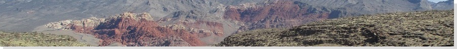
So the next day is clear and sunny, but cool after the storm, the highs likely not to exceed 50°F. I did not get moving until late morning. I left my dad's place and drove to the Charleston exit on CC-215, then west to the boundary of the Red Rocks area. Red Benchmark Hill rises south of the road, essentially on the border of the Red Rocks. I did not feel comfortable parking along the highway or at the sign, especially not near the sign because lots of people stop here to take photos of the sign. I didn't want my car to attract attention. So I found a spot on the opposite side of the road, up a little rise and near a berm. It wasn't out of sight, but someone whizzing by wouldn't really notice it.
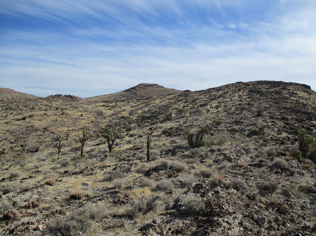
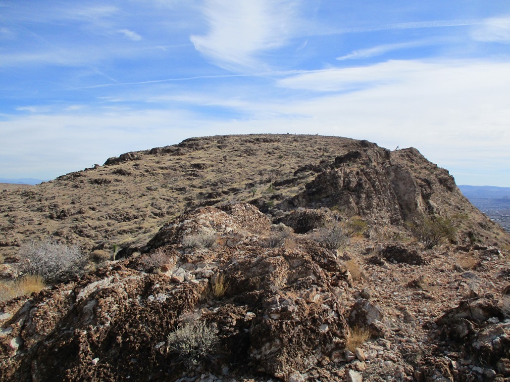
I got onto the base of the north ridge and found a good footpath beaten in by others. I followed it as far as it went, which was a few hundred feet. The ridge itself is full of rock outcrops, but the path skirted these on the left, as one looks up. The path would disappear at times. It wasn't vital, because I could see where I was going, but it was nice to follow when it was visible.
The route sidehills a subpeak, Peak 3835, skirts right, then starts up the only steep portion of the hike. I found paths that seemed to go a few different ways. It didn't matter. I angled generally right and up through the tiniest of cliffs, about a six-foot scramble. I was now on the straightaway to the top. There were more rocks here and there, but nothing to block me. I gained the summit, then saw it continues a few more yards south, to the real top. The one-way hike had taken me about 45 minutes.
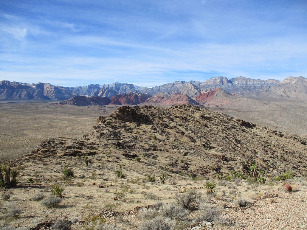
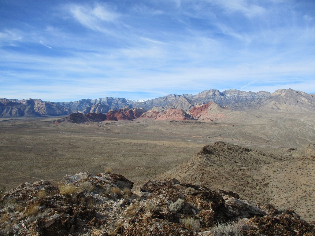
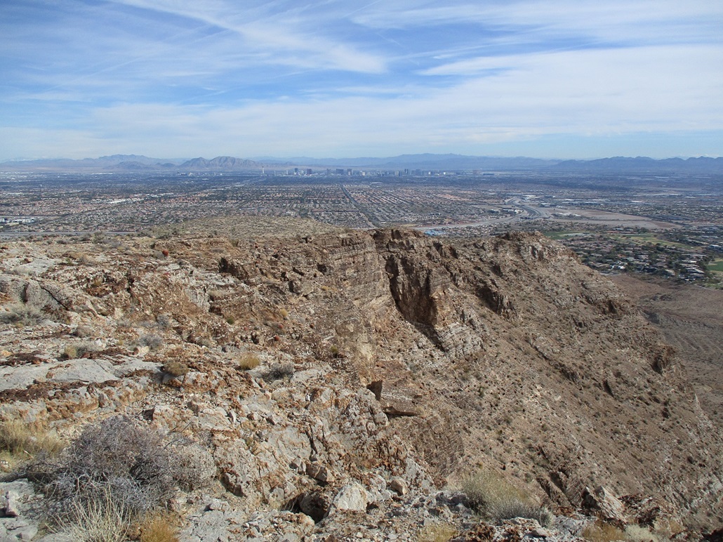
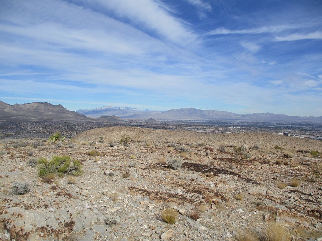
The top is flat, with a few rocks. There are steep cliffs on the south side, and excellent views of Las Vegas. Yesterday had been rainy, so the big peaks were covered in snow, and the lower peaks in a dusting. The light was good enough to take images showing the contrast in colors of the bands of rocks along with the snow. I found the benchmark, and also, a metal sculpture glued to a rock calling the top "Papous Peak". I don't know the details. I assume it's a local family honoring a loved one. It was cold and breezy up here. Then my phone buzzed. I took the call and spent a good half-hour on the call (it was important). I grew very chilled and ended the call, then started down.
Hiking down went well. I altered my route in a few spots when I saw lanes that I didn't see going up. I followed a mountain bike path for a little bit, too. The hike out took a little over a half hour, and I was back to my car two hours after starting the hike. The shooters in the nearby range had been shooting all day, but fortunately missed me and my car.
The hike had gone well. It was a good place to view the surrounding grandeur, without having to make too big of an epic of it. I drove back to my dad's place, and he treated me to a prime rib meal in downtown Henderson, near the new hockey rink for the Vegas Golden Knights' minor league affiliate, the Henderson Silver Knights. Henderson has really done a fine job of revamping its downtown area. When my folks first moved here in 1998, downtown Henderson was a really ragged, down-on-its-luck place.
I left the following morning, heading back into Arizona. Leaving was bittersweet because at this point in history, I don't know what the future holds. I suppose that's always true, but in this case, there's too much going on. I really hope my father improves. I love him too much to have him go too early.
The next day, I returned to Arizona. I hiked Merrit Benchmark to break up the drive.
|