The Mountains of Nevada
• www.surgent.net
|
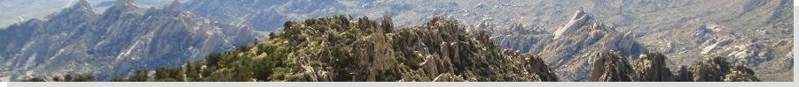
| Boundary Peak |
• Highpoint: State of Nevada • Highpoint: Esmeralda County • Boundary Peak Wilderness • Inyo National Forest |
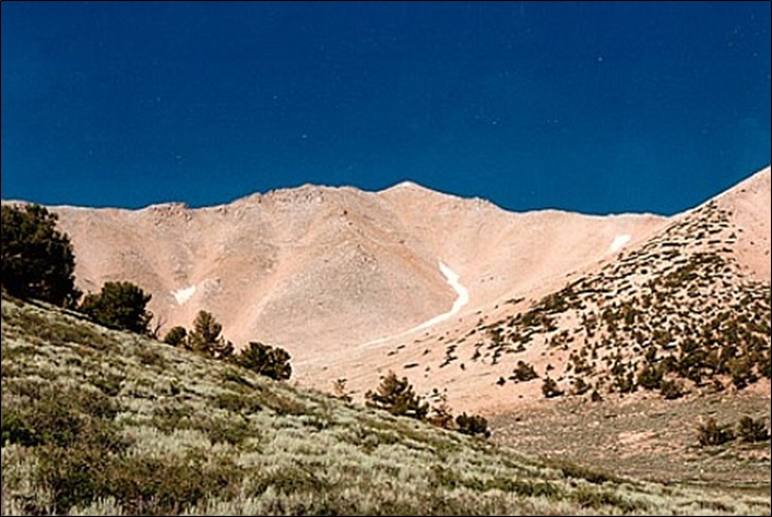
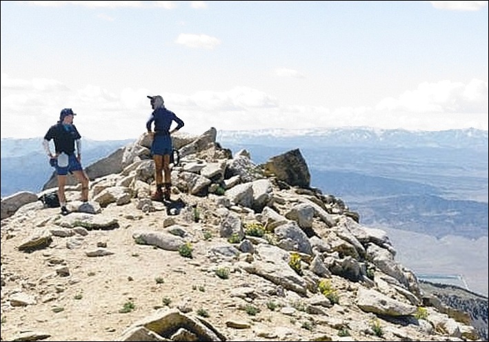
 Me at the Nevada state line with Boundary Peak in back
|
Date: August 12, 1995
• Elevation: 13,143 feet
• Prominence: 253 feet
• Distance: 8 miles
• Time: 9 hours
• Gain: 4,640 feet
• Conditions: Sunny and warm
• Teammates: K. and Steve
Nevada
•
PB
Boundary Peak is the highest point in Nevada, but is itself just a ridge bump emanating off of Mount Montgomery, which lies in California. The state line runs between the two peaks, placing Boundary Peak inside Nevada by about a thousand feet. The older Von Schmidt state line, surveyed in 1873 and found to be in error, placed Boundary Peak in California. By fortuitous placement of the corrected state line, the highest point in Nevada is this non-descript bump, which would never garner attention if not for its state highpoint status.
On July 4, 1995, I had nothing going on, so I drove to the new Gila River Indian Casino south of Phoenix. At the time it was just a trailer. The Indian Reservations had just won the right to develop gambling casinos, so they hauled in some slot machines and essentially put them in a big trailer. I don't normally gamble, but like I said, I had nothing much going on, it was hot and I just wanted out of my apartment.
I went on a driving tour, driving down to the Big House Ruins near Coolidge, then on the way home stopped in at the casino. I got $10 worth of dollar coins (actual coins, not tokens), was 0 for 8, then on my 9th coin, hit big. I had no idea how much I won. The bell kept on dinging and the coins dropping into the tray (they did not do printed vouchers back then).
Naturally, I was tickled to have won big (it turned out to be $400). But this was a small room of about 30 slot machines and everyone was watching me. I was scooping up my 400 dollar coins into plastic cups. I was surprised how much it all weighed and it took about three of those cups to hold them all. I just walked to the window and gave them the coins, and asked if they could cut me a check. They said no, I had to take the cash.
I have to be honest: I did not like the vibe one bit. The "casino" was a skanky trailer and the people there looked like a bunch of rogues, roustabouts, and ne'er-do-wells. They kept eyeballing me. I took my $400 and just left. I did not even play my 10th coin.
Anyway, that $400 paid for two flights, one to Colorado Springs last week where I hiked Mount Elbert, and one to Las Vegas for this weekend where I hoped to succeed on Boundary Peak. I flew into Vegas and was met by my friend K., who had driven in from California to join me for the hike. We piled into our vehicle (my brother's truck, which we borrowed) and drove up US-95 through Nye County, then lesser state routes toward the town of Dyer, then up a few miles of decent desert track to place ourselves at the opening of Trail Canyon, the de-facto trailhead of the hike to Boundary Peak.
We pulled into an open camping area, and met our neighbor, a guy named Steve who seemed friendly. He was also planning to hike Boundary Peak the next day too, so we agreed to hike it as a trio. At the time, I was barely getting into the state highpoint hobby, and I had my two highpoint books with me, one by Zumwalt. Steve said he was on that book's cover, and sure enough, there he was. Dude was famous.
The next morning, we got into our truck (Steve had a small sedan which he left at his camping area). We had to drive about a half mile to where the road peters out in the sage, where we would start hiking. We took a wrong turn (or missed a turn, more accurately), and started up another canyon that just did not seem right. We were going up, but away, and the road was getting sketchy. I decided to turn around, and had to do a 20-point u-turn on the narrow and exposed shelf road. We got down, found the right turn and went up the right canyon.
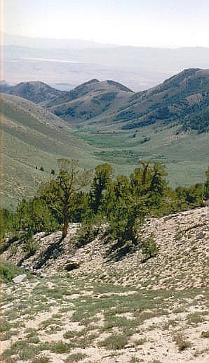
The three of us started hiking up Trail Canyon, aiming for Trail Canyon Saddle a couple miles ahead. There is no developed trail here, but there were many game-path openings in the sage which we could follow. Sometimes, we would drop off the slopes and into the creek bed, which was generally more open but, not surprisingly, muddier and wetter.
At one point, Steve up high and K. and me in the creek drainage, I stepped on what looked like grassy mud and my foot went in up to my knee, just like that, like it sucked me in. It was quicksand! Fortunately, I still had my other foot on solid ground and was able to stabilize myself, but I needed K.'s help to get me out. I held onto her hands so I had some leverage to pull out my foot from the muck, which had the consistency of wet cement. It took a lot of effort, but I got myself freed. My leg, sock and boot were caked in this mud. I was grateful to be out and we soon joined Steve up on the slopes.
In about 90 minutes, we had climbed the length of Trail Canyon onto Trail Canyon Saddle, just above 11,000 feet. We took a break here in the lovely sage, with small copses of trees in spots and a herd of mustangs up on the slopes to the north of us.
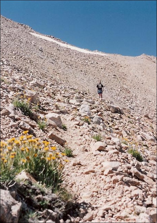
The remainder of the hike went well but underscored what a rookie I was on these sorts of things. We tracked south, going up a slope and following a thin trail through the rock and sage, which lessened as we gained elevation. The trail was just a climber's path, narrow and often ill-defined. It traversed south toward a notch below Peak 12,140 (Called Hosebag Peak on Peakbagger). To here, we covered another mile with about a thousand feet of gain. Up ahead was a saddle, elevation 12,100 feet, and another mile south, Boundary Peak.
I was not used to such thin trails and moved somewhat tentatively, never sure if we were on the right path. I tended to go over more than up, which got me into trouble a couple times. Past the notch, Steve went high while K. and I went more across, which put us on some steep slopes below Boundary Peak itself. K. then tracked more upward, and soon, announced she could see Steve again. He was on top already and we joined him a few minutes later.
We had the summit to ourselves for a few minutes. There was a steady trickle of hikers and we spent about 20 minutes up top before heading down, as a new group appeared. The day was sunny and clear with great views in all directions. Most notably, we could see the lengthy Sierra Nevada and its snowbound peaks to the west and north.
We started down, staying on the spine of the ridge back to the saddle at 12,100 feet. Steve mentioned going right (east) down from the saddle back to the trailhead, which would be steeper but would be shorter. We did not make any commitment to go that way, though. I was out ahead of those two by about a hundred feet. I got back to the notch below the saddle and looked up and did not see them.
Instead of pausing and looking again, I acted foolishly. I assumed they went down the east side slopes. I got annoyed and felt that I needed to rush down back to Trail Canyon Saddle then back to Trail Canyon itself to somehow meet up with them again. So I rushed, and sure enough fell, and I dropped my plastic gallon jug of water, busting it. I did not carry sturdier water jugs, and I had no choice but to drink down what I could before I lost all my water.
I basically jog-ran down the slopes, back to Trail Canyon, where I never saw neither hide nor hair of those two. Now I was really bothered. I hiked all the way out and even asked a few people if they'd seen two people, giving their general descriptions. No one had seen them. I was desperately thristy, so I got back to the truck, gulped some water, then re-stashed my pack and started back in, trying to find them.
Suddenly, they're right there. They had been following me the whole time. Naturally, they both thought I was a complete idiot, to put it kindly. K. was furious with me and rightly so. I was chastened and felt utterly stupid for not growing a brain and pausing to look up again. I have no excuse for what I did.
So.... we hike back to the truck, get in, drive back to Steve's car, drop him off, and his car barely runs. He turns over the key, and his engine sputters then dies. He does this repeatedly. It's not a flooded engine. It may be a bad carburetor or just what happens at 8,000 feet in a dusty environment. He was finally able to get it to run if he revved it at high RPMs. We agreed to follow him as he drove out to the highway. If he needed help, we'd drive him to the nearest town. Fortunately, the drive down seemed to help his car and he was able to drive off. We bid him farewell. He was a good partner.
It was now dusk, nearly dark. We had a couple hundred miles to drive back to Las Vegas. I was driving. We headed south through Dyer, then the highway back to Lida and US-95. This segment was unfenced rangeland. K. was still giving me heck for abandoning her up on the hike. We crested a small rise in the road, going about 70 m.p.h..
There were cattle in the road! We were going too fast to brake in time. I reacted purely on instinct alone and somehow weaved through the herd without hitting a single one. Had we hit one, it could have been tragic. K. screamed and I was a frazzled mess.
We still had about 40 miles to US-95 where the highway is fenced. I drove somewhat slowly, thinking every shadow is a cow. To add to the fun, rabbits would dart into the road and more than once, too late for me evade them. So I hit them. For that, I got called a rabbit murderer.
Once on US-95, it was a relatively event-free drive back to Las Vegas, where we rolled in about 11 p.m.. We had not made any reservations but figured that finding a room in Vegas shouldn't be that hard, especially in summer. I read somewhere that Las Vegas has lots of hotels. But we had no luck. Every place turned us down. Even the littler motels far from the strip had nothing, or so they said. We looked grubby, which probably did not help.
Finally, we found a grungy place near the downtown. The floor carpet had a huge oil stain on it. The shower and toilet worked, which was good. We cleaned up, went out for a bite, then came back around 1 a.m. to nap on top the covers. We did not get much sleep as I had an early flight.
I was happy to complete the hike and add another state highpoint to my record. However, I behaved stupidly and added a lot of unnecessary drama to the experience. Then all those things with the cattle, bunnies and hotels just was icing on the cake. But hey, life is more than toil and the grave.
|

|