
The Mountains of Colorado
• www.surgent.net
|
| Mount Elbert |
• Highpoint: State of Colorado • Highpoint: Lake County • Highpoint: Sawatch Mountains & Rocky Mountains Cordillera • Most Prominent Mountain in Colorado |
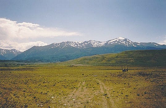 Mount Elbert from the road near Leadville
|
Date: August 5, 1995
• Elevation: 14,433 feet
• Prominence: 9,073 feet
• Distance: 11 miles
• Time: 10 hours
• Gain: 5,100 feet
• Conditions: Mild with clouds and one small thunderstorm
Colorado
•
PB
Mount Elbert is the highest peak in the Rocky Mountains (within the United States) and of the state of Colorado, and just misses being the highest point of the lower-48 United States by about 60 feet, falling short to California's Mount Whitney (14,491 feet). Despite its significant height, climbing it is not difficult due to gentle slopes, excellent trails, and lack of anything technical. For many people (such as me), it is one of the easier "14er" peaks to climb.
I was here as a result of a lucky dollar coin at the Gila River Casino south of Phoenix about a month ago. I won $400, and parlayed the proceeds into two trips: this one, and Nevada's Boundary Peak a week later.
I was still new to climbing, although I had success on Mount Whitney three years ago and a few other big peaks since then. However, anything requiring skills more than trail-following was beyond my skill set. Mount Elbert has three fine trails that lead to its top, offering a choice of length and gain. Despite its ease in technical terms, it does require a lot of elevation gain from any of the three trailheads, and at 14,400+ feet in the sky, the air is considerably thinner than lower down. I opted to follow the "southern" route, which would entail over 5,000 feet of elevation gain. For me, this would be my new one-day record if successful.
I left Phoenix on the 3rd, in the midst of one of the hottest heat waves ever. It had been 121 degrees a few days earlier, and we would have 20 consecutive days above 110 degrees, a record. The flight to Colorado Springs was short but bumpy as we descended into the airport. I stayed the night in a hotel in Manitou Springs. The plan was to drive into the Leadville area the next day and poke around and not do a whole lot. In doing so, I'd be spending the day at about 9,000 feet elevation, which would help me prepare for the big hike the following day. I made an exploratory drive to the trailhead, and stayed the night at a cabin south of Leadville, not too far from the trailhead.
I was up early this morning, intending to be at the trailhead and walking before sun-up. Visiting it the day before was helpful because in the dark, finding it would have been impossible. It's the least popular trailhead of the three, so not too many people come to it. It's well-hidden by the trees. I rolled in, got my pack in order, and was moving before 5 a.m.
The first couple of miles and 1,500 feet of elevation gain is up long, sweeping switchbacks in the forest. There were no views, so hiking this in the pre-dawn allowed me to complete this segment, saving useful daylight for when I'd need it. Of course, as the sun rose, and I gained elevation, there would be spots in the forest where views out over the valleys below were magnificent. I made good time on this segment and was on schedule, as far as I was concerned.
The next segment of the trail makes a northward turn and follows up a rocky drainage, about a mile. The trail is good, but the trees thinned noticeably. The trail came to an old miner's shack situated at the headwall of this little valley. I was about 12,000 feet elevation, perhaps a bit less, at this shack. To here the climbing had been straightforward, with the grades being moderate and never too steep. I was making good time and had covered about half of the elevation gain.
Past the shack, the trail starts up steeper slopes, with sparse trees and a few rock outcrops and fields of talus. At one point, a rogue little cloud blew in and started to drop rain. I took refuge beneath a fir tree to stay dry. There was no lightning and it was gone in 10 minutes. That was it for the rain today. The rest of the day was shaping up to be nice, with high clouds and the usual smattering of puffy cells. It was still early, so I still had plenty of time before the afternoon storms built.
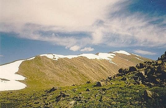
This segment lets out on the main ridge at above 13,000 feet, marked by a large cairn. I turned left (west) and started the final leg of the climb. Elbert's summit was still about 1.5 miles away and 1,400 feet higher, but the conditions along the ridge were superb. The trail was easy to follow, although it grew faint at times as it crossed over rocky areas. This went on for about 45 minutes until I came to another of the many bumps, at which time I would turn right again (north) for the final grunt to the top.
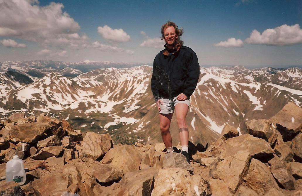
This final segment covered less than a mile with about 500 feet of gain. The summit was in plain view the whole way, but at 14,000 feet now, I was slowing down. I took many breaks and took it slow, methodically trudging my way along the ridge until at last, I came upon the summit of Mount Elbert ... hooray!
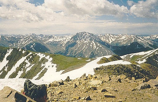
Not surprisingly, there were a few people up here, all having come from the other two routes. In fact, I had not seen anyone during my climb all morning. There were about six people up top, including two guys hitting golf balls from the summit rocks. I tagged the top and got someone to snap my photograph. The views were remarkable, a world of high, snow-capped Rocky Mountain summits in all directions, including a few nearby ones just a dozen or so feet shorter than Elbert. I spent about 15 minutes enjoying the summit and the views, plus catching what breath I could. It had taken me about five and a half hours to make the top, although it was just about 11 a.m. at the moment. It was a beautiful place.
For the descent, I went the way I had come up. Finding the trail down to the shack was kind of tricky, were it not for the big cairn built for that purpose. I jog-walked down the steep slopes, gaining energy as I descended where the air was thicker. At the shack there were a couple people hiking up, the first I'd seen on this route all day.
I took a more breaks along the way, but the easy slopes and the nice trails made it easy for me to keep up a good pace. I was back to my car at 3 p.m., a 10-hour day. I was beat, but thrilled to have climbed Elbert, to have gained nearly a vertical mile (my new record for the time), and to have another successful climb done for the record.
From here I drove back to Colorado Springs, finding it difficult to find a hotel to stay for the night. I eventually found one where I could get cleaned up. I flew home to Phoenix and the heat the next day.
|
|