The Mountains of New Mexico
www.surgent.net |
| Cerro El Tomé |
• Rio Grande River Valley • Tomé Land Grant • Valencia County |
 Cerro El Tomé
|
Date: July 28, 2023
• Elevation: 5,223 feet
• Prominence: 313 feet
• Distance: 0.8 mile
• Time: 40 minutes
• Gain: 353 feet
• Conditions: Very warm and sunny
New Mexico
•
PB
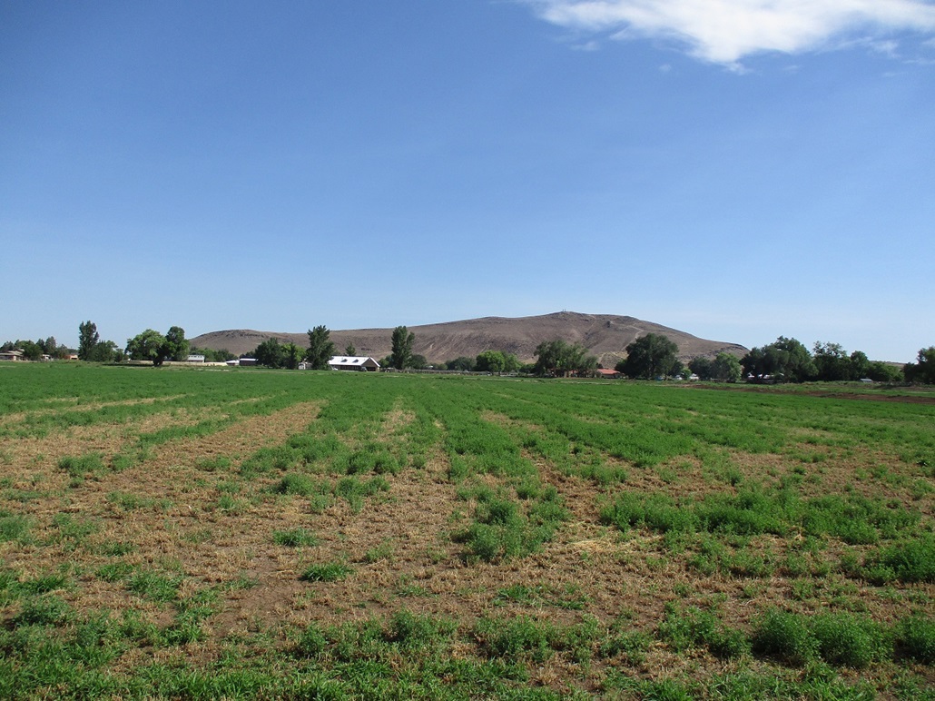
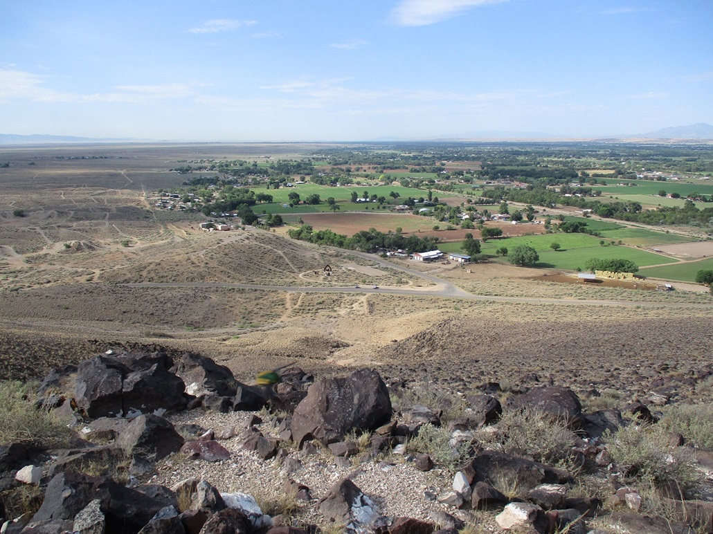
Cerro El Tomé is a lone little breadloaf-shaped hill east of the town of Los Lunas on the old Tomé Land Grant. It stands out because the surrounding area, mostly used for farming, is so flat, this being within the Rio Grande floodplain/river valley. The Tomé Land Grant dates from 1739, when the region was under Spanish control, then reaffirmed when the region became under United States jurisdiction in 1849. It is today its own town, the Town of Tomé Land Grant.
I was driving to Albuquerque, with plans to be there tomorrow. I had identified nearby Cerro de Los Lunas as a peak I wanted to hike. I also saw this little bump on the maps and added it to my agenda, if time permitted and I felt like it. I knew nothing of its history, or even its existence, beforehand. I assumed it to be some hill no one cares about, unaware it has a rich cultural and anthropological history attached to it.
I started today with a climb up Madre Mountain, then a drive across the Plains of San Agustin and the Very Large Array, a side trip to log a lat-long confluence, and some time in Socorro sitting in a McDonalds drinking a coke, looking at my maps and killing time in air-conditioned comfort. I then located myself to Los Lunas, where I had a room booked at the Days Inn. I arrived there about 3 p.m..
It was very hot, about 105°. I thought that I might hike El Tomé today, leaving more time for tomorrow's hike of Cerro de Los Lunas. I drove to it and rolled into a meager parking lot south of the hill, near a small park associated with the hill. But frankly, it was way too hot. Ten degrees cooler and I might have gone for it, but at 105°, it was simply too hot, not worth the gamble for such a "small" peak. I returned to my hotel. Not an hour later, a black monsoon cloud had descended over everything that way, with wind, rain and lightning. So it was doubly smart of me to not try it.
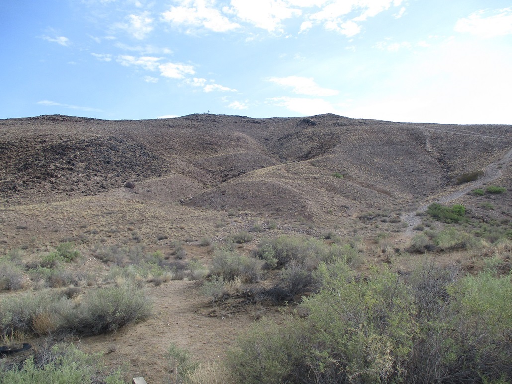
Early the next morning, I hiked Cerro de Los Lunas with a dawn start. I was finished with that hike at 8:40 a.m.., temperatures warm but pleasant, in the high 70s for now. The high today here was supposed to be about 100° but not until about 4 p.m.. It appeared I still had a decent window of tolerable temperatures for a few more hours, so I drove to the peak after the Los Lunas hike. I parked in the small lot, the time about 9:10 a.m..
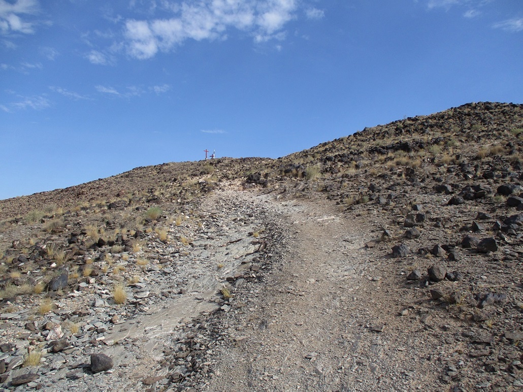
I would be approaching the summit from the south, going up a steep trail. It appears most people take the longer trail from the west, with an overall lesser gradient. I started walking immediately, marching up the steep and rubbly trail. A guy jogging came down as I was going uphill. On the trail were dozens of desert millipedes, one every few feet, each about 3-5 inches long. I had to be careful not to step on one.
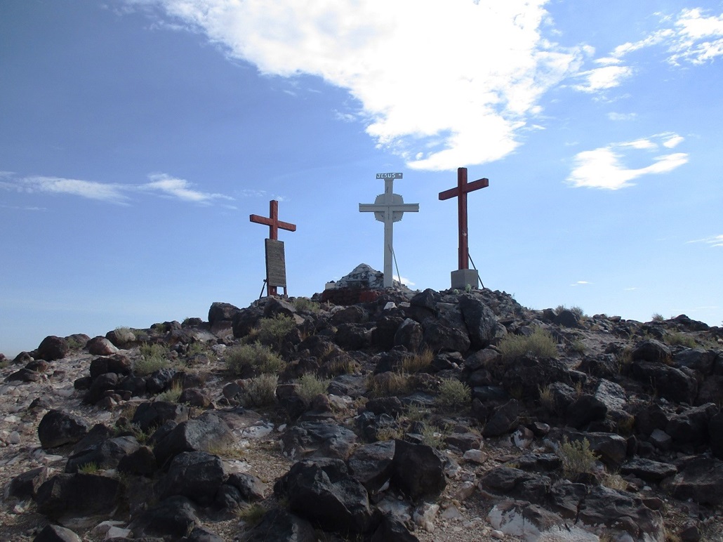
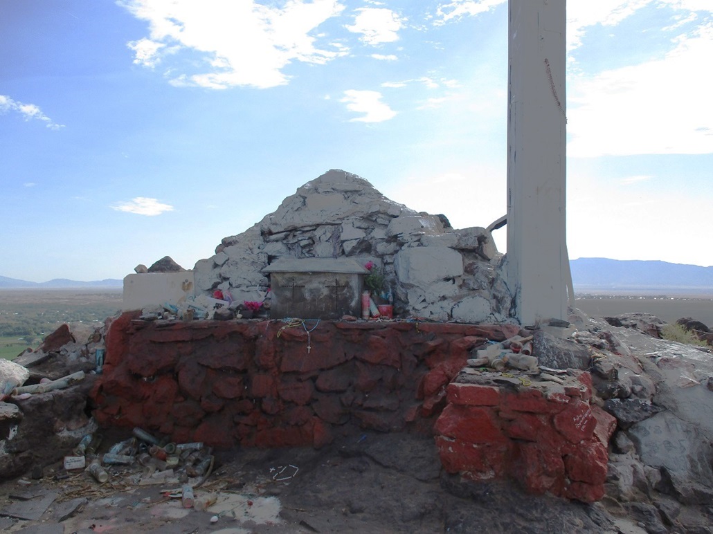
I was on top after about fifteen minutes. The top features three large crosses, easily seen from below. Up close, they're tall, about 15-20 feet high. The middle one has a Catholic shrine at its base, with offerings and votive candles and crucifixes and things like that. A guy was there who had just jogged up as I arrived. He had come up the longer way from the west and looked like he was going to pitch over and die. I said "hi" but he didn't say anything. I think he was too busy breathing to notice me. Then he got going back down, leaving the top to just me for the moment. I could see others walking toward it from this western trail.
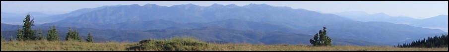
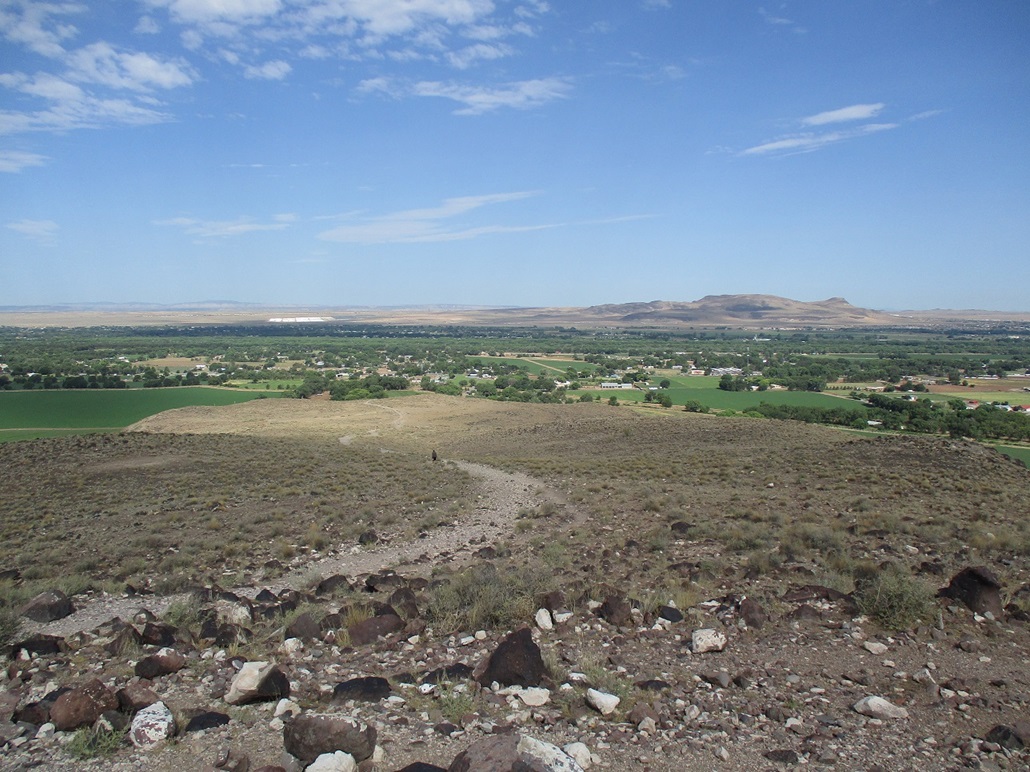
I spent a few minutes here checking out the crosses, the shrine, reading the plaques, and looking around the countryside. It was sunny and clear with low humidity for now, so everything was in sharp relief with good colors. It was a pretty summit with fine views in all directions.
As more people started to get closer, I started my downward trek, meeting a young woman who was doing her upward hike about halfway up. I was back to my car quickly, a 40-minute round trip, the temperatures still warm but mild.
I read up on the hill afterwards and was surprised it even has its own National Parks Service page! Apparently, petroglyphs can be found in places around the hill. I'm honored to have hiked such a famous hill!
My hotel in Albuquerque would not be ready for about 6 more hours. It was still mid-morning and with time to waste. I drove back toward the hustle and bustle of Los Lunas and sat in a Starbucks for a little bit, eating a scone and having a cold drink. I got onto the 'net and started looking around for something else to do, to fill the time. I "discovered" Cedro Peak in the mountains east of Albuquerque. It would be higher in elevation, with a road to its top and a lookout to look at. So that's where I headed next.
|
|