The Mountains of New Mexico
www.surgent.net |
| El Cerro de Los Lunas |
• El Cerro de Los Lunas Preserve • Highpoint: Village of Los Lunas • Valencia County |
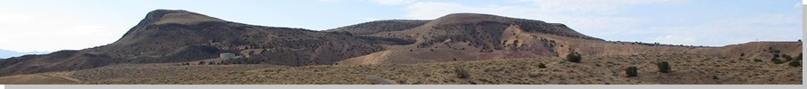
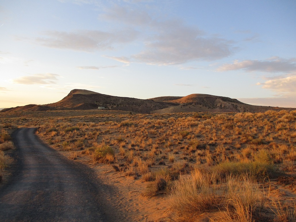 El Cerro de Los Lunas at dawn 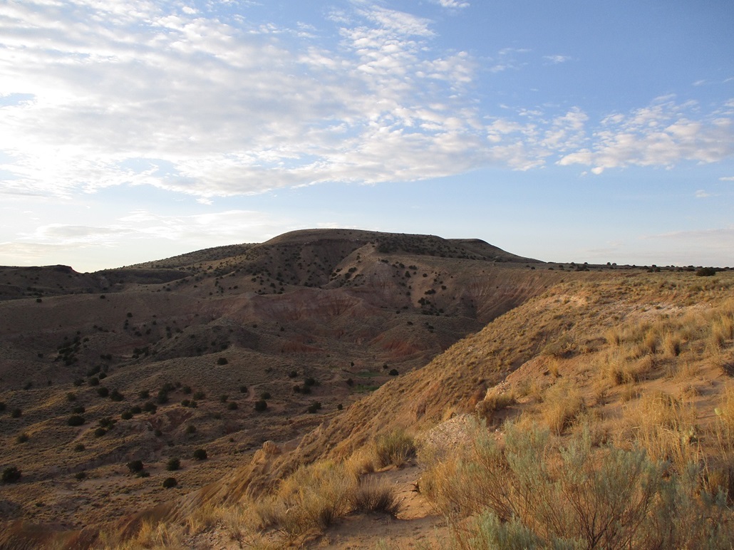 As I gain higher ground 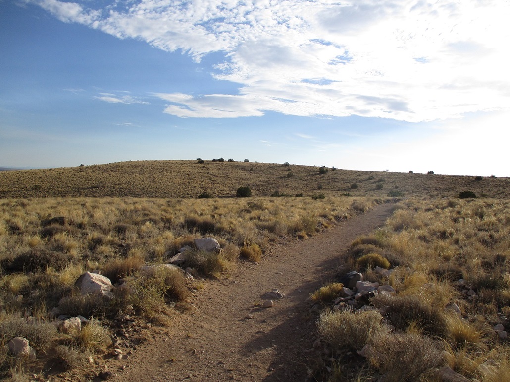 On top now, the highpoint is up ahead 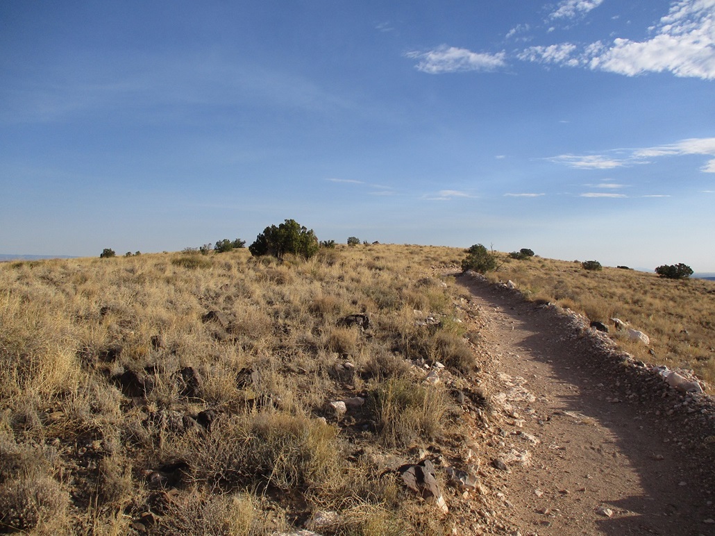 Almost to the top 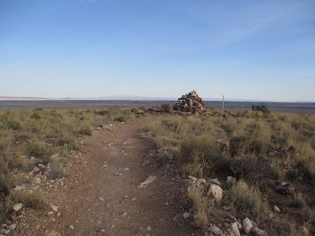 The big summit cairn 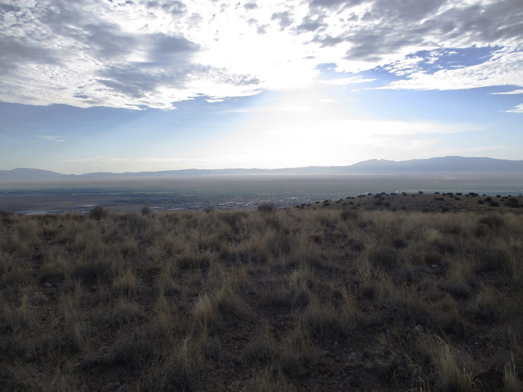 View east toward Los Lunas with morning sun glare 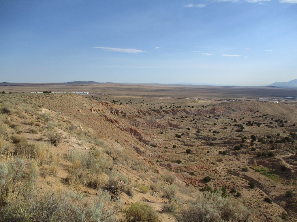 Hiking out, looking north at the badlands and sandy cliffs 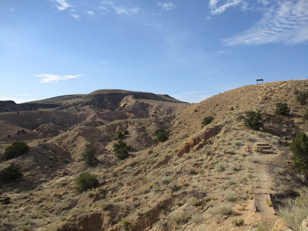 Another look up at the mountain  More of a general view of the mountain mass  Parting view as I exit
|
Date: July 28, 2023
• Elevation: 5,955 feet
• Prominence: 635 feet
• Distance: 5.4 miles
• Time: 2 hours & 20 minutes
• Gain: 755 feet
• Conditions: Clear and cool at first, warming rapidly
New Mexico
•
PB
El Cerro de Los Lunas (The Hill of the Moons) is a volcanic mound rising west of the town of Los Lunas, about an hour south of Albuquerque. It rises by itself, a big blob of rock, sand and brush, surrounded by desert, on the fringe of town and of the Rio Grande Valley.
In planning my drive to Albuquerque, I became aware of this peak and saw that it's developed with trails and a trailhead, and evidently a popular hike for locals and for people out of town, going by the online registers at Peakbagger and Lists of John. I added this peak into my agenda. It would be one of my "major" hikes for the trip.
Prior to 2006, it was privately owned and presumptively inaccessible to the public. The owners — the Huning family — gifted the land to the town of Los Lunas to be developed as a preserve, to be managed by the town, open to the public. This was all explained on a faded sign at the trailhead.
I arrived in Los Lunas about 3 p.m., having started the day with a big hike of Madre Mountain about a hundred miles west near Datil. It was very hot when I rolled into town, about 105°. I had no intention to hike it today in the heat. But with time to burn, I drove to the trailhead, which is a couple miles west of town on state route NM-6. I wanted to inspect it to get a sense of the area. I pulled in, there being two other vehicles in the big parking lot. I talked to a guy suiting up for a hike. He hikes it regularly and he gave me some general tips, which was helpful.
I also killed some time exploring another peaklet in town, Cerro El Tomé, located about ten driving miles away, on the east side of the town. It was simply too hot to do anything. I found my hotel and got situated, and did little the rest of the day. I did go for a walk about 6 p.m. to the Walgreens just down the road. A local guy, about 30 and walking his little dog, stopped me and proceeded to tell me he had just done 18 months in lockup and did I know that so-and-so was like a total meth dealer, that something should be done about it. He just offered this all to me, stream of conscious. What do you say? I wished him good luck. He quickly got distracted by other people. Maybe he's an actor paid to give us tourists a little random Breaking Bad experience. I got what I needed at Walgreens then got rained on by a thunderstorm as I walked back to my hotel.
I was up at dawn, my intention to be at the trailhead as early as possible. The website said the gate opens at 6 a.m.; I arrived at 6:15 and it was open. I was the first car in the lot, but within five minutes two other cars had pulled in. That made me feel better because I did not want to be the only car in the lot to draw attention. I was ready to go quickly. The sun was still below the eastern horizon but the eastern sky was lit brightly. It was clear and calm, air temperature about 65°. It was very comfortable.
The initial trail is a graveled road that leads to an old stock tank (and the road continues to what looks like a housing development). At the stock tank, I turned right (southwest) onto the Discovery Trail. The trail now was just a narrow path hewn into the sand, often not very distinct except for the abundance of footprints. I was able to stay on route. Sometimes the trail braided with little arroyos. Signs would help at certain junctions.
Above me on a bluff was a ramada, about 100 feet higher. The trail, which had been mostly level up to now, then gains a ridge that steeply gains to the bluff. Along this stretch where the grade is steepest, railroad ties have been installed as steps. Otherwise the sand would just erode away. Once at the ramada, I picked up the trail again, this time it looked like an old ATV track. It aimed directly for the mountain mass up ahead. By now, the sun was properly up, warming things a few degrees. But after ten more minutes, I had hiked back into the shadows.
The trail splits, both ways signed as the Discovery Trail. So I picked left. I followed the trail as it steepened. It reached a local apex, then made a hard right and cut across the slope, losing about thirty feet, to put me where the two branches rejoin. It was probably smarter to have chosen the right fork down below, but I didn't know that at the time.
By now, the trail is on the hillside, formed into switchbacks to lessen the gradient. It is very rocky here, the usual black basalt boulders. The trail is extremely well done here, the trail builders having moved aside the boulders to create a smooth path through the rocks. Soon, the trail gains the mountain mass's top. It's not flat up here, there being three or four gentle hills, but it is formed like a mesa would. I stayed on the trail and could see the highpoint hill up ahead. On top was a large cairn, easily seen from a distance.
The trail bends slightly away from the top, but a side trail, called the Summit trail naturally, branches off and leads straight to the top. Easy as falling off a log. It had taken me a little over an hour to get here, covering 2.7 miles. I walked around the big cairn. I did not see a register. The benchmark supposedly here was probably buried under the cairn. According to the online maps, the town limits of Los Lunas run just below the summit but cross the Summit trail, so that simply walking the trail, one "visits" the Los Lunas town highpoint, elevation about 5 feet less than the hill's elevation.
I had fine views in all directions. Big peaks rose above the flat deserts. Ladrones Mountain rose to the southwest. The Sandia Mountains rose to the northeast. To the east into the glare were the Manzano Mountains. Other mountains whose names I don't know rose in other directions. It's a very different "look" here in New Mexico than what we see in Arizona. I spent about ten minutes up top.
I hiked out the same way, the only variation being I took the other branch of the trail mentioned earlier. Two women were walking up, and they would be the only two people I saw. I was back to the ramada quickly, then down into the badlands below the bluffs. It was warming now, nearly 80°, but still very pleasant. I had gravity on my side, but the soft sand could be tiring at times. I kept an eye open for reptiles. All I saw were a few lizards. Signs near the trailhead warn against snakes.
I was back to my car at 8:40 a.m., a two-hour, twenty-minute round trip of 5.4 miles. The hike had gone extremely well with no undue issues at all. The fine trail allowed me to move quickly and I was pleased to be done before it got too hot. Lighting was better for photos and I snapped a few more images.
I next headed over to Cerro El Tomé, which would be a lovely second peak to hike in the area. I enjoyed Cerro de Los Lunas and recommend it.
|
|