The Mountains of New Mexico
www.surgent.net |
| Manzano Mountain |
• Highpoints: Torrance & Valencia Counties • Highpoint: Manzano Mountains • Cibola National Forest |
 The Valencia County highpoint
|
Date: October 20, 2001
• Elevation: 10,098 feet (Manzano Peak), 8,960 (Valencia CoHP)
• Prominence: 3,238 feet (Manzano Peak), 40 feet (Valencia CoHP)
• Distance: 15 miles
• Time: 7 hours
• Gain: 3,800 feet
• Conditions: Dry and bright blue skies
New Mexico
•
PB (Manzano Peak)
•
PB (Valencia CoHP)
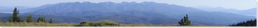
The Manzano Mountains extend south of Albuquerque and are essentially the southern extension of the Sandia Mountains, with Interstate-40 serving as the boundary with the Sandias to the north, the Manzanos to the south. Whereas the Sandias are much more uplifted and cliff-laden, the Manzanos are more rounded and less cliffy, but still with elevations topping 10,000 feet.
The highest point of the range, Manzano Peak, is also the highest point of Torrance County. In 1982, Valencia County split into two counties, with most of the west half becoming new Cibola County. Up to that time, Mount Taylor was the Valencia County highpoint. However, Mount Taylor went away into new Cibola County, and an anonymous bump on a ridge emanating west of the Manzano Range became the new Valencia County highpoint. Naturally, I would try to combine visits to both points on one single long hike.
I had actually booked plane tickets to Albuquerque in October 2000 and July 2001 specifically for this peak, each time getting to the airport and either weather or other delays prompting me to cancel my flight and carry the credit over to later tickets, which brings me to this visit, October 2001. The new security measures at the airports were not too much a hassle, and I arrived on Friday evening in Albuquerque, driving south to the Manzanos, staying the night at a neat old hotel in Mountainair.
There are many trails in the Manzanos, including "Crest Trail (#170)" which runs nearly the entire length of the range. A popular trail to Manzano Peak is the Kaiser Mills Trail, which is a shorter 7.5-mile round trip hike, but not convenient to the Valencia County highpoint. The Salas Trail from the west leads to The Valencia County highpoint, but is almost a 13-mile round-trip hike just to get to the Valencia point, and not convenient for Manzano Peak. Thus, I chose the Red Canyon Trail, which comes in from the east and would put me on the main range crest just above the Valencia County highpoint and about 3 miles north of Manzano Peak. I was looking at almost 15 miles of hiking.
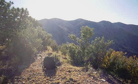
I was at the Red Canyon trailhead by 7 a.m., 20 miles from Mountainair, arriving in clear weather. The trail stays low and within a steep-walled canyon for the first section. This stretch is known for its waterfalls after a rain. Shortly, the trail breaks out of the canyon confines and switchbacks up moderately-steep forested slopes, eventually coming up to the main range crest and the junction with the Crest Trail. I turned left here and walked another half-mile south to the obscure junction with the Salas Trail. To here I had covered about three miles one-way with 2,000 feet of gain in 90 minutes.
For the Valencia County highpoint, I turned west onto the Salas Trail, which was hard to find under all the fallen leaves. It quickly surmounted the the ridge crest and dropped down the other side, switchbacking steeply. This trail doesn't get too many visitors and in places it was hard to follow. Valencia County's highpoint is about 1.5 miles and 1,100 feet down from the range crest. Twice, the trail crosses impressive rock outcroppings, the first a few hundred feet down and the second just before the highpoint is reached. This second rock outcrop has good trails and is not technical, but I found myself taking extra care in some sections.
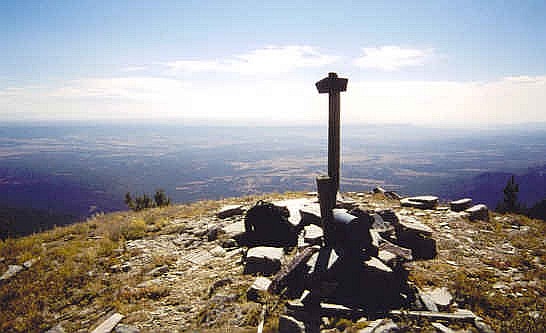
Shortly thereafter, I crossed the invisible Valencia county line and its highpoint, a point on a ridge that otherwise would not attract any attention. Previous visitors built a cairn at (near) the boundary, a few feet of walking up from the trail, but plainly obvious. Only a few people had signed in in the past few years: people from the county highpoints group whose names I recognized, and two hunters who probably signed in with amusement when they found this strange cairn just sitting there. After a few minutes, I started the trudge back up to the range crest, stopping at the first rock outcrops for a lunch. I was back at the Salas-Crest junction at 11 a.m.
The hike to Manzano Peak continued south along the Crest Trail. From the Salas junction, the trail stays mostly level below 10,000 feet for about three-fourths of a mile in a wooded forest with periodic openings for views. Early on, I heard an animal lumbering in the woods above me. It could have been deer but usually they take of running and make a lot of noise. This was more of a deliberate saunter. I couldn't see the animal but I wondered if it was a bear. I picked up a stick and beat it against some trees to make noise, as well as "talking". It didn't scare off the animal but it did continue on its way, in the opposite direction from me. I bet it was a bear.
Then a few hundred feet down the trail, I sat on a rocky section to rest when I heard a low roar that increased into a loud deafening roar. Then, for a split second, I saw it: a fighter jet was buzzing the range coming from the east and it banked sharply right and north, just enough time for me to see it. Cool! The roar was so loud that for about 30 seconds afterwards the whole range and valley echoed the roar.
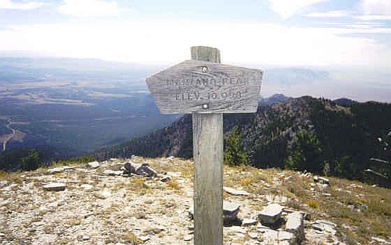
I continued onward. The trail drops about 400 feet in a grassy meadow where it meets with Ox Canyon Trail, about 1.25 miles (my estimation) from the Salas junction. It then regains the 400 feet, stays level, then drops about 300 feet again where it meets the Kaiser Mills Trail, about 1 mile south of the Ox Canyon junction. From here, Manzano Peak is about three-quarters of a mile (the sign says 1 mile) away and about 400 feet of gain. The final few hundred feet is relatively steep but the summit is open and wide, with a nice sign and plenty of sitting rocks. I took a long break up here, enjoying the views in the gorgeous southwestern fall weather. I was in no hurry and the conditions were fantastic.
After about a half four I started the 5.5-mile hike back north up the Crest Trail then down the Red Canyon Trail. It went slow because I aggravated a tendon high in my left thigh near the adductor muscle (it make it hard to lift my left leg high for steps). But in less than 3 hours I was back to my truck, about 3:40 in the afternoon. I saw a few people hiking up, the first people I'd seen all day on the trail. I drove to the town of Vaughn, about 50 miles east of Mountainair, and scouted Mesa Leon, the Guadalupe County highpoint. It was about 5 p.m. but I didn't have enough daylight so I stayed in town and hiked it the next morning.
|
|