
Montana
www.surgent.net |
| Granite Peak |
• Highpoint: State of Montana & Park County • Highpoint: Beartooth Mountains • Absaroka-Beartooth Wilderness, Custer & Gallatin National Forests |
|
Date: August 3-6, 2002
• Elevation: 12,799 feet
• Prominence: 4,759 feet
• Distance: 24 miles
• Time: 12 hours summit day
• Gain: 7,500 feet
• Conditions: Mild and calm on summit day, various ranging from sunny to rainy on the other days
• Teammates: Dave Covill (leader), Becky Covill, Chuck Bickes, Edward Earl, James Earl, Adam Helman, Jennifer Roach, Mike Coltrin, Kevin Williamson
Main
•
PB
•
LoJ
Granite Peak is an imposing cleaver-shaped peak in Montana's Absaroka-Beartooth Mountains, near Yellowstone. It is the highest mountain in Montana, and one of the toughest state highpoint of the lower-48 to climb. The most common route is 24 miles round trip usually requiring a one or two-night backpack, the range is prone to powerful storms year-round, including snowstorms in summer, and there are bears. Furthermore, the final pitches involve 4th and low-5th class rock climbing over exposed segments. It is not a mountain to be taken lightly.
Three years earlier, in 1999, I signed up with a guide to attempt Granite Peak, but that summer was a real drag for me for a variety of reasons. Two weeks earlier, I had attempted Gannett Peak in Wyoming and had to bail on that due to a two-inch blood blister on my heel. So I was back in Arizona, bummed about my Gannett experience. Frankly, I had no energy for Granite Peak, but I had already paid for the climb and had nothing going on at home, so I went forth with it.
Nothing went right. I made last-minute flight arrangements, flying into Salt Lake City since the cost to fly to Billings was prohibitive. It was a long drive (7 hours) to Red Lodge, Montana, where I stayed the night. I also got pulled over by a Red Lodge patrolman for speeding, but he just gave me a warning. I met my guide and the other client the next morning. I was exhausted. The climb had yet to start.
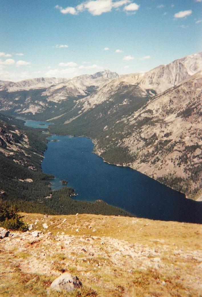
We started up the trail over the hydro-electric dam near Mystic Lake, then followed a lesser trail to the far end of Mystic Lake. We clambered over bad, muddy, steep trail sections through deadfall and came out above treeline into a set of glacial lakes and tarns, Granite Peak towering about 4,000 feet above us, and the Granite-Tempest Saddle, our route, at the far end of this hanging valley. We rock-hopped around the lakes, then grunted through a long gauntlet of house-sized boulders to arrive at high-camp, setting up our tents in a small patch of green alongside the lake. We had hiked close to nine miles just to get here.
My guide and the other client were both good guys. I was way in over my head and thoroughly beaten down, physically and emotionally. There was some solace of being here in such a beautiful setting. The guide, God bless his heart, brought a flask of high-end single-malt whiskey. I don't normally drink whiskey, but one or two sips of it at the end of the day was very soothing, much tastier than the plastic-tasting water I had been drinking all day.
That night, the storms built and lit up the sky with lightning. Rain was moderate, but when our intended pre-dawn start came around, the lightning was not letting up. The guide canceled the attempt. Deep down, I was relieved. I was in no mood for another long grunt. I just wanted out. When day broke, with the weather kind of mixed, we broke camp and retraced our route. It was a long, tedious, tiring hike out, and back at the trailhead, I slumped into my vehicle, drank a beer, rested, then drove on, staying in Idaho somewhere, before flying back home. I decided to lay low on Montana and Granite Peak for awhile.
This opportunity came about in June 2002, when I was hiking a series of peaks in Nevada with Adam Helman, who mentioned he and some others were going to attempt Granite Peak, the team being led by Dave Covill of Colorado. I made it clear to Adam that I was interested, and that if someone dropped out, I would like to be considered. A few weeks later, I received an email asking to join. My thanks to Adam for sending word up the chain to Dave. I had not met Dave yet, although knew of him from the State Highpointers Club and his book (with John Mitchler) detailing the county highpoints of Colorado.
Now part of the team, I had all of July to let this sink in. I was teaching a summer class at ASU. When not teaching, my mind was on the climb. It spooked me, but I was also eager for another attempt. To help get my mind right, I laid out all my gear on my dining-room table: ropes, axe, pack, carabiners, slings, doodads, whatchamacallits and thingymabobs. I spread it out on the table for all of July and stared at it. My cat sniffed and pawed at it, too. This helped me mentally prepare.
So the trip began. I flew into Denver and then from there, to Billings. I was met by Chuck Bickes, one of the team. We then waited for Adam's flight to arrive, and the three of us rode with Chuck to meet everyone else at the home of Jerry and Betty Brekhus, who live outside of Red Lodge and are experts about the peaks and trails of the Absaroka-Beartooths.
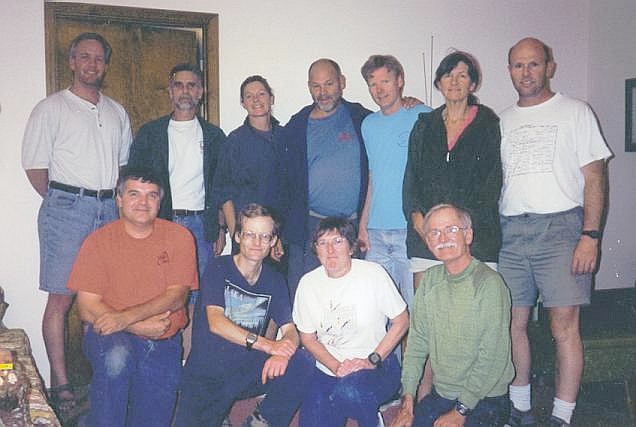
The whole team assembled: Dave Covill and his wife, Beckie were there. So was their pal, Jennifer Roach, whose husband, Gerry Roach, is one of the most well-known American mountaineers and was the second person ever to climb the Seven Summits, the highest points of the seven continents (Gerry was not on this climb, however. Shame, as I wanted to meet him, but I did meet him a few weeks later in Oklahoma, of all places). Adam's pal Edward Earl was there. We had met the first time in June. Kevin Williamson from Georgia and Mike Coltrin from Tucson rounded out the team of nine (Jerry and Betty were not going to climb with us). We all had a barbecue and talked, psyching one another up for the journey. I was heartened by the general tenor of the group. It seemed like a friendly, solid team.
The next day, we drove into Red Lodge and ... ate a hearty meal in town. While it was tasty, I had doubts about this plan. I figured we should be hiking as soon as possible. We did not arrive to the trailhead until about 10 a.m., starting the actual hike not long thereafter. The hike up and over the rocky dam is easy but tiring. The trail is good and gains about 1,200 feet before dropping down into Mystic Lake. A lot of day-hikers do this, many who come for a dip (or to fish) in the lake. We all had big packs, and we rested on a sandy beach beside the lake.
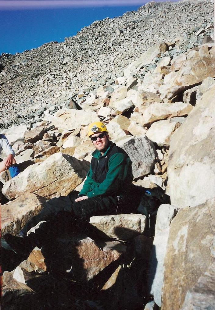
The real grind began next. Whereas in 1999 we had walked up Mystic Lake, now we would be following the higher Froze-To-Death Plateau route. To gain this evocatively-named plateau, we had to hike up steep trail, gaining about 2,500 feet through thick forest, talus and scree slopes, and lower stunted forest as we neared tree line, a light rain now falling. By late afternoon we had all arrived on top the plateau, a cold, thick fog covering the terrain. We set up camp and hunkered in. Me, I was beat and I napped briefly. Later that night, Edward's brother, Jim, showed up. He is an expert climber with a lot of experience in these ranges, and would be a great asset to our team. So now we numbered ten.
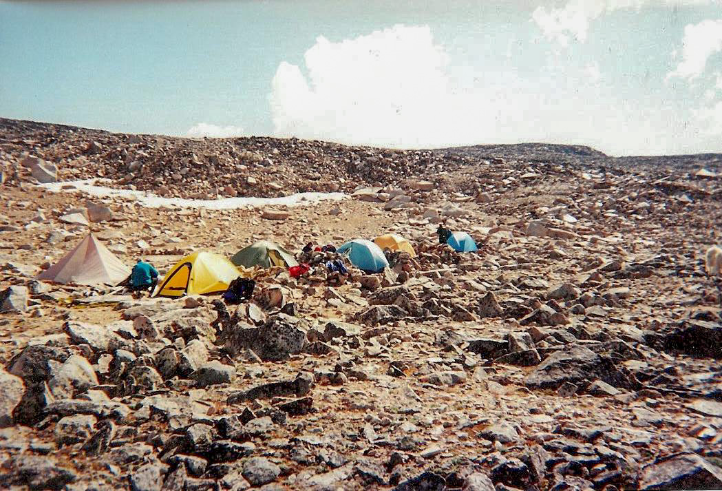
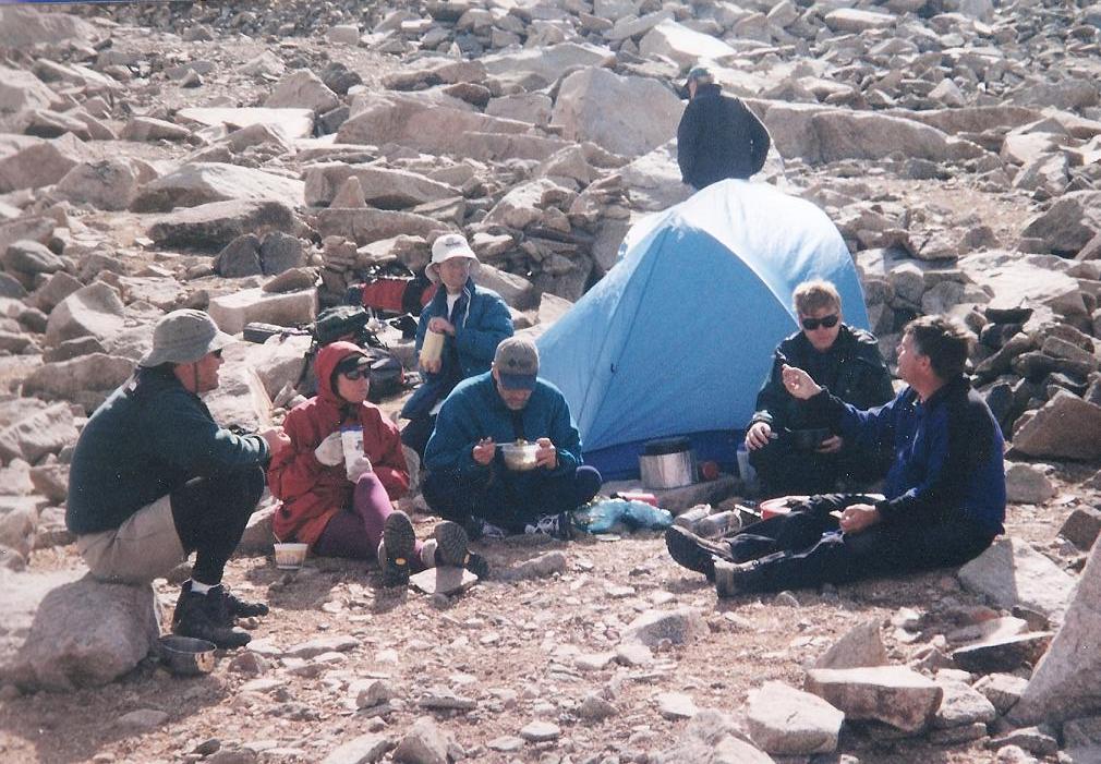
The next day started bright, the fog having moved on. No storms had developed. Today was another hike day, as we moved another few miles southwest along the Froze-To-Death Plateau to our high camp below Froze-To-Death and Tempest Mountains, both worthy peaks with elevations slightly above 12,000 feet. The hike was mostly flat: we'd hike across a meadow then up through rocky sections, then more meadow, and so on. Four miles later, we arrived at high camp and set up our tents. It was 2 p.m., leaving plenty of daylight to mill around and check out the area.
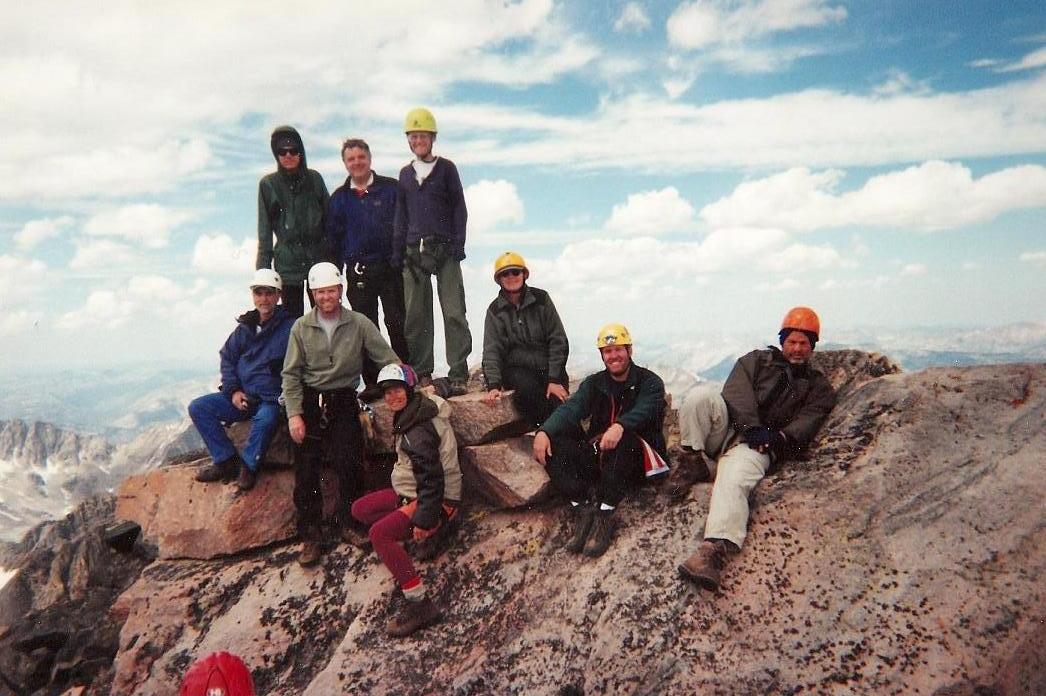
We were above tree line, and the terrain was rocky, but with a few flat patches of land to permit a tent. Previous teams had built stone walls to shield against the wind. Mountain goats stood in groups on the perimeter, watching us. Only now did we have a view of Granite Peak, its prow-shaped summit rising now across a deep-cut valley (the one I had been in back in 1999). That afternoon, another group of three, Jack, Leon and Lee, showed up. Apparently Dave knew one of them and thus, we now had an ad-hoc team of thirteen for tomorrow's summit day. They seemed like good people.
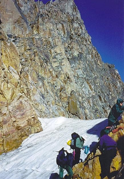
That night, I slept but not very well, excited and nervous about the next day's climb. A small rogue storm blew in and out in a matter of minutes. Knowing that the Froze-To-Death Plateau gets its name for a reason, the mild night was welcome, and a positive omen. I was up around 4:45 a.m., and everyone was ready to go by 5:45. From camp, we fell into line and walked an easy footpath to the lip of the plateau, now following this footpath as it descended about 500 feet across sloppy talus slopes to drop to the Granite-Tempest Saddle, elevation 11,500 feet. This took us an hour.
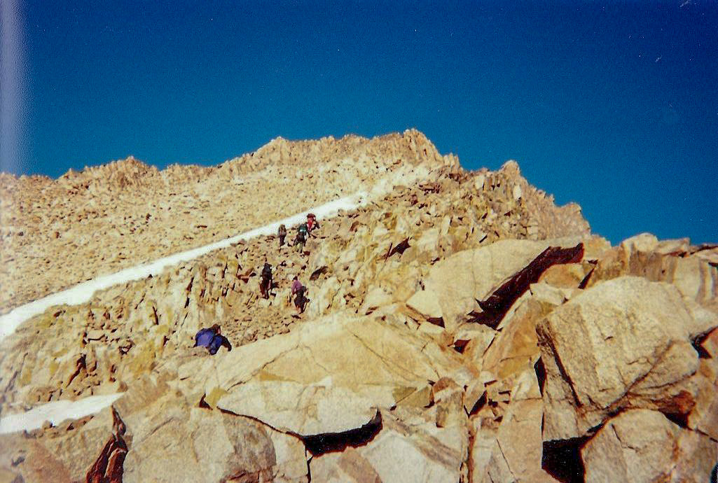
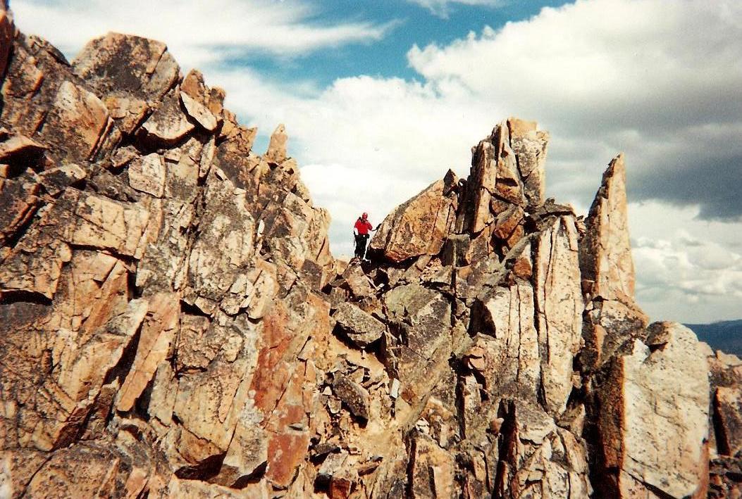
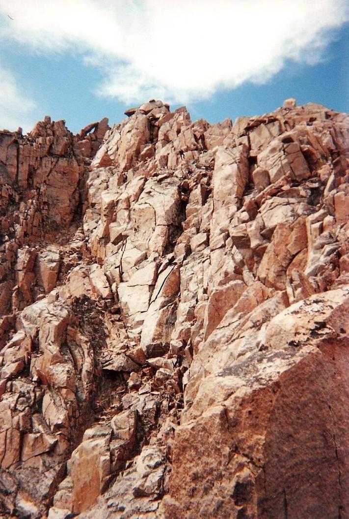
The next segment was up steep rocky slopes, following beaten paths in places, and where there were no paths, common sense. The going here was steep but easy, and we gained about 800 feet, aiming for a point on the rocky sky-line above us, Granite Peak once again hidden from view. No problems so far, and we were moving well. At this point, we traversed 50 easy feet along a path, then convened at the base of the first of many crux sections, the start of the real challenging sections of the climb.
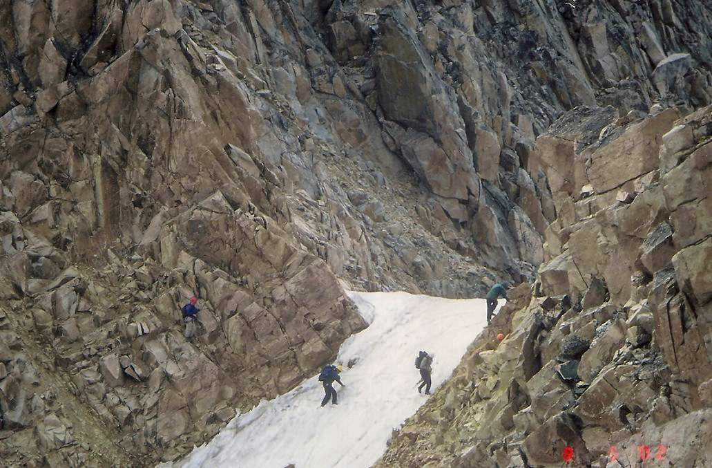
The first crux is a notch filled with ice-hard snow. Edward and others set up a tag-line belay, we got on our in-step crampons, and one at a time, walked gingerly across the snowy notch to the rocks on the other side. I went toward the end. Past the notch, there is no rest, as the next segment is up a steep 4th-class chute. Most everyone had already gone up. I summoned up courage and scampered up this chute, a gain of 50 feet, moving from one hand-hold or foot-hold to the next and avoiding looking down at the 3,000 feet of air below me.
So now we're all on the "real climbing" portion of the climb. The summit was just 500 feet higher, and we strung out a little bit here. Dave, Beckie, Jennifer and I clumped into one subgroup. Jim was bounding back and forth between us and the people ahead of us. He knew the climb well and gravity did not seem to affect him.
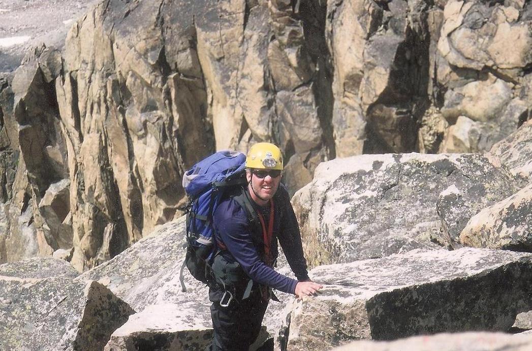
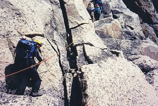
For the next segment, the climbing was easy, scampering up over rocks or through the spaces between them. Our next goal was a V-notch. From the notch, we downclimbed about 40 vertical feet, then scampered up more easy sloping ledges to come to the base of another chute. We congregated here as we needed time to set up the belay. By now we were in a routine, some of us with set tasks. Edward, Jim and Mike set the lines. Dave always went last and cleaned. I went second-to-last because I was "prusik master", showing people how to wrap a prusik around the line and how to manage it as they moved upward.
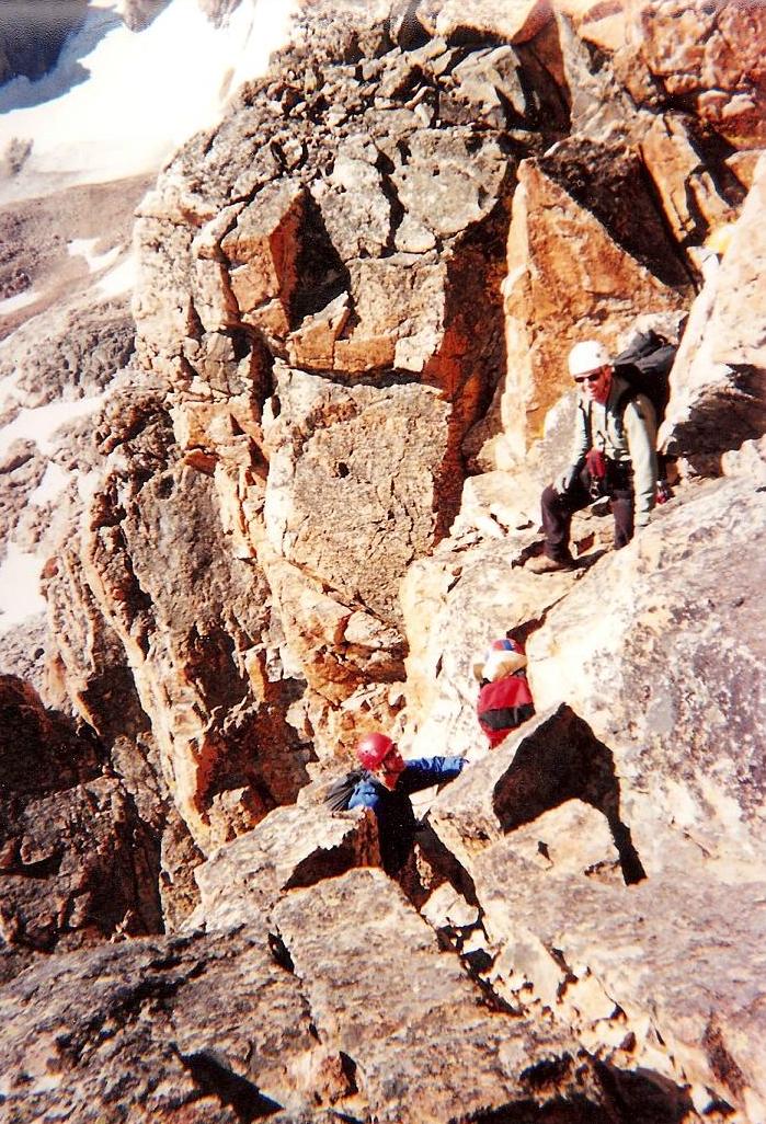
This particular chute presented a challenge: a large chockstone sat in the main part of the crack. People struggled to access one foot-hold, but me, being taller, I had no trouble. Above this chute, we were now on the "upper cliffs". The summit was now in view again, about 200 feet above us to the right of the "keyhole", a small hole in the rocks formed by a big slab leaning over a couple other slabs. Thus far, we were moving slowly (considering there was 13 of us) but efficiently. The weather was holding steady and no hints of storm cloud build-up.
The next segment was probably the main crux of the whole climb. It's a big wide crack but sloped steeply, near vertical, about 80 feet high. It has good holds but is exposed. To get to it also requires a short traverse along a narrow ledge. I watched as others went up, then it was my turn. As before, I concentrated on my immediate moves and not on the air below me. I moved fast. The sooner I was above this section, the better. A few more feet of scrambling and walking along ledges, I came to the last of the chutes. We upclimbed it, then angled left, hiked up sloppy slopes, angled around the keyhole, and finally, the summit.
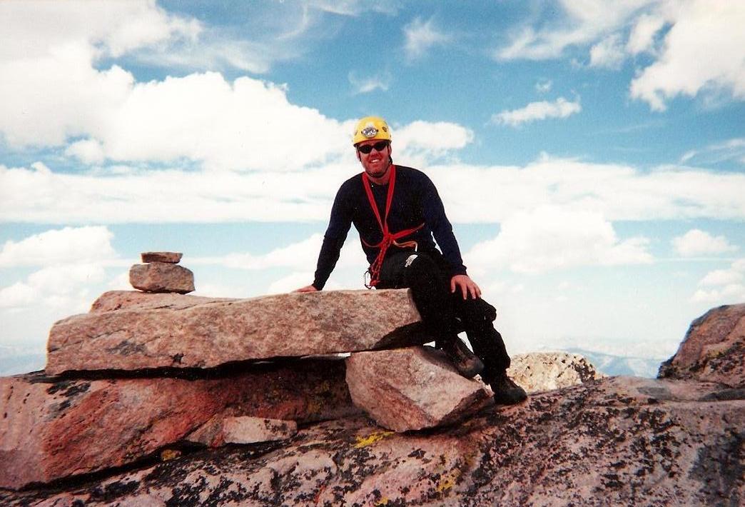
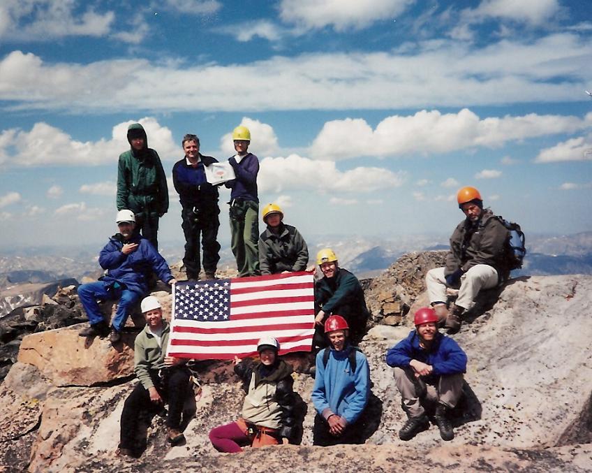
I was among the last to arrive (doing my duties as tie-in master). We all took turns touching the top-most slab and the small cairn atop it. People were spread out among the rocks, relaxing. The sky was still mostly blue, the time around 2 p.m. --- storms would usually build about now, but thus far, nothing --- an extremely welcome development. We had a duty to perform: to unfold the American flag for a group photo, our photo to be used as part of a poster "Fifty Flags Over America", in which photographs of the flag at each state highpoint were formed into a poster to be presented to various people on the one-year anniversary of the September 11 terrorist attacks. The photo below was the one used. I had the honor of carrying the flag in my pack.
The views, of course, were phenomenal. After getting my summit photo and the group photo, I wanted down. My total time up top was 15 minutes, being generous. There's no way I could relax until I was down below all the cliffs. So without any delay, I started down.
Getting to the top of the top-most chute was easy, and then the real fun began: we'd be rappelling down these sections, not downclimbing them. This top-most chute was cake, a rappel of 20 feet. Then we congregated near the biggest chute, the 80-footer. Lee went first, then bottom-belayed the rest of us as we rappeled. The rappel went quickly and I was happy to be below it. Then, another short, quick hike to the next chute, the one with the chockstone in it. This was an easy rappel, and after that, another quick hike to the big chute directly above the snowy notch.
Although we were moving efficiently, it was still a couple of hours by the time we were all above this last chute. I was among the last. I rappelled, untied, and immediately came to the notch. By now, in the shade, the snow was frozen solid. No time to let that sink in. I tied in to the tag-line line, got my crampons on, and walked with purpose across this notch. I was now on the "easy" side of the notch. I felt relief and then, exhaustion. I had been on such a high up there, running at full bore, that I crashed once I knew those sections were done.
However, there was still the 800-foot drop to the Granite-Tempest Saddle, then another 500-foot gain to camp. I was starving, having only jerky and cheese in my day pack. I was also low on water, but there was snow and trickles along the route, so I could get some along the way. Dave and I hiked to the saddle, then up the slope to camp, arriving at 8 p.m. Chuck was waiting for us and had kindly filtered some water for us, which I drank heartily.
Back at camp, I rested briefly, then sat around with everyone in the dusk (darkness came around 10 p.m.). We were elated to have succeeded, all thirteen having made the summit safely, and the weather behaving. Now it was time to party. We had an impromptu meal-trading session. I had some dreadful freeze-dried crap that I hated, and some other guy had a military MRE that he didn't want, so we traded and that MRE was like a gourmet meal. I slept soundly, as well as I could at near 12,000 feet.
The next day was our hike-out day. We broke camp and started the walk out, all agreeing to meet at the northeast end of Froze-To-Death Plateau, where the trail comes up from Mystic Lake. Here, we met a large group of Boy Scouts. They were under-dressed for the conditions (light t-shirts, that kind of thing). They were in their early teens, and asking us all sorts of questions about what to expect higher up. We were kind of concerned to think they had plans to climb Granite Peak. Their leader then showed up and yelled at them for talking to us. What a dick.
We left the Boy Scout troop to their fate, then started down the trail to Mystic Lake. We strung out again, convening at the sandy beach. Then we strung out as we hiked back to the cars, arriving in early afternoon, three-and-a-half days on the mountain. We were tired, smelly but happy.
To celebrate, we drove to the Grizzly Bar in the town of Roscoe. This is a popular place, full of bikers (this being Sturgis week) and people of all sorts, and us. I rewarded myself with the thickest 20-ounce prime rib steak they could muster up. From here, we started to split ways, people needing to get back to Billings or wherever for flights. I called ahead to the airport in Billings to get a rental car as I still had a few more days to explore up here.
In time, Chuck drove Adam and me to Billings. Adam flew home but I got my rental car, and agreed to meet everyone down in Thermopolis, Wyoming, where we'd be meeting some other guys to climb the Washakie Needles. The drive to Thermopolis took a couple hours and about half-way down there I decided I wanted no more of big cliffy climbs. Nevertheless, I drove to the hotel in Thermopolis, showered, and fell fast asleep. I told Dave I was backing out, and said my hearty thanks and goodbyes to everyone. Me, I decided I wanted to go check out Sturgis, then drive north into North Dakota for a hike up its state highpoint, White Butte.
I cannot thank Dave Covill and everyone on the team enough for their support and camaraderie on the mountain. It was an extremely supportive team, people helping people out in sections, willing everyone to get up to the top. For me, it was by far the most challenging climb I have ever done, and a wonderful way to put closure on my failed 1999 experience. We were fortunate the weather behaved so nicely, with no storms at all while up there. It was a true thrill to have safely summitted this grand, marvelous mountain.
|

|