
Michigan
www.surgent.net |
| Mount Arvon |
• Highpoint: State of Michigan • Highpoint: Baraga County • L'Anse Township |
 The hill 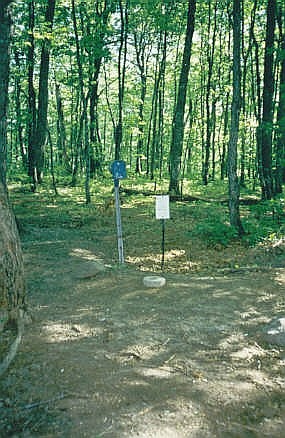 Sign at benchmark |
Date: May 22, 1998 • Elevation: 1,979 feet • Prominence: 949 feet • Distance: 0.5 mile • Time: 10 minute hike, 1 hour journey • Gain: 100 feet • Conditions: Sun with clouds
Main
•
PB
Today was the third day of a trip to visit the state highpoints near the Great Lakes. I started today with a hike up Eagle Mountain in Minnesota. I was done with that hike around 9 a.m., then set my sights on Mount Arvon, highpoint of Michigan.
I was near the extreme northeast tip of Minnesota, and Mount Arvon is near the northeast tip of the Upper Peninsula. This meant I would have to backtrack west to Duluth, then drive across the north coast of Wisconsin, to get to Mount Arvon, in Michigan's Upper Peninsula. It was a scenic drive, but a long one, taking up most of the day. I showed up at an information kiosk outside of the town of L'Anse at 5 p.m., just before they were going to close. There, I was given excellent and updated information on getting to the highpoint. They were most helpful.
Getting to Mount Arvon involves driving through miles of gravel logging roads in the forests, which can be tricky if the route is not well marked or if the roads are in poor shape. Fortunately, the information provided to me was accurate and up-to-date, and I negotiated the bumps, mudpits and washouts in the road with little problem to get within a few hundred yards of the top. The route is blazed with blue diamond-shaped directional signs.
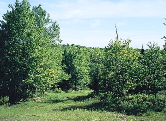
Once parked, I hiked the rest of the way, following the road. After a short hike, I was at the USGS benchmark and registry on the top of Mount Arvon. There are no views from the forested top, but there is a clearing along the road about 1 mile northwest of the hill that gives a relatively unobstructed view of the heavy forest atop Mount Arvon. Happy, I retreated and retraced my steps to L'Anse, then south to Iron Mountain on the Michigan-Wisconsin state line. I stayed in Iron Mountain for the night. Tomorrow, I would visit Timms Hill in Wisconsin.
The "old" state highpoint was Mount Curwood, at elevation 1,978 feet, only a foot lower than Mount Arvon. A survey in 1982 found Arvon to be higher by a foot. It's probably a good idea to do both, but I did not. Curwood is located nearby but I didn't do it. If I'm ever in the area I'll probably visit it.
|
|