
The County Highpoints of Minnesota
• www.surgent.net
|
. . . . . Olmsted County
. . . . . Mower County
. . . . . Fillmore County
. . . . . Dakota County
. . . . . Scott County
. . . . . Washington County
|
Prologue: I visited Minnesota's highpoint back in 1998 and thought that would be it for Minnesota. However, in 2015, βð and I found ourselves in Rochester twice, as she was being prepared for a surgery that summer. On our first trip, we had some days open, so I tagged a few highpoints in the area of Rochester. I could have done more, but the corn was growing thickly and I was not keen to wander through thick, waist-high corn. I read my Stephen King, I know better.
Date: May 21, 1998 • Elevation: 2,301 feet • Prominence: 1,321 feet • Distance: 6 miles • Time: 2.5 hours • Gain: 400 feet • Conditions: Gorgeous, but mosquitoey
Main
•
PB
The highpoint of Minnesota is Eagle Mountain, way up in the state's northeast, where it tucks under Canada and above Lake Superior. It's in an area stippled with thousands of lakes and rivers called the Boundary Waters. It is wild country up here, beautiful and remote, and when the cold has let up, home to billions of mosquitoes.
I had visited the Iowa state highpoint this morning, which is down on the Iowa-Minnesota border. From there to here is about 400 miles, a long haul as I had to cross the whole state nearly on a diagonal. I followed interstates through Minneapolis, then up through Duluth and then along a highway bordering Lake Superior to the small town of Grand Marais, where I stayed the night.
The scenery was beautiful. Down south, it was fairly dull corn fields and low hills, but as I travelled north past Minneapolis, the land became woodier and hillier. Then past Duluth and along the Lake, simply magnificent. The lake is so smooth it looks like glass.
The next morning (today), I got an early start and drove a couple-dozen miles along dirt road to the Eagle Mountain trailhead, arriving at 6:30 a.m. with the sun already high in the sky at this northerly latitude. I was the only person here. I came prepared: I dressed up in long pants, long sleeves, gloves, hat and face netting, plus spray.
The trail is a combination of normal trails over boggy ground, and wooden plank paths where it crosses over the wetter sections. After passing a few lakes, the trail starts a moderate incline for the last mile to the summit, with the last few hundred feet taking longer since I kept thinking I was there, only to discover a few more feet to go. By 8 a.m. I was at the top-most rocks, where a large plaque is affixed to one of them, marking the highpoint of Minnesoota.
At the summit, I took a self-portrait with my camera, exposing my head long enough to get bit a few times by the mosquitoes. A wonderful overlook is found along the trail just before the summit. This would a great place to sit and enjoy the scenery, have a picnic or cuddle your sweetie, presuming the mosquitoes don't carry you off.
The hike back was equally pleasant. I arrived at my car around 9 a.m., and quickly changed out of my hiking clothes and into more comfortable duds. Nevertheless, those damned mosquitos nailed me in about a dozen places.
βð and I returned to Minnesota in 2015 as she was preparing for surgery to relieve the effects of torticollis on her neck, back and upper torso. We flew to Minneapolis in June then drove south to Rochester, where the Mayo Clinic is located. She had a couple of consultations with the doctors, but the surgery would not be for another month. We had some down time, and generally tried to make this trip into a vacation. I had a few county highpoints identified that I wanted to visit, assuming I had the time.
We had good weather on our June visit. Temperatures were mild, with highs in the low 80s, lows about 60. Most days were humid with spotty clouds. We had two rainy days, including one in which a tornado warning was in effect. However, we saw no tornados.
To be honest, I would never come to this part of the country were it not for the Mayo Clinic. These were highpoints of opportunity. The land here is hilly and green, and generally pretty, in a corny-farmy-fieldy way. I have no complaints and I am glad I was able to visit the ones I did.
βð has been enduring torticollis in her neck for years now. The muscles are in a constant state of contraction, the effect being that her head is pulled far to the right, almost resting on her right shoulder. Some out-patient treatments have worked over the years, botox injections to deaden the muscles being the main one. But in time, the body develops antibodies to the botox and its palliative effects diminish. She is in constant pain.
Selective denervation is the surgical treatment that usually results in positive outcomes for torticollis sufferers. Nerves that govern certain muscles are snipped, paralyzing those muscles permanently. The doctor will sever certain strategic nerves and hopefully "release" the tightness in her neck. The hope is that she'll get back some movement and be in less pain, and able to do things she used to enjoy.
It's not possible to simply show up for a denervation surgery. Few surgeons do it. We had to go through many hoops to see neurologists who could help, finally seeing one at the Mayo Clinic in Scottsdale, not far from our home. He then referred us to the Mayo Clinic in Rochester, Minnesota, the original and biggest of the three Mayo hospitals in the United States (Florida has the third one). For our June trip, we were to meet with two doctors, the second being the surgeon who would decide whether surgery was a go or not.
We built in a whole week there, just in case there were follow-up meetings. The stress beforehand was high, because there was the possibility of the surgery being denied. We flew into Minneapolis a couple days before, drove to Rochester, killed a day, then saw the doctors. Happily, they all agreed surgery was a good idea, and we returned in July for the actual surgery.
Between all that, I was able to get away for a couple hours here and there to inspect and visit the various county highpoints in the region. I quickly discovered that they almost inviariably were not along roads but in corn fields. This would limit me because I decided beforehand that tromping on someone's plants was a bad idea, and under the circumstances, we needed all the positive karma points we could muster.
Date: June 18, 2015 • Elevation: 1,380 feet • Prominence: 168 feet • Distance: drive-up • Time: 5 minutes • Gain: 3 feet
PB
The highpoint of Olmsted County is a small rise stradding County Road 3, in the southwest part of the county south of the farming community of Rock Dell. Rochester is the county seat of Olmsted County, so we were close to this highpoint already.
Yesterday, I had gone into Rochester to inspect its downtown and figure out where βð's meetings were to take place. The Mayo buildings are interspersed all throughout the city, and we didn't want to be figuring them out for the first time on the actual day of her first meeting. So I volunteered to scout it all out for her.
After my scouting trip, I decided to drive to the highpoint, but the sky had turned black, with mean-looking thunderstorm clouds and, as I was to learn later, a tornado warning in effect for the region. I found the highpoint easily, but didn't get out to tag anything. Given the weather, I bailed and returned to our hotel.
Today was our first doctor's appointment. This went well, and we returned to our hotel about 1 p.m. I asked if I could escape for a couple hours for my stupid obsession. She agreed and I was out the door and on the road. From our hotel, it's a 20-mile drive along highways and lesser farm roads to the highpoint. Today's weather was much nicer: warm with variable clouds, and slightly humid.
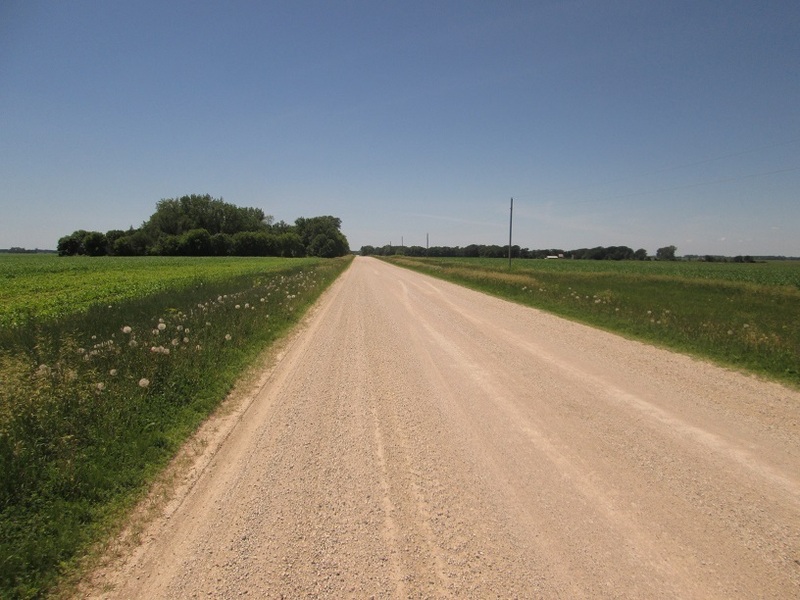
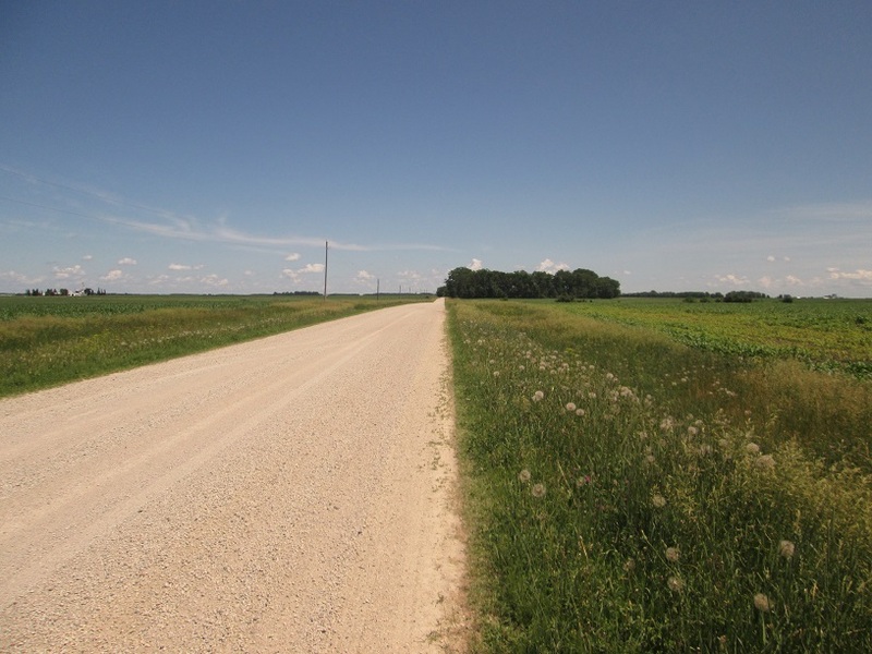
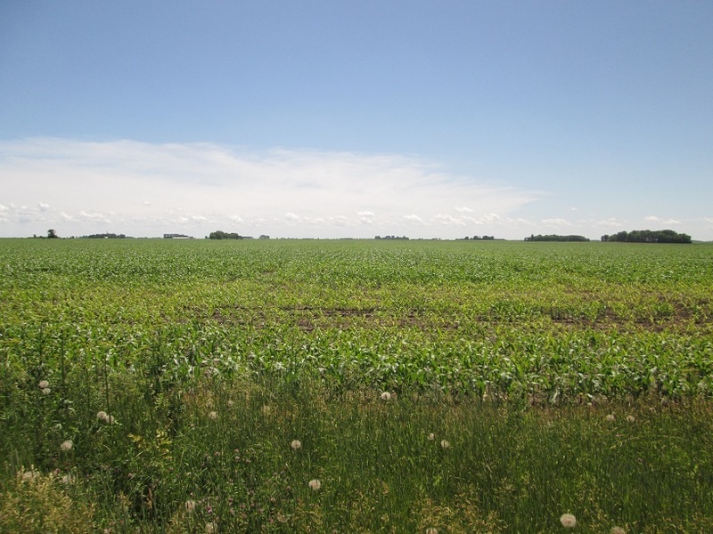
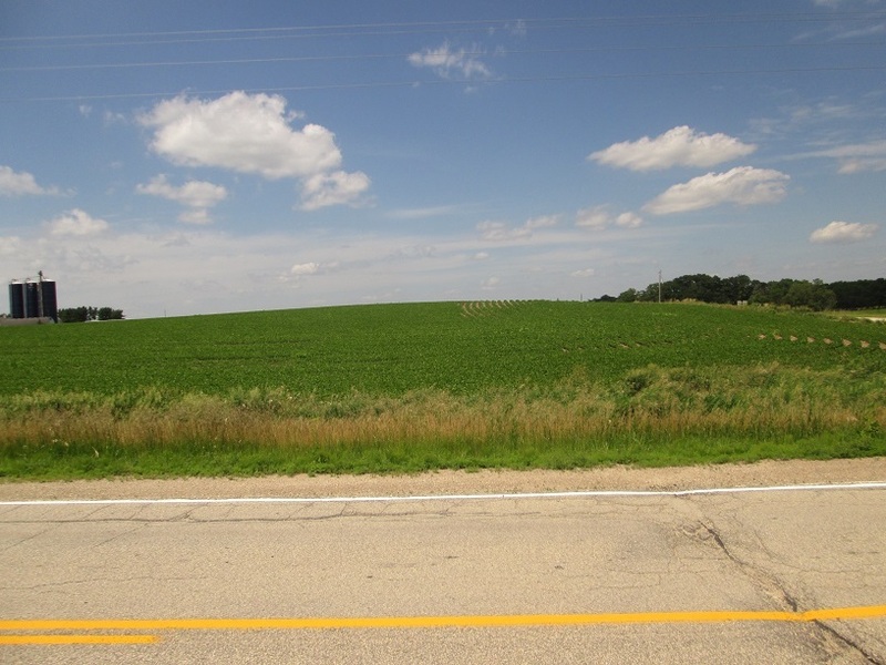
County Road 3 crests the "top" of the gentle highpoint hill. A house is located on the east side and a cornfield covers the west side. I parked and walked through grass and weeds to the edge of the cornfield and essentially within one of the 1,380-foot contours that comprise the highpoint. Looking southwest, the land seemed to rise another foot or two, but I did not walk to it due to the plants.
Looking at the house, which also sits within a 1,380-foot contour, it seemed slightly higher than where I was standing, perhaps as high as the cornfield. To me, it looked to be the highest point. But I didn't want to be skulking around someone's home. There were no cars there at the moment. Thus, I chose one tree that seemed to be "highest" and walked over to tag it and the ground beneath it. Looking west again, I seemed as high as the western swell of land.
I decided this was good enough. I simply would not walk out to the western area amid the young corn plants.
In August 2015, Gustav Sexauer assembled a detailed study of the county highpoints using much more refined data that shows contours down to the two-foot increment. For example, his study shows that the areas comprising the Olmsted County highpoints all reach to the same height, within the confines of the data. To me, this lends support to my visual observation that the land near the hourse and trees was as high as the land to the west in the cornfield.
Date: June 18, 2015 • Elevation: 1,440 feet • Prominence: 110 feet • Distance: 0.2 mile • Time: 15 minutes • Gain: 20 feet
PB
The highpoint of Mower County is not far from the Olmsted County highpoint. I followed county roads and in fifteen minutes located myself in the general area, a mile east of the town of Elkton. There are three contours that reach 1,440 feet, but the westernmost contour seems to be the consensus (albeit a small sample size) as the likeliest highpoint. Conveniently, it's also accessible as it sits between two fields. A scant path separates the two fields.
I parked west of the westernmost area and hiked to the top, gaining 15 feet in about 500 feet of walking. There is a rockpile here, presumably the rocks that used to sit in the surrounding fields that were then collected and piled here to allow the fields to be tilled.
I first stood beside the pile and inspected the two other areas, one about 500 feet to the northeast and another about 1,500 feet east, both in cornfields. The northeast area seemed lower with a strong probability, any rises long since tilled away over years of farming. The eastern area seemed to be about the same in elevation, but any distinct "tops" had been leveled away from years of tilling.
I then scampered up the rocks, which wasn't that easy. They are surrounded by thick weeds and I was concerned about critters hiding therein. On the rocks, they were loose and some turned under me, but in moments I was atop this pile, which stands about eight feet in height.
Two previous visitors both felt this western point was probably highest and I felt the same way. My sense tells me the northeast area can be ignored, and the eastern area is probably lower. In any case, I was not going to walk to them amid the corn. I left feeling good about this one.
Sexauer's study shows that the area to the northeast, or roughly in the middle of the three areas, is highest, but also observes that the western area is higher due to the rockpile. Thus, I feel less confident that I visited the highest "natural" point, although standing atop the rockpile was definitely the highest point all around. Thus, I am rescinding my claim to this county highpoint.
Date: June 18, 2015 • Elevation: 1,400 feet • Prominence: 50 feet • Distance: 0.6 mile • Time: 20 minutes • Gain: 50 feet
PB
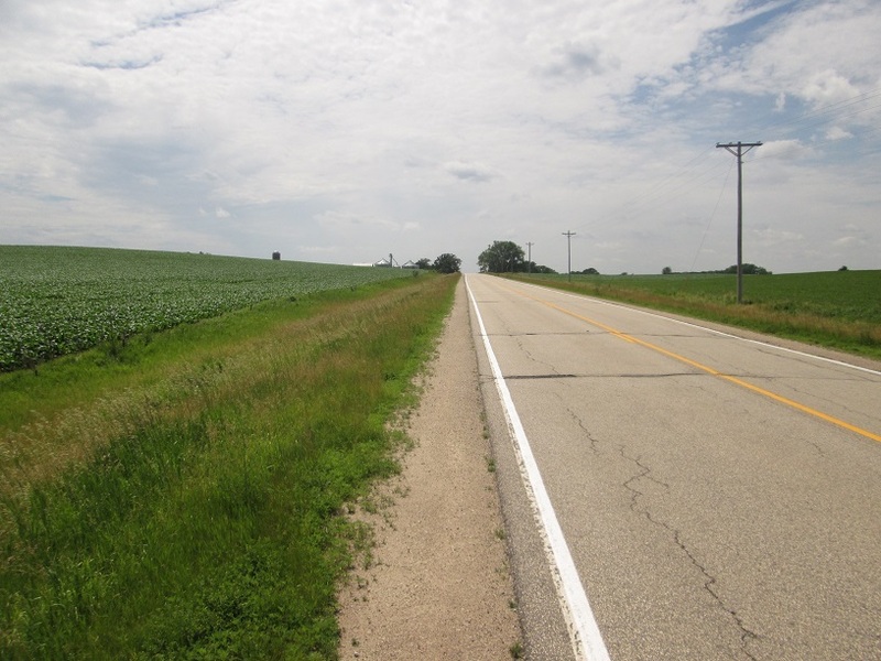
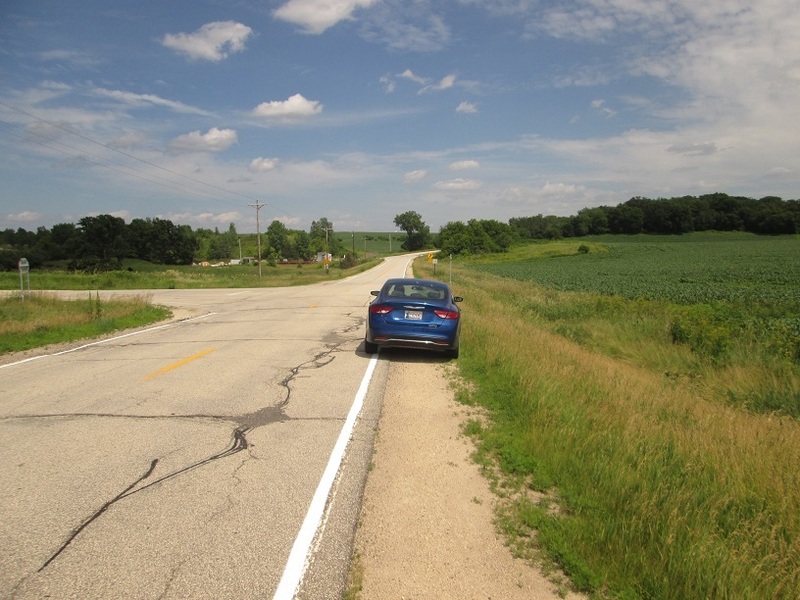
Next up was the highpoint of Fillmore County, about 30 miles away to the southeast. I followed more smaller highways and local county roads to situate myself northeast of the tiny village of Cherry Grove. The land here isn't as flat, being hillier and crossing into and out of small rivers. In some cases, the road would lose or gain a hundred feet at a time.
There are two areas that reach 1,400 feet, both side by side on a common hill about a quarter mile from the closest road. I drove to the road closest and parked, happy to see that there was a path of sorts to the top, and that this was a real hill, albeit small. Nevertheless, I was looking at 50 feet of gain.
I followed a path that hugged the margin between a cornfield and low grass, and kept to it until I reached a north-south fence. I found a breach a few feet to the north, crossed it and then hiked up to the top of the hill. Here, I broke my rule against hiking in corn, but just briefly. I was able to view to the smaller area about 300 feet away and it was clearly lower.
I returned to my car and returned to Rochester. I was pleased to visit three county highpoints, all in about a two-hour period, and I wasn't even that far from Rochester after all this driving, no more than 45 miles. I was back to the hotel by 4 p.m.
Date: June 20, 2015 • Elevation: 1,195 feet • Prominence: 215 feet • Distance: 0.5 mile • Time: 30 minutes • Gain: 200 feet
PB
I had half an afternoon open and the weather was actually pretty nice, with mostly blue skies. It was warm (about 85 degrees) and humid, but nothing that would stop me. I asked βð if I could bail for a couple hours and she agreed. My goal today were two county highpoints, those of Dakota and Scott counties, both located near Interstate-35 south of Minneapolis.
I left the hotel around 10:00 a.m. and drove west through Dodge Center to Owatonna, where I picked up Interstate-35. From here, I went north through Faribault and into the southern suburbs of Minneapolis, although I was still about 20 miles from the main city. The one-way drive covered just under 70 miles and took me a little over an hour.
I elected to visit Buck Hill first, then travel south and visit the second highpoint in Scott county afterwards. Unlike the cornfield counties I encountered two days earlier, these two highpoints were actual hills, not covered in corn, and relatively easy to reach.
Buck Hill is a ski area during winter, with about a 200-foot drop. It has one lift and a handful of buildings at the base. For skiers in the Plains, this is as good as it gets. I found it easily enough, as it sits about a half-mile west of the interstate. I pulled into the parking lot, which was empty save for one car on one end, and about twenty cars on the other end. These other cars looked to belong to a dealer, who was storing them here. They were all the same make and model.
With about 300 parking spots to choose from, I found one that I liked and rolled into it, then killed the engine. I grabbed my camera and walked into the ski area. The area is open, and I expected to see joggers or people playing on the grassy slopes, but there was no one. I walked around to find someone, but no one was in the buildings. There were a couple of "No Trespassing" signs hung in a couple spots. I preferred to have someone give me permission if possible.
After finding no one and determining the place to be entirely vacant, I gave myself permission and walked up the hill anyway. I followed beaten paths through the shin-high grass and arrived to the top in 10 minutes. I took a few moments to walk around, step on mounds of earth and shoot a few images. I didn't linger.
On the walk down I looked over at another hilltop that looked as high from below, but was clearly lower when abreast of it. I jog-walked downhill and was back to my car after a total time of twenty minutes. No one ever saw me or said anything. I was quite sweaty in the humidity, so I treated myself to the air-conditioning as I drove south to my next objective down the road.
Date: June 20, 2015 • Elevation: 1,235 feet • Prominence: unk. • Distance: 0.5 mile • Time: 30 minutes • Gain: 80 feet
PB
Back on the interstate, I drove south for 10 miles, to County Road 2 in the town of Elko-New Market. I went west a mile, then south a mile along Xerxes Road, which may be the first time in my life I have ever driven on a street whose name starts with an X, not counting lame rural county roads like "Road X".
The area was what I'd call "upscale rural middle class". The homes were all nice, not too big, but not small either. There were lots of trees, the lawns were well-kept and it looked like a safe, pleasant place.
The highpoint is locally called "Pete's Hill", and there is a paved path that runs through housing development and goes to the top. However, there is no place to park for visitors such as myself. I parked about a quarter-mile away on Glenborough Road, and walked along Xerxes Road to the paved path to the top.
The hike was easy and fast. A big water tower sits below the highest point. A number of breaks in the brush leads to the top, which is bare and features a bench and a concrete pad painted as the American flag. The benchmark was nearby the bench. Looking west, the views were of trees, roofs and distant water towers.
I returned to my car, this journey costing me 15 minutes of my time. On my drive back to Rochester, a major accident had closed Interstate-35 in Faribault, so I followed lesser highways through Kenyon into Dodge Center. I still had a lot of time on my hands, so I inspected a lat-long confluence, and the highpoint of Steele County.
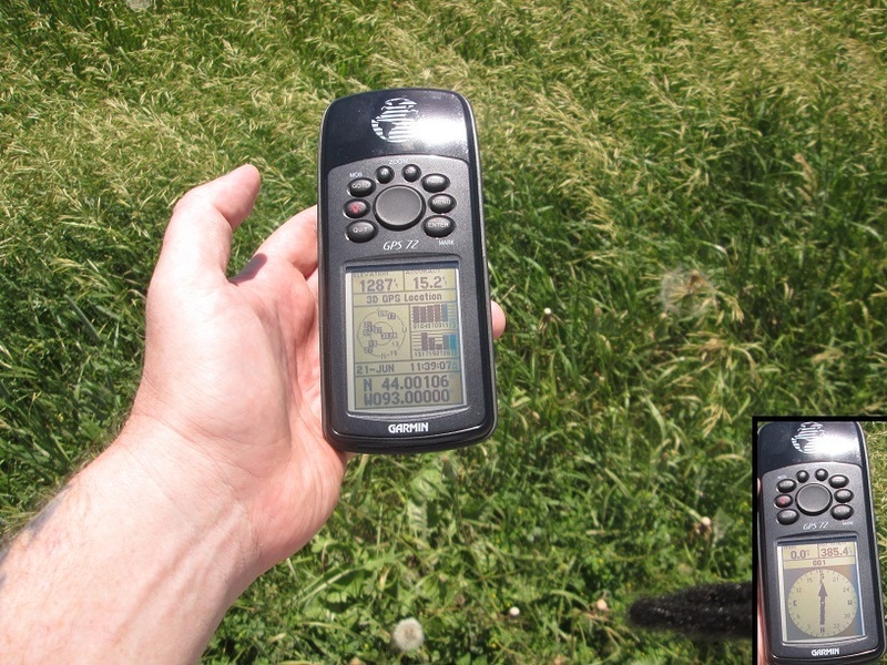
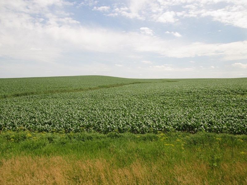
I found the confluence (North 44, West 93) easily, located southeast of Owatonna in a farm field. The Steele County highpoint was less than five miles west. I found it easily, too, and it may have been the most substantial hill of the cornfield counties, but it was covered over in the young plants. I chose not to hike to the top. From here, I returned to Rochester, about 35 miles away.
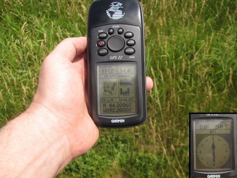
Here are the images from my visit to the confluence at North 44, West 93. I got no closer than about 385 feet (says my GPS). I did not want to walk into the corn field to it, partly due to scaring up a snake, and mainly due to the feeling that walking in someone's farm field - their livelihood - and squishing some of their plants would not be cool.
Two days later, with not a lot going on, I drove east about 25 miles from Rochester to visit this point. It too is in a corn field. I got to within about 260 feet. According to the bylaws at confluence.org, which allows a 100 meter radius, I was within this threshold.
Date: June 24, 2015 • Elevation: 1,104 feet • Prominence: 184 feet • Distance: 0.3 mile • Time: 30 minutes • Gain: 60 feet
PB
Washington County is located between St. Paul and the Wisconsin boundary. Its highpoint is one of two small hills, both containing water towers, about four miles apart from one another.
I didn't print a map beforehand, and only recalled the locations based on notes I took while at a computer at the Rochester Public Library (I didn't want to hassle with a printout). Both highpoint hills are located along suburban roads, the north one in the city of Oakdale, the southern one in Woodbury. I figured I would look for hills with water towers atop them when in the area.
We were returning to Minneapolis-St. Paul for our flight out later today. We drove northbound from Rochester and then followed the loop highway (Interstate-494) east and north into Washington County, roughly where Interstate-94 branches off toward Wisconsin. I exited the freeway at 10th Street North, went west a quarter mile to Hadley Avenue, then south. We could see the tower behind some homes and amid the trees. I turned onto Hadley Lane, a tiny round-about with a few homes. We parked near the tower and both walked to it, a 20-foot walk.
I was a little suspicious that this seemed too easy. I drove the immediate area, but in all directions, the land dropped down, although it was hilly nearby. I knew I was on the right road, so this had to be the highpoint. Still, I was not sure.
For the southern area, we got back on the freeway and went south a couple miles to Valley Creek Road, then east a little over a mile to Tower Road. We could see the water tower (and other towers) set back from the road about a hundred feet. The hill was surrounded by a city-owned facility, with all sorts of city vehicles going in and out.
I drove to the next residential road, Highpointe Road, then followed that to Windsor Road, looking for a possible way up the hill. We found a spot along Highpointe Road that had a path up to the fence that surrounded the top. I decided to go back out to the facility and try my luck there.
I pulled into the facility. The gate was open and the signs weren't too intimidating (just one that said "authorized vehicles only"). I saw some other vehicles parked, so I parked in among them, hiding in plain sight. I still felt a little uncomfortable being here without permission. Some guy was getting his truck in order, so I asked him if it was okay for me to be here, but he did not work directly for the city. I'd lollygagged enough. I walked up the rest of the road and up to the top of the water-tower hill, tagged some high spots and turned back to the car. The walk took just a couple minutes. No one stopped me. The trick is, act like you belong there. Very few people will question you.
I drove back to a point along Highpointe Road and walked a path in the grass up to the fence that surrounded the hilltop. I was curious if it got close to the actual top. It does, but stops short about three vertical feet. Scaling the fence would be difficult due to razor wiring. I also drove north to an apartment complex on Tower Lane, which seemed possibly as high as the tower hill.
We got moving from here, driving into Bloomington to spend time at the Mall of America, just a couple miles from the airport. We still had a couple hours to kill, so we walked around, got a bite and camped at the bookstore. We flew home that night. Later, I checked the maps and yes, we had been to both highpoints properly, so I didn't have to doubt myself.
We returned a month later for the actual surgery. The surgery went well, and achieved most of the goals we hoped it would achieve. We were in Rochester a week, and not surprisingly, doing anything trivial like highpoints was out of the question. The main highpoint was that βð made it through the surgery alive and well. I couldn't ask for anything more.
|


|