County Highpoints of Massachusetts
• www.surgent.net
|
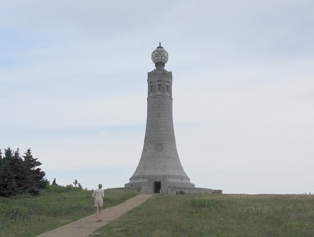
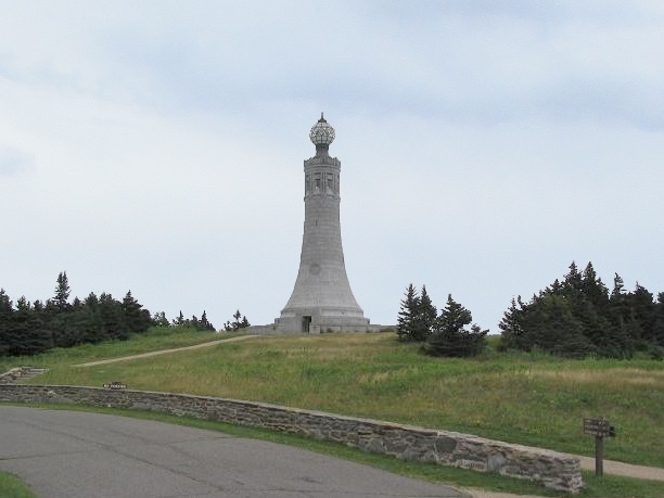 The tower atop Mount Greylock
|
Mount Greylock • Round Top Prologue: Mount Greylock is the highest point and most prominent mountain in Massachusetts. A road goes all the way to the top, while there are trail options for hikes, too. However, on both my visits, I had little time (and variable weather) for a long hike, so I drove the road both times. The top features a big tower, commemmorating the Massachusetts War Veterans. On a clear day, the views are supposedly excellent, but both times I've been here it's been cloudy and foggy.
Dates: (1) July 4, 2000; (2) August 8, 2006 • Elevation: 3,487 feet • Prominence: 2,464 feet • Distance: 0.2 miles • Time: 1 hour • Gain: 25 feet • Conditions: Cloudy in 2000, cold and sprinkly in 2006
Main
•
PB
July 4, 2000: I had flown into Manchester, New Hampshire two days ago, then spent all day yesterday visiting the five county highpoints of Rhode Island and seven of eight county highpoints in Connecticut. I visited the last county highpoint in Connecticut this morning, then had most of a day open. I planned to visit Mount Greylock here in Massachusetts, then get myself back to Manchester for my flight out tomorrow.
I entered into Massachusetts on US-7, and did okay until I got to Pittsfield. I had problems staying on course in town, where signs were hard to see or not there at all, and I found myself on the wrong road more than once. I eventually worked my way to the north into the town of North Adams and onto Notch Road, the scenic and twisting road that goes to the top of Mount Greylock.
The drive is interesting, with excellent views and portions where the road narrows along the ridges. There were bicyclists and motorcyclists, plus a steady stream of cars. I arrived to the upper parking area and walked to the tower, then walked around to be sure I had not missed any highpoint rocks. I spent thirty minutes walking around and checking out the visitor's center. The day was hazy, so the views were not good. I drove down the south road back into Pittsfield and then along US-20 into Chester, aiming to hike Round Top in nearby Hampden County.
August 8, 2006: βð and I were in the area, having visited highpoints in Vermont and heading south into New York toward West Point. We stayed in Bennington, Vermont, which is about 30 minutes north of Mount Greylock.
The day started cool and foggy with a stiff breeze. The fog lifted but the weather was still blustery. We drove the road from North Adams to the top. Our visit was short as βð was feeling unwell, but she walked the few yards to the highpont. We exited via the south road as before, and followed US-7 into Connecticut and then New York state.
Date: (1) July 4, 2000 • Elevation: 1,794 feet • Prominence: 403 feet • Distance: 1.2 miles • Time: 40 minutes • Gain: 300 feet • Conditions: Cloudy
PB
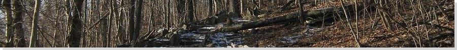
I arrived to the Round Top area about noon. I followed a rudimentary trail marked by white blazes on the trees. In places the trail was nonexistent but the blazed route helped. And it was steep --- my map seemed to indicate that it was about 100 feet of gain but then I realized I had one of those maps that mark things off using the confounded metric system, so it was actually more like 300 feet of gain.
The hike was short, steep, and quick. I burned a few joules along the way. I was at the summit in about 20 minutes, a grassy top with rocks and trees. I took a break in the open, but couldn't see much. I didn't stay long.
Coming down, I slipped and caked my pants in thick brown mud. They were goners for the trip. I'd have to take them home like that in a plastic bag and hope they were salvageable. From here, I drove back to Manchester, New Hampshire, and lazed in a local hotel before flying home the following morning.
|

|