The Mountains of Vermont
www.surgent.net |
|
Prologue: βð and I were visiting her family and friends in Virginia, and we worked in a side trip to Vermont for time to ourselves. The weather in Virginia had been humid, hot, moist and dreadfully uncomfortable. However, as we drove north, a cool and dry airmass from the north was coming in, resulting in beautiful conditions.
From Virginia, we drove north through about twelve states (or so it seemed), spending the night in Binghamton, New York. When we arrived, all the signs mentioned this thing called a Spiedie Festival. We asked the girl at the Super-8 Motel counter what it was, and got a stream-of-consciousness answer, like "you know those little dumplings they're like that Lupo's is the best". I still had no idea what a spiedie was, but now knew to go to Lupo for the best ones.
We spent another day getting to Burlington, Vermont. We took lots of local roads because the interstates were crammed with New Yorkers escaping the city. We rolled into Burlington around 4:30 in the afternoon. Our plan was to hike Mount Mansfield the next day, and visit the Stowe area while there.
Date: August 6, 2006
• Elevation: 4,393 feet
• Prominence: 3,633 feet
• Distance: 3 miles
• Time: 3 hours
• Gain: 550 feet
• Conditions: Sunny and pleasant
Main
•
PB
The next day (today) started clear and lovely. We drove to Mount Mansfield and assessed our options. There are three ways to visit the peak: The Long Trail (for a full day of hiking), a gondola that lets out just below the peak, or the Stowe Mountain Toll Road. This third option seemed most attractive, as it ends at a parking area on the mountain's ridge, leaving a 1.5 mile one-way hike to the summit with about 550 feet of gain. We paid the toll, which was $19.95. Naturally, everyone paid with a $20 bill, meaning the poor guy had to give back a nickel every time. This begged the question: why not charge an even $20? Over time, that extra 5 cents per vehicle could add up. I've never understood the habit of pricing things to end in ".95" or ".99". Just use an integer.
From the gate, it's a steep 5 miles and about 2,500 feet of gain to the upper parking area, a consistent 10% grade. The road is paved for the first quarter-mile then graded dirt the rest of the way. Our tiny Chevy Cobalt did fine going up the road, and it took us 30 minutes to get to the top parking area. For the faint-of-heart, there are some parts where the drop-offs are quite impressive. Curiously, about half-way up there's a small non-denominational chapel that apparently has services every day about 2 p.m. We arrived at the parking area around 11 a.m. in beautiful, dry and comfortable weather.
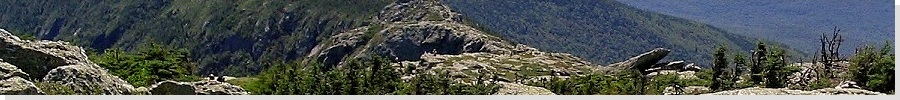
After a few minutes of getting ready, we started our hike to Mount Mansfield, an attractive granite summit sheathed in light forest and brush. The trail starts near the informational center at the parking area, entering into a glade of mid-sized trees. A wooden boardwalk is built in one section of perpetual mud. The route passes through a few of these boardwalk areas and onto rock balds where the route was blazed with white stripes. Shortly the trail leads to a small knob where the peak is once again in view.
After this knob, the trail becomes a little steeper, and more rocky. In some parts, the "suggested" trail came rather close to rocky cliffs and drop-offs. However, there was no danger of falling off. As we got closer, we had to negotiate a narrow walk between rocks and a moderate slope to get to the very top. Soon, we were on top.
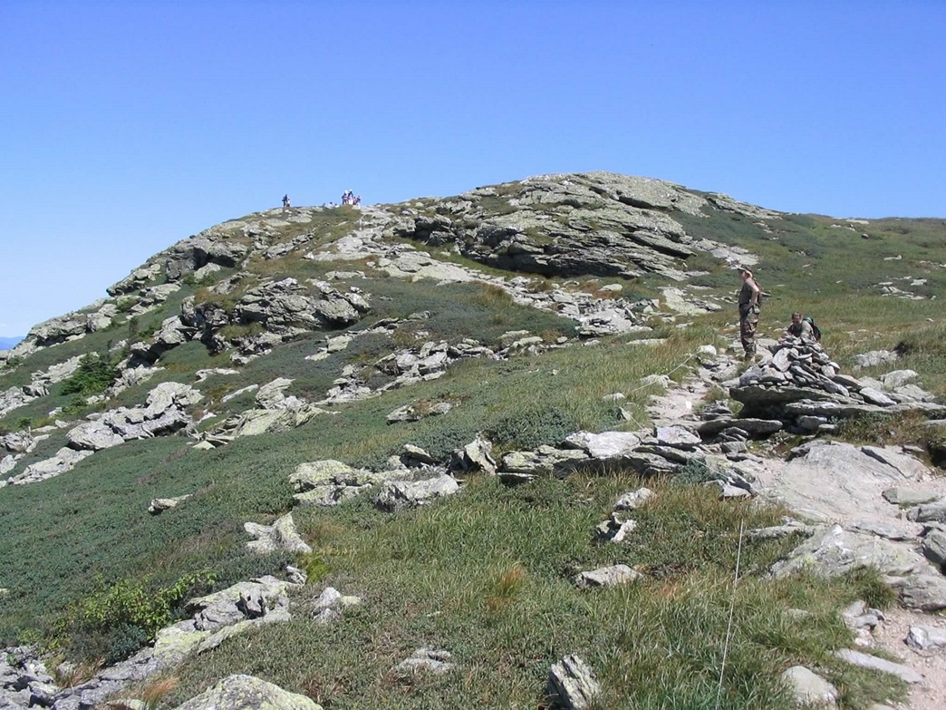
Did I mention this is a popular hike? There must have been 40 people at the summit, and a steady stream of new arrivals and people heading back down. It took us over an hour to get here, where a local guy shot our photo and told us about the local points of interest. Given our unexpectedly sunny, clear and dry day, we had sharp, well-defined views of distant ranges on all horizons. To the west were the Adirondacks in New York State, while New Hampshire's Mount Washington was the obvious big peak on the east horizon. The guy said that the low mesa-like ridges to the north were in Quebec, Canada. It's neat to meet someone like that who can fill you in on the details when you're playing the tourist. Despite the high number of people, we thoroughly enjoyed our time on the summit, and didn't feel like we were missing out on a true wilderness experience.
We spent quite awhile up here, relaxing and enjoying the views. But eventually, we needed to get moving. We slowly hiked back to the car, our total round trip covering 3 hours. We then sloooowly drove down that steep road, watching for cars coming up and trying not to ride the brakes the whole way down. We celebrated with a lunch at Friendly's, then spent the remainder of the day being chill. Despite the short hike, it had been a relatively eventful and enjoyable day. This was my 45th state highpoint.
We had one more day in Vermont, and we used some of the time to visit two more mountaintops, neither requiring much effort.
Date: August 7, 2006 • Elevation: 4,295 feet • Prominence: 3,315 feet • Distance: 0.2 mile • Time: 30 minutes • Gain: 40 feet
PB
The great weather we had the previous day was now a little more mixed, with clouds, a breeze and the threat of rain. Still, the weather was cool and not too humid. On the agenda today were two highpoints, both fairly high and prominent peaks, that had easy access via gondola or road.
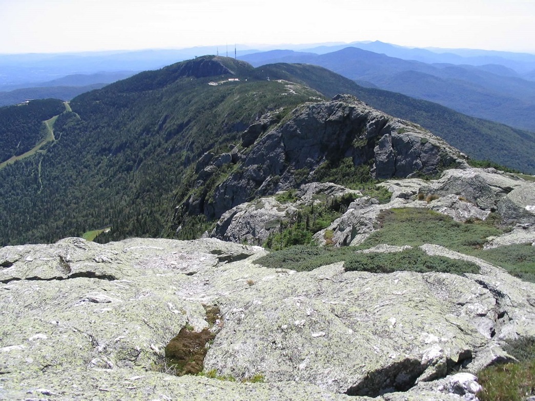
First was Killington Peak, site of another of Vermont's well-known ski resorts. We drove to the end of the road to the big lodge at the base of the gondolas and ski runs. βð was battling a migraine and decided to skip the ride, but she gave me her blessings to go up to the top and tag it. I bought a ticket ($14) and got right into a gondola. The big draw here is the bike paths. People take their bikes to the top on the gondola, then ride them down the network of roads and trails all the way to the bottom. Me, I just wanted to tag the top.
The ride to the top takes 8 minutes, and from there, a trail (trail J) winds about 40 vertical feet and 200 horizontal feet to the sloping, rocky granite summit. The hike itself took about 5 minutes. An English couple was there and they kindly took a shot of me. There was a stiff breeze and the views were obscured by the clouds and hazy moisture. I didn't stick around long, hiked back down to the gondola and rode down, the whole round trip taking less than 30 minutes. We continued south along US-7 for our next objective...
Date: August 7, 2006 • Elevation: 3,840 feet • Prominence: 3,040 feet • Distance: 0.2 mile • Time: 10 minutes • Gain: 5 feet
PB
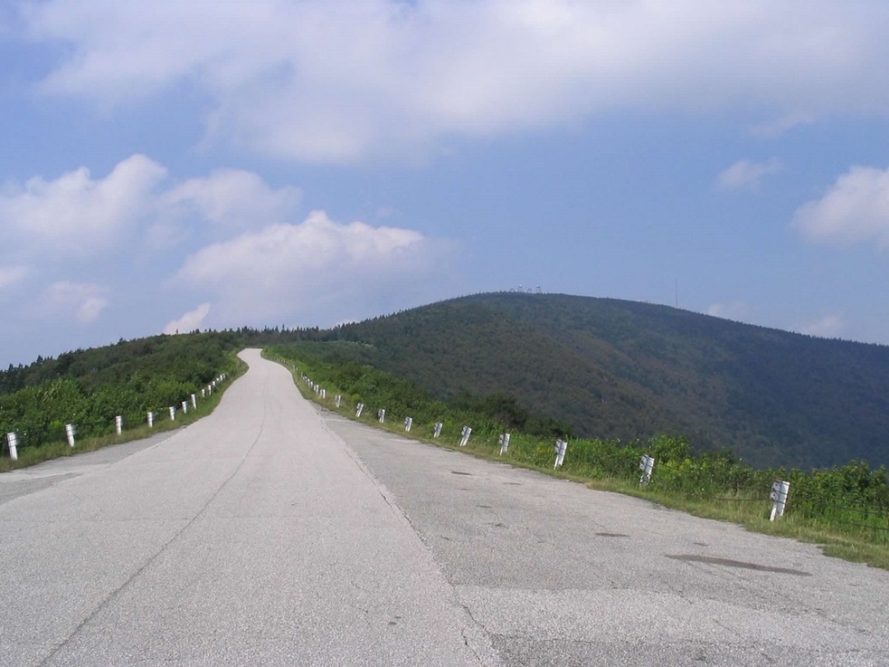
Another hour of driving got us to Equinox Peak, which is accessible by a toll road. We found the tollhouse and paid the $10 fee, and started our way up the mountain. Similar to the Stowe Road from yesterday, the road to the top of Equinox gains steeply, this time a little over 3,000 feet in about 5.5 miles, but the road is paved all the way. Our trusty Cobalt went up to the top with no difficulties, taking us 30 minutes.
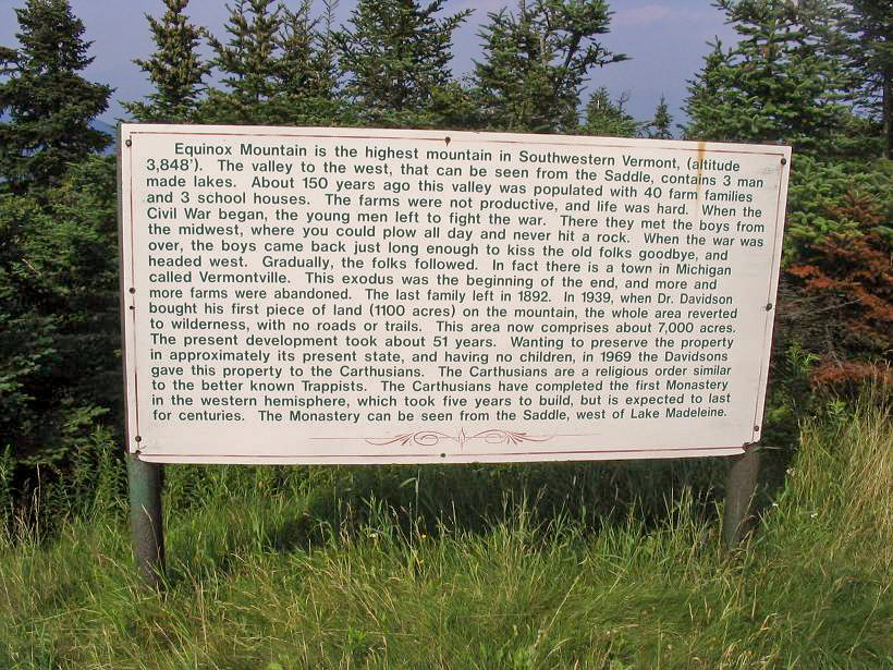
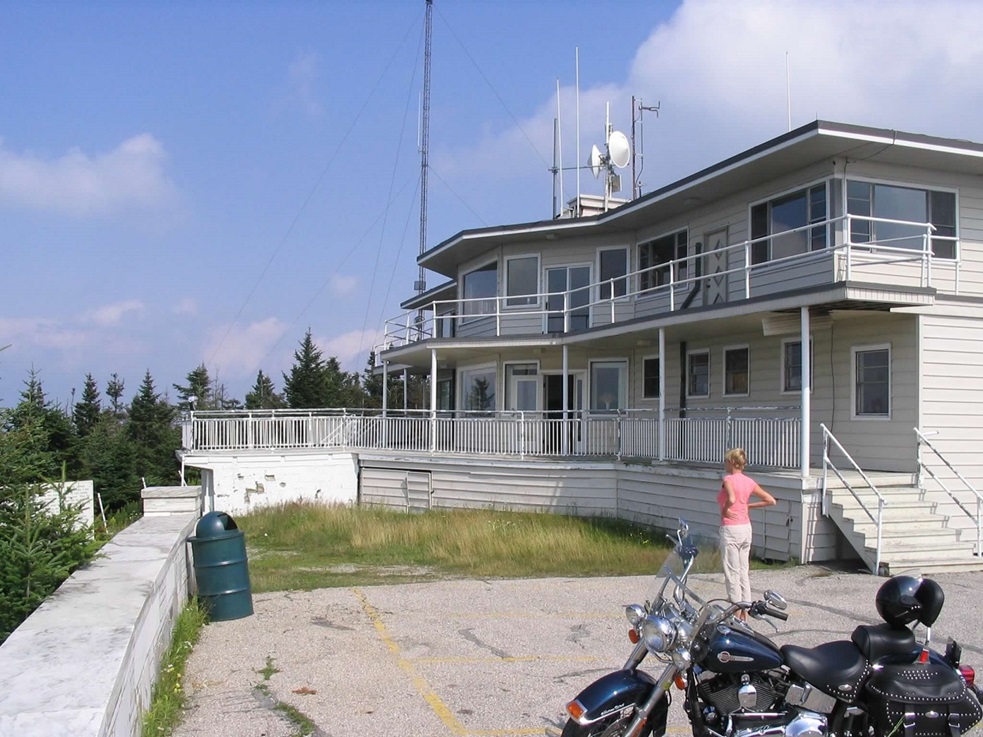
Nearer the top, the road comes into the open along a narrow saddle and gives nice views of the peak and of the valleys below. We rolled into the top parking area and walked around. The highpoint seemed to be a gentle mound about 50 feet off the road back toward some communications towers. We both stood on the mound, then went over to check out the interesting building at the summit.
The building looked like an old inn of some sort. The wall around the parking area is marble and cut skillfully, and it seems that at one time this was a high-end destination for the locals. A nearby sign gave us some sense of history of the area, but didn't really explain the building. We then walked to the building. It was in slight disrepair: some siding had blown off here and there, but for the most part looked pretty good. The windows were all in good shape.
Curiously, the main room was open and accessible. I peeked in. It had a number of tables and chairs, all with complete place-settings, and some china hutches, all intact and nice looking. Obviously someone takes care of the place. Maybe it's still used as an inn, although I doubt it. The main room had a musty smell to it. Even though there were a couple cars parked at the top, we did not see anyone around. The whole effect was kind of creepy, like one of those ghost-chaser episodes from television. Where was everyone, and why would someone keep the dining room intact and fully set, if no one is around, and keep the front doors open?
We left after a few minutes, taking the downhills as slow as possible, then drove to our hotel room in Bennington.
|


|