County Highpoints of Massachusetts
• www.surgent.net
|
. . . . . Holt Hill
. . . . . Great Blue Hill
|
Bellevue Hill • Holt Hill • Great Blue Hill Prologue: I was in Boston attending a conference at the Copley Marriott, partly a result of the upcoming publication of the textbook on which I am a co-author. I was meeting and greeting many people, attending talks, shaking hands, eating too much and having a great time. This was my first time ever in Boston and I enjoyed it very much. There are three easy county highpoints close to the city and I hoped that I had time to visit a few, and that the weather would behave too. It was cold but pleasant, no big storms blowing through. I was fortunate to visit the three I had planned for, aided greatly by the able help of Roy Wallen, who met me and drove me to the latter two.
Date: November 12, 2010 • Elevation: 330 feet • Prominence: 168 feet • Distance: 1 mile • Time: 2 hours • Gain: 100 feet • Conditions: Beautiful
Main
•
PB
My first day at the conference was filled with meetings, greetings, lunches, dinners, talks, and so on. I barely had time to do anything not on the official agenda. However, my second day was not as jam-packed. I saw I had a couple hours between commitments, so I decided to go check out Bellevue Hill, the highpoint of Suffolk County and the city of Boston. Suffolk County is small in area and basically encompasses Boston. Bellevue Hill is a few miles southwest of downtown, in the community of Bellevue.
To get there, I got on the T, Boston's subway system, and rode the orange line to its south terminus at Forest Hills. I wanted to take a bus the two miles more to the Bellevue Hill area, but when I got on what I thought was the right bus, the driver said the bus "don't go there". Just to be safe, I spent $10 for a taxi to take me the remaining distance via Washington Street. He dropped me off on a residential road and from there I walked the road, then entered the forested hill along a leaf-covered path. I walked up stairs and onto a clearing where a big water tower sits. I walked the perimeter of the fence and surmised the highpoint to be on the south side, a small rise on the hill near a tree. It was all very pretty.
I exited and walked back to Washington Street, and caught the bus as it drove back to the train depot. From there, I took the train back to downtown. The whole round trip, from hotel to highpoint and back, took less than two hours. I was amused that I used four modes of transportation: foot, taxi, train and bus. I was back to my hotel by 1 p.m., where I took a shower and made it back for some more presentations that afternoon. My walking portion covered about a mile, including the parts between the hotel and train station.
Date: November 13, 2010 • Elevation: 420 feet • Prominence: 334 feet • Distance: 1 mile • Time: 30 minutes • Gain: 100 feet • Conditions: Tremendous • Teammate: Roy Wallen
PB
Today was not as busy and I had most of the afternoon open between meetings and other engagements. Prior to leaving I had contacted Roy Wallen, a pal from the county highpointers club. Roy lives in the area, but I had not seen him since 2002 in Texas. Roy was gracious enough to show me around a couple county highpoints, both "in the area" and close to Boston. I took the orange line north to its end at Oak Grove where Roy picked me up. First on the list was Holt Hill in Essex County, not far from the city of Lawrence. The weather was spectacular for this time of year.
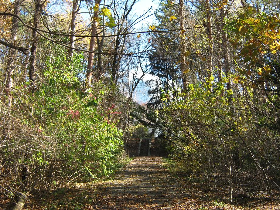
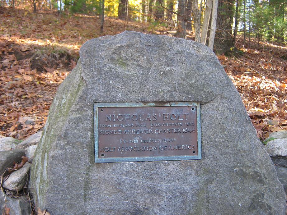
We went north a small ways along Interstate-93, then followed some smaller feeder highways to a residential area. I couldn't really tell you where we were, but Roy obviously knew where he was going. We parked in a small lot near the park that includes Holt Hill. This is a small land preserve set amid some very nice homes.
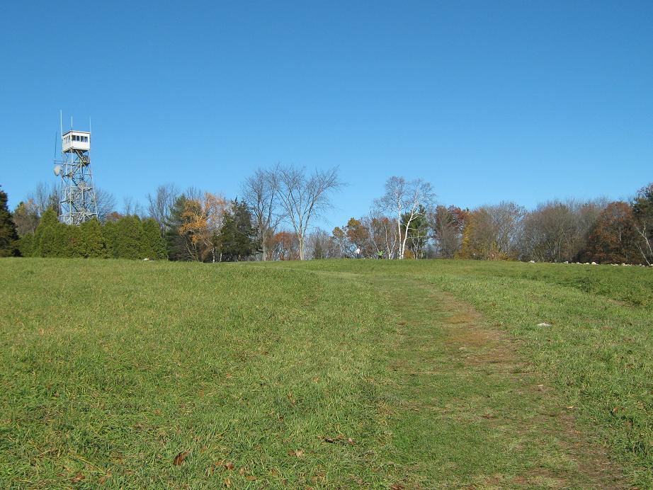
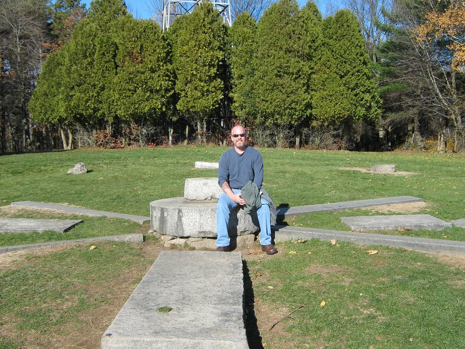
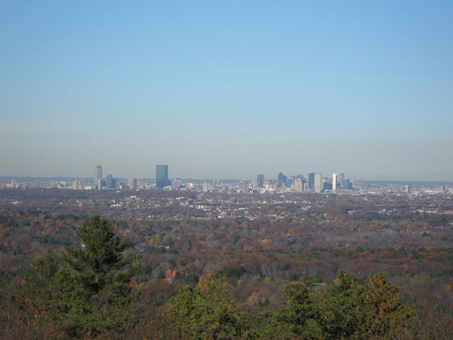
The park has a number of trails, some going direct to the top, others more meandering. Roy chose a nice one that swung south, then east, then north to the grassy hilltop. The one-way hike took us 15 minutes using a combination of wooded paths, open grassy meadows, and old access roads. The top is broad, features a lookout tower, and at the summit itself, a set of stones laid out in the cardinal directions. There were lots of people about, oldsters out for a hike, and families with small kids. The Boston skyline was visible to the south, about 30 miles away. Roy commented what a clear day this was, that it was unusual this time of year. Temperatures were about 60, no breeze, and not a cloud anywhere.
After 15 minutes at the top we took a shorter, more direct path back to Roy's car. After 40 minutes zipping along the beltway highways of the Boston 'burbs, we arrived at our next objective, Great Blue Hill.
Date: November 13, 2010 • Elevation: 630 feet • Prominence: 483 feet • Distance: 1.5 mile • Time: 40 minutes • Gain: 450 feet • Conditions: Superb • Teammate: Roy Wallen
PB
We exited Interstate-93 in Dedham, now on northbound highway MA-138. Great Blue Hill stands tall and is pretty big for these parts, with a summit at over 630 feet. We parked in the southern parking lot, south of the museum. Given the day's great conditions, the lots were jam-packed and we were lucky to find a spot.
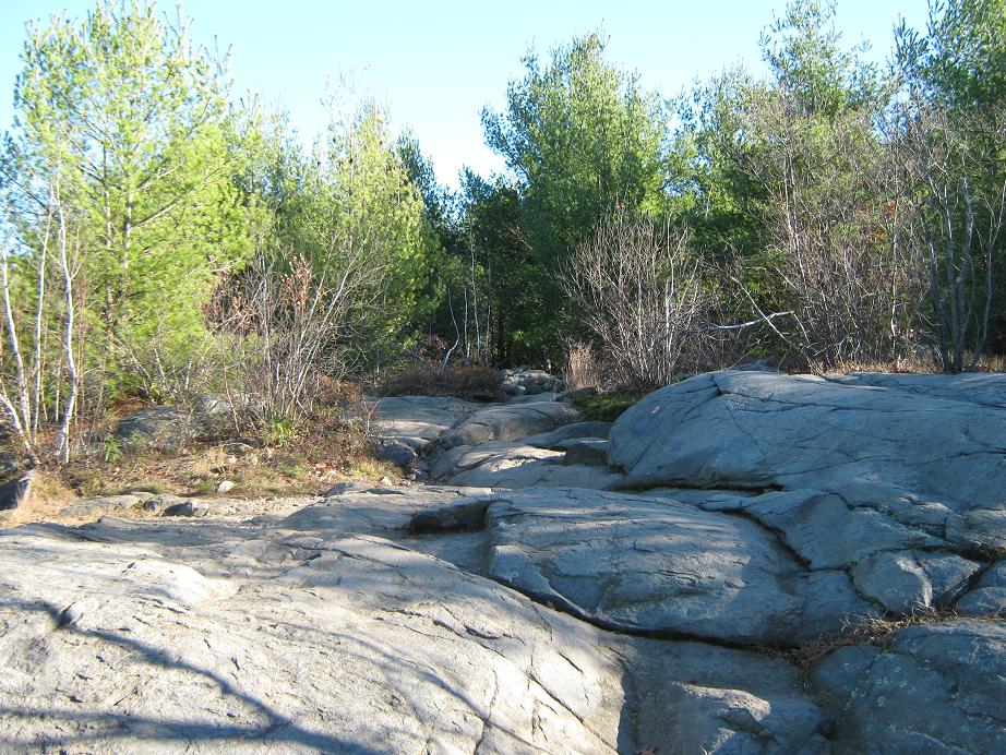
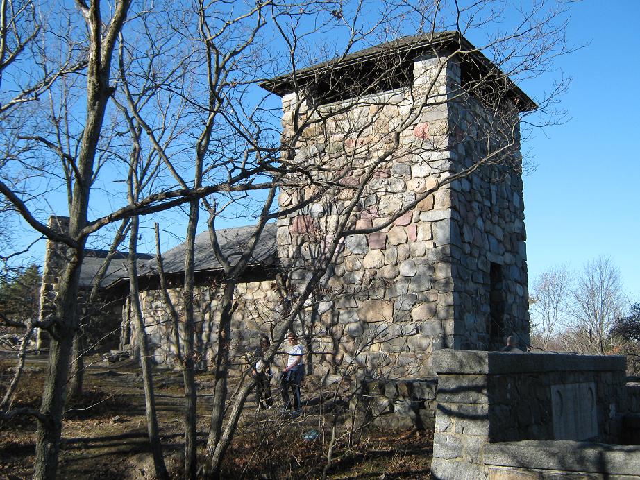
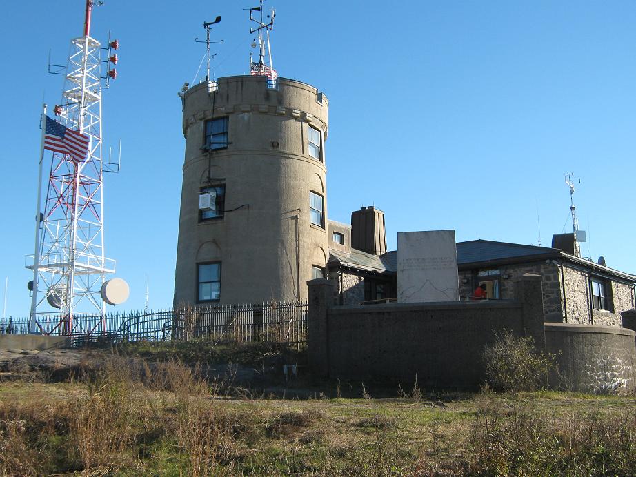
We started up a service road near the small ski run, cutting northeast to catch the main hiking trail, which we followed up. Much of the trail is over rocky outcrops, and in places there were puddles and mud from a recent storm. There were also many people. We kept a good pace and soon came upon a stone observation tower named after a Mr. Eliot, an architect and conservationist who did a lot of "park architecture", including Bellevue Park. We climbed up the stairs to the observation deck. I was able to take a couple photos of the Boston skyline amid the chaotic jumble of people (and dogs). There must have been 20 people crammed in that little space, where normally 5 might be a crowd.
This is not the highest point, though. The highpoint is a few more yards up a path to another building, this one a weather observation station. It has been re-done as a tourist draw with tours, or you can wander the area on your own. The views here were better toward the west. We had climbed about 450 vertical feet to gain this highpoint. Not bad for a hill so close to Boston. We spent a little while up here, then walked down the asphalt service road back to the north parking lot, then from there to Roy's car. Roy mentioned again that he'd never seen so many people here ever before.
We were two-for-two today, and I was tickled because I didn't think we'd get this one due to time restrictions. From the parking lot, Roy drove us up highway 138 into Boston, then along major boulevards into the downtown area, where he dropped me off at the hotel. Given all we had done today, it was still not yet 3 p.m., so I had some time to shower and then go wander the Marriott with all the math people who were also wandering around.
My sincerest thanks to Roy for being such a good tour guide and driver. I had a blast, and was happy to get the local county highpoints, and not take up a whole day to do them. They were surprisingly easy ... assuming you have a good driver who knows his way around town!
The next day, I flew back to Arizona, but I was able to get in an urban hike along the Freedom Trail, which goes to many of the old buildings and points of interest in downtown Boston.
|


|