The Freedom Trail
Boston, Massachusetts • November 14, 2010 |
|
The Freedom Trail is a walking path that winds its way through downtown Boston, passing by many buildings and locations of historical significance. The Freedom Trail starts in the Boston Common, a large park in the middle of downtown, and is marked by two parallel rows of red brick inlaid into the sidewalk. It runs about 3 miles, but follows a convoluted path through the narrow streets. I was in Boston for a conference and to meet the editors and publishers of the calculus textbook of which I am a co-author. Today was Sunday, and the conference had ended the previous day. My flight back to Phoenix did not depart until late in the afternoon, so I had a morning to kill.
Today was cloudier and cooler than yesterday, but mild. From my hotel, I took the subway a mile to the downtown exit nearest the Boston Common, and found my way to the start of the Freedom Trail. From there I dutifully followed it up and down, back and forth, hither and yon. The Massachusetts State House comes up first, north of the Common. Then south to an old cemetery. I found out fast that keeping on the path was trickier than it looked. Side routes painted in red would jut off, and the main path itself would be missing in places where the sidewalk had been torn up and replaced in the past. I only got off-route once or twice. There were others walking it too, clearly doing the same, with their little pocket-guide and cameras.
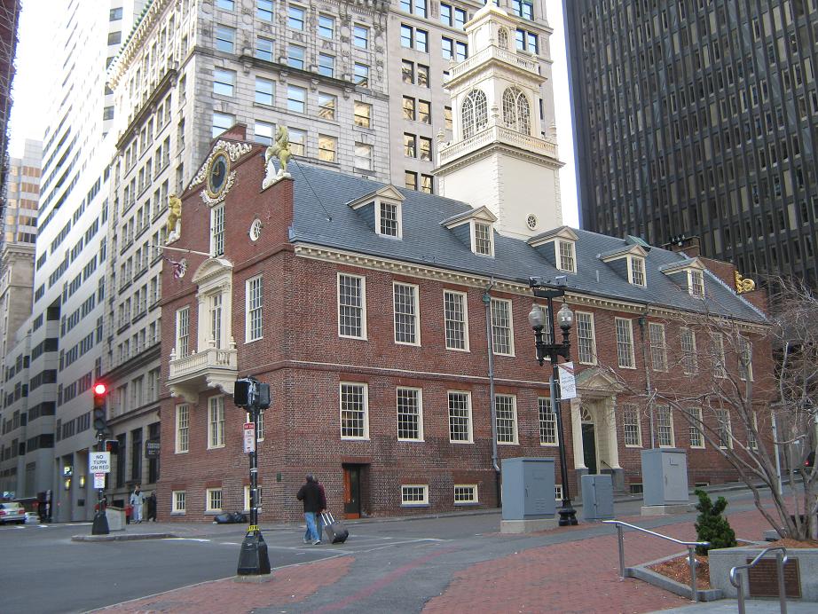
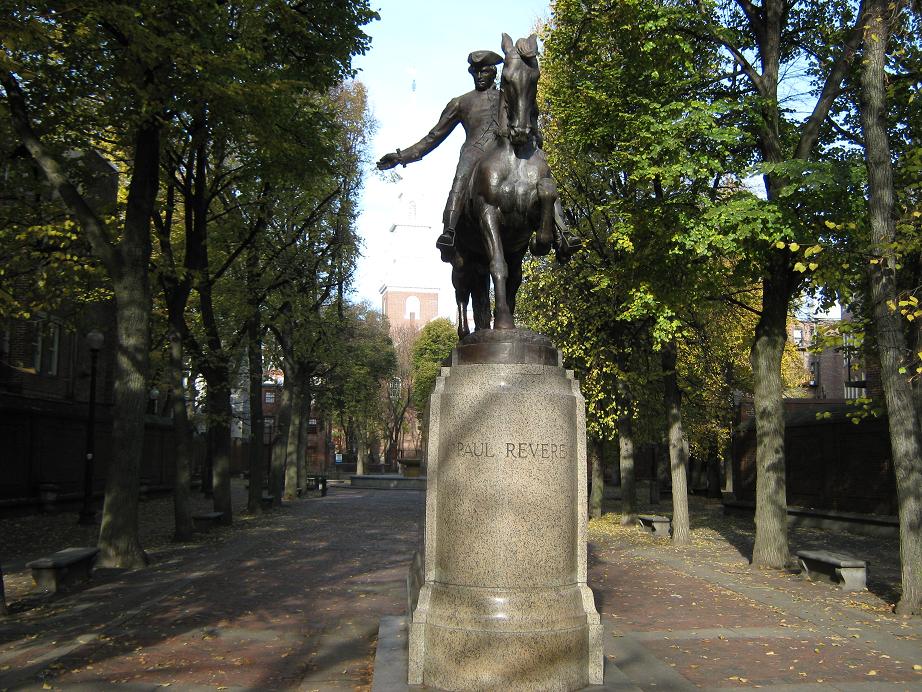
I walked by the old city hall, the old state house, then Faneuil Hall, then some interesting maze-like roads in the North End, where the Paul Revere House and statue is located. The route crosses over the Charlestown Bridge, where I had a good view of the Big Dig bridge. On the other side of the bridge is the USS Constitution, but I was too early today to take a tour, so I had to be content with photos from behind a fence. Then the route follows residential roads to top out on Bunker Hill (or Breeds Hill, I am not sure). Unfortunately, the obelisk monument was partially hidden in scaffolding. I had good views back downtown. The one-way walk took 90 minutes moving at a steady, but unhurried pace.
Instead of walking back the way I came, I walked to the subway stop nearby and rode that back to my hotel area. I had been gone about two-and-a-half hours. Yeah, I may have missed some of the more minor points of interest, and maybe I don't know the significance of every little place, but the walk gave me a good workout and a chance to tour the city. That was the end of my Boston trip. It had been busy and jam-packed with meetings and functions. This was a good way to finish it off. Back at the hotel, I showered, got my stuff packed, killed another hour at the Barnes & Noble across the way, then rode the subway to the airport, and flew home that night.
 Massachusetts State House
|
|
(c) 2010 Scott Surgent. For entertainment purposes only.
|