Georgia
• www.surgent.net
|
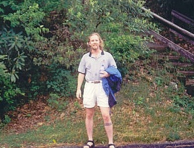 Me on the downhill
|
Prologue: My time in Georgia has been limited to a single trip in May of 2000. I flew into Atlanta and visited a couple peaks --- Brasstown Bald (the state's highpoint) and Rabun Bald --- before exiting into North Carolina and northward.
Georgia is a beautiful state, at the south end of the Appalachian Mountains with gorgeous mountain and hill-country scenery. I regret I don't visit more often, but they built Georgia too far from Arizona to get there conveniently.
Date: May 24, 2000
• Elevation: 4,783 feet
• Prominence: 2,107 feet
• Distance: 1 mile
• Time: 1 hour
• Gain: 450 feet
• Conditions: Foggy and cool
Main
•
PB
I flew to Atlanta from Phoenix via Las Vegas. The Vegas to Atlanta leg was a red-eye with few people on board. I had three seats to myself and was able to stretch out a little to sleep. We landed early and I got my rental car, joining Atlanta's morning rush-hour traffic. What little I saw of the city looked nice.
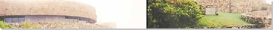
I beelined out of the city, following Interstates 75 and 575 northbound, and local state routes, to Brasstown Bald, the Georgia state highpoint. Plenty of signs point the way and I had no trouble finding the visitor's parking area below the summit. It was early and no one was here. The weather was slightly foggy and humid, but the temperatures were pleasant.
I grabbed a water bottle and my camera, and hiked up a paved walking path to the top. The walk covered a half-mile and 450 feet of gain. A large building is smack on the summit, but it was closed. I walked the perimeter and tagged whatever natural high rocks I could find. The fog was thick up here.
The highpoint for nearby Union County is nearby, a few dozen feet below the top. Going by the map and landmarks, I walked the area for about 10 minutes to convince myself I had visited this "highpoint" as well. Then I hiked back to my car. At this time there were a few more people here, but I was done, and on my way to nearby Rabun Bald.
Date: May 24, 2000
• Elevation: 4,680 feet
• Prominence: 1,016 feet
• Distance: 2 miles
• Time: 1 hour
• Gain: 1,100 feet
• Conditions: Still foggy but improving
PB
Rabun Bald is in the northeast corner of Georgia and is the second highest county highpoint in the state. I arrived at here an hour after I'd hiked Brasstown Bald. To get to the trailhead, I drove to the town of Sky Valley, Georgia. The main road is named Bald Mountain Road, which I followed for a couple miles to Kelsey Mountain Road on the right, and then a mile farther to the end of the pavement. My thanks to the guard at the booth at the gated entrance to the town for helping with directions. Seems like they get lots of hikers.
The route begins at the dead-end where a small sign nailed to a tree points the way. Two routes start from here: a rough road on the right and a footpath on the left. They both meet again half-way into the hike. I chose the footpath, an excellent maintained trail in the dense trees. Ferns dominated the underbrush (and ivy, too). Locust-like bugs bounced around, making a click sound each time. Some bounced into my legs but they were not a problem. I saw no snakes.
At the point where the road and footpath meet, the footpath continues past rocky obstacles to the steeper switchback portion of the hike. The trail is rockier in places, and the vegetation is so thick that it creates a canopy above, like I was hiking in a tunnel. Finally, the switchbacks cease and the path makes its final approach to the summit. A 20-foot tall viewing deck is on the summit, but I literally didn't see it until I was about 30 feet from it, that's how thick the trees and brush were. From the deck, the views are outstanding in all directions. The rolling hills and peaks shoot off in every direction, all covered in thick forest. Brasstown Bald is visible to the west (although I had clouds blocking the highest portions). I enjoyed this hike very much.
After 20 minutes, I hiked down back to my car. The one way mileage to the top is just over a mile and gains about 1,100 feet. It took me a little over an hour for the entire hike, including my rest up top.
|


|
(c) 2000, 2020 Scott Surgent. For entertainment purposes only. This report is not meant to replace maps, compass, gps and other common sense hiking/navigation items. Neither I nor the webhost can be held responsible for unfortunate situations that may arise based on these trip reports. Conditions (physical and legal) change over time! Some of these hikes are major mountaineering or backpacking endeavors that require skill, proper gear, proper fitness and general experience. |