
The Mountains of California
• www.surgent.net
|
| White Mountain Peak |
• Highpoint: Mono County • Highpoint: White Mountains • Inyo National Forest |
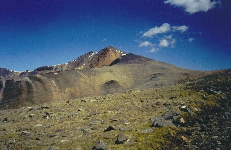 Summit from the hike, 3 miles away
Summit Panoramas
Computer generated pan- oramas from the summit, as created by Jonathan de Ferranti, a map-wizard based in
Scotland. His highly-detailed images describe the distant horizons, ranges and peaks, with compass bearings and distances provided. They are remarkable and, in my opinion, beautiful works of artPlease check them out!
|
Date: June 20, 2002
• Elevation: 14,246 feet
• Prominence: 7,196 feet
• Distance: 15 miles
• Time: 7 hours
• Gain: 2,550 feet net, 2,980 feet gross (ascent)
• Conditions: Magnificent
California
•
Main
•
PB
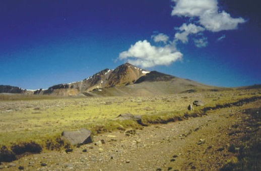
White Mountain Peak is a giant 14,000-foot mountain in Eastern California, northeast of the town of Big Pine. The White Mountains lie east of, and parallel to, the Sierra Nevada, and are effectively the western boundary of the Great Basin Desert. Thus, the White Mountains are aptly described as a Great Basin range, appearing more like its brethren Great Basin peaks and less craggy than those in the Sierra Nevada.
Climbing White Mountain Peak requires a lot of effort but not a lot of skill. The ability to put one foot in front of the other for fifteen miles at high elevation is all that one needs to climb this peak. A good road leads to a gate at elevation 11,700 feet. The road leads all the way to the summit, but hikers must park back at the gate and walk the rest. The University of California maintains a high-elevation laboratory (the Barcroft Laboratory) up here.
I was originally aiming north to the Sweetwater Mountains in Nevada where I was planning to hike, and later, pick up Adam Helman in Reno for a few more days of northern Nevada peaks. However, as I arrived in Big Pine, I learned that the Sweetwater Mountains were closed due to a massive forest fire. On the spot, I had to alter my plans. White Mountain Peak was close by and I immediately chose to climb it instead. I gassed up the truck and stocked up on supplies in Big Pine, then drove northeast along state route CA-168.
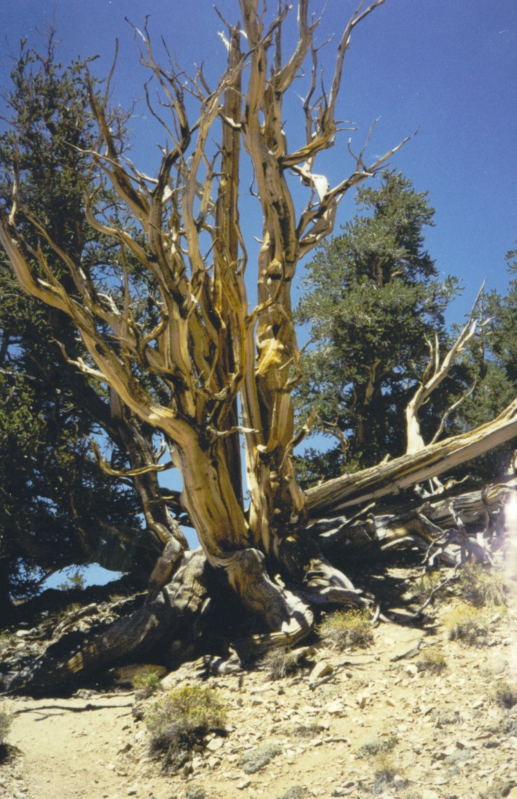
Soon, I was on the lesser paved roads that snake and wiggle up the steep mountain grades toward the ancient bristlecone pine forests. A visitor's center and parking area are located at about 10,000 feet elevation. I stopped here to walk the area, admiring the old trees, as well as a chance to acclimate at elevation in preparation for tomorrow's hike.
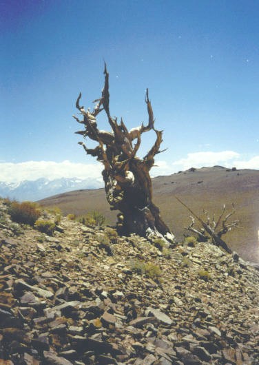
The bristlecone pines are famous for their age, some over 4,000 years old. The climate up here is harsh, with little rain, strong winds and lots of snow, so only a small portion of each tree may actually be alive at any one time. They grow slowly and in fascinating gnarled shapes. The oldest known tree is located in this grove but is not marked. Otherwise, everyone would snip pieces from the tree or scratch in their initials on it.
By early afternoon, I resumed driving higher on the road toward the gate near the Barcroft buildings. The pavement gave way to gravel, but was still well maintained. Despite being at 11,000 feet elevation, the mountain is so wide that it felt like I was driving on a plateau rather than on a mountain. I stopped in at the Patriarch Grove for more exploring, deliberately going slow and enjoying the day. I finally rolled into the small parking area near the Barcroft Lab gate in late afternoon.
I spent the remaining daylight walking around the area, which was high tundra with small grasses, tiny flowering plants, and nothing more. Healthy-looking pikas poked around looking for handouts. Past visitors have left behind chicken-wiring. The idea is to surround your vehicle with it because otherwise, those pikas have been known to gnaw at hoses that are underneath. I did my best to shore up my truck. By nightfall, the dayhikers had all returned to their vehicles and driven off. I was the only one here.
Already I was having the time of my life. I was the only one up here, at elevation 11,700 feet, higher than many big mountains. The landscape is like being on an alien planet, and during the night, I had clear skies and a near-full moon that lit up everything in that amazing, surreal dim moonlight. I slept well, but was so enthralled with the whole scene that I even considered a moon-light start to the hike. I didn't, but I was moving as close to dawn as possible.
From the gate, it is 7.5 miles to the top, and 2,550 vertical feet of net gain, not counting a couple of drops along the way. The gate was unlocked, but driving in would not have saved me much time. Besides, I might get locked in. The Barcroft Laboratory buildings are two miles up the road. I was expecting official-looking buildings, but in reality it's just basic pre-fab huts and storage buildings. There were sheep in a nearby pen. It did not appear that anyone was home, though.
After the Barcroft buildings, the road steepens slightly and surmounts a hill. The view from here was stunning: the full glory of White Mountain Peak stood in the distance, still four miles away. The road drops 250 feet, then starts a long ascent, cutting a line through the rocky alpine plain, and I felt like I was the only person on Earth at this moment.
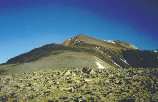
The next two or three miles was up easy gradients, so slight I barely noticed them at all, achieving an apex at just shy of 13,200 feet. Then the trail drops about 180 feet to a lowpoint, elevation about 12,980 feet. I was still a couple of miles below the top, but in reality, the top was much closer. The road switchbacks many times as it gains the top, adding mileage. I rested at this lowpoint and also watched the pikas try to steal stuff from my pack.
From the lowpoint, I resumed my trek and ambled up the remaining road. There were snow patches up this high, and I kept a steady pace, dutifully following the road. However, I grew weary of the road's length and ended up cutting off distance by barging directly upslope as I got closer to the top. By now, I was going slow, feeling the effects of being above 14,000 feet. I arrived on top at 8:45 a.m., four hours after starting.
The summit is big, and the building atop it was locked up tight with random items strewn about, but not in a messy way. The weather was crisp, perhaps a shade above freezing. The views were outstanding, with the big Sierra Nevada to the west and endless Great Basin desert and ranges to the east. I could have stayed up here longer, but knew I had a lot of downhill walking to do.
The hike out went well. I saw people for the first time as I descended to about the 13,000-foot saddle below the main summit, and as I trekked out saw a few more hikers. The hike out took about three hours. When I was back to my truck, I was mildly relieved to see the pikas had not nibbled at my truck's hoses while I was gone. I took the drive out slowly and was back in Big Pine by 2 p.m. From here I drove into Minden, Nevada, where I stayed the night in a hotel. I still had a day free before I had to pick up Adam, so the next day I hiked up Freel Peak, the highest summit overlooking Lake Tahoe.
For an unplanned peak, White Mountain Peak had gone very well and I was thrilled to have it done. It is a wondrous place, and I would go back again.
|

|