
Lake Tahoe Peaks
California & Nevada www.surgent.net |
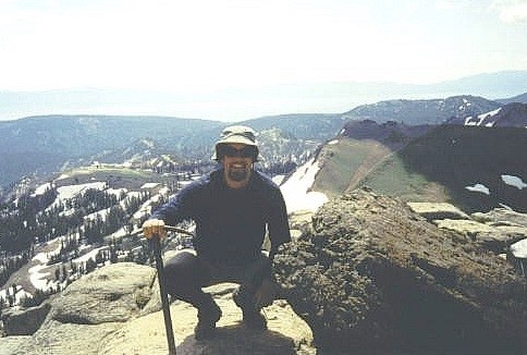
 Snow Valley Peak
|
Snow Valley Peak (NV) • East Peak (NV) • Thunder Mountain (CA) This page details the peaks I have climbed that lie near Lake Tahoe. Two are in Nevada, four more in California. I include a couple, Thunder Mountain and Corral Ridge, that are not really "near" Lake Tahoe, but are close enough ... and I did them all on the same journey. I visited the first four in 2000, then came back in 2002 and hiked Freel Peak and Granite Chief.
Date: August 10, 2000
• Elevation: 9,214 feet
• Prominence: 1,254 feet
• Distance: 10 miles
• Time: 3 hours
• Gain: 2,160 feet
• Conditions: Pleasant
I was hiking a few peaks in Nevada, starting with Mount Jefferson down in Nye County, then Mount Davidson near Virginia City, both hiked yesterday. That put me close to Carson City, where I found a hotel to stay for the night. My next days' plans were to hike a handful of peaks nearby Lake Tahoe.
While driving the main drag in Carson City, I spotted a couple of very pretty young women walking along the sidewalk. Then a couple more, then like ten more. Yeah, I wasn't paying too much attention to the road right about now. Anyway, I found out later there was a beauty pageant in town.
Carson City has a familial aspect for me: it was home to my maternal grandfather for the last twenty-or-so years of his life. He was estranged from the family and I only saw him a few times growing up. He was a master stonemason, an aspiring entertainer (songwriter, comedian), and one who would run off on some great scheme on a moment's notice. He was a very kind man who probably would have fit in better had this been the 1800s, not the 1900s. He ran a small apartment complex in town and died in 1993.
The next day (today, the 10th), I had two peaks on the agenda, Snow Valley Peak, which is the highest point of Carson City, and East Peak, highest point in nearby Douglas County. First up was Snow Valley Peak. Carson City is a consolidated city-county. It used to be Ormsby County, but when the surrounding county was trimmed down to just a small area surrounding Carson City, it made sense to abolish the county and just rename the whole thing Carson City. This happened in 1969.
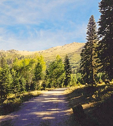
Early in the morning I got rolling, but didn't have far to travel to get to the trailhead. It's a few miles up the US-50 grade west of Carson City to the junction with state route NV-28 near Spooner Summit, and the entrance to the Spooner Lake Recreation Area. I paid a day-use fee, parked and got my stuff together. It was early but already there were many vehicles, including horse trailers, suggesting I may see people on horseback along the route as well (I did). The route to the summit is about 5 miles one way, but four miles of that is along a wide gravel forest road, closed to public vehicles, but perfect for mountain biking.
I had brought my bike for just this occasion. I hopped on and slowly pedaled onto the road. The first three miles is mostly flat with lenient grades, gaining 600 feet with easy uphills and downhills along the way. The fourth mile is a little steeper, gaining 500 feet to a junction with the side road that leads to the summit. I was making good time, but also realized that hiking muscles do not necessarily translate into biking muscles, and I found myself needing to walk the bike in some parts. A regular mountain-biker probably would have no trouble at all.
At the junction, I walked my bike up the side road a little, then stashed it in the brush, locking it against a small tree out of sight from the main road. Evidently, most hikers, bikers and horse-riders stay along the main road, which leads to Marlette Lake, a reservoir than spills into nearby Lake Tahoe (itself just a couple miles to my west but hidden from view by the hills). Not many people hike to Snow Valley Peak, it seems.
I walked this side road as it gained steeply to top out on the main ridge at a saddle north of Snow Valley summit. From here, I followed the Tahoe Rim Trail south but realized it only bypasses the top, so I left it and made my way up the open slopes to the summit area, featuring rock outcrops, with a couple being contenders for the highpoint. I visited anything that looked promising and enjoyed the lovely views of Lake Tahoe, now visible behind the foreground hills.
It was breezy but nice overall and I spent a little while enjoying my time here, me having the place all to myself. For the descent, I followed the road down to the saddle and from there back down to my bike. The four-mile egress on my bike took only 20 minutes, and it was still just mid-morning when I arrived back to my truck. The bicycle had paid big dividends for me.
My next objective, East Peak in Douglas County, was just a few minutes' drive south of Spooner Lake. I arrived there about noon, traffic being my only hindrance. My only regret is my lack of photographs. I had a lousy camera and I just didn't bother with any real photographs along the way. You'd think with Lake Tahoe nearby...
Date: August 10, 2000
• Elevation: 9,591 feet
• Prominence: 360 feet
• Distance: 5 miles
• Time: 3 hours
• Gain: 1,700 feet
• Conditions: Very nice, yes, very nice
From the Snow Valley Peak trailhead, I went south along US-50 along Lake Tahoe's shore to Kingsbury Grade (NV-207). This road gains elevation quickly, passing through a residential area. After a couple of miles, it comes to the main entrance to the Heavenly Ski Area, which is on the right side of the road at South Benjamin Road.
I followed the signs to the Stagecoach Ski Lift, then followed more signs to the Tramway Road, then on Tramway to another T-junction, then left, then a fast right to the Eagle's Nest Resort buildings, behind which is the dirt road that leads to the top of East Peak. This portion of Tramway Road is one-way and more than once I had to circle it a couple times before figuring out where I was and needed to be, and where to park.
The information I had about this peak was confusing. On the phone, the Heavenly Ski people said hiking was not allowed. In town, the Information kiosk on NV-207 near the South Benjamin turnoff said hiking is allowed. Then the signs near the trailhead said hiking, biking, jogging and all else was not allowed. But there were people there doing exactly that. I asked one guy coming back from a jog about the "prohibitions" against access and he looked at me like I was from Mars. It appears no one pays attention to the signs and no one patrols it, either. So I decided to walk in on the road despite the signs and hope for the best. I figured if I acted like I knew what I was doing, no one would bother me.
The road up the mountain is a wide dirt road, but driving it myself was probably pushing my luck. Also, trucks were regularly coming down that road, so there was something going on up there today. Hiking it was no problem and whenever a truck came by, I just stepped to the side. The drivers would wave, letting me know they saw me.
The road was pitched at a lenient grade to accommodate the trucks, but that means longer distances for me. It crosses a few ski runs, the bare slopes covered over on a hay-like mat, presumably to guard against erosion. A mile in and 900 feet higher, the road comes to a pond, where people were fishing. I waved hi and continued past. By now, I was growing weary of the long switchbacks. I got myself to yet another ski run.
Here, I bailed on the road and went directly up the steep slopes, which was tiring. But I was making fantastic upward progress and shaving off a mile or two along the way. I grunted up another 500 vertical feet to the top of this ski run. Signs here stick up about twelve feet above the ground. This makes sense when there's eight feet of snow, so that when on skis, the signs are at eye level. Anyway, I was back on the road and could hear beeping and motors, presumably where all the construction was going on. But I could not see any of them.
I hung a left and marched up another 400 feet to top out on the higher ski run's apex, but sensed I was not where I should be. Looking at my map and taking a bearing, I realized I had climbed up a slope inside California. East Peak was now visible across the way. I descended down and took the "right" road to East Peak's top.
The top is slightly rocky, with general ski-run buildings on the summit. I was able to find the benchmark and have an enjoyable rest sitting on the rocks, looking out over Lake Tahoe. I was beat by now, but the views were worth it. I had the peak to myself, just like earlier today. During the ski season, I can imagine probably hundreds of people at this very spot on a daily basis. Today, it was just me.
After a brief snack I started the walk down. I decided to follow the road instead of the ski-run but the road took so long going down that when it came back near the lower ski-run, I followed the run down instead. I also saved time and mileage on the switchbacks near the bottom by descending another ski-run. I was back to my truck in just a little over an hour.
I still wasn't that far from Carson City, so I drove back and stayed the night there again. Tomorrow, I would tackle a couple of peaks inside California.
Date: August 11, 2000
• Elevation: 9,140 feet
• Prominence: 330 feet
• Distance: 7 miles
• Time: 3 hours
• Gain: 1,800 feet
• Conditions: Pleasant
• Teammates: Pete Maurer (last half of hike)
California
•
Main
•
PB
I started today in Carson City, Nevada, crossed into California and got gas in Markleeville before heading up the highway, US-89. Thirty miles later, I was at the Kirkwood Ski Area, where Thunder Mountain is located. One option is to hike directly up the ski runs. This looked unnecessarily steep. Back on Highway 89, I drove over the "Carson Spur". I found the Thunder Mountain trailhead sign by luck as it was not obvious. I parked here. The sign said it was 3.6 miles to the top. Apparently, this was a new trailhead.
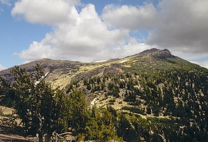
The hike starts in the woods, climbs steadily along the excellent trail, and then breaks out into a meadow after a third of a mile. The trail continues, re-enters the trees, switchbacks, then achieves the main ridge. Huge rock plugs dominate the ridge, with some plugs looming 100 feet high. The trail levels, then starts climbing again before coming back to the main ridge again near a big peak that could be seen from the trailhead. Here, there are excellent views down into the Kirkwood Ski Valley.
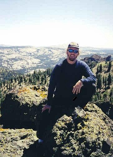
I continued past this peak and kept hiking, following the trail another mile to a rocky summit with tattered flags. I was pleased I had reached the highpoont, took a break and admired the views. Then, I turned around and started the hike out.
While descending back down to the main saddle, I met another hiker, a cool fellow named Peter Maurer. We got to talking and it turned out he was here for the highpoint, too. Then he laid a whammy on me: the summit that I visited was not the actual highpoint. He showed me a map and sure enough I had visited a bump that was two measly feet lower than the real highest point. He then pointed to me the real highpoint, which was just above us, where we stood. He commisserated with me, for he'd made the same error on a previous hike, too.
We hiked up the rise, crossed it and around the other side about a hundred feet until we found a path that led up to the rocky highpoint. It was fortuitous that I bumped into him. It turns out that I hiked 1.5 extra miles to the false summit (the terminus of the trail), not to mention the extra gain I needed to re-ascend the true highpoint. But, ultimately, it was worth it.
I returned to Markleeville, then south to state route CA-4 and up and over Ebbetts Pass along some of the steepest, curviest paved mountain roads I've ever been on. Some grades were 24%. The road was not striped for two lanes and when two cars would meet we'd have to go real slow to pass. Later in the day I hiked Corral Ridge, the highpoint of Calaveras County.
Date: August 11, 2000 • Elevation: 8,170 feet • Prominence: 210 feet • Distance: 6 miles • Time: 2 hours • Gain: 600 feet
PB
From Thunder Mountain, I drove through Markleeville and got onto westbound state route CA-4, which gains very steeply up the mountainside. The road is paved but is often just a lane wide, and at times has grades as steep as 24%, with some segments at a maintained grade of 15%. I drove this slowly and was happy to get past it.
The access to Corral Ridge is on the north side of CA-4 about a thousand feet inside Alpine county. It's not an obvious turnoff, and I passed it once. The road in is rough. I put my truck into 4-wheel drive but grew weary after only a half-mile on the road. There are lots of rounded rocks to negotiate and I just didn't want to bang up my truck on these rocks. I found a pullout and parked, and set in on foot. It was 6 p.m. and I was still 3 miles from the summit. I walked fast and hoped I would be out by dark.
For the first 1.5 miles, the gain was minimal. I came out into a meadow and was met by barking dogs belonging to a camping group in the area. In this meadow, the road becomes significantly steeper and sandier. After this rise I came to a saddle and a junction in the road. Here, I made a wrong turn. I continued straight but realized (by my shadow) I was traveling east and not west as I should be at this point, so I turned and resumed on the correct trail. After more uphill sections I came to a barbed-wire fence, passed it, hiked in the trees briefly, and finally came out into the open, where I could see the flattish summit about a half-mile to the north.
I hiked cross-country to the top, staying near the cliff edge. It wasn't much of a problem except for a profusion of plants with little burrs that caught my clothing. I achieved the rocky and flat summit area at 7:15 p.m., and found the biggest rock and stood atop it. I didn't stay long as I wanted to get hiking out while it was still light.
I retraced my route, got barked at again by the same dogs and was back to my truck at 8 p.m. My socks and my shoelaces were covered completely in these burrs. The socks were goners. Getting them off my shoelaces was easier. I had some caught in my hairy legs, too.
I bashed my way back to the highway and drove west about 40 miles to the town of Arnold and got a hotel. The next day I visited the towns of Angels Camp and Sonora, then drove back up and over the Sierra Nevada via Sonora Pass (CA-108). I intended to camp here and hike another peak, but after three days and six peaks, I was done with hiking and simply continued down the other side.
My dad had agreed to drive up to Tonopah, Nevada, so I drove there and met him late in the day. The next day, we drove east on US-6 to the Kawich and Reveille Mountains to explore the areas. My dad liked to hunt in the Kawich Range, so we scouted trails here for a few hours. We also explored an old ghost town that still had big mining apparati standing after all these years.
We were not far north of the sprawling Nevada Test Range, home to famous Area 51. We drove a good dirt road south to about a mile north of the boundary. We could see buildings off in the distance. The road was dusty and our dust cloud was impossible to miss. We weren't trying to be sneaky, and we had no intention to get near the boundary fence. The signs out here make it clear what "authorized force" will be used if you get too close.
Update 2022: LIDAR data suggests the southeastern point is highest, not the northern point I "officially" visited. The natural route gets within feet of the presumptive southeastern point, so I would have walked right past is anyway. Thus, I count this highpoint as completed.
Date: June 21, 2002 • Elevation: 10,881 feet • Prominence: 3,146 feet • Distance: 9 miles • Time: 5 hours • Gain: 3,180 feet • Conditions: Cloudy going up, storms developing as I descended
PB
Freel Peak is the highest peak overlooking Lake Tahoe, located south of the lovely lake, in the Carson Mountains. It is also the highest point in El Dorado County, which is why I initially considered hiking it. Actually, I had not planned to hike Freel Peak on this trip. Rather, I wanted to hike in the Sweetwater Mountains near Yerington, but a big fire was raging down there. With those plans set aside, I headed over to Freel Peak.
I was still sore from yesterday's long, 15-mile hike up White Mountain Peak in Mono County. After a night in Minden, Nevada, I drove up and over the Kingston Grade, past the Heavenly Ski Resort, past the traffic in South Lake Tahoe, and proceeded to get a little confused. The guidebook said to take Pioneer Trail, which I did, but the next turn off I was supposed to take never came up, until I realized Pioneer Trail is a big loop and I was on the wrong end of it. I finally found the right turnoff, and followed a local paved road (Oneidas Street) into the forest to the pavement's end, where I parked and started in.
My map was the one printed in Gary Suttle's California County Summits book, so I followed his directions. There are two ways to make it to the main saddle below the summit: a 4-mile hike via the Tahoe Rim Trail, or a 2-mile grind up a sandy, steep use trail. The main path actually led me to the steep use trail first, which I tried to follow up until I lost the trail amid a thicket of brush and downed aspen. After backtracking down to the main path, which cost me about 40 minutes overall, I decided to take the longer route. I went south through a marshy meadow, then a good trail up to the Tahoe Rim Trail junction, which I took northeasterly to the main 9,800-foot saddle. This took about 2 hours.
Once at the saddle I started up a steep boulder-sand pile, which gained 400 feet quickly. There was no trail here, so I went uphill whenever possible. The slope then moderated slightly and I found faint use-trails. The route climbs toward a 10,600-foot subpeak of Freel, then contours and gains the actual summit. Although I was moving quickly, the clouds were building fast and I was concerned about possible lightning (I had been through two such storm cells in the previous 48 hours).
As I approached the summit, I met a couple and their dog on the way down. We talked briefly, then I pushed on to the top, where I made it almost exactly 4 hours after starting (counting my time going up the dead-end at the bottom). The views were great. Lake Tahoe was visible, as Freel Peak is the highest point of all the surrounding peaks, while to my south I could see nasty clouds amassing. I didn't stay long before heading down. I was back to the main saddle in less than an hour.
For the remaining hike down, I took the steep use trail, which was steep and sandy and loose, but saved me 2 miles and made up for lost time. I came to where I lost the trail coming up, and yes, there was no way I would have known that the trail was where it was. It wasn't obvious at all from below, even after I'd come through it. The bad portion is short, fortunately, exacerbated by downed aspen and heavy undergrowth. Then it was just a simple mile or so to my truck, and on my way to Reno.
In Reno, I picked up Adam Helman, and we'd continue the trip with another peak in California, and a quartet inside Nevada.
Date: June 22, 2002 • Elevation: 9,006 feet • Prominence: 1,846 feet • Distance: 7 miles • Time: 5 hours • Gain: 2,725 feet • Conditions: Clear and dry • Teammates: Adam Helman and Edward Earl
PB
Granite Chief is the main peak overlooking Squaw Valley in northern California, where the 1960 Winter Olympics were held. It was assumed to be the highest point in Placer County until 2008 when a measly liner along the Nevada state line was shown to be higher by a few feet. Nevertheless, it is arguably the highest peak within the county and a fine mountain to climb.
I had picked up Adam Helman in Reno yesterday. We then drove to Squaw Valley area, finding Edward already camped in a site in the area. This was my first time meeting Edward. He was down to just this one peak to claim a completion of all 58 of the California County highpoints, which we know now was in error. But at the time, we did not know this. After greetings, we yakked for about two hours. Then we were all asleep by 11 p.m.. The next morning, we drove to the trailhead and started our hike at 6:30 a.m. in pleasant clear weather.
The trail starts behind the fire station along Squaw Valley's main road, and braids with other trails as it gains elevation up a small canyon. We took one wrong turn and found ourselves hiking along a swollen creek. Fortunately we discovered our error fast and backtracked to a junction, where a sign pointed the way to Granite Chief. How the three of us missed that sign going in is beyond me.
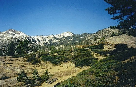
The trail gains steadily up the forested canyon walls, then starts a long traverse with some up and down as it heads toward the canyon headwall and main summit ridge. Periodically the views were expansive and we could see the summit off in the distance, other times we were amid huge trees. There were also some rocky areas where cairns marked the way. The scenery changed often enough to keep it interesting. We all made good time and in about 2 hours had covered about 4.5 miles. Small patches of snow started to infringe on the trail, eventually growing large and often forcing us to make educated guesses as to the proper direction of travel.
Eventually the snowdrifts simply forced us to find our own way, but since we were very close, this was not a problem. We descended into a marsh, then ascended up the headwall below a ski-lift to gain the saddle just east of the summit. This headwall was covered in snow and covered our trail, so we ascended via a steep series of rock outcrops and short, steep snow inclines. Only one move on the rocks might have approached class-3, and the snow traversing wasn't too bad as long as we kicked steps, and we made the saddle with no problems.
From here, it was about 300 more feet up the ridge amid snow, trees and rocks to the top. We picked our own routes through this mix and reached the top 3.5 hours after starting. The summit is topped by a big rock, and Edward deliberately waited before tagging it, as Adam read a prepared speech and I acted as witness and well-wisher to Edward. Then, the big moment for Edward: California was his, as he had reached the highest point in all 58 California counties. We congratulated him, ate lunch, snapped photos and took in the views, with Lake Tahoe dominating to the east, and a multitude of peaks to our north, west and south. Freel Peak, which I climbed the day before, was to the southeast. This was Adam's 50th California county highpoint, well on his way to completion.
After nearly an hour, we started down, but had no interest in re-negotiating the snowy bits we passed coming up. Instead, we descended to the saddle and ascended a subpeak to Granite Chief's east, and walked down service roads toward a tram complex that we could see off in the distance. We could see a pool and hear music. The temptation was too much and we took the tram down (for free) to the parking area, drastically cutting our time and distances down (and wear and tear on my knees). Coming up was about 5.5 miles and about 2,750 feet of gain, whereas going down was about 2 miles and just under 1,000 feet of loss; we shaved 3 miles and about 2 hours from our time.
We said our goodbyes in the parking area. Adam and I headed into Nevada to start tackling peaks out there, while Edward started back for San Diego. Congratulations to Edward for his feat; fewer than 2 dozen people (as of 2002) have climbed all 58 California counties. Adam, as it turned out, completed his 58th California county highpoint about two weeks later.
|


|